Gundabooka National Park
NSW National Parks and Wildlife Service (NPWS) says Gundabooka National Park is about 50 km south-west of Bourke and 110 km north-west of Cobar.
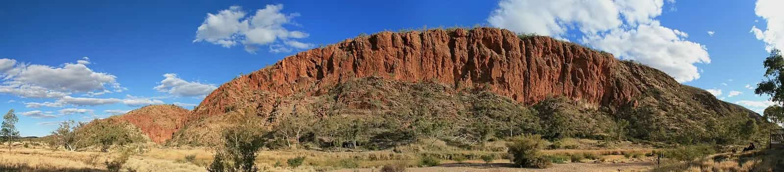
- Size and landscape. The park covers 63,903 hectares from the Darling River banks to the Gunderbooka Range. Grassy woodlands, open plains and rust-coloured rock dominate.
- Mount Gunderbooka. The mountain rises 500 m above the park.
- The conservation area. Together with Gundabooka State Conservation Area, the park stretches from the Darling River across the plains and over Mount Gunderbooka.
Ngemba and Paakandji Country
The Gunderbooka Range is highly significant to the Ngemba and Kurnu Baakandji people of western NSW. Ceremonial events were held within the range.
The Ngemba and Paakandji people now jointly manage the park and state conservation area with NPWS.
Walks in Gundabooka
Yapa (Mulgowan) Aboriginal art site walking track: 1.4 km return, 45 min to 1 hr 15 min (Grade 5).
- This challenging walk passes boulders to an enormous rock overhang.
- The overhang has rock paintings of the Ngemba and Paakandji people: animal motifs, dancers, hand stencils and hunting tools.
- A lookout viewing platform and a picnic area are at the site.
- Look for hooded robins and pink cockatoos on the way.
Valley of the Eagles walk: 5.7 km return, 2 hr 30 min to 3 hr 30 min (Grade 5).
- It starts at Bennetts Gorge picnic area.
- An easier first section, about 1 km return, leads to a viewing platform at the base of the mountain.
- From there, a difficult climb over rocky, very steep terrain reaches the summit, with 360-degree views. NPWS says it's for fit walkers only.
Little Mountain walking track: 4.8 km return, 2–3 hours (Grade 4).
- The track runs from Dry Tank campground through mulga woodland to Little Mountain lookout.
- The lookout has views of the range's whole northern escarpment, especially at sunset.
- Watch for brown snakes, and wear sturdy covered shoes.
Pastoral history and wildlife
Pastoral history. Charles Sturt noted the Gunderbooka Range in 1829, but pastoralists didn't use it until the late 1800s. Three smaller stations make up the park today: Ben Lomond, Belah and Mulgowan. You'll see old homesteads, quarters, shearing sheds and yards.
Wildlife. Several threatened species have been recorded here, including:
- the little pied bat
- the kultarr
- the pink cockatoo
- the painted honeyeater.
The park includes 21 plant communities.
Camping and accommodation
Dry Tank campground.
- Sites. 20, for tents, camper trailers, caravans and camping beside your vehicle.
- Facilities. Toilets, barbecues and picnic tables, with marked, unpowered sites.
- Bring. Drinking water, cooking water and firewood.
- Booking. Book online.
Redbank Homestead, in Gundabooka State Conservation Area at 4436 Bourke–Wilcannia Road.
- Beds. Five bedrooms for up to 12 guests.
- Facilities. Kitchen, air conditioning, showers and power. The Darling River is at the doorstep.
- Bring. Food, drinking water, linen and firewood. The nearest shops are in Bourke, an hour away.
Getting there and weather
Directions. From Bourke, drive south on the Kidman Way for about 49 km, then turn right onto Ben Lomond Road.
Weather. NPWS lists summer averages of 20°C to 33°C, with a highest recorded 47°C. Winter averages are 6°C to 17°C. The wettest months are January and February.
Mobile reception is limited.
Toorale National Park
Toorale National Park and State Conservation Area lies at the junction of the Warrego and Darling rivers, south of Bourke. NPWS says it's one of only a few places with access to both rivers.
- Best time. NPWS recommends visiting between April and November.
- Opening. The park is always open, but may close in poor weather or fire danger.
Kurnu-Baakandji Country
This country is of spiritual and cultural significance to the Kurnu-Baakandji People. NPWS explains that the name Baakandji comes from paaka, meaning Darling River, so Baakandji are the People belonging to the Darling River.
The reserves are jointly managed by NPWS and the Kurnu-Baakandji Joint Management Committee. Discovery tours share the culture and bush tucker of the region, such as:
- wild orange and quandongs
- wild plum bush and wild bananas
- bush tomatoes.
Toorale Homestead precinct (Yarramarra)
NSW bought Toorale in 2008. NPWS says it was once part of the world's largest sheep station. Henry Lawson worked there briefly in the 1890s.
- The homestead. It was built in 1896 as a wedding present to Samuel McCaughey's favourite niece, Louisa Robinson.
- The Toorale Homestead walk. An easy 200 m loop past the motor garage, blacksmith's shop and farrier's hut. NPWS calls these the best, most extensive surviving historic pastoral buildings in the far west of NSW.
- The name. Yarramarra means "tree" and "hand".
- Opening hours. The precinct is open 8 am to 5 pm daily. Going inside the buildings is by NPWS guided tour only, during school holidays.
Darling River drive and the floodplain
Darling River drive (Yuthuru Paaka Thuru): 41 km loop, about 1 hr 30 min.
- The drive passes coolabah woodlands and wetlands.
- After rain, the waterways offer fishing for yellow belly and cod.
- In spring, masses of tiny white sunray daisies appear.
Warrego Floodplain walking track: 1 km return, 30 min (Grade 2), dry weather only.
- The walk runs from Warrego Floodplain picnic area (Wariku Pulka) to a sheltered lookout.
- Look for brolgas, bustards, pelicans, spoonbills, sand goannas and shingleback lizards.
Camping at Toorale
Darling River campground (Yapara Paaka Thuru).
- Sites. 4 basic sites with toilets and picnic tables.
- Fees. There are no camping fees, but there's a booking fee.
- Water. There's no water, so arrive well prepared.
Getting there
Vehicle. NPWS says all roads in Toorale require a 4WD vehicle. Roads are unsealed and can close after rain, and driving on closed roads attracts heavy fines.
From Bourke:
- Drive 10.5 km north on Hungerford Road.
- Continue for 21.5 km.
- Turn left onto the unsealed Toorale Road towards Louth.
- Drive 38 km to the entrance.
From Louth: cross the Darling River bridge and drive 30 km towards Bourke.
Contacts and safety
- NPWS Bourke office. 51–53 Oxley Street, (02) 6830 0200, Monday to Friday, 8:30 am to 4:30 pm.
- Safety. Pets aren't permitted, mobile reception is limited and summer temperatures can be extreme. Carry plenty of water, and tell someone your plans.
Nearby:
- Bourke and Cobar
- the Brewarrina Fish Traps
- our Darling River Run road trip.
Frequently asked questions
What are some interesting things to see and do in Bourke?
Two national parks are a short drive south. In Gundabooka you can see Aboriginal rock art on the Yapa (Mulgowan) walking track, climb Mount Gunderbooka and camp at Dry Tank. In Toorale you can tour the Toorale Homestead precinct, drive the 41 km Darling River loop and birdwatch on the Warrego floodplain.
Where can you camp in Gundabooka National Park?
NSW National Parks runs Dry Tank campground, with 20 sites for tents, camper trailers and caravans. It has toilets, barbecues and picnic tables, but bring drinking water, cooking water and firewood. For a roof over your head, Redbank Homestead in Gundabooka State Conservation Area sleeps up to 12.
Do you need a 4WD for Toorale National Park?
Yes. NSW National Parks says all roads in Toorale require a 4WD vehicle. The roads are unsealed and can become impassable or close after rain, so check with the NPWS Bourke office or Bourke Shire Council before you set out.
Can you go inside Toorale Homestead?
Only on a guided tour. NPWS says the Toorale Homestead precinct (Yarramarra) is open 8 am to 5 pm daily for self-guided visits. Entry inside the homestead and outbuildings is by NPWS guided tour only, during school holidays. Call the Bourke office on (02) 6830 0200.
Who are the Traditional Owners of Gundabooka and Toorale?
NSW National Parks says the Ngemba and Paakandji people jointly manage Gundabooka with NPWS. Toorale lies within the traditional lands of the Kurnu-Baakandji People and is jointly managed with the Kurnu-Baakandji Joint Management Committee. The name Baakandji comes from paaka, meaning Darling River.
Sources and further reading
Facts on this page were checked against these primary and official sources. Conditions change — confirm before you travel or buy.
- Gundabooka National Park — NSW National Parks and Wildlife Service
- Gundabooka National Park: learn more — NSW National Parks and Wildlife Service
- Gundabooka National Park: visitor info — NSW National Parks and Wildlife Service
- Dry Tank campground — NSW National Parks and Wildlife Service
- Redbank Homestead — NSW National Parks and Wildlife Service
- Valley of the Eagles walk — NSW National Parks and Wildlife Service
- Yapa (Mulgowan) Aboriginal art site walking track — NSW National Parks and Wildlife Service
- Little Mountain walking track — NSW National Parks and Wildlife Service
- Toorale National Park — NSW National Parks and Wildlife Service
- Toorale National Park: learn more — NSW National Parks and Wildlife Service
- Toorale National Park: visitor info — NSW National Parks and Wildlife Service
- Toorale Homestead precinct (Yarramarra) — NSW National Parks and Wildlife Service
- Darling River drive — NSW National Parks and Wildlife Service
- Darling River campground (Yapara Paaka Thuru) — NSW National Parks and Wildlife Service