Wurre: a living cultural landscape
The NT Parks fact sheet says Rainbow Valley is the traditional country of the Upper Southern Arrernte people. The Traditional Owners know it as Wurre, part of Imarnte, the country to which they belong. The reserve has very important archaeological sites and artefacts that show ancient Aboriginal connections to the area.
Rainbow Valley became a jointly managed park in 2008. Visitors are asked to respect its natural and cultural values. Stay on tracks, and leave everything as you find it.
How the colours formed
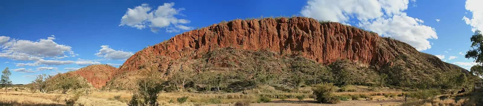
The free-standing cliffs are part of the James Range. The fact sheet explains how the colours formed:
- In earlier, wetter times, water dissolved the red iron in the sandstone layers and drew it to the surface during dry seasons.
- These red minerals formed a dark, iron-rich capping, leaving leached white layers below.
- The hard red capping weathers slowly, while the softer white sandstone below erodes quickly into loose sand.
- Weathering and erosion also shaped the valley, carving the sandstone blocks into rock faces and squared towers.
NT Parks says the bands change from ochre red to orange and purple in the soft light of morning and late afternoon, around sunset.
Walks
The fact sheet lists two walks, both Grade 2 (easy) and suitable for families:
| Walk | Distance | Highlights |
|---|---|---|
| Mushroom Rock loop | 1 km loop | A sandstone formation carved by wind and rain over millions of years, with many fairy martin nests on its upper walls. |
| Claypan Walk | 1.6 km return | Follows the edge of the mostly dry claypans, with several viewing platforms that give the best views of the valley. |
After rain, the claypans can briefly turn into reflective pools, which makes for spectacular photos of the bluffs. NT Parks says the claypan walk is well worth it, especially in wildflower season.
Getting there
- NT Parks says the turnoff is 75 km south of Alice Springs on the Stuart Highway.
- The reserve is a further 22 km on an unsealed access road. The fact sheet says it has some sandy patches.
- A 4WD is recommended.
- The reserve is open all year, except when roads close after heavy rain. Check the NT Road Report before you go.
See 4WD driving and the Stuart Highway.
Camping
Camping is permitted in the designated camping areas only.
- You must book online and pay a fee before you go. You can't pay at the site.
- Facilities listed by NT Parks include fire pits, public toilets, picnic tables, barbecues, campsites, walking tracks and information signs.
- Firewood collection isn't permitted in the reserve. Bring your own.
Camping lets you see the cliffs at both sunset and sunrise. On a clear night, the skies are superb. See outback camping and stargazing and dark skies.
When to visit
NT Parks says the best time is in the cooler months, from April to September. It warns that temperatures across the NT can exceed 40°C between October and April. Check for heatwave warnings with the Bureau of Meteorology before you go.
Photography tips
- Arrive for the last hour or two before sunset, or camp for sunrise.
- After rain, look for reflections in the claypans from the viewing platforms.
- Stay on the walking tracks and platforms.
- Drones aren't permitted in the reserve.
See outback photography.
Park rules
- Visitors to the NT need an NT Parks Visitor Pass.
- Stay on designated roads and tracks.
- Historic and cultural items, and wildlife, are protected.
- No firewood collection. Fires only in designated fire pits.
- No bins. Take your rubbish with you.
- No pets, generators or drones.
Safety
- Carry and drink plenty of water.
- Wear a hat, sunscreen, insect repellent and suitable clothing and footwear.
- Avoid strenuous activity in the heat of the day.
- Use the free interactive park maps on your phone or tablet. Download them while you still have coverage.
For park information, contact Parks and Wildlife on 08 8951 8250.
Combine with
Frequently asked questions
Do you need a 4WD for Rainbow Valley?
NT Parks recommends a 4WD. The turnoff is 75 km south of Alice Springs on the Stuart Highway, then it's a further 22 km on an unsealed access road. The fact sheet says the road has some sandy patches, and roads may close after heavy rain.
Can you camp at Rainbow Valley, NT?
Yes. Camping is permitted in the designated camping areas only. NT Parks says you must book online and pay before you go. You can't pay at the site. Facilities include fire pits, toilets, picnic tables and barbecues.
Why is Rainbow Valley sacred to Aboriginal people?
Rainbow Valley is the traditional country of the Upper Southern Arrernte people, who know it as Wurre. The fact sheet describes it as a living cultural landscape, part of the country to which they belong, with very important archaeological sites that show ancient Aboriginal connections to the area.
How far is Rainbow Valley from Alice Springs?
The turnoff is 75 km south of Alice Springs on the Stuart Highway, and the reserve is a further 22 km east on an unsealed road. That's about 97 km in total.
Is Rainbow Valley worth visiting?
Yes, especially at sunset or sunrise, when the banded sandstone bluffs glow red, orange and purple. It's an easy detour from the Stuart Highway south of Alice Springs, with two short, easy walks and a campground facing the cliffs.
Can you visit Rainbow Valley as a day trip from Alice Springs?
Yes. It's about 97 km from Alice Springs (75 km on the Stuart Highway, then 22 km of unsealed road), so a half-day or sunset trip is possible. If you stay for sunset, allow time to drive the unsealed road carefully in fading light, or book a campsite.
Sources and further reading
Facts on this page were checked against these primary and official sources. Conditions change — confirm before you travel or buy.
- Rainbow Valley Conservation Reserve — NT Government
- Rainbow Valley Conservation Reserve fact sheet (PDF) — Parks and Wildlife Commission of the Northern Territory
- NT Road Report — NT Government