About the park
Currawinya National Park is in Budjiti Country, in the semi-arid mulga lands of south-west Queensland. Queensland Parks and Wildlife Service (QPWS) says it's one of the state's largest national parks.
How it grew. The park was first declared in 1991, covering 154,870 ha of a former grazing property. In 2015 it expanded with the purchase of Boorara (115,000 ha), Werewilka (53,000 ha) and Bingara (21,000 ha). That brought the total to about 344,000 ha. QPWS's About page gives the figure as 334,000 ha, so treat the size as approximate.
The lakes. The centrepiece is a pair of large lakes separated by only a few kilometres of sand dunes:
- Lake Numalla is freshwater.
- Lake Wyara, slightly larger, is saline.
The Paroo River. The river meanders through the park, lined with coolabah, river red gums and yapunyah trees. QPWS says this 600 km river is the last free-flowing river in the whole Murray-Darling Basin.
Springs. In the low foothills and on the sandy plains are endangered mound springs and soaks, fed by water from the Great Artesian Basin.
Ramsar listing. QPWS says these wetlands and waterways are among the most important inland waterbird habitats in Australia. Their international significance was recognised in 1992, when the Currawinya Ramsar site was designated. It's one of only five Ramsar sites in Queensland.
Heritage. The park protects thousands of years of Aboriginal cultural heritage, as well as relics of pastoral activity dating from the 1860s. QPWS describes the entire park as a living cultural landscape for the Budjiti people. The welcome asks you to respect the lands and waters, and walk softly on their Country.
Getting there
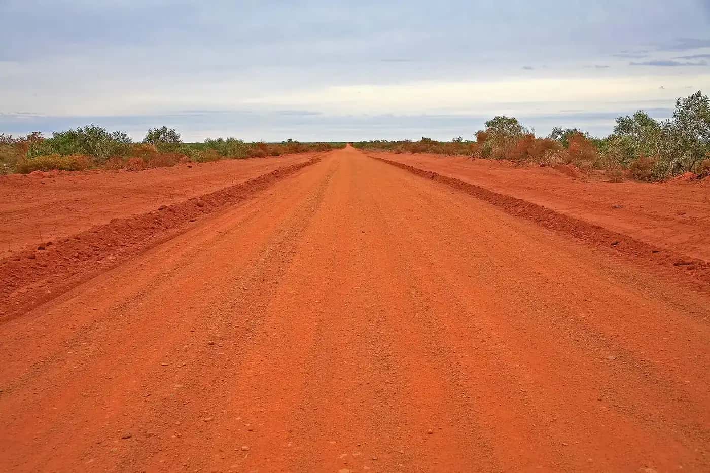
All roads to and in the park are unsealed and may become impassable when wet. QPWS recommends a 4WD.
- From the north: travel about 170 km south-west of Cunnamulla, turning towards Hungerford 4 km west of Eulo.
- From the south: enter via Hungerford, 217 km north-west of Bourke.
The park office is 4 km north of Ten Mile Bore, or 20 km north of Hungerford.
Pastoral land. Access is through working pastoral properties. Watch for stock on unfenced roads, leave gates as you find them, and respect landholders' rights.
Flooding. After good rain, whether local or far upstream, flooding can cut the park off from nearby towns for long periods and submerge the Paroo River campsites. The road to the lakes often closes after rain.
Things to do
Drive to the lakes. A drive from the park office to Lake Wyara and Lake Numalla is an 85 km round trip. QPWS says it shows some of inland Australia's most important wetlands, and a variety of mulga lands habitats on the way.
Heritage drives.
- Currawinya Woolshed, 4 km from the park office.
- Boorara Woolshed, 47 km north of the office. Stay inside the viewing area, because the woolshed has rotten timber, loose iron, rusty wire and nails.
- The old Caiwarro homestead site, at the eastern end of the park, 37 km from the office.
- Beefwood Road, where you'll pass 100-year-old gidgee fence posts, old stockyards and a station hut.
- Werewilka Creek Circuit, a 26 km drive with wildlife along creek beds and claypans.
The Granites. A 1.5 km return Grade 4 walk to a small outcrop of granite, dated at 230 to 310 million years old. It's on the Boorara Road. Please respect the site's cultural significance: climbing the Granites isn't allowed.
Budjiti Lookout. A 360 m return walk up a rocky slope, 44 km north-west of the park office, with sunset views over an endless horizon.
Birdwatching. Walk rather than drive near the lakes, to see more birds and protect fragile ecosystems. Pink (Major Mitchell's) cockatoos often feed along the roadsides. Early morning is best for spotting and photographing arid-zone wildlife.
Hungerford. On the border, 20 km south of the park office, the historic Royal Mail Hotel still operates and sells meals, diesel and unleaded fuel.
Camping
Paroo River bush camps:
- Ourimperee Waterhole, behind the Currawinya Woolshed
- Caiwarro Waterhole
- Corni Paroo
- Pump Hole
These are shady sites beside waterholes, where you can swim, fish, canoe, birdwatch and bushwalk. They take tents, caravans and camper trailers. They have no toilets, though Ourimperee is close to flushing toilets and a bush shower. Corni Paroo and Pump Hole have picnic tables.
Myninya camping area is a semi-permanent wetland in the heart of the park, ideal for birdwatching, photography and bushwalking. It has toilets, showers and picnic tables, and takes tents and camper trailers but not caravans. Camping is permitted only in the defined area.
Rules:
- Camping permits are required and fees apply. Display your booking tag at your site.
- All camping areas close when the Paroo River floods.
- Don't collect firewood, as penalties apply. Bring clean mill off-cuts or use a fuel stove.
- Generators and dogs aren't allowed.
Other accommodation is available at Hungerford, Eulo, Thargomindah and Cunnamulla.
Fishing and boating
- Fishing is allowed along some sections of the Paroo River, but not at the lakes. Only live bait caught next to the park can be brought in.
- Paddling and swimming. You can canoe, kayak or swim on Lake Numalla or the Paroo River.
- Motorised boats and jet-skis aren't permitted anywhere in the park.
- Aircraft must stay at least 1,500 ft above the ground over the Ramsar site.
Weather and the best time to visit
QPWS says the best time to visit is April to September.
| Conditions | |
|---|---|
| Summer | Days can exceed 40°C |
| July | Average maximum of 19°C, nights can fall to -5°C |
The clear winter nights bring magnificent starry skies. Average annual rainfall is just 295 mm, and more than half falls in summer.
Safety
Plan ahead:
- Tell someone your itinerary.
- Carry at least 7 litres of water per person per day, plus emergency food and water for at least seven days.
- Bring two spare tyres, coolant, oil and extra fuel.
- Prepare for an extra four or five days in case flooding strands you. QPWS says you can be stranded away from camp, especially if you visit the lakes.
On the road:
- Drive below 40 km/h on the park's narrow unsealed roads, and watch for kangaroos and emus.
- If your vehicle breaks down, stay with it.
Phones and emergencies:
- Mobile coverage is available at the ranger station, but poor or absent in most areas. Satellite phones work in the park, and a personal locator beacon is recommended.
- In an emergency, phone Triple Zero (000).
- Hungerford police are on (07) 4655 4088. Rangers and other visitors may be on UHF channel 2 (duplex).
Pets aren't permitted, and there are no bins, so take all rubbish with you. Fuel and supplies are available at Cunnamulla, Eulo, Thargomindah and Bourke.
Combine with
- Cunnamulla and Thargomindah.
- Bourke, across the border.
- Paroo-Darling National Park, downstream on the Paroo in NSW.
Frequently asked questions
Where is Currawinya National Park?
It's on the Queensland–NSW border near Hungerford, about 170 km south-west of Cunnamulla. From the south, enter via Hungerford, 217 km north-west of Bourke. Queensland Parks and Wildlife Service says the park office is 20 km north of Hungerford.
Can you camp at Currawinya National Park?
Yes. QPWS lists bush camping at Ourimperee Waterhole behind the Currawinya Woolshed, and at Caiwarro, Corni Paroo and Pump Hole waterholes on the Paroo River. Myninya, a semi-permanent wetland, has toilets and showers. Camping permits are required, fees apply, and all camping areas close when the Paroo River floods.
Can you swim or boat at Currawinya?
QPWS says you may canoe, kayak or swim on Lake Numalla or the Paroo River. Motorised boats and jet-skis aren't permitted on the lakes, waterholes or river. Signs at Lake Wyara and Lake Numalla show which activities are allowed where.
Can you fish at Currawinya National Park?
Yes, along some sections of the Paroo River, but not at the lakes. Check with the ranger or on-site signs. Only live bait caught next to the national park can be brought into the park.
Which national park in Queensland is considered the best?
That's a matter of taste. For wetlands and birdlife in the outback, Currawinya stands out: QPWS calls its lakes and wetlands among the most important inland waterbird habitats in Australia, and they're Ramsar-listed.
Sources and further reading
Facts on this page were checked against these primary and official sources. Conditions change — confirm before you travel or buy.
- Currawinya National Park — Queensland Parks and Wildlife Service
- Currawinya National Park: about — Queensland Parks and Wildlife Service
- Currawinya National Park: things to do — Queensland Parks and Wildlife Service
- Currawinya National Park: camping — Queensland Parks and Wildlife Service
- Visiting Currawinya safely — Queensland Parks and Wildlife Service