The Outback Way is often called "Australia's longest shortcut". It runs east–west across the middle of the continent, linking Western Australia's Goldfields with central-west Queensland through the Northern Territory's Red Centre. It's really a chain of existing roads, and governments are progressively sealing and upgrading them. The Outback Highway Development Council (OHDC), an alliance of the councils along the route formed in 1998, promotes it.
The route at a glance
| Ends | Laverton (WA) and Winton (Qld) |
| Length | 2,720 km (Australian Government); about 2,700 km (Outback Way) |
| Via | Warburton, the Uluru region, Alice Springs, Boulia |
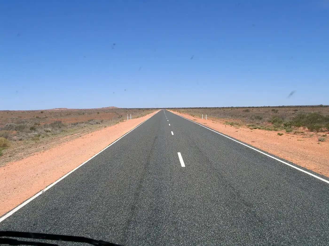
| Surface | Mix of dual-lane seal, single-lane seal and unsealed road |
| Sealing | About 1,600 km sealed; completion due by 2032 |
The OHDC says that since 1998 it has secured $1.2 billion in funding for sealing. In 2022 the federal government committed $678 million, with a 20% contribution from the states and territory, to complete the sealing by 2032. When it's finished, the OHDC says, it will be Australia's third east–west transcontinental road.
The sections
Laverton to the NT border (Great Central Road, WA). This is the most remote section. It crosses the Great Victoria and Gibson desert country through Aboriginal communities, including Warburton. Services are few and far apart, and permits may be required to travel through Aboriginal land. Check the requirements with the relevant land council and WA authorities before you go.
NT border to Alice Springs. In the Northern Territory, the route passes the Uluru-Kata Tjuta region and continues to Alice Springs. Many travellers break the trip here for several days. See the Uluru itinerary and the Red Centre guide. Travel on Aboriginal land in Central Australia may need a permit from the Central Land Council, depending on your route. Main public roads are generally excluded, but side trips may not be.
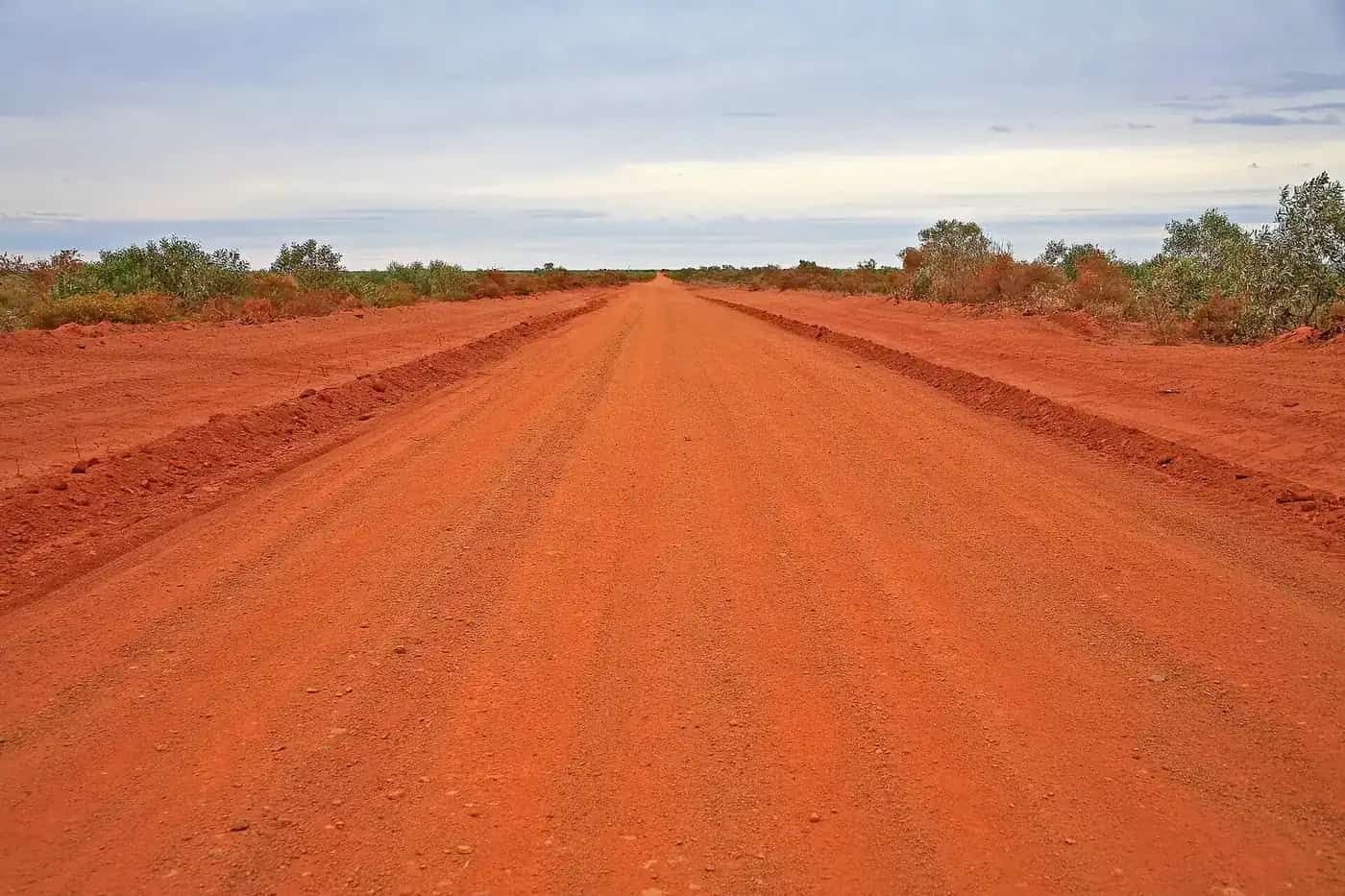
Alice Springs to Boulia (Plenty Highway and Donohue Highway). East of Alice Springs, the route follows the Plenty Highway across to the Queensland border. It then follows the Donohue Highway to Boulia. These sections include long unsealed stretches that can be corrugated and close after rain.
Boulia to Winton (Kennedy Developmental Road). The final leg is sealed. It leads into Winton, with its dinosaur attractions and the Waltzing Matilda Centre. From Winton, the Matilda Way runs north and south.
How long to allow
Unsealed and single-lane sections slow you down, and closures after rain can strand you for days. Plan on:
- 7–8 days minimum for a straight drive with overnight stops at roadhouses or communities.
- 10–14 days with a few days around Uluru, Kata Tjuta and Alice Springs.
- 2–3 weeks if you want side trips into the West MacDonnell Ranges, or to Boulia and Winton's attractions.
Vehicle and preparation
The Outback Way's FAQs note that conditions can change quickly with traffic and weather, and vary across the route. A high-clearance 4WD is the usual recommendation for the unsealed sections, particularly in WA and on the Plenty and Donohue highways. Carry:
- At least two spare tyres, a puncture repair kit and a compressor
- Enough fuel for the longest gap on your planned route, plus a margin
- Water for drinking and emergencies (see water and food planning)
- A satellite phone, satellite messenger or PLB
Read best vehicle for the outback and 4WD recovery before you go. Towing is possible on some sections, but corrugations are hard on trailers. See caravanning in the outback.
Road conditions
Check conditions every day:
- NT: Road Report NT
- Queensland: QLDTraffic (13 19 40)
- WA: Main Roads WA and the Shire of Laverton for the Great Central Road
The Outback Way publishes a paper map each year showing the latest sealing.
When to go
The cooler months, roughly April to September, are the most comfortable. Summer is extremely hot, and storms can close unsealed roads. See outback weather by month and wet season and road closures.
Respect Country
Much of the route crosses Aboriginal land. Follow permit conditions, stay on the road, don't enter communities unless invited or permitted, and respect any alcohol restrictions. See visiting Country respectfully.
Highlights along the route
- Laverton: the western gateway, in the WA Goldfields, with mining history and a starting point for the Great Central Road.
- The desert crossing: hundreds of kilometres of spinifex, desert oak and red sand through the Great Victoria and Gibson deserts. Some of the most remote country you can drive on a public road.
- Uluru and Kata Tjuta: the route's centrepiece. Allow at least two to three days. See the Uluru itinerary.
- Alice Springs: resupply, rest, and the MacDonnell Ranges. See Alice Springs.
- Boulia: a small Channel Country town known for its camel races and the Min Min light legend. See Boulia.
- Winton: the eastern end, with dinosaur sites and the Waltzing Matilda Centre. See the Dinosaur Trail.
Is it worth it?
The Outback Way suits experienced, well-prepared travellers who want to cross the continent through its centre rather than around its edges. It isn't the fastest route on every leg yet, because unsealed and single-lane sections are slow. As sealing progresses toward 2032, conditions will improve, but for now it remains a genuine remote-area drive. If you'd prefer a fully sealed east–west trip, the Nullarbor crossing in the south is the alternative.
Fuel and supplies
Fuel and food are available at roadhouses and some communities along the route, but opening hours are limited and supplies can run short. Don't rely on any single stop. Carry enough fuel to cover the longest gap on your planned route with a comfortable margin. Ask at Laverton, Yulara, Alice Springs, Boulia or Winton for current information. Remote community stores serve local residents first, so be patient and respectful.
Communications
Mobile coverage is very limited outside towns and some communities. Carry a satellite phone, messenger or PLB, and a UHF radio for talking to other vehicles and road trains. Register your travel plans with someone you trust, and agree on check-in times. See remote area travel safety.
Related guides
Frequently asked questions
How long is the Outback Way?
The Australian Government's Infrastructure Investment Program describes it as a 2,720 km route connecting Laverton (WA) with Winton (Qld) via Alice Springs (NT). The Outback Way's own site usually rounds it to 2,700 km.
Is the Outback Way sealed?
Not yet. The Outback Way's site says about 1,600 km has been sealed, with 1,100 to 1,150 km remaining, and sealing is due to be completed by 2032. Conditions vary from dual-lane seal to single-lane seal and unsealed sections.
How long does it take to drive the Outback Way?
Most travellers allow at least a week, and two weeks or more if they want time at Uluru, Kata Tjuta, Alice Springs and the Queensland towns. Unsealed sections are slow, and closures after rain can add days.
Where does the Outback Way start and finish?
It starts at Laverton in WA's Goldfields and finishes at Winton in central-west Queensland, on the Landsborough Highway (part of the Matilda Way). In between, it passes through Warburton, the Uluru region, Alice Springs and Boulia.
Sources and further reading
Facts on this page were checked against these primary and official sources. Conditions change — confirm before you travel or buy.
- Outback Way — Australian Government Infrastructure Investment Program
- About the Outback Way — Outback Highway Development Council
- Outback Way FAQs — Outback Highway Development Council
- Road Report NT — Northern Territory Government
- Permits to enter Aboriginal land — Central Land Council