The Simpson Desert spans the corners of South Australia, Queensland and the Northern Territory. Protected areas include Munga-Thirri–Simpson Desert National Park in SA and Munga-Thirri National Park in Queensland. The desert is the Country of the Wangkangurru and neighbouring peoples.
The crossing
Most crossings run between Dalhousie Springs in Witjira National Park (SA) and Birdsville. Common routes include:
- French Line — the most direct route, crossing many dunes.
- Rig Road — a longer route with a more gradual approach.
- QAA Line — the eastern section to Big Red near Birdsville.
Preparation
- A well-maintained 4WD, sand flag, recovery gear, compressor and tyre repair kit.
- Fuel for the crossing and a reserve — there is no fuel between Mount Dare and Birdsville.
- Plenty of water and food.
- Satellite communications and a PLB.
- Travel in convoy if you can, and tell someone your plans.
Seasons
The desert parks close over summer. The cooler months bring cold nights and mild days.
Respect
The desert holds many cultural sites. Stay on designated tracks, take rubbish out and leave artefacts where they lie.
The world's longest parallel dunes
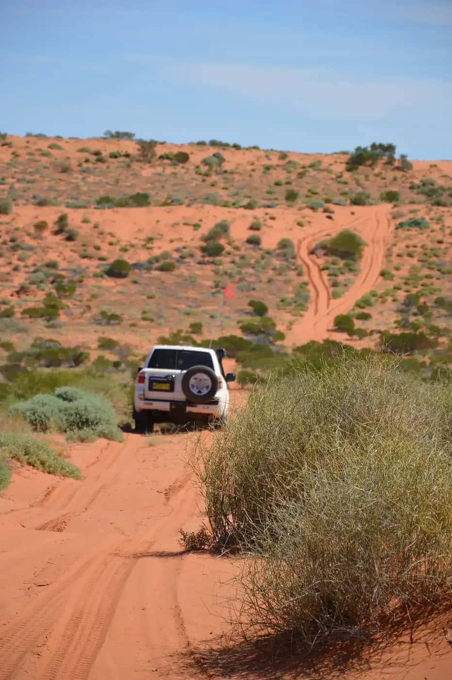
The Simpson Desert is famous for its long, parallel red sand dunes, which run roughly north-north-west to south-south-east for hundreds of kilometres. Crossing west to east means climbing over them one after another; on the French Line, there are more than a thousand. Between the dunes lie swales of clay, gibber and spinifex, and salt lakes in the south. After rain, the desert can bloom with wildflowers.
Poeppel Corner
Poeppel Corner, where South Australia, Queensland and the Northern Territory meet, lies in the heart of the desert on the edge of a salt lake. A replica of the original survey post, placed by surveyor Augustus Poeppel in the 1880s, marks the spot. Many crossing routes pass nearby.
Big Red
At the eastern edge of the desert, about 35 km west of Birdsville, Big Red (Nappanerica) is the best-known dune in the Simpson. Climbing it by 4WD is a rite of passage, but it is steep and requires lowered tyre pressures and care. It is also the site of a large music festival held in some years.
Dalhousie Springs
On the western edge of the desert, Dalhousie Springs in Witjira National Park is a warm artesian pool, a welcome stop before or after a crossing. Mount Dare, nearby, has fuel, a hotel and camping, and is the last fuel stop before Birdsville.
Fuel and water planning
Fuel use in sand is much higher than on bitumen, often double or more, especially with heavy loads or soft dunes. Calculate fuel for the longest route you might take and add a generous reserve. Carry enough water for the trip and extra in case of delays. There are no services between Mount Dare and Birdsville.
Driving in the dunes
- Lower tyre pressures to suit sand, and carry a compressor to reinflate.
- Fly a sand flag high on your vehicle so oncoming traffic can see you on dune crests.
- Use your UHF radio to announce your position as you approach dune crests.
- Don't attack dunes at speed. Use momentum carefully, and back down and try again if needed.
- Stay on designated tracks to protect the dunes and cultural sites.
See our 4WD driving guide and remote-area travel safety guide.
Wangkangurru Country
The Simpson Desert is the Country of the Wangkangurru, Yarluyandi and neighbouring peoples, who lived in the desert by using a network of wells (mikiri) dug into the swales. Many cultural sites remain. Leave artefacts where they lie, and respect closures.
Camping
Camping is permitted at many sites along the tracks with the correct permits. Bring a portable toilet or use designated facilities where available, collect firewood before entering the parks if fires are allowed, and take all rubbish out.
Choosing a route
The French Line is the most direct crossing but has the most dunes and is the most demanding. The Rig Road, built for oil exploration, is longer but generally gentler, with a firmer surface in places. The QAA Line links the eastern part of the desert to Big Red and Birdsville. Many travellers combine routes, for example taking the Rig Road for part of the way and the QAA Line at the eastern end. Detours to Approdinna Attora Knolls, Purni Bore and Poeppel Corner add interest. Check current track conditions and closures with park authorities before choosing your route.
Life in the dunes
The Simpson Desert is far from lifeless. Spinifex and canegrass grow on the dunes, while gidgee and coolibah grow in the swales between them. Dingoes, lizards such as sand goannas and thorny devils, and birds including the Eyrean grasswren live here. After rain, the desert can turn green and flower, and wildlife becomes much more active. Keep to tracks to avoid damaging dune vegetation and burrows.
Recovery costs and insurance
If your vehicle breaks down or is badly bogged in the Simpson, recovery can be extremely expensive and slow. Check what your vehicle insurance and roadside assistance cover in remote areas — many standard policies exclude or limit off-road recovery. Travelling with at least one other vehicle and carrying spares and recovery gear greatly reduces the risk.
Communications
There is no mobile coverage in the desert. Carry a satellite phone or messenger and a registered personal locator beacon. UHF radio is useful for talking to other vehicles on the tracks, especially near the dune crests.
Related guides
Nearby park guide: Witjira National Park and Dalhousie Springs.
Frequently asked questions
Do you need a permit to cross the Simpson Desert?
Yes. You need a Desert Parks Pass (or relevant permits) for the South Australian parks, and a camping permit for Munga-Thirri National Park in Queensland.
How long does it take to cross the Simpson Desert?
Most travellers allow three to five days for a crossing between Dalhousie Springs and Birdsville, depending on the route, vehicle and conditions.
When is the Simpson Desert closed?
The Simpson Desert parks in South Australia and Queensland close each summer, generally from 1 December to 15 March, because of extreme heat. Check the park websites for current dates.
When is the Simpson Desert closed?
The desert parks in SA and Queensland close over the hottest months, generally from December to mid-March. Check current closure dates.
Do I need a permit to cross the Simpson?
Yes. A Desert Parks Pass is required for the South Australian sections, and a Queensland park permit or camping permit for Munga-Thirri National Park in Queensland.
Sources and further reading
Facts on this page were checked against these primary and official sources. Conditions change — confirm before you travel or buy.
- Desert Parks Pass — National Parks and Wildlife Service SA
- Munga-Thirri–Simpson Desert National Park — National Parks and Wildlife Service SA
- Munga-Thirri–Simpson Desert National Park (SA) — National Parks and Wildlife Service SA
- Munga-Thirri National Park (Qld) — Queensland Parks and Wildlife Service