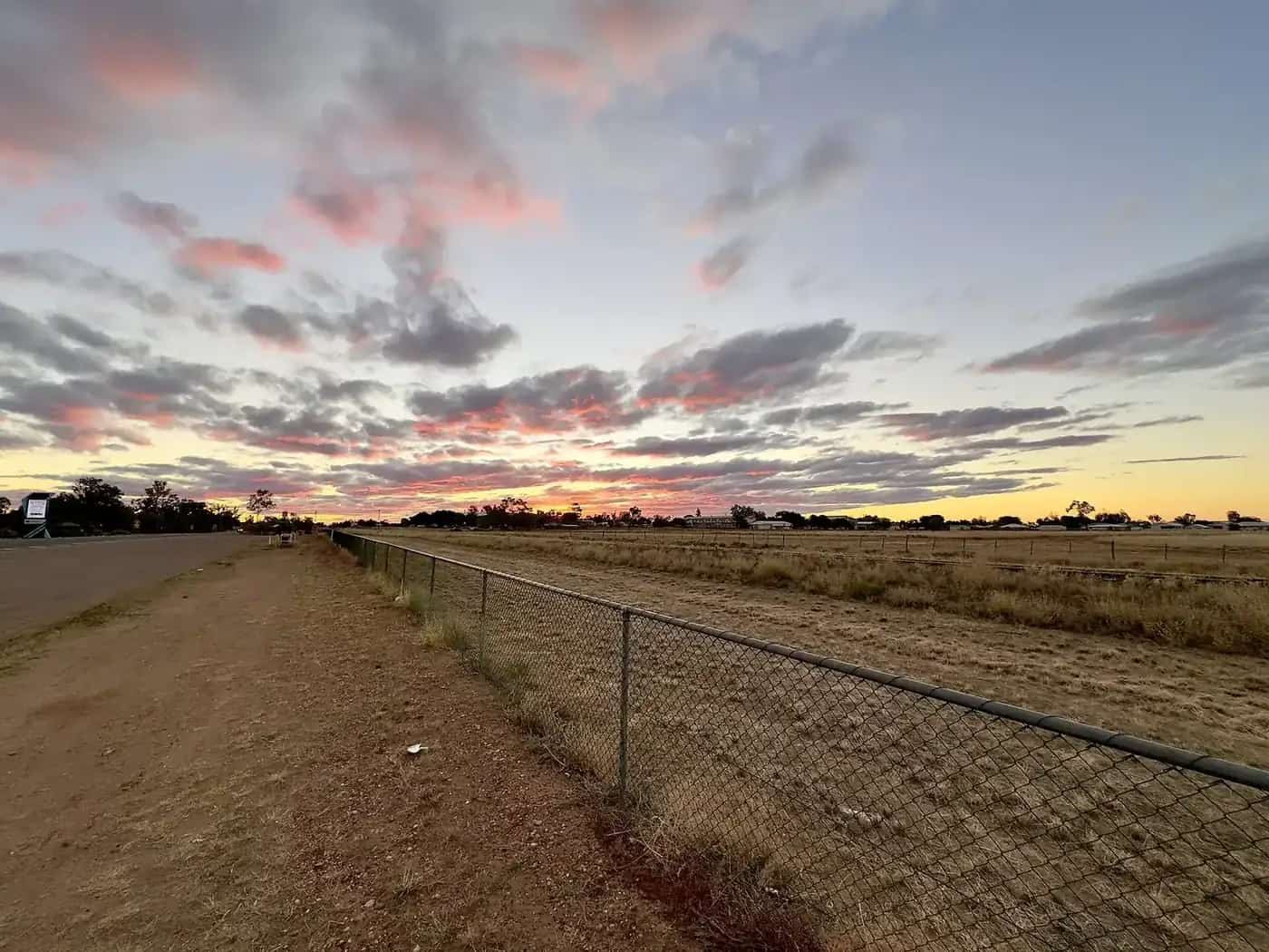
Duaringa lies on the Capricorn Highway in Central Queensland, on Ghungalu Country, in a district of cattle, grain and coal. It was settled in the 1860s and today is a quiet service town and rest stop for travellers heading west to the gemfields and Longreach.
Mackenzie Park
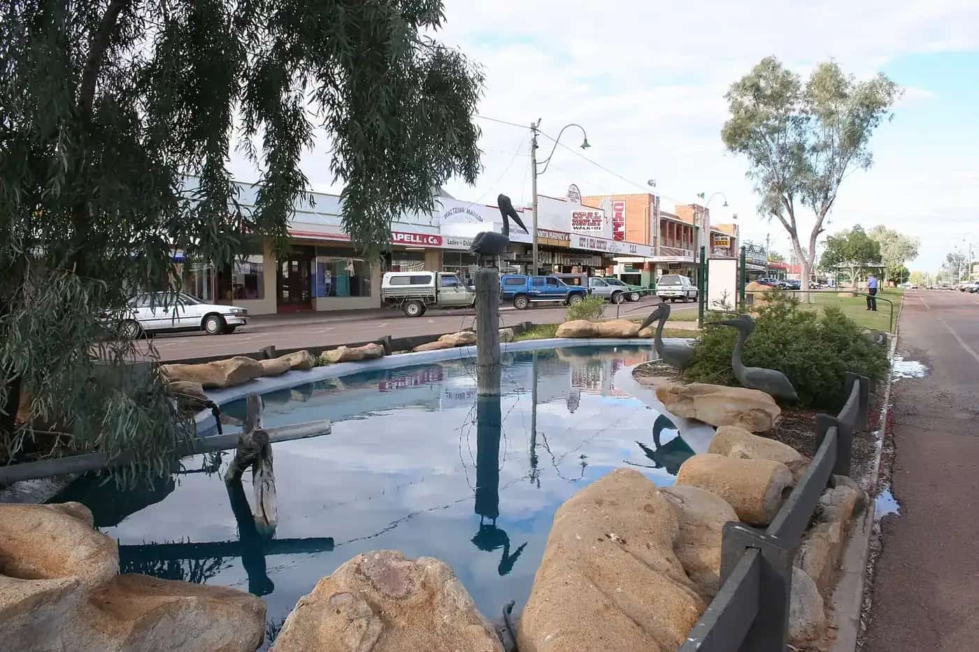
The centrepiece of town is Mackenzie Park, with a man-made waterfall and lagoon fed from the Dawson River supply line and recycled by pump. The waterfall is lit at night, creating colourful reflections on the water. Shady trees make it a favourite picnic and rest spot, and locals gather here for community events.
Among the trees are local stringybarks — a type of eucalypt with fibrous bark and small white spring flowers — that grow in the area's deep sedimentary and red volcanic soils and are a point of local pride.
Nearby
Dingo, about 40 km west, is known for its dingo statue and its tradition of a Dingo Trap Throwing competition. Blackdown Tableland National Park, further west near Dingo, offers sandstone escarpments, waterfalls and Ghungalu rock art, accessed by a steep range road. The Mackenzie River and Fitzroy River system offer fishing.
A short history
Duaringa sits in the Fitzroy Basin, a district of brigalow scrub, open eucalypt woodland and black-soil plains drained by the Mackenzie and Dawson rivers. Ghungalu people have cared for this Country for thousands of years, and rock art in the nearby Blackdown Tableland is a reminder of that long connection.
European pastoralists took up runs in the 1850s and 1860s, and a small settlement grew where the road west from Rockhampton crossed the district. The Central Western railway line, which pushed inland from Rockhampton from the late 1860s towards Emerald, Barcaldine and Longreach, gave towns like Duaringa a reason to exist: they became stopping points for steam trains, mail and supplies. Through the twentieth century the district's mainstay was beef cattle, joined from the 1960s by large-scale brigalow clearing for grazing and cropping, and later by the coal mines of the Bowen Basin to the north and west.
Today Duaringa is a quiet highway town in the Central Highlands Regional Council area. Its population is small, and it functions mainly as a service and rest stop for the cattle country around it and for travellers on the Capricorn Highway.
Why travellers stop
For people driving west from Rockhampton, Duaringa arrives at about the right time for a break, and Mackenzie Park makes that break pleasant. The lagoon and waterfall, the shady trees and the picnic facilities are a welcome contrast with the long, hot highway. The original Outback Now listing for Mackenzie Park was picked up by Wikipedia's article on the town, which is why many people still arrive at this page looking for it.
A typical stop involves a stretch of the legs around the lagoon, lunch in the park, a look at the town's few historic buildings and a top-up of fuel. Travellers who stay overnight often comment on how peaceful the park is once the highway traffic eases, and on the coloured lighting of the waterfall at night.
A day around Duaringa
Morning: leave Rockhampton early and drive west on the Capricorn Highway, stopping at Duaringa for coffee and a walk around Mackenzie Park while it is still cool.
Late morning: continue about 40 km to Dingo to see its dingo statue and the old railway town, then turn south towards Blackdown Tableland National Park. The road climbs steeply onto the sandstone plateau, which is markedly cooler than the plains. Walk to Rainbow Falls or Two Mile Falls (check current track status with Queensland Parks and Wildlife Service), and see the Ghungalu rock art on the Mimosa Culture Circuit.
Afternoon: return to the highway and either push on to Blackwater — known for its coal mining heritage and the Japanese Garden — and Emerald, or come back to Duaringa for the night.
The Blackdown Tableland access road is unsealed on the plateau and its range section is steep and narrow; it is not suitable for caravans. Check conditions after rain.
Seasons and weather
Duaringa has a subtropical, semi-arid climate. Summers are hot and humid, with most of the year's rain falling in storms between about November and March. Winters are mild and dry, with cool nights. The Bureau of Meteorology's climate statistics for the region show that the cooler months from April to September are the most comfortable for touring. Flooding on the Mackenzie and Dawson river systems can cut roads in a wet summer, so check QLDTraffic before travelling in the wet season.
Getting there
- From Rockhampton: about 110 km west on the sealed Capricorn Highway, roughly 75 minutes' drive.
- From Emerald: about 160 km east on the Capricorn Highway.
- By rail: Queensland Rail's Spirit of the Outback runs between Brisbane, Rockhampton and Longreach on the Central Western line through the region; check the current timetable for which towns it stops at.
The Capricorn Highway carries heavy vehicles servicing the coal mines and cattle industry. Drive with headlights on, be patient behind road trains, and avoid driving at dawn and dusk when kangaroos are active.
Where to stay and eat
Accommodation in Duaringa is limited to a small number of options, including a hotel and camping near Mackenzie Park. Check signage and the Central Highlands Regional Council for current camping rules and fees. Rockhampton, Blackwater and Emerald have a much wider choice of motels and caravan parks. For meals, the local pub is the main option; carry snacks and water, as opening hours in small towns can be limited.
Nearby towns
- Dingo — a small town west of Duaringa on the Capricorn Highway, known for its "Dingo statue" and annual Dingo Trap Throwing competition, held in some years.
- Blackwater — Queensland's "coal capital", with the Japanese Gardens and the Bluff and Blackwater mining towns further west.
- Emerald — the Central Highlands' main centre, gateway to the gemfields at Sapphire and Rubyvale, and to Lake Maraboon.
- Rockhampton — the coastal city on the Tropic of Capricorn, about 110 km east.
Travelling the Capricorn Highway
The highway is sealed and carries heavy traffic, including road trains and mining vehicles. Rest areas are spaced along the route. Fatigue is a major risk on long highway stretches; stop at least every two hours. Wildlife is common at dawn and dusk.
Blackdown Tableland from Duaringa
The Central Highlands guide puts Blackdown Tableland National Park about 70 km from Duaringa, so it makes an easy day trip. See our Blackdown Tableland guide for walks, camping and access.
Practical information
Duaringa has fuel, a hotel and basic services. Rockhampton is the nearest large centre. Continue west towards Emerald and the gemfields at Sapphire and Rubyvale, and on to Barcaldine and Longreach.
Explore nearby
Frequently asked questions
Where is Duaringa?
Duaringa is on the Capricorn Highway in Central Queensland, roughly 110 km west of Rockhampton, between Westwood and Dingo.
Can you camp in Duaringa?
The town has had a low-cost or free camping area near Mackenzie Park. Rules and fees change, so check signs and the Central Highlands Regional Council.
Sources and further reading
Facts on this page were checked against these primary and official sources. Conditions change — confirm before you travel or buy.
- Central Highlands Regional Council — Central Highlands Regional Council
- Blackdown Tableland National Park — Queensland Parks and Wildlife Service