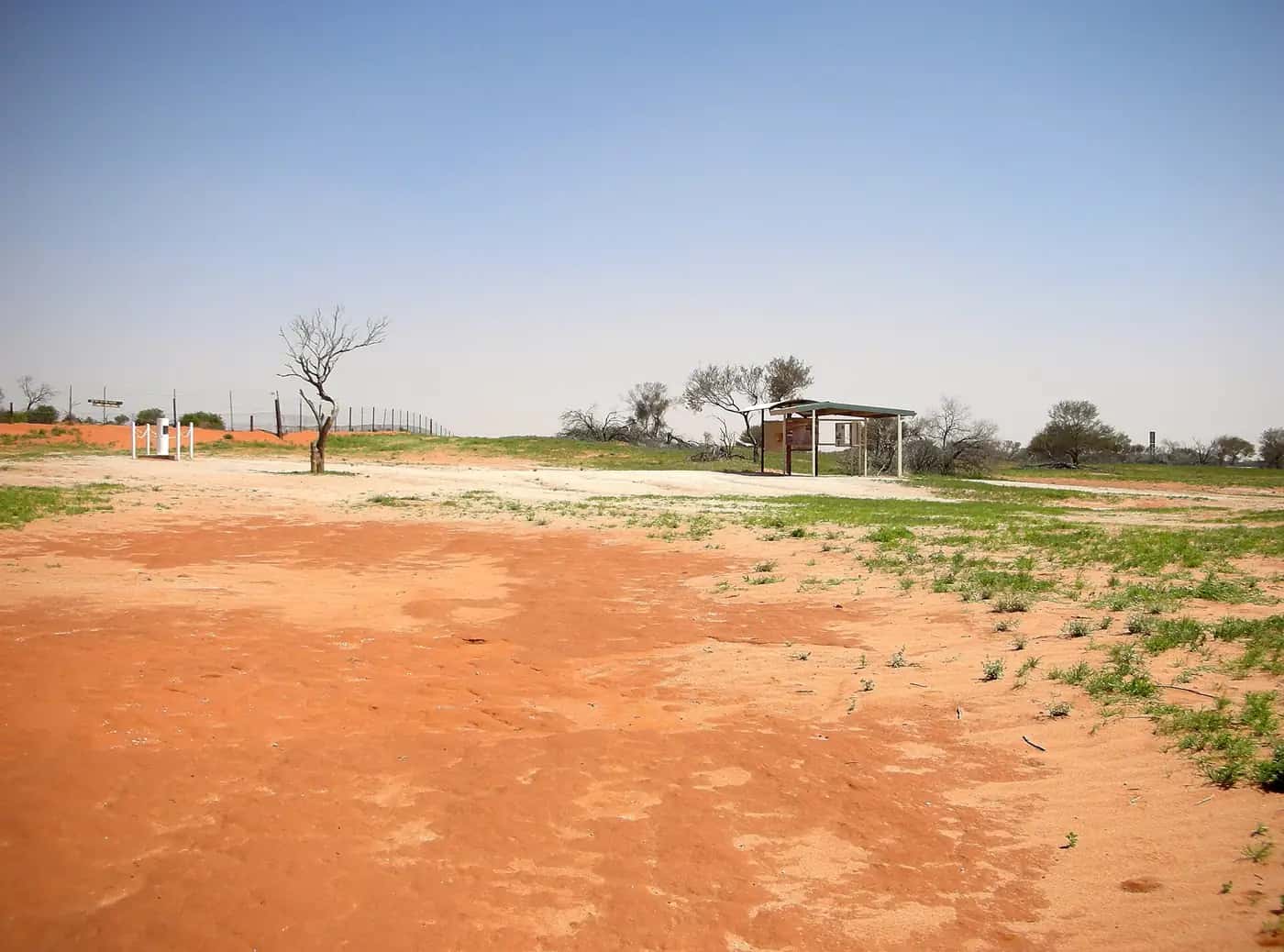
Cameron Corner sits about 140 km west of Tibooburra by unsealed road, at the meeting point of three states. There is no town: just the survey post, the Dog Fence, the Corner Store and the immense sand-dune country of the Strzelecki Desert. Reaching it is the point, and it is a classic Corner Country trip.
The survey post and its history
The Corner is named after John Brewer Cameron, a surveyor with the NSW Lands Department who marked the border between New South Wales and Queensland in the early 1880s, placing a post at the point where it met the South Australian border. The current marker commemorates that survey. Standing at the post, you can walk around three states in a few steps — one of the most photographed outback moments in Australia.
The Dog Fence
The Dingo Barrier Fence, usually called the Dog Fence, passes through Cameron Corner. Built to keep dingoes out of the sheep country of south-eastern Australia, it is one of the longest fences in the world. At the Corner it follows the state borders; gates must be left as you find them.
The Corner Store
The Corner Store, on the Queensland side of the post, has long been the only business here, offering fuel, meals, drinks, basic supplies and camping. It has also been a gathering point for local events. Opening hours and services vary, so contact it before relying on it.
Sturt National Park
Most travellers approach through Sturt National Park, which covers a large area of north-western NSW between Tibooburra and the Corner. Highlights include:
- Fort Grey — the closest camping area to the Corner, near Lake Pinaroo, where Charles Sturt's expedition camped in 1845. Its shallow lake fills only after rain, attracting waterbirds.
- Jump-ups and gibber plains on the Gorge Loop Road east of the park's centre.
- Wildlife — red kangaroos, emus, and birds such as zebra finches after rain.
Camping fees apply and facilities are basic; book through NSW National Parks.
Seasons and time zones
The cooler months from about May to September are best. Summer heat is extreme and makes breakdowns dangerous. In summer, daylight saving gives the Corner three time zones, a popular New Year's Eve novelty for those who celebrate it more than once.
Getting there
- From Tibooburra (NSW): about 140 km west via Fort Grey, unsealed.
- From Innamincka (SA): via the Strzelecki Track region and side roads, unsealed and remote.
- From Queensland: via Noccundra and Bollards Lagoon tracks, unsealed.
All routes close after rain, sometimes for days. Check Live Traffic NSW, Queensland's QLDTraffic and SA's outback road warnings, and observe closures — fines apply for driving on closed roads.
Travel safety
- Travel in a suitable, well-maintained vehicle with recovery gear, two spare tyres and plenty of water.
- Carry a satellite communication device such as a PLB or satellite phone; mobile coverage is very limited.
- Tell someone your route and expected arrival time.
- If you break down, stay with your vehicle.
See our outback safety guide for more.
Corner Country wildlife
After rain, the dune country around Cameron Corner can burst into life. Wildflowers such as poached-egg daisies, Sturt's desert peas and parakeelya bloom, and birds including budgerigars, zebra finches, black kites and wedge-tailed eagles become more common. Red kangaroos, emus and dingoes (on the northern side of the Dog Fence) are often seen, especially at dawn and dusk. Fort Grey and Lake Pinaroo are good places to see waterbirds when the lake holds water.
Charles Sturt's 1844–46 expedition
Charles Sturt led an expedition into central Australia from 1844, hoping to find an inland sea. His party was trapped for months at Depot Glen, near today's Milparinka, by heat and drought. They later pushed north-west, and Sturt's party camped near Lake Pinaroo, at what is now Fort Grey in Sturt National Park. The expedition endured scurvy and the death of second-in-command James Poole. Sturt never found an inland sea, but his journey opened knowledge of the region. The Depot Glen site and Poole's grave can be visited near Milparinka.
Packing list
- At least 10 litres of water per person per day, plus a reserve.
- Spare tyres (two is recommended), tyre repair kit and compressor.
- Recovery gear, shovel and first aid kit.
- Satellite phone or PLB, and paper maps.
- Food for extra days in case roads close.
Who it suits
Cameron Corner suits experienced outback travellers and those on guided 4WD tours. It is a remote, bucket-list destination rather than a casual detour, and should not be attempted in a two-wheel-drive car or in wet conditions.
Fuel, phones and medical help
The Cameron Corner Store sells unleaded and diesel, does puncture and minor mechanical repairs, and serves meals. Tibooburra is about 139 km away, and Innamincka about 274 km away via the Strzelecki Track. The nearest hospital is in Broken Hill.
Travelling with kids
Kids usually love standing in three states at once at the corner post.
Sturt National Park near the Corner
Cameron Corner sits on the north-western edge of Sturt National Park, and Fort Grey is the closest park campground. NSW National Parks lists Talpero lookout near Fort Grey, about 2 hours' drive from Tibooburra, as one of the park's lookouts.
Lake Pinaroo, about 24 km south-east of the Corner, was listed as a Ramsar wetland of international importance in 1996. When it fills after rain, it is one of the few places in the area with surface water and draws waterbirds.
The park also protects fenced areas where locally extinct mammals are being returned through the Wild Deserts program. NPWS lists the bilby, crest-tailed mulgara, western barred bandicoot, greater stick-nest rat, golden bandicoot, burrowing bettong and western quoll. These areas are not open for casual wandering, but they are part of why the landscape around the Corner matters.
The Dingo Fence runs along the state border here. NPWS describes the fence as about 5,614 km long, which makes it one of the longest fences in the world.
Practical information
- Nearest towns: Tibooburra (NSW), Innamincka (SA), Thargomindah (Qld).
- Services: the Corner Store only; no hospital, police or reliable mobile coverage.
- Permits: none needed to visit the Corner itself; park fees apply in Sturt National Park.
Explore nearby
See the Corner Country region guide for the wider area.
Frequently asked questions
Do you need a 4WD to reach Cameron Corner?
The roads are unsealed and conditions change quickly. A high-clearance 4WD is strongly recommended, and roads close after rain. Check NSW, Queensland and SA road reports before setting out.
Is there fuel at Cameron Corner?
The Corner Store has historically sold fuel, but supply and opening hours are not guaranteed. Carry enough fuel to reach Tibooburra, Innamincka or another reliable source, plus a reserve.
Why are there different time zones at the Corner?
South Australia uses Australian Central Time, New South Wales and Queensland use Eastern Time, and only NSW and SA observe daylight saving, so in summer three different clock times can apply within a few metres.
How long is the Dingo Fence?
NSW National Parks describes the Dingo Fence as about 5,614 km long. It runs past Cameron Corner along the state border.
Is there a campground near Cameron Corner?
Fort Grey campground in Sturt National Park is the closest. Park fees apply; check NSW National Parks for current bookings and fees.
Sources and further reading
Facts on this page were checked against these primary and official sources. Conditions change — confirm before you travel or buy.
- Sturt National Park — NSW National Parks and Wildlife Service
- Live Traffic NSW — Transport for NSW
- Outback road warnings — Government of South Australia
- Cameron Corner (Wikipedia) — Wikipedia
- Sturt National Park — NSW National Parks and Wildlife Service