Caravanners hit Longreach because the Matilda Way is bitumen, the town still has a supermarket, and two museums justify two nights with the van unhitched. This page stays with that official picture. It will not name parks the Explore Centre has not confirmed for you.
See caravanning in the outback and outback camping.
Town parks
The Longreach hub describes several caravan parks, some with nightly entertainment in season, plus cabins. Those are categories, not a roster with site counts and tariffs.
Longreach Explore Centre, 99A Eagle Street, (07) 4658 4141 or (07) 4658 4142, holds current names, whether big rigs fit, dump points and pet rules. Weekend hours shrink: noon close in March, weekends closed November–February. Phone on a weekday if you will arrive Saturday afternoon in summer.
Powered versus unpowered mixes change. Ask. Operators who want a checked listing use feature your business. Until then the hub listings slot stays empty.
If you need a motel instead, see Longreach accommodation.
Thomson River camping
The Thomson, a few kilometres north-west of town, is a Channel Country stream lined with coolabahs. The hub notes a free camping area on the river has been available near town and tells you to check current rules locally. That is still the instruction.
River camping is not a town tourist park. Confirm:
- Exact location and access.
- Maximum stay and whether the site is self-contained only.
- Fires, generators and dogs.
- Whether it is open after rain.
After big rains the river spreads across a wide floodplain. A dry-looking bank is not a forecast. January mean rainfall at Longreach Aero is 76.1 mm; February 77.9 mm (BOM). Do not camp in a channel because a blog pin from a drought year still shows a tent.
Iningai Country includes that waterhole. Stay on the public area the Explore Centre names. Do not drive onto station river frontage.
Highway towing
From Brisbane it is about 1,170 km via the Warrego and Landsborough, all sealed, or about 690 km from Rockhampton on the Capricorn Highway, also sealed. Road trains share both. Arrive in daylight. Wildlife and fatigue close more trips than corrugations do on this run.
Winton is about 180 km north-west — book that park separately if you are continuing the dinosaur trail. Barcaldine is about 105 km east. Neither is same-night overflow you can count on without a phone call.
Check QLDTraffic (13 19 40) after storms. Sealed highways still have floodways.
When sites fill
Experience Longreach puts the visitor season at April–October. Winter school holidays fill parks. A town that is also the end of the Spirit of the Outback line gets rail travellers and vans in the same week.
BOM Longreach Aero: annual mean rain 432.7 mm, driest mean month August 10.7 mm, hottest mean maximum December 37.7 °C. Dry-season vans want power and shade. Summer vans still need both, plus a plan if tours have paused. See Longreach weather.
Restock water and groceries in town. Choices thin west of here. Dump points belong in parks or signed council facilities, not in the river.
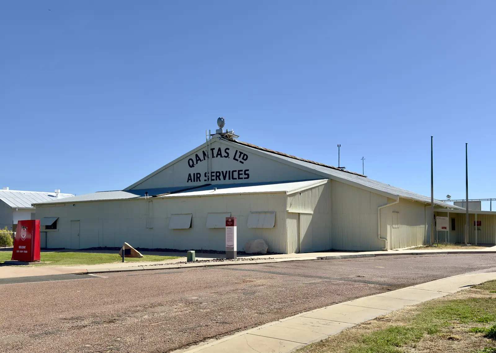
A practical sequence: QLDTraffic in the morning, Explore Centre or a phoned park booking, Landsborough Highway in daylight, Hall of Fame or Qantas hangar the next morning without moving the van across town in 37 °C.
What “caravan park” means here
Longreach is a full-service town: dump points, potable water, mechanics and groceries exist, but they are not evenly spread after hours. Experience Longreach’s visitor information is the place to confirm which parks currently take vans, tents and cabins — we do not keep an invented roster. If a park is full, Ilfracombe and Barcaldine are separate towns with their own rules, not overflow paddocks.
Pets, generators and unpowered sites are operator decisions. Ask before you assume a Queensland caravan-park standard. For a listing on this site, operators use Feature your business; empty slots on the Longreach hub stay empty until a real park is checked in.
Thomson River camping is not a substitute for a booked town park unless a public, signed camping area is named by the council or the Explore Centre. Station river frontage is not a free camp. Check QLDTraffic if you are arriving after rain, then unhitch in daylight.
Plan this trip
Tell us the dates, who you are travelling with and where you need help. We reply with planning notes for Longreach — we are not a booking agent.
Frequently asked questions
Are there caravan parks in Longreach?
Yes. Official visitor material describes several caravan parks, some with nightly entertainment in season, plus cabins. Confirm names, powered sites and pet rules at the Longreach Explore Centre, 99A Eagle Street. This page does not invent park names or prices.
Can I camp on the Thomson River?
A free camping area on the river has been available near town; check current rules locally with the Explore Centre. After big rains the Thomson spreads across a floodplain — do not camp on a flood runner.
Is the highway suitable for caravans?
The Warrego, Landsborough and Capricorn highways into Longreach are sealed. Road trains, wildlife and fatigue are the issues, not dirt. Check QLDTraffic after storms.
Sources and further reading
Facts on this page were checked against these primary and official sources. Conditions change — confirm before you travel or buy.
- Longreach Visitor Information Centre — Longreach Regional Council (Experience Longreach)
- Climate statistics for Longreach Aero (036031) — Bureau of Meteorology
- QLDTraffic — Queensland Government