At a glance
Sourced facts only. Distances and services change — confirm before you travel.
- Population
- 1,022 people in the urban centre (UCL515014, 2021 Census); 1,181 in the wider locality (SAL50508)
- Local government
- Shire of Derby/West Kimberley
- Traditional Owners
- Bunuba people for Dan͟ggu National Park (Parks and Wildlife Service WA; Bunuba Country)That wording is for the gorge park. A single nation for the Fitzroy Crossing townsite is not named on the sourced Tourism WA destination page used here. Confirm current wording with the shire.
- Nearest regional city
- Broome, 391 km west (Visit Broome Fitzroy Crossing page). Kununurra 647 km east on the same Visit Broome page.
- Nearest fuel
- Highway town; this hub does not list bowser brands. Fill when you can — Derby, Halls Creek and Broome are the next towns on this site.
- Nearest hospital or clinic
- Fitzroy Valley Health Service (WA Country Health Service Kimberley hospitals page)
- Mobile coverage
- Check Telstra and Optus coverage maps before travel; do not assume a signal off the highway.
- Best time to visit
- Tourism WA: May to October for warm dry days and cool evenings; December to March for storms. BOM Fitzroy Crossing Aero rain is concentrated December–March.
Climate
Monthly means from the Bureau of Meteorology station Fitzroy Crossing Aero (003093). This is not a forecast. Open station. Temperature 29 years (1997–2026); rainfall 27 years (1997–2026). Do not blend with FITZROY CROSSING COMP. (003006). Hottest mean maximum is November 40.8 °C.
| Month | Mean max (°C) | Mean min (°C) | Rainfall (mm) |
|---|---|---|---|
| Jan | 37.5 | 25.2 | 192.6 |
| Feb | 36.9 | 24.8 | 140.0 |
| Mar | 37.0 | 24.1 | 103.5 |
| Apr | 36.9 | 20.8 | 21.3 |
| May | 33.2 | 16.1 | 14.9 |
| Jun | 30.6 | 13.1 | 6.7 |
| Jul | 31.0 | 12.2 | 4.8 |
| Aug | 33.6 | 13.9 | 2.2 |
| Sep | 37.5 | 18.8 | 1.8 |
| Oct | 40.3 | 23.2 | 13.9 |
| Nov | 40.8 | 25.6 | 37.7 |
| Dec | 39.4 | 25.8 | 132.5 |
Fitzroy Crossing in pictures
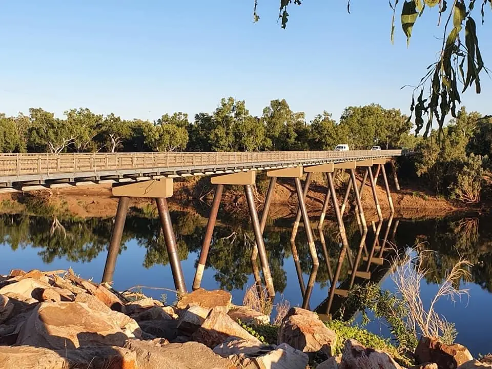
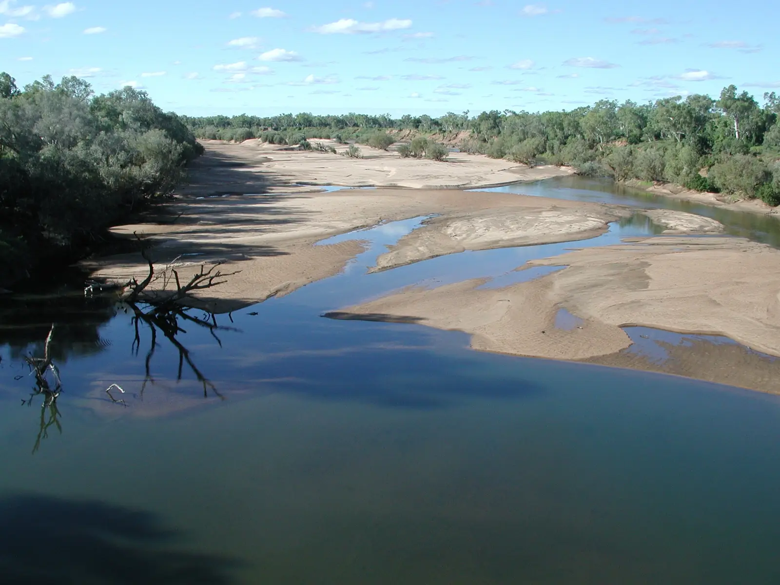
Fitzroy River, Western Australia 02Photo: Dan arndt · CC BY-SA 4.0 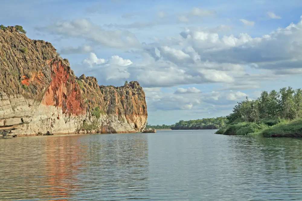
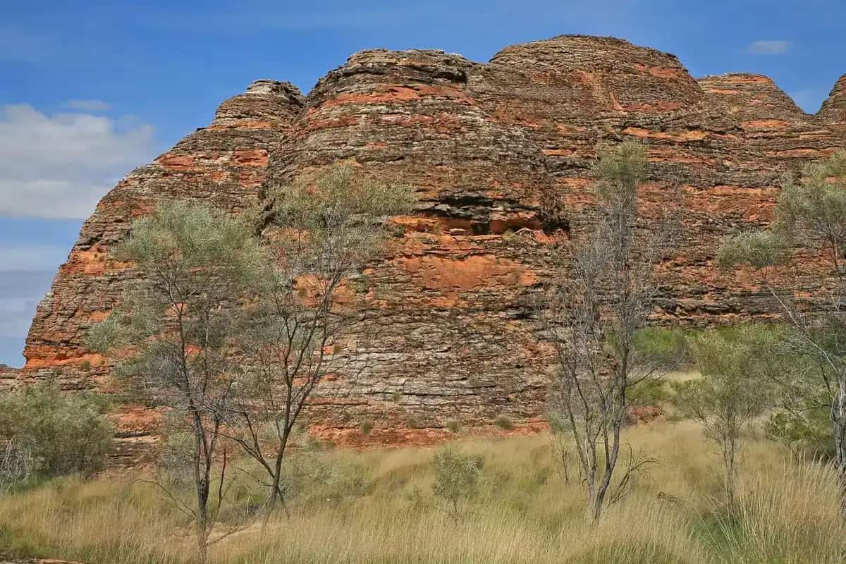
Western Australia Geikie Gorge National ParkPhoto: W. Bulach · CC BY-SA 4.0 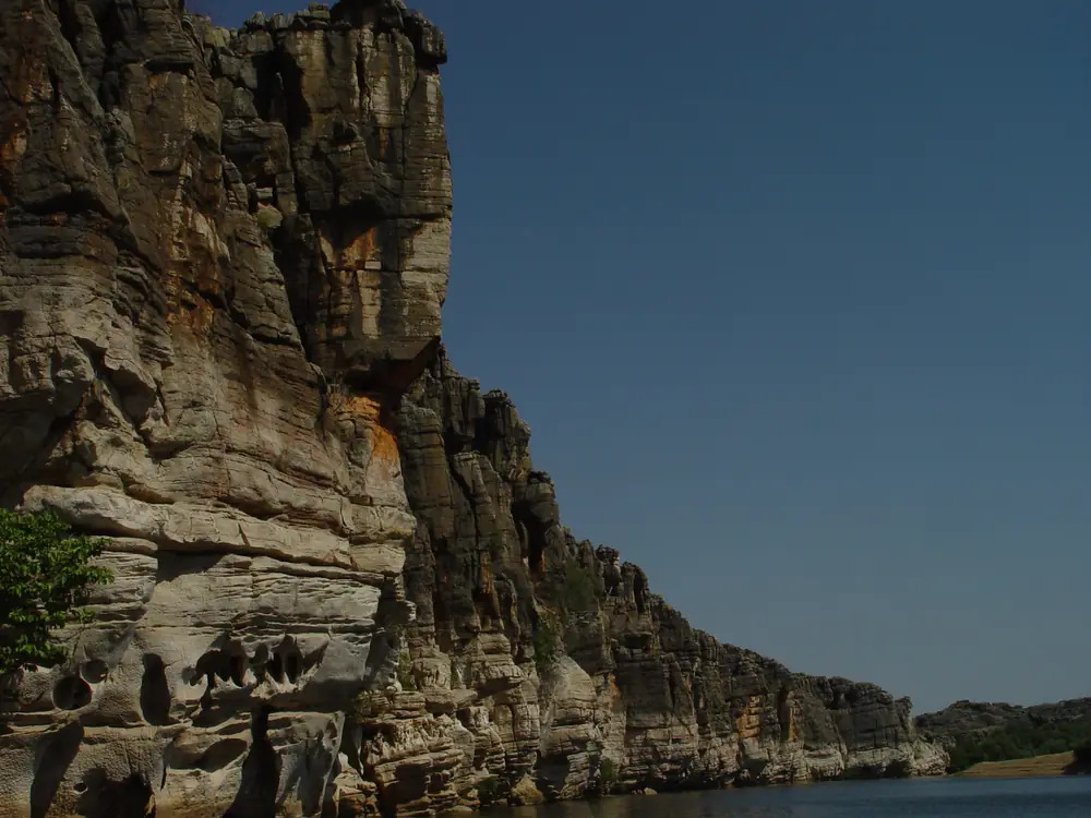
Geikie Gorge National ParkPhoto: GrahamWitt · CC BY-SA 4.0 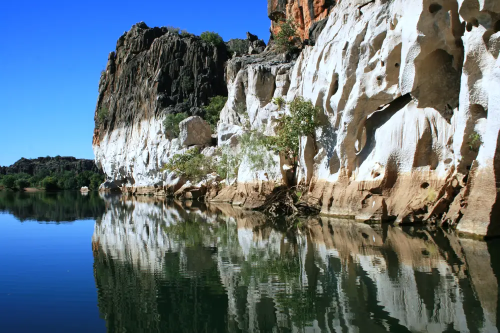
Geikie cliffsPhoto: Natalie Siegel-Brown · CC BY-SA 4.0
Fitzroy Crossing sits on the Fitzroy River in the Kimberley, on the Great Northern Highway, in the Shire of Derby/West Kimberley. Parks and Wildlife locate Dan͟ggu National Park (Geikie Gorge) here; Bunuba people are the Traditional Owners of that park and joint managers. This is a highway and river town, not a beach resort like Broome. Visit Broome’s Fitzroy Crossing page puts it 391 km east of Broome and 647 km west of Kununurra. Derby and Halls Creek are the other Kimberley highway neighbours on this site.
The wet season is not a footnote. Main Roads WA rebuilt the river crossing after Ex-Tropical Cyclone Ellie. Check the travel map before you treat the highway as open.
Where it is, and how far
Tourism WA describes a roughly four-and-a-half-hour drive from Broome after a Perth (or other capital) flight. Parks, Bunuba Country and Visit Broome put Dan͟ggu / Geikie Gorge about 20 km from town on a sealed road; Tourism WA has also published 18 km. Use that as “a short sealed run”, then confirm Parks alerts.
| Place | How official pages describe it |
|---|---|
| Dan͟ggu (Geikie Gorge) | About 20 km (Parks / Bunuba / Visit Broome); 18 km also published by Tourism WA; sealed access |
| Broome | 391 km west (Visit Broome) |
| Kununurra | 647 km east (Visit Broome) |
| Derby and Halls Creek | Highway neighbours on this site; confirm kilometres on Main Roads when you plan |
This hub does not invent a Halls Creek kilometre to replace Main Roads.
Facts at a glance
Population. Australian Bureau of Statistics 2021 Census, Urban Centres and Localities UCL515014: 1,022 people. Median age 33. Sex split 48.4% male / 51.6% female. Aboriginal and/or Torres Strait Islander people 610 (59.7%). Suburbs and localities SAL50508: 1,181. Use UCL for the town. Read ABS QuickStats.
Climate. BOM FITZROY CROSSING AERO, 003093, commenced 1997, open. 18.18°S, 125.56°E, elevation 115 m. Annual mean rainfall 686.4 mm (27 years, 1997–2026). Hottest month by mean maximum: November 40.8 °C. Coolest month by mean maximum: June 30.6 °C. January mean rainfall 192.6 mm; August 2.2 mm. See Fitzroy Crossing weather and the BOM table.
Visitor information. Shire of Derby/West Kimberley visitor centre at the library / shire precinct, corner Forest Road and 5 Flynn Drive on the contact page. Phone switchboard (08) 9191 0999. Public notice 25 November 2025: centre closed from 26 November 2025; use the Derby team and the same phone and email. Confirm whether a desk has reopened before you arrive. Australia’s Boab Country has also listed the hub as currently closed.
Traditional Owners
Parks and Wildlife: Bunuba Aboriginal people are Traditional Owners and joint park managers of Dan͟ggu. Bunuba people call the gorge Dan͟ggu, which Parks translates as the area where the water is very deep under the cave. The river in Parks wording is Bandaraln͟garri (Fitzroy River). Main Roads names the new bridge over the Martuwarra River at Fitzroy Crossing.
Visit Broome states Fitzroy Crossing is home to five First Nations language groups. Tourism WA names Gooniyandi in connection with Mimbi Caves. This guide does not flatten those sentences into a single-nation label for the whole townsite. Read Parks’ Dan͟ggu page and Bunuba Country for gorge culture, and ask the shire which art centres and tours are operating.
Parks quotes the joint management plan on Garuwa (water) places, camping and resources, Junba song-lines and Ungguds. That is park-agency wording, not a visitor licence to leave the designated area.
History and the river crossing
Tourism WA points visitors to the original town site and causeway crossing and to the Crossing Inn. Australia’s North West’s Fitzroy Crossing itinerary describes the Crossing Inn as built in 1897 as a shanty inn and trade store for travellers fording the river, and as the oldest establishment in the Kimberley region on that page. Visit Broome names the old townsite, Pioneer Cemetery, old post office, police station group and the old concrete crossing. Those are heritage stops, not a guarantee that every building is a museum with tickets.
The highway story that Main Roads owns is the 2022–23 flood and the new bridge. That belongs in the road section below, not as folklore.
Things to do
Dan͟ggu National Park (Geikie Gorge). Parks: no park entry fee; no dogs; parking for long vehicles and conventional vehicles; freshwater crocodiles present — Be Crocwise. The gorge was carved by the river through an ancient limestone barrier reef; Parks notes that around 250 million years ago much of the Kimberley was an ancient sea. The best current experience on the Parks page is walking the sand bank on one trail — short, challenging, uneven sandy surface, no wheelchair access. Look for white-bellied sea eagles, purple-crowned fairy-wrens, and freshwater crocodiles on banks. Stay in the designated visitor use area.
Recovery. Parks: heavy rain in late December 2022 and early January 2023 from ex-Tropical Cyclone Ellie caused record flooding and major impacts. Stage 2 recovery works completed; park open with limited facilities (carpark and toilets) at the time of that page. Bunuba Country: day use, toilets, no camping in the national or conservation park, no water or seating at the time of that page, temperatures can exceed 40 °C, carry at least 1 L per person per hour. Confirm Parks alerts and emergency.wa.gov.au. This guide does not assert ranger boat tours as a current product; the live Parks page describes the sand-bank walk.
Old townsite / Crossing Inn. Tourism WA and Australia’s North West: short drive to the original crossing. Treat the Inn as a named historic place on those pages. Hours and meals change.
Mimbi Caves. Tourism WA: Gooniyandi rock art and Indigenous-led tours. Book only through current official channels; this page does not copy a stale timetable.
Windjana Gorge (Bandilngan) and Tunnel Creek (Dimalurru). Parks-named Kimberley parks. Visit Broome lists them as 4WD days from Fitzroy Crossing and gives unsealed distances. They are not Dan͟ggu. Check Parks alerts and Main Roads. A 4WD is the visitor-page recommendation.
Fuller order: things to do in Fitzroy Crossing.
Where to stay
Tourism WA: motel-style and caravan park accommodation is available. That is the stay-type sentence this hub uses. Regional directories name individual properties; they change after floods and seasons. This page does not assert a lodge inventory. Confirm with the Shire of Derby/West Kimberley (08) 9191 0999 and current tourism lists.
Parks and Bunuba: no camping in Dan͟ggu. Nearest camping and accommodation is in Fitzroy Crossing on those pages.
Dry-season (roughly May–October on Tourism WA) is when highway travellers concentrate. Book. Wet-season rooms can still be a community and freight story while tourism thins.
Caravan and camping
Sealed highway into town when Main Roads says it is open. Town caravan-park category exists on Tourism WA. Named commercial parks are left on live directories so flood rebuilds do not leave a ghost listing here. Dan͟ggu is day-use. See Fitzroy Crossing caravan parks.
Fuel and services
A town of 1,022 (UCL) with a shire office, airport functions listed under Fitzroy Crossing Operations, and highway traffic. This guide does not list bowser brands. Fill when you can; the next towns are Derby, Halls Creek and Broome, not a 20-minute grid. Wet-season closures can isolate communities east of the river — that is Main Roads’ wording from the 2023 damage, and it is why you do not skip fuel because a map looks short.
Road access and flood
Source for flood and the bridge: Main Roads WA only.
Flooding generated by Ex-Tropical Cyclone Ellie in December 2022 and January 2023 caused significant damage to Great Northern Highway at Willare Crossing and Fitzroy Crossing. At Fitzroy Crossing the Fitzroy River Bridge, just east of the townsite, was significantly damaged, along with 500 metres of road, cutting access to Aboriginal communities east of the Fitzroy River as well as the East Kimberley and Northern Territory.
New Fitzroy River Bridge (Main Roads): two-lane bridge on the same alignment, pedestrian pathway, reconstructed approaches, flood and scour protection. Officially opened to traffic 10 December 2023, more than six months ahead of the original public schedule on that project page. Main Roads names it over the Martuwarra River.
The project page still carries construction-era detour notes. For today’s closures, ignore old detour paragraphs and open the Main Roads travel map and 138 138. Wet-season water over the floodplain remains a live risk even with a stronger bridge. See wet season and road closures and the Perth to Darwin drive.
Do not drive around closed signs to keep a gorge picnic.
Nearby parks and towns
Parks (official park pages):
- Dan͟ggu National Park — Geikie Gorge, Bunuba Country, day use
- Bandilngan (Windjana Gorge) and Dimalurru (Tunnel Creek) — Parks-named, 4WD access from visitor pages; confirm alerts
Towns on this site:
- Broome — 391 km west (Visit Broome)
- Derby — west Kimberley shire centre
- Halls Creek — east on the highway toward Purnululu and the Tanami
When to go, and how long
Tourism WA: visit May to October for warm dry days and cool evenings; December to March storms turn the country green. BOM supports that split: June mean maximum still 30.6 °C, November 40.8 °C, and two-thirds of the 686.4 mm annual rain in December–March.
One night is a highway stop. Two nights lets you do Dan͟ggu as Parks currently offers it (walk, limited facilities) without rushing heat. Three nights only if Mimbi or a 4WD park day is open and roads agree. See Fitzroy Crossing weather. Operators: feature your business.
Plan this trip
Tell us the dates, who you are travelling with and where you need help. We reply with planning notes for Fitzroy Crossing — we are not a booking agent.
Events and road-conditions newsletter
Occasional notes on outback festivals, race days and official road-condition sources — not a daily blast. We use these details only to send the newsletter.
Western Australia · North West
Fitzroy Crossing accommodation
Where to stay in Fitzroy Crossing: motel-style and caravan-park stays as Tourism WA groups them. Confirm with the Shire of Derby/West Kimberley — no invented lodge round-up.
Read · 3 min
Western Australia · North West
Fitzroy Crossing caravan parks
Caravan parks in Fitzroy Crossing: Tourism WA lists caravan-park stays in town. Dan͟ggu (Geikie Gorge) is day-use only. No invented park names — confirm with the shire and Main Roads.
Read · 3 min
Western Australia · North West
Fitzroy Crossing weather
Fitzroy Crossing climate from BOM Fitzroy Crossing Aero (003093): November mean maximum 40.8 °C, June 30.6 °C, annual rainfall 686.4 mm with a December–March wet season.
Read · 4 min
Western Australia · North West
Things to do in Fitzroy Crossing
Things to do in Fitzroy Crossing: Dan͟ggu (Geikie Gorge) National Park as Parks WA describes it now, old townsite and Crossing Inn as tourism pages name them, Mimbi Caves via official tours.
Read · 4 min
Frequently asked questions
What is Fitzroy Crossing’s population?
1,022 people at the 2021 Census for the urban centre (UCL515014). The suburbs-and-localities figure is 1,181 (SAL50508). Median age 33. Use the UCL figure for the town.
How do I get to Geikie Gorge from Fitzroy Crossing?
Parks and Wildlife’s Dan͟ggu National Park page locates the park at Fitzroy Crossing. Bunuba Country and Kimberley visitor pages put it about 20 km from town on a sealed road. Tourism WA has also published 18 km. Confirm current opening, alerts and facilities on the Parks page before you drive.
What happened to the Fitzroy River Bridge?
Main Roads WA says flooding from Ex-Tropical Cyclone Ellie in December 2022 and January 2023 significantly damaged the Fitzroy River Bridge just east of the townsite, along with 500 metres of road. The new two-lane bridge, with a pedestrian pathway, opened to traffic on 10 December 2023. Always check the Main Roads travel map in the wet season.
What is the weather like in Fitzroy Crossing?
BOM Fitzroy Crossing Aero (003093) has a November mean maximum of 40.8 °C (hottest month by mean max), a June mean maximum of 30.6 °C (coolest), and annual mean rainfall of 686.4 mm, concentrated in December–March. The full table is on the BOM page.
Is the Fitzroy Crossing Visitor Centre open?
The Shire of Derby/West Kimberley published a notice that the visitor centre would close from 26 November 2025, with enquiries to sdwk@sdwk.wa.gov.au or (08) 9191 0999. Confirm current status with the shire before you rely on a desk in town.
Whose Country is Dan͟ggu on?
Parks and Wildlife Service WA and Bunuba Country locate Dan͟ggu National Park (Geikie Gorge) at Fitzroy Crossing and name Bunuba people as Traditional Owners and joint managers of that park. A single nation for the Fitzroy Crossing townsite is not named on the sourced Tourism WA destination page used here.
Sources and further reading
Facts on this page were checked against these primary and official sources. Conditions change — confirm before you travel or buy.
- Fitzroy Crossing 2021 Census QuickStats (SAL50508) — Australian Bureau of Statistics
- Kimberley hospitals and health services — WA Country Health Service
- Fitzroy Crossing 2021 Census QuickStats (UCL515014) — Australian Bureau of Statistics
- Climate statistics for Fitzroy Crossing Aero (003093) — Bureau of Meteorology
- Dan͟ggu National Park — Parks and Wildlife Service WA
- New Fitzroy River Bridge — Main Roads Western Australia
- Main Roads WA travel map — Main Roads Western Australia
- Public Notice — Fitzroy Crossing Visitor Centre Closure — Shire of Derby / West Kimberley
- Fitzroy Crossing — Tourism Western Australia — Tourism Western Australia
- Danggu — Bunuba Country — Bunuba