At a glance
Sourced facts only. Distances and services change — confirm before you travel.
- Population
- 37 people (SAL50494, 2021 Census). The ABS does not publish a 2021 Urban Centre named Eucla.
- Local government
- Shire of Dundas
- Traditional Owners
- Not named for the Eucla townsite on the sourced Tourism WA, Golden Outback or Shire of Dundas town pagesThe Woodlands Centre Aboriginal Culture and Heritage page names Ngadju for country surrounding Norseman. That sentence is 717 km west of Eucla and is not flattened onto this townsite.
- Nearest regional city
- Norseman, 717 km west (Shire of Dundas tourism page). Tourism WA / Golden Outback put Eucla 10 minutes from the South Australian border.
- Capital
- 1,430 km from Perth by road (Tourism WA Eucla; Australia’s Golden Outback Eucla)
- Nearest fuel
- Tourism WA and Golden Outback treat Eucla as a Nullarbor rest stop with a motor inn. Confirm the bowser on arrival; this hub does not invent a brand or hours.
- Mobile coverage
- Check Telstra and Optus coverage maps before travel; do not assume a signal on the Eyre Highway gaps.
- Best time to visit
- Autumn, winter and spring on this site’s Nullarbor road-trip page. BOM Eucla January mean maximum is 26.0 °C; July 18.1 °C, with winter-peak rain.
Climate
Monthly means from the Bureau of Meteorology station Eucla (011003). This is not a forecast. Open station. Temperature 105 years (1910–2026); rainfall 130 years (1876–2026). Latest available data 13 November 2026. Winter-peak rain (May and June 30.5 mm), not a Top End Wet.
| Month | Mean max (°C) | Mean min (°C) | Rainfall (mm) |
|---|---|---|---|
| Jan | 26.0 | 16.8 | 16.4 |
| Feb | 25.8 | 17.1 | 18.6 |
| Mar | 25.2 | 16.1 | 22.9 |
| Apr | 23.7 | 13.5 | 26.2 |
| May | 21.2 | 10.6 | 30.5 |
| Jun | 18.8 | 8.3 | 30.5 |
| Jul | 18.1 | 7.2 | 25.0 |
| Aug | 19.3 | 7.6 | 26.5 |
| Sep | 21.5 | 9.3 | 21.9 |
| Oct | 23.3 | 11.4 | 18.9 |
| Nov | 24.2 | 13.5 | 20.0 |
| Dec | 25.1 | 15.2 | 18.4 |
Eucla in pictures
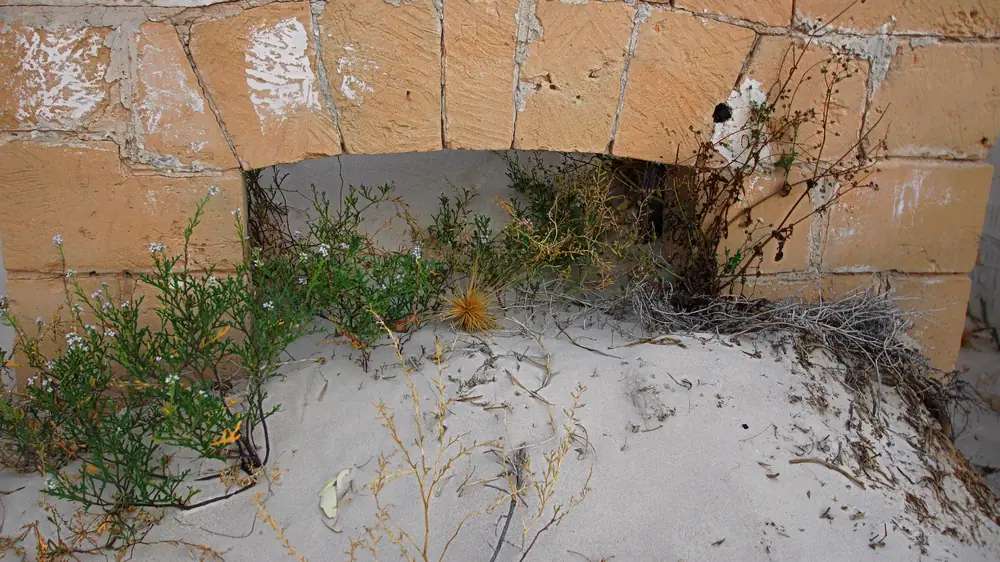
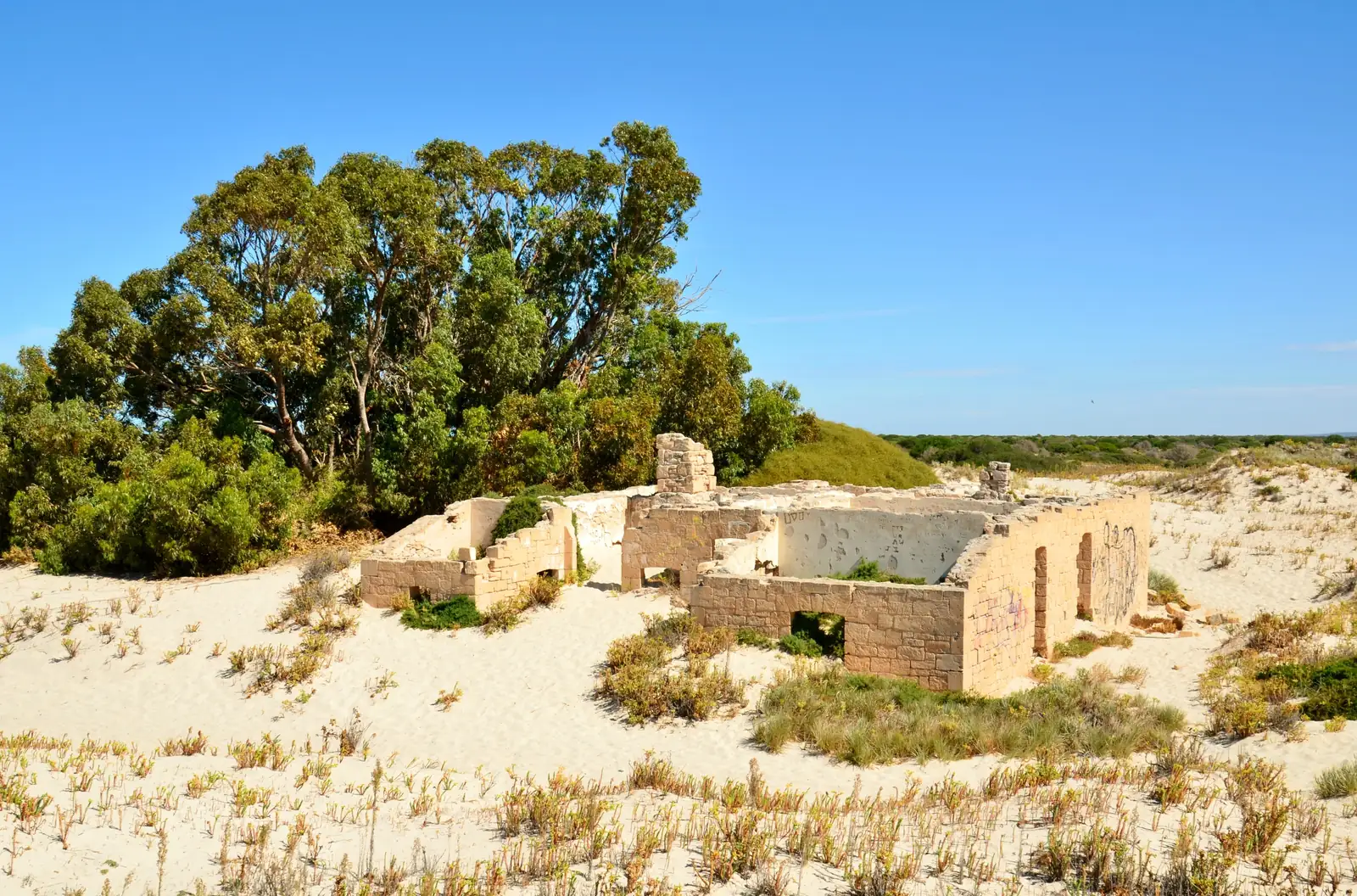
Old Telegraph Station at EuclaPhoto: MaryWShields · CC BY-SA 4.0 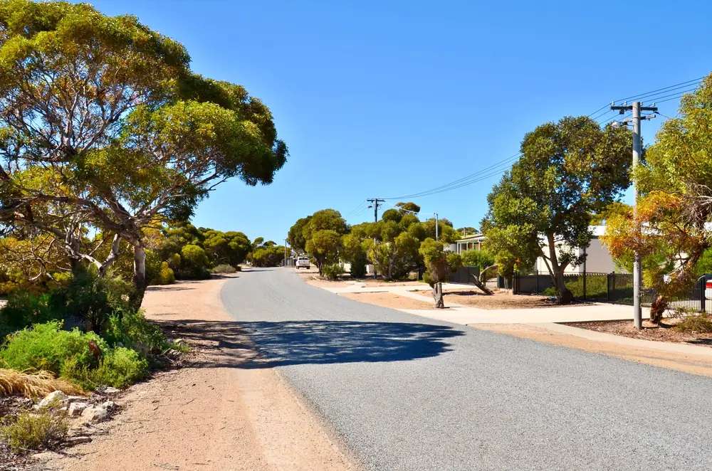
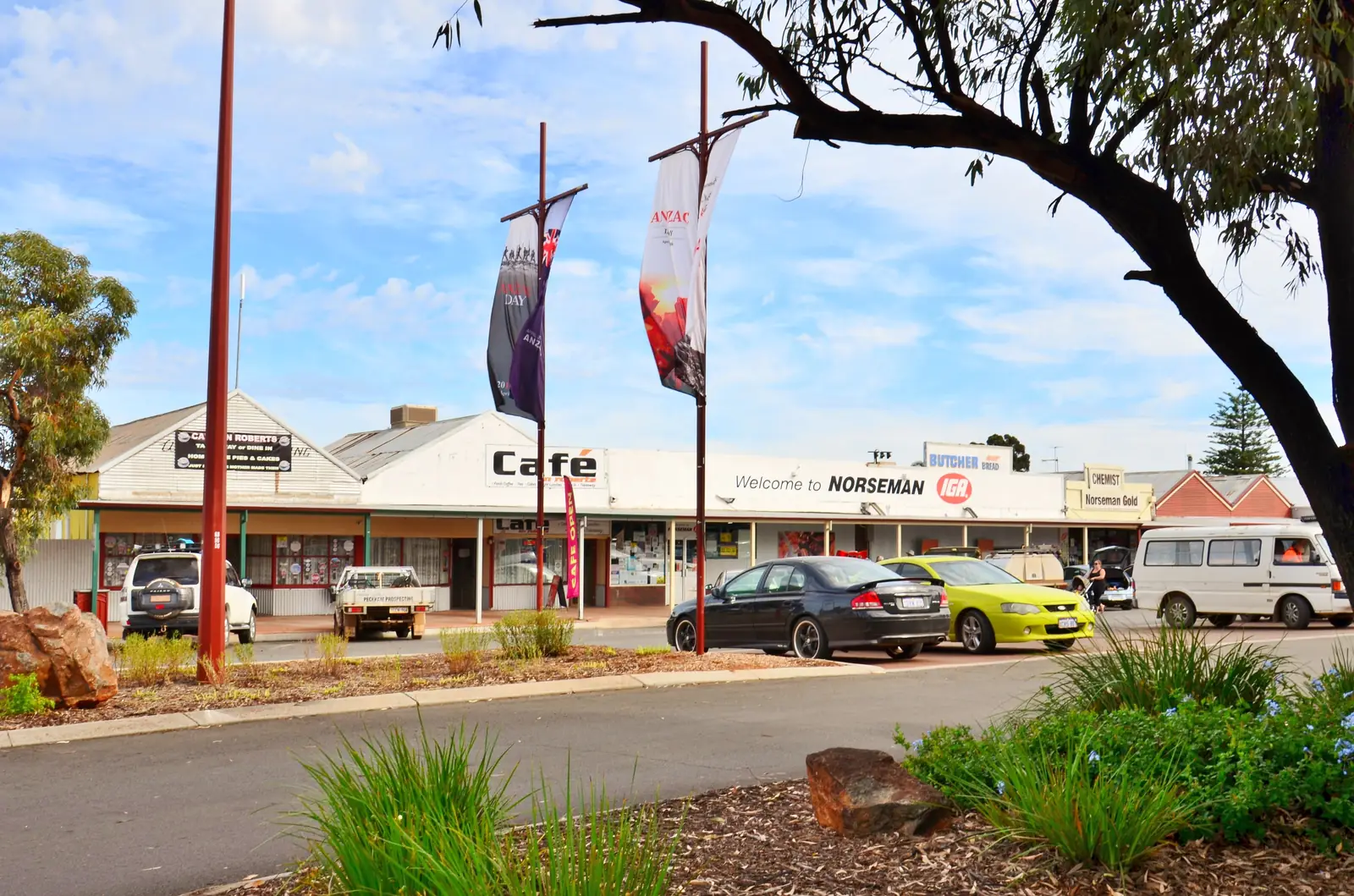
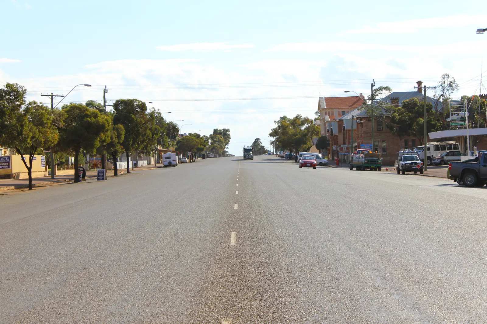
Patupis Street in EuclaPhoto: Bahnfrend · CC BY-SA 4.0 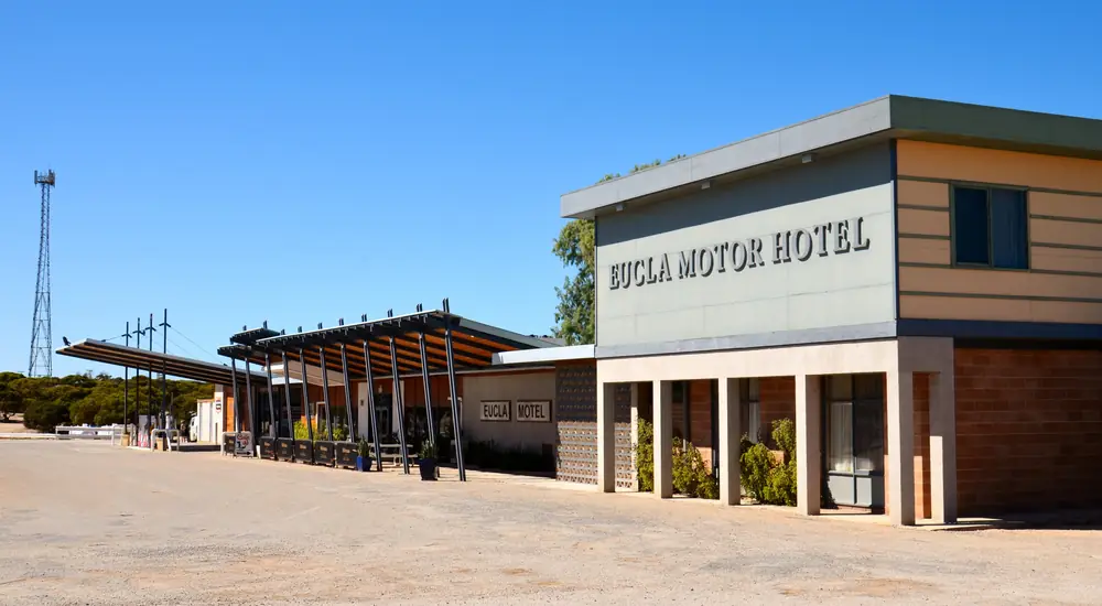
Eucla Hotel MotelPhoto: Bahnfrend · CC BY-SA 4.0 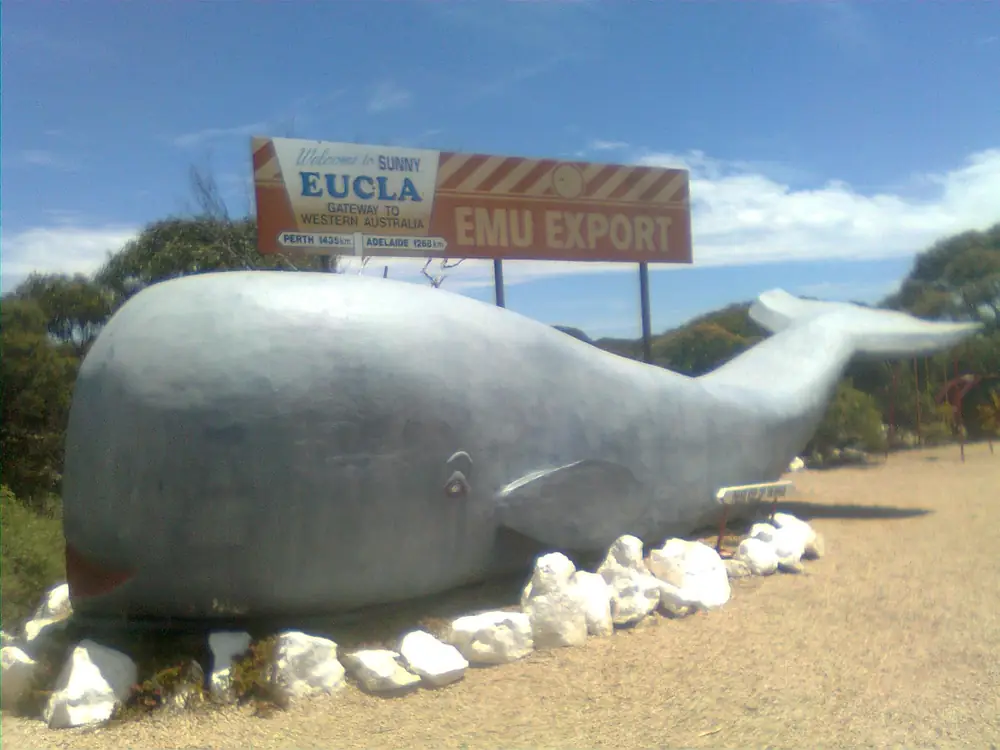
Big whale statue at EuclaPhoto: Jarrod Walkabout · CC BY-SA 3.0
Eucla sits on the Eyre Highway in Western Australia’s Golden Outback, inside the Shire of Dundas, 10 minutes from the South Australian border on Tourism WA and Australia’s Golden Outback. Tourism WA puts the town 1,430 km from Perth by road. The Shire of Dundas tourism page puts Eucla 717 km east of Norseman. This hub is the Western Australian Nullarbor town, not a Ceduna suburb and not a South Australian town page. Ceduna is the SA service town on this site. Perth is the capital; it has no town page here.
Tourism WA’s destination sentence is the geography used here: Eucla is the largest settlement built on the vast Nullarbor Plain — the biggest limestone karst landscape on Earth, covering an area of 270,000 square kilometres. That is a karst-plain sentence, not a second Norseman gold-rush story and not a wheatbelt town borrowed from Southern Cross.
The Australian Bureau of Statistics does not publish a 2021 Urban Centre (UCL) named Eucla. Use suburbs-and-localities SAL50494: 37 people, median age 56, sex split 53.3% male / 46.7% female. 4 families, 31 private dwellings. QuickStats notes limited tables because of the small population. Travellers stop for the Old Telegraph Station, the museum, fuel and a Nullarbor night. You still need Main Roads WA after rain, because a 1,430 km run from Perth is no use if the highway is closed.
Where it is, and how far
Eucla is the eastern Western Australian settlement on the sealed Eyre Highway. Golden Outback’s Eyre Highway page: two days, sealed roads, Norseman to Ceduna; at the WA border in Eucla, wander the old telegraph station ruins, and check out the historical collection at the Eucla Motel. Tourism WA prints the highway as 1,675 km from Norseman in Western Australia to Port Augusta in South Australia. This site’s Nullarbor guide uses about 1,206 km Norseman–Ceduna. Those are different end-points; this hub does not average them.
Tourism WA: head 50 kilometres east of Eucla to 100 metre high limestone cliffs that form part of the longest unbroken cliff line in the world. That cliff sentence is east of town — confirm the day’s lookout on Main Roads rather than treating it as a Eucla main-street walk.
| Place | Distance from Eucla (sourced) |
|---|---|
| Perth | 1,430 km (Tourism WA Eucla; Golden Outback Eucla) |
| South Australian border | 10 minutes (Tourism WA; Golden Outback) |
| Norseman | 717 km west (Shire of Dundas tourism page) |
| Limestone cliffs | 50 km east (Tourism WA Eucla) |
A separate Eucla–Ceduna kilometre was not on those sourced town pages, so this hub does not invent one. Use the Nullarbor road-trip page for the crossing table.
Facts at a glance
Population. ABS 2021 Census SAL50494: 37 people. Median age 56. Limited tables. Use Eucla QuickStats.
Climate. Bureau of Meteorology EUCLA, 011003, 31.68°S, 128.90°E, elevation 93 m, commenced 1876, status: open, latest available data 13 November 2026. Mean maximum (105 years, 1910–2026): January 26.0 °C, July 18.1 °C, annual 22.7 °C. Mean minimum: February 17.1 °C, July 7.2 °C, annual 12.2 °C. Mean rainfall (130 years, 1876–2026): annual 273.7 mm; May and June 30.5 mm (wettest mean months); January 16.4 mm driest on that table. Mean days of rain ≥ 1 mm: 40.2. This is a winter-rain Nullarbor table, not a Kimberley Wet. See Eucla weather.
Visitor information. Tourism WA and Golden Outback are the official town listings used here. Hard-copy Nullarbor maps: Golden Outback names Ceduna, Kalgoorlie-Boulder and Norseman Visitor Centres. Shire of Dundas Woodlands Centre in Norseman: 78 Prinsep Street, (08) 9039 0040. Roads: Main Roads WA.
Traditional Owners
A Traditional Owner nation named for the Eucla townsite was not on the Tourism WA Eucla page, the Golden Outback Eucla page, or the Shire of Dundas tourism page fetched for this rebuild. The Woodlands Centre Aboriginal Culture and Heritage page names Ngadju people as living in the country surrounding Norseman. Norseman is 717 km west. This guide does not flatten that Norseman sentence onto Eucla. Confirm current wording at the Woodlands Centre before you treat any label as a townsite acknowledgement. See visiting Country respectfully.
History
Tourism WA’s Old Telegraph Station listing: the original town was established in 1877 as a manual repeater station for the overland telegraph. The remainder of the original town is now under the sand after a plague of rabbits ate most of the dune vegetation, which then caused large sand drifts to encroach on the townsite. The listing puts Eucla ten minutes from the South Australian border and a two-day drive east of Perth. Golden Outback and Tourism WA: Eucla played a role in the early 1900s when it was the country’s busiest telegraph station outside Australia’s capital cities. Visit Eucla Museum, the Bureau of Meteorology, and the historic telegraph station and jetty.
This is a telegraph-and-sand founding, not a gold-rush naming and not a wheatbelt railway anecdote. The present highway town sits on the escarpment; the old station ruins sit in dunes to the south of town on Tourism WA’s attraction page.
Things to do
Tourism WA and Golden Outback name these in and around Eucla:
- Old Eucla Telegraph Station — Tourism WA; stone ruins in white dunes south of town; 1877 repeater station
- Historic jetty — named with the telegraph station on the destination pages
- Eucla Museum — pioneering heritage; Golden Outback’s Eyre Highway page also names the historical collection at the Eucla Motel
- Bureau of Meteorology — named as a visit on both destination pages
- Nullarbor Links — world’s longest golf course, 1,365 km from Kalgoorlie-Boulder to Ceduna on Tourism WA
- Limestone cliffs — 50 km east, 100 m, Tourism WA
Nearby, not in-town: Golden Outback’s Eyre Highway page names Balladonia, the 90 Mile Straight (146.6 km), Caiguna Blowhole, Cocklebiddy caves, Eyre Bird Observatory, Madura Pass and Mundrabilla Motel’s Nullarbor Museum as corridor stops, not Eucla main-street walks. Ceduna is the SA end of the crossing.
Where to stay
Golden Outback: Eucla Motor Hotel offers powered caravan and camping sites, as well as a motor inn, where you’ll find a bar, restaurant, café and motel-style accommodation. Tourism WA’s destination page names powered caravan and camping sites and a motor inn with a bar, restaurant, café and motel-style accommodation. Those are official named types, not a ranked motel strip. If Eucla is full, you are still on a Nullarbor roadhouse chain — do not invent a second hotel here.
- How to choose: Eucla accommodation
- Camping detail: Eucla caravan parks
- Operator enquiries: feature your business
Caravan and camping
Vans use Eucla as a Western Australian Nullarbor night, or the first WA night coming west from South Australia. Official named camping is the powered caravan and camping sites at the Motor Hotel / motor inn. Ask on arrival for stay limits, dump points and pets. Read Eucla caravan parks and outback camping. Do not camp in the dunes around the telegraph ruins.
Fuel and services
A locality of 37 people will not match Norseman or Ceduna for a hospital. Tourism WA and Golden Outback treat Eucla as a rest stop and refreshment break. This guide does not list a bowser brand or invent clinic hours. Fill in Norseman before you leave the Goldfields if you are eastbound, and treat every Nullarbor roadhouse as a confirm-on-arrival bowser. Quarantine: this site’s Nullarbor guide, citing DPIRD, records Western Australia’s border checkpoint on the Eyre Highway at Eucla operating 24/7, with most fresh fruit, vegetables and honey prohibited entering WA. Heading east, South Australia’s fruit rules are a Ceduna briefing. Check the current lists.
For maps, use Norseman’s Woodlands Centre or the Kalgoorlie-Boulder and Ceduna visitor centres Golden Outback names. Roads: Main Roads WA.
Road access
The Eyre Highway is sealed. Golden Outback: two days Norseman to Ceduna in ordinary weather. Wildlife, road trains and fatigue are the crossing risks on this site’s Nullarbor page — not a 4WD track. After rain, check Main Roads. Do not drive into soft dunes at the telegraph ruins.
West: Mundrabilla, Madura, Cocklebiddy, Caiguna, Balladonia, then Norseman on Golden Outback’s corridor list. East: the SA border in 10 minutes, then Border Village and South Australian roadhouses toward Ceduna. Coolgardie and Kalgoorlie-Boulder are Goldfields towns before Norseman if you are coming from Perth, not Eucla suburbs.
Nearby parks and towns
Eucla does not sit inside a Parks WA park named on the sourced town pages. The Nullarbor is the landscape. Named nature on Golden Outback’s highway page includes the Great Australian Bight, caves and a bird observatory as corridor stops.
Towns on this site:
- Norseman — 717 km west, Shire of Dundas seat
- Ceduna — SA Nullarbor service town
- Kalgoorlie-Boulder — Nullarbor Links western city
- Coolgardie — Goldfields neighbour of Kalgoorlie-Boulder
When to go, and how long
BOM Eucla’s January mean maximum of 26.0 °C is milder than inland Goldfields January. July’s 18.1 °C mean maximum and 7.2 °C mean minimum, with May–June 30.5 mm, is the cool, slightly wetter winter on a 273.7 mm annual table. This site’s Nullarbor page: autumn, winter and spring are the most comfortable; summer can be very hot inland even if Eucla’s coastal means look moderate. Wind on the escarpment is a packing problem, not a waterfall season.
An hour covers the telegraph ruins and a museum photograph if those named places are reachable. A night covers fuel, a motel or van site, and an early start. The 50 km cliff run is a separate highway hour, not a town walk.
Operators who want a checked listing: feature your business. The listings slot on this hub stays empty until then.
Plan this trip
Tell us the dates, who you are travelling with and where you need help. We reply with planning notes for Eucla — we are not a booking agent.
Events and road-conditions newsletter
Occasional notes on outback festivals, race days and official road-condition sources — not a daily blast. We use these details only to send the newsletter.
Western Australia · Golden Outback
Eucla accommodation
Where to stay in Eucla: Golden Outback names Eucla Motor Hotel powered caravan and camping sites plus motel-style rooms. Tourism WA names a motor inn. Confirm before you unhitch. This is WA, not SA.
Read · 3 min
Western Australia · Golden Outback
Eucla caravan parks
Camping in Eucla: Golden Outback names Eucla Motor Hotel powered caravan and camping sites. Tourism WA names powered sites at the motor inn. Confirm before you unhitch. This is WA, not SA.
Read · 3 min
Western Australia · Golden Outback
Eucla weather
Eucla climate from BOM Eucla (011003): January mean max 26.0 °C, July 18.1 °C, annual rainfall 273.7 mm with May–June 30.5 mm. Open station. WA Nullarbor, not a South Australian table.
Read · 3 min
Western Australia · Golden Outback
Things to do in Eucla
Things to do in Eucla: Old Telegraph Station ruins, jetty, Eucla Museum, BOM and Nullarbor Links. This is the Western Australian Nullarbor town, 10 minutes from the SA border, not a South Australian page.
Read · 4 min
Frequently asked questions
Is Eucla in Western Australia or South Australia?
This hub is Eucla in the Shire of Dundas, Western Australia, on the Eyre Highway. Tourism WA and Australia’s Golden Outback put the town 10 minutes from the South Australian border and 1,430 km from Perth. It is not a South Australian town page. Ceduna is the SA Nullarbor service town on this site.
How far is Eucla from Perth and Norseman?
Tourism WA’s Eucla destination page and Australia’s Golden Outback put Eucla 1,430 km from Perth by road. The Shire of Dundas tourism page puts Eucla 717 km east of Norseman. Tourism WA also prints the Eyre Highway as 1,675 km from Norseman to Port Augusta.
What is Eucla’s population?
37 people at the 2021 Census for Eucla suburbs-and-localities (SAL50494), median age 56. QuickStats notes limited tables because of the small population. The ABS does not publish a 2021 Urban Centre named Eucla.
What is there to do in Eucla?
Tourism WA and Golden Outback name the Old Telegraph Station and jetty, Eucla Museum, the Bureau of Meteorology, Nullarbor Links, and limestone cliffs 50 km east of Eucla. Tourism WA’s Old Telegraph Station listing: the original town was established in 1877 as a manual repeater station for the overland telegraph; sand later covered much of the old townsite.
What is the weather like in Eucla?
BOM Eucla (011003, open): January mean maximum 26.0 °C, July 18.1 °C, annual rainfall 273.7 mm (130 years, 1876–2026). May and June are the wettest mean months at 30.5 mm. Temperature means use 105 years (1910–2026).
Can I camp at Eucla?
Yes, as named types. Australia’s Golden Outback names Eucla Motor Hotel powered caravan and camping sites plus motel-style rooms. Tourism WA’s destination page names powered caravan and camping sites and a motor inn. Confirm on arrival. This hub does not invent extra parks.
Sources and further reading
Facts on this page were checked against these primary and official sources. Conditions change — confirm before you travel or buy.
- Eucla 2021 Census QuickStats (SAL50494) — Australian Bureau of Statistics
- Climate statistics for Eucla (011003) — Bureau of Meteorology
- Eucla — Tourism Western Australia
- Eucla — Australia's Golden Outback
- Old Eucla Telegraph Station — Tourism Western Australia
- Eyre Highway & The Nullarbor Plain — Australia's Golden Outback
- Tourism — Shire of Dundas — Shire of Dundas
- Aboriginal Culture and Heritage — Shire of Dundas
- Quarantine WA border checkpoints — Department of Primary Industries and Regional Development, WA
- Main Roads WA travel map — Main Roads Western Australia