At a glance
Sourced facts only. Distances and services change — confirm before you travel.
- Population
- 98 people (SAL30982, 2021 Census)QuickStats notes limited tables because of the small population.
- Local government
- Quilpie Shire
- Nearest regional city
- Quilpie 108 km east on Outback Queensland; Visit Quilpie Shire prints 106 km — this hub quotes both
- Nearest fuel
- Confirm in the service town named under nearest regional city; this guide does not list bowser brands.
- Nearest hospital or clinic
- Confirm with Queensland Health — do not invent a clinic name.
- Mobile coverage
- Check Telstra and Optus coverage maps before travel; do not assume a signal on floodways, parks or unsealed approaches.
- Best time to visit
- May–September on Quilpie Airport (045015) cooler mean maxima (July 20.1 °C; January 37.0 °C). QLDTraffic after rain.
Climate
Monthly means from the Bureau of Meteorology station Quilpie Airport (045015). This is not a forecast. Commenced 1917. Elevation 200 m. Status: Open. Annual mean rainfall 345.8 mm. Eromanga has no township table on the monthly index used here. Quilpie Airport is the labelled shire comparison.
| Month | Mean max (°C) | Mean min (°C) | Rainfall (mm) |
|---|---|---|---|
| Jan | 37.0 | 23.8 | 51.3 |
| Feb | 35.6 | 23.3 | 49.2 |
| Mar | 33.4 | 20.5 | 47.2 |
| Apr | 29.2 | 15.6 | 24.0 |
| May | 24.0 | 10.9 | 26.2 |
| Jun | 20.4 | 7.4 | 19.9 |
| Jul | 20.1 | 6.1 | 16.4 |
| Aug | 22.7 | 7.7 | 13.4 |
| Sep | 27.1 | 11.7 | 14.7 |
| Oct | 31.0 | 16.1 | 23.0 |
| Nov | 34.0 | 19.6 | 30.4 |
| Dec | 36.3 | 22.2 | 34.9 |
Eromanga in pictures
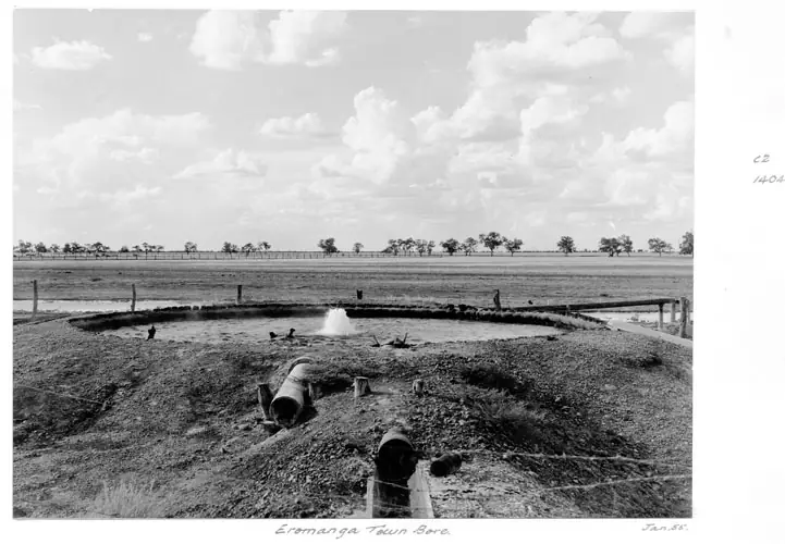
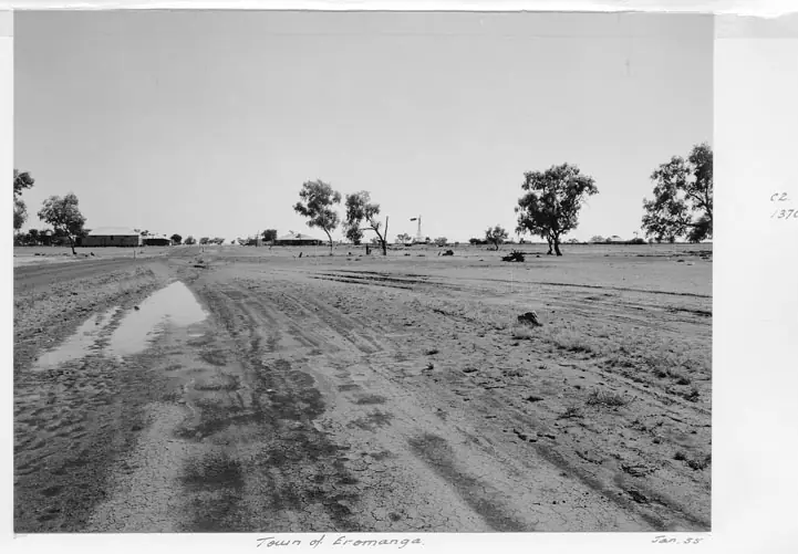
The town bore at EromangaPhoto: Lands Department, Survey Office, Cartographic Branch, Photographic Section · Public domain 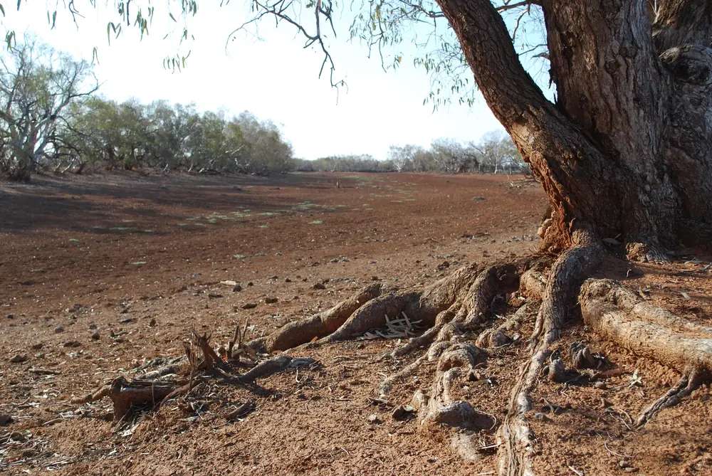
Ulloomunta Waterhole in EromangaPhoto: Dale Smith · CC BY-SA 3.0 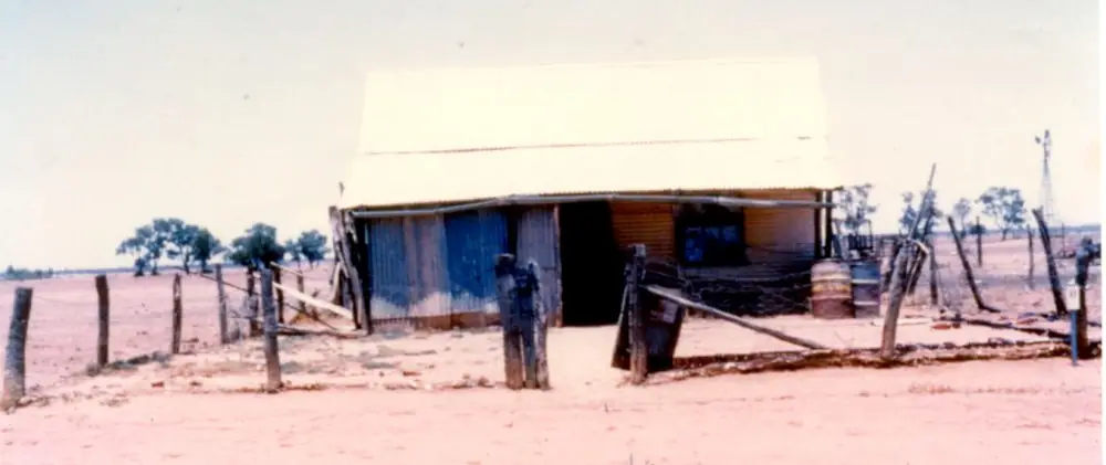
The first police residence in EromangaPhoto: Unknown authorUnknown author · CC BY 4.0
Eromanga is the Eromanga Natural History Museum town west of Quilpie — Quilpie Shire’s sealed Natural Sciences Loop detour through Channel Country, not a Barcoo Shire river town. Outback Queensland’s town page puts it 108 kilometres west of Quilpie on a fully sealed loop off the Warrego Way. Visit Quilpie Shire’s Eromanga page prints 106 km west of Quilpie. This hub quotes both official kilometres rather than averaging them.
The Australian Bureau of Statistics does not publish a 2021 Urban Centre (UCL) named Eromanga. Use suburbs-and-localities SAL30982: 98 people, median age 47, sex split 60.0% male / 40.0% female. QuickStats also prints 27 families and 73 private dwellings, and notes limited tables because of the small population. Travellers stop for the Eromanga Natural History Museum, the Living History Centre, and a Channel Country overnight — not for a high street this guide can invent.
The Cooper Developmental Road through this pocket is sealed on Outback Queensland’s wording. You still need QLDTraffic after rain, because a 108 km run to Quilpie is no use if Channel Country floodwater has closed the road.
Where it is, and how far
Eromanga sits west of Quilpie in the Cooper–Eromanga oil and gas basin, with Thargomindah to the south on the Natural Sciences Loop itinerary. Outback Queensland’s attraction listing places the museum three kilometres outside of Eromanga and approximately one hour’s drive west from Quilpie. The same organisation’s Natural Sciences Loop itinerary prints 105 km from Thargomindah to Eromanga. Visit Quilpie Shire names Yapunyah Sandhills 35 km north on the Kyabra Road and Kyabra Waterhole 40 km north.
This hub does not invent an Eromanga–Windorah or Eromanga–Jundah kilometre that is not on those pages. Windorah and Jundah are Channel Country neighbours; Yowah and Eulo sit on the Adventure Way further south-east.
| Place | Distance from Eromanga (sourced) |
|---|---|
| Quilpie | 108 km east (Outback Queensland town page); 106 km (Visit Quilpie Shire) |
| Eromanga Natural History Museum | 3 km outside town (Outback Queensland attraction listing) |
| Thargomindah | 105 km on the Natural Sciences Loop itinerary (Thargomindah to Eromanga leg) |
| Yapunyah Sandhills | 35 km north on Kyabra Road (Visit Quilpie Shire) |
| Kyabra Waterhole | 40 km north (Visit Quilpie Shire) |
Facts at a glance
Population. ABS 2021 Census, Suburbs and Localities SAL30982: 98 people. Median age 47. 27 families, 73 private dwellings. No UCL. Use the Eromanga SAL QuickStats.
Climate. BOM lists EROMANGA - WEBBER ST, 045006 on the Queensland rainfall-station directory (about 26.6694°S, 143.2700°E; January 1905–June 2021). BOM does not publish a monthly climate-averages table for that site. The nearest published open table is Quilpie Airport, 045015, commenced 1917, location 26.61°S, 144.26°E, elevation 200 m, status open. Mean maximum temperature (72 years, 1941–2014): January 37.0 °C, July 20.1 °C, annual 29.2 °C. Mean rainfall (95 years, 1917–2026): annual 345.8 mm; January 51.3 mm wettest mean month; August 13.4 mm driest. Full columns: BOM Quilpie Airport. See Eromanga weather.
Visitor information. There is no Eromanga VIC on the sourced pages. Use the Quilpie Visitor Information Centre, Museum and Gallery, 51 Brolga Street, Quilpie, (07) 4656 0540, tourism@quilpie.qld.gov.au — the phone Visit Quilpie Shire prints on the Living History Centre listing.
Traditional Owners
Quilpie Shire Council’s 2023–24 Annual Report states that the shire is the ancestral home of the Mardigan. This site’s Quilpie guide uses Mardigan Country for the shire seat on the Bulloo. Visit Quilpie Shire’s Eromanga page does not print a separate nation label for the Eromanga townsite only. This hub follows the shire wording rather than flattening neighbouring Channel Country groups onto one street. Confirm a sentence you want on a plaque with the Quilpie Visitor Information Centre.
History
Outback Queensland’s town page places Eromanga on surrounding pastoral properties, some of which are over 8,000 square kilometres, and in the Eromanga Oil and Gas Basin, which that page says produces around one and a half million barrels of oil each year. Visit Quilpie Shire names the Cooper–Eromanga basin as Australia’s most prolific oil and gas region and says the IOR Refinery processes over 1,200 barrels of crude oil a day. Those are two official production sentences, not the same figure twice.
The Old Royal Hotel is one of the town’s original buildings on Outback Queensland’s wording: built 1885, once a Cobb & Co. staging post. Visit Quilpie Shire calls the historic Eromanga Royal Hotel a local icon since 1895. This hub quotes both dates rather than picking one. Outback Queensland’s Natural Sciences Loop itinerary: the unmanned Living History Centre is used by signing out the key from the Royal Hotel, then wandering the display and watching the film in the theatre.
Outback Queensland names a park next door with playground and barbecue facilities and a mining memorial inlaid with real opal. Visit Quilpie Shire names the Opal Mining Memorial with the Living History Centre. Saturday-night community barbecues and the Easter Eromanga Rodeo, Campdraft and Gymkhana are named on the Outback Queensland town page as annual events. Confirm any current date with (07) 4656 0540 rather than treating Easter as a 2026 booking.
Things to do
Eromanga Natural History Museum, 1 Dinosaur Drive, (07) 4656 3084, info@enhm.com.au. Outback Queensland: Australia’s largest dinosaur on display is a 95–98 million-year-old titanosaur nicknamed Cooper; Stage 2 is finished with a new café and shop; the guided Australian Giants Tour runs four times a day. The museum’s own site prints Tuesday–Saturday tour times 9:30am, 11am, 1pm, 2:30pm, and a summer closure from November to 2 February with pre-booked tours only. Indicative rates on the Outback Queensland listing: $35 to $110. Book. Do not arrive in January and expect a walk-in. See things to do in Eromanga.
Living History Centre — Outback Queensland and Visit Quilpie Shire: early settlers, industry and opal mining; Object Theatre; key from the Royal Hotel on the loop itinerary. Phone printed on Visit Quilpie Shire: (07) 4656 0540.
Knot-a-Saurus Park — Visit Quilpie Shire: sauropod sculpture and babies, dinosaur footprints and interpretive designs.
Town History Walk — named on Visit Quilpie Shire. Walk it in the cooler hours. Quilpie Airport’s January mean maximum is 37.0 °C.
Yapunyah Sandhills, 35 km north on Kyabra Road — sunset on red sandhills on Visit Quilpie Shire. Kyabra Waterhole, 40 km north — picnics, birdwatching, swimming, fishing and camping; when full it stretches over 55 hectares on that page. After rain, QLDTraffic first. Queensland fisheries rules apply.
This is not the Australian Age of Dinosaurs in Winton. Use the Dinosaur Trail guide for the wider fossil story.
Where to stay
Official named types on the pages used here:
- Cooper’s Country Lodge — onsite at the museum; Outback Queensland and the museum’s accommodation page name studio rooms, an Outback Family Suite, shared BBQ, dining and laundry. Phone (07) 4656 3084.
- Toogunna Plains Farmstay — Visit Quilpie Shire and Outback Queensland: fifth-generation sheep and cattle station. Phone 0456 491 777 on Visit Quilpie Shire.
Outback Queensland’s Eromanga stay list also prints named Quilpie parks and hotels as nearby, not in Eromanga. Those are official named types, not a ranked inventory. Confirm at (07) 4656 0540.
- How to choose: Eromanga accommodation
- Camping detail: Eromanga caravan parks
- Operator enquiries: feature your business
If Eromanga is full, Quilpie is 106–108 km east and has more rooms. That is a distance fact, not a booking guarantee.
Caravan and camping
Vans use Eromanga as a Natural Sciences Loop overnight and a museum base. Official named stays in or next to town are the lodge and the farmstay. Visit Quilpie Shire names Kyabra Waterhole camping 40 km north. This page does not invent a main-street caravan park that those official lists omit. Ask the Quilpie VIC for stay limits, dump points and whether Kyabra is open after rain. Read Eromanga caravan parks and outback camping.
After rain, Channel Country is the constraint. QLDTraffic first.
Fuel and services
A locality of 98 people will not match Quilpie for fuel, groceries or a hospital. This guide does not list bowser brands or invent a servo. Fill up in Quilpie. Confirm what is open with (07) 4656 0540. For current questions, use Quilpie Shire Council.
Road access
Outback Queensland describes the run from Quilpie as the fully sealed Natural Sciences Loop / Cooper Developmental Road. It is still a freight and oilfield corridor. Pull over for road trains. After rain, check QLDTraffic and 13 19 40. Do not drive around closed signs to keep a museum booking.
East: Quilpie, then Charleville. South: the Natural Sciences Loop itinerary’s 105 km Thargomindah leg. North: Kyabra Road to the named sandhills and waterhole — confirm that spur after rain rather than assuming the loop’s seal continues. Yowah and Eulo are Adventure Way country, not a 20-minute side road.
Nearby parks and towns
Parks and named nature sites:
- Yapunyah Sandhills (35 km, Visit Quilpie Shire)
- Kyabra Waterhole (40 km)
- There is no national park inside Eromanga. Hell Hole Gorge is Adavale country; Currawinya is the Paroo wetland park south of this basin. Use Currawinya only as a separate trip from Thargomindah or Hungerford.
Towns on this site:
- Quilpie — 106–108 km; boulder opal, Baldy Top, VIC
- Thargomindah — 105 km on the loop itinerary; artesian hydro
- Windorah — Channel Country further west
- Jundah — Thomson River, Welford approach
- Yowah and Eulo — Paroo Shire Adventure Way neighbours
When to go, and how long
Quilpie Airport’s January mean maximum of 37.0 °C is hot for a sandhill walk at midday. July’s 20.1 °C mean maximum is the comfortable walking season; July’s 6.1 °C mean minimum is why a waterhole camp needs a layer. Annual rainfall 345.8 mm on the open-station table is Channel Country dry until it is not. The museum’s November–2 February pre-booked-only window is a scheduling fact, not a climate mean.
Two hours at the museum, hotel story and Knot-a-Saurus is the minimum if a tour is actually running. A night lets you use Cooper’s Country Lodge or the farmstay if those operators have confirmed a room. Two nights only if you are adding Yapunyah, Kyabra and QLDTraffic agrees.
Operators who want a checked listing: feature your business. The listings slot on this hub stays empty until then.
Plan this trip
Tell us the dates, who you are travelling with and where you need help. We reply with planning notes for Eromanga — we are not a booking agent.
Events and road-conditions newsletter
Occasional notes on outback festivals, race days and official road-condition sources — not a daily blast. We use these details only to send the newsletter.
Queensland · South West
Eromanga accommodation
Where to stay in Eromanga: Cooper’s Country Lodge at the Natural History Museum and Toogunna Plains Farmstay as named by Visit Quilpie Shire. Confirm at the Quilpie VIC.
Read · 3 min
Queensland · South West
Eromanga caravan parks
Camping in Eromanga: Kyabra Waterhole named by Visit Quilpie Shire, museum lodge and farmstay as in-town stays. No extra park names are invented. Confirm at the VIC.
Read · 3 min
Queensland · South West
Eromanga weather
Eromanga climate: BOM station 045006 has no monthly averages table. Use Quilpie Airport (045015): January mean max 37.0 °C, July 20.1 °C, annual rainfall 345.8 mm.
Read · 4 min
Queensland · South West
Things to do in Eromanga
Things to do in Eromanga: Natural History Museum and Cooper the titanosaur, Living History Centre, Knot-a-Saurus Park, Yapunyah Sandhills and Kyabra Waterhole.
Read · 4 min
Frequently asked questions
How far is Eromanga from Quilpie?
Outback Queensland’s Eromanga town page puts the town 108 kilometres west of Quilpie on the fully sealed Natural Sciences Loop. Visit Quilpie Shire’s Eromanga page prints 106 km west of Quilpie. The museum listing says the site is three kilometres outside town and about one hour’s drive west from Quilpie.
What is Eromanga’s population?
98 people at the 2021 Census for Eromanga suburbs-and-localities (SAL30982). The ABS does not publish a 2021 Urban Centre (UCL) named Eromanga. QuickStats notes limited tables because of the small population.
What is the Eromanga Natural History Museum?
The museum at 1 Dinosaur Drive displays fossils from the upper Murray/Darling and Lake Eyre/Cooper basins. Outback Queensland names Australia’s largest dinosaur on display as Cooper, a 95–98 million-year-old titanosaur. Phone (07) 4656 3084. Book; summer hours change.
What is the weather like in Eromanga?
BOM lists Eromanga - Webber St (045006) as a rainfall station but does not publish a monthly climate-averages table. Use Quilpie Airport (045015), the nearest published open table: January mean maximum 37.0 °C, July 20.1 °C, annual rainfall 345.8 mm.
Can I stay in Eromanga?
Yes, as named types. Visit Quilpie Shire names Cooper’s Country Lodge onsite at the museum and Toogunna Plains Farmstay. Confirm with the Quilpie Visitor Information Centre rather than assuming a motel strip.
Where is the visitor centre?
There is no Eromanga visitor centre on the sourced pages. Use the Quilpie Visitor Information Centre, Museum and Gallery at 51 Brolga Street, Quilpie, (07) 4656 0540, tourism@quilpie.qld.gov.au.
Sources and further reading
Facts on this page were checked against these primary and official sources. Conditions change — confirm before you travel or buy.
- Eromanga 2021 Census QuickStats (SAL30982) — Australian Bureau of Statistics
- Climate statistics for Quilpie Airport (045015) — Bureau of Meteorology
- Outback Queensland — Eromanga — Outback Queensland Tourism Association
- Eromanga Natural History Museum — Eromanga Natural History Museum
- Eromanga Natural History Museum — Outback Queensland — Outback Queensland Tourism Association
- Visit Quilpie Shire — Eromanga — Quilpie Shire Council
- Natural Sciences Loop — Outback Queensland Tourism Association
- Quilpie Shire Council — Quilpie Shire Council
- QLDTraffic — Queensland Government