At a glance
Sourced facts only. Distances and services change — confirm before you travel.
- Population
- 43 people (SAL40127, 2021 Census)
- Traditional Owners
- Adnyamathanha people named by Parks SA for Ikara-Flinders Ranges National ParkThe park is jointly managed with the Adnyamathanha people. This hub does not invent a separate Blinman-only nation label.
- Nearest regional city
- Wilpena Pound (resort) 64 km south (SATC Best of Flinders Ranges itinerary). Hawker is the sealed-road service town.
- Nearest fuel
- Fill in Hawker or Leigh Creek. A locality of 43 people is not a supermarket town.
- Nearest hospital or clinic
- Hawker Memorial Hospital is named on this site’s Hawker guide (08 8648 4007). Emergencies 000.
- Mobile coverage
- Check Telstra and Optus coverage maps before travel; do not assume a signal.
- Best time to visit
- Cooler months. Closed Angorichina Hostel (017003) January mean max 33.5 °C; open Leigh Creek Airport 36.0 °C.
Climate
Monthly means from the Bureau of Meteorology station Angorichina Hostel (017003). This is not a forecast. Closed 31 December 1977. Closest named table on the SA list toward Blinman. Temperature 30 years (1928–1960); rainfall 42 years (1866–1977). Nearest open alternative Leigh Creek Airport (017110), 60.2 km on that BOM page.
| Month | Mean max (°C) | Mean min (°C) | Rainfall (mm) |
|---|---|---|---|
| Jan | 33.5 | 19.0 | 34.0 |
| Feb | 31.9 | 18.8 | 29.3 |
| Mar | 29.2 | 15.8 | 17.5 |
| Apr | 23.8 | 11.1 | 20.8 |
| May | 19.5 | 7.7 | 31.0 |
| Jun | 16.0 | 5.5 | 32.2 |
| Jul | 15.2 | 4.5 | 28.2 |
| Aug | 17.4 | 5.6 | 27.4 |
| Sep | 21.3 | 7.7 | 22.9 |
| Oct | 24.7 | 10.9 | 27.1 |
| Nov | 28.6 | 14.6 | 22.1 |
| Dec | 31.6 | 17.4 | 18.8 |
Blinman in pictures
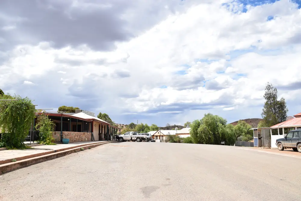
Blinman SA 5730, AustraliaPhoto: Matthew Summerton · CC BY-SA 3.0 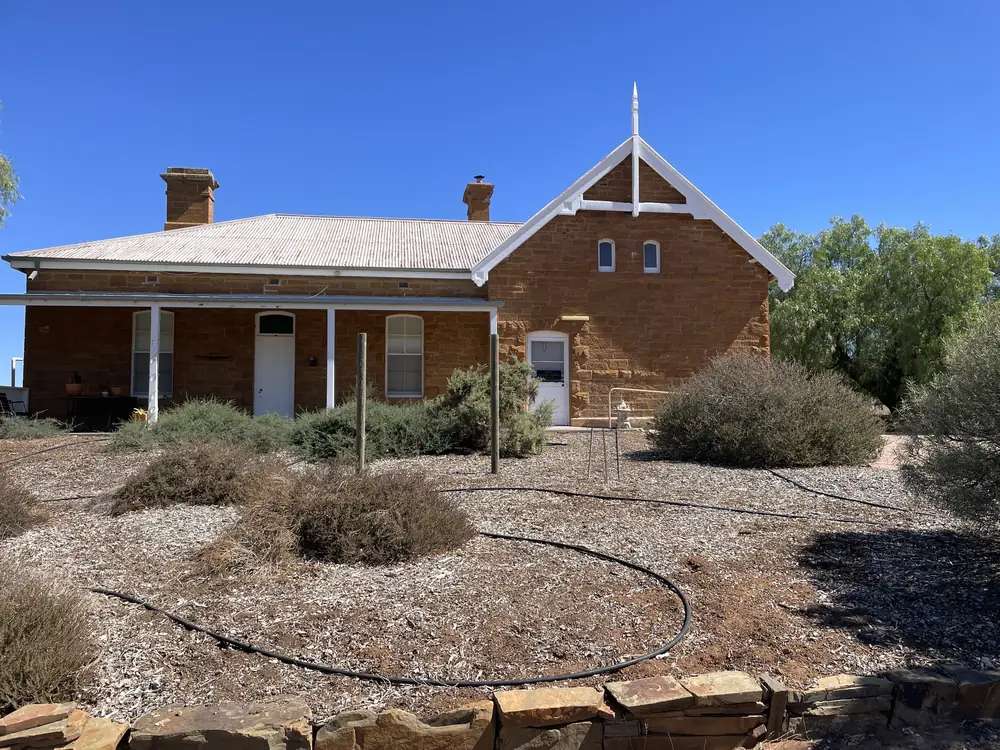
Blinman Old SchoolPhoto: Pru.mitchell · CC BY-SA 4.0 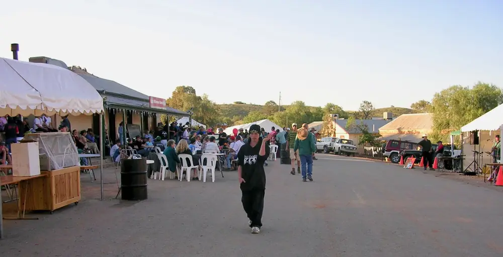
Cook out backPhoto: Maelgwn at English Wikipedia · Public domain 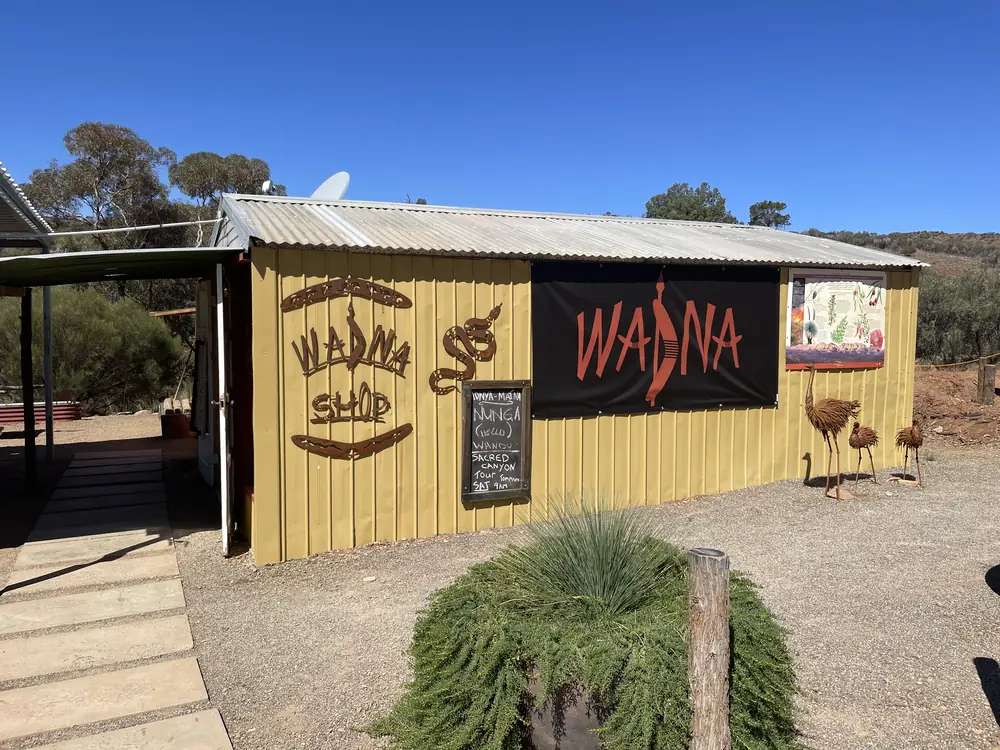
WadnaPhoto: Pru.mitchell · CC BY-SA 4.0
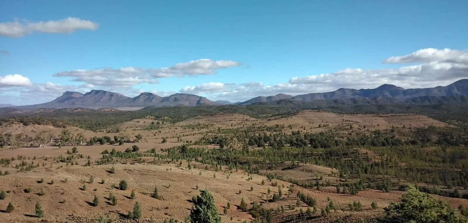
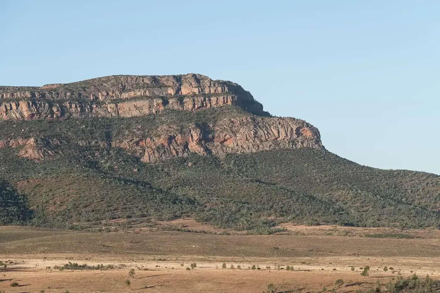
Blinman is a northern Flinders Ranges copper town on Adnyamathanha Country, grouped on this site with Flinders Ranges towns. SATC’s Best of Flinders Ranges self-drive itinerary puts Wilpena Pound (resort) to Blinman at 64 kilometres (about 1 hour) and calls Blinman the highest town in South Australia, at the northern edge of Ikara-Flinders Ranges National Park. That kilometre is a resort-to-town figure. Wilpena is the park amphitheatre and resort, not a Wave 5 town hub — do not look for /outback-towns/south-australia/wilpena. Use the park guide.
The Australian Bureau of Statistics does not publish a 2021 Urban Centre (UCL) named Blinman. Use suburbs-and-localities SAL40127: 43 people, median age 41, sex split 47.7% male / 52.3% female. QuickStats notes limited tables because of the small population. SATC’s Heritage Mine listing quotes 30 permanent residents; this hub uses the ABS count.
This is not a council-seat town in the way Quorn is. The Flinders Ranges Council’s published suburb list used in this rebuild names Quorn and southern Flinders localities, not Blinman. Use the council for the southern gateway and Parks SA / SATC / DIT for Blinman itself. Hawker remains the main service town for the park on this site’s Flinders hub.
Where it is, and how far
Blinman sits north of Wilpena Pound on the public gorge and ranges roads that also reach Parachilna. The South Australian Heritage Council’s 2024 note on Parachilna Gorge Geological Monument places that gorge about 8 kilometres east of Parachilna on Parachilna Gorge Road toward Blinman. SATC’s Explorers Way trade material names Heritage Blinman Mine on the same northern Flinders loop as Parachilna Gorge and the Prairie Hotel. This hub does not invent a Blinman–Parachilna kilometre that is not on those sheets.
East and north of town, Arkaroola’s getting-here page is the access authority for the dirt to Arkaroola: 152 km of dirt, about 2.5 hours from Blinman or 3 hours from Wilpena. SATC’s self-drive PDF lists Blinman to Arkaroola 155 kilometres (about 3 hours). Those are two official figures for the same corridor. Confirm with DIT the day you drive. That road is not a sedan shortcut from the Pound unless the vehicle and the warning page agree.
| Place | Distance from Blinman (sourced) |
|---|---|
| Wilpena Pound (resort) | 64 km south (SATC Best of Flinders Ranges itinerary; about 1 hour) |
| Arkaroola | 152 km dirt / about 2.5 hours (Arkaroola getting-here); SATC lists 155 km / about 3 hours |
| Parachilna Gorge Geological Monument | 8 km east of Parachilna on the gorge road toward Blinman (SA Heritage Council 2024 note) — not a Blinman-town kilometre |
| Leigh Creek Airport (BOM open station from the Angorichina table) | 60.2 km from Angorichina Hostel (BOM nearest-alternative line) — not a town-to-town drive time |
Hawker is the sealed-road service town about 370 km north of Adelaide on that town’s own guide, with Wilpena about 55 km further. This hub does not add those two figures and call the sum a Blinman distance.
Facts at a glance
Population. ABS 2021 Census, Suburbs and Localities SAL40127: 43 people. Median age 41. 8 families, 31 private dwellings. No UCL. Use the Blinman SAL QuickStats. SATC’s mine page is community wording for 30 residents, not a substitute Census.
Climate. Bureau of Meteorology does not publish a Blinman row on the South Australia climate-averages site-name list fetched for this guide. The closest named table on that list is ANGORICHINA HOSTEL, 017003, 31.13°S, 138.56°E, elevation 320 m, commenced 1866, closed 31 December 1977. Mean maximum (30 years, 1928–1960): January 33.5 °C, July 15.2 °C, annual 24.4 °C. Mean minimum: January 19.0 °C, July 4.5 °C, annual 11.5 °C. Mean rainfall (42 years, 1866–1977): annual 316.4 mm. BOM’s nearest open alternative from that page is Leigh Creek Airport, 017110 (60.2 km): January mean maximum 36.0 °C, July 16.9 °C, annual rainfall 212.8 mm. See Blinman weather.
Visitor information. SATC lists the Blinman Heritage Mine at Mine Road, Blinman, 08 8648 4782, info@heritageblinmanmine.com.au. Hawker remains the Flinders service desk on this site’s Hawker guide. Quorn holds The Flinders Ranges Council seat and SATC’s Flinders Ranges Visitor Information Centre at the station. Confirm gorge closures with Parks SA and DIT outback road warnings.
Traditional Owners
This is Adnyamathanha Country. Parks SA’s Ikara-Flinders Ranges National Park page states the park is jointly managed with the Adnyamathanha people. Ikara is the Adnyamathanha name for Wilpena Pound. Parks SA’s Vulkathunha-Gammon Ranges National Park page states that park is traditional country of the Adnyamathanha people and has been co-managed with them since 2010. SATC’s Flinders Ranges and Outback destination sits on the same ranges. This hub follows those official sentences. It does not flatten other language groups onto the townsite, and it does not invent a Blinman-only nation label that Parks SA does not print.
Adnyamathanha Traditional Owners ask visitors to consider walking to Tanderra Saddle rather than the summit of St Mary Peak — that request lives on the park page, not in Blinman’s main street. Stay on public roads and marked walks. Ask before photographing people or closed sites. See visiting Country respectfully.
History
SATC’s Heritage Mine listing is the official copper story used here. The Blinman Underground Mine Tour is a community initiative. SATC says the ten-year project involved extensive excavations to access old tunnels once worked by Cornish miners in 1862. Tours are personalised and fully guided, combining a theatrical presentation with light and soundscapes. An above-ground self-guided walk of about one hour has interpretive signage. Difficulty is listed as medium.
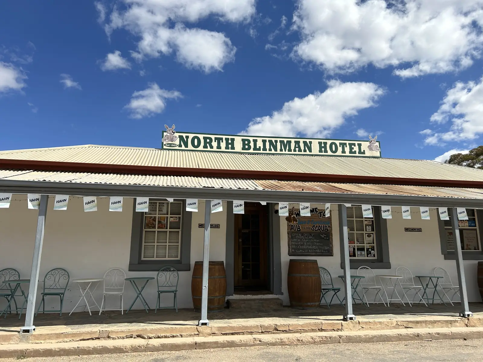
SATC’s Mining Mysteries tour listing sends visitors to Blinman to explore the old copper mine and wander the streets of the historic town, with lunch at the Blinman Hotel. SATC’s Wallabies, Rocks and Copper tour names lunch at the North Blinman Hotel, then the underground mine. Those are SATC product names, not a pub review.
SATC’s Best of Flinders Ranges itinerary places Blinman at the northern edge of the Flinders Ranges National Park and calls it the highest town in South Australia. This hub repeats that wording. It does not invent a founding year, a peak production figure, or a visitor count that SATC does not print.
Parachilna Gorge was the wagon route that SATC’s Explorers Way material pairs with Blinman Pools and the Prairie Hotel. The Heritage Council’s monument listing is geology, not a fossicking permit.
Things to do
Blinman Heritage Mine, Mine Road — SATC: underground tours on the hour, seven days, about one hour; above-ground self-guided walk about one hour; Monday–Sunday 09:00–16:30 on the SATC hours line; phone 08 8648 4782. SATC lists a price band from $28 to $35 and notes group discounts, Companion Card and assistance dogs. Confirm before you treat those hours as a winter guarantee. SATC’s Explorers Way PDF also says tours run three times daily March to November — a second official timetable. Ask the mine which sentence applies the week you arrive.
Town streets and the hotel. SATC’s Mining Mysteries listing is the warrant to walk the historic town and to name the Blinman Hotel as a lunch stop. SATC’s Wallabies, Rocks and Copper listing names the North Blinman Hotel. Hours change. This is not a 24-hour museum.
Alpana Station — SATC lists the working merino property at 20321 Flinders Ranges Way, Blinman, in the Henery family since 1878, opened to tourism in 1994. SATC also lists a Blinman Pools guided drive and guided walk from Alpana reception. The pools sit on station country, not on a Parks SA walk-from-the-pub sheet. Book the operator. Do not invent a free 12 km public track as a park walk.
Parachilna Gorge Geological Monument on the public road toward Parachilna — a State Heritage landscape you pass through, not a fossil-collecting site.
Ikara-Flinders Ranges National Park is the central Flinders park via Hawker and Wilpena, 64 km from Blinman on SATC’s resort figure. Walks, gorge drives and camping belong on the park guide. Parks SA is the access authority.
Where to stay
SATC names these stay types at or for Blinman:
- Alpana Station — scenic camping and unpowered sites, ensuite powered sites, independent powered sites, self-contained shearers’ quarters and Nungawurtina Hut. SATC’s product page lists a band from $20 to $200 and phone 08 8648 4626. Confirm.
- North Blinman Hotel / Blinman Hotel — named on SATC tour listings as the lunch and historic-town pub. This hub does not invent a room inventory SATC does not print on those tour pages. Ask the hotel or Hawker VIC.
- Park and resort beds at Wilpena — 64 km on SATC’s sheet, inside the park, not a Blinman motel strip.
If Blinman is full, Hawker is the service-town overflow and Leigh Creek is the northern sealed-road fallback before you commit to Arkaroola dirt.
- How to choose: Blinman accommodation
- Camping detail: Blinman caravan parks
- Operator enquiries: feature your business
Caravan and camping
A van can reach the Flinders sealed spine through Hawker and Parachilna in ordinary weather. SATC names powered and unpowered sites at Alpana Station, including drive-through sites on that listing. Parks SA names park campgrounds in Ikara-Flinders Ranges National Park — those are park camps, 64 km from Blinman on SATC’s resort figure, not a town park. Read Blinman caravan parks and outback camping.
Unsealed gorge roads and the Blinman–Arkaroola dirt close after rain. Check DIT outback road warnings and 1300 361 033. Do not drive around a closed sign to keep a powered-site booking.
Fuel and services
A locality of 43 people will not match Hawker or Leigh Creek for fuel, groceries or a hospital. This guide does not list bowser brands. SATC names a shop at the Heritage Mine (gift shop on the facilities list) and Alpana’s tour desk — neither is a supermarket. Fill in Hawker before you leave the sealed park approach, or in Leigh Creek if you are coming from the north. Hawker Memorial Hospital is on that town’s guide (08 8648 4007). For current questions use SATC’s mine phone 08 8648 4782, The Flinders Ranges Council in Quorn, and DIT.
Road access
Sealed Flinders highways from Adelaide run through Port Augusta, Quorn and Hawker. Traffic SA is the sealed-road source. Parachilna Gorge Road toward Blinman is the Heritage Council’s public gorge approach; it is unsealed in the gorge and closes after rain. DIT outback road warnings cover the northern dirt, including the 152 km Blinman–Arkaroola road. Hire-car policies often exclude unsealed roads — Arkaroola’s getting-here page is explicit on that point.
Do not treat Wilpena Pound Resort as a town interchange. The SATC 64 km is a resort-to-Blinman drive on the itinerary sheet, then you are in a 43-person copper town.
Our Flinders Ranges itinerary is the regional road-trip page. SATC’s self-drive PDF is the kilometre source used here.
Nearby parks and towns
Parks and named nature sites:
- Ikara-Flinders Ranges National Park — jointly managed with the Adnyamathanha people; SATC’s 64 km from Wilpena Pound Resort
- Parachilna Gorge Geological Monument — State Heritage, toward Parachilna
- Vulkathunha-Gammon Ranges National Park — Adnyamathanha Country, co-managed since 2010; reached via Copley, not as a Blinman main-street walk
- Arkaroola wilderness sanctuary — 152 km dirt on the operator’s page
Towns on this site:
- Hawker — park service town, fuel and rooms
- Parachilna — Prairie Hotel, gorge road
- Quorn — Flinders Ranges Council seat, Pichi Richi
- Beltana — State Heritage town on the northern sealed road
- Leigh Creek — northern service town
- Lyndhurst — Strzelecki start
- Arkaroola — sanctuary locality, not a city
Wilpena Pound village is named throughout the park guides. It still has no standalone town page in this rebuild.
When to go, and how long
Angorichina Hostel’s January mean maximum of 33.5 °C (1928–1960) is hot for an underground tour queue at midday; Leigh Creek Airport’s open-station January 36.0 °C is hotter still on the plains. July’s 15.2 °C mean maximum at Angorichina is the walking season on paper; July’s 4.5 °C mean minimum is why a gorge camp needs a layer. SATC’s Explorers Way note that some Flinders places close mid December to mid February belongs in your booking call to the mine and Alpana.
Two hours at the mine and a street walk is the minimum if SATC’s hourly tours are running. A night at Alpana or in Hawker lets you add the gorge road without driving tired. Two nights only if DIT agrees and you are adding Arkaroola dirt or a full Ikara park day — those are separate road-conditions questions, not a Blinman main-street itinerary.
Operators who want a checked listing: feature your business. The listings slot on this hub stays empty until then.
Plan this trip
Tell us the dates, who you are travelling with and where you need help. We reply with planning notes for Blinman — we are not a booking agent.
Events and road-conditions newsletter
Occasional notes on outback festivals, race days and official road-condition sources — not a daily blast. We use these details only to send the newsletter.
South Australia · Flinders Ranges
Blinman accommodation
Where to stay around Blinman SA from SATC listings: Alpana Station camping and quarters, North Blinman Hotel named on SATC tours, and park beds at Wilpena Pound Resort 64 km south.
Read · 3 min
South Australia · Flinders Ranges
Blinman caravan parks
Caravan and camping around Blinman SA from SATC and Parks SA: Alpana Station powered and unpowered sites, park camping 64 km south at Wilpena, and DIT gorge-road closures.
Read · 3 min
South Australia · Flinders Ranges
Blinman weather
Blinman climate from BOM Angorichina Hostel (017003, closed 1977): January mean max 33.5 °C, July 15.2 °C, annual rain 316.4 mm. Leigh Creek Airport 017110 remains open 60.2 km away.
Read · 3 min
South Australia · Flinders Ranges
Things to do in Blinman
Blinman things to do from SATC and Parks SA: Heritage Mine tours, Alpana Station, Parachilna Gorge Road and Ikara-Flinders Ranges National Park. Not a Wilpena town page.
Read · 5 min
Frequently asked questions
How far is Blinman from Wilpena Pound and Arkaroola?
SATC’s Best of Flinders Ranges self-drive itinerary lists Wilpena Pound (resort) to Blinman at 64 kilometres (about 1 hour) and Blinman to Arkaroola at 155 kilometres (about 3 hours). Arkaroola’s getting-here page lists the Blinman road as 152 km of dirt, about 2.5 hours from Blinman or 3 hours from Wilpena. Confirm the day you drive.
What is Blinman’s population?
43 people at the 2021 Census for Blinman suburbs-and-localities (SAL40127). The ABS does not publish a 2021 Urban Centre (UCL) named Blinman. QuickStats notes limited tables because of the small population. SATC’s Heritage Mine listing quotes 30 permanent residents — this hub uses the ABS count.
Is Blinman the highest town in South Australia?
SATC’s Mining Mysteries tour listing and the same organisation’s Best of Flinders Ranges itinerary both call Blinman the highest town in South Australia. This hub repeats that SATC wording. It does not invent a surveyed elevation for the townsite.
Whose Country is this?
Parks SA’s Ikara-Flinders Ranges National Park page states the park is jointly managed with the Adnyamathanha people. Ikara is the Adnyamathanha name for Wilpena Pound. SATC’s Flinders Ranges and Outback destination sits on the same corridor. This hub follows those official sentences rather than inventing a separate nation label for the townsite only.
What weather record should I use?
BOM does not publish a Blinman climate-averages table on the South Australia site-name list. The closest named table on that list is Angorichina Hostel (017003), closed 31 December 1977: January mean maximum 33.5 °C, July 15.2 °C, annual rainfall 316.4 mm. The nearest open station BOM prints from that page is Leigh Creek Airport (017110), 60.2 km from Angorichina.
Can I treat Wilpena as a Blinman town neighbour with its own town hub?
No. Wilpena Pound is the park and resort inside Ikara-Flinders Ranges National Park. SATC’s kilometre is to Wilpena Pound (resort). This site’s park guide is /national-parks/ikara-flinders-ranges. There is no Wave 5 town hub for Wilpena.
Sources and further reading
Facts on this page were checked against these primary and official sources. Conditions change — confirm before you travel or buy.
- Blinman 2021 Census QuickStats (SAL40127) — Australian Bureau of Statistics
- Climate statistics for Angorichina Hostel (017003) — Bureau of Meteorology
- Climate statistics for Leigh Creek Airport (017110) — Bureau of Meteorology
- Blinman Heritage Mine — South Australian Tourism Commission
- Alpana Station — South Australian Tourism Commission
- Best of Flinders Ranges self-drive itinerary — South Australian Tourism Commission
- 4WD Tour — Mining Mysteries & Outback History — South Australian Tourism Commission
- Getting to Arkaroola Village — Arkaroola
- Ikara-Flinders Ranges National Park — National Parks and Wildlife Service SA
- Vulkathunha-Gammon Ranges National Park — National Parks and Wildlife Service SA
- The Flinders Ranges Council — The Flinders Ranges Council
- Traffic SA — Government of South Australia
- Outback road warnings — Department for Infrastructure and Transport SA