At a glance
Sourced facts only. Distances and services change — confirm before you travel.
- Local government
- Weipa Town
- Traditional Owners
- Alngith people (Weipa Town Authority). Neighbouring groups named by the Authority include the Thanikwithi, Peppan, Wathayn, Anathangayth and Wik-Waya.
- Nearest regional city
- Just over 800 km on the Peninsula Developmental Road from Cairns, or about 1 hour 20 minutes by air (Weipa Town Authority)
- Mobile coverage
- Check Telstra and Optus coverage maps before travel; do not assume a signal.
- Best time to visit
- May–September on Weipa Aero dry-season rainfall; wet-season PDR closures are common
Climate
Monthly means from the Bureau of Meteorology station Weipa Aero (027045). This is not a forecast. Open. Commenced 1972. Elevation 18 m.
| Month | Mean max (°C) | Mean min (°C) | Rainfall (mm) |
|---|---|---|---|
| Jan | 32.0 | 24.3 | 515.0 |
| Feb | 31.4 | 24.3 | 502.2 |
| Mar | 31.9 | 24.0 | 415.9 |
| Apr | 32.3 | 23.0 | 111.0 |
| May | 31.9 | 21.6 | 18.8 |
| Jun | 31.2 | 20.1 | 3.2 |
| Jul | 31.2 | 19.1 | 1.7 |
| Aug | 32.3 | 18.9 | 4.1 |
| Sep | 34.5 | 20.1 | 1.8 |
| Oct | 35.9 | 21.9 | 18.5 |
| Nov | 36.0 | 23.6 | 90.4 |
| Dec | 34.0 | 24.3 | 292.6 |
Weipa in pictures
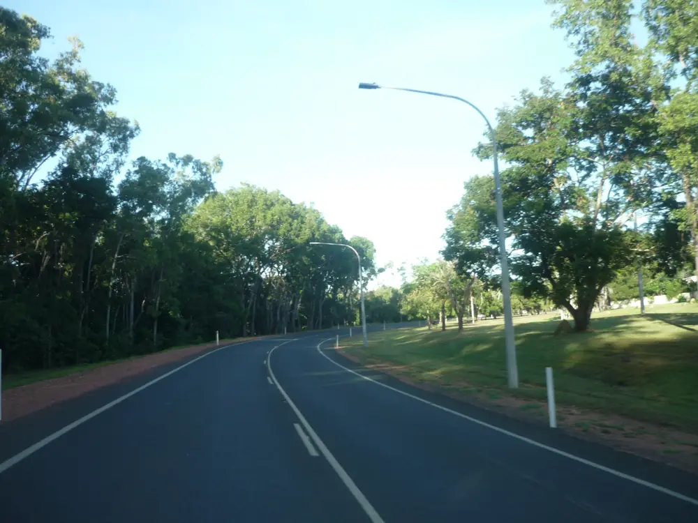
Weipa Central Avenue roadPhoto: Q8682 · CC BY-SA 4.0 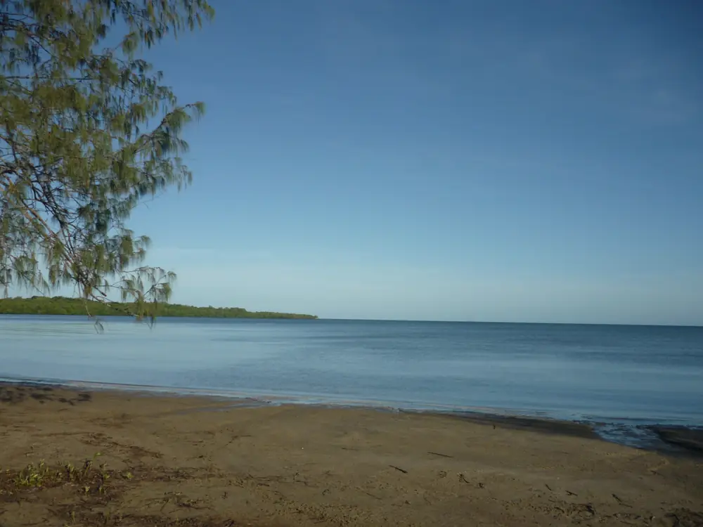
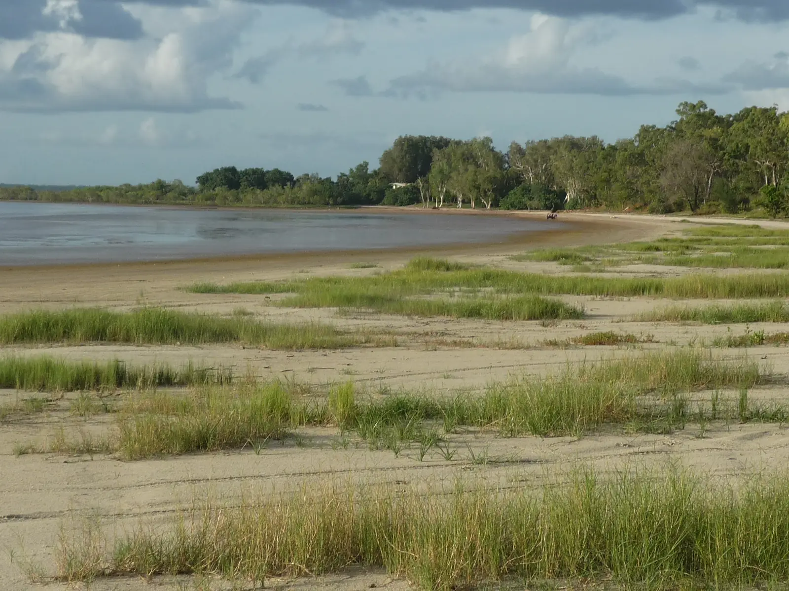
Weipa coastal bayPhoto: Q8682 · CC BY-SA 4.0 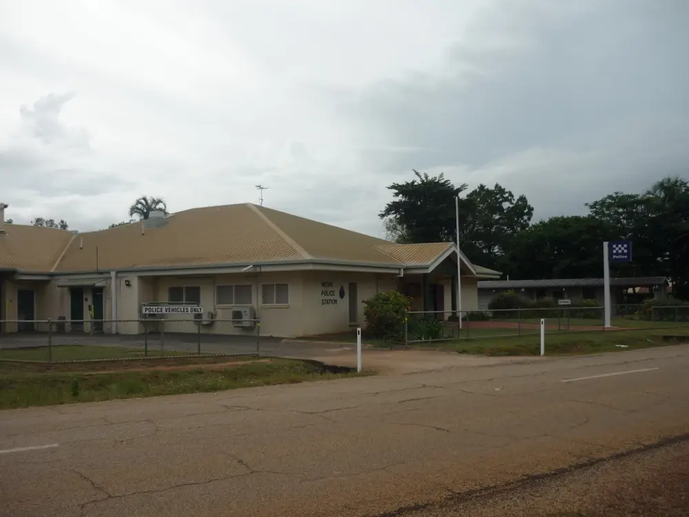
Weipa police stationPhoto: Q8682 · CC BY-SA 4.0 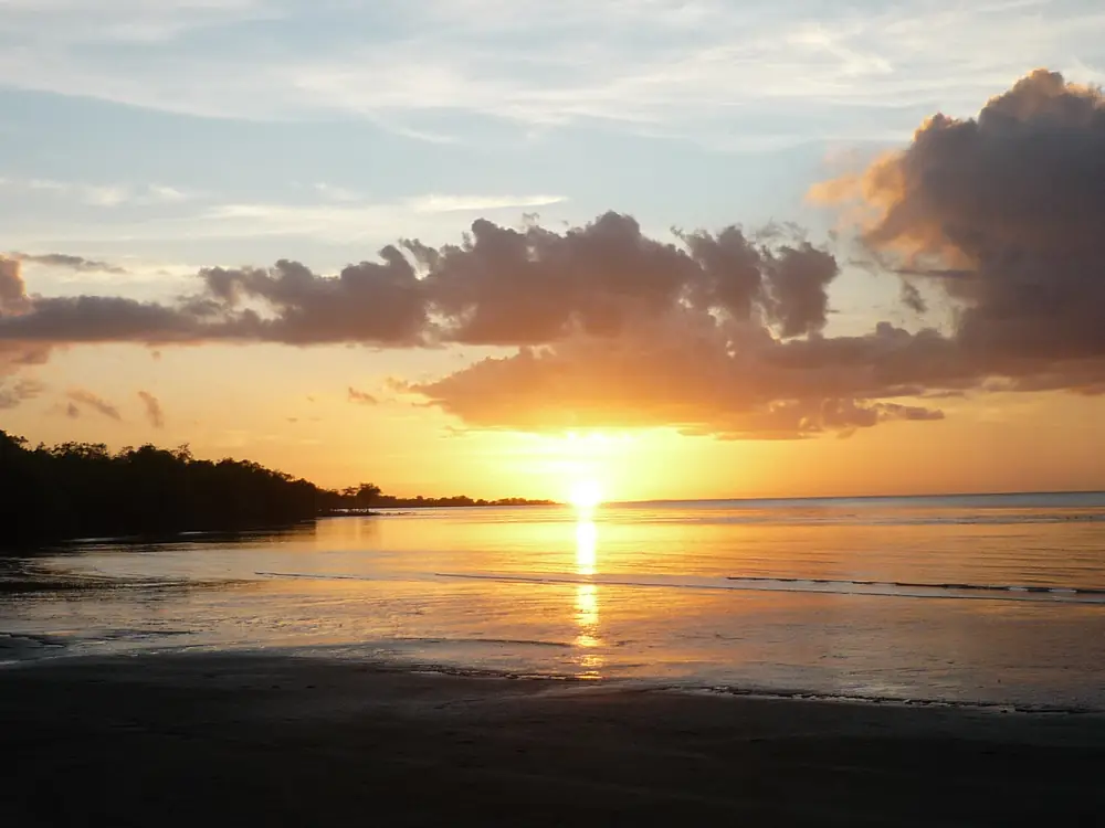
Weipa sunset from Nanum beach areaPhoto: Q8682 · CC BY-SA 4.0
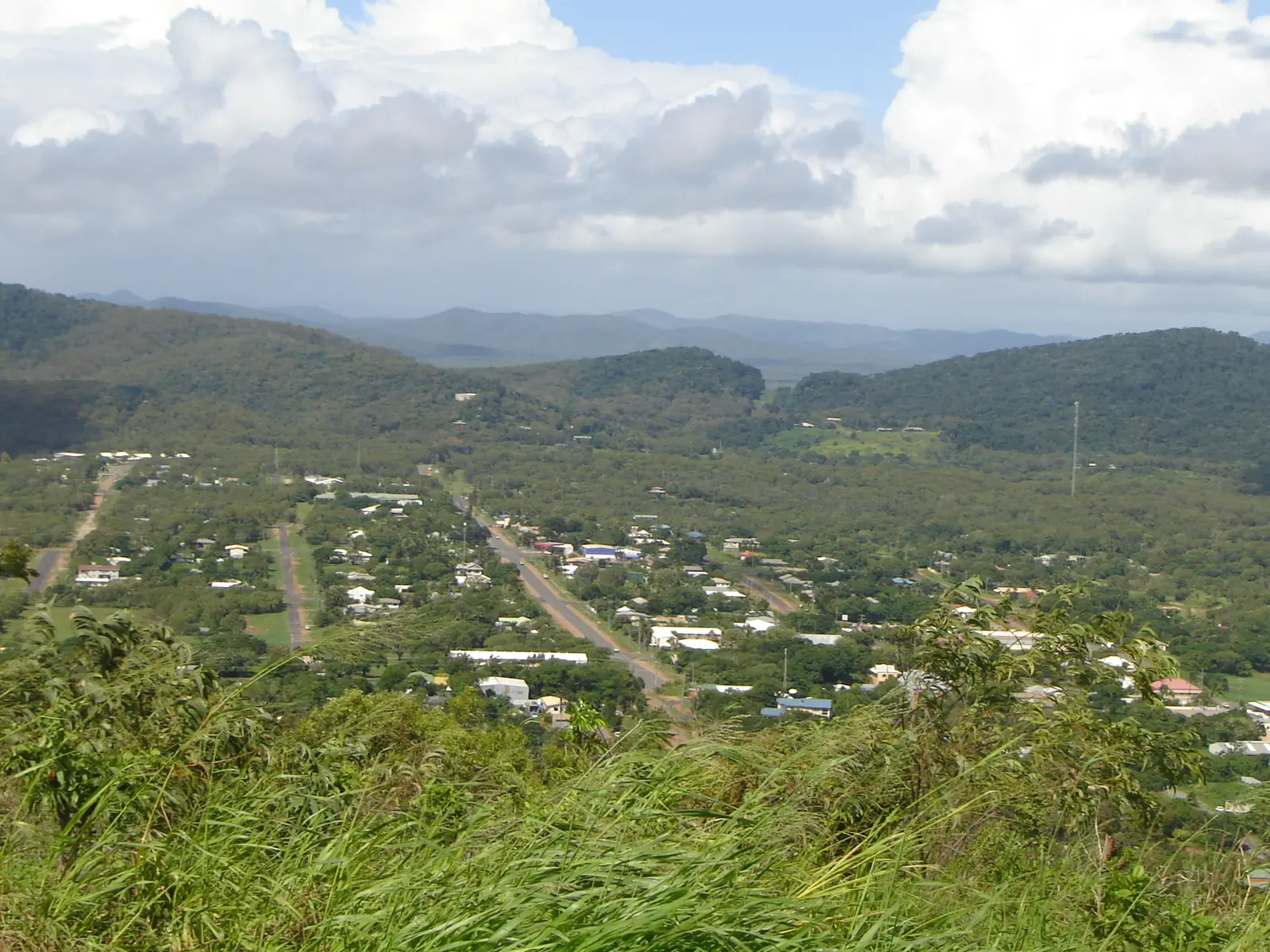
Weipa sits on the western side of Cape York Peninsula, on Alngith Country, looking out toward the Gulf of Carpentaria. Weipa Town Authority describes it as the gateway to the western Cape: beaches, fishing, wilderness and a living cultural landscape, with a mining township that was built here in the 1960s. It is a long way from anywhere. Indigenous.gov.au places the town about 800 kilometres north-west of Cairns by road and about 200 kilometres south of the tip of Australia.
The name Weipa comes from the Anhathangayth words Waypa or Waypundun, which the Authority records as “fighting ground”. Neighbouring Traditional Owner groups named on the same history page include the Thanikwithi, Peppan, Wathayn, Anathangayth and Wik-Waya. Visit as a guest on Country: ask before photographing people, stay off closed or unmarked tracks, and book Aboriginal-led tours rather than treating cultural places as casual lookouts. See visiting Country respectfully.
Where is Weipa
Weipa is a Queensland town in the Outback North and Gulf directory region. The urban centre is compact: Rocky Point, Evans Landing and the beaches sit a short drive from the airport. Weipa Town Authority says the airport is about 15 minutes from the township. There is no need to guess driving distances to Brisbane or the east-coast cities — official Weipa pages used for this guide do not publish those figures.
On a map of Cape York, Weipa is the large service town on the west coast. Cooktown is the corresponding east-coast gateway. Between them runs the Peninsula Developmental Road and a scatter of communities, roadhouses and parks. The Cape York 4WD guide covers the drive north toward the Tip; Weipa is a western base, not the Tip itself.
Things to do in Weipa
The Weipa Town Authority “what to do” list is town-based. It does not attach a national-park URL to the township, so this guide does not invent one. Start in town, then ask the Authority what is open beyond it.
Western Cape Cultural Centre, Evans Landing. Local cultural information and artwork. The Authority lists free entry, 10am–2pm Monday to Friday. It is the straightforward first stop if you want to understand who lives here and whose Country you are on.
Cape York Collection, Hibberd Library. Historical documents and artefacts from Weipa and across the Cape, listed on the same Authority page.
Lake Patricia and Lake McLeod. Freshwater lakes known locally for birdlife. Lake Patricia has a picnic area with barbecues, public toilets and a children’s playground.
Gonbung Beach and Front Beach. The Authority points to Gonbung, just past Evans Landing, and Front Beach in front of the Weipa Caravan Park and Camping ground, for sunset walks. Crocodiles inhabit the waterways in and around Weipa — treat beaches and river edges as croc country, not swimming holes. See crocodile safety and Queensland’s Be Crocwise advice. Report crocodiles seen inside the township as the Authority directs.
WWII P-47D Thunderbolt wrecks near Duyfken Point. The Authority records that in 1944 two P-47D Thunderbolts force-landed on the beach near Duyfken Point during operations in Papua New Guinea, and that remains can be seen from the shoreline. Go only where public access is clearly allowed, and do not disturb wreckage.
Alngith Choolatha cultural tourism. Alngith Corporation describes ranger-led on-Country tours sharing cyclone dreaming, Welcome to Country, bush tucker, artefact workshops and the Embley, Mission and Hay Rivers. Availability changes; check alngith.com rather than assuming a daily departure.
Fishing and river tours. The Authority names Tackle World Weipa for fishing charters and Western Cape Eco Tours for Embley River and Roberts Creek trips in the dry season (daily tours, sunset tours, fishing charters). Confirm current operators, licences and tides locally. We do not publish package prices.
Recreation in town. The Authority also lists barbecue areas at Lake Patricia and Hibberd Park, the Weipa Bowls Club (four greens; equipment hire) and the Carpentaria Golf Club’s eight-hole course. Ask in town for current opening times.
A longer things to do in Weipa page sits beside this hub.
History and Country
Alngith people are the Traditional Owners of the township. Weipa Town Authority records that an Alngith representative sits on the Authority board. The former Presbyterian mission on this coast became Weipa South / Napranum, gazetted in 1990.
The modern mining town is recent. The Authority’s Western Cape history page records economic bauxite discovered near Weipa in 1955, an exploration camp in 1956, a Comalco agreement in 1957, and a township built between 1964 and 1967 near Kumrunja (Rocky Point). That mining story still shapes daily life: shift work, a young median age at the 2021 Census (30), and services aimed at residents as much as at travellers. Visitors should not treat industrial areas, haul roads or closed mine land as lookouts.
Napranum is a neighbouring community, not a suburb to wander through for photographs. Stay on public roads in Weipa unless you have been invited elsewhere, and take Alcohol Management Plan rules on the wider Cape seriously. The Authority states that Weipa township itself does not have an Alcohol Management Plan, but plans exist throughout Cape York communities and heavy fines may apply for breaches.
Getting there
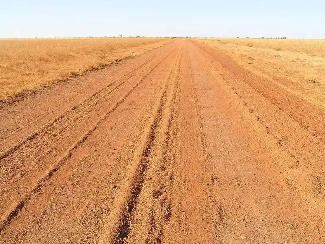
By road. Just over 800 km from Cairns on the Peninsula Developmental Road (PDR), via Lakeland. The road is sealed in sections. Wet-season closures are common. Weipa Town Authority and indigenous.gov.au both warn travellers to check conditions. Use QLDTraffic (13 19 40) for state roads and Cook Shire’s road-conditions page for local Cape roads. Closed means closed — driving a closed PDR damages the road and can leave you cut off with no help. Read wet season and road closures.
By air. About 1 hour 20 minutes from Cairns. The Authority names Qantaslink and Skytrans on that tourist-information page, plus charter operators for passengers and freight. Check current schedules with the airlines; we do not publish fares.
By barge. Vehicles can be sent from Cairns to Weipa by sea. Useful when the PDR is closed or when you do not want to tow a van over wet-season floodways. Confirm sailings with the barge operator before you lock in dates.
A high-clearance 4WD is the sensible choice for Cape travel even when the PDR looks dry. Caravans belong on the formed road, not on side tracks. See the Cape York 4WD guide for the route north of Lakeland.
Weipa weather and when to go
Weipa has a tropical monsoon climate. Bureau of Meteorology statistics for Weipa Aero (station 027045; 12.68°S, 141.92°E; elevation 18 m; commenced 1972) show a mean annual rainfall of 1,959.8 mm (31 years, 1990–2026). January averages 515.0 mm; July averages 1.7 mm. The hottest mean maximum is November 36.0 °C; June and July share the coolest mean maximum, 31.2 °C. Mean minima fall to 18.9 °C in August. Even the “cool” months are warm by southern standards.
The dry season — roughly May to September, when monthly rainfall means sit between 18.8 mm (May) and 1.8 mm (September) — is when most visitors arrive, tours run and the PDR is most often open. The wet, peaking January to March, brings heat, humidity, storms and road closures. A dedicated Weipa weather page sets out the monthly BOM table and what it means for a trip.
Where to stay
Weipa is a mining and service town, not a resort strip. Weipa Town Authority names the Weipa Caravan Park and Camping ground at Front Beach. Other traveller categories that exist here are motel and hotel rooms. Do not expect this page to list every lodge: we do not invent business names or room rates. Confirm current operators with the Authority’s tourist information hub. Book ahead for the dry season, when Cape traffic is highest. See Weipa accommodation and Weipa caravan parks.
Population
The 2021 Census counted 4,097 people in the Weipa urban centre (UCL315098), with a median age of 30 and 52.7% male / 47.3% female. The Weipa Town LGA figure was 4,100. That is the town, not Cape York as a whole.
Food, fuel and safety
Weipa supplies a mining workforce, so fuel, groceries and basic medical services exist in town. Treat them as resident services that also serve travellers, not as a tourist precinct. Carry extra water on the PDR, and do not rely on every roadhouse being open at night.
Crocodiles inhabit local waterways. Stay back from the water’s edge, do not clean fish at the bank, and never swim in the river, lakes or sea unless an official swimming area is clearly signed — WTA’s tourist page does not list one. Estuarine crocodiles occur across Cape York; this is not an exception.
Fatigue, wildlife, road trains and sudden wet-season flooding are the main road hazards. Plan to be off the PDR before dusk. Mobile coverage is limited outside town; carry a way to call for help.
A suggested stay
Day 1. Fly in, or arrive by road only after checking QLDTraffic that morning. Settle in. Walk Front Beach or Gonbung Beach at sunset, staying well back from the water. If you arrive on a weekday, fit the Western Cape Cultural Centre into the afternoon.
Day 2. Lake Patricia for a picnic and birdwatching, then the Cape York Collection at Hibberd Library. If Alngith ranger tours are running, that is the day to take one — book direct. Otherwise ask the Authority about current fishing or river-tour operators.
Day 3. A longer look at Duyfken Point wrecks if access is open and conditions are safe, or a rest day in town before the drive south. Do not add a national-park side trip unless you have a current parks.qld.gov.au alert and a named destination from local advice. This guide will not guess a park hours away.
Practical information
- Country: Alngith (township), with neighbouring groups named by Weipa Town Authority.
- Population: 4,097 (2021 UCL).
- From Cairns: just over 800 km on the PDR, or about 1 h 20 min by air.
- Best time: dry season, when BOM rainfall means are lowest and the PDR is most likely open.
- Roads: QLDTraffic 13 19 40; Cook Shire local roads as well.
- Related: Cooktown, Cape York by 4WD, crocodile safety, outback safety.
Plan this trip
Tell us the dates, who you are travelling with and where you need help. We reply with planning notes for Weipa — we are not a booking agent.
Events and road-conditions newsletter
Occasional notes on outback festivals, race days and official road-condition sources — not a daily blast. We use these details only to send the newsletter.
Weipa · Outback Queensland
Things to do
Things to do in Weipa on Alngith Country: Western Cape Cultural Centre, Cape York Collection, Lake Patricia, Gonbung and Front beaches, WWII wrecks and Alngith ranger tours.
Read · 4 min
Weipa · Outback Queensland
Accommodation
Where to stay in Weipa, Queensland: motel and hotel rooms in a western Cape mining town, the named Front Beach caravan park, and why this guide does not invent operators or prices.
Read · 4 min
Weipa · Outback Queensland
Caravan parks
Caravan parks in Weipa, Queensland: Weipa Caravan Park and Camping ground at Front Beach, Peninsula Developmental Road wet-season closures, and how to confirm sites without invented parks or prices.
Read · 4 min
Weipa · Outback Queensland
Weather
Weipa weather from Bureau of Meteorology Weipa Aero: 1,959.8 mm a year, January 515.0 mm, July 1.7 mm, November heat, and what that means for the Peninsula Developmental Road.
Read · 3 min
Frequently asked questions
How far is Weipa from Cairns?
Weipa Town Authority puts the drive at just over 800 km on the Peninsula Developmental Road, or about 1 hour 20 minutes by air. The airport is about 15 minutes from town. Indigenous.gov.au also describes Weipa as about 800 kilometres north-west of Cairns by road and about 200 kilometres south of the tip of Australia.
Is the road to Weipa 2WD in the wet season?
Often no. Rivers on the Peninsula Developmental Road rise quickly in the wet, and closures are common. Check QLDTraffic (13 19 40) and Cook Shire local-road notices before you leave, and again as you travel. Weipa Town Authority also notes that vehicles can travel by barge from Cairns.
Whose Country is Weipa on?
Weipa Town Authority states that the township is on the traditional lands of the Alngith people. Neighbouring groups named by the Authority include the Thanikwithi, Peppan, Wathayn, Anathangayth and Wik-Waya. Indigenous.gov.au lists Anathangayth, Alngith, Peppan, Thanakwithi and Wathyn as Traditional Owners.
What is the population of Weipa?
The 2021 Census counted 4,097 people in the Weipa urban centre (UCL315098). Median age was 30. The Weipa Town local government area was 4,100 — almost the same figure. Do not confuse the town with the much larger Cape York region.
When is the dry season in Weipa?
Bureau of Meteorology means for Weipa Aero show rainfall dropping from May (18.8 mm) through September (1.8 mm). The wet peaks in January (515.0 mm) through March. June and July share the coolest mean maximum, 31.2 °C; November is the hottest, 36.0 °C.
Where can I see local culture in Weipa?
The Western Cape Cultural Centre at Evans Landing is free and open 10am–2pm Monday to Friday. Alngith Corporation lists ranger-led Choolatha cultural tourism on Alngith Country. Confirm current hours and tour availability locally.
Sources and further reading
Facts on this page were checked against these primary and official sources. Conditions change — confirm before you travel or buy.
- Weipa 2021 Census QuickStats (UCL315098) — Australian Bureau of Statistics
- Climate statistics for Weipa Aero (027045) — Bureau of Meteorology
- Tourist information — Weipa Town Authority
- What to do — Weipa Town Authority
- Western Cape history — Weipa Town Authority
- Weipa community — Australian Government
- Alngith cultural tourism — Alngith Corporation
- QLDTraffic — Queensland Government
- Cook Shire road conditions — Cook Shire Council