At a glance
Sourced facts only. Distances and services change — confirm before you travel.
- Population
- 15 people (SAL40431, 2021 Census)
- Local government
- Pastoral Unincorporated Area
- Traditional Owners
- Not named for the Farina townsite on the sourced pagesDEW names the Adnyamathanha people as traditional custodians of the Flinders Ranges. This site’s Marree guide names Arabana and Dieri Country further north. Confirm wording at Leigh Creek or the Quorn visitor centre.
- Nearest regional city
- Leigh Creek Health Service is the named SA Health clinic on this corridor; a Farina–Leigh Creek kilometre is not printed on the SATC bakery page.
- Capital
- About 660 km north of Adelaide (South Australian Tourism Commission bakery listing and story)
- Nearest fuel
- Confirm in Leigh Creek or Marree. SATC does not name a Farina bowser on the bakery product page.
- Nearest hospital or clinic
- Leigh Creek Health Service, Black Oak Drive, (08) 8678 6022 (SA Health). Emergencies 000.
- Mobile coverage
- Check Telstra and Optus coverage maps before travel; do not assume a signal among the ruins.
- Best time to visit
- May–July when SATC and the Farina Restoration Group say the underground bakery runs; cooler BOM mean maxima
Climate
Monthly means from the Bureau of Meteorology station Marree (Farina) (017024). This is not a forecast. Open. Temperature means 50 years (1889–1939); rainfall 141 years (1879–2026). Elevation 91 m.
| Month | Mean max (°C) | Mean min (°C) | Rainfall (mm) |
|---|---|---|---|
| Jan | 35.5 | 19.9 | 19.1 |
| Feb | 35.4 | 20.0 | 20.1 |
| Mar | 32.0 | 17.0 | 16.1 |
| Apr | 26.5 | 12.1 | 10.6 |
| May | 21.6 | 8.1 | 14.4 |
| Jun | 17.7 | 5.5 | 15.6 |
| Jul | 17.3 | 4.1 | 9.4 |
| Aug | 19.8 | 5.7 | 10.6 |
| Sep | 23.7 | 8.5 | 10.5 |
| Oct | 27.9 | 12.5 | 13.3 |
| Nov | 31.9 | 16.1 | 12.9 |
| Dec | 34.5 | 18.7 | 14.7 |
Farina in pictures
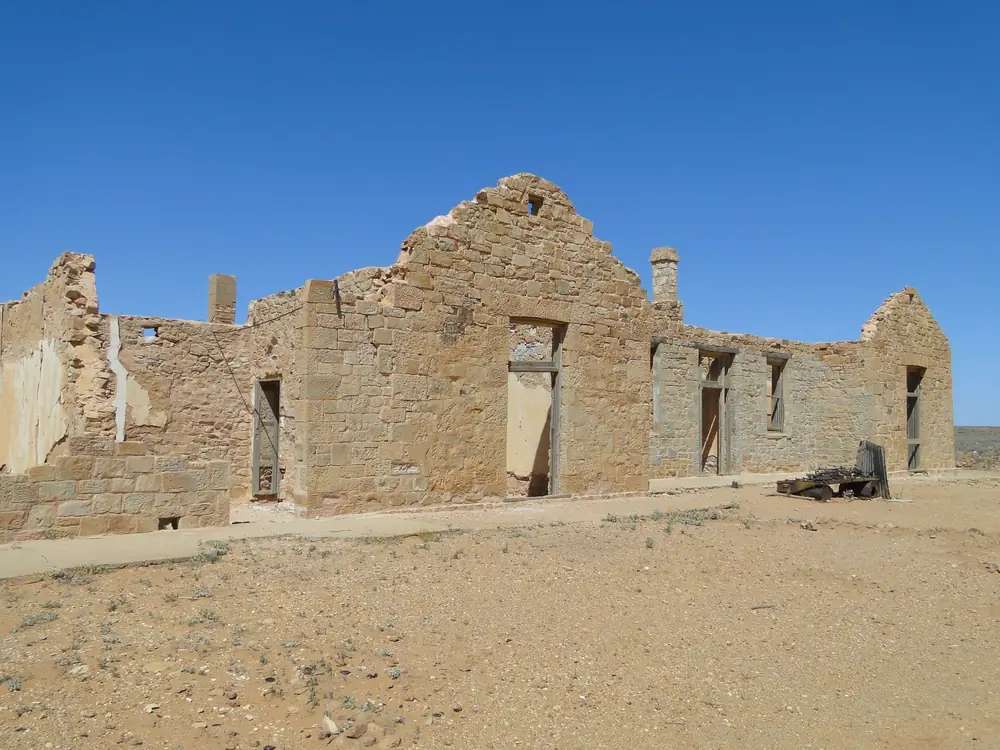
Ruins of the Transcontinental Hotel at FarinaPhoto: Peterdownunder · CC BY-SA 4.0 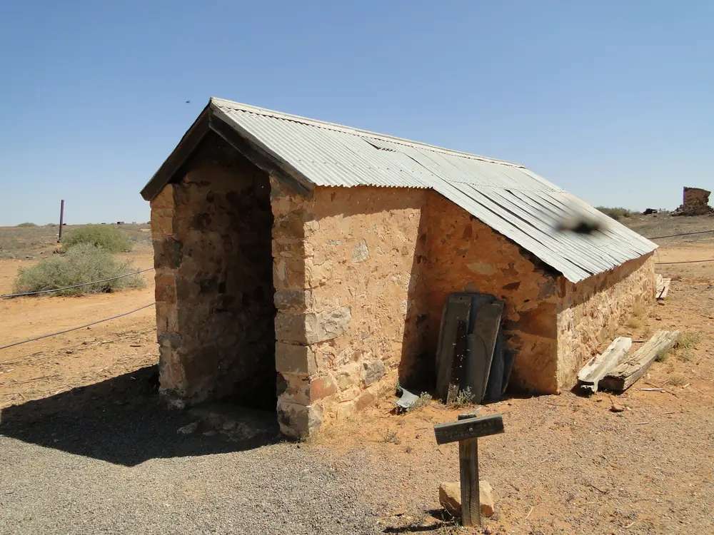
Underground bakery at FarinaPhoto: Peterdownunder · CC BY-SA 4.0 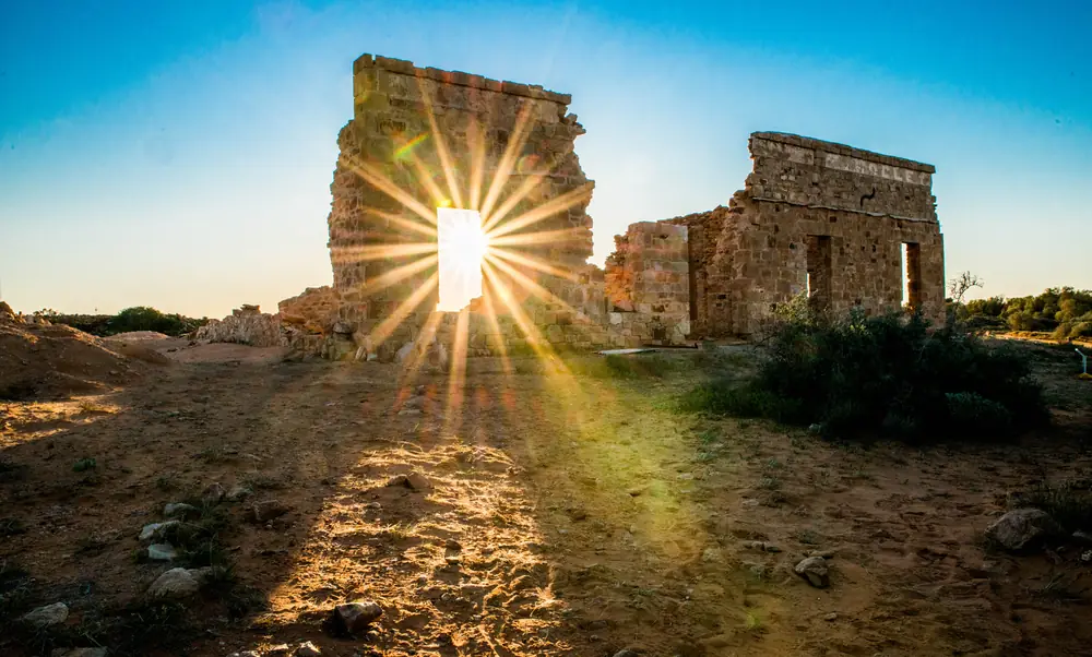
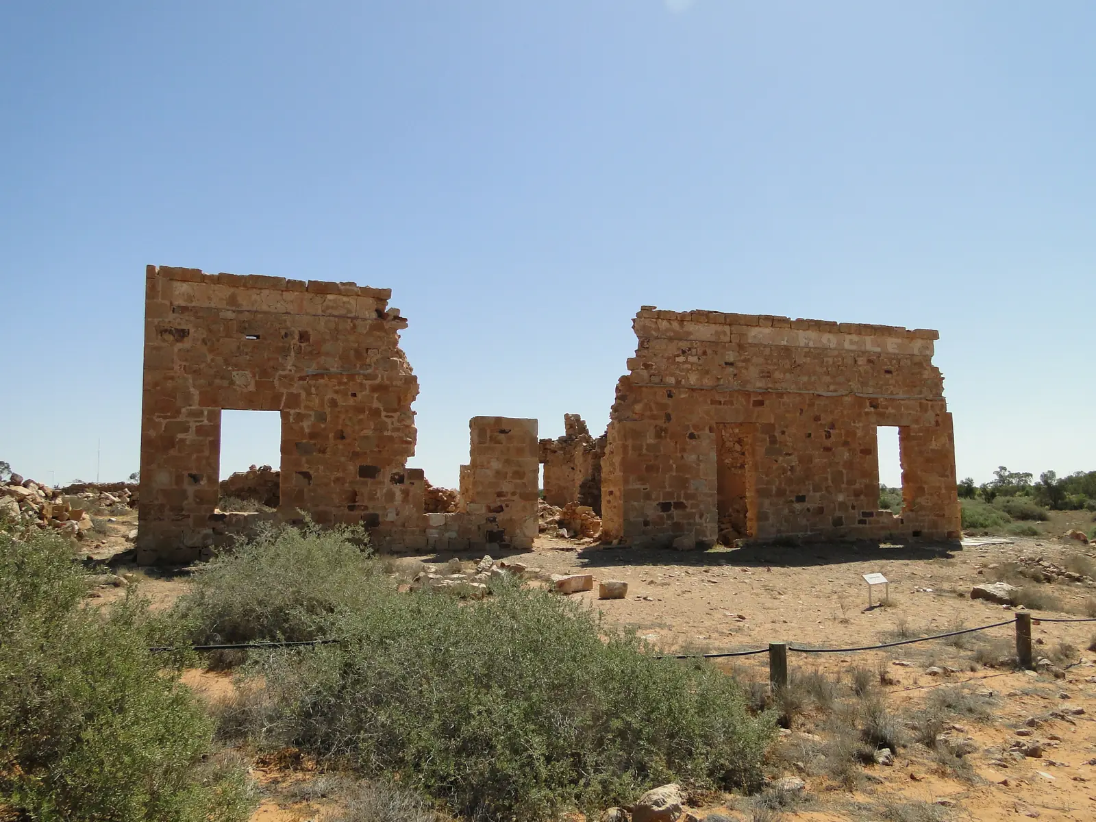
Stone ruin in the Farina ghost townPhoto: Mshort1803 · CC BY 3.0 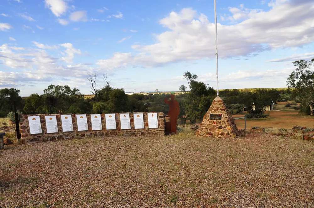
Farina war memorialPhoto: zapacit · CC BY-SA 4.0
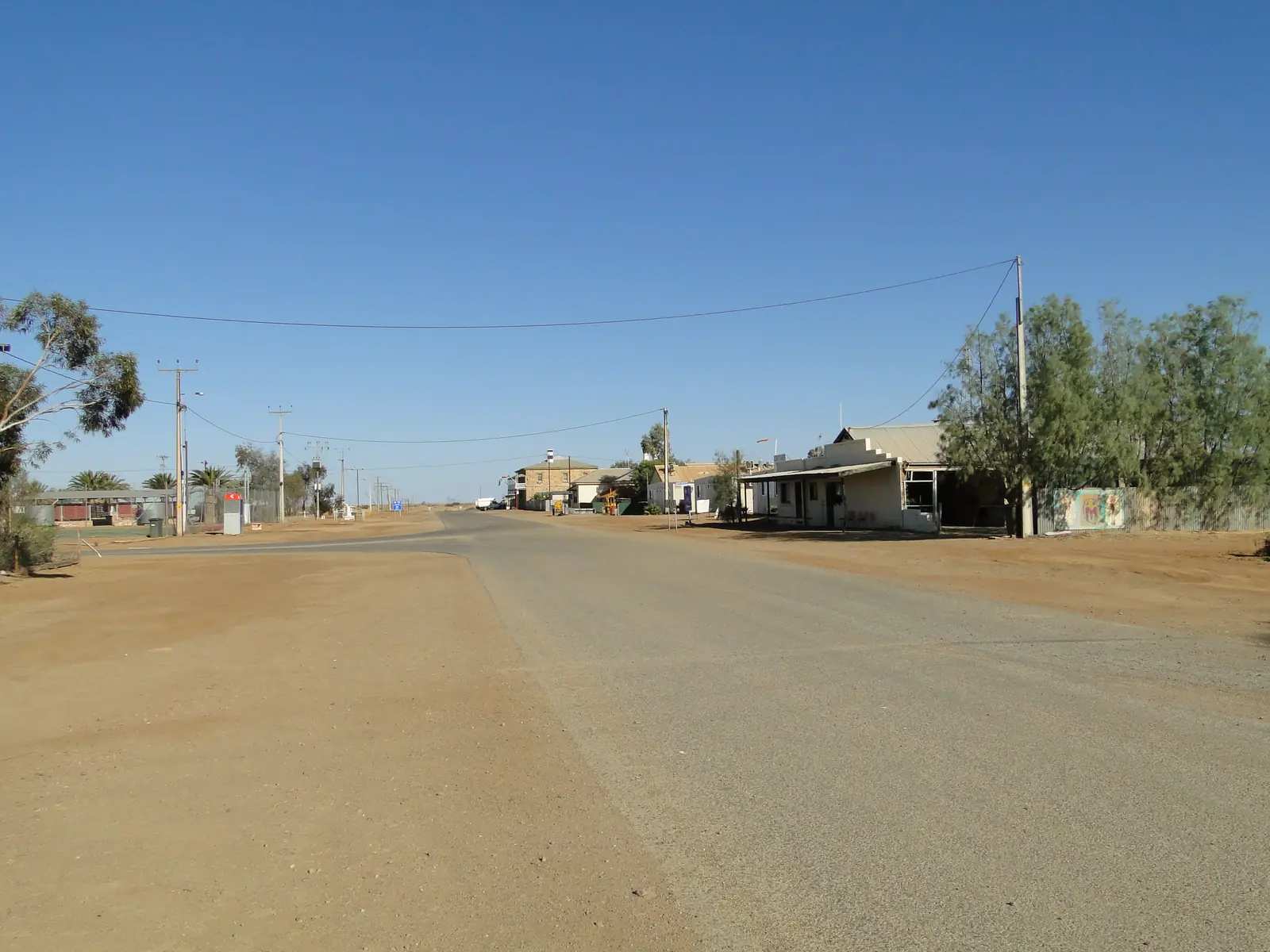
Farina is a ghost town of sandstone ruins on the old Great Northern Railway, later called the Ghan, in South Australia’s northern Flinders / far north. SATC’s underground-bakery listing and story put it 660 km north of Adelaide. The Farina Restoration Group, the operator SATC links, puts the locality 26 km north of Lyndhurst and 55 km south of Marree. SATC’s story describes turning off the main highway 26 kilometres past the last town. This is the sealed Leigh Creek–Lyndhurst–Marree road this site’s Marree FAQ already calls sealed — not the unsealed Oodnadatta Track or Birdsville Track that begin at Marree.
The Australian Bureau of Statistics does not publish a 2021 Urban Centre (UCL) named Farina. Use suburbs-and-localities SAL40431: 15 people, median age 59, sex split 50.0% male / 50.0% female. QuickStats notes limited tables because of the small population. 7 families, 20 private dwellings. Treat that as the official Farina SAL, not a headcount of people standing among the ruins on the day you visit.
This site groups Farina with Flinders Ranges towns. Local government is the Pastoral Unincorporated Area. Visitor meaning on SATC pages is the seasonal bakery and the restored stone town, not a council VIC.
Where it is, and how far
Farina sits north of Lyndhurst on the way to Marree, on the old railway alignment the Restoration Group names as the Great Northern / Ghan. SATC’s Explorers Way material marks Lyndhurst on the northern run toward Farina and Marree. From Marree the unsealed tracks start. From Lyndhurst the Strzelecki Track heads toward Innamincka. Farina is the ruins stop between those two decisions.
| Place | Official note |
|---|---|
| Adelaide | 660 km north (SATC bakery listing and story) |
| Lyndhurst | 26 km south (Farina Restoration Group; SATC story: 26 km past the last town) |
| Marree | 55 km north (Farina Restoration Group) |
| Leigh Creek | On the same sealed northern Flinders spine; this hub does not invent a Farina–Leigh Creek kilometre |
Sealed highway: Traffic SA. Unsealed tracks beyond Marree or Lyndhurst: DIT outback road warnings. Parks SA also prints 1300 361 033.
Facts at a glance
Population. ABS 2021 Census, Suburbs and Localities SAL40431: 15 people. Median age 59. 7 families, 20 private dwellings. No UCL. Use the Farina SAL QuickStats.
Climate. Bureau of Meteorology station MARREE (FARINA), 017024, commenced 1879, location 30.07°S, 138.27°E, elevation 91 m, status open. Mean maximum temperature (50 years, 1889–1939): January 35.5 °C, July 17.3 °C, annual 27.0 °C. Mean minimum: January 19.9 °C, July 4.1 °C, annual 12.4 °C. Mean rainfall (141 years, 1879–2026): annual 164.2 mm; February 20.1 mm wettest mean month; July 9.4 mm driest. Full columns: BOM Marree (Farina). Temperature means stop in 1939. See Farina weather.
Visitor information. There is no SATC-accredited VIC in Farina on the product pages used here. SATC lists the bakery at Mulgaria Rd, Farina 5733, phone 04 7676 1916, website farinarestoration.com, and listed it temporarily closed when fetched. Use the Restoration Group for trails and camping, Leigh Creek for fuel and the SA Health clinic, and the Flinders Ranges Visitor Information Centre in Quorn for the wider ranges.
Traditional Owners
DEW’s Flinders Ranges facts page names the Adnyamathanha people as traditional custodians of the Flinders Ranges. Parks SA jointly manages Ikara-Flinders Ranges National Park with the Adnyamathanha people. This site’s Marree guide names Arabana and Dieri Country further north at Marree. Farina sits between Lyndhurst and Marree on that sealed spine. This hub does not flatten those nations onto a single Farina-ruins label without a page that names the townsite. Confirm wording at Leigh Creek or the Quorn visitor centre. Read visiting Country respectfully.
History
SATC’s bakery story is the public history used here. Farina is Italian for flour. In the 1870s settlers named the town thinking they could grow wheat after a few good seasons. The story says that dream dried up with the Goyder Line — the boundary marking country too arid to farm. The wheat did not come. The town did: cattle drovers, copper miners, Afghan cameleers and railway workers, two pubs, a school, a police station and an airstrip. Then the railway closed, the mine dried up and people moved on, leaving sandstone walls.
SATC dates the underground Scotch oven to 1887 and calls it the only underground Scotch oven still operating in Australia. The town was largely forgotten by 1967, with just a few residents left. Restoration started from a 2008 campfire collection on Tom Harding’s caravan tour ($850 on that SATC story), and the Farina Restoration Group was born the following year. SATC says around 200 volunteers a year — stonemasons, bakers, retired teachers, grey nomads — give two weeks to run the bakery, which funds the stonework. This hub does not invent a 19th-century population figure that SATC does not print.
This site’s cameleer history names Farina among railheads with Marree and Oodnadatta. Use that page for the camel trade; use this page for the ruins.
Things to do
A SAL of 15 people does not need an invented attraction list. Official pages support:
- Underground bakery and cafe — SATC product, Mulgaria Rd, eight weeks around May–July. SATC listed it temporarily closed. FRG printed 8.30 am–3.30 pm seven days in the 2026 works programme, and a 22 May–18 July 2027 season on the homepage fetched for this guide. Phone 04 7676 1916. Do not arrive in January expecting bread.
- Ruins, street signs and walking trails — SATC describes roofless stone, North Terrace and Twelfth Street signs, and a queue that appears only in bakery season. FRG says walking trails, information boards and the camping ground are open 365 days.
- Restoration works — SATC: volunteers restoring sandstone. FRG: emphasis on around 18 stone buildings and the railway precinct, plus Patterson House as bakery, cafe and visitor centre. Watch from public trails. Do not climb unstable walls.
- Continuing sealed to Marree for Lake Eyre flights and the track starts — this site’s Marree guide.
- Turning back to Leigh Creek for fuel, a bed and Copley as the Arkaroola turnoff.
Ikara-Flinders Ranges National Park is the southern ranges day, not a main-street walk from the bakery.
Where to stay
The Farina Restoration Group’s where-to-stay page names:
- Farina Camping Ground — bush camp adjacent to Farina creek, maintained by the owners of present-day Farina Station, not far from the town and historic railway siding, with hot shower and toilet facilities. Confirm the current fee with the group. The group also describes an off-season volunteer section with more trees.
- Marree caravan parks — the same page names Oasis Town Centre Caravan Park and Marree Caravan and Campers Park (Maree Drovers Rest) as the next-town options, with no water provided on those Marree listings.
SATC does not list a Farina motel on the bakery product page. If you need a room with air-conditioning, plan Leigh Creek or Marree. Confirm before you commit.
- How to choose: Farina accommodation
- Camping detail: Farina caravan parks
- Operator enquiries: feature your business
Caravan and camping
Vans use Farina as a quieter overnight than Marree on bakery weeks, and as a ruins camp when the oven is cold. The official named camp is the Farina Station campground. Ask the Restoration Group for stay limits, generator rules and whether the volunteer section is public. Read Farina caravan parks and outback camping.
After rain, the constraint is the unsealed tracks beyond Marree, not the sealed Lyndhurst–Marree road this site already describes. DIT still applies if you intended to continue to the Oodnadatta or Birdsville tracks.
Fuel and services
A locality of 15 people on a SAL will not match Leigh Creek for fuel, groceries or a clinic. SATC does not name a Farina bowser on the bakery page. Fill at Leigh Creek (this site’s Leigh Creek guide names a service station on Black Oak Drive) or confirm in Marree. Do not treat the bakery queue as a supermarket — SATC’s story is explicit that if you run out of something, there is no corner shop.
Leigh Creek Health Service, Black Oak Drive, (08) 8678 6022, is the SA Health clinic on this corridor: weekday clinic hours 9 am–5 pm, 24/7 emergency support on that number, Triple Zero 000 for emergencies. There is no Farina hospital on the SA Health list used here.
Dump points, potable water and card-only fuel belong to operators you confirm on the day. For current questions use the Restoration Group, OCA and Leigh Creek.
Road access
The sealed road from Leigh Creek and Lyndhurst to Marree is the spine this site’s Marree FAQ already states. Farina is the named ruins turnout on that run. SATC’s story describes a dust cloud as you leave the highway. Stay on formed access. Unstable ruins are not a playground.
East and north of Marree, the Oodnadatta and Birdsville tracks are unsealed and close after rain. West from Lyndhurst, the Strzelecki is a DIT outback-road problem. SATC’s Explorers Way page reminds travellers that the sealed Stuart Highway is the Darwin run — a different road, via Port Augusta and Coober Pedy, not this Flinders spine.
Check Traffic SA for the seal and DIT outback road warnings before any unsealed kilometre. Closed means closed. Do not drive around a closed sign to keep a bakery date.
Nearby parks and towns
Parks and named nature sites:
- Farina ruins, walking trails and information boards (SATC / FRG)
- Ikara-Flinders Ranges National Park — further south; jointly managed with the Adnyamathanha people
- Kati Thanda–Lake Eyre — flights and access are a Marree / William Creek question, not a Farina walk
Towns on this site:
- Lyndhurst — 26 km south; Strzelecki Track start
- Marree — 55 km north; Oodnadatta and Birdsville track starts
- Leigh Creek — fuel, clinic, planned mining town
- Copley — Arkaroola and Vulkathunha turnoff
- Beltana, Blinman and Hawker — southern and central Flinders neighbours
When to go, and how long
SATC and the Restoration Group concentrate the visitor season in May–July because that is when the underground oven is fired. January’s 35.5 °C mean maximum at Marree (Farina) is hot for a ruins walk at midday; July’s 17.3 °C mean maximum is the comfortable walking season on paper; July’s 4.1 °C mean minimum is why a creek camp needs a layer. Annual rainfall 164.2 mm is arid even by inland standards.
Two hours among the walls and boards is the minimum when the bakery is closed. A bakery-season morning plus a campground night is the trip SATC describes. Two nights only if you are adding Marree, a track start or a Leigh Creek reset and DIT agrees. SATC’s Explorers Way note that some outback places close in summer (mid December to mid February) is the packing warning, not a Farina-only by-law.
Operators who want a checked listing: feature your business. The listings slot on this hub stays empty until then.
Plan this trip
Tell us the dates, who you are travelling with and where you need help. We reply with planning notes for Farina — we are not a booking agent.
Events and road-conditions newsletter
Occasional notes on outback festivals, race days and official road-condition sources — not a daily blast. We use these details only to send the newsletter.
South Australia · Flinders Ranges
Farina accommodation
Where to stay in Farina: Farina Station campground named by the Restoration Group SATC links, plus Marree parks as the next-town rooms. Confirm before you unhitch.
Read · 4 min
South Australia · Flinders Ranges
Farina caravan parks
Camping in Farina: Farina Station campground as named by the Restoration Group SATC links, open 365 days. Confirm facilities. Marree parks are the next-town fallback.
Read · 3 min
South Australia · Flinders Ranges
Farina weather
Farina climate from BOM Marree (Farina) 017024: January mean max 35.5 °C, July 17.3 °C, annual rainfall 164.2 mm. Temperature means 1889–1939; rainfall 1879–2026.
Read · 4 min
South Australia · Flinders Ranges
Things to do in Farina
Things to do in Farina: SATC ghost-town ruins, May–July underground bakery, Restoration Group walking trails and information boards. Confirm bakery dates before you drive.
Read · 3 min
Frequently asked questions
How far is Farina from Adelaide, Lyndhurst and Marree?
SATC’s Farina Underground Bakery listing and story put the ghost town 660 km north of Adelaide. The Farina Restoration Group, the operator SATC links, puts Farina 26 km north of Lyndhurst and 55 km south of Marree on the old Great Northern / Ghan railway alignment.
What is Farina’s population?
15 people at the 2021 Census for Farina suburbs-and-localities (SAL40431). Median age 59. The ABS does not publish a 2021 Urban Centre (UCL) named Farina. QuickStats notes limited tables because of the small population.
When is the underground bakery open?
SATC says the Farina underground bakery is only open for eight weeks a year from around May–July, and listed the product as temporarily closed when this guide was fetched. The Farina Restoration Group homepage (linked from SATC) printed a later season: Saturday 22 May 2027 to Sunday 18 July 2027. Confirm dates with the group before you drive for pie.
Whose Country is this?
DEW’s Flinders Ranges facts page names the Adnyamathanha people as traditional custodians of the Flinders Ranges. This site’s Marree guide names Arabana and Dieri Country further north at Marree. No sourced SATC, Parks SA or DEW sentence names a single nation for the Farina ruins only. Confirm wording at Leigh Creek or the Flinders Ranges Visitor Information Centre in Quorn.
What weather record should I use?
BOM Marree (Farina) (017024): January mean maximum 35.5 °C, July 17.3 °C, annual rainfall 164.2 mm. Temperature means use 50 years (1889–1939). Rainfall uses 141 years (1879–2026). The station is listed open.
Can I camp at Farina when the bakery is closed?
Yes, as a named type. The Farina Restoration Group says walking trails, information boards and the camping ground are open 365 days of the year, and that camping is available in the Farina Station campground all year. Confirm facilities with the group. This is not a motel strip.
Sources and further reading
Facts on this page were checked against these primary and official sources. Conditions change — confirm before you travel or buy.
- Farina 2021 Census QuickStats (SAL40431) — Australian Bureau of Statistics
- Climate statistics for Marree (Farina) (017024) — Bureau of Meteorology
- Farina Underground Bakery — South Australian Tourism Commission
- Is Farina the most remote bakery in Australia? — South Australian Tourism Commission
- The Rescue of Farina — Farina Restoration Group
- Where to Stay — Farina Restoration Group
- Explorers Way Road Trip — South Australian Tourism Commission
- 15 fascinating facts about the Flinders Ranges — Department for Environment and Water
- Ikara-Flinders Ranges National Park — National Parks and Wildlife Service SA
- Outback road warnings — Department for Infrastructure and Transport SA
- Traffic SA — Government of South Australia
- Leigh Creek Health Service — SA Health
- Outback Communities Authority — Outback Communities Authority