At a glance
Sourced facts only. Distances and services change — confirm before you travel.
- Population
- 38,783 people (UCL112006, 2021 Census)
- Local government
- Dubbo Regional Council
- Traditional Owners
- Wiradjuri people (Dubbo Regional Council acknowledgement)Destination NSW separately names the Tubbagah people at Terramungamine Rock Grooves — a site sentence, not a replacement for the council wording.
- Nearest regional city
- Regional city in its own right. Coonabarabran is about two hours north-east (Destination NSW / Warrumbungle Region). Nyngan is about two hours west of Dubbo Airport (Bogan Shire / Visit NSW).
- Capital
- Around five hours’ drive north-west from Sydney, or about 6.5 hours by train (Destination NSW). A Dubbo–Sydney kilometre is not printed on that page.
- Nearest fuel
- Full-service regional city — confirm bowsers in Dubbo; this guide does not name a brand. Fill here before the Mitchell run west.
- Nearest hospital or clinic
- Dubbo Health Service, Myall Street — Dubbo Hospital is a major rural referral facility with an emergency department (NSW Health / Western NSW LHD)
- Mobile coverage
- Generally good in town and along the Newell, Mitchell and Golden highways; can drop in the Warrumbungles and on unsealed side roads. Check Telstra and Optus coverage maps before travel.
- Best time to visit
- April–May and September–October (between BOM Dubbo Airport AWS January 33.7 °C and July 15.7 °C mean maxima). Autumn on that table still carries March’s 66.7 mm mean rain.
Climate
Monthly means from the Bureau of Meteorology station Dubbo Airport AWS (065070). This is not a forecast. Open. Commenced 1946. Elevation 284 m. Temperature 34 years (1993–2026); rainfall 26 years (1994–2026).
| Month | Mean max (°C) | Mean min (°C) | Rainfall (mm) |
|---|---|---|---|
| Jan | 33.7 | 18.4 | 58.4 |
| Feb | 32.2 | 17.7 | 47.2 |
| Mar | 29.3 | 15.0 | 66.7 |
| Apr | 24.9 | 10.3 | 38.5 |
| May | 20.1 | 6.6 | 42.1 |
| Jun | 16.4 | 4.4 | 48.4 |
| Jul | 15.7 | 3.1 | 43.1 |
| Aug | 17.7 | 3.4 | 38.0 |
| Sep | 21.6 | 6.1 | 40.7 |
| Oct | 25.3 | 9.6 | 48.0 |
| Nov | 28.8 | 13.5 | 61.0 |
| Dec | 31.6 | 15.9 | 58.9 |
Dubbo in pictures
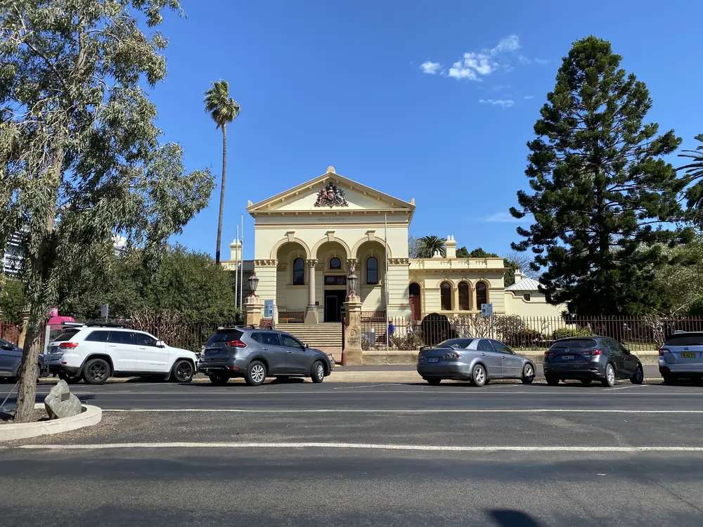
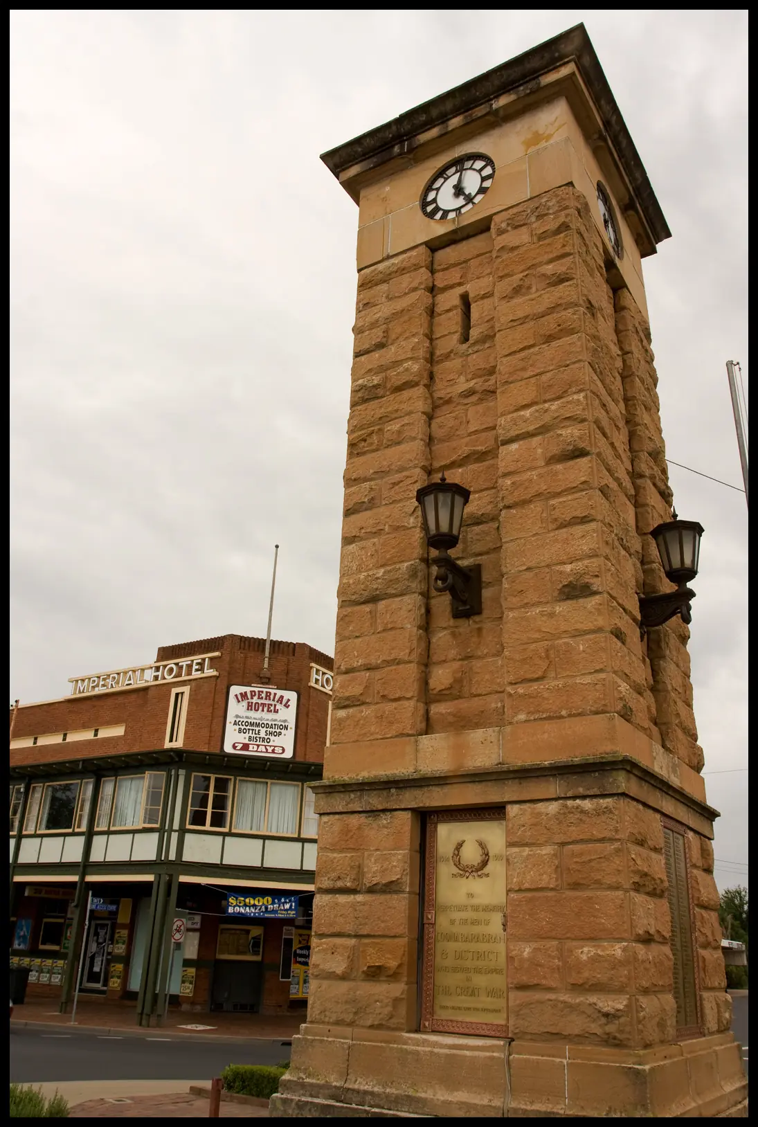
Dubbo Court HousePhoto: Bidgee · CC BY-SA 3.0 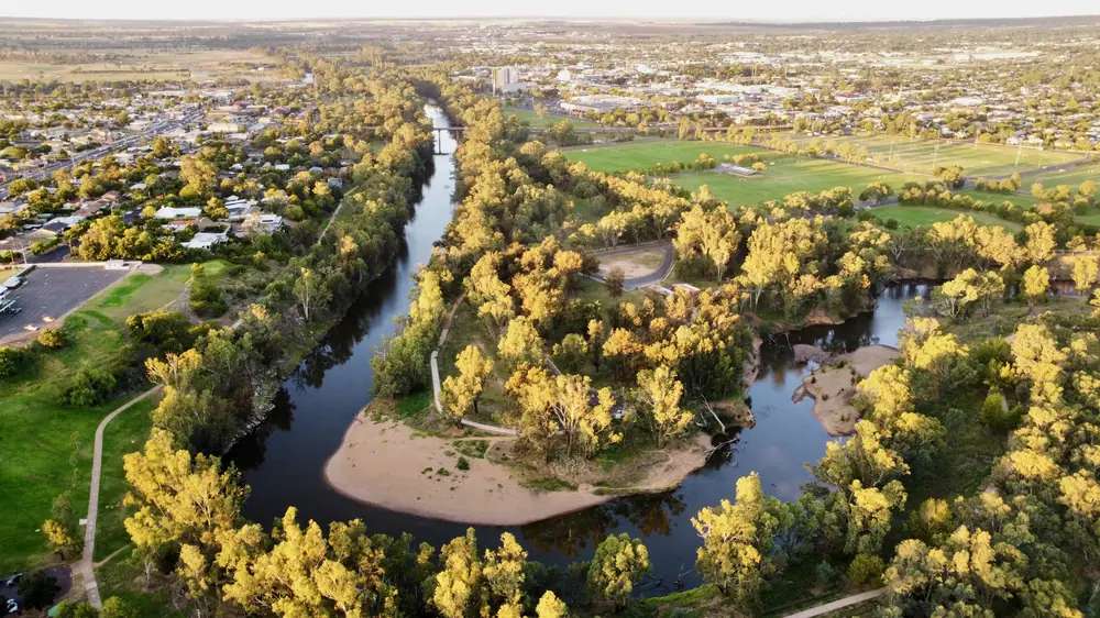
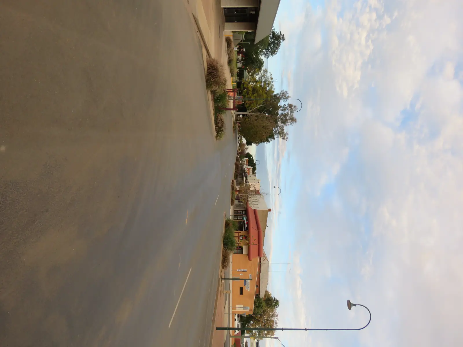
Macquarie River (Wambuul) in Dubbo, NSW 2026 1Photo: SnowyRiver28 · CC BY-SA 4.0 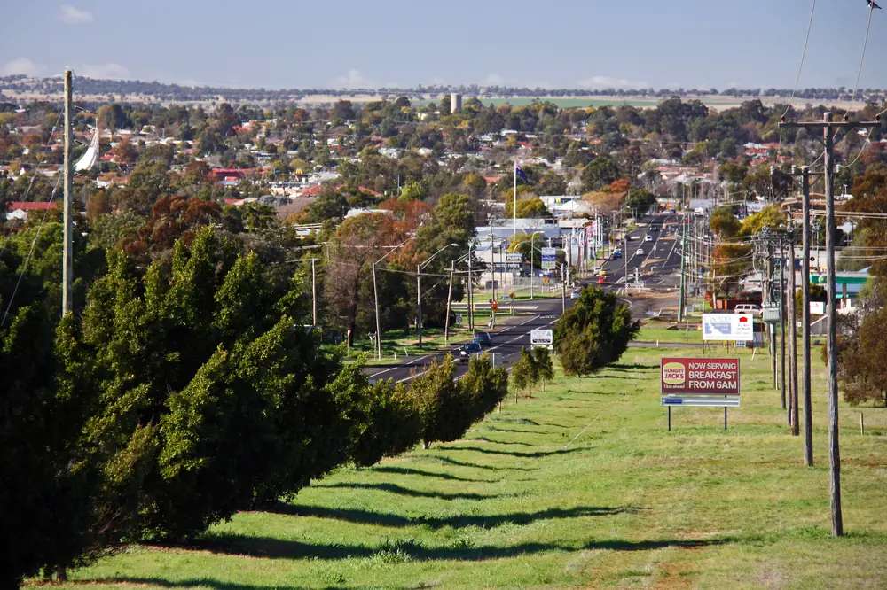
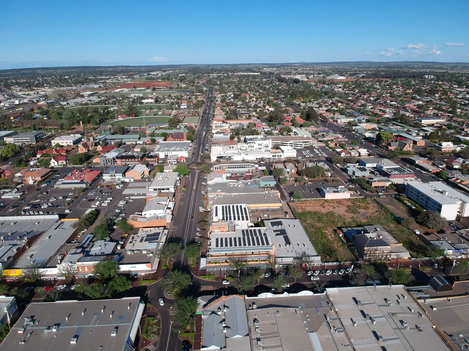
Overlooking Dubbo from the suburb of West DubboPhoto: Tim Keegan · CC BY-SA 2.0 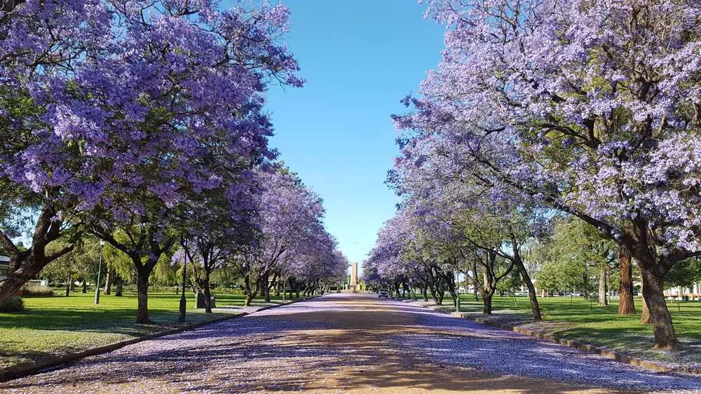
Jacarandas DubboPhoto: Doug butler · CC BY-SA 4.0
Dubbo sits on the Macquarie River in the heart of the Macquarie Valley, where the Newell, Mitchell and Golden highways meet. Destination NSW files the city under the Great Western Plains and calls it the City of Smiles. On this site it belongs in Explorer Country — the inland New South Wales belt around Dubbo and Coonabarabran — because that is the sealed-road step between Sydney and outback NSW. Dubbo is a gateway. It is not itself the far west. Fuel, a hospital, supermarkets and a long choice of rooms sit here; they thin once you leave on the Mitchell toward Nyngan and Bourke.
The 2021 Census counted 38,783 people in the Dubbo urban centre (UCL112006). Use that figure for the town. The suburbs-and-localities geography (SAL11299) counted 43,516. Do not mix the two. Read the ABS QuickStats page for Dubbo UCL.
Where it is, and how far
Destination NSW places Dubbo where the Newell, Mitchell and Golden highways meet. The same pages describe the drive north-west from Sydney as around five hours, a flight into Dubbo Regional Airport, or a train from Sydney of around 6.5 hours to a heritage-listed station that opened in 1881. Exact road kilometres to Sydney are not published on those official pages, so this guide does not invent them.
Coonabarabran is described on Destination NSW and Warrumbungle Region pages as about two hours north-east. Bogan Shire and Visit NSW describe Nyngan as about two hours west of Dubbo Airport. Kilometre figures for those runs are not on the same pages. Treat the hours as touring times, not a guarantee in harvest traffic or after storms.
| Place | Official note (not an invented kilometre) |
|---|---|
| Sydney | Around five hours’ drive, or about 6.5 hours by train (Destination NSW) |
| Dubbo Regional Airport | Regular flights; the usual fly-drive door for Explorer Country |
| Coonabarabran / Warrumbungles | About two hours north-east (Destination NSW / Warrumbungle Region) |
| Nyngan | About two hours west of Dubbo Airport (Bogan Shire / Visit NSW) |
| Warrumbungle National Park | Less than two hours north (Destination NSW Dubbo page) |
If you are continuing west, Nyngan is the Mitchell–Barrier junction. Bourke sits further north on the Darling. This city is where you restock, not where the bitumen ends.
Facts at a glance
Population. Australian Bureau of Statistics 2021 Census, Urban Centres and Localities UCL112006: 38,783 people. Median age 35. Sex split 48.0% male / 52.0% female. Families 9,770. Private dwellings 16,221. Average household size 2.5. Use the ABS UCL QuickStats. Do not quote the SAL or the larger statistical-area figures as the town.
Climate. Bureau of Meteorology station Dubbo Airport AWS (065070). Location 32.22°S, 148.58°E, elevation 284 m. The station commenced in 1946 (status open; product date on the table used here 14 November 2026). Mean maximum temperatures in the published table use 34 years (1993–2026). Annual mean rainfall 587.5 mm over 26 years (1994–2026). Hottest month by mean maximum: January 33.7 °C. Coolest month by mean maximum: July 15.7 °C. Full twelve-month columns sit on the BOM Dubbo Airport AWS table and on our Dubbo weather page.
Visitor centre. Corner of Macquarie Street and the Newell Highway. Dubbo Regional Council lists it open seven days except Christmas Day and Boxing Day: Monday–Friday 9.00am–4.30pm, Saturday–Sunday 8.00am–3.30pm. Phone 1800 674 443. NSW Government also lists (02) 6801 4450. Confirm hours before a public holiday. This is the desk that answers zoo tickets, beds and highway questions. We do not publish a ranked hotel list for a city this size.
Traditional Owners
Dubbo Regional Council acknowledges the Wiradjuri people as the traditional custodians of the land on which the council lives, works and plays, and pays respects to Elders past and present of the Wiradjuri Nation. This hub follows that council wording.
Destination NSW’s Dubbo page separately names the Tubbagah people at Terramungamine Rock Grooves, where more than 150 ancient grooves can still be seen in the stones. That is a site-specific sentence, not a replacement for the council’s Wiradjuri acknowledgement. Read visiting Country respectfully before you walk to grinding grooves.
History
Destination NSW describes Dubbo as a regional city on the Macquarie River with a heritage walk that starts at the visitor centre. The same page dates Old Dubbo Gaol to 1847 and the railway station to 1881. Those are the official dates this guide will repeat. It does not invent gazettal trivia, bushranger lists or hotel founding years that are not on the sourced pages.
The gaol is heritage-listed in the city centre. Visit NSW points to displays, performances and After Dark tours — confirm current hours at the visitor centre, not from a blog. The Royal Flying Doctor Service visitor experience is also named on that Destination NSW page. Dubbo’s role as a medical and freight hub for western New South Wales is the practical history most highway travellers still use: this is where you fix a tyre and fill a fridge before the plains open out.
Explorer Country on this site is the old directory name for this inland belt. Destination NSW no longer uses that label; it files Dubbo under the Great Western Plains. The geography has not moved.
Things to do
Start at the Dubbo Visitor Information Centre, corner of Macquarie Street and the Newell Highway. Collect the Dubbo Heritage Walk brochure there. Then decide whether the day is a zoo day, a city-heritage day, or both.
Taronga Western Plains Zoo Dubbo is the family draw Destination NSW and taronga.org.au both name. Visit NSW describes an open-plains design, animals separated by moats rather than walls, and overnight stays on site. Taronga’s own page names Serengeti Resort, Zoofari Lodge, Savannah Cabins and Billabong Camp as zoo stays, plus bikes, carts and pedal boats for moving around the grounds. We do not invent species counts beyond what those official pages publish on the day you check them. Plan a full day. See things to do in Dubbo.
Old Dubbo Gaol (from 1847 on the Visit NSW page), the Royal Flying Doctor visitor experience, Dubbo Observatory, Dubbo Regional Botanic Garden, Victoria Park, the Western Plains Cultural Centre, Terramungamine Rock Grooves, the Tracker Riley Cycleway (Visit NSW gives 13 km, from the city centre past the zoo to Dundullimal Homestead) and the Macquarie River Trail are the other in-town or near-town stops Destination NSW names. Confirm opening hours at the visitor centre. This page does not add cafés, pubs or a “top ten” that is not on those official lists.
Warrumbungle National Park is less than two hours north on the Dubbo Visit NSW page. It is a Coonabarabran day, not a city park. Use NSW National Parks pages for walks, Dark Sky camping and the $8 vehicle entry figure — confirm the fee there.
Where to stay
Dubbo is large enough for motels, hotels, apartments, caravan parks and the zoo’s own overnight products. This hub does not rank operators, quote prices or invent star ratings. Named motels change hands. The live directories are the visitor centre and Destination NSW.
- Zoo-ground stays named on taronga.org.au: Serengeti Resort, Zoofari Lodge, Savannah Cabins, Billabong Camp — confirm ages, inclusions and bookings on Taronga Western Plains Zoo.
- City rooms and parks: ask at the Dubbo Visitor Information Centre (1800 674 443).
- How to choose a type of stay: Dubbo accommodation
- Parks and camping: Dubbo caravan parks
- Operator enquiries for this site: feature your business
Book ahead for school holidays and for zoo-event weekends. A full park in Dubbo is still easier to solve than arriving after dark in a smaller western town.
Caravan and camping
Caravanners use Dubbo because three sealed highways meet here, the town has dump points and supplies, and you can unhitch for a zoo day without towing through the exhibits. Town parks are the overnight choice if you need shops. Conservation-park or national-park camps sit outside the city — Warrumbungle camping is an NPWS booking, not a Dubbo town-park booking. Read Dubbo caravan parks and caravanning in the outback. Check Live Traffic NSW before you leave for Nyngan or the Newell.
Fuel and services
Dubbo is a full-service regional city: fuel, groceries, pharmacies, workshops and a hospital. This guide does not list bowser brands or hours that go stale. For current local-service questions, use Dubbo Regional Council and the visitor centre. Fill up here if you are heading west on the Mitchell. Do not assume every smaller plains town has 24-hour fuel.
Mobile coverage is generally good in town and along the main highways. It can drop in the Warrumbungles and on unsealed side roads. Carry water in January even on sealed runs; the airport mean maximum that month is 33.7 °C.
Road access
Sealed highways meet at Dubbo:
- Newell Highway — the inland Melbourne–Brisbane spine, also the road toward Coonabarabran.
- Mitchell Highway — west toward Nyngan, then the choice to Cobar on the Barrier or north toward Bourke.
- Golden Highway — the Hunter / central-west approach.
These are freight roads. Expect road trains and, after storms, water on the Macquarie floodplain. Check Live Traffic NSW before you leave. Do not drive around closed signs to keep a zoo booking. Destination NSW also flags Great Western Highway disruption closer to the mountains for people coming from Sydney — plan that approach on Transport for NSW advice, not from memory.
A suggested outback NSW road trip often starts west of here. Dubbo is the sealed on-ramp.
Nearby parks and towns
Parks (official park pages):
- Warrumbungle National Park — less than two hours north on the Visit NSW Dubbo page; Dark Sky Park, walks, camping. Our Coonabarabran guide covers the town gate.
- Terramungamine Rock Grooves — named by Destination NSW; confirm access at the visitor centre.
Towns on this site:
- Coonabarabran — about two hours; Siding Spring, Warrumbungles.
- Nyngan — about two hours west of the airport; Mitchell / Barrier junction.
- Bourke — further north once you leave the gateway city behind.
Wellington and Narromine appear on Destination NSW’s Dubbo-area pages and do not yet have full guides here. Coonamble now does. Use the visitor centre and Visit NSW for the others.
When to go, and how long
January’s mean maximum of 33.7 °C at the airport is hot for a midday zoo circuit if you are on foot. July’s 15.7 °C mean maximum is the comfortable walking season; nights are colder than that daytime mean. Annual rainfall 587.5 mm is not desert and not a wet tropics wet season. Autumn and spring sit between the two extremes. See Dubbo weather and best time to visit the outback.
One night is enough if you only need fuel and a motel on the way west. Two nights lets you do the zoo properly and a heritage or river walk. Three nights is comfortable if you add the Warrumbungles as a day trip without rushing. The zoo overnight products on taronga.org.au are a different stay, not a substitute for confirming a city motel at the visitor centre.
Operators who want a checked listing on this town page can use feature your business. Until then the listings slot stays empty on purpose.
Plan this trip
Tell us the dates, who you are travelling with and where you need help. We reply with planning notes for Dubbo — we are not a booking agent.
Events and road-conditions newsletter
Occasional notes on outback festivals, race days and official road-condition sources — not a daily blast. We use these details only to send the newsletter.
New South Wales · Explorer Country
Dubbo accommodation
Where to stay in Dubbo: city hotels and motels, caravan parks, and Taronga Western Plains Zoo overnight products. Official visitor centre, not a fake hotel round-up.
Read · 4 min
New South Wales · Explorer Country
Dubbo caravan parks
Caravan parks and camping in Dubbo: town parks and cabins, zoo-ground overnight products named by Taronga, and why Dubbo is the last full-service van stop before the Mitchell thins.
Read · 4 min
New South Wales · Explorer Country
Dubbo weather
Dubbo climate from Bureau of Meteorology Dubbo Airport AWS (065070): January mean maximum 33.7 °C, July 15.7 °C, annual rainfall 587.5 mm. Full monthly table.
Read · 4 min
New South Wales · Explorer Country
Things to do in Dubbo
Things to do in Dubbo: Taronga Western Plains Zoo, Old Dubbo Gaol, RFDS visitor experience, botanic garden, Terramungamine grooves and the Macquarie River trails.
Read · 6 min
Frequently asked questions
How far is Dubbo from Sydney?
Destination NSW describes the drive north-west from Sydney as around five hours. You can also fly into Dubbo Regional Airport or take the train from Sydney, which Visit NSW puts at around 6.5 hours to the heritage-listed station.
What is Dubbo’s population?
38,783 people at the 2021 Census for the Dubbo urban centre (UCL112006). Median age 35. The larger suburb/locality figure is 43,516 (SAL11299) and should not be mixed with the town count.
Is Dubbo in the far west?
No. Dubbo is the last large service city on the sealed highways before the Mitchell Highway thins toward Nyngan, Cobar and Bourke. Destination NSW files it under the Great Western Plains. Far-west towns sit further out on our outback NSW hub.
When is the hottest weather?
Bureau of Meteorology means for Dubbo Airport AWS (065070) show January as the hottest month by mean maximum (33.7 °C) and July as the coolest (15.7 °C). Annual mean rainfall is 587.5 mm.
Where is the Dubbo visitor centre?
Dubbo Regional Council places the Dubbo Visitor Information Centre at the corner of Macquarie Street and the Newell Highway. Open seven days except Christmas Day and Boxing Day. Weekdays 9.00am–4.30pm; Saturday–Sunday 8.00am–3.30pm. Phone 1800 674 443. Confirm hours before you arrive.
Can I name Taronga Western Plains Zoo as the main attraction?
Yes. Destination NSW and taronga.org.au both name Taronga Western Plains Zoo Dubbo. Start there, then use the visitor centre for the rest of a city day.
Sources and further reading
Facts on this page were checked against these primary and official sources. Conditions change — confirm before you travel or buy.
- Dubbo 2021 Census QuickStats (UCL112006) — Australian Bureau of Statistics
- Dubbo 2021 Census QuickStats (SAL11299) — Australian Bureau of Statistics
- Climate statistics for Dubbo Airport AWS (065070) — Bureau of Meteorology
- Dubbo — Destination NSW
- Dubbo and the Great Western Plains — Destination NSW
- Dubbo Visitor Information Centre — Dubbo Regional Council
- Visit Taronga Western Plains Zoo Dubbo — Taronga Conservation Society Australia
- Live Traffic NSW — Transport for NSW
- Dubbo Health Service — NSW Government / Western NSW Local Health District