At a glance
Sourced facts only. Distances and services change — confirm before you travel.
- Population
- 2,387 people (UCL115043, 2021 Census)
- Local government
- Warrumbungle Shire
- Traditional Owners
- Gamilaraay side of Warrumbungle Shire (council thematic history: Gamilaraay northeast, Wiradjuri south, Wayilwan west)Confirm current wording at the Coonabarabran Visitor Information Centre on the Newell.
- Nearest regional city
- Dubbo, about two hours south-west on Destination NSW / Warrumbungle Region wording used on this site’s Dubbo hub. A Coonabarabran–Dubbo kilometre is not printed on those pages.
- Capital
- About 500 km north-west of Sydney (Australian National University Siding Spring how-to-get-here page)
- Nearest fuel
- Service town — confirm bowsers in Coonabarabran; this guide does not name a brand
- Nearest hospital or clinic
- Coonabarabran Health Service, 101-103 Edward Street — 24-hour emergency (NSW Health / Western NSW LHD)
- Mobile coverage
- Check Telstra and Optus coverage maps before travel; coverage can drop in Warrumbungle National Park and on the Siding Spring mountain road.
- Best time to visit
- Autumn and spring for park walking (between BOM Coonabarabran Airport AWS January 31.2 °C and July 14.2 °C mean maxima). Winter for long Dark Sky nights; NPWS notes park nights can drop below freezing.
Climate
Monthly means from the Bureau of Meteorology station Coonabarabran Airport AWS (064017). This is not a forecast. Open. Commenced 2001. Elevation 645 m. Temperature 25 years (2001–2026); rainfall 23 years (2001–2026). Copied from the BOM table fetched 18 November 2026 (latest available data 14 Nov 2026).
| Month | Mean max (°C) | Mean min (°C) | Rainfall (mm) |
|---|---|---|---|
| Jan | 31.2 | 18.1 | 74.5 |
| Feb | 29.6 | 17.0 | 75.4 |
| Mar | 26.9 | 15.3 | 79.6 |
| Apr | 22.8 | 11.8 | 38.1 |
| May | 18.2 | 8.6 | 38.9 |
| Jun | 14.6 | 6.2 | 49.0 |
| Jul | 14.2 | 5.4 | 41.6 |
| Aug | 16.2 | 6.2 | 39.0 |
| Sep | 20.1 | 9.0 | 46.1 |
| Oct | 23.8 | 11.6 | 47.6 |
| Nov | 26.9 | 14.2 | 73.0 |
| Dec | 29.3 | 16.2 | 85.3 |
Coonabarabran in pictures
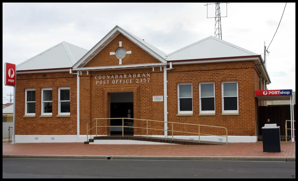
Coonabaraban Post Office-1+Photo: Sheba_Also 43,000 photos · CC BY-SA 2.0 
Coonabaraban Commonwealth Bank-1andPhoto: Sheba_Also 43,000 photos · CC BY-SA 2.0 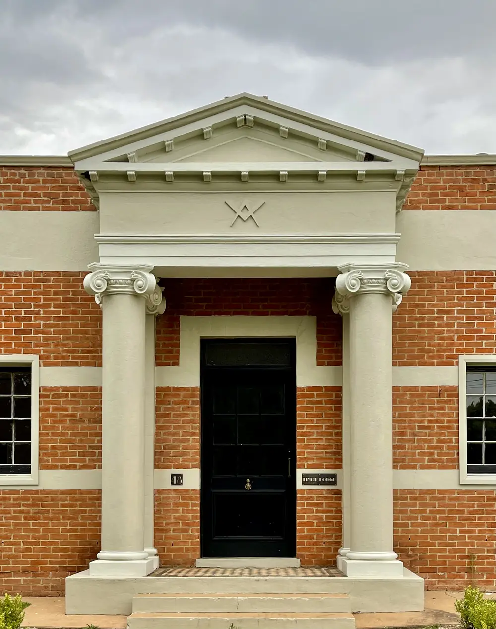
Coonabarabran Masonic Hall, NSW, 2021Photo: Kgbo · CC BY-SA 4.0 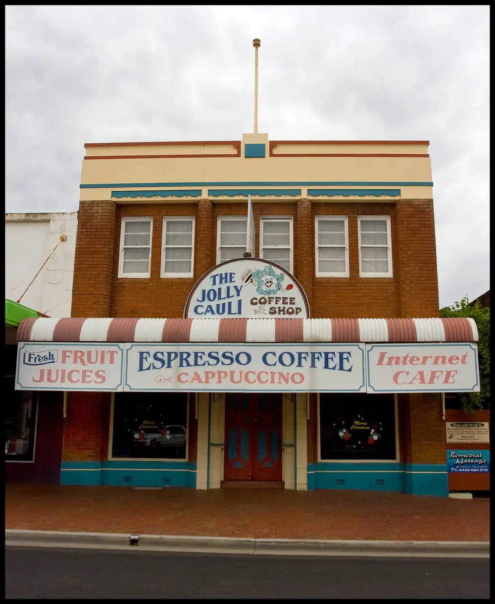
Coonabaraban Jolly Cauli Coffee Shop-1+Photo: Sheba_Also 43,000 photos · CC BY-SA 2.0
Coonabarabran sits at the junction of the Newell Highway and the Oxley Highway in inland New South Wales, on the north-east side of Warrumbungle Shire. Council’s thematic history places that shire at the meeting of Gamilaraay (northeast), Wiradjuri (south) and Wayilwan (west) Country; Coonabarabran is on the Gamilaraay side of that description. Warrumbungle Region tourism markets the town as the Astronomy Capital of Australia and the gateway to Australia’s only Dark Sky Park, Warrumbungle National Park. The Australian National University runs Siding Spring Observatory on the range west of town.
The 2021 Census counted 2,387 people in the Coonabarabran Urban Centre and Locality (UCL115043), with a median age of 51 and a split of 46.6% male and 53.4% female. The larger suburb and locality figure is 3,477 (SAL11043). Use the UCL when you want the town, not the surrounding locality.
This page is the hub for a Coonabarabran stop. Use the things to do, accommodation, caravan parks and weather pages for the detail, and start at the visitor centre on the Newell before you drive into the park. Coonabarabran sits in our Explorer Country grouping — the inland NSW belt around the Warrumbungles and Dubbo, on sealed highways between Sydney and outback NSW.
Things to do
Coonabarabran Visitor Information Centre. On the Newell Highway. Warrumbungle Region lists it open daily 9am–5pm except Christmas Day. It houses the Australian Museum Diprotodon Exhibition, which is free. Ask here for current park alerts, night-sky operators and beds before you leave town.
Warrumbungle National Park. Walks, camping and Australia’s Dark Sky Park. NSW National Parks puts the park visitor centre about 35 km west of town via Timor Road / John Renshaw Parkway. Park entry is listed at $8 per vehicle per day — confirm on the NPWS visitor-info page before you go. We do not have a separate Warrumbungle park guide on this site yet; use the official NPWS pages and our national parks hub for how park travel works.
Siding Spring Observatory. Australia’s premier optical astronomy research facility, run by the Australian National University. ANU gives 28 km from the town clock; the observatory visitor page gives 27 km west of town. Day visits are listed 8:30am–4:00pm. Caravans are not allowed on the mountain road. The working telescopes are not a public night observatory.
World’s Largest Virtual Solar System Drive. Signed from Coonabarabran and mentioned on the ANU Siding Spring page. Treat it as a signed roadside drive, not as a ticketed attraction; pick up current notes at the visitor centre.
Allow at least one night if you only want the town and a day in the park, and two or three if you want a Dark Sky evening as well as Siding Spring by day. Full notes sit on the Coonabarabran things to do page.
Nearby
Dubbo and Tamworth are each described as “just two hours” on the Warrumbungle Region town page; those pages do not publish kilometre figures, so we do not invent them. Dubbo is the usual fly-drive door and the last large service city before the Mitchell Highway thins toward Nyngan and Cobar. From Coonabarabran the Newell also runs north toward Queensland and south toward the Riverina. West, Explorer Country hands over to outback NSW. See the outback NSW road trip if this stop is part of a longer westbound loop.
Exact kilometres to Dubbo, Tamworth or Brisbane are not stated on the official pages used for this guide.
History and Country
Warrumbungle Shire’s thematic history acknowledges Gamilaraay, Wiradjuri and Wayilwan. The shire sits at the convergence of Gamilaraay Country to the northeast, Wiradjuri to the south and Wayilwan to the west. Coonabarabran is in the north-east of the shire, which that history treats as the Gamilaraay side.
The same council publication records Aboriginal occupation east of Coonabarabran estimated up to 25,000 years, and occupation of the Warrumbungle Range up to 17,000 years. It cites estimates of a Gamilaraay population in the region of about 7,000 in the early 1800s (Flood and Somerville, as quoted in the thematic history). Those figures belong to the council history; they are not Census counts.
European-era Coonabarabran grew as a highway and pastoral service town at the Newell–Oxley junction. The astronomy story is later: Siding Spring is the ANU’s optical research facility on the range, and Warrumbungle Region tourism now leads with dark skies and the national park. Walks, campgrounds and the park visitor centre are the public face of that landscape; the telescopes remain a working observatory.
A suggested two- or three-day itinerary
Day 1 — Town and the visitor centre. Arrive on the Newell. Spend time at the Coonabarabran Visitor Information Centre and the free Diprotodon Exhibition. Confirm park entry, track notes, campground bookings and whether any night-sky operator is running. If you are towing, this is also the day to park the van in town or at a caravan park — do not plan to take it up the observatory mountain road. Walk the town in daylight and get fuel and water while services are open.
Day 2 — Warrumbungle National Park. Drive west on Timor Road / John Renshaw Parkway to the park visitor centre, about 35 km. Pay the vehicle entry fee listed by NPWS, pick up current walking notes, and spend the day on park tracks and lookouts. Camp in the park (Camp Blackman and other NPWS campgrounds are named by the parks service) if you want a Dark Sky night, or return to town. Winter nights in the park can drop below freezing; carry layers even if the July daytime mean maximum in town is only cool, not alpine.
Day 3 — Siding Spring by day, or push west. Day visits to the observatory are 8:30am–4:00pm. Leave caravans below. If you are continuing an outback trip, use the rest of the day to run toward Nyngan, Bourke or Cobar on sealed highways, checking Live Traffic NSW before you leave. If you stay a third night, keep the evening for a local night operator listed on the Siding Spring visitor page — not for walking into the research facility after dark.
Seasons and when to go
Coonabarabran Airport AWS (station 064017, opened 2001, 31.33°S, 149.27°E, elevation 645 m) has a mean annual rainfall of 703.8 mm over 23 years (2001–2026). The hottest month by mean maximum is January at 31.2°C; the coolest is July at 14.2°C. That is higher and wetter than the Barrier Highway towns further west. NSW National Parks warns that winter nights in the park can drop below freezing.
Autumn and spring are the most comfortable seasons for walking on the range. Summer is hot on exposed tracks and is the fire-danger season; the park can close in poor weather or extreme fire danger — check NPWS alerts, not this page, on the morning you drive in. Winter days can be clear and good for astronomy, but they are short and cold in a tent. See Coonabarabran weather, best time to visit the outback and outback summer heat.
Getting there
- By road from Sydney: about 500 km north-west (ANU Siding Spring). The town sits on the Newell Highway at its junction with the Oxley Highway. All of that approach is sealed on the highway network; still check Live Traffic NSW for incidents, harvest-season road trains and any park-road closures.
- From Dubbo or Tamworth: Warrumbungle Region describes each as “just two hours”. No official kilometre figure is published on that page, so we do not invent one.
- To the park: sealed access via Timor Road / John Renshaw Parkway to the Warrumbungle Visitor Centre, about 35 km west.
- To Siding Spring: 27–28 km west of town. Caravans must not use the narrow Observatory mountain road. Park in town or at the designated parking at the bottom.
The Newell carries a lot of freight between Victoria and Queensland. Fatigue and road trains are the main hazards. Plan to arrive before dusk. See road trains, outback road rules and fuel, permits and road conditions.
Where to stay
Official visitor pages used for this research do not publish a full accommodation inventory. Traveller categories that exist in the region — without inventing business names here — are motel, hotel/pub, and caravan park / camping, including NPWS campgrounds in Warrumbungle National Park such as Camp Blackman and others listed by the parks service. Confirm current operators, vacancies and park bookings at the Coonabarabran Visitor Information Centre.
Book ahead for school holidays and for clear winter weekends if you want a park camp under dark skies. See Coonabarabran accommodation and caravan parks, plus caravanning in the outback and outback camping.
Food, fuel and supplies
Coonabarabran is a highway service town. Treat it as a place to fill the tank, buy food and confirm park notes before you head into the range or further west, where choices thin out. Opening hours and which pumps or shops are trading on a given day change; ask at the visitor centre rather than relying on a list invented for this page. Carry water even on the short run to the park in summer.
Travel safety
John Renshaw Parkway is the sealed park road; the observatory mountain road is a different, narrower road and is not for caravans. Wildlife and fatigue matter on the Newell after dark. In the park, stay on formed tracks, carry water, and respect fire bans. Dark Sky Park rules mean keeping white light and generators under control at night if you camp — follow NPWS signs, not ad-hoc lighting. For night-sky etiquette see stargazing and dark skies.
If you are heading west beyond Dubbo toward Nyngan, Cobar or Bourke, distances stretch and mobile coverage thins. That is still sealed-highway country, but it is not a city commute. Check Live Traffic NSW, tell someone your plan, and do not drive tired.
How long do you need in Coonabarabran?
One full day covers the visitor centre, a park visit and a look at Siding Spring only if you rush and skip a dark-sky evening. Two nights is a realistic minimum: a park day, an observatory day visit, and a night in town or in the park. Add a night if you are using Coonabarabran as the astronomy stop on a Melbourne–Brisbane Newell run or as the last range country before outback NSW.
Is Siding Spring a night-time observatory?
No. The visitor page is explicit: it is a working research facility and is not open at night for public viewing. Day hours are 8:30am–4:00pm. If you want a guided night sky, use a local operator listed on that page and confirm current tours before you travel. Camping in the Dark Sky Park is the other legal, practical way to see the sky — not wandering around the telescopes after closing.
Can I take the caravan to the telescopes?
No. Park in town or at the designated parking at the bottom of the mountain road. Towing into the park campgrounds is a separate question: use NPWS listings for Camp Blackman and other campgrounds, and check vehicle length and booking rules there.
What is the Diprotodon Exhibition?
A free Australian Museum display at the Coonabarabran Visitor Information Centre on the Newell Highway. Warrumbungle Region lists the centre open daily 9am–5pm except Christmas Day. It is the right first stop even if you already have a park plan.
Practical information
Population 2,387 (2021 UCL). Median age 51. Elevation at the airport AWS is 645 m. Mean annual rainfall 703.8 mm. January mean maximum 31.2°C; July 14.2°C. Park entry $8 per vehicle per day on the NPWS page used for this research — re-check before you pay. Road conditions: Live Traffic NSW.
Explore nearby
- Explorer Country — Dubbo, the Warrumbungles and the Newell gateway
- Nyngan — Mitchell and Barrier Highway junction on the way west
- Cobar and Bourke — outback NSW on sealed highways
- Stargazing and dark skies
- Outback national parks
Coonabarabran is a natural stop on a Sydney or Melbourne run north on the Newell, and on a westbound trip that continues through Dubbo toward outback NSW.
Plan this trip
Tell us the dates, who you are travelling with and where you need help. We reply with planning notes for Coonabarabran — we are not a booking agent.
Events and road-conditions newsletter
Occasional notes on outback festivals, race days and official road-condition sources — not a daily blast. We use these details only to send the newsletter.
Coonabarabran
Things to do
Things to do in Coonabarabran: the visitor centre and Diprotodon Exhibition, Warrumbungle National Park, Siding Spring Observatory and the Virtual Solar System Drive.
Read · 5 min
Coonabarabran
Accommodation
Where to stay in Coonabarabran: motels, hotel and pub rooms, caravan parks and NPWS campgrounds in Warrumbungle National Park. Confirm operators at the visitor centre.
Read · 4 min
Coonabarabran
Caravan parks
Caravan parks and camping around Coonabarabran, including NPWS campgrounds such as Camp Blackman in Warrumbungle National Park. Caravans cannot use the Siding Spring mountain road.
Read · 4 min
Coonabarabran
Weather
Coonabarabran weather from Bureau of Meteorology station 064017: 703.8 mm of rain a year, January mean max 31.2°C, July 14.2°C, and freezing winter nights in Warrumbungle National Park.
Read · 4 min
Frequently asked questions
How far is Coonabarabran from Sydney?
About 500 km north-west, according to the Australian National University’s Siding Spring “How to get here” page. Exact driving time depends on the route and Newell Highway traffic.
Can I take a caravan to Siding Spring Observatory?
No. The observatory visitor page says the mountain road is too narrow. Park in town or at the designated parking at the bottom of the mountain road.
Is Siding Spring open at night?
Siding Spring is a working research facility and is not open at night for public viewing. Day visits run 8:30am to 4:00pm. Night tours, if you want them, are a separate local operator listed on the observatory visitor page — confirm there before you plan.
How much is Warrumbungle National Park entry?
NSW National Parks lists $8 per vehicle per day. Confirm the current fee on the NPWS visitor-info page before you go; park rules and charges change.
What is Coonabarabran’s population?
2,387 people at the 2021 Census (ABS Urban Centre and Locality UCL115043). Median age 51. Do not mix that figure with the larger suburb and locality count of 3,477 (SAL11043).
When is it coldest?
July has the coolest mean maximum at Coonabarabran Airport AWS, 14.2°C. NSW National Parks notes that winter nights in Warrumbungle National Park can drop below freezing.
Sources and further reading
Facts on this page were checked against these primary and official sources. Conditions change — confirm before you travel or buy.
- Coonabarabran (2021 Census QuickStats, UCL115043) — Australian Bureau of Statistics
- Coonabarabran (2021 Census QuickStats, SAL11043) — Australian Bureau of Statistics
- Climate statistics for Coonabarabran Airport AWS (064017) — Bureau of Meteorology
- Siding Spring Observatory — how to get here — Australian National University
- Siding Spring Observatory visitors — Siding Spring Observatory
- Coonabarabran — Warrumbungle Region
- Coonabarabran Visitor Information Centre — Warrumbungle Region
- Warrumbungle National Park — visitor info — NSW National Parks and Wildlife Service
- Warrumbungle National Park — NSW National Parks and Wildlife Service
- Warrumbungle Shire thematic history — Warrumbungle Shire Council
- Live Traffic NSW — Transport for NSW
- Coonabarabran Health Service — NSW Government / Western NSW Local Health District