At a glance
Sourced facts only. Distances and services change — confirm before you travel.
- Local government
- Shire of Meekatharra
- Traditional Owners
- Ngoonooru Wajarri to the west (part of the Wajarri Yamatji people) and Yugunga-Nya to the east (Shire of Meekatharra Our Background page). The same page says the area was known as Mikadah by Yamatji inhabitants.Confirm current wording at Lloyds Plaza.
- Nearest regional city
- Cue, 120 km south on the Shire of Cue About page. Wiluna is 180 km east on the Main Roads WA Goldfields Highway project page.
- Capital
- About 760 km north of Perth on the Great Northern Highway (Shire of Meekatharra New Residents page). Golden Outback separately places it approximately 500 km inland from Geraldton.
- Nearest fuel
- Shire December 2024 business directory names BP 24 Hr Card, Caltex 24 Hr Diesel, and Coles/Shell Roadhouse on the Great Northern Highway. Confirm on arrival; this hub does not freeze hours or prices.
- Nearest hospital or clinic
- Meekatharra Health Centre (WA Country Health Service Midwest hospitals page), 24-hour acute and emergency care. Shire directory names Meeka Hospital, 08 9981 0600.
- Mobile coverage
- Check Telstra and Optus coverage maps before travel. The shire FAQ names Telstra as the mobile network and describes reception as hard to come by once you leave town.
- Best time to visit
- Cooler BOM Meekatharra Airport mean maxima May–August (July 19.3 °C).
Climate
Monthly means from the Bureau of Meteorology station Meekatharra Airport (007045). This is not a forecast. Open station. Temperature 76–77 years (1950–2026); rainfall 78 years (1944–2026). Latest available data 14 November 2026.
| Month | Mean max (°C) | Mean min (°C) | Rainfall (mm) |
|---|---|---|---|
| Jan | 38.5 | 24.5 | 28.9 |
| Feb | 37.0 | 23.9 | 35.1 |
| Mar | 34.4 | 21.5 | 30.4 |
| Apr | 29.4 | 17.2 | 18.5 |
| May | 24.0 | 12.1 | 21.0 |
| Jun | 19.8 | 8.8 | 29.3 |
| Jul | 19.3 | 7.5 | 19.7 |
| Aug | 21.8 | 8.8 | 11.0 |
| Sep | 25.9 | 11.7 | 5.0 |
| Oct | 30.0 | 15.4 | 5.9 |
| Nov | 33.5 | 18.9 | 11.9 |
| Dec | 36.7 | 22.3 | 14.4 |
Meekatharra in pictures
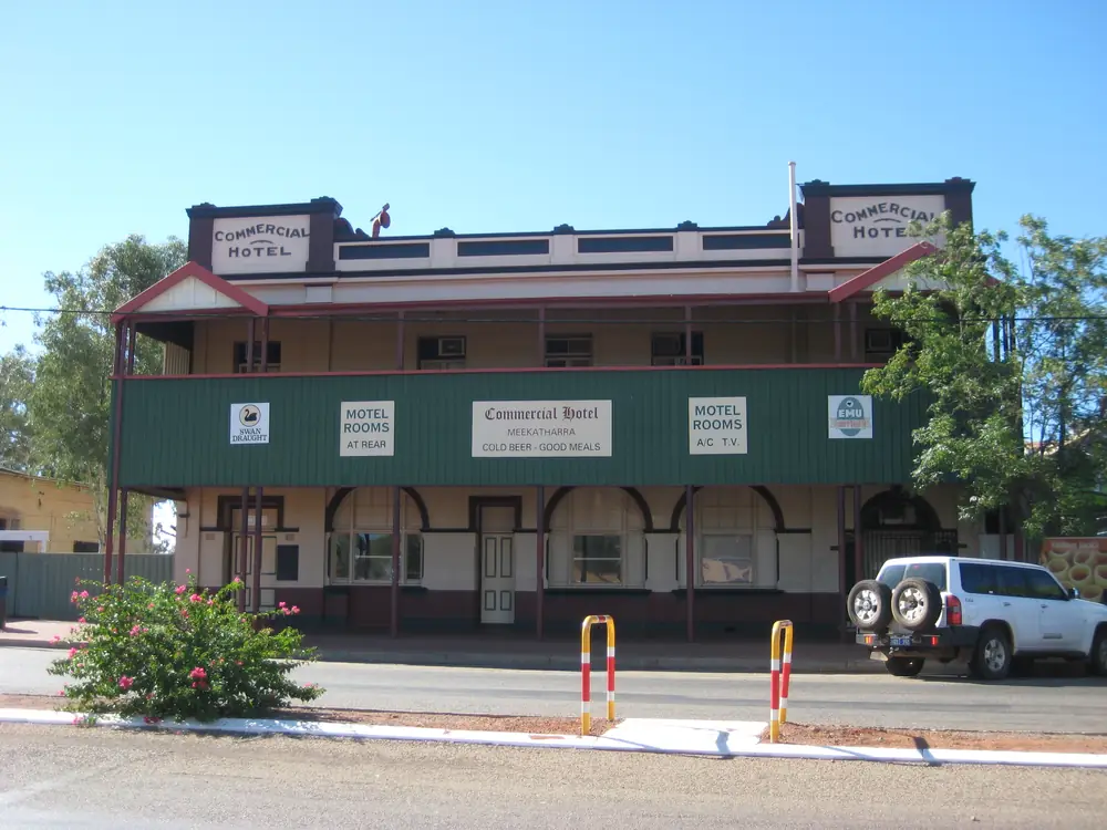
Commercial Hotel, MeekatharraPhoto: Calistemon · CC BY-SA 3.0 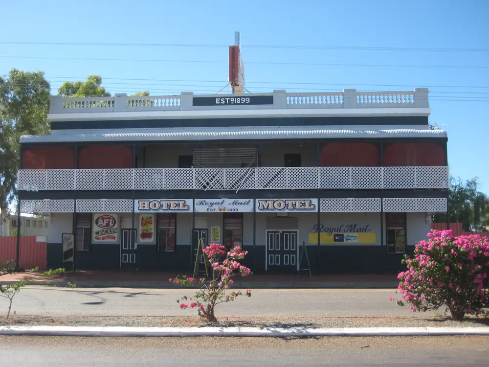
Royal Hotel, MeekatharraPhoto: Calistemon · CC BY-SA 3.0 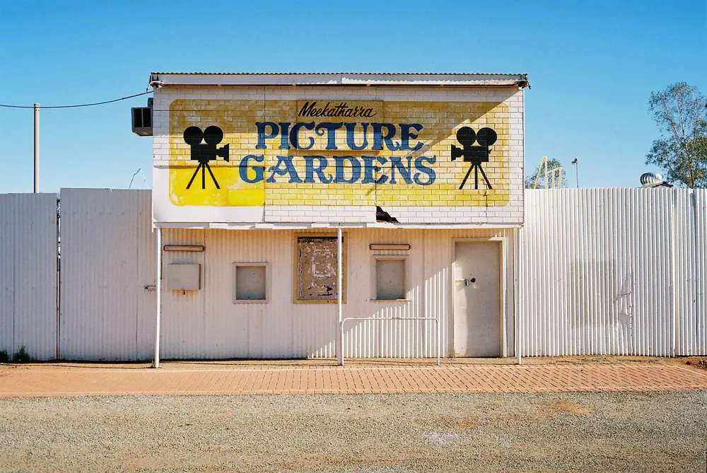
Meekatharra Picture Gardens, 2010Photo: brettanomyces · CC BY-SA 2.0 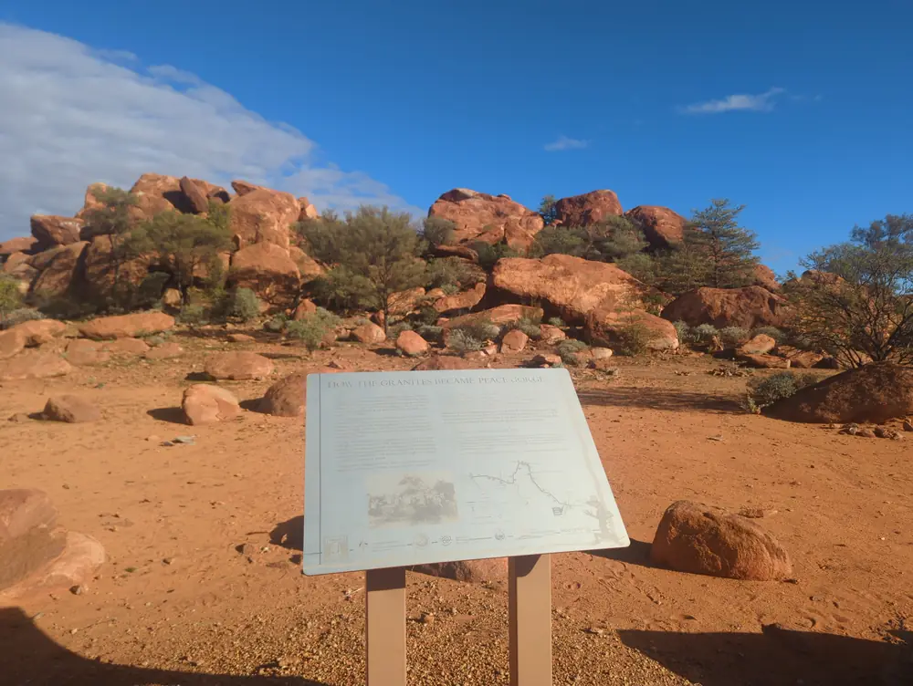
Peace Gorge meekatharraPhoto: Loomhigh223555 · CC0
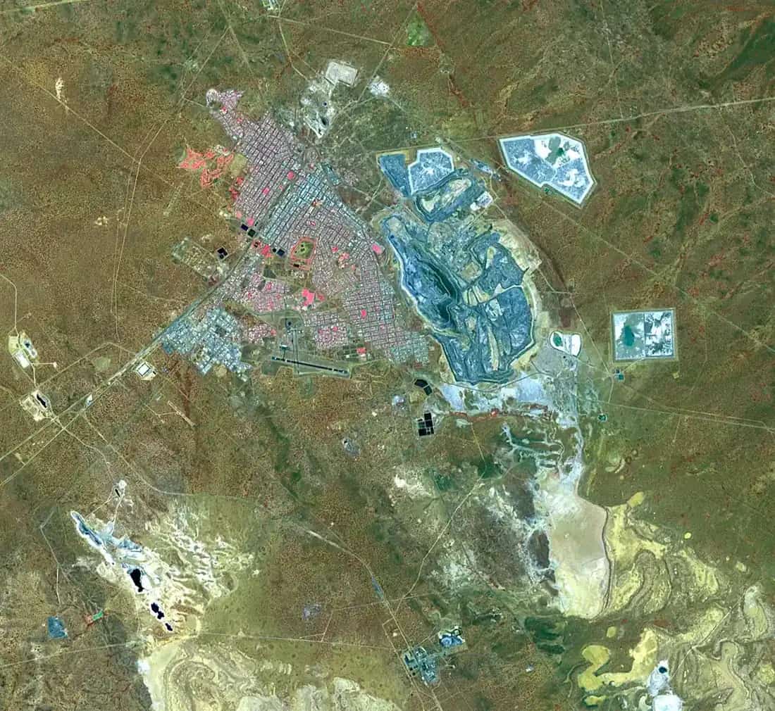
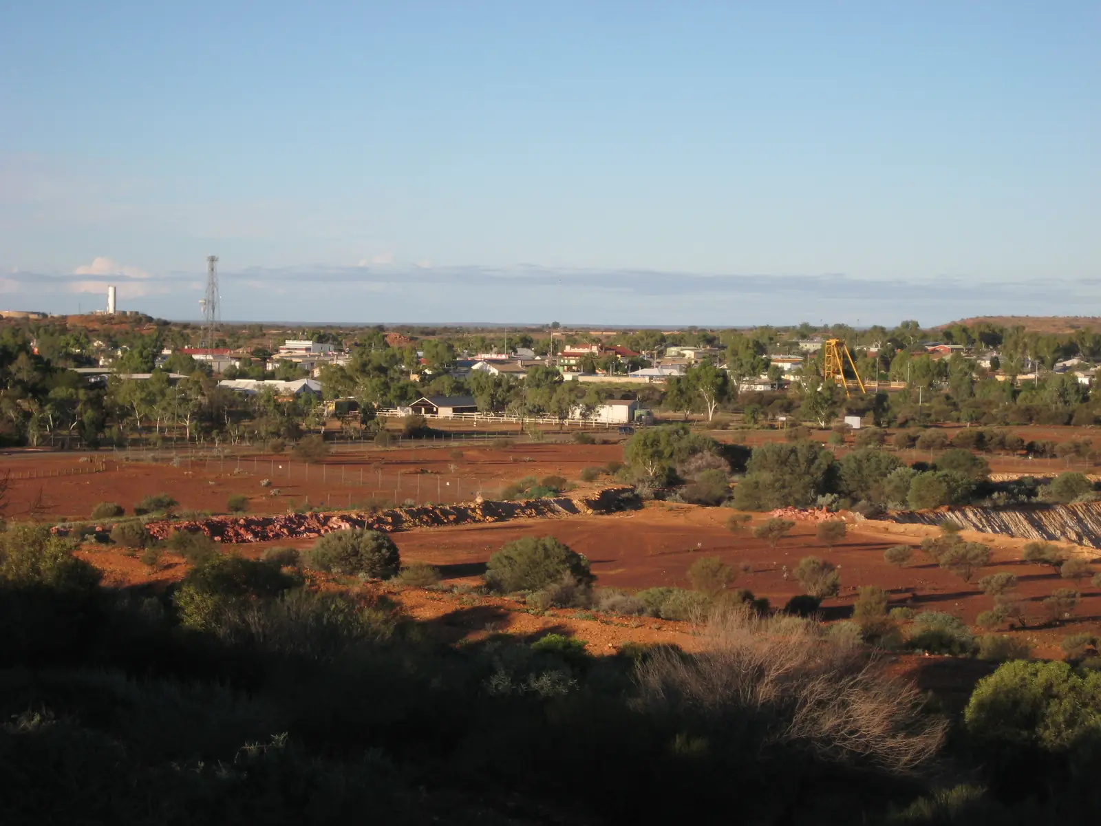
Australia’s Golden Outback calls Meekatharra the largest centre in the Murchison region — a mining, sheep and cattle district first settled as a gold-prospecting town in 1896, approximately 500 km inland from Geraldton. The Shire of Meekatharra New Residents page puts it about 760 km north of Perth on the Great Northern Highway, inside the Golden Outback hub.
Freight on that highway is sealed. After rain, check the Main Roads WA travel map before you treat the half-way-to-Port-Hedland wording as a live road-report, and carry water in January. The inventory row that once bundled “meekatharra and wiluna” is split here: Wiluna is a separate Goldfields Highway / Canning Stock Route town, 180 km east on the Main Roads WA Goldfields Highway project page.
Where it is, and how far
The shire FAQ places Meekatharra on the Great Northern Highway half way between Perth and Port Hedland. South on that sealed freight road is Mount Magnet; further north is Newman. East, the Goldfields Highway runs toward Wiluna. The Shire of Mount Magnet Miners Pathway notes, used on this site’s Mount Magnet guide, warn that Meekatharra to Sandstone is not sealed. Sandstone is the shire neighbour on that gravel question, not a Great Northern Highway suburb.
| Place | Distance from Meekatharra (sourced) |
|---|---|
| Perth | about 760 km north (Shire of Meekatharra New Residents) |
| Geraldton | approximately 500 km inland (Australia’s Golden Outback) |
| Wiluna | 180 km on the Goldfields Highway / Wiluna–Meekatharra Road (Main Roads WA) |
| Peace Gorge | 3 km on the Landor–Meekatharra Road (shire attractions); Golden Outback also uses about 5 km off the Gascoyne Junction Road |
| 25 Mile Well | 40 km north on the Great Northern Highway (Golden Outback) |
| Mount Yagahong | 40 km south-east on the Meekatharra–Sandstone Road (shire attractions) |
| Barlangi Rock | 75 km on the Meekatharra–Sandstone Road (shire attractions) |
| Bilyuin Pool | 85 km north on the Ashburton Downs Road (shire attractions) |
| Mt Gould Police Station | 156 km west on the Landor–Meekatharra Road (shire attractions) |
The shire FAQ also names Skippers Aviation (Perth via Wiluna; return via Mount Magnet) and two bus companies, TransWA and Integrity Coaches. Confirm current services with the operator, not with this page.
Facts at a glance
Population. Australian Bureau of Statistics 2021 Census, Urban Centres and Localities UCL521032 Meekatharra (L): 675 people. Median age 32. Sex split 50.5% male / 49.5% female. Aboriginal and/or Torres Strait Islander people 372 (55.1%). 144 families, 401 private dwellings. Suburbs and localities SAL50926: 849. Local government area LGA55250: 1,200. The shire FAQ also uses “around 1200 people” for the shire and an area of 100,733 square kilometres. Use UCL for the town. Read ABS QuickStats for Meekatharra (L).
Climate. Bureau of Meteorology MEEKATHARRA AIRPORT, 007045, commenced 1944, open. Location 26.61°S, 118.54°E, elevation 517 m. Annual mean rainfall 233.4 mm (78 years, 1944–2026). Hottest month by mean maximum: January 38.5 °C. Coolest month by mean maximum: July 19.3 °C. Annual mean maximum 29.2 °C, mean minimum 16.0 °C. Full table: BOM Meekatharra Airport. See Meekatharra weather.
Visitor centre. Meekatharra Community Resource and Visitors Centre, Lloyds Plaza, Main Street. Shire FAQ: 9980 1811, hello@meekacrc.com.au. The December 2024 business directory lists the same centre at Lot 55 Main Street.
Shire office. Main Street, Meekatharra WA 6642. (08) 9980 0600, shire@meekatharra.wa.gov.au.
Museum. In the shire offices / library on Main Street. Shire museum page: more than 100 photographs and memorabilia; Monday–Friday 9.00am–4.00pm, closed public holidays. Golden Outback’s museum listing uses 81 Main Street and weekday hours 8:00am–4:30pm. Confirm at the CRC or shire before you treat either hour set as a walk-in guarantee.
Traditional Owners
The Shire of Meekatharra Our Background page is the source used here. Before the 1890s the area was known as Mikadah by Yamatji inhabitants, meaning place of little water. The same FAQ repeats that Yamatji meaning. Soaks and gnamma holes are named as year-round water; a historic soak is signposted on the Rangelands Creek Trail that parallels Main Street.
Traditional owners of the lands around Meekatharra are named as the Ngoonooru Wajarri to the west (part of the Wajarri Yamatji people) and the Yugunga-Nya people to the east. The whole shire “stretches almost all the way to Newman” and is also home to the Nharnuwangga, Gingirana, Nyiyaparli and Ngarlawangga peoples. Main Aboriginal languages spoken locally today, on that page: Wajarri, Martu Wangka and Tjupan. This guide follows that list rather than flattening six groups onto one plaque sentence. Confirm current wording at the Community Resource Centre.
History
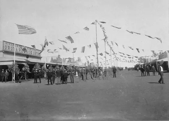
Golden Outback: gold-prospecting town, first settled in 1896. The shire background page adds: a brief mid-1890s flurry after J.F. Connolly’s horse reputedly stumbled on gold-bearing rock south of here; prospectors Meehan, Porter and Stoich registered their mine, “The Meekatharra”, in 1894; a settlement sprang up the same year. The town was gazetted in 1903. Afghan camel trains used the dirt track that is now the Great Northern Highway; the shire describes a 1910 photograph of a camel train on Main Street.
Railway: Perth connection 1910, Wiluna line 1932, Wiluna line closed 1957, leaving Meekatharra as the northern end of the state-owned railway until the railway itself closed in 1978. Sheep gave way to cattle. In the 1970s the Great Northern Highway was sealed. During World War II, the shire says, Americans built the airstrip, now an important Royal Flying Doctor Service base.
Garden Gully and Nannine are named on that page as barely-visible ghost towns a short distance from town. Golden Outback also names Peak Hill and Nannine. Peak Hill, on the shire attractions list, is an abandoned gold-mining town with remains of what was a busy town of around 190 people in 1898.
Things to do
Start at the Community Resource and Visitors Centre on Main Street. A fuller order of a day: things to do in Meekatharra.
Meeka Rangelands Discovery Trail — shire and Golden Outback: an easy 3 km walk around Meekatharra Creek with 17 interpretive panels on Indigenous heritage, nature and settlement. The same shire trails page names a 900 m walk or drive to Meeka Lookout (seven large signs and a directional dial).
Meeka Heritage Walk Trail — shire: old bakery, Masonic Lodge, hotels and other town buildings. Golden Outback also names the Meeka Town Heritage Walk and Creek Trail, and a State Battery on Main Street.
Meekatharra Museum — shire offices / library. Hours above.
Peace Gorge — granite picnic and (on the shire FAQ and attractions pages) self-contained camping. Shire attractions: 3 km on the Landor–Meekatharra Road. Golden Outback: about 5 km off the Gascoyne Junction Road, originally The Granites, renamed after a June 1919 picnic for returned World War I service men. Use the shire’s Landor-road location, and do not treat the two kilometre figures as a GPS error you can average.
Murchison GeoRegion — shire: a self-drive of 21 sites in seven shires. Golden Outback repeats the GeoRegion trail.
Peak Hill, Nannine, 25 Mile Well, Mount Yagahong, Barlangi Rock, Bilyuin Pool, Mt Gould Police Station — named on the shire attractions and/or Golden Outback pages, with the distances in the table above. Barlangi is described there as centred in one of Australia’s 27 confirmed meteorite craters, the rock formed over 2.23 billion years ago. These are out-of-town legs, some on the unsealed Sandstone road. Check shire road reports and Main Roads before you tow.
Outdoor Picture Garden — Golden Outback names it among town attractions. Confirm screenings at the CRC. This hub does not invent a session time.
Fossicking is not a free-for-all on other people’s leases. Golden Outback says visitors are welcome to try their luck at prospecting; ask the CRC and see fossicking and gem fields.
Where to stay
The shire accommodation page and December 2024 business directory are the live named lists. Golden Outback groups motels, hotels and a shady caravan park as town types. Named operators on the shire accommodation page:
- Auski Inland Motel — (08) 9981-1433
- Commercial Hotel — (08) 9981-1020
- Royal Mail Hotel — (08) 9981-1148
- Meekatharra Accommodation Centre (Caravan Park) — 119 Main Street, (08) 9981-1253
- Meekatharra Hotel — 0410 806 484
- Paddy’s Flat — 0407 174 843
- Karalundi Caravan Park — Great Northern Highway, (08) 9981-2000
Those are official named types, not a ranked inventory and not a price list. Hours and vacancies change. Ask the CRC (9980 1811) or the operator.
- How to choose: Meekatharra accommodation
- Parks: Meekatharra caravan parks
- Feature your business
If Meekatharra is full, Mount Magnet is the next Great Northern Highway town with a shire park on this site. That is a neighbour fact, not a booking guarantee.
Caravan and camping
The shire FAQ calls Meekatharra an RV friendly town. Named facilities there:
- Potable water in Welcome Park on Main Street, on the adjoining south side block of the public toilets
- A dump point in the alley between Main Street and Hill Street, entrance from Savage Street or Porter Street
- Short-term park at the Information Bay on Main Street; the empty block across from the Royal Mail Hotel; Main Street between Porter and Savage Streets; Lions Park on Hill Street
Free camping named for self-contained vehicles: Peace Gorge and Bilyuin Pool (no facilities at Bilyuin Pool on the attractions page). Stay limits belong to the shire, not to a travel website guessing. After rain, unsealed Sandstone and Landor legs are a conditions question. Read Meekatharra caravan parks and caravanning in the outback.
Fuel and services
The December 2024 shire business directory names fuel points as BP 24 Hr Card (Main and Connaughton Streets), Caltex 24 Hr Diesel (Railway Street), Coles/Shell Roadhouse on the Great Northern Highway (08 9981 1033), plus the Corner Store at 16 Main Street and Kumarina Roadhouse further out on the highway. This guide does not list bowser brands’ opening hours as a 24-hour guarantee, or prices. Fill here before unsealed legs.
The same directory names IGA at 22 Main Street, Meekatharra Pharmacy, Meeka Hospital and Meeka GP Clinic on Savage Street (hospital 08 9981 0600), police on Savage Street, and an RFDS terminal at the airport. Telstra is the mobile network named on the shire FAQ; reception is described as hard to come by once you leave town. Free Wi-Fi is listed at the Town Hall (Savage Street), Lloyds Plaza, the airport and the Community Resource Centre.
Road access
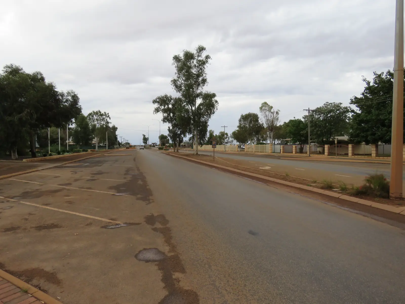
Great Northern Highway — sealed freight road through town. Road trains, heat, animals at dusk. Main Roads WA travel map, 138 138. The Perth to Darwin drive uses this highway.
Goldfields Highway / Wiluna–Meekatharra Road — Main Roads WA: 180 km, and the upgrade page used here recorded 113 km of unsealed pavement, with sealing packages under construction. Golden Outback’s Wiluna page still treats the Meekatharra approach as an unsealed road. Check the travel map on the day; do not assume the 180 km is now a dual-lane holiday highway.
Meekatharra–Sandstone Road — unsealed in the Mount Magnet Miners Pathway notes. Shire attractions sit on it (Mount Yagahong, Barlangi). Closed means closed.
Shire FAQ: for Great Northern Highway or Goldfields Highway (Meekatharra to Wiluna), contact Main Roads; for other unsealed roads, use the shire road-condition reports linked from that FAQ.
Nearby parks and towns
There is no national park inside Meekatharra on the Parks WA pages used for this research. Nature stops are shire and GeoRegion sites: Peace Gorge, Meeka Lookout, creek trail, Mount Yagahong.
On this site:
- Mount Magnet — south on the Great Northern Highway, museum and 37 km tourist trail
- Sandstone — south-east on the unsealed Meekatharra–Sandstone road; London Bridge on heritage listings
- Wiluna — 180 km east; Canning Stock Route and Gunbarrel gateway
- Newman — further north on the Great Northern Highway
- Kalgoorlie-Boulder — Goldfields service city if you are looping rather than running the highway north
Cue appears on Golden Outback’s Gascoyne Murchison list and in the shire staff welcome book as within a day’s drive.
When to go, and how long
January’s 38.5 °C mean maximum at Meekatharra Airport is hot for the Heritage Walk at midday. July’s 19.3 °C mean maximum is the walking season; July’s 7.5 °C mean minimum is why a Peace Gorge night needs a layer. Annual rain 233.4 mm still includes storm bursts — February’s 35.1 mm is the wettest mean month; September’s 5.0 mm is the driest. The shire attractions page says the red dirt comes alive with wildflowers when winter rains arrive, without a guaranteed peak week.
One night covers museum, main street and Peace Gorge if the Landor road is open. Two nights cover the 3 km creek trail, lookout and a quiet van day. Three nights only if you are adding Peak Hill, Barlangi or the GeoRegion and the gravel is open. See Meekatharra weather. Operators: feature your business. The listings slot stays empty until a checked listing exists.
Plan this trip
Tell us the dates, who you are travelling with and where you need help. We reply with planning notes for Meekatharra — we are not a booking agent.
Events and road-conditions newsletter
Occasional notes on outback festivals, race days and official road-condition sources — not a daily blast. We use these details only to send the newsletter.
Western Australia · Golden Outback
Meekatharra accommodation
Where to stay in Meekatharra: hotels, motel rooms and caravan park types named by the Shire of Meekatharra. Confirm at the Community Resource Centre. No invented rates.
Read · 4 min
Western Australia · Golden Outback
Meekatharra caravan parks
Camping in Meekatharra: Meekatharra Accommodation Centre, Karalundi, Peace Gorge and shire-named RV short-term parks. Confirm at the Community Resource Centre.
Read · 4 min
Western Australia · Golden Outback
Meekatharra weather
Meekatharra climate from BOM Meekatharra Airport (007045): January mean max 38.5 °C, July 19.3 °C, annual rainfall 233.4 mm. Station open. Use Main Roads WA after rain.
Read · 4 min
Western Australia · Golden Outback
Things to do in Meekatharra
Things to do in Meekatharra: Meeka Rangelands Discovery Trail, Heritage Walk, museum, Peace Gorge, Peak Hill and Murchison GeoRegion sites named by the shire and Golden Outback.
Read · 5 min
Frequently asked questions
What is Meekatharra’s population?
675 people at the 2021 Census for the urban centre (UCL521032). The suburbs-and-localities figure is 849 (SAL50926). The Shire of Meekatharra local government area counted 1,200 (LGA55250). Use the UCL figure for the town.
How far is Meekatharra from Perth?
The Shire of Meekatharra New Residents page puts the town about 760 km north of Perth on the Great Northern Highway. Australia’s Golden Outback separately places it approximately 500 km inland from Geraldton.
What is the weather like in Meekatharra?
BOM Meekatharra Airport (007045) has a January mean maximum of 38.5 °C, a July mean maximum of 19.3 °C and annual mean rainfall of 233.4 mm. The station is open. The full table is on the BOM page.
Is Meekatharra on a sealed highway?
Yes. The town sits on the Great Northern Highway. The Goldfields Highway / Wiluna–Meekatharra Road is a separate 180 km leg that Main Roads WA recorded as including 113 km of unsealed pavement on the upgrade page used here. Check the Main Roads WA travel map.
Whose Country is Meekatharra on?
The Shire of Meekatharra Our Background page says the area was known as Mikadah by Yamatji inhabitants, meaning place of little water. Traditional owners around Meekatharra are named as Ngoonooru Wajarri to the west (part of the Wajarri Yamatji people) and Yugunga-Nya to the east.
Where is the visitor centre?
The shire FAQ names the Meekatharra Community Resource and Visitors Centre at Lloyds Plaza on Main Street. Phone 9980 1811 or hello@meekacrc.com.au. Confirm hours when you arrive.
Sources and further reading
Facts on this page were checked against these primary and official sources. Conditions change — confirm before you travel or buy.
- Midwest hospitals and health services — WA Country Health Service
- Meekatharra (L) 2021 Census QuickStats (UCL521032) — Australian Bureau of Statistics
- Meekatharra 2021 Census QuickStats (SAL50926) — Australian Bureau of Statistics
- Meekatharra 2021 Census QuickStats (LGA55250) — Australian Bureau of Statistics
- Climate statistics for Meekatharra Airport (007045) — Bureau of Meteorology
- FAQ — Shire of Meekatharra — Shire of Meekatharra
- New Residents — Shire of Meekatharra — Shire of Meekatharra
- Our Background, Our Culture — Shire of Meekatharra — Shire of Meekatharra
- Attractions — Shire of Meekatharra — Shire of Meekatharra
- Meeka Rangelands Discovery Trail — Shire of Meekatharra
- Museum — Shire of Meekatharra — Shire of Meekatharra
- Accommodation — Shire of Meekatharra — Shire of Meekatharra
- Business and Services Directory — Shire of Meekatharra — Shire of Meekatharra
- Meekatharra — Australia’s Golden Outback — Australia's Golden Outback
- Peace Gorge — Australia’s Golden Outback — Australia's Golden Outback
- Goldfields Highway — Wiluna to Meekatharra — Main Roads Western Australia
- Main Roads WA travel map — Main Roads Western Australia