At a glance
Sourced facts only. Distances and services change — confirm before you travel.
- Population
- 107 people (SAL31073, 2021 Census)
- Local government
- Etheridge Shire
- Traditional Owners
- Ewamian — Unearth Etheridge / this hub’s sourced Country FAQ
- Nearest regional city
- Georgetown 45 km / about one hour (Etheridge Shire Gems and Gorges map)
- Nearest fuel
- Confirm in the service town named under nearest regional city; this guide does not list bowser brands.
- Nearest hospital or clinic
- Confirm with Queensland Health — do not invent a clinic name.
- Mobile coverage
- Check Telstra and Optus coverage maps before travel; do not assume a signal on floodways, parks or unsealed approaches.
- Best time to visit
- Dry season about May–September (Queensland Parks wet-season roads December–March on far-north/Gulf pages). Georgetown Airport (030124) January mean maximum 33.9 °C, July 28.8 °C. QLDTraffic in the wet.
Climate
Monthly means from the Bureau of Meteorology station Georgetown Airport (030124). This is not a forecast. Commenced 2004. Elevation 302 m. Status: Open. Annual mean rainfall 843.4 mm. Forsayth has no township table on the monthly index used here. Georgetown Airport is the labelled Etheridge Shire comparison.
| Month | Mean max (°C) | Mean min (°C) | Rainfall (mm) |
|---|---|---|---|
| Jan | 33.9 | 23.4 | 257.4 |
| Feb | 33.3 | 22.9 | 214.4 |
| Mar | 33.5 | 22.0 | 137.1 |
| Apr | 32.9 | 19.5 | 23.1 |
| May | 30.5 | 16.6 | 12.8 |
| Jun | 28.9 | 14.0 | 7.7 |
| Jul | 28.8 | 13.2 | 10.2 |
| Aug | 30.5 | 13.7 | 1.4 |
| Sep | 33.7 | 17.0 | 5.7 |
| Oct | 36.3 | 20.6 | 14.0 |
| Nov | 36.9 | 22.9 | 77.6 |
| Dec | 36.3 | 23.7 | 143.2 |
Forsayth in pictures
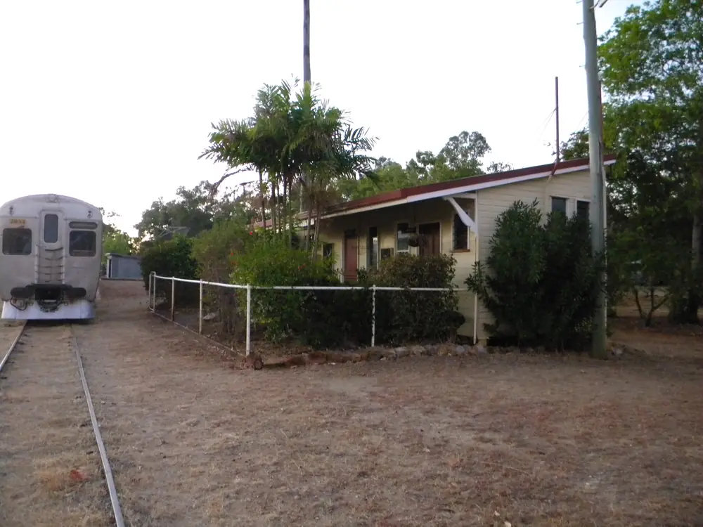
The Savannahlander at Forsayth stationPhoto: Lobster1 · CC BY-SA 3.0 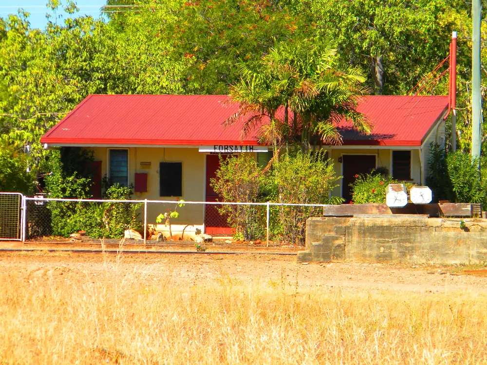
Forsayth railway stationPhoto: Lobster1 · CC BY-SA 3.0 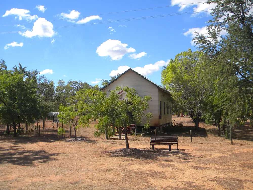
A church in ForsaythPhoto: Lobster1 · CC BY-SA 3.0 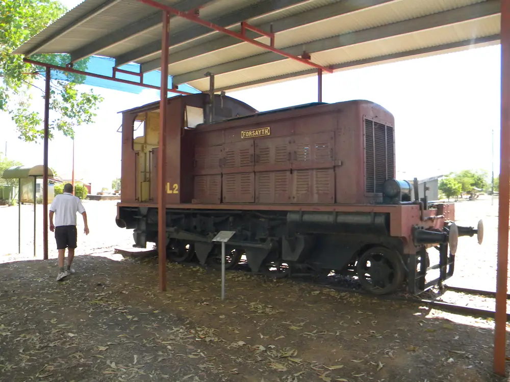
A preserved locomotive in ForsaythPhoto: Lobster1 · CC BY-SA 3.0
Forsayth sits in Etheridge Shire in Far North Queensland, on Ewamian Country, in the Outback North directory. Forsayth is the Savannahlander railhead — the Savannahlander operator lists Cairns as the start and Forsayth as the end of the Etheridge Railway — and Unearth Etheridge’s named road approach to Cobbold Gorge. Etheridge Shire Council’s tourism site treats it as the former gold-mining town south of Georgetown, on Ewamian Country in this site’s Outback North directory. The shire’s Gems and Gorges map puts Forsayth 45 km (about one hour) from Georgetown. The 2021 Census counted 107 people in the locality. This is not a second Georgetown.
The Gulf Developmental Road / Savannah Way stays on the Georgetown–Mount Surprise–Croydon spine. Forsayth is the south turn. The last kilometres toward Cobbold include gravel on the operator’s own getting-here page. You still need QLDTraffic in the wet, because a 45 km run from Georgetown is no use if the road is closed.
Where it is, and how far
Forsayth is south of Georgetown in the Etheridge gold and gorge country. Etheridge’s Gems and Gorges map is the kilometre source used on this hub for the shire loop. Cobbold Gorge’s getting-here page is the kilometre source for the gorge spur, and it does not match the map on every figure. This page prints both rather than averaging them into a fake blended kilometre.
| Place | Distance from Forsayth (official pages used here) |
|---|---|
| Georgetown | 45 km / about one hour (Etheridge Gems and Gorges map). Cobbold Gorge’s getting-here page puts Georgetown to Forsayth at 40 km |
| Cobbold Gorge / Cobbold Village | 45 km / about one hour (same Etheridge map). Cobbold Gorge repeats about 45 km from Forsayth, of which about 10 km is bitumen and 35 km is gravel |
| Einasleigh | 72 km / about one hour (Etheridge Gems and Gorges map) |
| Agate Creek | 70 km / about 1.5 hours (same map) |
| Cairns or Townsville (to Cobbold) | about a six-hour drive on Cobbold Gorge’s own page; this hub does not invent a separate Forsayth–Cairns kilometre |
Brisbane kilometres are not on the Etheridge or Cobbold pages used here. Greenvale is the Gregory Developmental Road neighbour on this site; this hub does not invent a Forsayth–Greenvale kilometre.
Facts at a glance
Population. Australian Bureau of Statistics 2021 Census, Suburbs and Localities SAL31073, Forsayth: 107 people. Median age 53. Sex split 55.0% male / 45.0% female (60 male, 49 female). Families 19. Private dwellings 150. Average household size 1.9. Median weekly household income $593. The ABS does not publish a 2021 Urban Centre (UCL) named Forsayth. QuickStats notes small random adjustments for privacy. Use the Forsayth SAL QuickStats.
Climate. Bureau of Meteorology station FORSAYTH, 030055, opened 1956, 18.59°S, 143.60°E, elevation 400 m. The Climate Data Online monthly rainfall table fetched for this guide prints all-years means: annual 824.8 mm; January 224.7 mm wettest mean month; August 1.9 mm driest. Median annual 755.3 mm. Highest annual total in that table 1960.0 mm; lowest 283.1 mm. BOM does not publish a temperature climate-averages table for this site. For a still-open nearby temperature table, use Georgetown Airport, 030124, clearly labelled as a different station: November mean maximum 36.9 °C, July 28.8 °C. See Forsayth weather.
Visitor information. There is no Forsayth VIC on the Unearth Etheridge town page. Use the TerrEstrial Centre, 20 Low Street, Georgetown, (07) 4079 9092 — Etheridge’s accredited visitor information centre. The Forsayth town page prints the same Georgetown contact block.
Traditional Owners
Ewamian people are named for Forsayth on a Traditional Owner corporation page. Ewamian People Aboriginal Corporation states that the Ewamian People are the Traditional Owners of an area of north-western Queensland extending over the Gilbert and Einasleigh River catchments, including Georgetown, Mount Surprise, Forsayth and Einasleigh. Ewamian Country includes Undara Volcanic National Park, Cobbold Gorge and Talaroo Hot Springs. The Savannah Way travels across Ewamian Country. The corporation records native title determined over more than 2.9 million hectares. Visit as a guest; see visiting Country respectfully.
This guide does not flatten neighbouring nations onto the townsite. For the inland Gregory Developmental Road approach through Greenvale, see Gugu Badhun wording on the Greenvale hub.
History
Unearth Etheridge’s Forsayth page is the town-origin source used here. The settlement was originally known as Finnigan’s Camp after the prospector who discovered gold nearby in 1871. Within a year it had become Charleston Township. It continued to grow despite near desertion when inhabitants rushed to the Palmer River Goldfield in 1874 and to the Hodgkinson in 1876. After a slump in the mid-1880s, the township was again a flourishing centre by the mid-1890s, with five hotels, a school and a court of petty sessions.
By the late 1890s, the same page says, copper deposits were opened at Charleston, Einasleigh and Ortona, and several were acquired by a subsidiary of the Chillagoe Company. That company commenced a rail link in 1907 from Almaden to Einasleigh and the Charleston area, completed in January 1910. The Etheridge Railway terminated at a new settlement on the other side of the Delaney River. First known as New Charleston, it was renamed Forsayth after the railway’s commissioner, James Forsayth Thallon. During that year, all the buildings in Charleston, including the police station and the school (which had previously been at Gilberton), were moved across the Delaney River to Forsayth.
New buildings followed the railway: a hospital, a new courthouse and a new school built in 1912, and a public hall two years later. In 1914 the Chillagoe Smelters were shut down and the town’s importance as an ore-loading facility declined. Forsayth remained the railhead for transport to the west; plans in the 1930s to extend the railway to the Croydon line did not proceed. From the 1980s, the same page says, renewed mining and livestock traffic revived the town. Today Unearth Etheridge calls Forsayth a service centre for road transport and regional tourism.
This hub does not invent a production-ounce table or a 1870s hotel list beyond what Etheridge prints.
Things to do
Unearth Etheridge’s “while in Forsayth” list names:
- Caschafor Park — wood carvings worked into the trees by a local artist. The Gems and Gorges map adds gold-day relics including a rail engine, and public toilets in the park
- the Old Library — read a classic, on the town page wording
- the Forsayth Lockup — jail cells once behind the now-closed police station, with pictures and items from Forsayth’s past
- the Hole in the Fence Cafe, held every Flying Doctors Day for country-style morning tea. That is a named event type, not a daily cafe hour
- historical-building signage around town
- nearby Charleston Dam — fishing, water sports, bird watching and sunsets on that page. This hub does not invent a kilometre to the dam that Etheridge does not print
The Savannahlander is the named rail reason to be here. savannahlander.com.au lists four-day tours with an overnight at Forsayth and short tours from a few hours to a couple of days. Phone 1800 793 848. Do not treat a travel website as a 2026 departure board.
Cobbold Gorge is the named gorge day from this town, not a main-street walk. Access is by guided tour only. Season: 1 April (or Easter if earlier) to 31 October. See the Cobbold Gorge guide and book with the operator.
Agate Creek fossicking is 70 km from Forsayth on the Etheridge map. Camping is not permitted in the fossicking area on that map; a campground nearby is named. A Queensland fossicking licence is required. Read fossicking and gem fields.
A fuller order of a day is on things to do in Forsayth.
Where to stay
Unearth Etheridge’s accommodation directory names Forsayth stays as Finnigan’s Rest (cabins and camping, (07) 4062 5374) and Cobbold Gorge (tours, camping, accommodation, meals, 1800 669 922). Outback Queensland’s listing for Goldfields Hotel and Finnigan’s Rest places the hotel at the corner of First and Fourth Street, with Finnigan’s Rest adjacent: air-conditioned rooms and powered camping sites. Those names belong on the official stay page, which can take a listing down when a business closes. This page does not publish prices or ratings.
- How to choose a type of stay: Forsayth accommodation
- Parks and camping: Forsayth caravan parks
- Phone the TerrEstrial: (07) 4079 9092
- Operator enquiries: feature your business
If Forsayth is full, Georgetown is 45 km on the Etheridge map (or 40 km on Cobbold’s page). That is geography, not a booking guarantee.
Caravan and camping
Vans use Forsayth because it is the named overnight before the gravel into Cobbold, and because Etheridge names Finnigan’s Rest camping. Cobbold Village, on the gorge spur, is the other named park type on the same directory. Confirm dump-point rules at 20 Low Street rather than assuming a main-street bay. Read Forsayth caravan parks and outback camping.
After rain, the Forsayth and Cobbold roads are the constraint. January’s Forsayth rainfall mean of 224.7 mm is not a drizzle. QLDTraffic first.
Fuel and services
A locality of 107 people will not match Georgetown for a supermarket or a hospital ward. Etheridge’s Info and Services list for Forsayth names: Forsayth Clinic (hospital services, 07 4062 5372), Finnigan’s Rest, Forsayth Post Office (07 4062 5548), Goldfield’s Hotel (refreshments, groceries, Forsayth By Night Tour and meals, 07 4062 5374), and Forsayth Library (07 4062 5462). Outback Queensland’s hotel listing adds diesel and unleaded from the pump in front of the hotel, LP gas refills on request, a convenience store and a postal agency inside the hotel. Confirm bowser hours when you arrive. This guide does not list brands.
Georgetown remains the shire headquarters for a roadhouse, mechanics and the TerrEstrial. Fill up with a plan before the gravel into Cobbold. Etheridge Shire Council phone on the services page is (07) 4079 9090; the TerrEstrial is 9092.
Road access
From the Savannah Way, the named turn is Georgetown then south to Forsayth. Cobbold Gorge’s getting-here page says about 8 km of the Georgetown–Forsayth run is unsealed, and the Forsayth–Cobbold Village run is about 10 km of bitumen and 35 km of gravel. Conventional vehicles and caravans are described as managing that in normal dry-season conditions on the operator page; hire-car unsealed-road clauses are a contract question, not a tourism slogan.
Check QLDTraffic and 13 19 40. Do not drive around closed signs to keep a gorge booking. The wet-season closure of Cobbold Village (November to March, subject to the 1 April / Easter opening) is why a summer Forsayth night is a town stop, not a gorge guarantee.
East and north: Georgetown, then Mount Surprise and the Tablelands approaches, or west toward Croydon. South of Einasleigh the Gems and Gorges map names the Lynd Junction as the southern access. The Gregory Developmental Road through Greenvale is the inland Charters Towers spine.
Nearby parks and towns
Parks and gorges (official pages):
- Cobbold Gorge — guided only, south of Forsayth
- Charleston Dam — named on the Forsayth town page
- Undara Volcanic National Park — lava tubes by guided tour only; not in this main street
- Agate Creek fossicking area — 70 km on the Etheridge map
Towns on this site:
- Georgetown — 45 km on the Etheridge map; TerrEstrial Centre
- Mount Surprise — Savannah Way, Undara and O’Brien’s Creek
- Croydon — gold precinct and Gulflander terminus, west on the Savannah Way
- Greenvale — Gregory Developmental Road
Einasleigh is the Copperfield Gorge neighbour 72 km on the Etheridge map.
When to go, and how long
January’s Forsayth rainfall mean of 224.7 mm is the wet-season core on paper. August’s 1.9 mm is the driest month on that table. Cobbold’s own season is April to October. The TerrEstrial in Georgetown is seven days in April–September and weekdays only in October–March on the Georgetown hub’s sourced hours.
Two hours at Caschafor Park, the lockup and the hotel story is the minimum if you are only passing between Georgetown and the gorge. A night lets you meet a Savannahlander overnight if the operator has you booked here. Two nights if you are adding Cobbold without rushing the gravel. Three nights if QLDTraffic or a tour booking forces a buffer.
Operators who want a checked listing: feature your business. The listings slot on this hub stays empty until then.
Plan this trip
Tell us the dates, who you are travelling with and where you need help. We reply with planning notes for Forsayth — we are not a booking agent.
Events and road-conditions newsletter
Occasional notes on outback festivals, race days and official road-condition sources — not a daily blast. We use these details only to send the newsletter.
Queensland · Outback North
Forsayth accommodation
Where to stay in Forsayth: Finnigan’s Rest rooms and camping and Cobbold Village as named by Etheridge Shire. Confirm at the TerrEstrial Centre in Georgetown.
Read · 4 min
Queensland · Outback North
Forsayth caravan parks
Camping in Forsayth: Finnigan’s Rest powered sites and seasonal Cobbold Village camping as named by Etheridge Shire. Confirm at the TerrEstrial in Georgetown.
Read · 4 min
Queensland · Outback North
Forsayth weather
Forsayth climate from BOM station 030055: annual mean rainfall 824.8 mm, January 224.7 mm, August 1.9 mm. No Forsayth temperature averages table — use Georgetown Airport only as a labelled comparison.
Read · 4 min
Queensland · Outback North
Things to do in Forsayth
Things to do in Forsayth: Caschafor Park and lockup, Charleston Dam, Savannahlander railhead and the guided-only approach to Cobbold Gorge.
Read · 5 min
Frequently asked questions
How far is Forsayth from Georgetown and Cobbold Gorge?
Etheridge Shire’s Gems and Gorges map puts Forsayth 45 km (about one hour) from Georgetown, and Cobbold Gorge 45 km (about one hour) from Forsayth. Cobbold Gorge’s own getting-here page puts Georgetown to Forsayth at 40 km, then about 45 km to Cobbold Village.
What is Forsayth’s population?
107 people at the 2021 Census for Forsayth suburbs-and-localities (SAL31073). Median age 53. The ABS does not publish a 2021 Urban Centre (UCL) named Forsayth.
Is Forsayth the end of the Savannahlander?
Yes on the operator’s own wording. Savannahlander lists Cairns as the start and Forsayth as the end of the line, with an overnight at Forsayth on the four-day tour. Treat the live timetable at savannahlander.com.au as the authority; Etheridge’s Einasleigh page notes that a bus currently covers sections the train cannot.
What is the weather like in Forsayth?
BOM Forsayth rainfall station (030055) has an all-years annual mean of 824.8 mm, wettest in January (224.7 mm) and driest in August (1.9 mm). BOM does not publish a temperature climate-averages table for Forsayth. Use Georgetown Airport (030124) only as a labelled nearby comparison.
Whose Country is Forsayth on?
Ewamian People Aboriginal Corporation names the Ewamian People as Traditional Owners of an area including Georgetown, Mount Surprise, Forsayth and Einasleigh, across the Gilbert and Einasleigh River catchments. Cobbold Gorge is named on the same page as Ewamian Country.
Can I visit Cobbold Gorge without a tour?
No. Unearth Etheridge and Cobbold Gorge both say access is by guided tour only. The gorge and village are open from 1 April (or Easter if earlier) to 31 October.
Sources and further reading
Facts on this page were checked against these primary and official sources. Conditions change — confirm before you travel or buy.
- Forsayth 2021 Census QuickStats (SAL31073) — Australian Bureau of Statistics
- Monthly rainfall — Forsayth (030055) — Bureau of Meteorology
- Climate statistics for Georgetown Airport (030124) — Bureau of Meteorology
- Unearth Etheridge — Forsayth — Etheridge Shire Council
- Unearth Etheridge — Accommodation — Etheridge Shire Council
- Unearth Etheridge — Info and Services — Etheridge Shire Council
- Unearth Etheridge — Gorges — Etheridge Shire Council
- Lava Tubes, Gems and Gorges Trail map — Etheridge Shire Council
- Goldfields Hotel and Finnigan’s Rest — Outback Queensland Tourism Association
- Savannahlander — Cairns Kuranda Steam
- Ewamian People Aboriginal Corporation — About — Ewamian People Aboriginal Corporation
- Cobbold Gorge — Getting Here — Cobbold Gorge
- QLDTraffic — Queensland Government