At a glance
Sourced facts only. Distances and services change — confirm before you travel.
- Local government
- Barcaldine Regional Council
- Nearest regional city
- Use kilometres printed on Explore the Barcaldine Region / Outback Queensland pages used here. Do not invent a Longreach–Muttaburra figure those pages omit.
- Mobile coverage
- Check Telstra and Optus coverage maps before travel; do not assume a signal.
- Best time to visit
- May–September on Longreach Aero cooler mean maxima
Climate
Monthly means from the Bureau of Meteorology station Longreach Aero (036031). This is not a forecast. Open. Labelled neighbour table — Muttaburra (036037) is rainfall-only. Do not blend. Commenced 1949. Elevation 192 m.
| Month | Mean max (°C) | Mean min (°C) | Rainfall (mm) |
|---|---|---|---|
| Jan | 37.3 | 23.4 | 76.1 |
| Feb | 36.0 | 22.7 | 77.9 |
| Mar | 34.8 | 20.6 | 58.0 |
| Apr | 31.6 | 16.6 | 34.0 |
| May | 27.1 | 12.1 | 22.6 |
| Jun | 23.9 | 8.4 | 18.2 |
| Jul | 23.7 | 7.3 | 18.2 |
| Aug | 26.3 | 8.7 | 10.7 |
| Sep | 30.5 | 12.9 | 11.4 |
| Oct | 34.3 | 17.3 | 23.2 |
| Nov | 36.4 | 20.3 | 29.8 |
| Dec | 37.7 | 22.4 | 52.3 |
Muttaburra in pictures
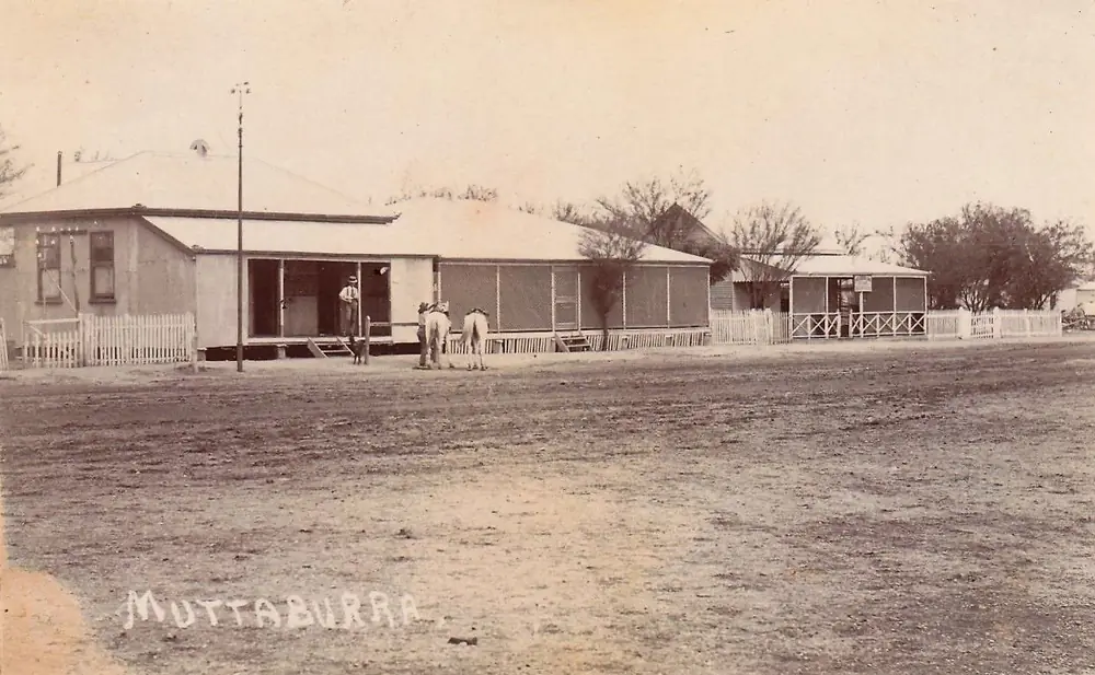
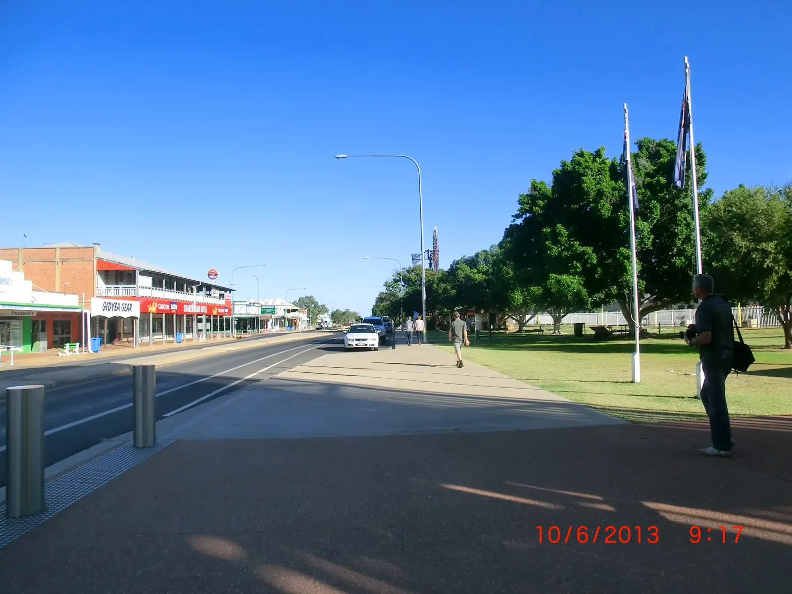
A historic street scene in MuttaburraPhoto: Aussie~mobs · Public domain 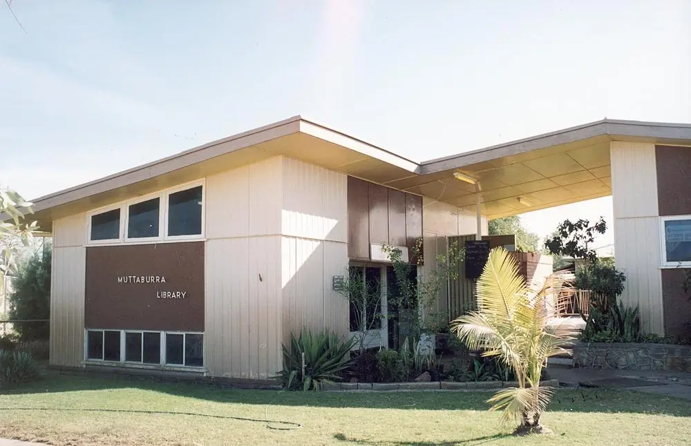
Muttaburra Library, Aramac ShirePhoto: Unknown authorUnknown author · CC BY 3.0 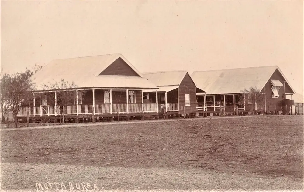
Muttaburra Hospital In MuttaburraPhoto: Aussie~mobs · Public domain 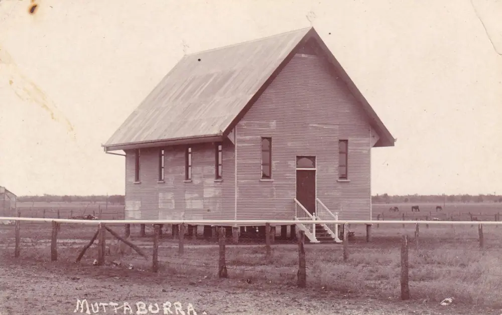
Muttaburra's Anglican churchPhoto: Aussie~mobs · Public domain
Muttaburra sits in the Barcaldine Region in Queensland’s central west, on country Explore the Barcaldine Region and Outback Queensland describe as close to the Thomson and Landsborough rivers. Outback Queensland says the name comes from the local Aboriginal tribe of Mootaburra, meaning the meeting of waters, and that Muttaburra has the distinction of being the town closest to the geographic centre of Queensland. Travellers stop for the Muttaburrasaurus langdoni, the Dr Arratta hospital museum, the A.A. Cassimatis store and cottage, and river fishing. This is not the Landsborough Highway. You need QLDTraffic after rain on the connecting roads toward Longreach and Barcaldine.
The Australian Bureau of Statistics does not publish a 2021 Urban Centre (UCL) named Muttaburra. Use suburbs-and-localities SAL32094: 158 people, median age 45, sex split 51.6% male / 48.4% female. Explore the Barcaldine Region’s town page prints POPULATION: 100; Outback Queensland writes around 200 people. Those are visitor-guide sentences. This hub uses the Census SAL.
A kilometre figure from Muttaburra township to Longreach or Barcaldine was not printed on the Explore the Barcaldine Region or Outback Queensland town pages used here. Outback Queensland’s nearby-stay list puts named Longreach properties from about 81 km. This guide will not convert that into a fake town-centre distance.
Where it is, and how far
Muttaburra is north of the Landsborough Highway towns, in the same Barcaldine Region as Aramac and Barcaldine. Explore the Barcaldine Region names five towns: Alpha, Jericho, Barcaldine, Aramac and Muttaburra. Outback Queensland’s Muttaburra stay list places Longreach-area parks from 81 km and a Barcaldine motel at 131 km. Use those as sourced nearby-stay distances, not as a road-table substitute. The VIC at 16 Sword Street is the live check for which road you should actually drive.
| Place | Distance from Muttaburra (sourced) |
|---|---|
| Longreach (named stays on Outback Queensland) | from about 81 km (Muddy Duck Tourist Park listing) |
| Barcaldine (named stay on Outback Queensland) | 131 km (Barcaldine Country Motor Inn listing) |
| Aramac | Barcaldine Region neighbour; a separate Muttaburra–Aramac kilometre was not on the town pages used here |
Winton is the dinosaur-trail hub west-north-west of this district, not a Muttaburra suburb. Outback Queensland lists the Australian Age of Dinosaurs at 152 km among nearby tours.
Facts at a glance
Population. ABS 2021 Census, Suburbs and Localities SAL32094: 158 people. Median age 45. 36 families, 140 private dwellings. No UCL. Use the Muttaburra SAL QuickStats.
Climate. Bureau of Meteorology lists MUTTABURRA, 036037 on the Queensland rainfall-station directory (about 22.60°S, 144.55°E; commenced January 1885). BOM does not publish a monthly climate-averages table for that site. The nearest published tables are Longreach Aero, 036031 (January mean maximum 37.3 °C, July 23.7 °C, annual rainfall 432.7 mm) and Barcaldine Post Office, 036007 (January mean maximum 35.7 °C, July 22.8 °C, annual rainfall 499.3 mm). See Muttaburra weather.
Visitor information. Muttaburra Information Centre, Postal Agency, 16 Sword Street, (07) 4658 7147, Monday to Friday 9.00 am–1.00 pm and 2.00 pm–5.00 pm, weekends closed. Barcaldine Visitor Information Centre, 149 Oak Street, (07) 4651 5630, tourism@barc.qld.gov.au, is the region desk.
Traditional Owners
Outback Queensland and Explore the Barcaldine Region derive the town name from Mootaburra, “the meeting of waters”. That is visitor-guide etymology, not a native-title determination. The Longreach guide on this site names Iningai Country for the Thomson downs. This hub quotes the Mootaburra wording as printed and does not flatten several groups onto one street. Confirm a sentence you want on a plaque at 16 Sword Street.
History
Explore the Barcaldine Region and Outback Queensland: local grazier Doug Langdon uncovered the fossilised skeleton of Muttaburrasaurus langdoni, a land-living, plant-eating dinosaur that roamed about 100 million years ago. Explore the Barcaldine Region’s interpretation-centre page dates the find to 1963, near the Thomson River. Outback Queensland: the discovery was the first of its kind in Australia, the second most complete dinosaur skeleton found in Queensland, and the first of five Muttaburrasaurus skeletons found in Australia. The fossilised remains are in the Queensland Museum in Brisbane. A statue stands at the Muttaburrasaurus Interpretation Centre on Bruford Street.
Dr Joseph Andrew Arratta was the resident doctor from 1925 until he retired in 1960, described as a pioneer in isolated-area surgery. After the hospital closed in 1989, the building became a medical museum named for him. Guided tours are arranged through the information centre on (07) 4658 7147.
A.A. Cassimatis moved from Greece with his family in 1913 and established a business in Muttaburra; the general store and cottage museum are on Bruford Street. The cemetery on Union Hole Road has graves dating back to 1871 on the region’s cemetery page.
Things to do
Muttaburrasaurus Interpretation Centre, Bruford Street — replicas of the original bones, dinosaur history, and the discovery story. Statue on the same official pages.
Centre of Queensland Monument — photograph stop on Outback Queensland and Explore the Barcaldine Region.
Dr Arratta Memorial Museum, Nev Bullen Drive — medical artefacts; guided tours via the VIC.
A.A. Cassimatis General Store and Cottage Museum, Bruford Street.
Public art across town, named on Explore the Barcaldine Region as capturing historical values, lifestyle and landscape.
Agate fossicking — the region page says Muttaburra is known for its agates. Confirm licence rules at the VIC. This hub does not invent a fossicking map.
Thomson and Landsborough rivers — Outback Queensland and the town page name camping, fishing and water sports, and yellowbelly / golden perch as the local fishing reputation. Queensland fisheries rules apply.
See things to do in Muttaburra.
There is no national park inside Muttaburra. Winton’s Australian Age of Dinosaurs is a separate town day.
Where to stay
Explore the Barcaldine Region names:
- AJ’s Pad, 12 Sword Street — accommodation and hire, sleeps 6 or more, 0457 302 126
- Muttaburra Caravan Park, 17 Bridge Street — honesty box or council office, 07 4651 5654
- Freedom of Choice Park, Union Hole Drive — water, BBQ, fire pit, no bathroom facilities, book online, 07 4651 5600
The Town Dam page says that dam area is also used as camping for the Freedom Park. Those are official named types, not a ranked inventory. Confirm at 16 Sword Street.
- How to choose: Muttaburra accommodation
- Camping detail: Muttaburra caravan parks
- Operator enquiries: feature your business
If Muttaburra is full, Longreach-area stays begin around 81 km on Outback Queensland’s list. That is a nearby-stay fact, not a booking guarantee.
Caravan and camping
Vans use Muttaburra as a quieter dinosaur-and-river overnight than Longreach. Official named camps are the council caravan park, Freedom of Choice Park (no bathrooms), and river spots the VIC confirms. Ask about stay limits, dump points and whether the Town Dam camp is open. Read Muttaburra caravan parks and outback camping.
After rain, the Thomson and Landsborough crossings are the constraint. QLDTraffic first.
Fuel and services
A locality of 158 people will not match Longreach or Barcaldine for fuel choice, groceries or a hospital. This guide does not list bowser brands. Confirm what is actually open at 16 Sword Street, especially on a weekend when the information centre is closed. Fill up in Longreach or Barcaldine if you are not sure. For current questions, use Barcaldine Regional Council and (07) 4658 7147.
Road access
Muttaburra is off the Landsborough Highway spine. Connecting roads toward Longreach, Aramac and Barcaldine include stretches that close after rain even when the highway towns look dry. Check QLDTraffic and 13 19 40. Do not drive around closed signs to keep a museum tour.
Outback Queensland names Starlight’s Lookout as about 40 minutes from Longreach on unsealed Muttaburra-Westside Road — a Longreach-side outing, not a claim that every approach to Muttaburra is sealed. Confirm the road you intend at the VIC.
Nearby parks and towns
Parks and named nature sites:
- Thomson and Landsborough river camps (Outback Queensland / Explore the Barcaldine Region)
- Town Dam / Freedom of Choice Park (Union Hole Drive)
- No national park in town
Towns on this site:
- Longreach — Hall of Fame, Qantas Founders Museum; named stays from about 81 km
- Barcaldine — Tree of Knowledge; region VIC
- Aramac — White Bull, Lake Dunn Sculpture Trail
- Winton — dinosaurs and Waltzing Matilda
- Ilfracombe — Machinery Mile, 27 km east of Longreach
When to go, and how long
Longreach Aero’s January mean maximum of 37.3 °C is hot for a Bruford Street walk at midday. July’s 23.7 °C mean maximum is the comfortable walking season on paper; July’s 7.3 °C mean minimum is why a river camp needs a layer. Two hours at the interpretation centre, monument and Cassimatis cottage is the minimum. A night lets you fish a cooler hour if the VIC has confirmed a site. Two nights only if you are adding river time, fossicking advice, and QLDTraffic agrees.
Operators who want a checked listing: feature your business. The listings slot on this hub stays empty until then.
Plan this trip
Tell us the dates, who you are travelling with and where you need help. We reply with planning notes for Muttaburra — we are not a booking agent.
Events and road-conditions newsletter
Occasional notes on outback festivals, race days and official road-condition sources — not a daily blast. We use these details only to send the newsletter.
Queensland · Central West
Muttaburra accommodation
Where to stay in Muttaburra: AJ’s Pad, Muttaburra Caravan Park and Freedom of Choice Park as named by Explore the Barcaldine Region. Confirm at 16 Sword Street.
Read · 3 min
Queensland · Central West
Muttaburra caravan parks
Camping in Muttaburra: Muttaburra Caravan Park and Freedom of Choice Park as named by Explore the Barcaldine Region. Confirm river camps at 16 Sword Street.
Read · 3 min
Queensland · Central West
Muttaburra weather
Muttaburra climate: BOM station 036037 has no monthly averages table. Use Longreach Aero (036031): January mean max 37.3 °C, July 23.7 °C, 432.7 mm rain.
Read · 4 min
Queensland · Central West
Things to do in Muttaburra
Things to do in Muttaburra: Muttaburrasaurus Interpretation Centre, centre of Queensland monument, Dr Arratta museum, Cassimatis store, river fishing and agate fossicking.
Read · 4 min
Frequently asked questions
What is Muttaburra’s population?
158 people at the 2021 Census for Muttaburra suburbs-and-localities (SAL32094). Median age 45. The ABS does not publish a 2021 Urban Centre (UCL) named Muttaburra. Explore the Barcaldine Region prints a visitor-guide population of 100; that is not the Census count.
Where is the Muttaburra visitor centre?
Explore the Barcaldine Region places the Muttaburra Information Centre at the Postal Agency, 16 Sword Street, phone (07) 4658 7147, weekdays 9.00 am to 1.00 pm and 2.00 pm to 5.00 pm, closed weekends.
What is the Muttaburrasaurus?
Explore the Barcaldine Region and Outback Queensland name Muttaburrasaurus langdoni, a plant-eating dinosaur found by grazier Doug Langdon near the Thomson River. The fossil is in the Queensland Museum. A statue stands at the Muttaburrasaurus Interpretation Centre on Bruford Street.
Is Muttaburra the centre of Queensland?
Outback Queensland and Explore the Barcaldine Region both describe Muttaburra as the geographic centre of Queensland and name a Centre of Queensland Monument as a photograph stop.
What is the weather like in Muttaburra?
BOM lists Muttaburra (036037) as a rainfall station but does not publish a monthly climate-averages table. Use Longreach Aero (036031) and Barcaldine Post Office (036007) as the nearest published tables. Longreach Aero: January mean maximum 37.3 °C, July 23.7 °C, annual rainfall 432.7 mm.
Can I camp at Muttaburra?
Yes, as named types. Explore the Barcaldine Region names Muttaburra Caravan Park at 17 Bridge Street, Freedom of Choice Park on Union Hole Drive (no bathrooms), and AJ’s Pad at 12 Sword Street. Confirm at 16 Sword Street or (07) 4658 7147.
Sources and further reading
Facts on this page were checked against these primary and official sources. Conditions change — confirm before you travel or buy.
- Muttaburra 2021 Census QuickStats (SAL32094) — Australian Bureau of Statistics
- Climate statistics for Longreach Aero (036031) — Bureau of Meteorology
- Climate statistics for Barcaldine Post Office (036007) — Bureau of Meteorology
- Explore the Barcaldine Region — Muttaburra — Barcaldine Regional Council
- Muttaburrasaurus Interpretation Centre — Barcaldine Regional Council
- Outback Queensland — Muttaburra — Outback Queensland Tourism Association
- Visitor Information Centres — Barcaldine Region — Barcaldine Regional Council
- QLDTraffic — Queensland Government