At a glance
Sourced facts only. Distances and services change — confirm before you travel.
- Local government
- Mareeba Shire
- Traditional Owners
- Muluridji for the town / west and north (Wet Tropics Plan, festival acknowledgement, council reconciliation project). Davies Creek National Park is Buluwai Country on the Queensland Parks page.
- Nearest regional city
- Cairns, 63 km, about an hour (Mareeba Heritage Museum and Visitor Information Centre)
- Mobile coverage
- Check Telstra and Optus coverage maps before travel; do not assume a signal.
- Best time to visit
- May–September on Mareeba Airport cooler mean maxima and dry winter rainfall
Climate
Monthly means from the Bureau of Meteorology station Mareeba Airport (031210). This is not a forecast. Open. Commenced 2000. Elevation 472 m.
| Month | Mean max (°C) | Mean min (°C) | Rainfall (mm) |
|---|---|---|---|
| Jan | 31.2 | 21.5 | 243.1 |
| Feb | 30.7 | 21.5 | 216.7 |
| Mar | 29.9 | 20.8 | 163.4 |
| Apr | 28.6 | 19.3 | 47.7 |
| May | 26.9 | 17.0 | 13.3 |
| Jun | 25.5 | 15.4 | 10.1 |
| Jul | 25.2 | 14.2 | 8.8 |
| Aug | 26.4 | 14.1 | 7.1 |
| Sep | 28.6 | 15.6 | 6.7 |
| Oct | 30.8 | 17.6 | 15.4 |
| Nov | 31.9 | 19.3 | 38.8 |
| Dec | 32.1 | 20.9 | 128.8 |
Mareeba in pictures
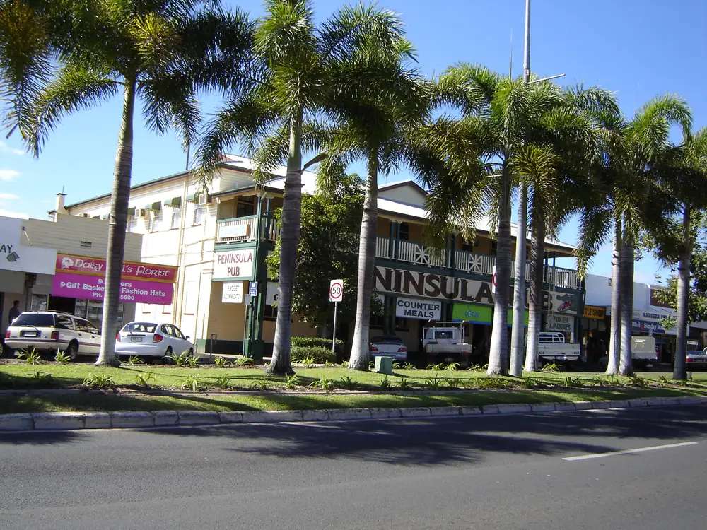
The Peninsula Hotel in MareebaPhoto: The original uploader was Danmiles at English Wikipedia. · Public domain 
A view over MareebaPhoto: Danmiles · Attribution 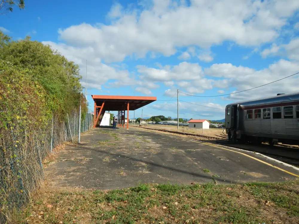
A view over MareebaPhoto: Lobster1 · CC BY-SA 3.0 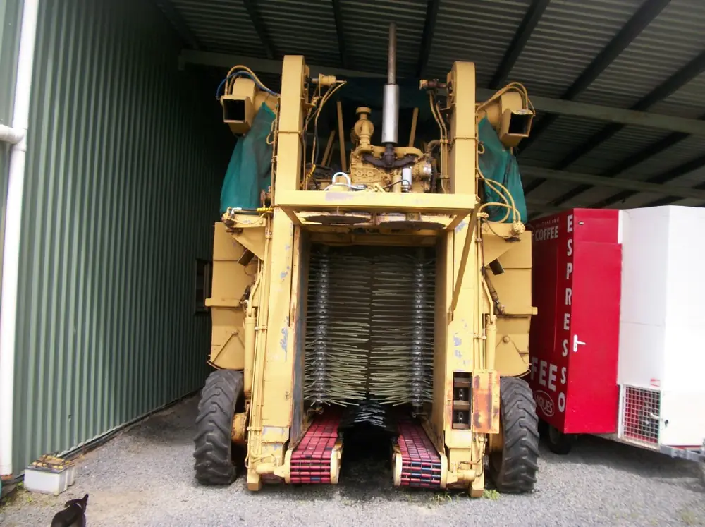
A coffee harvester in MareebaPhoto: Photnart · CC BY-SA 3.0
Mareeba sits on the dry side of the Wet Tropics divide, 63 km west of Cairns on the Kennedy Highway — about an hour according to the Mareeba Heritage Museum and Visitor Information Centre. The same centre describes itself as 35 km north of Atherton. It is the Tablelands town many Cape and Gulf trips pass through: sealed road from Cairns via the Kuranda Range, then the Mulligan Highway north toward Mount Molloy and the inland route to Cooktown. In this directory it belongs with outback north and Gulf because that is how the old town list grouped Cape approaches, not because Mareeba is a mining camp on the Flinders Highway.
The town urban centre had 8,585 people at the 2021 Census. Do not quote the shire LGA (22,858) as if it were the town. Coffee, a former tobacco story, a council-endorsed museum and two very different nature stops — Davies Creek National Park and privately owned Granite Gorge — are the reasons to stay a night instead of driving straight through to the coast or the Cape.
Where it is, and how far
Cairns is the coastal reference: 63 km. Atherton is 35 km south of the museum on the Heritage Centre’s own wording. A driving distance to Brisbane was not published on the official VIC and council pages used for this research, so this guide does not invent one.
From Mareeba you are on the inland Tablelands network:
- Kennedy Highway east toward Kuranda and Cairns, west and south toward other Tablelands towns.
- Mulligan Highway north toward Mount Molloy and the sealed inland Cooktown route. A Brisbane kilometre figure was not published on the Mareeba VIC or council pages used for this guide.
The Cape York 4WD guide starts in earnest further north; Mareeba is where many people buy groceries and sleep in a motel before the Peninsula Developmental Road becomes the problem. The Savannah Way is a Gulf story to the west; Undara Volcanic National Park sits on that inland volcanic plateau if you are heading toward the Gulf rather than the Cape.
Facts at a glance
Population. ABS 2021 Census, Urban Centres and Localities UCL314016: 8,585 people; median age 40; 48.8% male / 51.2% female. Do not use LGA34880 (22,858) for the town. SAL31763 is 11,825 (larger locality). ABS QuickStats for Mareeba UCL.
Climate. BOM Mareeba Airport, 031210, commenced 2000. Location 17.07°S, 145.43°E, elevation 472 m. Annual mean rainfall 894.9 mm (25 years, 2000–2026). Hottest month by mean maximum: December 32.1 °C. Coolest month by mean maximum: July 25.2 °C. July mean rainfall 8.8 mm on the all-years table — a marked dry winter. BOM Mareeba Airport and the full table. See Mareeba weather.
Visitor centre. Mareeba Heritage Museum and Visitor Information Centre, 345 Byrnes Street, Centenary Park. Monday–Friday 9am–4pm, weekends 8am–3pm. (07) 4092 5674. Museum admission listed $5 adult (16+), children free. Mareeba Shire Council repeats the Heritage Centre as the accredited VIC.
Traditional Owners
Use Muluridji for Mareeba town and the country west and north of town. The Wet Tropics Plan records Muluridji native title west and north of Mareeba (Muluridji Tribal Aboriginal Corporation RNTBC). The Mareeba Multicultural Festival, council-supported, states it is held on the land of the Muluridji people. Mareeba Shire Council’s reconciliation project included Muluridji Tribal Aboriginal Corporation RNTBC.
Davies Creek National Park, east of Mareeba toward Kuranda, is Buluwai Country on the Queensland Parks Davies–Dinden–Bare Hill page. Do not paste Muluridji onto that park, and do not paste Buluwai onto the main street.
Shire-wide, other groups hold determinations (Bar-Barrum, Djabugay, Djungan, Western Yalanji and others — North Queensland Land Council). Those names belong to those determinations. This town page uses Muluridji for Mareeba.
History
The Heritage Museum, which council endorses as the visitor centre, tells a sequence from First Australians through explorers, mining, timber, communications and the former tobacco industry. That is the right order to walk the galleries: do not skip the first rooms to get to the agricultural machines.
Queensland Parks’ Davies Creek culture page records that John Atherton established a cattle station near present-day Mareeba in 1876, and that gold was worked in Davies Creek in the early 1900s. The park is still woodland and streams; the gold story is interpretation, not a fossicking free-for-all. Check current fossicking rules before you swing a pick — this facts file does not issue a permit.
The visitor centre states the region produces 70% of Australia’s coffee crop. Tobacco declined; coffee and mixed tropical agriculture are what staff will talk about when you ask what the district grows now. Ask them for tasting venues. This guide does not invent farm names.
Things to do
Heritage Museum and VIC, 345 Byrnes Street. Start here. Pay the listed museum admission if you are 16 or over. Use the desk for Davies Creek camping, Granite Gorge tickets, coffee-tasting suggestions and Mulligan Highway conditions. Full detail: things to do in Mareeba.
Davies Creek National Park (Davies–Dinden–Bare Hill complex): streams, woodland, camping. Queensland Parks park page. Buluwai Country.
Granite Gorge Nature Park — privately owned, named on the official VIC page, ticketed rock-wallaby feeding. It is not a QPWS park. Confirm hours and tickets at the Heritage Centre.
Coffee. Seventy per cent of the national crop is a VIC statistic, not a café review. Staff recommend venues. We do not publish an unofficial plantation trail.
The Mareeba Multicultural Festival is a council-supported event on Muluridji land. Dates move; use the festival site and the VIC rather than a copied weekend from a previous year.
Where to stay
The VIC advises on accommodation. Categories present in the facts file: motel, caravan park, cabin and camping, including Davies Creek National Park camping. Named motels: confirm at the Heritage Centre. This hub does not run a hotel round-up.
- Types and how to choose: Mareeba accommodation
- Parks and park camping: Mareeba caravan parks
- Operator listings on this site: feature your business
Book ahead in the dry season (winter rainfall at the airport is very low) when Cape-bound traffic and Tablelands weekenders overlap. Summer is the wetter, hotter end of the year; December’s mean maximum is 32.1 °C, and the range road from Cairns can close or slow in storms — QLDTraffic.
Caravan and camping
Town parks (ask the VIC for current names) plus Davies Creek NP camping cover most vans that are not trying to take a caravan up a narrow park track unsuited to it. Granite Gorge is a ticketed private park, not a QPWS campground. Read Mareeba caravan parks and caravanning in the outback. If you are continuing to Cape York, Mareeba is a last easy supermarket stop compared with what comes later on the Peninsula Developmental Road.
Fuel and services
Mareeba is an 8,585-person service town: fuel, groceries, workshops. This guide does not list brands or Sunday hours. For council service questions use Mareeba Shire Council and the Heritage Centre. Fill here before the Mulligan Highway if you are heading toward Cooktown. Mobile coverage is good in town; it is not a promise on every park track east toward Davies Creek.
Crocodile country begins in earnest on Cape York and Gulf waters, not in the main street. If you are going north, read crocodile safety before you treat every creek like a Tablelands swimming hole.
Road access
Kennedy Highway from Cairns via the Kuranda Range is sealed and steep enough that caravans should use the official range advice and QLDTraffic, not a memory of “it was fine in July”. Mulligan Highway north is the inland sealed route toward Mount Molloy and Cooktown. Check QLDTraffic and 13 19 40, especially in the wet season and after cyclone warnings.
The range is a different driving problem from the Warrego at Dalby: more rain, more tourist traffic, more mist. Dry-season mornings are the comfortable window at the airport (July mean maximum still 25.2 °C — warm by southern inland standards).
Nearby parks and towns
Parks:
- Davies Creek / Dinden / Bare Hill — QPWS; camping; Buluwai Country
- Granite Gorge Nature Park — private; VIC-listed; not QPWS
- Further inland on a Gulf/Cape loop: Undara Volcanic National Park, and much further north Rinyirru (Lakefield) if you are already committed to a Cape parks itinerary
On this site, for the next stretch of road:
- Cape York by 4WD
- Savannah Way
- Outback north hub — Mount Isa, Cloncurry, Gulf towns; Cooktown, Weipa and Charters Towers guides are still landing in this wave
Atherton, Kuranda and Cairns do not have town hubs in this outback directory. Use the Heritage Centre for those coastal and Tablelands questions.
When to go, and how long
Dry winter mornings (July rainfall 8.8 mm mean) are why so many vans sit in Mareeba in July. Days are still warm (mean maximum 25.2 °C). December heat (32.1 °C mean max) plus wet-season rain on the range is a different trip: possible, but build slack into the Cairns drive and do not count on every park camp being pleasant.
One night is enough for the museum and a coffee tasting the VIC recommends. Two nights if you want Davies Creek or Granite Gorge without rushing. Three nights if you are using Mareeba as a Tablelands base before the Mulligan Highway. See Mareeba weather and best time to visit.
Operators: feature your business. Listings on this hub stay empty until a checked business asks to appear.
Plan this trip
Tell us the dates, who you are travelling with and where you need help. We reply with planning notes for Mareeba — we are not a booking agent.
Events and road-conditions newsletter
Occasional notes on outback festivals, race days and official road-condition sources — not a daily blast. We use these details only to send the newsletter.
Queensland · Tablelands
Mareeba accommodation
Where to stay in Mareeba: motels, caravan parks, cabins and Davies Creek National Park camping. Confirm names at the Heritage Museum visitor centre — no fake motel round-up.
Read · 3 min
Queensland · Tablelands
Mareeba caravan parks
Caravan parks and camping in Mareeba: town park categories plus Davies Creek National Park camping. Confirm current park names at the Heritage Museum — no invented holiday-park list.
Read · 3 min
Queensland · Tablelands
Mareeba weather
Mareeba climate from Bureau of Meteorology Mareeba Airport (031210): December mean maximum 32.1 °C, July 25.2 °C, annual rainfall 894.9 mm, July rainfall 8.8 mm. Full table on BOM.
Read · 3 min
Queensland · Tablelands
Things to do in Mareeba
Things to do in Mareeba: Heritage Museum and visitor centre, Davies Creek National Park, Granite Gorge Nature Park, coffee tastings recommended by the VIC, and the multicultural festival.
Read · 4 min
Frequently asked questions
How far is Mareeba from Cairns?
63 km, about an hour, according to the Mareeba Heritage Museum and Visitor Information Centre. The museum also describes itself as 35 km north of Atherton. A Brisbane kilometre figure was not published on those official pages.
What is the population of Mareeba town, not the shire?
8,585 people at the 2021 Census for the Mareeba urban centre (UCL314016). The Mareeba Shire LGA figure is much larger (22,858) and must not be used as the town population.
Is Mareeba as wet as Cairns?
No. Mareeba Airport’s annual mean rainfall is 894.9 mm, with a marked dry winter (July mean 8.8 mm on the BOM all-years table). That is a Tablelands dry-side climate, not a Cairns wet-tropics mean.
Where is the Mareeba visitor centre?
Mareeba Heritage Museum and Visitor Information Centre, 345 Byrnes Street, Centenary Park. Monday–Friday 9am–4pm; weekends 8am–3pm. Phone (07) 4092 5674. Mareeba Shire Council repeats it as the accredited VIC.
Whose Country is Mareeba on?
Use Muluridji for the town / west and north (Wet Tropics Plan, festival acknowledgement, council reconciliation project). Davies Creek National Park, east toward Kuranda, is Buluwai Country on the Queensland Parks page.
Can I see coffee near Mareeba?
The visitor centre states the region grows 70 per cent of Australia’s coffee crop and staff recommend tasting venues. This guide does not invent plantation names — ask at 345 Byrnes Street.
Sources and further reading
Facts on this page were checked against these primary and official sources. Conditions change — confirm before you travel or buy.
- Mareeba 2021 Census QuickStats (UCL314016) — Australian Bureau of Statistics
- Climate statistics for Mareeba Airport (031210) — Bureau of Meteorology
- Mareeba Heritage Museum and Visitor Information Centre — Mareeba Heritage Museum
- Mareeba Shire Council — visitor information centres — Mareeba Shire Council
- QLDTraffic — Queensland Government