At a glance
Sourced facts only. Distances and services change — confirm before you travel.
- Population
- 371 people in the urban centre (UCL722010, 2021 Census); 396 in the wider locality (SAL70024)
- Local government
- Coomalie Community Government Council
- Traditional Owners
- Not named for the Batchelor townsite on the sourced Tourism NT and Coomalie pagesLitchfield National Park is important to the Koongurrukun, Mak Mak Marranunggu, Werat and Warray Aboriginal peoples on NT Government park wording.
- Nearest regional city
- Darwin, 98 km north (Tourism NT Batchelor). Darwin has no town page in this rebuild.
- Capital
- 98 km south of Darwin (Tourism NT Batchelor destination page)
- Nearest fuel
- Tourism NT’s Litchfield camping guide names Batchelor as a place to get supplies including fuel. Confirm on arrival; this hub does not invent a bowser brand.
- Nearest hospital or clinic
- NT Health remote-health table names Batchelor clinic, 08 8976 0011, 9 am–5 pm, emergencies 24/7
- Mobile coverage
- Check Telstra and Optus coverage maps before travel; do not assume a park-track signal.
- Best time to visit
- May–September (Dry; BOM Batchelor Airport July mean rain 0.8 mm; Litchfield swimming closures in the Wet on Parks NT)
Climate
Monthly means from the Bureau of Meteorology station Batchelor Airport (014272). This is not a forecast. Open station. Temperature 30 years (1992–2026); rainfall 27 years (1994–2026). Latest available data 14 November 2026. Adelaide River’s town hub uses this same table because BOM does not publish an Adelaide River town averages product.
| Month | Mean max (°C) | Mean min (°C) | Rainfall (mm) |
|---|---|---|---|
| Jan | 32.7 | 24.0 | 336.9 |
| Feb | 32.5 | 23.9 | 329.8 |
| Mar | 33.1 | 23.6 | 226.7 |
| Apr | 33.7 | 21.9 | 87.5 |
| May | 32.8 | 19.2 | 22.1 |
| Jun | 31.7 | 17.2 | 0.8 |
| Jul | 32.0 | 16.5 | 0.8 |
| Aug | 33.6 | 17.2 | 1.8 |
| Sep | 36.1 | 20.7 | 11.0 |
| Oct | 36.8 | 23.2 | 66.5 |
| Nov | 35.6 | 24.0 | 144.1 |
| Dec | 34.0 | 24.2 | 274.0 |
Batchelor in pictures
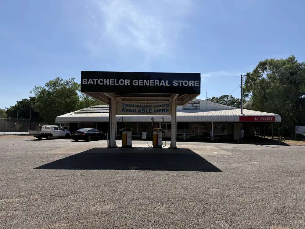
Batchelor General StorePhoto: DaHuzyBru · CC BY-SA 4.0 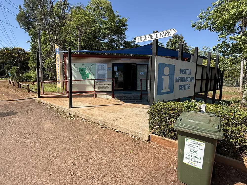
Visitor Information Centre in BatchelorPhoto: DaHuzyBru · CC BY-SA 4.0 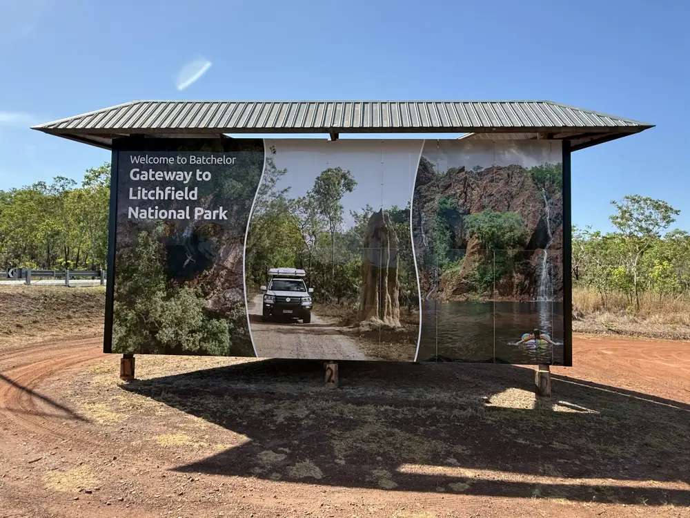
Gateway sign at Stuart Highway / Batchelor RoadPhoto: DaHuzyBru · CC BY-SA 4.0 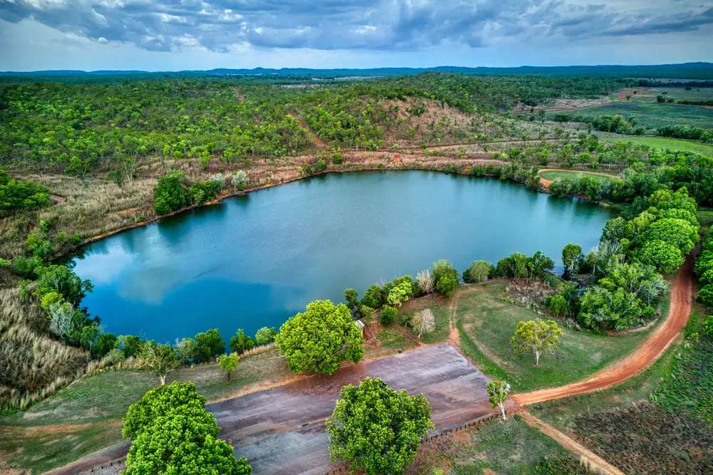
Rum Jungle Lake at BatchelorPhoto: Hagai Agmon-Snir حچاي اچمون-سنير חגי אגמון-שניר · CC BY-SA 4.0
This page is the town, not Darwin and not the waterfall park. Batchelor is a Coomalie Community Government Council town in the Top End, 98 km south of Darwin, just off the Stuart Highway on Tourism NT’s destination page. Tourism became the key industry when Litchfield National Park was declared in 1986. Adelaide River on this site is the next Stuart Highway town; Tourism NT’s Inn listing puts that inn 112 km south of Darwin. Do not flatten Batchelor into Darwin, and do not write a park landscape hub and call it the town.
The 2021 Census Urban Centre (UCL722010) is the town count: 371 people, median age 44, sex split 51.2% male / 48.8% female. 59 families, 297 private dwellings. Aboriginal and Torres Strait Islander people 113 (30.5%). The wider SAL70024 locality is 396 people, median age 45, Indigenous 119 (30.1%). Tourism NT still prints a population of around 500. This hub uses UCL for the town.
Where it is, and how far
Batchelor sits just off the public sealed Stuart Highway, on the same corridor as our Adelaide to Darwin guide. South, Adelaide River is the WWII railway town. Further south, Pine Creek is Tourism NT’s gold town 90 km north of Katherine. This hub does not add 98 km to 112 km and call the sum a Batchelor–Adelaide River figure. Darwin is the capital; it has no town page in this rebuild.
Litchfield is the nearby park day — NT Government: about 120 km south-west of Darwin, around 90 minutes, main sites on sealed roads. Tourism NT’s Litchfield camping guide: Florence Falls about 35 minutes from Batchelor; Wangi Falls about 45 minutes; Walker Creek about one hour. Batchelor is a gateway town, not the park visitor centre.
| Place | Distance / time (sourced) |
|---|---|
| Darwin | 98 km north (Tourism NT Batchelor) |
| Litchfield National Park (from Darwin) | about 120 km south-west, around 90 minutes (NT Government) |
| Florence Falls | about 35 minutes from Batchelor (Tourism NT Litchfield camping) |
| Wangi Falls | about 45 minutes from Batchelor (Tourism NT Litchfield camping) |
| Walker Creek | about one hour from Batchelor (Tourism NT Litchfield camping) |
Facts at a glance
Population. ABS 2021 Census UCL722010: 371 people. Median age 44. Indigenous 113 (30.5%). Wider SAL70024: 396. Use UCL QuickStats or SAL QuickStats.
Climate. BATCHELOR AIRPORT, 014272, 13.05°S, 131.03°E, elevation 104 m, commenced 1992, status open, latest available data 14 November 2026. Mean maximum (30 years, 1992–2026): October 36.8 °C (hottest month by mean max), February 32.5 °C, July 32.0 °C, annual 33.7 °C. Mean rainfall (27 years, 1994–2026): annual 1,545.1 mm. Mean days of rain ≥ 1 mm: 87.6. See Batchelor weather.
Visitor information. Tourism NT’s Batchelor destination page is the official town listing. Coomalie Community Government Council: 22 Cameron Road, 08 8976 0058. Parks NT for Litchfield. NT Health Batchelor clinic: 08 8976 0011. Roads: NT Road Report.
Traditional Owners
This hub does not invent a Batchelor townsite nation label that Tourism NT’s destination page and Coomalie’s public home page do not print for the town. Nearby Litchfield National Park carries official Parks NT wording you should read before you leave the highway: an ancient landscape important to the Koongurrukun, Mak Mak Marranunggu, Werat and Warray Aboriginal peoples. That is park wording, not a town-main-street label. Stay on public roads. See visiting Country respectfully.
History
Tourism NT: the town was named after South Australian Labor politician Egerton Lee Batchelor (1865–1911), who became Minister for the Northern Territory in 1911. Batchelor grew slowly, with brief spurts of mining and agricultural activity, until World War II, when it was turned into an Allied Air Force base. An extension to the 1930s airstrip occurred in 1941 to accommodate US B-17 Flying Fortress aircraft after the bombing of Pearl Harbour.
Tourism NT’s museum listing: Batchelor became a strategic base for the Pacific region in WWII; Rum Jungle Uranium Mine was established in 1952. The destination page: prospector Jack White discovered uranium at nearby Rum Jungle; mining began in 1951; the mine closed in 1963; the treatment plant closed in 1971. Tourism NT also records the Rum Jungle name legend: in 1871 a bullock-wagon loaded with rum became bogged near jungle in the East Finniss River area. This hub does not invent a yield figure.
Batchelor Institute is named on Tourism NT as a dual-sector tertiary provider catering specifically to Aboriginal and Torres Strait Islander students. The Coomalie Cultural Centre conducts artist residencies, exhibitions and cultural projects and operates a retail outlet, with a bush tucker garden and a mural.
Things to do
Tourism NT names these in and around Batchelor:
- Batchelor Museum — Aboriginal culture, 1911 agricultural plans, WWII, Rum Jungle; expect an hour or two on that listing
- Coomalie Cultural Centre — residencies, exhibitions, retail
- Batchelor Institute — named education campus, not a public theme park
- Batchelor Butterfly Farm and Petting Zoo — named on Tourism NT’s Litchfield scenic-route and destination-guide articles
- Litchfield National Park — Florence Falls, Wangi Falls, Buley Rockhole, magnetic termite mounds, Lost City; NT Parks Visitor Pass for interstate and overseas visitors; saltwater crocodiles; Wet-season swimming closures
Nearby, not in-town: Adelaide River war cemetery (the town, not the Arnhem Highway crocodile-cruise river); Kakadu via a different highway hinge; Nitmiluk at Katherine.
See things to do in Batchelor.
Where to stay
Tourism NT’s Litchfield camping guide names Batchelor Holiday Park in Batchelor (powered and unpowered sites) and Litchfield Safari Camp on the edge of the park (powered and unpowered, glamping tents named on that page). Park campgrounds at Florence Falls and Wangi Falls are park camps with park fees and the NT Parks Visitor Pass for interstate and overseas visitors. This hub does not reprint dollar figures that date. If the town is full, Adelaide River is the next Stuart town and Darwin is 98 km north.
- How to choose: Batchelor accommodation
- Camping detail: Batchelor caravan parks
- Operator enquiries: feature your business
Caravan and camping
The Stuart Highway and Litchfield’s main sites are sealed on Parks NT. Tourism NT names Batchelor Holiday Park and Litchfield Safari Camp. Park camps need the NT Parks Visitor Pass for interstate and overseas visitors; camping fees extra; book as Parks NT requires. Read Batchelor caravan parks and outback camping. Wet-season swimming and some camp closures are a Parks NT brief.
Fuel and services
A town of 371 people will not match Darwin for a hospital. Tourism NT’s Litchfield camping guide names Batchelor as a place to get supplies including fuel. This guide does not list bowser brands. NT Health’s remote-health table names the Batchelor clinic, 08 8976 0011, 9 am–5 pm, emergencies 24/7. Coomalie Council sits at 22 Cameron Road. Fill in Darwin if you are unsure. For current questions use Tourism NT, Coomalie 08 8976 0058, and the NT Road Report.
Road access
Stuart Highway sealed, with Batchelor just off that spine. Litchfield main sites on sealed roads on Parks NT; 4WD tracks to the Lost City and other named sites are park tracks, not town streets. NT Road Report is the authority, especially in the Wet when 1,545.1 mm of annual mean rain arrives in a few months (January 336.9 mm). Stay on gazetted roads.
Our Stuart Highway and Adelaide to Darwin guides are the road-trip pages.
Nearby parks and towns
Parks:
- Litchfield National Park — gateway park day; NT Parks Pass; crocodile and Wet-season notes
- Kakadu National Park — Parks Australia pass; not a Batchelor street
- Nitmiluk National Park — via Katherine
Towns on this site:
- Adelaide River — Stuart Highway WWII town (not the cruise river)
- Pine Creek — gold town 90 km north of Katherine
- Katherine — Nitmiluk
Darwin is the capital. It has no town page here.
When to go, and how long
Batchelor Airport’s October mean maximum of 36.8 °C is the build-up. January’s 32.7 °C sits under 336.9 mm of January mean rain. July’s 32.0 °C mean maximum and 16.5 °C mean minimum, with 0.8 mm July mean rain, is the Dry on the open-station table. Litchfield swimming sites close during and after the Wet on Parks NT. Crocodile risk is a Parks NT brief in every month.
Two hours covers the museum and cultural centre if Tourism NT’s named places are open. A night at a named Batchelor park covers a Litchfield day if the Road Report and park status agree. Florence, Wangi and the Lost City are park days, not a main-street add-on.
Operators who want a checked listing: feature your business. The listings slot on this hub stays empty until then.
Plan this trip
Tell us the dates, who you are travelling with and where you need help. We reply with planning notes for Batchelor — we are not a booking agent.
Events and road-conditions newsletter
Occasional notes on outback festivals, race days and official road-condition sources — not a daily blast. We use these details only to send the newsletter.
Northern Territory · Top End
Batchelor accommodation
Where to stay in Batchelor: Tourism NT names Batchelor Holiday Park in town and Litchfield Safari Camp on the park edge. Florence and Wangi are Parks NT camps. Confirm before you unhitch.
Read · 3 min
Northern Territory · Top End
Batchelor caravan parks
Camping in Batchelor: Tourism NT names Batchelor Holiday Park and Litchfield Safari Camp. Florence Falls and Wangi Falls are Parks NT camps with a visitor pass. Confirm before you unhitch.
Read · 3 min
Northern Territory · Top End
Batchelor weather
Batchelor climate from BOM Batchelor Airport (014272): October mean max 36.8 °C, July 32.0 °C, annual rainfall 1,545.1 mm. Open station. NT Road Report and Litchfield Wet closures.
Read · 3 min
Northern Territory · Top End
Things to do in Batchelor
Things to do in Batchelor: Batchelor Museum, Coomalie Cultural Centre, Rum Jungle story, Litchfield National Park as a nearby park day. This is the town, not Darwin.
Read · 4 min
Frequently asked questions
Is Batchelor a Darwin suburb?
No. This hub is the Coomalie Community Government Council town 98 km south of Darwin, just off the Stuart Highway on Tourism NT’s Batchelor destination page. Darwin has no town page in this rebuild. Litchfield National Park is the nearby park, not the town.
What is Batchelor’s population?
Use the 2021 Urban Centre for the town (UCL722010): 371 people, median age 44, Aboriginal and Torres Strait Islander people 113 (30.5%). The wider suburbs-and-localities geography (SAL70024) is 396 people. Tourism NT still prints a population of around 500 — use the Census.
How far is Batchelor from Litchfield?
Tourism NT’s Litchfield camping guide puts Florence Falls about 35 minutes from Batchelor, Wangi Falls about 45 minutes, and Walker Creek about one hour. NT Government’s Litchfield park page puts the park about 120 km south-west of Darwin, around 90 minutes, with main sites on sealed roads. This hub does not invent a town-to-Florence-Falls kilometre Parks NT does not print for the township.
What is the weather like in Batchelor?
BOM Batchelor Airport (014272): October mean maximum 36.8 °C (hottest month by mean max), February 32.5 °C, July 32.0 °C, annual rainfall 1,545.1 mm (27 years, 1994–2026). Temperature means use 30 years (1992–2026). Status open; latest available data 14 November 2026.
Do I need an NT Parks Pass in Batchelor itself?
The township is not a Parks NT park. Litchfield National Park, if you add it as a nearby park day, requires an NT Parks Visitor Pass for interstate and overseas visitors. Check park status, crocodile signs and Wet-season swimming closures.
Can I camp at Batchelor?
Yes, as named types. Tourism NT’s Litchfield camping guide names Batchelor Holiday Park (powered and unpowered sites) in Batchelor, and Litchfield Safari Camp on the edge of the park. Park campgrounds at Florence Falls and Wangi Falls are Parks NT products with camping fees extra. Confirm before you unhitch.
Sources and further reading
Facts on this page were checked against these primary and official sources. Conditions change — confirm before you travel or buy.
- Batchelor (L) 2021 Census QuickStats (UCL722010) — Australian Bureau of Statistics
- Batchelor 2021 Census QuickStats (SAL70024) — Australian Bureau of Statistics
- Climate statistics for Batchelor Airport (014272) — Bureau of Meteorology
- Batchelor — Tourism NT
- Batchelor Museum — Tourism NT
- Camping in Litchfield National Park — Tourism NT
- Litchfield National Park — Northern Territory Government
- Remote health services — Northern Territory Government
- Coomalie Community Government Council — Coomalie Community Government Council
- NT Parks Visitor Pass — Northern Territory Government
- NT Road Report — Northern Territory Government