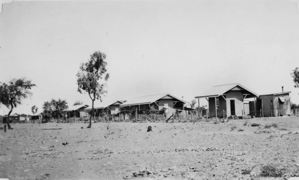
Kajabbi sits on the Leichhardt River 100 km north-west of Cloncurry. Bureau of Meteorology does not publish a monthly climate-averages table for a Kajabbi township station on the product used here. Kajabbi Kalkadoon Hotel 029026 is a closed rainfall-only station (closed 2008) on BOM’s Queensland list. This page therefore uses Cloncurry Airport, 029141, as a labelled neighbour comparison. Do not treat it as a Kajabbi street mean.
Cloncurry Airport (029141) commenced 1978, elevation 186 m, status Open. Means on the climate-averages table:
| Month | Mean max °C | Mean min °C | Mean rain mm |
|---|---|---|---|
| January | 37.3 | 25.1 | 149.7 |
| February | 36.2 | 24.3 | 109.1 |
| March | 35.7 | 23.0 | 79.1 |
| April | 33.6 | 20.1 | 16.4 |
| May | 29.3 | 15.7 | 7.1 |
| June | 26.3 | 11.7 | 7.5 |
| July | 26.3 | 10.8 | 6.1 |
| August | 28.9 | 12.3 | 3.7 |
| September | 33.1 | 16.6 | 6.4 |
| October | 36.6 | 20.7 | 20.2 |
| November | 37.9 | 23.3 | 37.8 |
| December | 38.7 | 25.0 | 84.4 |
| Annual | 33.3 | 19.0 | 522.1 |
Years of record on that table: temperature 33, rainfall 27 (1978–2026). Full columns: BOM Cloncurry Airport.
December’s 38.7 °C mean maximum is extreme for a relic walk at midday. January’s 149.7 mm mean rainfall is why the Cloncurry north-west run closes. July’s 26.3 °C mean maximum is the more comfortable season on paper; July’s 10.8 °C mean minimum is why a van night needs a layer. August is the driest month on this labelled table (3.7 mm).
The Leichhardt River the tourism pages name for wildlife floods. Freshwater crocodiles are named on Experience Cloncurry. Stay off closed banks. Check QLDTraffic and 13 19 40. Do not drive around closed signs to keep a hotel meal.
There is no Kajabbi visitor centre. Cloncurry Unearthed, 07 4742 1361, can confirm what is open on a wet day.
Nearby climate context on this site includes Cloncurry and Quamby. Those pages are neighbours, not substitutes for the labelled Cloncurry Airport table above.
Our outback weather by month guide explains how to read those columns for inland Australia. Kajabbi is north-west Cloncurry Shire, not the Wet Tropics, but January rain still closes roads.
How to use the table on the road
Why a neighbour station. BOM does not publish a Kajabbi climate-averages table. Cloncurry Airport is the labelled shire comparison with maxima, minima and rain. Kajabbi Kalkadoon Hotel 029026 is a closed rainfall-only station. If you need last week’s observations, use BOM forecasts, not this averages page.
Summer. A December Cloncurry Airport mean maximum of 38.7 °C is extreme working weather for smelter-stack photographs. January’s 149.7 mm mean is the wettest month on that table. Check QLDTraffic (13 19 40) rather than assuming the 100 km from Cloncurry is always easy. Closed means closed.
Winter. A July Cloncurry Airport mean maximum of 26.3 °C is still warm. A July mean minimum of 10.8 °C is why a van night needs a layer. August’s 3.7 mm is the driest mean month on that labelled table.
Rainfall. 522.1 mm a year at Cloncurry Airport is a north-west Queensland figure with a long dry. Averages are not a week-ahead prediction.
How closed roads behave. The Cloncurry north-west run is remote shire country. After rain, QLDTraffic may close sections even when Kajabbi’s hotel verandah looks dry. Do not drive around a closed sign to keep a pub meal. If you are towing, wet dirt after a January storm is as much a problem as the highway. See Kajabbi caravan parks and wet season and road closures.
When to visit Kajabbi
If you are choosing months for comfort:
- May to September — the usual compromise between December heat and January rain. Confirm the hotel is open at Unearthed. Book accommodation in Cloncurry if Kajabbi has no room.
- Winter days — good for relics and the river photograph; nights still need a layer.
- Summer — possible only if you have air-conditioning, extra water and a habit of checking QLDTraffic. Do not tent on the Leichhardt on a 38 °C mean-max month unless you know inland camping.
People drive to Cloncurry year-round. Climate here is a packing and closed-road problem. See best time to visit the outback.
Combining weather with a trip plan
If you are continuing to Quamby or Cloncurry, take the labelled Cloncurry Airport table with you as the regional picture and still check QLDTraffic for each day’s road.
Related
Plan this trip
Tell us the dates, who you are travelling with and where you need help. We reply with planning notes for Kajabbi — we are not a booking agent.
Frequently asked questions
What is the weather like in Kajabbi?
BOM does not publish a Kajabbi township climate-averages table on the product used here. Cloncurry Airport (029141) is the labelled shire comparison: December mean maximum 38.7 °C, July 26.3 °C, annual rainfall 522.1 mm.
How hot does it get in summer?
Cloncurry Airport’s December mean maximum is 38.7 °C and January 37.3 °C, with January mean minimum 25.1 °C. Those are labelled neighbour means, not Kajabbi Hotel figures.
How cold are winter nights?
Cloncurry Airport’s July mean minimum is 10.8 °C and July mean maximum 26.3 °C. A van night in July still needs a layer.
When is the wettest month?
On the Cloncurry Airport table, January mean rainfall is 149.7 mm and the annual total 522.1 mm (27 years of rainfall record, 1978–2026). Wet-season roads close; check QLDTraffic.
Sources and further reading
Facts on this page were checked against these primary and official sources. Conditions change — confirm before you travel or buy.
- Climate statistics for Cloncurry Airport (029141) — Bureau of Meteorology
- Experience Cloncurry — Kajabbi — Cloncurry Shire Council (Experience Cloncurry)
- Outback Queensland — Kajabbi — Outback Queensland Tourism Association
- QLDTraffic — Queensland Government