At a glance
Sourced facts only. Distances and services change — confirm before you travel.
- Local government
- Murweh Shire
- Traditional Owners
- Murweh Shire Council acknowledges the Bidjara people as the Traditional Custodians of the land within the shire, which includes Charleville, Augathella, Morven and Cooladdi.
- Nearest regional city
- On the Warrego Highway between Mitchell and Charleville (this hub). Use kilometres printed on the sourced Murweh / Outback Queensland pages — do not invent a Brisbane figure.
- Mobile coverage
- Check Telstra and Optus coverage maps before travel; do not assume a signal.
- Best time to visit
- May–September on Charleville Aero cooler mean maxima
Climate
Monthly means from the Bureau of Meteorology station Charleville Aero (044021). This is not a forecast. Open. Labelled Murweh neighbour table. Commenced 1942. Elevation 302 m.
| Month | Mean max (°C) | Mean min (°C) | Rainfall (mm) |
|---|---|---|---|
| Jan | 35.3 | 22.0 | 73.7 |
| Feb | 34.1 | 21.4 | 66.7 |
| Mar | 32.2 | 19.0 | 62.2 |
| Apr | 28.3 | 13.9 | 28.5 |
| May | 23.4 | 9.0 | 29.4 |
| Jun | 20.0 | 5.7 | 24.1 |
| Jul | 19.8 | 4.4 | 24.0 |
| Aug | 22.2 | 6.0 | 19.4 |
| Sep | 26.4 | 10.1 | 23.7 |
| Oct | 30.1 | 14.6 | 36.6 |
| Nov | 32.9 | 18.1 | 46.5 |
| Dec | 34.9 | 20.5 | 55.8 |
Morven in pictures
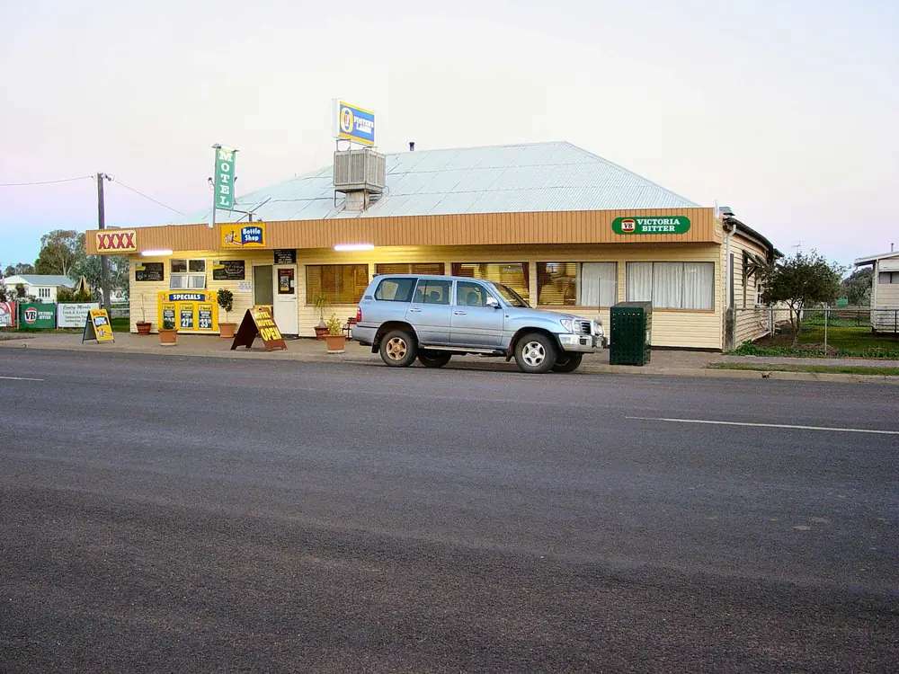
A view of MorvenPhoto: Yewenyi at English Wikipedia · CC BY-SA 3.0 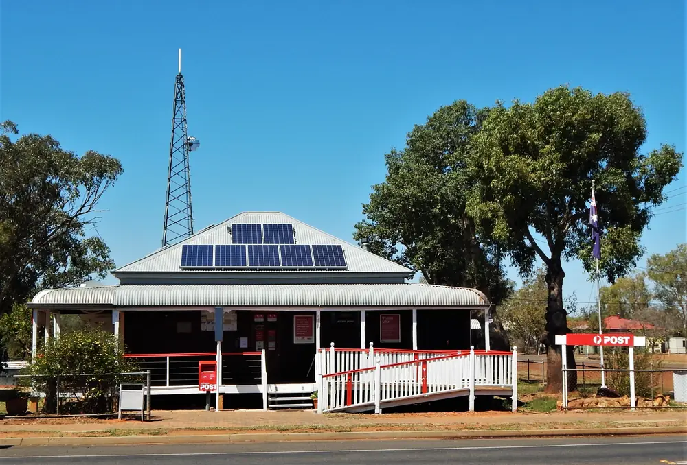
Morven Post OfficePhoto: RegionalQueenslander · CC BY-SA 4.0 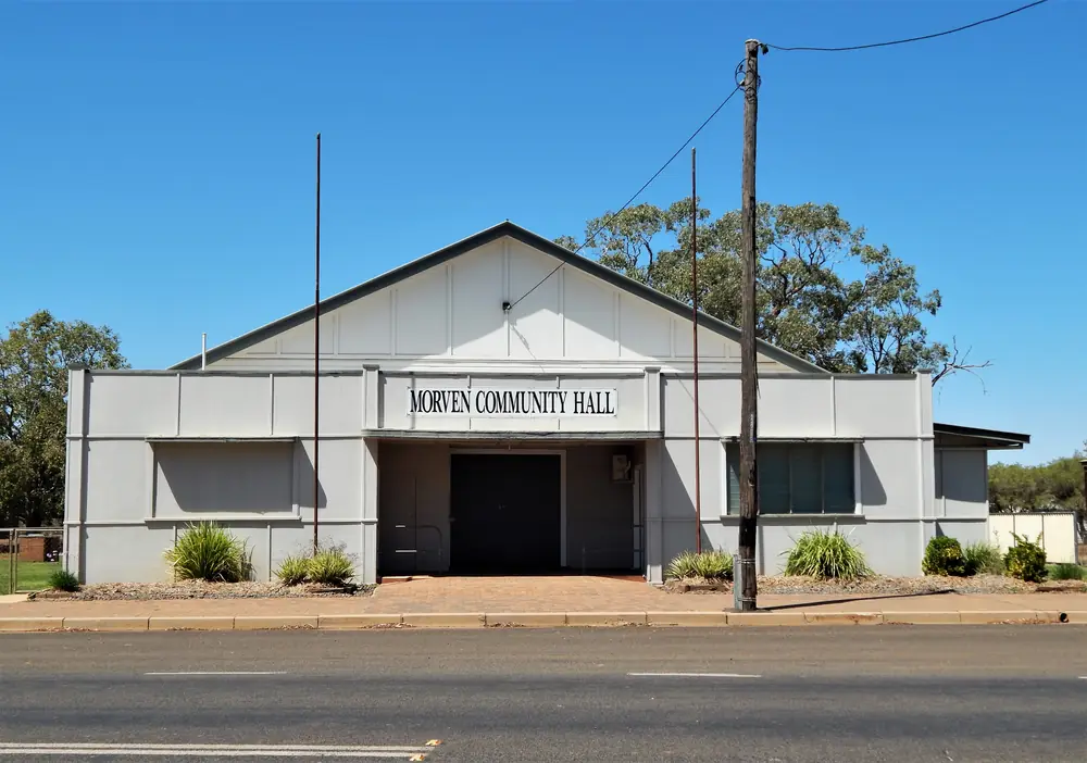
Morven Community HallPhoto: RegionalQueenslander · CC BY-SA 4.0 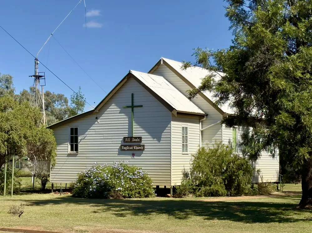
Morven's All Souls' Anglican ChurchPhoto: Kgbo · CC BY-SA 4.0
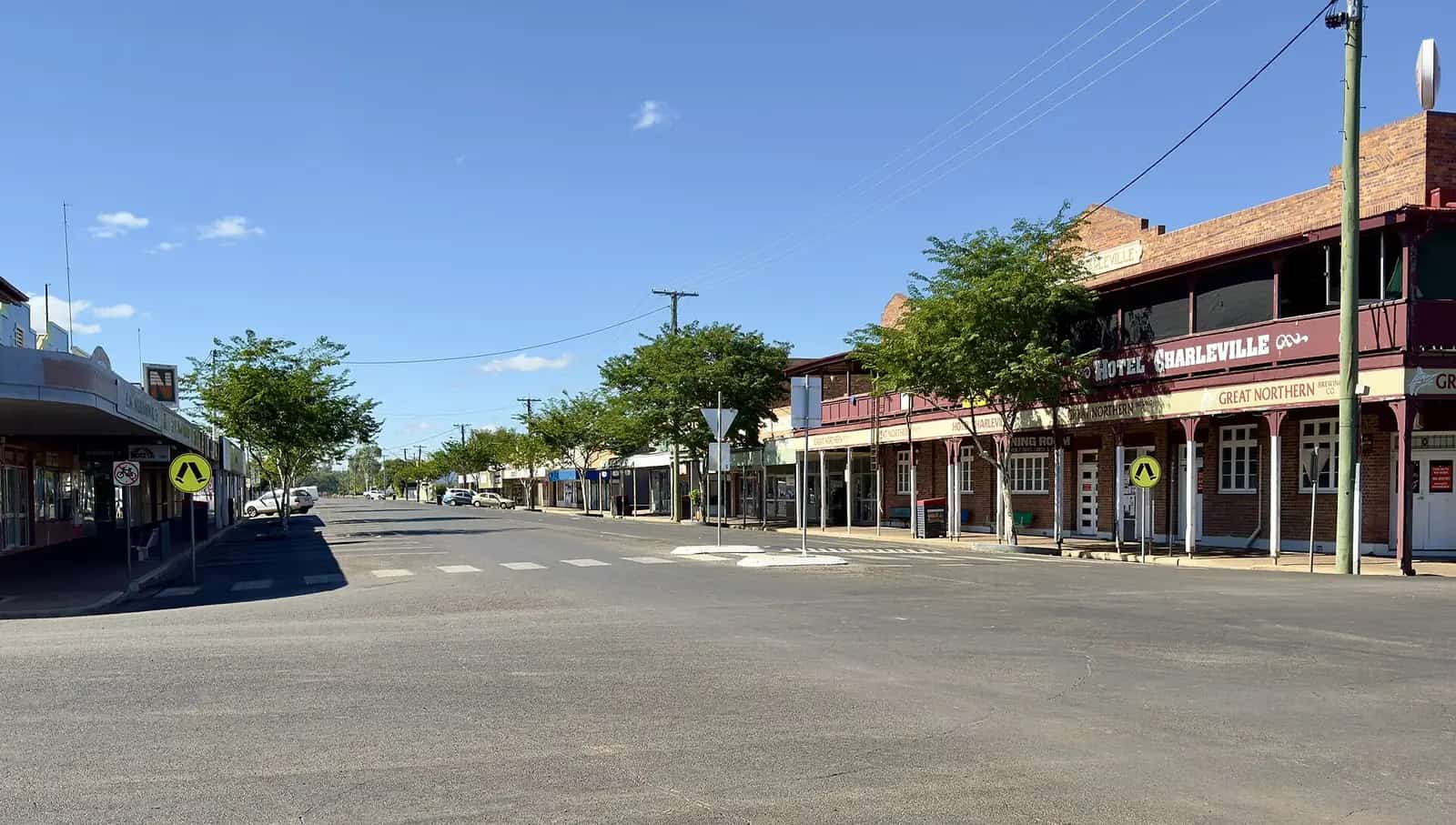
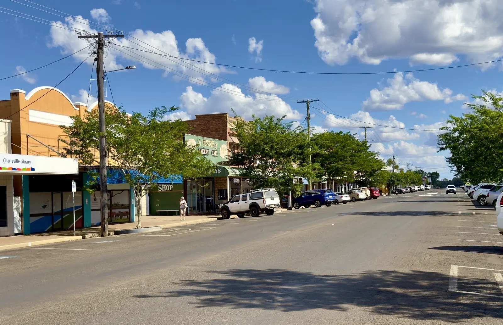
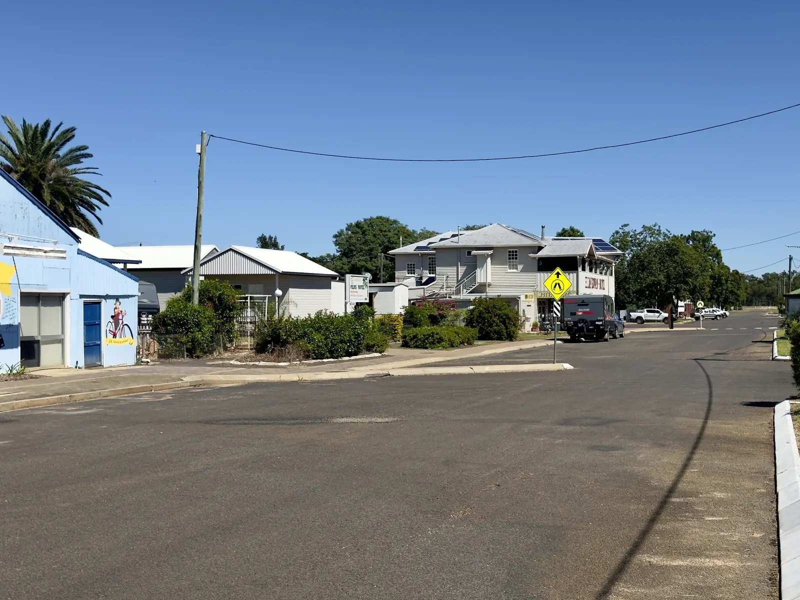
Morven is a Murweh Shire town in Queensland’s south-west, on the Warrego Highway between Mitchell and Charleville. Murweh Shire Council names Charleville, Augathella, Morven and Cooladdi as the shire’s towns. Outback Queensland describes Morven as a welcome break that services a large agricultural area, with camping, accommodation and meals for those who stay. Queensland Parks puts Tregole National Park 11 km south-west of Morven. The Warrego is sealed through town in ordinary weather. You still need QLDTraffic after rain, because an 85 km run to Charleville on Outback Queensland’s stay list is no use if the highway is closed.
The Australian Bureau of Statistics does not publish a 2021 Urban Centre (UCL) named Morven. Use suburbs-and-localities SAL31925: 184 people, median age 50, sex split 51.9% male / 48.1% female. QuickStats also prints 57 families and 113 private dwellings. Travellers stop for the Historical Museum, the kerosene-tin hut, the highway visitor centre and Tregole’s ooline.
Where it is, and how far
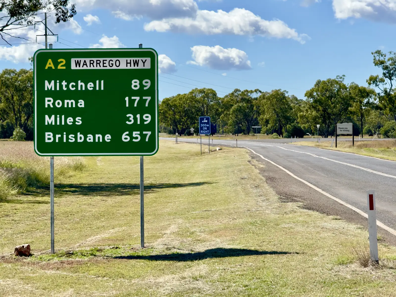
Morven sits on the Warrego Highway (A2), the sealed spine from Roma and Mitchell west to Charleville. Murweh Shire says the shire is served by the Landsborough, Mitchell and Warrego highways, with Charleville Airport, Greyhound and Queensland Rail’s Westlander as the larger-town connections. Morven is the highway town, not the airport town.
Outback Queensland’s Morven stay list prints kilometre figures to named Charleville parks and motels. This hub uses those as the sourced Charleville band rather than inventing a single town-to-town number.
| Place | Distance from Morven (sourced) |
|---|---|
| Tregole National Park | 11 km south-west (Queensland Parks) |
| Charleville (named parks/motels on Outback Queensland’s Morven stay list) | 85–88 km |
| Mitchell | not printed as a single Morven kilometre on the pages used for this hub |
| Augathella | not printed as a single Morven kilometre on those pages |
Augathella is the Matilda Way town north of Charleville, not a Morven suburb. Cunnamulla is south of Charleville on the Mitchell Highway.
Facts at a glance
Population. ABS 2021 Census, Suburbs and Localities SAL31925: 184 people. Median age 50. 57 families, 113 private dwellings. No UCL. Use the Morven SAL QuickStats.
Climate. BOM lists MORVEN POST OFFICE, 044050 on the Queensland rainfall-station directory (about 26.42°S, 147.11°E, from December 1886). BOM does not publish a monthly climate-averages table for that site. The nearest published all-years table is Charleville Aero, 044021, commenced 1942, elevation 302 m, January mean maximum 35.3 °C, July 19.8 °C, July mean minimum 4.4 °C, annual mean rainfall 492.6 mm (81 years, 1942–2026). Full columns: BOM Charleville Aero. Murweh’s About page prints a shire snapshot of summer highs averaging 35.0 °C in January and winter lows around 4.1 °C in July, with average annual rainfall 490.5 mm — treat that as a shire snapshot, not a Morven station table. See Morven weather.
Visitor information. Morven Visitor Information Centre, Warrego Highway. Outback Queensland: history boards and interpretative signage, plus detailed information on Tregole, local attractions, accommodation, camping and neighbouring regions. Phone (07) 4656 8340, info@murweh.qld.gov.au. Experience Charleville: Monday to Friday 9am–5pm (April–September), free Wi-Fi, parking, toilets. Charleville’s own VIC is on King Street, (07) 4656 8359.
Traditional Owners
Murweh Shire Council acknowledges the Bidjara people as the Traditional Custodians of the land within the Murweh Shire and pays respects to Elders past and present. The same About page names Charleville, Augathella, Morven and Cooladdi as the shire’s towns. Outback Queensland’s Morven Historical Museum listing includes a collection of Aboriginal grinding stones, stone axe heads, spears, coolamons and boomerangs — museum objects, not a substitute for a living acknowledgement. Confirm wording with the Morven or Charleville visitor centre.
History
Outback Queensland’s Morven page: in 1845 Major Mitchell compiled the first records for this area, encouraging pioneers to venture here. In 1859 Captain TJ Sadlier and his wife were the first to arrive; Sadleir’s waterhole was their original camp as their homestead was being built. Today the local watering hole, the hotel, carries the namesake. This hub stops where that official paragraph stops. It does not invent a gazettal year the sourced pages did not give.
The Morven Historical Museum on Albert Street holds everyday early outback life, the kerosene-tin hut built as Depression housing in the 1930s, and a Vietnam Nurses Memorial whose first stage — a permanent photographic exhibition of civilian, RAAF and RAANC nurses deployed to Vietnam between 1964 and 1972 — was listed to open 24 April 2024. Confirm current opening with morvenmuseum@bigpond.com. Outback Queensland tags the experience as free, with carpark, picnic area and public toilet.
Murweh’s About page places European settlement from the 1860s, with growth in the late 1800s and early 1900s spurred by the railway and small townships. That is shire history, not a Morven-only timeline.
Things to do
Morven Historical Museum, Albert Street — memorabilia, Aboriginal artefact collection as listed, kerosene-tin hut, Vietnam Nurses photographic exhibition. Outback Queensland: walks, picnic area, public toilet, experience is free.
Morven Visitor Information Centre — history boards and interpretative signage on the Warrego Highway. The place to ask about Tregole conditions.
Tregole National Park, 11 km south-west. Queensland Parks: the park straddles the Brigalow Belt and Mulga Lands; it protects a small, almost pure stand of ooline (Cadellia pentastylis), a dry rainforest tree now uncommon and considered vulnerable. Mulga on the ridges, poplar box on alluvial plains, brigalow on heavy clay, Mitchell grasslands on undulating plains. Facilities: picnic tables, toilets, barbecue, walking. No camping. No campfires. Use a fuel stove or the electric barbecue. Take rubbish with you. Check park alerts and QLDTraffic.
Hotel / Sadleir namesake — Outback Queensland’s town history paragraph. Confirm meals when you arrive.
Charleville’s Cosmos Centre, Bilby Experience and RFDS visitor centre are real, and this site has a Charleville guide, but they sit in the 85–88 km band on the stay list. They are a separate town day.
Where to stay
Official named types:
- Morven Recreational Grounds, Victoria Street — Experience Charleville: hot showers, toilets, dump point, camping-tag envelope; powered and unpowered sites listed with a fee; bookings per night per vehicle, maximum five people to a site. Confirm current fees.
- Gidgee Bush Camp & Farm Stay — named on Outback Queensland’s Morven page and on Experience Charleville (Lot 37 Charleville Road; turn at the post office toward the police station on that listing).
- Hotel meals and accommodation — Outback Queensland says camping sites, accommodation and meals are available without printing extra motel brands on the town page.
Those are official named types, not a ranked inventory. Confirm at (07) 4656 8340.
- How to choose: Morven accommodation
- Camping detail: Morven caravan parks
- Operator enquiries: feature your business
If Morven is full, Charleville is the shire’s largest town in the 85–88 km band on that stay list. Mitchell has the Great Artesian Spa if you are heading east.
Caravan and camping
Vans use Morven as a quieter Warrego Highway overnight than Charleville. Official named camps are Morven Recreational Grounds and Gidgee Bush Camp. Murweh’s mayor’s message, quoted on this site’s Augathella hub, invites self-sufficient travellers to budget camping in Morven and Augathella. Tregole is not a campground. Ask the Morven VIC for stay limits and dump points. Read Morven caravan parks and outback camping.
After rain, QLDTraffic first. Queensland Parks says even small amounts of rain can affect western park access; Tregole’s page still tells you to check 13 19 40.
Fuel and services
A locality of 184 people will not match Charleville for a hospital or a supermarket aisle. This guide does not list bowser brands. Confirm fuel when you arrive. Fill up in Charleville or Mitchell if you are unsure. For current questions, use Murweh Shire Council and (07) 4656 8340.
Road access
The Warrego Highway (A2) is the sealed spine through Morven between Mitchell and Charleville. It is a freight road. Pull over for road trains. After rain, check QLDTraffic and 13 19 40. Do not drive around closed signs to keep a Tregole picnic.
West: Charleville, then Augathella on the Matilda Way or Cunnamulla south. East: Mitchell and Roma. Tregole is 11 km south-west on the park page (Morven–Bollon Road appears on some tourism address lines — use the park page for access).
Nearby parks and towns
Parks:
- Tregole National Park — 11 km south-west, ooline, no camping
Towns on this site:
- Charleville — 85–88 km on the stay list; Cosmos Centre, Bilby Experience, RFDS
- Mitchell — east on the Warrego; Great Artesian Spa
- Augathella — north of Charleville on the Matilda Way
- Roma — Warrego service centre if you are arriving from Brisbane
When to go, and how long
Charleville Aero’s January mean maximum of 35.3 °C is hot for a Tregole walk at midday. July’s 19.8 °C mean maximum is the comfortable walking season; July’s 4.4 °C mean minimum is why a recreational-grounds night needs a layer. The Morven VIC’s printed hours on Experience Charleville are April–September weekdays — a seasonal desk, not a closed town. Two hours at the museum and visitor-centre boards is the minimum. A night lets you use the recreational grounds if the VIC has confirmed them. Two nights only if you are adding Tregole in a cooler hour and QLDTraffic agrees.
Operators who want a checked listing: feature your business. The listings slot on this hub stays empty until then.
Plan this trip
Tell us the dates, who you are travelling with and where you need help. We reply with planning notes for Morven — we are not a booking agent.
Events and road-conditions newsletter
Occasional notes on outback festivals, race days and official road-condition sources — not a daily blast. We use these details only to send the newsletter.
Queensland · South West
Morven accommodation
Where to stay in Morven: Morven Recreational Grounds and Gidgee Bush Camp as named by Experience Charleville and Outback Queensland. Confirm at the Morven VIC.
Read · 4 min
Queensland · South West
Morven caravan parks
Camping in Morven: Morven Recreational Grounds and Gidgee Bush Camp as named by Experience Charleville and Outback Queensland. Tregole National Park has no camping.
Read · 3 min
Queensland · South West
Morven weather
Morven climate: BOM Morven Post Office (044050) has no monthly averages table. Use Charleville Aero (044021): January mean max 35.3 °C, July 19.8 °C, 492.6 mm rain.
Read · 4 min
Queensland · South West
Things to do in Morven
Things to do in Morven: Historical Museum and kerosene-tin hut on Albert Street, Warrego Highway visitor centre, and Tregole National Park 11 km south-west.
Read · 4 min
Frequently asked questions
How far is Morven from Charleville and Tregole National Park?
Queensland Parks puts Tregole National Park 11 km south-west of Morven. Outback Queensland’s Morven stay list puts named Charleville parks and motels at 85 to 88 km. This hub does not invent a separate Mitchell kilometre that is not on those pages.
What is Morven’s population?
184 people at the 2021 Census for Morven (Qld) suburbs-and-localities (SAL31925). The ABS does not publish a 2021 Urban Centre (UCL) named Morven.
Who are the Traditional Owners of Morven?
Murweh Shire Council acknowledges the Bidjara people as the Traditional Custodians of the land within the shire, which includes Charleville, Augathella, Morven and Cooladdi.
Can I camp at Tregole National Park?
No. Queensland Parks lists picnic tables, toilets, an electric barbecue and walking, and states no camping and no campfires. Stay in Morven or Charleville.
What is the weather like in Morven?
BOM lists Morven Post Office (044050) as a rainfall station but does not publish a monthly climate-averages table. Use Charleville Aero (044021): January mean maximum 35.3 °C, July 19.8 °C, annual rainfall 492.6 mm.
Where is the visitor centre?
Morven Visitor Information Centre is on the Warrego Highway. Outback Queensland lists phone (07) 4656 8340 and info@murweh.qld.gov.au. Experience Charleville lists Monday to Friday 9am–5pm from April to September.
Sources and further reading
Facts on this page were checked against these primary and official sources. Conditions change — confirm before you travel or buy.
- Morven (Qld) 2021 Census QuickStats (SAL31925) — Australian Bureau of Statistics
- Climate statistics for Charleville Aero (044021) — Bureau of Meteorology
- Outback Queensland — Morven — Outback Queensland Tourism Association
- Morven Historical Museum — Outback Queensland Tourism Association
- Morven Visitor Information Centre — Outback Queensland Tourism Association
- About Murweh — Murweh Shire Council
- Tregole National Park — Queensland Parks and Wildlife Service
- Experience Charleville — Morven Recreational Grounds — Murweh Shire Council
- QLDTraffic — Queensland Government