At a glance
Sourced facts only. Distances and services change — confirm before you travel.
- Local government
- Southern Downs Regional Council
- Nearest regional city
- Brisbane 154 km (about two hours); Toowoomba 84 km (about one hour) on Southern Downs and Granite Belt getting-here table
- Capital
- Brisbane 154 km (Southern Downs and Granite Belt getting-here table)
- Mobile coverage
- Check Telstra and Optus coverage maps before travel; do not assume a signal.
- Best time to visit
- May–September on Warwick cooler mean maxima
Climate
Monthly means from the Bureau of Meteorology station Warwick (041525). This is not a forecast. Open. Commenced 1994. Elevation 475 m.
| Month | Mean max (°C) | Mean min (°C) | Rainfall (mm) |
|---|---|---|---|
| Jan | 30.5 | 17.2 | 85.7 |
| Feb | 29.7 | 17.1 | 64.4 |
| Mar | 27.9 | 15.5 | 79.4 |
| Apr | 25.0 | 11.5 | 29.6 |
| May | 21.3 | 7.3 | 45.5 |
| Jun | 18.5 | 4.8 | 34.2 |
| Jul | 18.2 | 3.3 | 25.6 |
| Aug | 20.3 | 3.6 | 26.4 |
| Sep | 23.8 | 7.1 | 33.7 |
| Oct | 26.3 | 10.9 | 74.4 |
| Nov | 28.2 | 13.8 | 81.2 |
| Dec | 29.7 | 16.0 | 100.1 |
Warwick in pictures
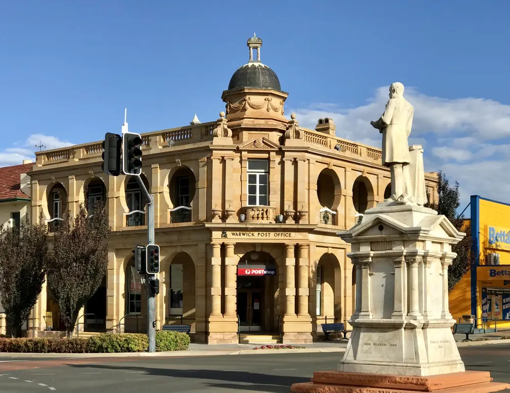
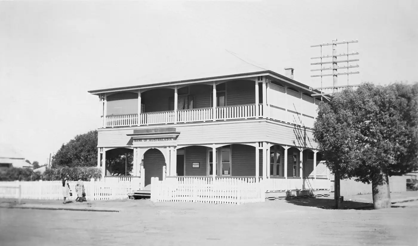
Warwick Post OfficePhoto: Chris Olszewski · CC BY-SA 4.0 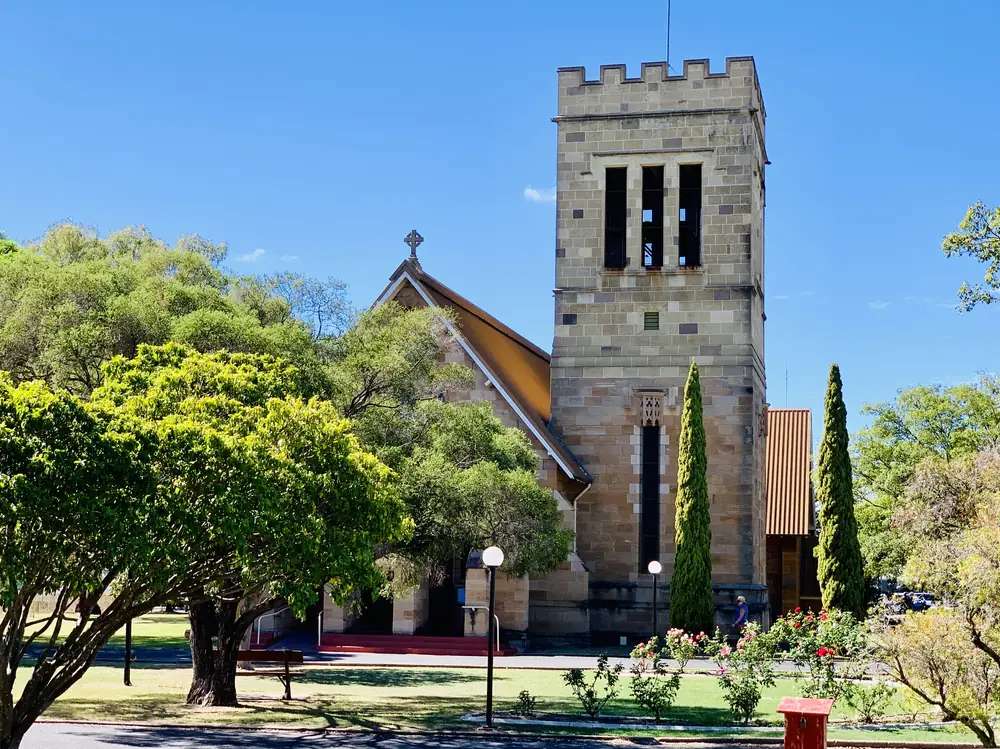
Warwick's St Mark's Anglican ChurchPhoto: Chris Olszewski · CC BY-SA 4.0 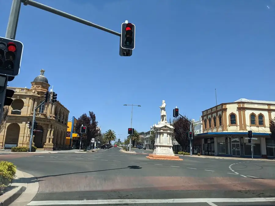
T.J. Byrnes monument, intersection of Palmerin and Grafton Streets in WarwickPhoto: Anonymous · CC BY 4.0 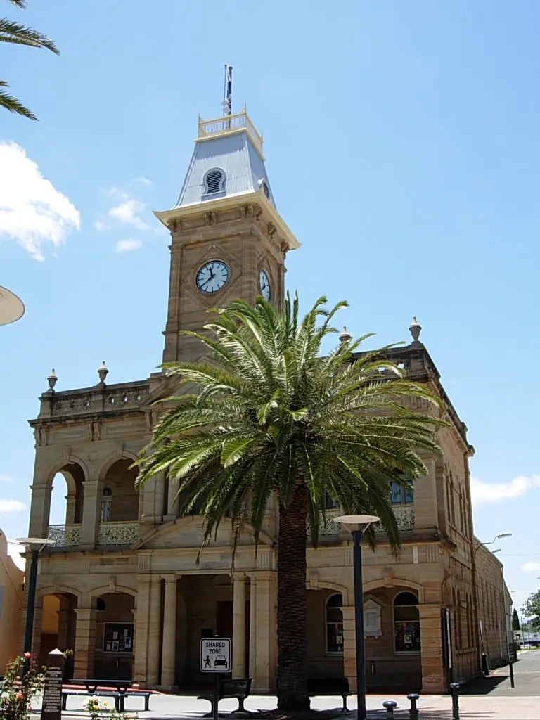
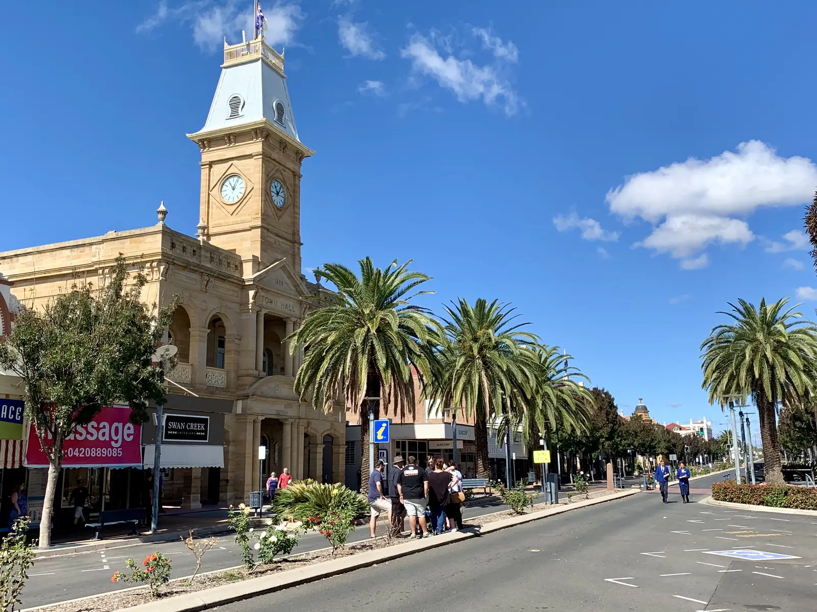
Warwick Town HallPhoto: Sherry Kang · CC BY 2.0
Warwick sits on the Southern Downs of southern Queensland, on the sealed Cunningham Highway and New England Highway, about 154 km south-west of Brisbane on the Southern Downs and Granite Belt getting-here table. It is the largest town in this hub’s eastern corner of the Darling Downs and Western Downs grouping — a farming and service centre, not deep outback. People use it as a first or last overnight when driving from the coast toward the Granite Belt, or as a base for Main Range National Park. If you came looking for Channel Country, keep going west through Dalby and Roma. Warwick is the on-ramp.
The same official distance table puts the Darling Downs city of Toowoomba 84 km north (about one hour). Stanthorpe, the Granite Belt wine town, does not yet have a guide on this site; Southern Downs lists Brisbane–Stanthorpe at 214 km and Toowoomba–Stanthorpe at 144 km. Do not treat a missing town page as a broken link. Ask at 72 Palmerin Street for current cellar-door and park advice.
Where it is, and how far
Southern Downs and Granite Belt tourism describes the region as about two hours’ drive south-west from Brisbane, entering at Cunningham’s Gap, and two and a half hours from the Gold Coast. Visitors from New South Wales cross at Wallangarra. Distances below are from that official getting-here table.
| Place | Distance (Southern Downs getting-here table) |
|---|---|
| Brisbane to Warwick | 154 km |
| Toowoomba to Warwick | 84 km |
| Gold Coast to Warwick | 186 km |
| Sydney to Warwick | 799 km |
| Brisbane to Stanthorpe | 214 km |
| Toowoomba to Stanthorpe | 144 km |
Queensland Parks puts Main Range National Park 50 km east of Warwick at Cunninghams Gap (and 116 km south-west of Brisbane). The Cunningham Highway crosses the park there. Goomburra, another Main Range section, is reached from the New England Highway near Allora. Those are park-agency figures, not a promise of time in fog or after landslips.
Dalby and Millmerran are Downs neighbours on other highways (Warrego and Gore), not a 20-minute side road from Palmerin Street.
Facts at a glance
The Australian Bureau of Statistics counted 14,110 people in the Warwick urban centre at the 2021 Census (Urban Centres and Localities code UCL313010). Median age was 43. The sex split was 48.0% male and 52.0% female. That UCL figure is the one to use for the town. The suburbs-and-localities geography (SAL33000, labelled Warwick (Qld)) counted 12,294 people; do not mix the two. Read the ABS QuickStats page for Warwick UCL.
Climate figures come from the Bureau of Meteorology station WARWICK (041525), which commenced in 1994. Elevation is 475 m. Location is 28.21°S, 152.10°E. The annual mean rainfall is 667.2 mm over 19 years of record (1994–2026) on the summary table. The hottest month by mean maximum is January at 30.5 °C; the coolest month by mean maximum is July at 18.2 °C. December is the wettest month on the same table (100.1 mm mean); July is the driest (25.6 mm). The full monthly table is on the BOM climate page for Warwick. Our Warwick weather page explains what those averages mean for a visit.
Warwick is large enough for a hospital, fuel, grocery shopping and same-day mechanical help. That is why it works as a gateway overnight before the longer run west, and why it is a poor substitute for a remote outback town if what you wanted was silence and a single pub.
Traditional Owners
A dedicated Southern Downs Regional Council RAP sentence that names Warwick township only was not found in the sourced research used for this guide. Queensland Parks manages Main Range National Park 50 km east; use park-agency culture pages for Country on the range rather than flattening several nations onto Palmerin Street. Confirm the sentence you want on a plaque or school project with the Warwick Visitor Information Centre on (07) 4661 3122 before publishing a single-nation claim for the townsite.
History
Southern Downs heritage trail copy, published for the region’s visitor centres, records botanist Allan Cunningham exploring in 1827, and the Leslie brothers arriving in 1840 to establish the first homestead on the Downs — described there as the site of the first free European settlement in Queensland. Warwick grew as the administrative and market town of that pastoral district. This guide does not invent gazettal dates, hotel lists or railway trivia that are not on the sourced pages.
Jackie Howe is the local name visitors still look up. The same Southern Downs heritage trail names him as born at Canning Downs Station and becoming famous in 1892 for shearing more sheep in a day than any other person. Charles Chauvel, described there as a founder of cinematography in Australia, is also named as born on Canning Downs. Current memorial locations change with roadworks; ask at the Town Hall visitor centre rather than driving to an old rest-area pin.
The trail also notes four distinct seasons on the Southern Downs and Granite Belt — cooler and more “inland highland” than the Western Downs highway towns further west. That climate is why Warwick is a gateway to granite country, not a desert overnight.
Things to do
Start at the Warwick Visitor Information Centre, Town Hall, 72 Palmerin Street. Southern Downs Regional Council lists hours Monday–Friday 9am–5pm, Saturday 9am–4pm, Sunday 9am–2pm, phone (07) 4661 3122. Caravan and bus parking is available on Palmerin Street in front of Leslie Park. Ask for the heritage and historic building trails booklet, current Main Range track alerts, and which district homesteads or parks are open.
Palmerin Street and the Town Hall are the sandstone civic strip. Southern Downs visitor material treats Warwick as a heritage-building town. Walk it while the visitor centre is open rather than treating the highway bypass as the whole story.
Jackie Howe heritage is the named local story. Use the visitor centre for the current memorial and Canning Downs visiting arrangements. Do not confuse the shearer with a motel listing.
Main Range National Park (Cunninghams Gap) is 50 km east on the Cunningham Highway. Queensland Parks lists rainforest and lookout walks from The Crest car park, including a 1.6 km Rainforest circuit. The highway is a freight road; turning in and out of the crest car park needs care. There is no developed camping at Cunninghams Gap itself — developed camping is at Spicers Gap and Goomburra. Use the Main Range park page and visiting safely notes. Check park alerts after rain and fire.
Granite Belt approaches. Girraween National Park — massive granite outcrops, wildflowers in spring — is on the Queensland–New South Wales border, described by Parks as halfway between Stanthorpe and Tenterfield. It is a Granite Belt day or overnight from Warwick, not a Warwick street. Use the Girraween park page. Stanthorpe visitor information is at 28 Leslie Parade, (07) 4681 2057, if you are continuing south; this site does not yet have a Stanthorpe town guide.
A fuller list, with how to order a day, is on things to do in Warwick.
Where to stay
Southern Downs and Granite Belt tourism groups visitor stays as hotels and motels in town, caravan and holiday parks, and council and dam campgrounds (Washpool at Leslie Dam, Connolly Dam). This page does not publish a ranked list of operators, prices or ratings. Named businesses change hands; the official directories are kept current.
- Caravan and camping directory: Southern Downs — caravan, camping and holiday parks
- Visitor centre bookings and maps: Warwick Visitor Information Centre
- How to choose a type of stay: Warwick accommodation
- Parks and camping in more detail: Warwick caravan parks
- Empty listings slot and operator enquiries: feature your business
Book ahead for school holidays, long weekends and event weekends. Main Range camping is a Queensland Parks booking, not a Warwick motel booking.
Caravan and camping
Warwick works as a van overnight because the highways are sealed, the town has supplies, and you can choose a town park or a dam camp the same afternoon. Southern Downs names town parks and Leslie Dam / Connolly Dam camps on its camping pages. Confirm pet rules, site length and whether you need to book. Read Warwick caravan parks and caravanning in the outback.
Caravan parking at the visitor centre is on Palmerin Street in front of Leslie Park. Dump points and stay limits belong on council and park pages, not in an invented facilities table.
Fuel and services
Warwick is a full-service Downs town: fuel, groceries, pharmacies and mechanical workshops sit on and just off the highway. This guide does not list brand names or opening hours that go stale. For current local-service questions, use Southern Downs Regional Council and the visitor centre at 72 Palmerin Street. Fill up here if you are heading to the Granite Belt, Killarney or the longer run west; do not assume every smaller Downs village has 24-hour fuel.
Southern Downs notes hospitals in Warwick and Stanthorpe, and Toowoomba as the larger medical centre 84 km north. For anything beyond basic travel needs, that is the referral pattern — not a booking.
Mobile coverage is generally good in town and along the highways. It can drop on Main Range walks and dam shores. Carry water on park days even in July.
Road access
Sealed highways meet at Warwick:
- Cunningham Highway — Brisbane–Ipswich–Cunninghams Gap–Warwick, then toward Goondiwindi. Queensland Parks warns the crest car park sits on a busy truck road.
- New England Highway — toward Toowoomba (84 km) and, south, the Granite Belt and the NSW border at Wallangarra.
- Australia’s Country Way is named on the getting-here page as part of the regional network.
These are freight roads. Expect road trains, range fog at Cunninghams Gap, and, after storms, landslips and water over the Condamine floodplain west of town. Check QLDTraffic and call 13 19 40 before you leave. Do not drive around closed signs on the Gap. Daily coach services between Brisbane, Toowoomba, Warwick and Stanthorpe are listed through Crisps Coaches on the getting-here page. Toowoomba Wellcamp Airport is described as one hour north-west of Warwick.
A suggested outback Queensland road trip often starts west of the Downs; Warwick is the sealed on-ramp from the south-east, not the remote stretch.
Nearby parks and towns
Parks (official park pages, not pages on this site):
- Main Range National Park — 50 km east at Cunninghams Gap; World Heritage rainforest, walks, no developed camping at the Gap.
- Girraween National Park — granite belt; halfway between Stanthorpe and Tenterfield on the Parks location line.
- Sundown National Park — named in Southern Downs camping material as a Granite Belt park with camping.
Towns on this site:
- Dalby — Warrego Highway Western Downs town if you are heading west toward Miles and Roma
- Millmerran — Gore Highway; Australian Camp Oven Festival in even years
- Roma — further west on the Warrego; Big Rig, bottle trees, saleyards
Stanthorpe and Killarney appear throughout Southern Downs visitor material but do not yet have full guides here. Toowoomba does not have a town page on this site; use the Downs region hub. Use Southern Downs visitor pages for those stops.
When to go, and how long
For comfortable driving, autumn and spring sit between January heat (mean maximum 30.5 °C at Warwick station) and July’s cooler days (mean maximum 18.2 °C). At 475 m, Warwick is cooler than Dalby Airport. Winter nights are cold; pack layers. Summer storms and range rain can close or slow Cunninghams Gap — that is a QLDTraffic and park-alerts question.
One night is enough if you only need fuel and a motel on the way to the Granite Belt or west to the Warrego. Two nights lets you walk Palmerin Street and do Cunninghams Gap as a day trip. Three nights is comfortable if you want Girraween as well without rushing — still a Downs-and-granite trip, not an outback expedition. See Warwick weather and best time to visit the outback.
A practical day from the visitor centre
Collect maps at 72 Palmerin Street. Walk the Town Hall precinct while you are in town. If QLDTraffic and park alerts are clear, drive east 50 km to Cunninghams Gap for the Rainforest circuit and lookouts, and be off the crest before dusk. If you would rather stay on the Downs, use the heritage trail booklet and a dam picnic named by the visitor centre. Back in Warwick, eat and fuel in town; this is not a place where you need to carry two days of food unless you are leaving the sealed network for Sundown or a remote Main Range camp.
Operators who want a checked listing on this town page can use feature your business. Until then the listings slot stays empty on purpose.
Plan this trip
Tell us the dates, who you are travelling with and where you need help. We reply with planning notes for Warwick — we are not a booking agent.
Events and road-conditions newsletter
Occasional notes on outback festivals, race days and official road-condition sources — not a daily blast. We use these details only to send the newsletter.
Queensland · Southern Downs
Things to do in Warwick
Things to do in Warwick: Town Hall visitor centre, Jackie Howe heritage, Palmerin Street sandstone, Cunninghams Gap in Main Range National Park and Granite Belt approaches.
Read · 5 min
Queensland · Southern Downs
Warwick accommodation
Where to stay in Warwick: hotels and motels, caravan parks and cabins, Leslie Dam and Connolly Dam camping. Official Southern Downs directories, not a fake hotel round-up.
Read · 4 min
Queensland · Southern Downs
Warwick caravan parks
Caravan parks and camping in Warwick: town parks and cabins, Leslie Dam and Connolly Dam, plus Main Range park camping. Official names from Southern Downs only.
Read · 4 min
Queensland · Southern Downs
Warwick weather
Warwick climate from Bureau of Meteorology station 041525: January mean maximum 30.5 °C, July 18.2 °C, annual rainfall 667.2 mm. Full monthly table on BOM.
Read · 5 min
Frequently asked questions
How far is Warwick from Brisbane and Toowoomba?
Southern Downs and Granite Belt tourism’s getting-here table puts Brisbane 154 km from Warwick (about two hours) and Toowoomba 84 km (about one hour).
What is Warwick’s population?
14,110 people at the 2021 Census for the Warwick urban centre (UCL313010). The suburb/locality figure (SAL33000, 12,294) is smaller and is not the urban-centre count.
Is Warwick in the outback?
No. Warwick is a Southern Downs farming and highway town — a gateway onto the Downs and the Granite Belt, not deep outback. Use it to restock before heading west, not as a substitute for Charleville or Longreach.
Who was Jackie Howe?
Southern Downs heritage trail copy names Jackie Howe as born at Canning Downs Station and famous in 1892 for shearing more sheep in a day than any other person. Confirm current memorial locations at the Warwick Visitor Information Centre.
When is the best weather in Warwick?
Bureau of Meteorology means for Warwick (041525) show the hottest month in January (mean maximum 30.5 °C) and the coolest in July (18.2 °C). Annual mean rainfall is 667.2 mm, wetter in summer.
Where is the Warwick visitor centre?
Warwick Visitor Information Centre is in the Town Hall at 72 Palmerin Street. Phone (07) 4661 3122. Monday–Friday 9am–5pm, Saturday 9am–4pm, Sunday 9am–2pm. Confirm before a public holiday.
Sources and further reading
Facts on this page were checked against these primary and official sources. Conditions change — confirm before you travel or buy.
- Warwick 2021 Census QuickStats (UCL313010) — Australian Bureau of Statistics
- Climate statistics for Warwick (041525) — Bureau of Meteorology
- Southern Downs and Granite Belt — Getting here — Southern Downs Regional Council
- Warwick Visitor Information Centre — Southern Downs Regional Council
- Main Range National Park — visiting safely — Queensland Parks and Wildlife Service
- QLDTraffic — Queensland Government