At a glance
Sourced facts only. Distances and services change — confirm before you travel.
- Population
- 1,797 people (UCL315024, 2021 Census)
- Local government
- Cook Shire
- Traditional Owners
- Guugu Yimithirr for Cooktown; Eastern Kuku Yalanji at Kalkajaka / southern approaches (Explore Cooktown and QPWS)
- Nearest regional city
- Cairns about 331 km inland on the sealed Mulligan Highway (Explore Cooktown and Cape York)
- Nearest fuel
- Confirm in the service town named under nearest regional city; this guide does not list bowser brands.
- Nearest hospital or clinic
- Confirm with Queensland Health — do not invent a clinic name.
- Mobile coverage
- Check Telstra and Optus coverage maps before travel; do not assume a signal on floodways, parks or unsealed approaches.
- Best time to visit
- Dry season about May–September (Queensland Parks wet-season roads December–March on far-north/Gulf pages). Cooktown Airport (031209) January mean maximum 32.1 °C, July 26.4 °C. QLDTraffic in the wet.
Climate
Monthly means from the Bureau of Meteorology station Cooktown Airport (031209). This is not a forecast. Commenced 2000. Elevation 5 m. Status: Open. Annual mean rainfall 1563.5 mm. Cooktown Airport.
| Month | Mean max (°C) | Mean min (°C) | Rainfall (mm) |
|---|---|---|---|
| Jan | 32.1 | 24.4 | 317.8 |
| Feb | 31.9 | 24.4 | 332.1 |
| Mar | 30.7 | 23.9 | 387.5 |
| Apr | 29.4 | 23.2 | 165.3 |
| May | 27.9 | 21.4 | 46.8 |
| Jun | 26.8 | 19.7 | 32.6 |
| Jul | 26.4 | 18.3 | 22.2 |
| Aug | 27.3 | 18.5 | 18.5 |
| Sep | 28.8 | 21.0 | 11.3 |
| Oct | 30.6 | 22.6 | 22.9 |
| Nov | 31.9 | 23.9 | 56.0 |
| Dec | 32.4 | 24.5 | 182.9 |
Cooktown in pictures
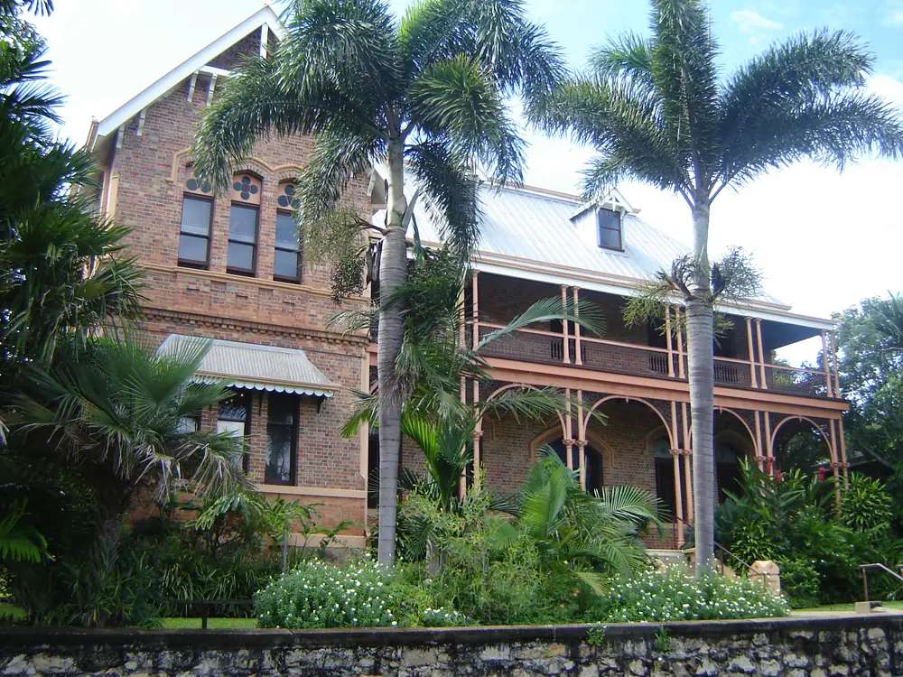
The James Cook Museum in CooktownPhoto: Frances76 at English Wikipedia · CC BY-SA 3.0 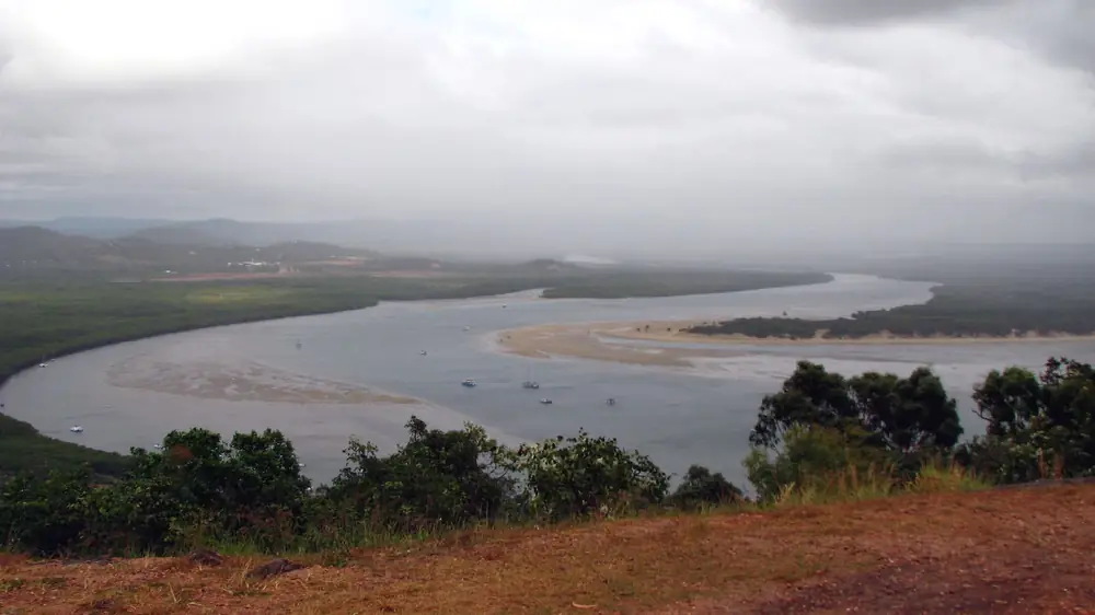
Endeavour River in CooktownPhoto: Rob and Stephanie Levy from Townsville, Australia · CC BY 2.0 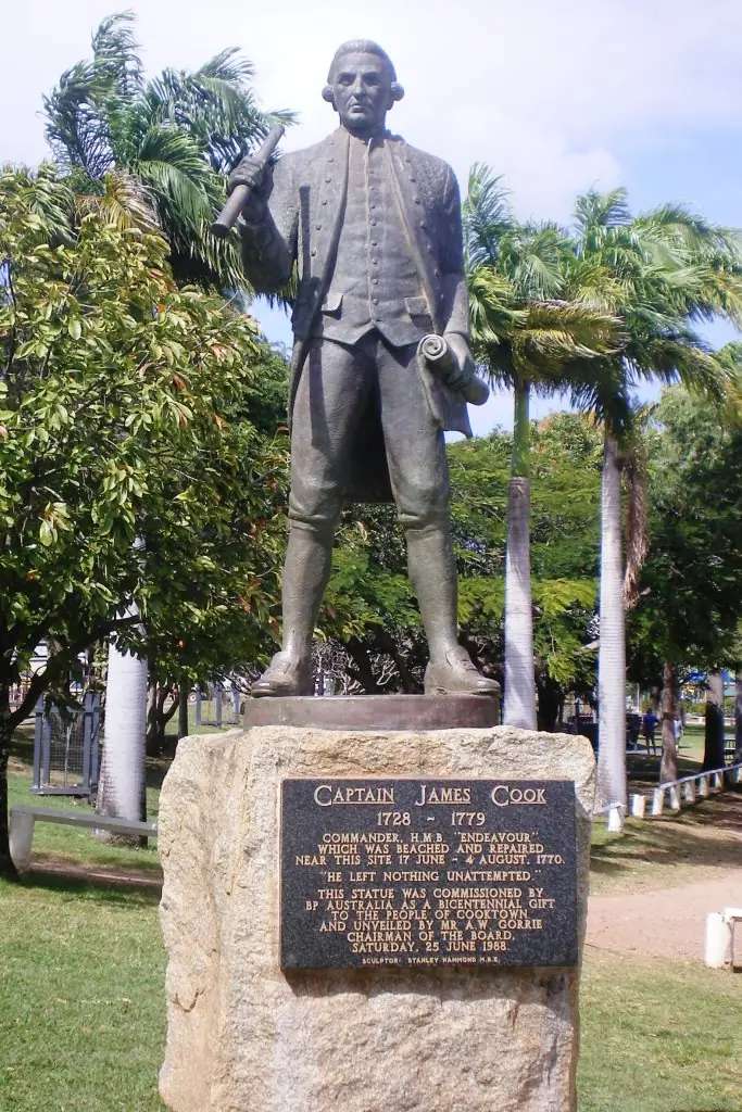
Captain Cook statue in CooktownPhoto: John Hill · CC BY-SA 4.0 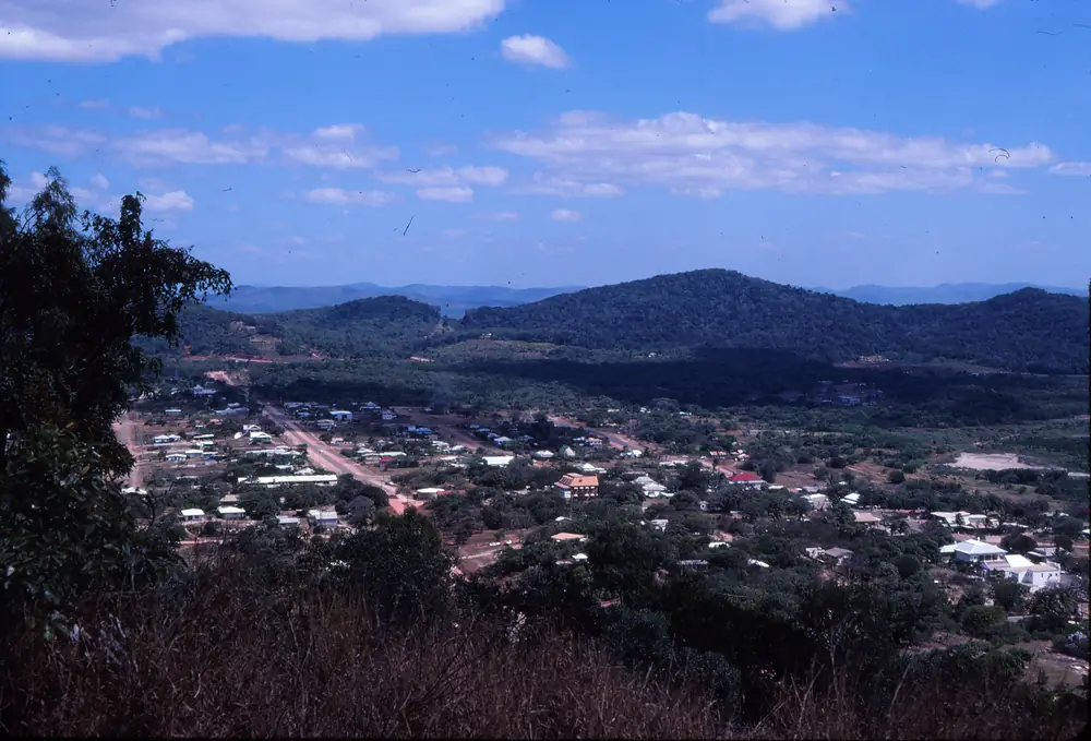
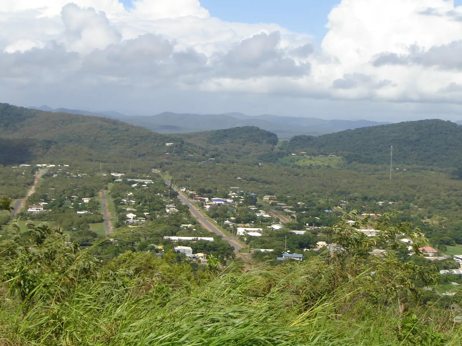
A view of CooktownPhoto: John Robert McPherson · CC BY-SA 4.0
Cooktown sits on the Endeavour River on the east coast of Cape York Peninsula, on Guugu Yimithirr Country. Explore Cooktown records the Guugu Yimithirr name Gungardie, from gun-gaar, a crystal quartz used in the area. The same page places Guugu Yimithirr country from the Annan River south of town to Princess Charlotte Bay. Queensland Parks’ Mount Cook culture page adds that the Cooktown area is also the northern boundary of Eastern Kuku Yalanji lands (including Yuku Baja-Muliku, Kuku Bididji and Kuku Nyungkul clans) and names the Waymbuurr and Gamay clans among Gungarde and Guugu Yimithirr people.
It is a small town — 1,797 people at the 2021 Census (UCL315024) — and a large story: a river QPWS says Lieutenant James Cook named in 1770 after his ship, a gold-rush port in the 1870s, a Second World War airfield, and today’s sealed-road gateway toward Cape York. For the drive north, use the Cape York 4WD guide. For the west-coast counterpart, see Weipa.
Where is Cooktown
Cooktown is in Queensland’s Outback North directory region, north of Cairns, at the mouth of the Endeavour River. Explore Cooktown’s inland route from Cairns is about 331 km, around four hours, fully sealed on the Mulligan Highway via Mareeba. The coastal Bloomfield Track is about 234 km, five to six hours, 4WD only from Cape Tribulation to Wujal Wujal, and uses the Daintree ferry.
Brisbane kilometres are not on the local visitor pages used for this guide; this page does not invent them.
Things to do in Cooktown
Nature’s Powerhouse, Walker Street, inside the heritage-listed Cooktown Botanic Gardens: Cooktown Visitor Information Centre, Vera Scarth-Johnson Gallery (original botanical illustrations of regional flora), exhibition space, shop and café. Explore Cooktown lists Tuesday–Sunday 8.30am–4.00pm, Monday closed, (07) 4069 6004. Start here for current park alerts, road advice and operators.
Cooktown Museum (National Trust of Australia Queensland), corner of Helen and Furneaux Streets, in the 1888 Sisters of Mercy convent. The Trust describes Guugu Yimithirr culture, early encounters with Lieutenant James Cook, and “one of Australia’s first recorded acts of reconciliation”, plus gold-rush and Chinese-migration displays, convent-school history (1888–1940s), HMB Endeavour artefacts, and an Endeavour Gallery with a jettisoned cannon and an anchor recovered from the Great Barrier Reef. Queen Elizabeth II opened it as the James Cook Historical Museum on 22 April 1970. Hours and tickets change with the season — use the National Trust page, not a copied price list. Accessible entry is described via Furneaux Street, with a lift inside.
Milbi Wall at the wharf. Explore Cooktown: hand-painted tiles telling Guugu Yimithirr history in the form of a Rainbow Serpent. Aboriginal artists learned tile-making to build it.
Kalkajaka National Park (CYPAL) — Black Mountain — 25 km south on the Mulligan Highway. Eastern Kuku Yalanji Country. Queensland Parks lists a lookout only. Do not enter the boulder field. People have been injured or died there.
Mount Cook National Park. QPWS culture and history for the mountain above town, including how Lieutenant Phillip Parker King named Mount Cook in June 1819. Check parks.qld.gov.au for walks and alerts.
Endeavour River National Park, about 6 km north of town (QPWS). Coastal dunes, wetlands, mangroves and tropical woodland, roughly 2,200 hectares. No camping. Most of the park is boat-only; two boat ramps are on the Cooktown waterfront. Estuarine crocodiles are often seen on the river bank. QPWS visiting-safely notes there are no wheelchair-accessible facilities in the park.
Explore Cooktown also names Aboriginal-led tours with Traditional Owners (including Culture Connect Australia rock-art tours and Rossville Retreat tours with Kuku Nyungkul elder Harold Tayley). Book those operators directly and confirm at Nature’s Powerhouse. We do not publish tour prices.
A longer things to do in Cooktown page follows this hub.
History and Country — without invented Cook stories
Official Queensland Parks and National Trust pages, not folklore, are the sources used here.
QPWS Endeavour River: English navigator Lieutenant James Cook named the Endeavour River after his ship when it struck a reef off Cooktown on 11 June 1770. Botanists Banks and Solander collected plant specimens along the river. QPWS also records that they noted their first European sighting of a kangaroo, named from the Guugu Yimithirr word Gangurru. QPWS Mount Cook: King moored in 1819 opposite the site where Cook repaired the Endeavour after damaging it on reefs off Cape Tribulation; Cook had already identified the mountain as Gores Mount after Lieutenant John Gore, but the name Mount Cook took hold.
The National Trust asks visitors to see Cook’s landing from the Aboriginal perspective at the museum, and names one of Australia’s first recorded acts of reconciliation among the stories told there. This guide will not invent dialogue, camp layouts or a day-by-day beaching diary. Go to the museum and the Milbi Wall.
Guugu Yimithirr people, Explore Cooktown says, lived in thirty-two clan areas with boundaries in geographical landmarks, and maintain strong links with land and story places. The word Bama is widely used on the Cape for an Aboriginal person; in Guugu Yimithirr it simply means “person”. QPWS records the Guugu Yimithirr belief that Wahalumbaal birri (the Endeavour River) was created by the Mungurru (amethystine python) travelling down the valley to Walmba muulaarr (the Great Barrier Reef).
QPWS: Palmer River gold in 1872–73 (William Hann, James Mulligan) turned Cooktown into a port; thousands of people, including many Chinese, rushed here in the 1870s. Sisters of Mercy opened the convent school in 1888. During the Second World War the civilian population was evacuated; Cooktown became a military base and the airfield was built in 1942 for operations in New Guinea and the Coral Sea.
Visit as a guest. Ask before photographing people or ceremony. Stay out of Kalkajaka’s boulders. See visiting Country respectfully.
Getting there
Inland (preferred for 2WD and most caravans): Mulligan Highway via Mareeba, about 331 km, sealed, around four hours. Check QLDTraffic (13 19 40).
Coastal: Bloomfield Track, about 234 km, 5–6 hours, 4WD only on the unsealed Cape Tribulation–Wujal Wujal section, Daintree ferry. Wet-season sensitive. Cook Shire publishes local road closures.
From Cooktown the Peninsula Developmental Road heads toward Laura, Coen and the Tip. That is a different trip: see Cape York by 4WD. Rinyirru (Lakefield) is reached via Laura and is closed in the wet; caravans are not recommended in that park.
Cooktown weather and when to go
Cooktown Airport (station 031209, commenced 2000; 15.45°S, 145.19°E; elevation 5 m) has a mean annual rainfall of 1,563.5 mm (23 years). Wettest month mean: March 387.5 mm. Driest: September 11.3 mm. Hottest mean max: December 32.4 °C. Coolest mean max: July 26.4 °C. QPWS describes the Endeavour River climate as tropical, with a wet season from about December to April and cooler, drier months from May to September. The Cooktown weather page has the monthly BOM table.
Where to stay
Regional tourism lists motel, hotel, caravan park and cabin or camping. Named operators belong at Nature’s Powerhouse, not in an invented directory. QPWS notes a range of motels, hotels and caravan parks in Cooktown and no camping in Endeavour River National Park. Kalkajaka has no camping. See Cooktown accommodation and Cooktown caravan parks.
Population, food and safety
Population: 1,797 (2021 UCL), median age 43, 49.8% male / 50.2% female.
Cooktown is the last large east-coast service town before the Cape proper. Fuel and groceries exist; treat them as a restock, not a city supermarket. Estuarine crocodiles live in the Endeavour River, creeks, swamps, beaches and the sea. QPWS says they are often seen sunning on the river bank. Never swim in the river or at undeveloped beaches. Read crocodile safety.
A suggested stay
Day 1. Drive the sealed Mulligan Highway. Nature’s Powerhouse and the Botanic Gardens. Sunset at the wharf and the Milbi Wall, staying back from the water.
Day 2. Cooktown Museum for Guugu Yimithirr history and the official Endeavour collections. If an Aboriginal-led tour is running, take it instead of improvising at cultural sites.
Day 3. Kalkajaka lookout only, then Mount Cook or a boat on the Endeavour River with a licensed operator if conditions and crocodile advice allow. Do not add Rinyirru unless you have a 4WD, a camping permit and a park that is open.
Practical information
- Country: Guugu Yimithirr (Gungardie); Eastern Kuku Yalanji at Kalkajaka and southern approaches.
- From Cairns: about 331 km sealed inland, or 234 km coastal 4WD.
- Visitor centre: Nature’s Powerhouse, Walker Street.
- Roads: QLDTraffic and Cook Shire.
- Related: Weipa, Cape York, Rinyirru (Lakefield).
Plan this trip
Tell us the dates, who you are travelling with and where you need help. We reply with planning notes for Cooktown — we are not a booking agent.
Events and road-conditions newsletter
Occasional notes on outback festivals, race days and official road-condition sources — not a daily blast. We use these details only to send the newsletter.
Cooktown · Outback Queensland
Things to do
Things to do in Cooktown: Nature’s Powerhouse and botanic gardens, National Trust Cooktown Museum, Milbi Wall, Kalkajaka lookout, Mount Cook and Endeavour River National Park.
Read · 4 min
Cooktown · Outback Queensland
Accommodation
Where to stay in Cooktown, Queensland: motel, hotel, cabin and caravan-park categories named by regional tourism, confirmed at Nature’s Powerhouse — no invented operators or room rates.
Read · 4 min
Cooktown · Outback Queensland
Caravan parks
Caravan parks in Cooktown, Queensland: town parks confirmed at Nature’s Powerhouse, no camping in Endeavour River National Park, Kalkajaka lookout-only, and the sealed Mulligan Highway for vans.
Read · 3 min
Cooktown · Outback Queensland
Weather
Cooktown weather from Bureau of Meteorology Cooktown Airport: 1,563.5 mm a year, March 387.5 mm, September 11.3 mm, and what that means for the Mulligan Highway and Bloomfield Track.
Read · 3 min
Frequently asked questions
Can I drive from Cairns to Cooktown in a 2WD?
Yes, on the inland Mulligan Highway — about 331 km, fully sealed, around four hours via Mareeba, according to Explore Cooktown and Cape York. The coastal Bloomfield Track is about 234 km, five to six hours, and 4WD only between Cape Tribulation and Wujal Wujal, with the Daintree ferry.
What is the population of Cooktown?
The 2021 Census counted 1,797 people in the Cooktown urban centre (UCL315024). Median age was 43.
Whose Country is Cooktown on?
Explore Cooktown states that Cooktown lies in Guugu Yimithirr country, from the Annan River south of town to Princess Charlotte Bay. The Guugu Yimithirr name for Cooktown is Gungardie. Queensland Parks’ Mount Cook culture page also describes the town area as the northern boundary of Eastern Kuku Yalanji lands and the southern boundary of Gungarde and Guugu Yimithirr (Waymbuurr and Gamay clans). Kalkajaka (Black Mountain), 25 km south, is Eastern Kuku Yalanji Country.
When is Cooktown’s wet season?
Cooktown Airport mean rainfall is 387.5 mm in March and 11.3 mm in September, with an annual mean of 1,563.5 mm (23 years). December has the hottest mean maximum, 32.4 °C; July the coolest, 26.4 °C.
Can I climb Black Mountain (Kalkajaka)?
No. Queensland Parks lists a lookout on the Mulligan Highway only. Do not enter the boulder field — people have been injured or died in the boulders. Stay at the lookout.
Where is the Cooktown visitor centre?
Nature’s Powerhouse, Walker Street, in the botanic gardens. Explore Cooktown lists Tuesday–Sunday 8.30am–4.00pm, Monday closed. Phone (07) 4069 6004.
Sources and further reading
Facts on this page were checked against these primary and official sources. Conditions change — confirm before you travel or buy.
- Getting there — Explore Cooktown and Cape York
- Aboriginal culture, Cooktown — Explore Cooktown and Cape York
- Nature’s Powerhouse — Explore Cooktown and Cape York
- Cooktown Museum — National Trust of Australia (Queensland)
- Kalkajaka National Park (CYPAL) — Queensland Parks and Wildlife Service
- Mount Cook National Park — culture — Queensland Parks and Wildlife Service
- Endeavour River National Park — Queensland Parks and Wildlife Service
- Climate statistics for Cooktown Airport (031209) — Bureau of Meteorology
- Cooktown 2021 Census QuickStats (UCL315024) — Australian Bureau of Statistics
- QLDTraffic — Queensland Government