At a glance
Sourced facts only. Distances and services change — confirm before you travel.
- Population
- 2,290 people (UCL415008, 2021 Census)
- Local government
- District Council of Ceduna
- Traditional Owners
- Mirning, Kokatha and Wirangu Peoples (Ceduna Tourism)Ceduna Tourism acknowledgement: Traditional Custodians of the land and waters of the Far West Coast.
- Capital
- 780 km west of Adelaide on the Eyre Highway, about 8.5 hours (Ceduna Tourism and District Council of Ceduna)
- Nearest fuel
- Last major service town before the Nullarbor on Ceduna Tourism and SATC. Confirm bowsers and hours in town.
- Mobile coverage
- Check Telstra and Optus coverage maps before travel; do not assume a signal.
- Best time to visit
- Cooler months and winter-dominant rain at Ceduna AMO: January mean max 28.7 °C, July 17.5 °C. Oysterfest October long weekend (SATC).
Climate
Monthly means from the Bureau of Meteorology station Ceduna AMO (018012). This is not a forecast. Open. Temperature 85 years (1939–2026); rainfall 86 years (1939–2026). Elevation 15 m. January mean maximum 28.7 °C; July 17.5 °C; annual rainfall 291.3 mm, winter-dominant.
| Month | Mean max (°C) | Mean min (°C) | Rainfall (mm) |
|---|---|---|---|
| Jan | 28.7 | 15.3 | 12.9 |
| Feb | 28.3 | 15.1 | 14.4 |
| Mar | 26.7 | 13.4 | 16.2 |
| Apr | 24.3 | 10.8 | 19.9 |
| May | 20.9 | 8.5 | 31.8 |
| Jun | 18.2 | 6.5 | 36.1 |
| Jul | 17.5 | 5.8 | 38.2 |
| Aug | 18.8 | 6.2 | 33.7 |
| Sep | 21.7 | 7.9 | 25.4 |
| Oct | 24.1 | 10.1 | 25.2 |
| Nov | 26.0 | 12.4 | 19.3 |
| Dec | 27.5 | 14.2 | 20.4 |
Ceduna in pictures
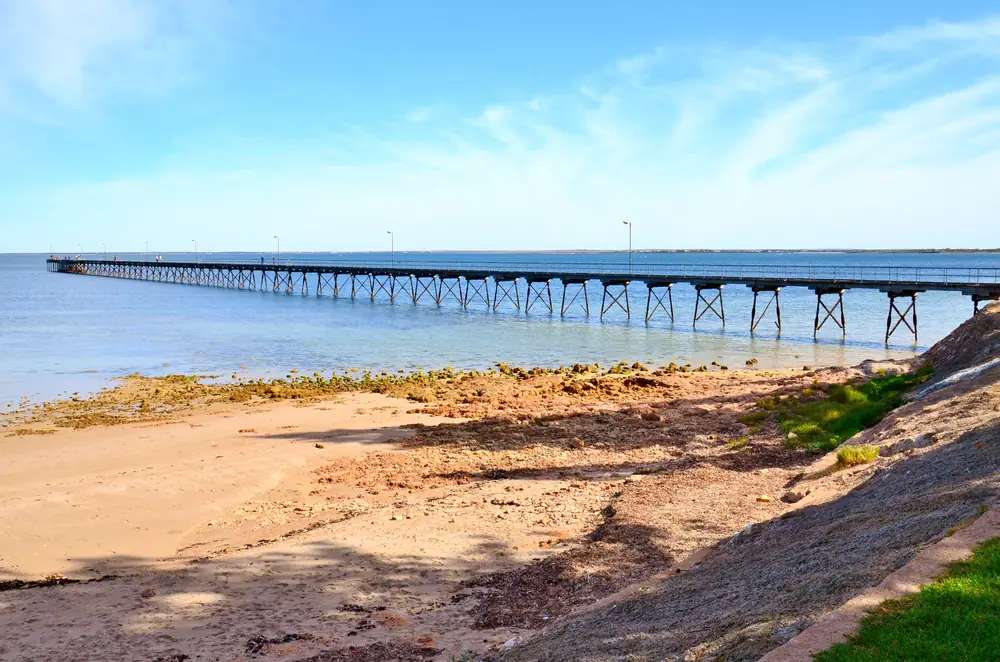
Ceduna Jetty, Ceduna, 2017Photo: Bahnfrend · CC BY-SA 4.0 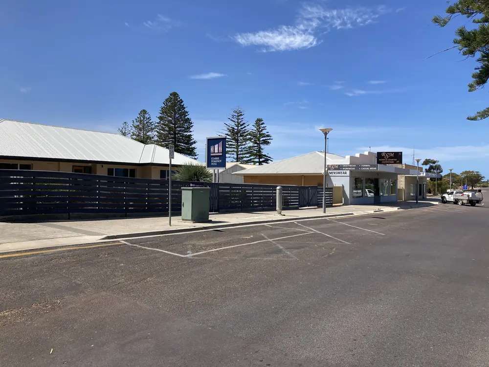
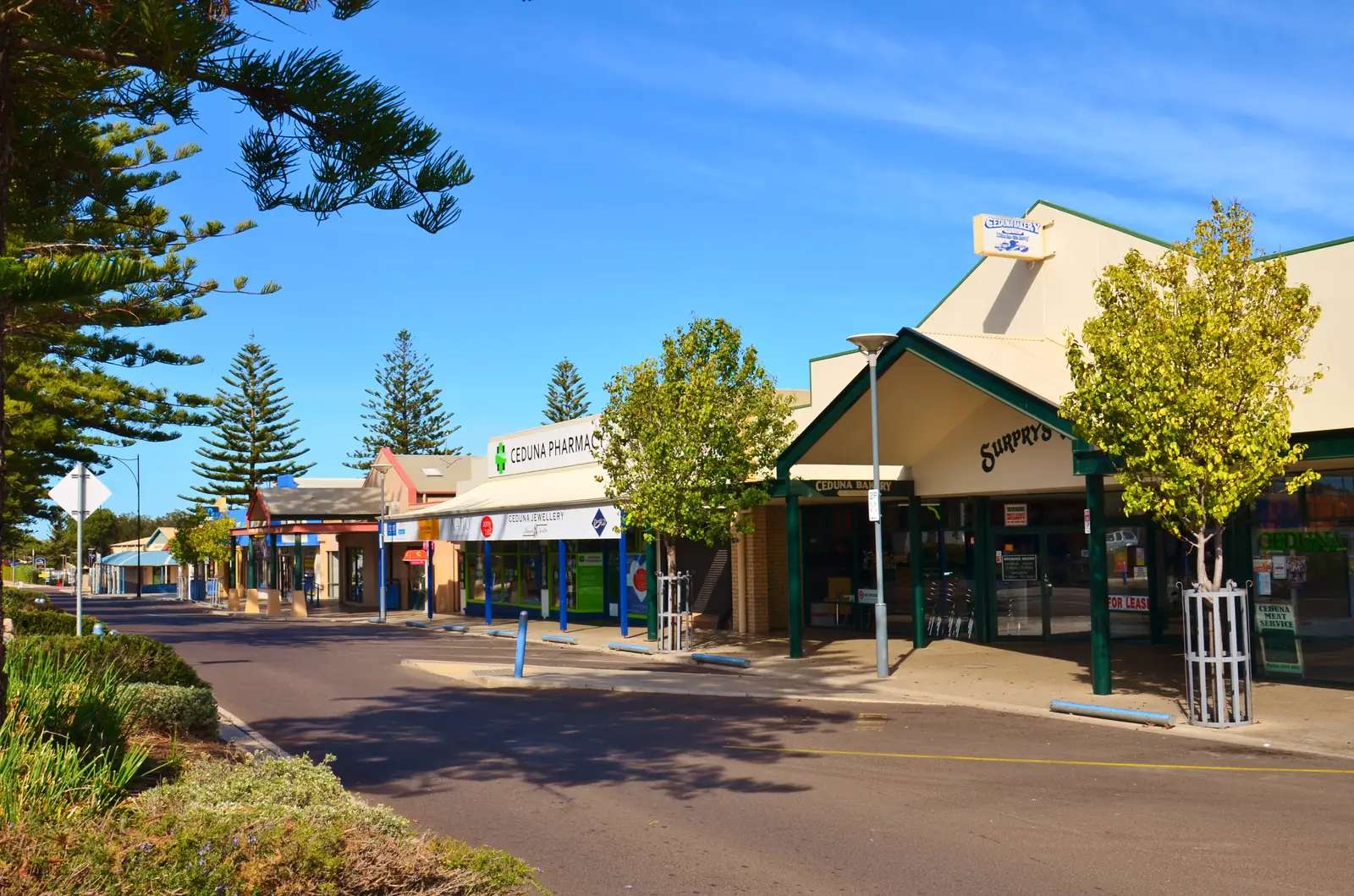
Ceduna, South Australia streetscapePhoto: Chuq · CC BY-SA 4.0 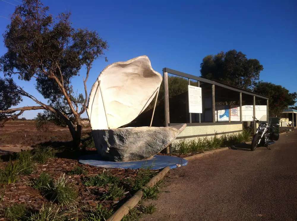
The Big OysterPhoto: Unaimedplaya · CC BY-SA 4.0 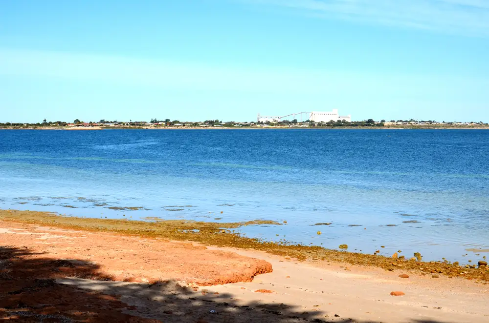
Thevenard Silos, 2017Photo: Bahnfrend · CC BY-SA 4.0
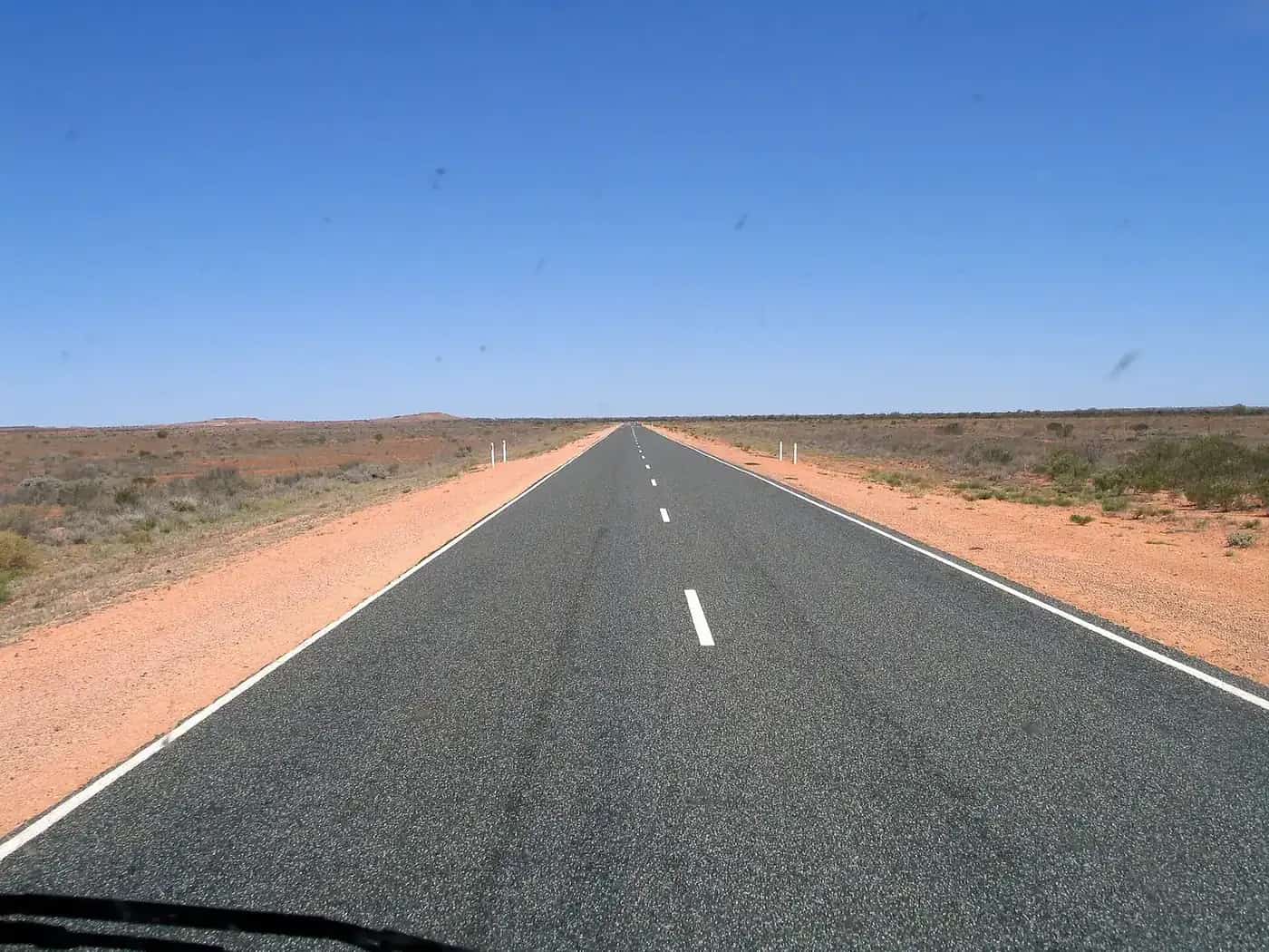
Ceduna sits on the Far West Coast of South Australia, where the Eyre Highway (A1) reaches the last major town before the treeless Nullarbor run to Norseman in Western Australia. Ceduna Tourism and the District Council put Adelaide at 780 km west, about 8.5 hours, and Perth at about 1,900 road kilometres. Flights from Adelaide take about 1 hour 30 minutes on Ceduna Tourism’s getting-here page.
The 2021 Census counted 2,290 people in the Ceduna urban centre (ABS UCL415008). That is the town figure — not the District Council LGA total of 3,505.
Ceduna Tourism acknowledges the Mirning, Kokatha and Wirangu Peoples as Traditional Custodians of the land and waters of the Far West Coast.
Things to do
Ceduna Visitor Information Centre, 58 Poynton Street. Eyre Peninsula’s listing: weekdays 9am–5pm, weekends 9am–1pm. This is the practical start for Nullarbor briefing, local maps and Nullarbor Links scorecards. The VIC also hires clubs on that listing.
Nullarbor Links. Ceduna Tourism describes the world’s longest golf course: 1,365 km from Ceduna to Kalgoorlie. You play holes at stops along the Eyre Highway. Start or finish here; do not treat it as a town golf club only.
Wittelbee Conservation Park, 10 km south-east of Ceduna (National Parks SA). Coastal park time after a highway day.
Ceduna National Trust Museum. Pioneering and Maralinga-related displays are named in regional visitor copy; confirm hours at the VIC.
Arts Ceduna / Mint Bush Gallery and a language centre for Wirangu, Kokatha and Mirning — named on regional hotel/tourism pages. Treat them as named places and confirm at the VIC rather than assuming open hours.
Oysters. Ceduna Tourism points to tasting at Denial Bay (14 km west) and Smoky Bay. A regional hotel page puts Smoky Bay around 40 km; use the VIC for current operators. We do not invent farm names or prices.
Oysterfest is on the October long weekend (SATC Ceduna page).
Read things to do in Ceduna. For the crossing itself, use our Nullarbor on the Eyre Highway guide.
The Nullarbor and the Eyre Highway
Ceduna is the eastern full-service end of the classic crossing. Norseman to Ceduna is about 1,206 km of sealed Eyre Highway in that road-trip guide, with 13 fuel stops and long gaps. Eastbound travellers arrive here for fuel, food, a bed and quarantine. Westbound travellers leave here knowing the next “town” is really a chain of roadhouses.
Quarantine. Fruit and vegetable rules apply when entering South Australia from Western Australia. PIRSA prohibits bringing fresh fruit into SA; disposal bins are at Ceduna. Westbound, WA’s checkpoint at Eucla is the other end of the same problem. Eat or bin produce before the checkpoint. Details sit on the Nullarbor guide and on PIRSA / DPIRD pages.
Head of Bight whale watching (May–October in SATC-style seasonal notes) is further west, not in Ceduna township. Do not plan it as a town stroll.
If you turn north of the highway onto outback dirt, use DIT outback road warnings. The Eyre Highway itself is sealed; check Traffic SA.
Nearby
- Denial Bay — 14 km west (Ceduna Tourism).
- Wittelbee Conservation Park — 10 km south-east (Parks SA).
- Laura Bay Conservation Park — named on SATC’s Ceduna destination page with Wittelbee. Confirm access on parks.sa.gov.au; this guide does not guess a URL slug.
- Penong and the roadhouse chain west — see the Nullarbor fuel table.
- Streaky Bay — District Council of Streaky Bay foreshore town, just off the Eyre Highway on official tourism.
- Wirrulla — Eyre Highway locality between Poochera and Ceduna, Streaky Bay council, not a Ceduna suburb.
- Port Augusta — the eastern highway junction toward Adelaide, the Flinders and the Stuart Highway.
- Kalgoorlie-Boulder — the western end of Nullarbor Links.
History and Country
Ceduna Tourism’s acknowledgement is the wording we use: Mirning, Kokatha and Wirangu. The town’s traveller role is consistent across Ceduna Tourism and SATC: last major service town before the Nullarbor / Eyre Highway.
The oyster industry and Oysterfest on the October long weekend are the civic celebration SATC and local tourism put on the calendar. The National Trust museum holds local pioneering history and Maralinga-related displays as named in regional visitor material — ask the VIC for what is on show this year.
A two-day outline
Day 1 — Town and coast. Visitor centre on Poynton Street, museum if open, Wittelbee in the afternoon, oysters at Denial Bay if the VIC still recommends a current operator. Sleep in town: this is a service centre, and rooms fill when the highway is busy.
Day 2 — Highway. East toward Port Augusta, or west onto the Nullarbor with fuel, water, quarantine awareness and a copy of the crossing guide. Nullarbor Links players collect the scorecard before they leave.
A single night is enough if you only need fuel and sleep. Two nights suit Oysterfest, a slower coast day, or recovering from the 1,206 km crossing.
Seasons and when to go
Ceduna AMO (station 018012, commenced 1939, elevation 15 m) has a mean annual rainfall of 291.3 mm over 86 years (1939–2026). Rain is winter-dominant (July mean 38.2 mm). January mean maximum 28.7°C; July mean maximum 17.5°C. That is cooler in summer than inland Woomera Aerodrome’s 34.8°C January mean max, and wetter than Woomera’s 183.0 mm year — still semi-arid, with a Southern Ocean influence.
The cooler months suit the Nullarbor drive. Summer can be hot on the bitumen; coastal winds can take the edge off, which is not the same as a mild day inland. Oysterfest pins a busy weekend in October. Whale season at Head of Bight is a westbound extra, not a Ceduna street festival. More figures: Ceduna weather.
Getting there
- By road: sealed Eyre Highway (A1). Adelaide 780 km / about 8.5 hours. Perth about 1,900 road km.
- By air: about 1 h 30 min from Adelaide (Ceduna Tourism).
- Quarantine bins at Ceduna for eastbound produce rules.
Check Traffic SA on the highway. Check DIT outback warnings only if you leave the A1 for northern dirt. See fuel, permits and road conditions.
Where to stay
Last major town before the Nullarbor: hotel/motel, caravan park and cabin categories. SATC and regional pages name the Ceduna Foreshore Hotel Motel. Confirm current caravan parks at the VIC — we do not invent a park roster or prices. Book ahead for school holidays, Oysterfest and the peak Nullarbor touring months.
Ceduna accommodation and caravan parks expand that without fake listings.
Travel safety
The Eyre Highway is sealed and busy with road trains, caravans and tired Nullarbor drivers. Fatigue on the long straights is the usual problem, plus wildlife at dawn and dusk. See kangaroos and driving safety and the Nullarbor safety notes.
Carry water. Mean rainfall is still only 291.3 mm. Do not assume every roadhouse west is open 24 hours — the Nullarbor guide flags long gaps and changing hours.
Services & fuel
Ceduna Tourism and this hub treat Ceduna as the last major service town before the Nullarbor: fuel, food and an accredited visitor centre at 58 Poynton Street. Restock here. Westbound, choices thin to roadhouses — this page does not invent a bowser roster or prices. Fruit and vegetable quarantine bins are at Ceduna for eastbound PIRSA rules.
Population and practical information
2,290 people (2021 UCL); median age 39; 50.5% male / 49.5% female. This is large enough for fuel, food and a visitor centre, which is why highway guides call it the last major service town. Restock here. Westbound, choices thin to roadhouses.
How far from Adelaide?
780 km, about 8.5 hours, on the Eyre Highway (Ceduna Tourism / council). Flights about 1 h 30 min.
Can I start Nullarbor Links here?
Yes. Scorecard and club hire at the visitor centre (Eyre Peninsula VIC listing / Ceduna Tourism getting-here).
Explore nearby
- Crossing the Nullarbor
- Port Augusta
- Kalgoorlie-Boulder
- Outback South Australia towns
- Woomera — Stuart Highway village, a different SA outback stop
Plan this trip
Tell us the dates, who you are travelling with and where you need help. We reply with planning notes for Ceduna — we are not a booking agent.
Events and road-conditions newsletter
Occasional notes on outback festivals, race days and official road-condition sources — not a daily blast. We use these details only to send the newsletter.
Outback South Australia
Things to do
Things to do in Ceduna: visitor centre on Poynton Street, Nullarbor Links scorecards, Wittelbee Conservation Park, oysters at Denial Bay, Oysterfest and the National Trust museum.
Read · 3 min
Outback South Australia
Accommodation
Where to stay in Ceduna, South Australia: hotel/motel, cabin and caravan-park categories in the last major town before the Nullarbor. Ceduna Foreshore Hotel Motel is named on SATC pages; confirm the rest at the VIC.
Read · 3 min
Outback South Australia
Caravan parks
Caravan parks in Ceduna, SA: the last major town before the Nullarbor on the sealed Eyre Highway. Confirm current parks at the visitor centre; we do not invent a site list or prices.
Read · 3 min
Outback South Australia
Weather
Ceduna weather from BOM Ceduna AMO (018012): 291.3 mm mean annual rain, winter-dominant, January mean max 28.7°C and July 17.5°C — what that means on the Eyre Highway.
Read · 3 min
Frequently asked questions
How far is Ceduna from Adelaide?
780 km west on the Eyre Highway, about 8.5 hours, according to Ceduna Tourism and the District Council of Ceduna. It is also about 1,900 road kilometres to Perth.
What is Ceduna’s population?
2,290 people at the 2021 Census (ABS Urban Centre and Locality UCL415008). Do not use the whole District Council figure (3,505) for the town.
Whose Country is Ceduna on?
Ceduna Tourism acknowledges the Mirning, Kokatha and Wirangu Peoples as Traditional Custodians of the land and waters of the Far West Coast.
When is Oysterfest?
The October long weekend, on SATC’s Ceduna destination page.
Is Ceduna a desert climate?
Semi-arid coast. Ceduna AMO’s mean annual rainfall is 291.3 mm, wetter in winter (July mean 38.2 mm). January mean maximum is 28.7°C; July’s is 17.5°C (BOM).
Can I start Nullarbor Links in Ceduna?
Yes. The visitor centre sells the scorecard and hires clubs, according to the Eyre Peninsula visitor-centre listing Ceduna Tourism points to.
Sources and further reading
Facts on this page were checked against these primary and official sources. Conditions change — confirm before you travel or buy.
- Ceduna Tourism — getting here — District Council of Ceduna
- District Council of Ceduna — history — District Council of Ceduna
- Ceduna Tourism — District Council of Ceduna
- Ceduna Visitor Information Centre — Eyre Peninsula
- Ceduna (2021 Census QuickStats, UCL415008) — Australian Bureau of Statistics
- Climate statistics for Ceduna AMO (018012) — Bureau of Meteorology
- Wittelbee Conservation Park — National Parks and Wildlife Service SA
- Ceduna — South Australian Tourism Commission — South Australian Tourism Commission
- Outback road warnings — Department for Infrastructure and Transport SA
- Traffic SA — Government of South Australia