At a glance
Sourced facts only. Distances and services change — confirm before you travel.
- Local government
- Shire of Ngaanyatjarraku
- Traditional Owners
- Ngaanyatjarra people of the Central Desert (Shire of Ngaanyatjarraku). The shire community page also uses Milyirrtjarra (and, in the same page body, Mirlirrtjarra) for the community, and Yarnangu for Ngaanyatjarra people.Transit travellers are not permitted to enter communities except people providing essential services, on Ngaanyatjarra Council and shire permit wording.
- Nearest regional city
- Laverton, 560 km of gravel road southwest on the Shire of Ngaanyatjarraku Our Region page.
- Capital
- 1,542 km northeast of Perth (Shire of Ngaanyatjarraku Our Region page).
- Nearest fuel
- Fill at permitted roadhouses when they are open. The shire community page lists a community store for residents; transit travellers should not treat it as a tourist stop. This hub does not list bowser brands.
- Nearest hospital or clinic
- The shire community page lists a clinic (Ngaanyatjarra Health Service). That is a community clinic, not a WACHS hospital named on the Goldfields hospitals page used here.
- Mobile coverage
- Check Telstra and Optus coverage maps before travel; do not assume a signal on the Great Central Road.
- Best time to visit
- May–August on BOM Warburton Airfield mean maxima if the road and both transit permits are open. Permit and shire road reports override the calendar.
Climate
Monthly means from the Bureau of Meteorology station Warburton Airfield (013011). This is not a forecast. Open station. Temperature maxima 53 years (1940–2026); rainfall 60 years (1940–2026). Ngaanyatjarra Lands, Western Australia — not a Yarra Ranges gauge. Product date on the research copy 14 November 2026.
| Month | Mean max (°C) | Mean min (°C) | Rainfall (mm) |
|---|---|---|---|
| Jan | 38.0 | 23.3 | 30.7 |
| Feb | 36.8 | 22.5 | 32.9 |
| Mar | 34.4 | 20.4 | 29.6 |
| Apr | 29.7 | 15.6 | 17.2 |
| May | 24.4 | 10.5 | 14.6 |
| Jun | 20.8 | 6.7 | 17.9 |
| Jul | 20.9 | 5.8 | 11.1 |
| Aug | 23.5 | 7.6 | 8.7 |
| Sep | 28.2 | 11.8 | 6.5 |
| Oct | 32.1 | 16.2 | 16.6 |
| Nov | 34.5 | 19.0 | 24.6 |
| Dec | 36.8 | 21.7 | 32.8 |
This is Warburton in Western Australia, on Ngaanyatjarra Lands, on the Great Central Road section of the Outback Way. It is not Warburton in Victoria’s Yarra Ranges. If a search result, booking site or weather app shows a Dandenongs village, a Yarra river walk or a Melbourne day trip, you are looking at the wrong place. The Australian Bureau of Statistics labels this locality Warburton (L) (WA) and Warburton (WA) so the two towns stay apart in Census products. Use those labels.
The Shire of Ngaanyatjarraku’s community page also uses Milyirrtjarra (and, in the same page body, Mirlirrtjarra) for the community, and Yarnangu for Ngaanyatjarra people. The shire is local government for traditional lands of the Ngaanyatjarra people of the Central Desert. Its Our Region page puts the main township 1,542 km northeast of Perth, 560 km of gravel road northeast of Laverton, 750 km northeast of Kalgoorlie-Boulder and 1,050 km southwest of Alice Springs. Neighbouring shires named on that page are Wiluna, Laverton and East Pilbara. This hub does not invent extra “nearby towns” that those pages do not name.
Warburton is a living community, not a highway theme park. Ngaanyatjarra Council and the shire permit page treat Great Central Road travel as transit on Aboriginal-owned land. Read the permit rules before you pack.
Where it is, and how far
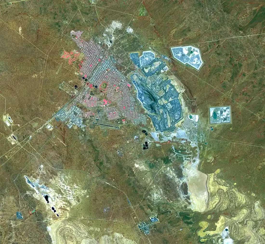
The community sits on the Great Central Road between the Gibson Desert (north, on the shire community page) and the Great Victoria Desert (south, same page). The Bureau of Meteorology’s Warburton Airfield station is at 26.13°S, 126.58°E, elevation 459 m. Use those coordinates, not a Victoria pin.
| Place | Distance on the Shire of Ngaanyatjarraku Our Region page |
|---|---|
| Perth | 1,542 km northeast of Perth |
| Laverton | 560 km of gravel road northeast of Laverton |
| Kalgoorlie | 750 km northeast of Kalgoorlie |
| Alice Springs | 1,050 km southwest of Alice Springs |
The shire’s Tjulyuru page also describes the centre as on the Great Central Highway 1000 km north-east of Kalgoorlie, and the Warburton (Milyirrtjarra) community page gives 920 km north-east of Kalgoorlie. Those are different shire figures for the same corridor. This guide quotes the Our Region table above and does not invent a fourth number. Treat all of them as “a long Goldfields–desert run”, then measure your own fuel.
The shire area is 159,948 square kilometres. Ngaanyatjarra Council’s permit page uses the same Lands area when it describes the reserve. You are not in wheatbelt Warburton Victoria. You are in Central Desert country on a remote road that the shire still describes as gravel on the Laverton approach.
Facts at a glance
Population. Australian Bureau of Statistics 2021 Census, Urban Centres and Localities UCL521049 Warburton (L) (WA): 511 people. Median age 28. Sex split 48.3% male / 51.7% female. Aboriginal and/or Torres Strait Islander people 431 (84.3%). Suburbs and localities SAL51530 is also 511 people. Do not mix this with Warburton Victoria. Read the ABS QuickStats page for Warburton (L) (WA).
Climate. Bureau of Meteorology station WARBURTON AIRFIELD, 013011, commenced 1940, status open. Location 26.13°S, 126.58°E, elevation 459 m. Annual mean rainfall 241.8 mm (60 years, 1940–2026). Hottest month by mean maximum: January 38.0 °C. Coolest months by mean maximum: June 20.8 °C and July 20.9 °C. Mean annual maximum 30.0 °C. Mean annual minimum 15.1 °C. Full columns: BOM Warburton Airfield climate table. See Warburton WA weather.
Shire. Shire of Ngaanyatjarraku, offices at the Tjulyuru Cultural and Civic Centre, Great Central Road, Warburton Community. Phone 08 8956 7966. Email mail@ngaanyatjarraku.wa.gov.au.
Traditional Owners
This is Ngaanyatjarra Country. The shire’s Our Region page states that its community of interest is contained within the traditional lands of the Ngaanyatjarra people of the Central Desert, and that 99-year leases held by the Ngaanyatjarra Land Council on behalf of the traditional owners also form the shire boundary. Ngaanyatjarra Council’s permit page states that the Lands are governed and controlled by the Ngaanyatjarra people, that it is private land, and that the Council issues permits on behalf of the people under Council by-laws.
The shire community page uses Yarnangu for people of the Lands and records that Warburton was the first community established on the Lands. Photography and landscape rules on the shire’s general visitor page are cultural rules, not optional etiquette. Ask first. The shire notes that Yarnangu may reply wanti — leave it alone.
This guide does not invent a tourism “welcome to Country script” or a single plaque sentence beyond those official pages.
Permits and access
Access is the whole story. Do not drive in and hope.
Two applications, on the Shire of Ngaanyatjarraku permit page:
- A 3-day transit permit from Ngaanyatjarra Council.
- A permit to access or travel through Aboriginal land from the Department of Planning, Lands and Heritage (ALPS / Aboriginal Affairs Planning Authority Lands Permit System).
The shire says obtain permits before travelling the Great Central Road and allow two to three weeks. DPLH says apply several weeks ahead, and not more than thirty days before the journey. Traditional owners may refuse a permit. The area is patrolled; the shire says fines apply without a permit. Keep the permit with you.
Ngaanyatjarra Council describes a standard 3-day permit as three days and two nights to transit the Ngaanyatjarra Lands Reserve between the Northern Territory and Ngaanyatjarraku Shire borders (closest landmark Tjukayirla Roadhouse). Council says you cannot get more than three days for transit. If you cannot cross in three days, look for another route. Groups and tours get the same 3-day permit.
Roads Council lists for automatic approval: Great Central Road, Ngaanyatjarra Southern Road, Sandy Blight Junction Road, Gunbarrel Highway, Giles Mulga Park Road, Connie Sue Highway, Heather Highway. Abandoned section of Gunbarrel: not open to the public. Council does not issue or approve permits for the Anne Beadell Highway, Gary Junction Road, Neale Junction, or entry permits for Kiwirrkurra Community — those DPLH/other processes are a different application.
Communities. Council: enter only if you are providing an essential service. Otherwise no. The shire repeats that Great Central Road visitors are not permitted to enter communities; no exceptions. Roadhouses: Council says yes, you may enter; roadhouses are independently owned and operated.
Tjulyuru. The shire’s attraction page encourages visitors to the Tjulyuru Regional Arts Gallery and Warta Shop, Monday to Friday 8.30am–4.00pm or by appointment, and describes the complex as a civic and cultural hub on the Great Central Road at Warburton Community. That sits next to the community-entry rule. Confirm with Ngaanyatjarra Council and the shire (08 8956 7966) whether your transit permit covers the gallery before you treat it as a guaranteed stop. Do not wander residential streets.
Northern Territory travel needs Central Land Council advice on the DPLH page. This WA hub does not write NT permit steps.
Wider permit planning: fuel, permits and road conditions and remote-area travel safety.
History
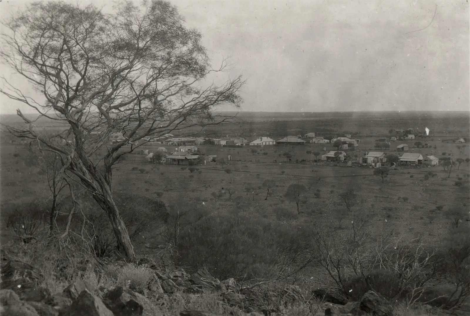
The shire community page is the source used here. Warburton or Mirlirrtjarra was the first community on the Lands after United Aboriginal Missionaries Will and Iris Wade established a base in the 1930s. The Old Well near the roadhouse was the first chosen mission site. The community takes its English name from the Warburton Ranges to the north, themselves named after a European explorer. People also call it Ranges. Mirlirrtjarra / Milyirrtjarra is the name of a nearby site.
Yarnangu lived a nomadic subsistence life before the mission. Movement onto the mission was gradual. In 1973 the mission organisation relinquished control to the incorporated Warburton Aboriginal Community with an elected Aboriginal council. In 1981 Ngaanyatjarra Council was incorporated; Warburton was among the first member communities named on that page.
This guide stops there. It does not invent gold-rush dates, hotel lists or explorer itineraries that the shire page does not carry.
Things to do
Transit time is short. The sourced visitor list is short on purpose. See things to do in Warburton WA.
Tjulyuru Cultural and Civic Centre — shire attraction: Tjulyuru Regional Arts Gallery and Warta Shop. The shire describes exhibitions from contemporary regional practice and the Warburton Art Collection, which it calls the most substantial collection of Aboriginal art in the country under direct Aboriginal ownership and control. Gallery opened October 2000, evolving from the Warburton Arts Project in 1990. Hours above; confirm permit access.
Great Central Road country named by the shire visitor page: Rawlinson Range, Walter James Ranges, Gill Pinnacle, Beadell’s Tree and Giles Meteorological Station along the Outback Way through the shire. Those are corridor features, not a Warburton main-street circuit. Stay on permitted roads.
Photography. Shire general visitor information: always ask first. Landscape photography may not be allowed for cultural reasons (sacred sites). Professional photographers need a legal agreement with Council to take and publish photos. Amateurs also need permission to publish.
Do not treat the community store, clinic, school, pool or oval on the shire facilities list as tourist attractions. They are community infrastructure.
Where to stay
This page does not invent lodges, room rates or star ratings. Ngaanyatjarra Council allows roadhouse entry. The shire community page names a roadhouse among local facilities. That is a stay type (roadhouse rooms / transit overnight), not a reviewed hotel. Confirm that an overnight fits your three days and two nights permit, and that the roadhouse is open, before you plan to sleep.
- How to choose: Warburton WA accommodation
- Vans and camping: Warburton WA caravan parks
- Operator enquiries for this site: feature your business
If you cannot transit in three days, Council says consider another route. Kalgoorlie-Boulder is the large Goldfields service centre on the western approach. Alice Springs sits on the eastern Outback Way story. Neither is a 20-minute neighbour.
Caravan and camping
A 3-day transit permit is not a touring-park holiday. Council and the shire do not publish a town caravan-park directory on the pages used for this research. Do not camp in the community. Do not assume a rest bay is a legal overnight. Ask Council, the shire and the roadhouse what is allowed on your permit. After rain, closed roads stay closed. Read Warburton WA caravan parks and outback camping.
Fuel and services
The shire community page lists a community store (dry goods, frozen food, fruit and vegetables, resupplied fortnightly), a clinic (Ngaanyatjarra Health Service), a workshop/garage, a police station and shire administration. Those are community and essential-service facts. Transit travellers should not treat the store or clinic as a tourist stop. Fill fuel at permitted roadhouses when they are open. Carry extra fuel, water and tyres. Mechanical help is not a highway-hour guarantee. This guide does not list bowser brands or opening hours that go stale.
Road access
The Great Central Road is the Outback Way through this shire. DPLH states a transit permit is required between the Northern Territory border and Laverton along that road. Check:
- Shire of Ngaanyatjarraku road reports
- Main Roads WA travel map (DPLH safe-travel tip)
- Shire of Laverton reports for the western gravel before the Ngaanyatjarraku boundary
- NT road reports once you leave WA
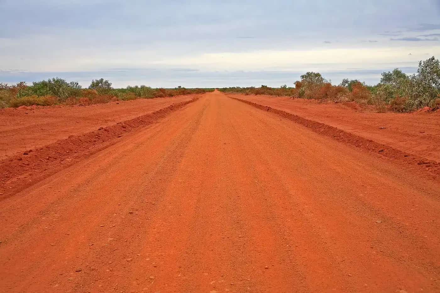
The shire road report uses Open, Open to 4WDs Only, and Closed to All Traffic. Closed means closed. Penalties apply. After rain the shire tells drivers to travel with extreme caution. This is remote desert road, not the sealed Yarra Ranges tourist drive in Victoria.
Council lists several side roads for automatic permit approval and others it will not approve. Stay on the roads named on your permit. Do not take the abandoned Gunbarrel section.
Nearby parks and towns
There is no national park inside Warburton on the Parks and Wildlife pages used for this research. The shire visitor page names ranges and corridor sites on the Great Central Road, not a day-use national park on the main street.
On this site (journey towns, not suburbs):
- WA’s Golden Outback — regional hub
- The Outback Way — Laverton to Winton via this road
- Kalgoorlie-Boulder — Goldfields service centre on the western approach
- Alice Springs — eastern Outback Way service centre on the shire distance table
Laverton is the Goldfields start of this road on this site. Warakurna, Jameson (Mantamaru) and other Ngaanyatjarra communities appear on shire pages and do not have town guides here. Do not invent a neighbour list.
When to go, and how long
January’s 38.0 °C mean maximum at Warburton Airfield is hot desert summer. BOM records a highest temperature of 47.7 °C (10 January 2013) and a mean of 13.1 January days of 40 °C or more. July nights have a mean minimum of 5.8 °C; the record low is -5.0 °C (15 July 2002). Annual rainfall 241.8 mm is low, but individual years have reached 691.0 mm and daily falls above 100 mm. Rain closes the gravel. That is a shire road-report problem, not a reason to drive around a closed sign.
You get three days and two nights on the standard Lands transit permit. That is a crossing, not a week-long base. One roadhouse night plus gallery-if-permitted is the visitor shape this source set supports. Operators: feature your business. The listings slot stays empty until a checked listing exists.
Plan this trip
Tell us the dates, who you are travelling with and where you need help. We reply with planning notes for Warburton WA — we are not a booking agent.
Events and road-conditions newsletter
Occasional notes on outback festivals, race days and official road-condition sources — not a daily blast. We use these details only to send the newsletter.
Western Australia · Golden Outback
Things to do in Warburton WA
Things to do in Warburton WA on Ngaanyatjarra Lands: Tjulyuru gallery if your permit allows, Great Central Road ranges named by the shire, photography rules. Not Warburton Victoria.
Read · 4 min
Western Australia · Golden Outback
Warburton WA accommodation
Where to stay in Warburton WA: transit roadhouse stays on Ngaanyatjarra Lands, three-day permit limits, no invented lodges. Confirm Council and shire rules before you book.
Read · 4 min
Western Australia · Golden Outback
Warburton WA caravan parks
Camping and caravans at Warburton WA: Ngaanyatjarra 3-day transit limits, no community camping, roadhouse questions only. No invented park names.
Read · 4 min
Western Australia · Golden Outback
Warburton WA weather
Warburton WA climate from Bureau of Meteorology Warburton Airfield (013011): January mean maximum 38.0 °C, July 20.9 °C, annual rainfall 241.8 mm. Not Warburton Victoria.
Read · 4 min
Frequently asked questions
Is this Warburton in Victoria?
No. This guide is Warburton WA (ABS Warburton (L) (WA), UCL521049 / SAL51530) on Ngaanyatjarra Lands on the Great Central Road. Warburton in Victoria is a separate Yarra Ranges town and is not on this site.
What is Warburton WA’s population?
511 people at the 2021 Census for both the urban centre (UCL521049) and the suburbs-and-localities geography (SAL51530). Median age 28. Aboriginal and/or Torres Strait Islander people were 84.3% of the urban centre.
Do I need a permit to drive through Warburton WA?
Yes. Ngaanyatjarra Council and the Shire of Ngaanyatjarraku require a 3-day transit permit for the Ngaanyatjarra Lands, plus a Department of Planning, Lands and Heritage transit permit for Aboriginal land. Great Central Road is listed for automatic Ngaanyatjarra approval. Apply before you travel.
Can I enter Warburton community?
Ngaanyatjarra Council and the shire permit page say visitors travelling the Great Central Road are not permitted to enter communities except people providing essential services. Council says travellers may enter roadhouses. Confirm Tjulyuru and any other stop against your permit conditions before you leave the road.
How far is Warburton WA from Perth and Laverton?
The Shire of Ngaanyatjarraku Our Region page puts Warburton 1,542 km northeast of Perth, 560 km of gravel road northeast of Laverton, 750 km northeast of Kalgoorlie and 1,050 km southwest of Alice Springs.
What is the weather like in Warburton WA?
Bureau of Meteorology Warburton Airfield (013011) has a January mean maximum of 38.0 °C, a July mean maximum of 20.9 °C and annual mean rainfall of 241.8 mm. The full table is on the BOM page.
Sources and further reading
Facts on this page were checked against these primary and official sources. Conditions change — confirm before you travel or buy.
- Warburton (L) (WA) 2021 Census QuickStats (UCL521049) — Australian Bureau of Statistics
- Warburton (WA) 2021 Census QuickStats (SAL51530) — Australian Bureau of Statistics
- Climate statistics for Warburton Airfield (013011) — Bureau of Meteorology
- Permits — Ngaanyatjarra Council Group — Ngaanyatjarra Council
- Travel Through Aboriginal Land Permits — Shire of Ngaanyatjarraku
- Apply for a permit to access or travel through Aboriginal land — Government of Western Australia
- Our Region — Shire of Ngaanyatjarraku — Shire of Ngaanyatjarraku
- Warburton (Milyirrtjarra) — Shire of Ngaanyatjarraku
- Tjulyuru Cultural and Civic Centre — Shire of Ngaanyatjarraku
- Road Reports — Shire of Ngaanyatjarraku — Shire of Ngaanyatjarraku
- Main Roads WA travel map — Main Roads Western Australia