At a glance
Sourced facts only. Distances and services change — confirm before you travel.
- Population
- 1,761 people (UCL115113, 2021 Census)
- Local government
- Bogan Shire
- Traditional Owners
- Wangaaypuwan (Wongaibon), Ngiyampaa (Ngemba) and Wayilwan (Weilwan) lands (Bogan Shire history page)Visitor-centre and history acknowledgements also name Ngemba, Wayilwan and Wiradjuri Mayi. Confirm wording at the railway-station VIC.
- Nearest regional city
- Dubbo, approximately two hours east of Nyngan from Dubbo Airport (Bogan Shire; Visit NSW). A Nyngan–Dubbo kilometre is not printed on those pages.
- Capital
- About seven hours from Sydney, six from Canberra and nine from Melbourne (Visit NSW). Kilometres to those capitals are not printed on that page.
- Nearest fuel
- Service town at the Mitchell–Barrier junction — confirm bowsers in Nyngan; this guide does not name a brand. Fill here before Cobar or Bourke.
- Nearest hospital or clinic
- Nyngan Health Service, 15 Hoskins Street — 24-hour emergency (NSW Health / Western NSW LHD)
- Mobile coverage
- Check Telstra and Optus coverage maps before travel; coverage is generally good in town and can drop on Barrier Highway stretches west.
- Best time to visit
- May–September (cooler BOM Nyngan Airport mean maxima). July mean maximum 16.5 °C is the comfortable highway season on that table toward Cobar and Bourke.
Climate
Monthly means from the Bureau of Meteorology station Nyngan Airport (051039). This is not a forecast. Open. Commenced 1879. Elevation 173 m. Temperature 97 years (1920–2025); rainfall 138 years (1879–2026). Monthly columns copied from the complete Nyngan Airport tables used on this site’s Hermidale weather page.
| Month | Mean max (°C) | Mean min (°C) | Rainfall (mm) |
|---|---|---|---|
| Jan | 34.5 | 19.7 | 50.5 |
| Feb | 33.4 | 19.3 | 46.5 |
| Mar | 30.6 | 16.5 | 41.8 |
| Apr | 25.7 | 12.0 | 33.7 |
| May | 20.7 | 7.8 | 36.3 |
| Jun | 17.0 | 5.0 | 33.6 |
| Jul | 16.5 | 3.8 | 28.9 |
| Aug | 18.6 | 4.8 | 29.4 |
| Sep | 22.7 | 7.8 | 27.2 |
| Oct | 26.7 | 11.5 | 34.0 |
| Nov | 30.1 | 15.1 | 36.5 |
| Dec | 33.0 | 17.9 | 43.5 |
Nyngan in pictures
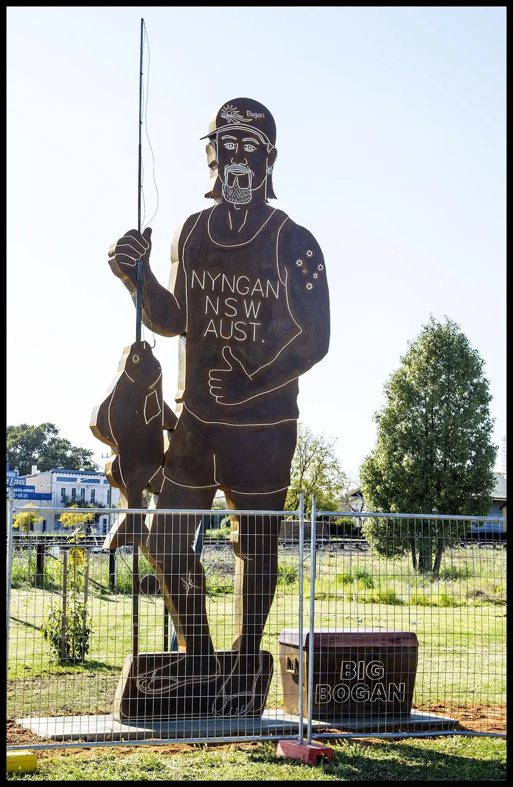
Nyngan Big Bogan Fishing Memorial-1Photo: Sheba_Also 43,000 photos · CC BY-SA 2.0 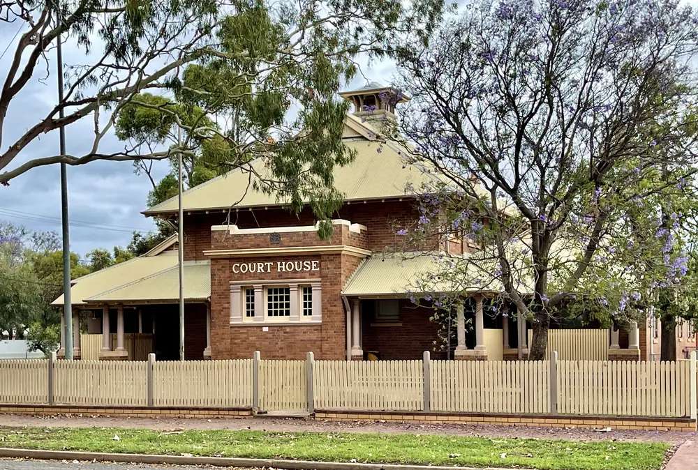
Nyngan Court House, NSW, 2021Photo: Kgbo · CC BY-SA 4.0 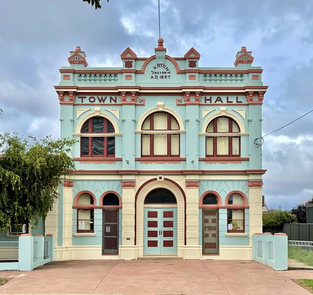
Nyngan Town Hall, NSW, 2021Photo: Kgbo · CC BY-SA 4.0 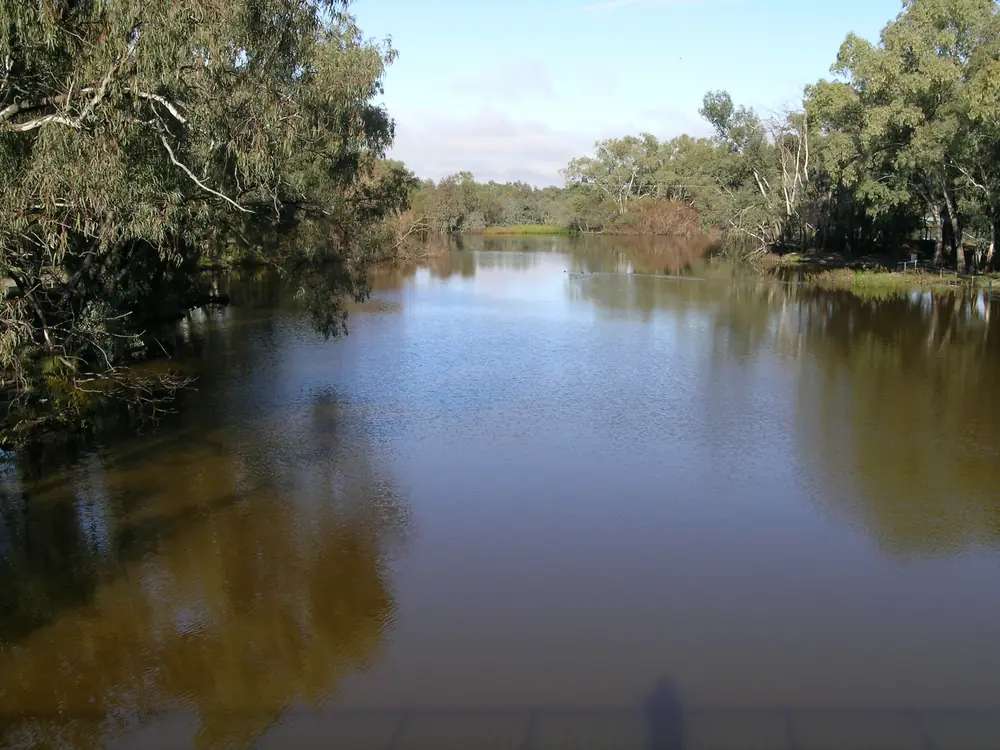
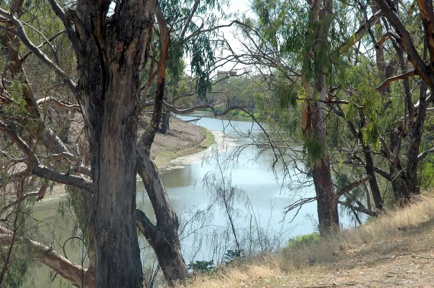
Bogan River-NynganPhoto: Cgoodwin · CC BY-SA 3.0
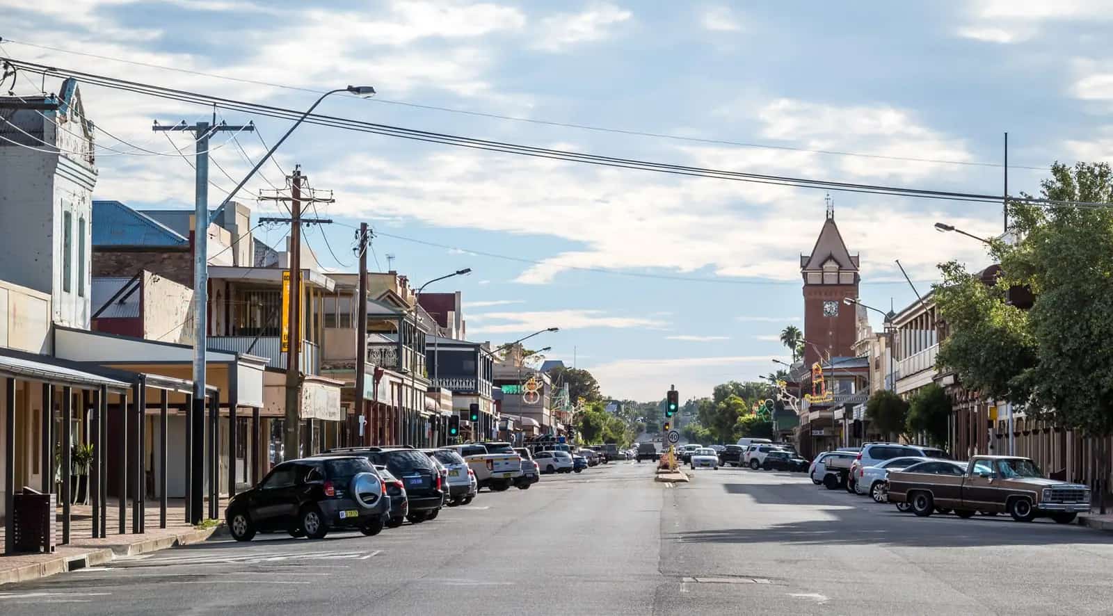
Nyngan sits on the Bogan River in central-western New South Wales, on the Mitchell Highway, at the point where the Barrier Highway starts west toward Cobar, Wilcannia and Broken Hill. Bogan Shire’s getting-there page places it approximately two hours west of Dubbo Airport, at GPS 31°33′S, 147°12′E. Visit NSW describes about seven hours from Sydney, six from Canberra and nine from Melbourne, or fly to Dubbo then that two-hour drive. Exact kilometres to Sydney, Dubbo or Cobar are not on those official pages. We do not fill them in from elsewhere.
The 2021 Census counted 1,761 people in the Nyngan Urban Centre and Locality (UCL115113), median age 39, 48.8% male and 51.2% female. The larger suburb and locality figure is 1,953 (SAL13060). Use the UCL for the town.
Bogan Shire’s history page places the shire across traditional lands of the Wangaaypuwan (Wongaibon), Ngiyampaa (Ngemba) and Wayilwan (Weilwan) peoples. Acknowledgements on the visitor centre and history pages name Ngemba, Wayilwan and Wiradjuri Mayi.
Nyngan is the highway-junction town on our outback NSW hub: the place many Sydney–Broken Hill or Sydney–Bourke drives first feel the country open out. Use things to do, accommodation, caravan parks and weather for the detail. Start at the visitor centre in the historic railway station.
Things to do
Nyngan Visitor Information Centre and Nyngan Museum. In the historic railway station, Railway Square, Pangee Street. The VIC is the entrance to the museum. Hours listed by Bogan Shire: Monday–Friday 8.30am–4.00pm; Saturday–Sunday 10.00am–2.00pm. Phone (02) 6832 1056.
The Big Bogan. 70 Pangee Street. Steel sculpture almost six metres tall (NSW Government). The roadside photograph, then the museum for the rest of the story.
Bogan River. The VIC points to the river. Nature trails are listed there without a national-park name inside town. Stay on public access.
Nyngan Solar Plant and the Geographical Centre of NSW. Also flagged by the VIC. Ask at the desk for current viewing or access notes rather than assuming a self-drive gate is open.
Cobb & Co Heritage Trail sites. Visit NSW names Nyngan Coach Works, Royal Hotel, Barrett’s Hotel and the museum. Treat those as named historic sites on an official tourism page; confirm what you can actually go inside.
Council pages used for this research do not name a nearby NPWS park as a Nyngan day trip. We do not add Macquarie Marshes or Gundabooka as “nearby Nyngan”. Those places have their own geographies; Bourke is the Gundabooka town on this site.
Full notes: things to do in Nyngan.
Nearby
West on the Barrier Highway is Cobar. North-west on the Mitchell is Bourke. East, Dubbo is the airport and service city about two hours away on council and Visit NSW wording. South-east, Coonabarabran and the Warrumbungles sit in Explorer Country on the Newell, a different highway corridor.
This is a junction, not a wilderness trailhead. See the outback NSW road trip if Nyngan is night one or two of a westbound loop.
History and Country
Bogan Shire’s history page is the source for the following, not a local legend we have dressed up.
Charles Sturt passed through in 1828–29. Thomas Mitchell, on 10 May 1835, described “Nyingen” as a long pond. The railway was completed in 1883; Canonba declined as Nyngan grew. The Municipality of Nyngan was formed on 17 February 1891, Bogan Shire in 1906, amalgamated in 1972.
April 1990 flood: the levee breached on 24 April. Almost the entire population was airlifted. Damage about $50 million. A new levee was built one metre higher than the 1990 level. That event is still the story Nyngan tells about water on the Bogan. The museum in the railway station is the place to hear it with objects, not only a paragraph.
Country: use the shire wording above — Wangaaypuwan, Ngiyampaa / Ngemba, Wayilwan, and the VIC acknowledgement that also names Wiradjuri Mayi. Do not flatten that into a single invented nation for the townsite.
A suggested one- or two-day stop
Half day (highway transit). Pull off the Mitchell or Barrier. Big Bogan at 70 Pangee Street. Visitor centre and museum while it is open (note the short weekend hours). Fuel and food. Back on the highway toward Bourke or Cobar before dusk.
Overnight. As above, plus a walk to the Bogan River on public trails the VIC names, and time in the museum for the 1990 flood and Cobb & Co material. Stay in a motel, cabin, farmstay or campsite — Visit NSW lists those types; Callubri Station is the named farmstay example on that page.
Second night only if you have a station booking or you are waiting on weather. Nyngan is a junction town; it does not need a week unless you have work or family reasons.
NSW TrainLink coach to Dubbo is listed by Visit NSW / council travel notes as a public-transport option if you are not driving the whole way.
Seasons and when to go
Nyngan Airport (station 051039, commenced 1879, 31.55°S, 147.20°E, elevation 173 m) has a mean annual rainfall of 445.6 mm over 138 years (1879–2026). Hottest month by mean maximum: January 34.5°C. Coolest: July 16.5°C. That is hotter and drier than Coonabarabran, and drier than Moree. Summer is a heat plan; winter is the comfortable highway season. See Nyngan weather and outback summer heat.
The 1990 flood is a reminder that “dry town” is a mean, not a promise. After heavy rain, check Live Traffic NSW before you assume the Mitchell or Barrier is a straight run.
Getting there
- Mitchell Highway (Dubbo–Bourke), sealed.
- Barrier Highway begins at Nyngan and runs west to Cobar and Broken Hill, sealed.
- From Dubbo Airport: about two hours west (Bogan Shire).
- From Sydney: about seven hours (Visit NSW). Kilometres: unknown on that page.
- From Canberra: about six hours (Visit NSW).
- From Melbourne: about nine hours (Visit NSW).
- Coach: NSW TrainLink coach to Dubbo.
Check Live Traffic NSW for incidents, harvest traffic and flood-related closures. Road trains use both highways. See road trains, outback road rules and fuel, permits and road conditions.
Where to stay
Visit NSW lists motels, farmstays, cabins and campsites. The named example on that page is Callubri Station. Confirm current operators, including town caravan parks, at the visitor centre. We do not invent other station or motel names.
See Nyngan accommodation, caravan parks and outback station stays.
Food, fuel and supplies
Nyngan is a highway service town at a real junction: last straightforward restock for some travellers before Cobar or Bourke, depending on hours. Weekend museum hours close at 2pm; do not assume every counter in town matches weekday hours. Ask at the VIC rather than using a shop list we would have to invent.
Travel safety
Fatigue on the Mitchell and Barrier is the main killer on this corridor. Plan to be off the road before dusk. Wildlife, road trains and heat in January (mean maximum 34.5°C) are the ordinary hazards. The levee is part of the town’s flood story, not a walking attraction to climb. River trails stay on public, signed access.
If you are continuing to Corner Country or unsealed park roads beyond Broken Hill, Nyngan is still bitumen. The 4WD decisions start later. This town does not require a 4WD on the highways named above.
How long do you need in Nyngan?
A couple of hours covers the Big Bogan and the museum if you hit weekday hours. An overnight is the right highway stop on a Sydney–Broken Hill or Dubbo–Bourke drive. Two nights if you have booked Callubri Station or another farmstay the VIC confirms.
Is Nyngan “the outback”?
Destination NSW files it under Outback NSW (Cobar area). On this site it is the junction where many people first feel the plains open west of Dubbo. It is not Broken Hill and it is not a national park. It is the practical town that makes the Barrier and Mitchell choice. See where is the outback?.
What is the Geographical Centre of NSW?
The visitor centre points to it. Ask there for the current access notes. We do not invent a kilometre figure or a picnic-ground description that the council page did not give us in this research pass.
Practical information
Population 1,761 (2021 UCL). Median age 39. Mean annual rainfall 445.6 mm; January mean maximum 34.5°C; July 16.5°C at Nyngan Airport. VIC in the railway station, Railway Square, Pangee Street, (02) 6832 1056. Big Bogan at 70 Pangee Street. Road conditions: Live Traffic NSW.
Explore nearby
- Outback NSW
- Cobar — west on the Barrier
- Bourke — north-west on the Mitchell
- Coonabarabran — Explorer Country on the Newell
- Outback NSW road trip
Nyngan is the turn. Take the Barrier for the Silver City; take the Mitchell for back o’ Bourke. Either way, check Live Traffic NSW before you leave Pangee Street.
Plan this trip
Tell us the dates, who you are travelling with and where you need help. We reply with planning notes for Nyngan — we are not a booking agent.
Events and road-conditions newsletter
Occasional notes on outback festivals, race days and official road-condition sources — not a daily blast. We use these details only to send the newsletter.
Nyngan
Things to do
Things to do in Nyngan: the Big Bogan, Nyngan Museum in the railway station, Bogan River, Cobb & Co Heritage Trail sites, and VIC notes on the solar plant and Geographical Centre of NSW.
Read · 3 min
Nyngan
Accommodation
Where to stay in Nyngan: motels, farmstays, cabins and campsites. Visit NSW names Callubri Station. Confirm town operators at the railway-station visitor centre.
Read · 3 min
Nyngan
Caravan parks
Caravan parks and campsites in Nyngan: Visit NSW lists campsites and cabins, and names Callubri Station. Confirm town parks at the railway-station visitor centre.
Read · 3 min
Nyngan
Weather
Nyngan weather from Bureau of Meteorology station 051039: 445.6 mm of rain a year over 138 years, January mean max 34.5°C, July 16.5°C, and what that means on the Mitchell and Barrier highways.
Read · 3 min
Frequently asked questions
How do I get to Nyngan from Sydney?
Drive about seven hours (Visit NSW) or fly to Dubbo then drive about two hours west (Bogan Shire and Visit NSW). Exact kilometres to Sydney or Dubbo are not published on those official pages, so we do not invent them.
What is Nyngan’s population?
1,761 people at the 2021 Census (ABS Urban Centre and Locality UCL115113). Median age 39. Do not mix that with the larger suburb and locality figure of 1,953 (SAL13060).
What is the Big Bogan?
A steel sculpture almost six metres tall at 70 Pangee Street, listed by the NSW Government.
What happened in 1990?
An inland flood. Bogan Shire records that the levee breached on 24 April, almost the entire population was airlifted, damage was about $50 million, and a new levee was built one metre higher than the 1990 level.
Whose Country is Nyngan on?
Bogan Shire’s history page places the shire across Wangaaypuwan (Wongaibon), Ngiyampaa (Ngemba) and Wayilwan (Weilwan) lands. The VIC and history acknowledgements also name Ngemba, Wayilwan and Wiradjuri Mayi.
How dry is it?
Mean annual rainfall 445.6 mm at Nyngan Airport (BOM station 051039, 138 years, 1879–2026). January mean maximum 34.5°C; July 16.5°C.
Sources and further reading
Facts on this page were checked against these primary and official sources. Conditions change — confirm before you travel or buy.
- Nyngan (2021 Census QuickStats, UCL115113) — Australian Bureau of Statistics
- Climate statistics for Nyngan Airport (051039) — Bureau of Meteorology
- Nyngan Airport climate (all years) — Bureau of Meteorology
- Getting to Nyngan — Bogan Shire Council
- Nyngan — Destination NSW
- History of Nyngan — Bogan Shire Council
- Nyngan Visitor Information Centre — Bogan Shire Council
- Big Bogan — NSW Government
- Live Traffic NSW — Transport for NSW
- Nyngan Health Service — NSW Government / Western NSW Local Health District