At a glance
Sourced facts only. Distances and services change — confirm before you travel.
- Population
- 127 people (SAL11901, 2021 Census)
- Local government
- Bogan Shire
- Traditional Owners
- Wangaaypuwan (Wongaibon), Ngiyampaa (Ngemba) and Wayilwan (Weilwan) lands named for Bogan ShireBogan Shire’s history page. Confirm a Hermidale-only sentence at the Nyngan Visitor Information Centre.
- Nearest regional city
- Nyngan, east on the Barrier Highway (Bogan Shire maps and Visit NSW junction wording). A Hermidale kilometre is not printed on the pages fetched for this hub.
- Nearest fuel
- This guide does not list a bowser. Fill in Nyngan or Cobar. Bogan Shire’s eat-and-drink page names the Hermidale Hotel, not a fuel brand.
- Nearest hospital or clinic
- Confirm with NSW Health — do not invent a clinic name. Nyngan Health Service, 15 Hoskins Street, is the shire 24-hour emergency desk.
- Mobile coverage
- Check Telstra and Optus coverage maps before travel; do not assume a signal on Barrier Highway pull-offs.
- Best time to visit
- May–September (cooler BOM Nyngan Airport mean maxima). Visit NSW describes about seven hours from Sydney to Nyngan — a Nyngan figure, not a Hermidale offset.
Climate
Monthly means from the Bureau of Meteorology station Nyngan Airport (051039). This is not a forecast. Open. Nearest complete open Bogan Shire table — BOM publishes no Hermidale climate-averages table. Commenced 1879. Elevation 173 m. Temperature 97 years (1920–2025); rainfall 138 years (1879–2026). Cobar MO 048027 is the open table west; do not blend the two.
| Month | Mean max (°C) | Mean min (°C) | Rainfall (mm) |
|---|---|---|---|
| Jan | 34.5 | 19.7 | 50.5 |
| Feb | 33.4 | 19.3 | 46.5 |
| Mar | 30.6 | 16.5 | 41.8 |
| Apr | 25.7 | 12.0 | 33.7 |
| May | 20.7 | 7.8 | 36.3 |
| Jun | 17.0 | 5.0 | 33.6 |
| Jul | 16.5 | 3.8 | 28.9 |
| Aug | 18.6 | 4.8 | 29.4 |
| Sep | 22.7 | 7.8 | 27.2 |
| Oct | 26.7 | 11.5 | 34.0 |
| Nov | 30.1 | 15.1 | 36.5 |
| Dec | 33.0 | 17.9 | 43.5 |
Hermidale in pictures
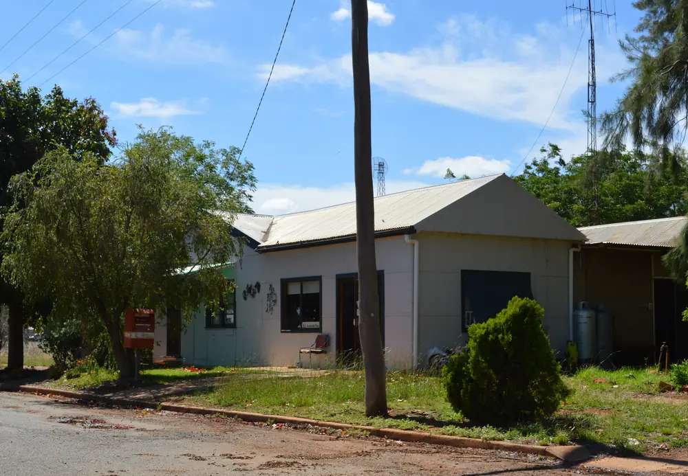
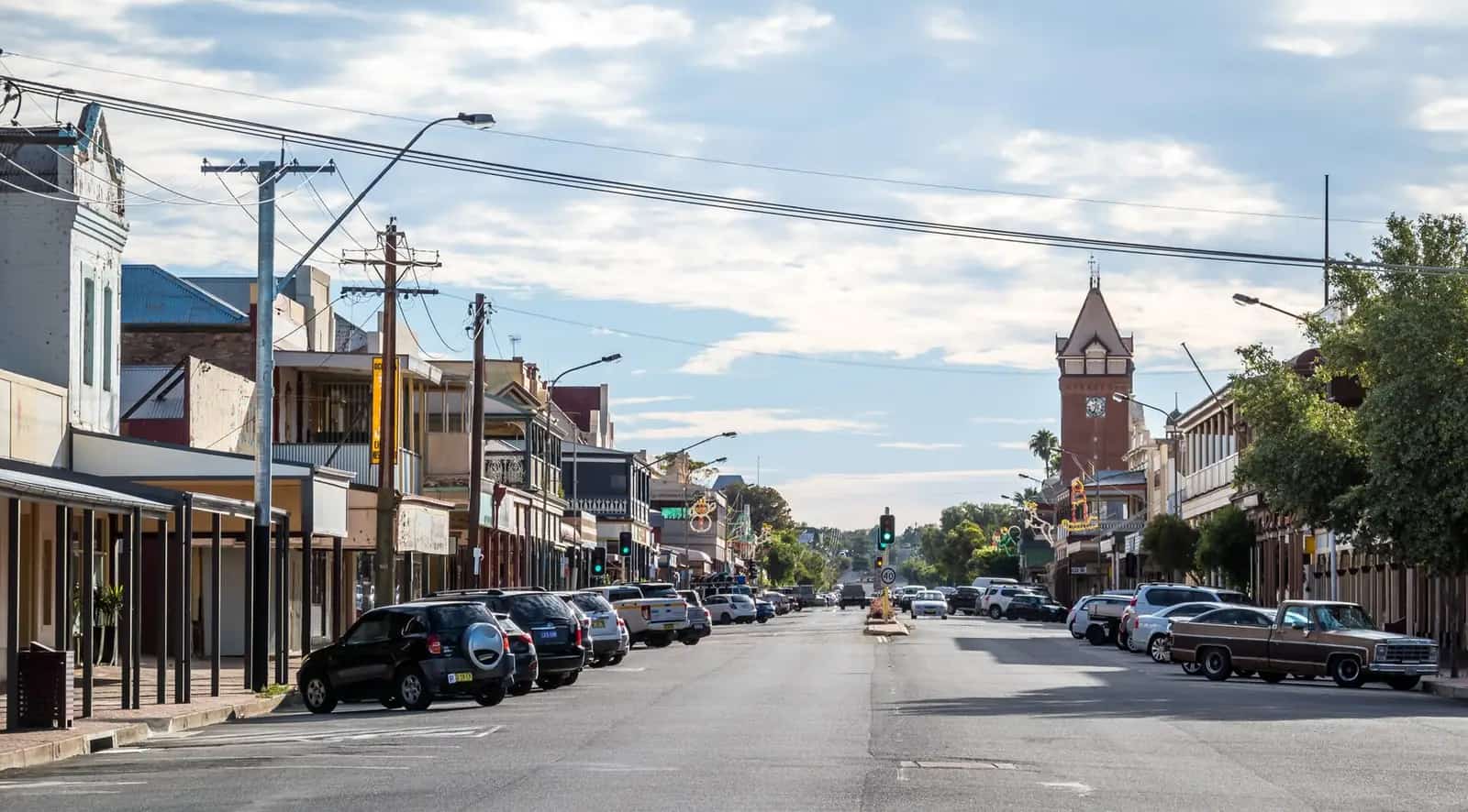
Hermidale Post OfficePhoto: Mattinbgn (talk · contribs) · CC BY 3.0 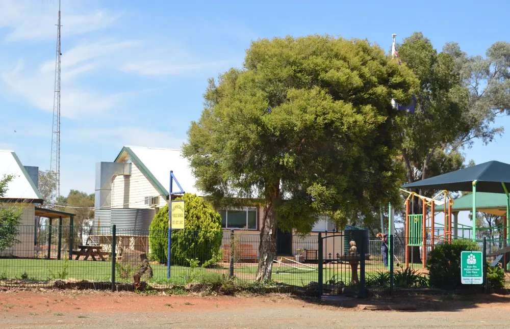
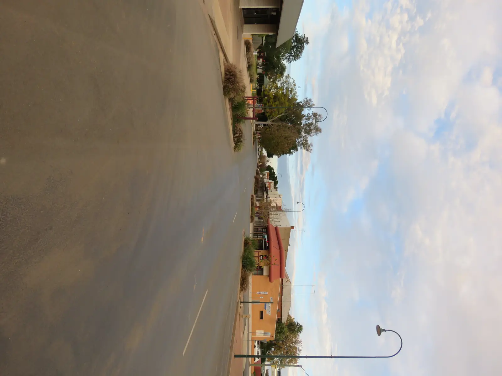
Hermidale Public SchoolPhoto: Mattinbgn (talk · contribs) · CC BY 3.0 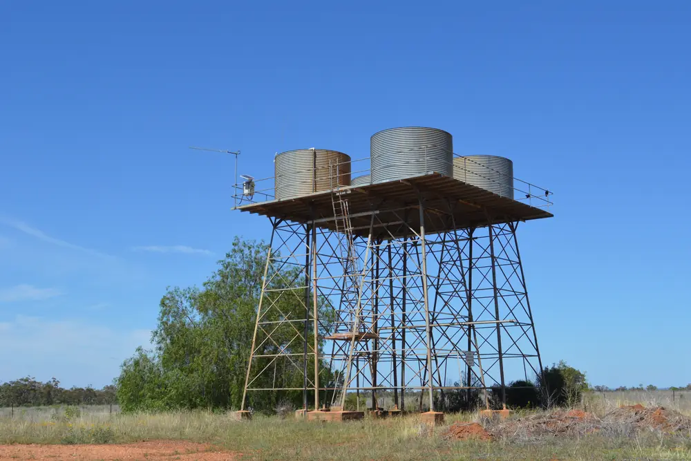
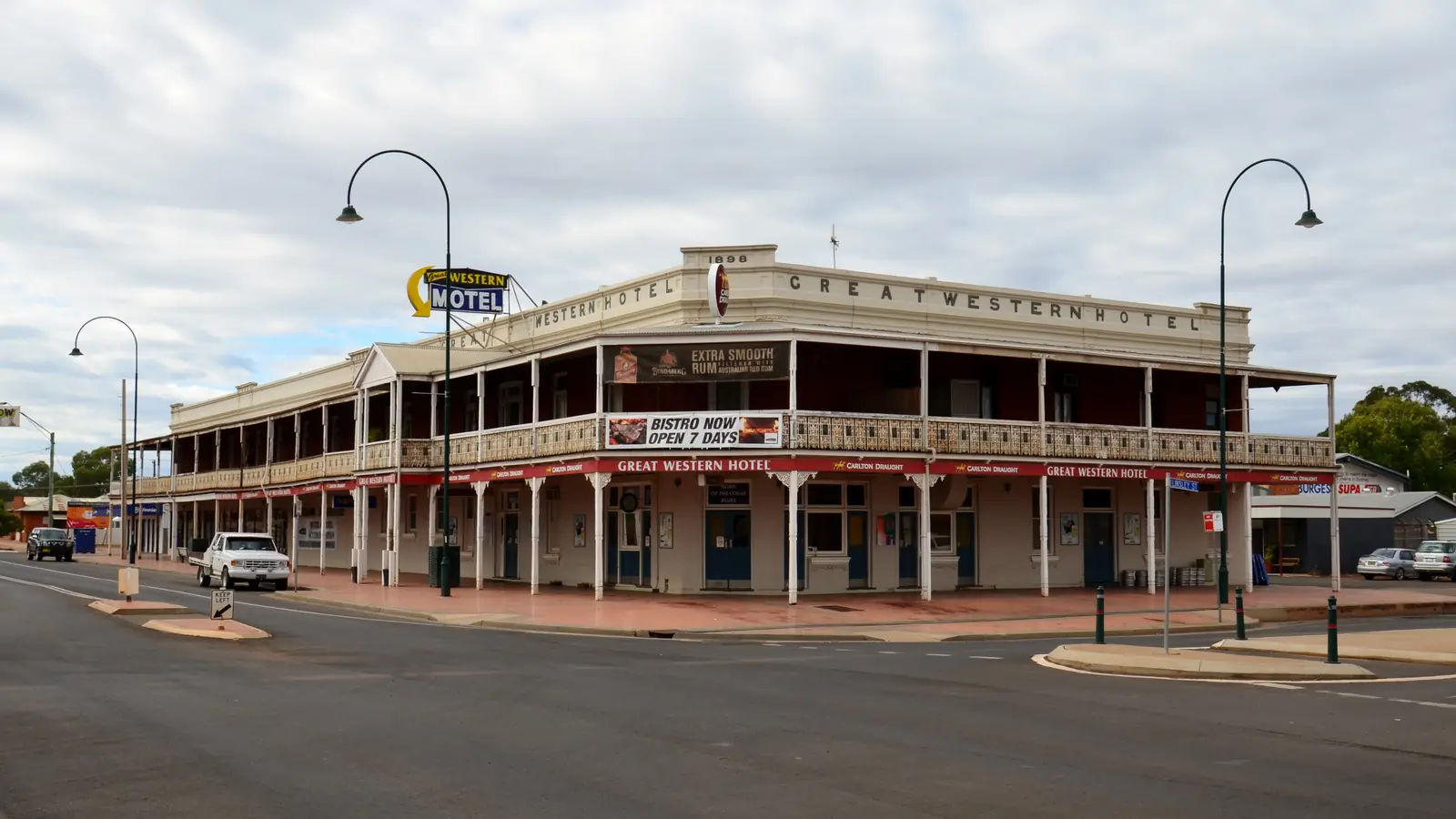
Hermidale Water TowerPhoto: Mattinbgn (talk · contribs) · CC BY 3.0 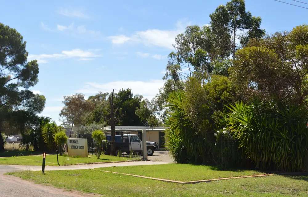
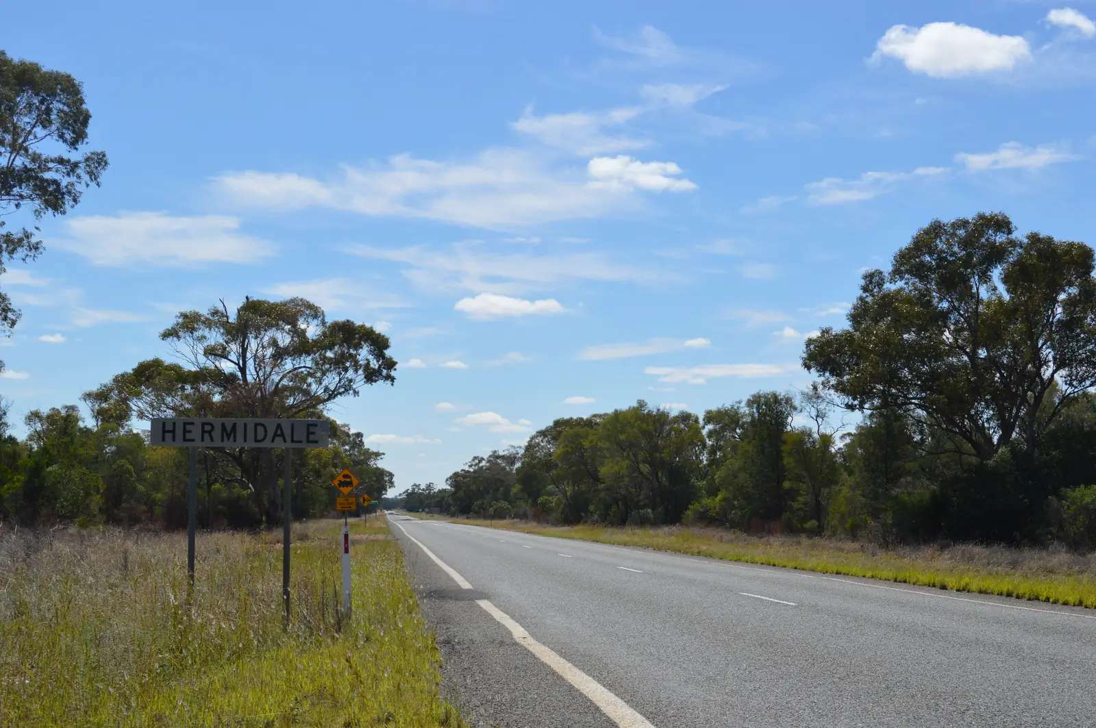
Hermidale Outback LodgePhoto: Mattinbgn (talk · contribs) · CC BY 3.0
Hermidale sits on the Barrier Highway in Bogan Shire, between Nyngan and Cobar, through outback NSW. Bogan Shire publishes a Hermidale Village Map beside Nyngan, Coolabah and Girilambone maps. Visit NSW treats Nyngan as the Barrier Highway junction where that road leaves the Mitchell for Cobar and Broken Hill. Hermidale is the named locality on that westbound seal, not a service city. This hub does not invent kilometres. Nyngan’s own guide on this site already records that exact Nyngan–Cobar kilometres are not on those official pages. After rain, Live Traffic NSW is the check on the Barrier before you leave Nyngan or Cobar for this locality.
The Australian Bureau of Statistics does not publish a 2021 Urban Centre (UCL) named Hermidale on the QuickStats pages used here. Use suburbs-and-localities SAL11901: 127 people, median age 43, sex split 55.7% male / 44.3% female, 29 families, 64 private dwellings. QuickStats notes small random adjustments for confidentiality. Read the ABS SAL QuickStats.
Travellers pass through on the Barrier Highway. The only visitor business named on Bogan Shire’s eat-and-drink page for this locality is the Hermidale Hotel, 1 Quanda Street. This hub will not invent a bowser, a hospital, a caravan park brand or a second pub.
Where it is, and how far
Hermidale is west of Nyngan and east of Cobar on the Barrier Highway. Bogan Shire’s getting-there page places Nyngan approximately two hours west of Dubbo Airport. Visit NSW describes about seven hours from Sydney to Nyngan. Those are Nyngan figures. This hub does not subtract an invented Hermidale offset from them.
| Place | Distance from Hermidale (sourced) |
|---|---|
| Nyngan | east on the Barrier Highway (Bogan Shire maps and Visit NSW junction wording; no kilometre on the pages fetched) |
| Cobar | west on the Barrier Highway (same; no kilometre on the pages fetched) |
| Bourke | north of Nyngan on the Mitchell Highway, not a Hermidale side road |
| Dubbo Airport to Nyngan | about two hours (Bogan Shire getting-there page) |
Bourke is the Mitchell Highway neighbour from Nyngan, not a Barrier Highway suburb of Hermidale. Fill and plan in Nyngan or Cobar.
Facts at a glance
Population. ABS 2021 Census, Suburbs and Localities SAL11901: 127 people. Median age 43. No UCL on the pages used here.
Climate. BOM does not publish a climate/averages/tables page named Hermidale in the NSW monthly-statistics list used here. Use Nyngan Airport, 051039, the nearest open Bogan Shire table: commenced 1879, location 31.55°S, 147.20°E, elevation 173 m. January mean maximum 34.5 °C, July 16.5 °C, annual rainfall 445.6 mm (138 years, 1879–2026). Cobar MO, 048027, west of here, is the other open highway table: January 34.6 °C, July 16.0 °C, annual rainfall 397.2 mm. Do not average the two into a fake Hermidale mean. See Hermidale weather.
Visitor information. There is no Hermidale VIC on the sourced pages. Use Nyngan Visitor Information Centre in the historic railway station, Railway Square, Pangee Street. Bogan Shire hours used on this site’s Nyngan guide: Monday–Friday 8.30am–4.00pm; Saturday–Sunday 10.00am–2.00pm. Phone (02) 6832 1056.
Traditional Owners
Bogan Shire’s history page places the shire across traditional lands of the Wangaaypuwan (Wongaibon), Ngiyampaa (Ngemba) and Wayilwan (Weilwan) peoples. Acknowledgements on Nyngan visitor pages also name Ngemba, Wayilwan and Wiradjuri Mayi. Hermidale is a Bogan Shire locality on that visitor account. This hub does not flatten several groups onto one village label. Confirm wording at (02) 6832 1056. Read visiting Country respectfully.
History
This hub does not invent a gazettal year, a copper-mine catalogue or a school history that was not on the Bogan Shire and Visit NSW pages fetched. What those pages do record is a named village on the Barrier Highway with a council map, grouped with Coolabah and Girilambone as the shire’s smaller settlements around Nyngan.
Nyngan’s own history on this site — drawn from Bogan Shire — is the regional story: Charles Sturt in 1828–29, Thomas Mitchell on 10 May 1835, the railway completed in 1883, the 1990 flood and airlift. Hermidale sits on the highway that starts at that flooded river town and runs west to Cobar. Ask at the Nyngan Museum in the railway station rather than expecting a Hermidale museum that is not on the sourced list.
Things to do
Hermidale Hotel — 1 Quanda Street, named on Bogan Shire’s eat-and-drink page. Confirm meals, rooms and hours at the Nyngan VIC. Do not treat a closed door as a 24-hour roadhouse.
Barrier Highway transit — pull off, check Live Traffic NSW, continue to Nyngan or Cobar. That is the honest visitor activity for a locality of 127 people.
There is no sourced heritage trail, bore bath, national park or big thing in Hermidale on the pages used here. Nyngan’s Big Bogan and museum are in Nyngan. Cobar’s mining story is in Cobar. See things to do in Hermidale.
Where to stay
Official named stay types:
- Hermidale Hotel — named by Bogan Shire at 1 Quanda Street; confirm whether rooms are offered
- Nyngan motels, cabins, farmstays and campsites — Visit NSW lists those types for Nyngan, including Callubri Station as a named farmstay example on that page
- Cobar — west on the same highway if you are continuing toward Broken Hill
Those are official named types, not a ranked inventory. Confirm at (02) 6832 1056. This page will not invent a caravan park brand for Hermidale.
- How to choose: Hermidale accommodation
- Camping detail: Hermidale caravan parks
- Operator enquiries: feature your business
If Hermidale is full or closed, Nyngan is the shire’s service town on the same Barrier Highway. That is a geography fact, not a booking guarantee.
Caravan and camping
Vans use Hermidale as a possible Barrier Highway pause, not as a park destination. This page does not invent a village caravan park. Ask the Nyngan VIC whether the hotel accepts vans and what Nyngan parks are open. Read Hermidale caravan parks. After rain, Live Traffic NSW first. Do not assume a highway rest area is a legal overnight.
Fuel and services
A locality of 127 people will not match Nyngan or Cobar for fuel, groceries or a hospital. This guide does not list a bowser, a shop brand or a 24-hour claim that is not on Bogan Shire’s Hermidale pages. The sourced service is the hotel on the eat-and-drink list. Fill in Nyngan or Cobar. Carry water. January’s mean maximum at Nyngan Airport is 34.5 °C.
For current questions, use Nyngan VIC (02) 6832 1056 and Bogan Shire Council.
Road access
The Barrier Highway is the sealed spine. It begins at Nyngan and runs west to Cobar, Wilcannia and Broken Hill. It is a freight road. After rain, check Live Traffic NSW. Road trains use it. See road trains and the outback NSW road trip.
East: Nyngan, then the Mitchell toward Dubbo or Bourke. West: Cobar. Do not invent a shortcut to Bourke from Hermidale that is not on the shire map.
Nearby parks and towns
There is no national park inside Hermidale on the visitor pages used here. Nyngan’s VIC points to the Bogan River in Nyngan, not in this locality.
Towns on this site:
- Nyngan — Barrier/Mitchell junction, Big Bogan, museum
- Cobar — mining service town west on the Barrier
- Bourke — Mitchell Highway, north from Nyngan
Coolabah and Girilambone appear on the same Bogan Shire map set but do not have town guides here.
When to go, and how long
Nyngan Airport’s January mean maximum of 34.5 °C is hot for a highway unhitch at midday. July’s 16.5 °C mean maximum is the comfortable driving season; July’s 3.8 °C mean minimum is why any overnight needs a layer. Annual rainfall 445.6 mm is the shire mean, not a Hermidale AWS. See Hermidale weather.
Nyngan’s 1990 flood is a reminder that “dry town” is a mean. After heavy rain, check Live Traffic NSW before you assume the Barrier is a straight run.
A meal stop is the honest Hermidale visit if the hotel is open. An overnight only if the VIC has confirmed a room or a legal site. Two full tourist days in the locality is more than the sourced list supports.
Operators who want a checked listing: feature your business. The listings slot stays empty until then.
Plan this trip
Tell us the dates, who you are travelling with and where you need help. We reply with planning notes for Hermidale — we are not a booking agent.
Events and road-conditions newsletter
Occasional notes on outback festivals, race days and official road-condition sources — not a daily blast. We use these details only to send the newsletter.
New South Wales · Outback NSW
Hermidale accommodation
Where to stay in Hermidale: Bogan Shire names the Hermidale Hotel on Quanda Street. Confirm rooms at Nyngan VIC. Do not expect a motel strip we invented.
Read · 3 min
New South Wales · Outback NSW
Hermidale caravan parks
Camping in Hermidale: Bogan Shire does not name a village caravan park on the pages used here. Confirm hotel van rules at Nyngan VIC. Nyngan and Cobar are the sourced park towns.
Read · 3 min
New South Wales · Outback NSW
Hermidale weather
Hermidale climate: BOM publishes no Hermidale monthly table. Use Nyngan Airport (051039): January mean max 34.5 °C, July 16.5 °C, annual rainfall 445.6 mm. Cobar MO is the west table.
Read · 4 min
New South Wales · Outback NSW
Things to do in Hermidale
Things to do in Hermidale: Bogan Shire names the Hermidale Hotel on Quanda Street. Nyngan’s Big Bogan and Cobar’s mining story are other town days — we do not invent Hermidale attractions.
Read · 3 min
Frequently asked questions
How far is Hermidale from Nyngan and Cobar?
Official Bogan Shire and Visit NSW pages used for this hub place Hermidale on the Barrier Highway between Nyngan and Cobar. They do not print a Hermidale kilometre on the extracts fetched here. This guide does not invent one.
What is Hermidale’s population?
127 people at the 2021 Census for Hermidale suburbs-and-localities (SAL11901), median age 43. The ABS does not publish a 2021 Urban Centre (UCL) named Hermidale on the QuickStats pages used here.
What services are in Hermidale?
Bogan Shire’s eat-and-drink page names the Hermidale Hotel at 1 Quanda Street. Council also publishes a Hermidale Village Map. This hub does not invent fuel, a hospital, a visitor centre or other services that are not on those official pages.
What is the weather like in Hermidale?
BOM does not publish a monthly climate-averages table named Hermidale in the NSW list used here. Use Nyngan Airport (051039), the nearest open Bogan Shire table: January mean maximum 34.5 °C, July 16.5 °C, annual rainfall 445.6 mm. Cobar MO (048027) is the open table to the west.
Whose Country is Hermidale on?
Bogan Shire’s history page places the shire across Wangaaypuwan (Wongaibon), Ngiyampaa (Ngemba) and Wayilwan (Weilwan) lands. Confirm a Hermidale-only sentence at the Nyngan Visitor Information Centre.
Sources and further reading
Facts on this page were checked against these primary and official sources. Conditions change — confirm before you travel or buy.
- Hermidale 2021 Census QuickStats (SAL11901) — Australian Bureau of Statistics
- Climate statistics for Nyngan Airport (051039) — Bureau of Meteorology
- Climate statistics for Cobar MO (048027) — Bureau of Meteorology
- Eat and Drink — Bogan Shire Council
- Maps — Bogan Shire Council
- Getting to Nyngan — Bogan Shire Council
- Nyngan — Destination NSW
- History of Nyngan — Bogan Shire Council
- Nyngan Visitor Information Centre — Bogan Shire Council
- Live Traffic NSW — Transport for NSW