At a glance
Sourced facts only. Distances and services change — confirm before you travel.
- Population
- 74 people (SAL12403, 2021 Census)
- Local government
- Bourke Shire
- Traditional Owners
- Ngemba and Barkindji for the Bourke Darling district; Kurnu-Baakandji at TooraleVisit Bourke’s Bourke page treats the district as Ngemba and Barkindji Country. NPWS: Toorale is jointly managed with the Kurnu-Baakandji. Confirm a single-nation sentence for the village with the Bourke visitor centre.
- Nearest regional city
- Darling River Run Bourke-to-Louth: 99 km east on Louth Road (mostly unsealed) or 126 km west on Toorale Road (104 km unsealed).
- Nearest fuel
- Visit Bourke names Louth as a pub, a fuel stop and a tiny school. The official Darling River Run Q&A lists fuel in Louth. Fill in Bourke as well.
- Nearest hospital or clinic
- Confirm with NSW Health — do not invent a clinic name. Bourke is the shire service town.
- Mobile coverage
- Check Telstra and Optus coverage maps before travel; do not assume a signal on surrounding roads.
- Best time to visit
- Darling River Run: autumn, winter and spring. Cooler BOM Bourke Airport AWS mean maxima May–September (nearest complete open table); January mean maximum 37.8 °C. Visit Bourke: Louth Races in August.
Climate
Monthly means from the Bureau of Meteorology station Bourke Airport AWS (048245). This is not a forecast. Open. Nearest complete open table used here — not a Louth town station. Bourke Airport AWS (048245), commenced 1998, elevation 107 m. Do not blend with closed Bourke Post Office.
| Month | Mean max (°C) | Mean min (°C) | Rainfall (mm) |
|---|---|---|---|
| Jan | 37.8 | 22.8 | 34.0 |
| Feb | 35.8 | 21.9 | 30.6 |
| Mar | 32.9 | 18.9 | 39.4 |
| Apr | 28.1 | 13.6 | 22.0 |
| May | 22.6 | 8.6 | 25.5 |
| Jun | 18.9 | 5.9 | 28.5 |
| Jul | 18.7 | 4.3 | 15.6 |
| Aug | 21.4 | 5.4 | 14.0 |
| Sep | 26.0 | 9.4 | 18.5 |
| Oct | 29.8 | 14.1 | 26.7 |
| Nov | 32.6 | 17.6 | 43.5 |
| Dec | 35.6 | 20.5 | 32.9 |
Louth in pictures
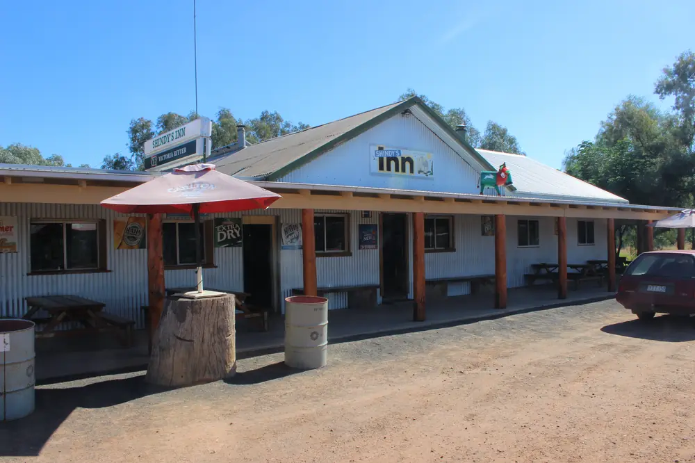
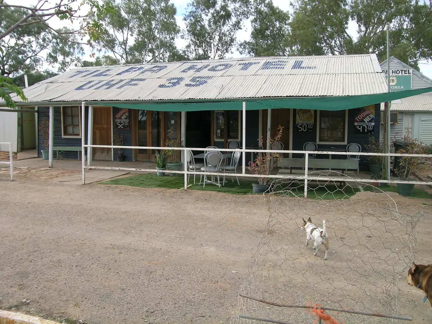
Hotel in Louth, New South WalesPhoto: Grahamec · CC BY-SA 3.0 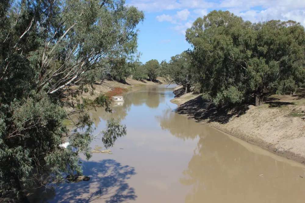
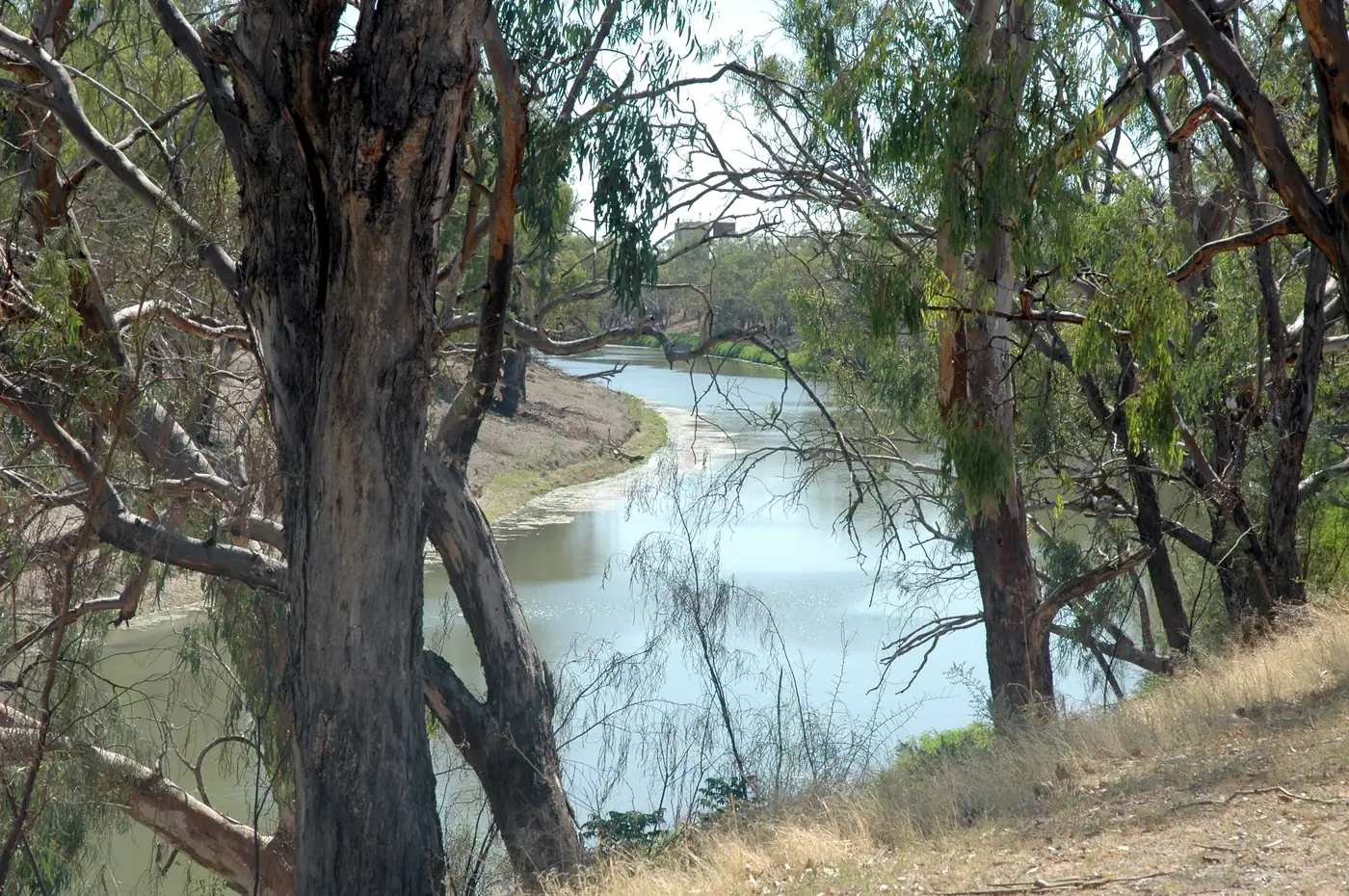
Darling River at LouthPhoto: Grahamec · CC BY-SA 3.0 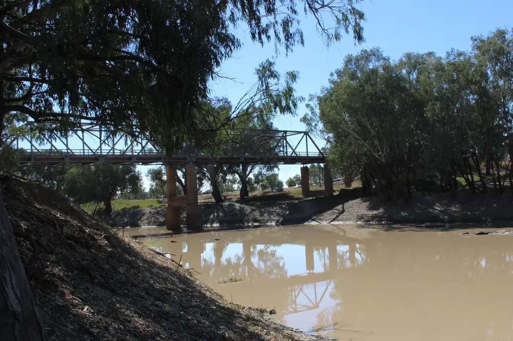
Louth bridge 1Photo: Grahamec · CC BY-SA 3.0 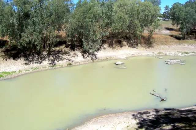
Darling River LouthPhoto: Poyt448 Peter Woodard · CC0
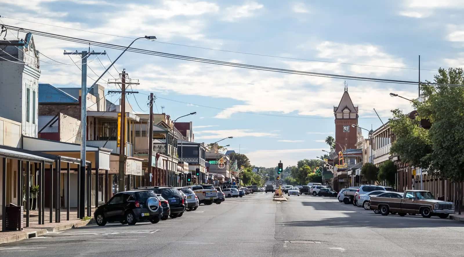
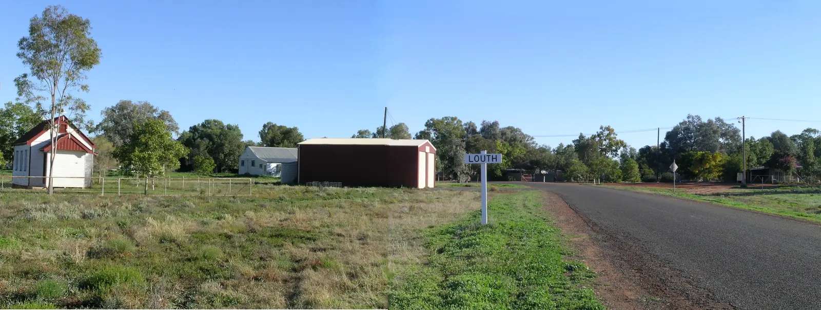
Louth sits on the Darling River (Baaka) in Bourke Shire, on the Darling River Run through outback NSW. Visit Bourke says the village was established in 1859 when an Irishman named T.A. Mathews built a pub for the river trade and Cobb and Co coaches. Today it names a pub, a fuel stop, and a tiny school. The Darling River Run’s Louth-to-Tilpa page puts Louth about 100 km downstream of Bourke. The same organisation’s Bourke-to-Louth page splits the drive: 99 km east on Louth Road (mostly unsealed) or 126 km west on Toorale Road (104 km unsealed). This is not a sealed Mitchell Highway suburb. You need Live Traffic NSW and the Bourke Shire road report after rain.
The Australian Bureau of Statistics does not publish a 2021 Urban Centre (UCL) named Louth. Use suburbs-and-localities SAL12403: 74 people, median age 51, sex split 53.5% male / 46.5% female. QuickStats notes limited tables because of the small population, and that small random adjustments have been made for confidentiality. Do not confuse this Louth with Louth Park (SAL12404, a different NSW locality). Read the ABS QuickStats page.
Travellers stop for Shindy’s Inn, the August races, the cemetery cross, Dunlop Station and the river. This hub is the village. Tilpa is the next Darling River Run stop downstream.
Where it is, and how far
Louth is west of Bourke on the Darling, with a choice of eastern or western river roads. Destination NSW’s Tilpa page puts Louth two hours’ drive northeast of Tilpa. This hub does not invent a Sydney kilometre that is not on the sourced pages. Fill and plan in Bourke.
| Place | Distance from Louth (sourced) |
|---|---|
| Bourke (east / Louth Road) | 99 km, mostly unsealed (Darling River Run Bourke-to-Louth) |
| Bourke (west / Toorale Road) | 126 km, 104 km unsealed (same page) |
| Tilpa (west / Toorale Road) | 91 km, partly sealed (Darling River Run Louth-to-Tilpa) |
| Tilpa (east / Darling River Road East) | 93 km (same page; the heading also calls the east route unsealed) |
| Dunlop Station | 14 km downstream (Visit Bourke) |
| Toorale National Park from Louth | cross the Darling River bridge and drive 30 km towards Bourke (NPWS Toorale getting-there) |
| Rose Isle Station | 70 km downstream of Bourke on the Louth–Bourke road (Visit Bourke / Visit NSW) |
Wilcannia is the next large Darling port after Tilpa, not a 20-minute side road. Gundabooka and Toorale are the park days from this corridor.
Facts at a glance
Population. ABS 2021 Census, Suburbs and Localities SAL12403: 74 people. Median age 51. 22 families, 68 private dwellings. No UCL. Use the Louth SAL QuickStats.
Climate. BOM does not publish a climate/averages/tables page named Louth (it is absent from the NSW monthly-statistics station list). Use Bourke Airport AWS, 048245, the nearest open table: commenced 1998, location 30.04°S, 145.95°E, elevation 107 m. January mean maximum 37.8 °C, July 18.7 °C, annual rainfall 315.7 mm (25 years, 1998–2026). The longer closed Bourke Post Office (048013) table remains useful as history (January 36.3 °C, annual 351.9 mm). Do not average the two into a fake Louth mean. See Louth weather.
Visitor information. There is no Louth VIC on the sourced pages. Use Visit Bourke / Back O’ Bourke, Kidman Way, (02) 6872 1321, info@backobourke.com.au. Shindy’s Inn phone on the Visit Bourke product page: (02) 6874 7422, 33 Bloxham Street.
Traditional Owners
Visit Bourke’s Bourke town page places the district on the traditional lands of the Ngemba and Barkindji peoples, with the Darling (Baaka) central to that story. Louth is a Bourke Shire village on that river. NSW National Parks says Toorale lies within the traditional lands of the Kurnu-Baakandji and is jointly managed with them; the NPWS Toorale notes used on this site give 30 km from Louth toward Bourke after the river bridge. This guide follows those official sentences rather than flattening several groups onto one village label. Confirm wording at (02) 6872 1321. Read visiting Country respectfully.
History
Visit Bourke: Louth was established in 1859 when T.A. Mathews built a pub for passing river trade and Cobb and Co. At one stage the town had three hotels, a cordial factory, three bakeries, two butchers, a post office, three churches, a Chinese garden, a general store, and a police station. That is the paddle-steamer boom in one list. The same page names a restored post office established in 1869 and a tiny church.
The cemetery holds an 8 metre polished granite Celtic Cross memorialising Mary Mathews, wife of Louth’s founder. Visit Bourke says that for three minutes at sunset the sun catches the monument and shines bright. Destination NSW’s Tilpa page spells the name Mary Matthew and calls her one of the founders; this hub follows Visit Bourke’s Louth spelling.
Dunlop Station, 14 km downstream, was established in 1880, once a million acres, and Visit Bourke calls it the first sheep station in the world to use mechanical shears. The Darling River Run’s Louth-to-Tilpa page dates the first completed mechanical shearing to 1888 and says Dunlop has tours every day except Monday. Confirm the current tour day with Bourke VIC or the station; this hub does not invent an opening hour.
Things to do
Shindy’s Inn — Visit Bourke: pub meal, artefacts, photos and memorabilia, seats under shady trees. Destination NSW: the town’s only shop and cafe, walls covered in photos. 33 Bloxham Street, (02) 6874 7422. Hours change.
Cemetery and Celtic Cross — 8 m granite, sunset catch (Visit Bourke).
Post office (1869) and Louth church — named on the Visit Bourke Louth page.
Louth Races — Visit Bourke: held in August each year. Destination NSW: horse racing, fashion and entertainment, and camping by the river. Confirm the current meeting with Bourke VIC rather than treating an old August as a ticket.
Dunlop Station — 14 km downstream; tours as the current operator and DRR page state.
Fishing — named as an attraction on Visit Bourke’s Louth page. NSW fisheries rules apply.
Toorale and Gundabooka — Visit Bourke groups Toorale, Louth and Tilpa as a loop. NPWS: 4WD for all Toorale roads. See things to do in Louth.
Where to stay
Official named stay types on Visit Bourke, Visit NSW and the Darling River Run:
- Shindy’s Inn — Visit Bourke lists it under accommodation as well as the pub
- Trilby Station — Louth NSW 2840 on Visit Bourke: stockman’s cottages, shearer’s bunkhouse, powered caravan sites and secluded river campsites
- Rose Isle Station — 6588 Louth Road, 70 km downstream of Bourke: powered and unpowered lawn and river sites, shearer quarters, cabins, cottages
- Dunlop Station — Visit NSW names unpowered riverside campsites and shearers’ huts; bookings required
- Toorale Darling River campground (Yapara Paaka Thuru) — NPWS, from Louth 30 km toward Bourke after the bridge
Those are official named types, not a ranked inventory. Confirm at (02) 6872 1321.
- How to choose: Louth accommodation
- Camping detail: Louth caravan parks
- Operator enquiries: feature your business
If Louth is full, Bourke is 99 km on the east route in ordinary (but unsealed) conditions and has more rooms. That is a distance fact, not a booking guarantee. Do not assume you can run that road after rain.
Caravan and camping
Vans use Louth as a Darling River Run overnight between Bourke and Tilpa. Official named camps are station stays (Trilby, Rose Isle, Dunlop), the Toorale river camp, and whatever Shindy’s Inn or the VIC currently describes for village camping. This page does not invent a “Louth campground” brand that is not on those official lists. Ask Bourke VIC for stay limits. Read Louth caravan parks. After rain, the constraint is the unsealed river road. Live Traffic NSW first.
Fuel and services
Visit Bourke says Louth consists of a pub, a fuel stop, and a tiny school. The official Darling River Run Q&A lists fuel in Louth among Brewarrina, Bourke, Tilpa, Wilcannia, Menindee and Wentworth. Distances between towns can be long. Fill in Bourke as well. Do not rely on remote fuel outside normal trading hours. This guide does not list bowser brands or 24-hour claims. Carry water. January’s mean maximum at Bourke Airport AWS is 37.8 °C.
Nearest hospital-scale services are in Bourke on that geography. For current questions, use Visit Bourke (02) 6872 1321.
Road access
The Darling River Run is the reason Louth is on a touring map. Louth Road (east, 99 km, mostly unsealed) and Toorale Road (west, 126 km) are the Bourke legs. Downstream, Toorale Road 91 km or Darling River Road East 93 km to Tilpa. Many sections are 2WD in dry weather on the official DRR Q&A; they still close after rain. Never drive on a closed road. Check Live Traffic NSW and Bourke Shire.
Kangaroos, goats, emus and stock are the same warning Bourke already prints for the unsealed roads to Louth. Avoid dawn and dusk.
Nearby parks and towns
Parks:
- Gundabooka and Toorale — rock art, homestead precinct, 4WD
- Darling River banks named for fishing and camping on Visit Bourke and DRR
Towns on this site:
- Bourke — 99 km east route; Back O’ Bourke Exhibition Centre
- Tilpa — next DRR village, Tilpa Hotel
- Wilcannia — sandstone port further downstream
- Menindee — lakes and Kinchega, further south on the Run
When to go, and how long
Bourke Airport AWS January mean maximum 37.8 °C is extreme for a cemetery walk at midday. July’s 18.7 °C mean maximum is the comfortable river season; July’s 4.3 °C mean minimum is why a river camp needs a layer. Annual rainfall 315.7 mm on the short open-station record is dry country that still floods. See Louth weather.
The official Darling River Run site recommends autumn, winter and spring, and says summer can exceed 40 °C with some station stays closed in the hotter months.
One night is the honest village stop: pub, cross, post office. Two nights if Dunlop is touring and the road is open, or if you are sitting out a closure. August is when Visit Bourke and Destination NSW place the races — confirm the date. Two full tourist days in the village is more than the sourced main-street list supports unless you are using Louth as a rest day on the Run.
Operators who want a checked listing: feature your business. The listings slot stays empty until then.
Plan this trip
Tell us the dates, who you are travelling with and where you need help. We reply with planning notes for Louth — we are not a booking agent.
Events and road-conditions newsletter
Occasional notes on outback festivals, race days and official road-condition sources — not a daily blast. We use these details only to send the newsletter.
New South Wales · Outback NSW
Louth accommodation
Where to stay in Louth: Shindy’s Inn and Darling River station stays named by Visit Bourke and the Darling River Run. Confirm at the Bourke visitor centre.
Read · 4 min
New South Wales · Outback NSW
Louth caravan parks
Camping in Louth: station stays and Toorale river camp as named by Visit Bourke, Visit NSW and the Darling River Run. Confirm at the Bourke VIC.
Read · 3 min
New South Wales · Outback NSW
Louth weather
Louth climate: BOM publishes no Louth monthly table. Use Bourke Airport AWS (048245): January mean max 37.8 °C, July 18.7 °C, annual rainfall 315.7 mm.
Read · 4 min
New South Wales · Outback NSW
Things to do in Louth
Things to do in Louth: Shindy’s Inn, August races, Mary Mathews Celtic Cross, 1869 post office, Dunlop Station and the Darling River Run toward Toorale and Tilpa.
Read · 4 min
Frequently asked questions
How far is Louth from Bourke?
The Darling River Run’s Bourke-to-Louth page puts the east route (Louth Road, mostly unsealed) at 99 km and the west route (Toorale Road) at 126 km, of which 104 km is unsealed. The Louth-to-Tilpa page also calls Louth about 100 km downstream of Bourke.
What is Louth’s population?
74 people at the 2021 Census for Louth suburbs-and-localities (SAL12403). The ABS does not publish a 2021 Urban Centre (UCL) named Louth. QuickStats notes limited tables because of the small population.
What is there in Louth?
Visit Bourke says the village consists of a pub, a fuel stop and a tiny school, and names Shindy’s Inn, the August races, the cemetery and 8 m Celtic Cross, the 1869 post office, the church, and Dunlop Station 14 km downstream.
What is the weather like in Louth?
BOM does not publish a monthly climate-averages table named Louth. Use Bourke Airport AWS (048245), the nearest open table: January mean maximum 37.8 °C, July 18.7 °C, annual rainfall 315.7 mm.
Do I need a 4WD?
The Darling River Run marks both Bourke–Louth legs as mostly unsealed. NSW National Parks says all roads in Toorale require a 4WD. Check Live Traffic NSW and the Bourke Shire road report. This guide does not invent a remaining-dirt kilometre beyond those pages.
Whose Country is Louth on?
Louth is a Bourke Shire village on the Darling (Baaka). Visit Bourke’s Bourke page treats the district as Ngemba and Barkindji Country. Toorale, 30 km from Louth on the NPWS page, is jointly managed with the Kurnu-Baakandji. Confirm a single-nation sentence for the village with the Bourke visitor centre.
Sources and further reading
Facts on this page were checked against these primary and official sources. Conditions change — confirm before you travel or buy.
- Louth 2021 Census QuickStats (SAL12403) — Australian Bureau of Statistics
- Climate statistics for Bourke Airport AWS (048245) — Bureau of Meteorology
- Visit Bourke — Louth — Bourke Shire Council
- SHINDY'S INN — Bourke Shire Council
- Bourke to Louth — The Darling River Run
- Louth to Tilpa — The Darling River Run
- Tilpa — Destination NSW
- Toorale National Park — NSW National Parks and Wildlife Service
- Live Traffic NSW — Transport for NSW