At a glance
Sourced facts only. Distances and services change — confirm before you travel.
- Local government
- Roper Gulf Regional Council
- Traditional Owners
- Roper Gulf names four town camps in the township boundary: Garawa Camp One, Garawa Camp Two, Yanyula Camp and Mara Camp. Parks NT names Yanyuwa for Barranyi (North Island) and Gadanji for Caranbirini — those are park sentences, not flattened onto the townsite here.Tourism NT names the road through Garawa Aboriginal Land Trust from Queensland. Confirm current wording with Roper Gulf and Parks NT.
- Nearest regional city
- Katherine. Roper Gulf puts the township 670 km east-south-east of Katherine, about seven hours on the sealed Carpentaria Highway. Tourism NT puts Borroloola 380 km from Daly Waters.
- Capital
- Darwin has no town page in this rebuild. A Darwin kilometre for the township is not printed on the Roper Gulf or Tourism NT Borroloola pages used here.
- Nearest fuel
- Roper Gulf / BushTel: Opal and diesel available in the community. Puma fuel cards accepted. This hub does not invent hours.
- Nearest hospital or clinic
- Roper Gulf / BushTel: Primary Health Care delivered by Top End Health Service, (08) 8975 8757. Police station yes.
- Mobile coverage
- Roper Gulf / BushTel: Telstra 4G telephone and internet coverage.
- Best time to visit
- May–September Dry on this site’s Top End pages. Parks NT Caranbirini fact sheet: most comfortable May–August. BOM Borroloola Airport (014723) November mean maximum 37.7 °C; June 30.5 °C, with a Wet-season rain peak.
Climate
Monthly means from the Bureau of Meteorology station Borroloola Airport (014723). This is not a forecast. Open. Not the main-street post office — Roper Gulf puts the sealed aerodrome about 1.5 km south of town. Elevation 16 m, commenced 1987. Temperature 32 years (1987–2026); rainfall 30 years (1987–2026). Latest available data 14 November 2026.
| Month | Mean max (°C) | Mean min (°C) | Rainfall (mm) |
|---|---|---|---|
| Jan | 34.7 | 25.0 | 206.2 |
| Feb | 34.2 | 24.6 | 210.9 |
| Mar | 34.0 | 23.5 | 167.6 |
| Apr | 34.3 | 20.4 | 54.6 |
| May | 32.5 | 15.8 | 6.4 |
| Jun | 30.5 | 12.9 | 1.5 |
| Jul | 30.7 | 12.3 | 1.0 |
| Aug | 32.3 | 13.7 | 0.6 |
| Sep | 35.2 | 17.7 | 3.4 |
| Oct | 37.2 | 21.6 | 13.2 |
| Nov | 37.7 | 24.0 | 70.1 |
| Dec | 36.8 | 25.2 | 140.7 |
Borroloola in pictures
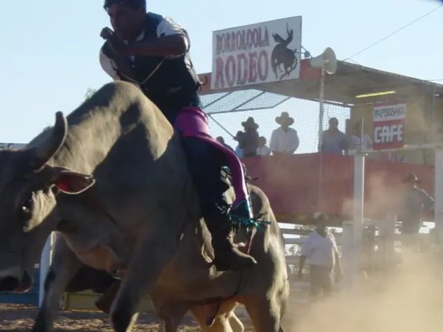
Borroloola rodeoPhoto: Peter Nihill · CC BY 2.0 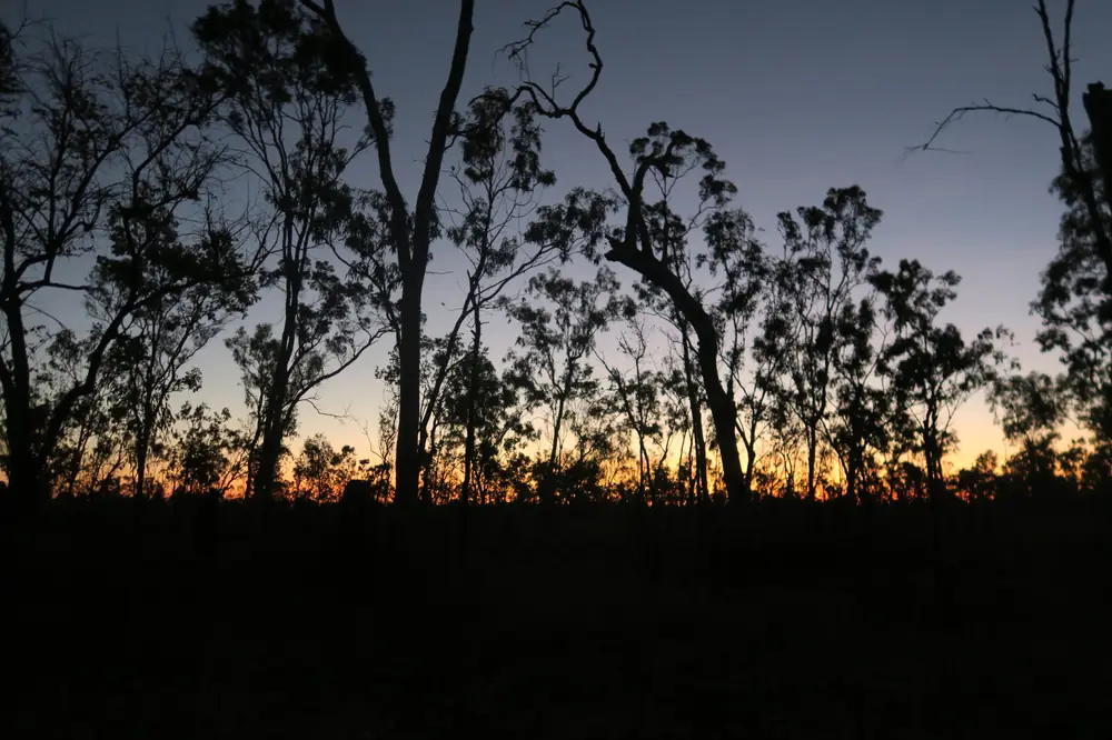
Bush at dusk at BorroloolaPhoto: Felix Dance · CC BY 2.0
Borroloola sits on the McArthur River in this site’s Top End hub, inside Roper Gulf Regional Council’s South West Gulf Ward, on the Gulf of Carpentaria and the Savannah Way. Roper Gulf puts the township 670 kilometres east-south-east of Katherine, about seven hours on the sealed Carpentaria Highway. Tourism NT puts it 380 km from Daly Waters. This hub is the Gulf / Savannah Way service town, not a Darwin suburb. Darwin is the Territory capital; it has no town page in this rebuild.
Tourism NT’s destination sentence is the geography used here: Borroloola is a remote fishing community on the banks of the McArthur River, considered the gateway to the Gulf region. That is a river-and-Gulf story, not a Stuart Highway railhead borrowed from Larrimah and not a thermal-pool story borrowed from Mataranka.
The 2021 Census Urban Centre (UCL721003) and suburbs-and-localities (SAL70037) both count 755 people, median age 32, sex split 50.5% male / 49.5% female. 182 families, 335 private dwellings, average household size 3.5. Aboriginal and/or Torres Strait Islander people 73.9% on the UCL table. Tourism NT prints approx. 950 residents; this hub uses the Census count. See Borroloola UCL QuickStats. Travellers stop for fishing, the old police station and the highway night. You still need Road report NT in the Wet, because Roper Gulf says the road east is unsealed and can close.
Where it is, and how far
Borroloola is the eastern Northern Territory settlement on the sealed Carpentaria Highway, which Roper Gulf describes as an all-weather, single-lane road. It is also on the Savannah Way, which that council page says links Cairns in Queensland and Broome in Western Australia. The Tablelands Highway links Tennant Creek. Tourism Top End: access the Gulf via the Savannah Way from Katherine or Burketown, the Tablelands Highway from Barkly Homestead, or the Carpentaria Highway from the Hi-Way Inn on the Stuart Highway.
Roper Gulf: the sealed Borroloola Aerodrome is approximately 1.5 km south of town; it is approximately two kilometres from the airstrip to the town centre. A barge landing is 40 kilometres from Borroloola, functional only when weather conditions are suitable. Tourism NT: King Ash Bay is 50 km from Borroloola on the McArthur River.
| Place | Distance from Borroloola (sourced) |
|---|---|
| Katherine | 670 km east-south-east; about seven hours (Roper Gulf) |
| Daly Waters | 380 km (Tourism NT) |
| King Ash Bay | 50 km (Tourism NT) |
| Caranbirini Conservation Reserve | 46 km south-west, or 64 km east of Cape Crawford (Parks NT) |
| Limmen National Park | 182 km northwest (Tourism Top End) |
| Barranyi boat run | 35 km via McArthur River and Carrington Channel (Parks NT) |
| Barge landing | 40 km (Roper Gulf) |
| Aerodrome | about 1.5 km south (Roper Gulf) |
A Darwin kilometre was not on those sourced town pages, so this hub does not invent one.
Facts at a glance
Population. ABS 2021 Census UCL721003 / SAL70037: 755 people. Median age 32. Use Borroloola UCL QuickStats.
Climate. Bureau of Meteorology BORROLOOLA AIRPORT, 014723, 16.08°S, 136.30°E, elevation 16 m, commenced 1987, status: open, latest available data 14 November 2026. Mean maximum (32 years, 1987–2026): November 37.7 °C, June 30.5 °C, annual 34.2 °C. Mean minimum: December 25.2 °C, July 12.3 °C, annual 19.7 °C. Mean rainfall (30 years, 1987–2026): annual 887.4 mm; February 210.9 mm wettest mean month; August 0.6 mm driest. Mean days of rain ≥ 1 mm: 53.9. This is a Gulf Wet–Dry table. See Borroloola weather.
Visitor information. Tourism NT, Tourism Top End and Roper Gulf are the official listings used here. Council office: 167 Robinson Road. Roads: Road report NT. Parks: NT Parks Visitor Pass for interstate and international visitors.
Traditional Owners
Official community wording on Roper Gulf: Borroloola includes four town camps within its boundary — Garawa Camp One, Garawa Camp Two, Yanyula Camp and Mara Camp. Township alcohol is unrestricted on that BushTel table; the four town camps are Alcohol Protected Areas.
Parks NT’s Barranyi (North Island) National Park page: the island is home to the Yanyuwa Aboriginal people. Do not go into the residential area of the traditional owners at Webe Point. Parks NT’s Caranbirini page: the waterhole provides traditional food for the Gadanji people; landscapes tell the dreaming story of Barrawulla, the white cockatoo, and Jagududgu, the emu. Tourism NT names the road through Garawa Aboriginal Land Trust from Queensland.
This guide does not flatten the Barranyi Yanyuwa sentence or the Caranbirini Gadanji sentence onto the townsite as a single label. Confirm current wording at Roper Gulf and Parks NT. See visiting Country respectfully.
History
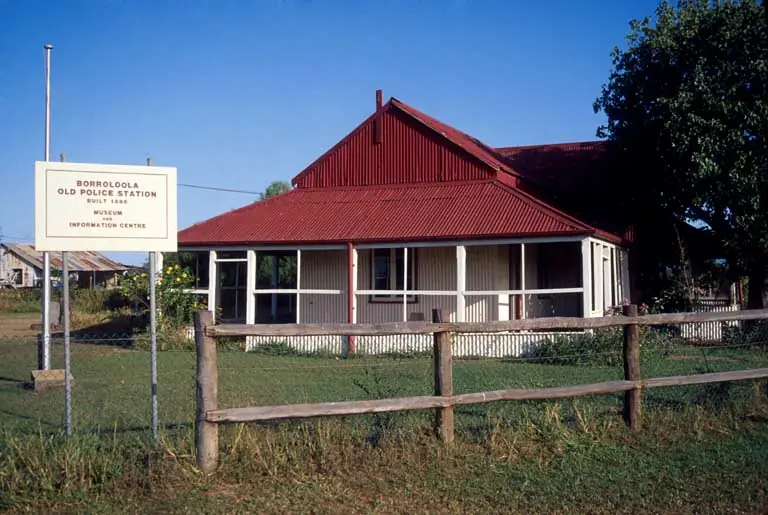
Tourism Top End: Borroloola was first gazetted as a township in 1885, at which time it was considered a lawless outpost. Tourism NT’s old police station listing: construction of the police station commenced in 1887; the building is cypress pine framing and floors with unlined corrugated walls and ceilings and verandahs; the station operated from 1887 to 1947. From 1947 it was used as a Welfare Patrol depot, health clinic and community library. The Centenary of Borroloola saw restoration of the Old Police Station in 1985, which Tourism NT says was the catalyst for the National Trust Gulf Branch.
Tourism Top End: the Heritage Trail starts at the O’Shea and Johnson Graves on Robinson Road. Historic graves around town include the unusual headstone of William Sayle, one of the first drovers in the Northern Territory. Lynotts Lookout, named for Tom Lynott who first discovered traces of silver, lead and copper in the mid 1880s, is at the western end of Garawa Street, after the Police Station.
This is a river-port, police-outpost and Gulf stock-route founding, not a 1940 Gorrie Airfield story.
Things to do
Tourism NT, Tourism Top End and Parks NT name these in and around Borroloola:
- Fishing — Tourism NT: McArthur River, King Ash Bay, Sir Edward Pellew Group (red emperor, coral trout, parrot fish). Parks NT Barranyi names northern bluefin tuna, Spanish mackerel, queenfish, trevally and reef species. Do not swim — saltwater crocodiles and, at Barranyi, box jellyfish
- King Ash Bay — 50 km; Tourism NT: fishing spot all year; boat-and-fishing club; service station, mini-mart, houseboats, accommodation and fishing tours
- Old police station museum — Tourism NT: oldest remaining police station property in the NT; indicative tickets from $5. Tourism Top End: open seasonally May to September; entry fees apply
- Heritage Trail and historic graves — Tourism Top End
- Lynotts Lookout — Garawa Street
- Waralungku Arts — Tourism NT: indigenous art centre in town (pronounced Wharr Ral Loonghu on that listing)
- Caranbirini Conservation Reserve — 46 km south-west; sandstone pillars to 25 m; no camping; Parks NT listed closed with forecast opening 1 May 2027 when fetched for this guide — check the live Parks NT table
- Barranyi (North Island) National Park — boat only, 35 km from King Ash Bay; Mud Bay campground open; Paradice Bay campground and loop walk closed permanently on the Parks NT table fetched here
- Limmen National Park — 182 km northwest (Tourism Top End)
See things to do in Borroloola.
Where to stay
Roper Gulf’s BushTel table lists McArthur River Caravan Park, (08) 8975 8734, and Savannah Way Motel, (08) 8975 8883. Tourism NT’s destination page also names Savannah Way Motel. Tourism NT names King Ash Bay accommodation 50 km on. Tourism Top End names Limmen River Fishing Camp and Lorella Springs (caravan, camping and cabins, 180 km west) as Gulf-region stays, not Borroloola main-street rooms.
Those are official named types, not a ranked motel strip. This hub does not invent extra lodges or a star rating.
- How to choose: Borroloola accommodation
- Camping detail: Borroloola caravan parks
- Operator enquiries: feature your business
Caravan and camping
Vans use Borroloola as a Gulf night on the Savannah Way, or a base for King Ash Bay. Official named camping in town starts with McArthur River Caravan Park on Roper Gulf. King Ash Bay is a separate 50 km destination on Tourism NT. Parks NT: no camping at Caranbirini. Barranyi camping is boat-only, booked online before you go. Read Borroloola caravan parks and outback camping. Do not camp on the river bank where crocodile signs say no.
Fuel and services
Roper Gulf / BushTel: Opal and diesel in the community; Puma fuel cards accepted. Primary Health Care by Top End Health Service, (08) 8975 8757. Police, (08) 8975 8770. School, post office at 305 Robinson Road, council office at 167 Robinson Road, Telstra 4G, shops, early childcare and aged care listed as yes. Sealed airstrip about 1.5 km south. Katherine Coaches is the named regular transport.
A town of 755 people is the Gulf service centre Roper Gulf describes — still not Katherine. Fill before you leave if you are heading east on unsealed Savannah Way. Check Road report NT. See fuel, permits and road conditions.
Road access
West: sealed Carpentaria Highway to Cape Crawford and Daly Waters on the Stuart Highway. Roper Gulf: single-lane, all-weather, about seven hours from Katherine. East: unsealed Savannah Way; subject to Wet-season closures. Tablelands Highway toward Tennant Creek. Air: chartered small aircraft to the sealed aerodrome. After rain, Road report NT decides. Wildlife, cattle, road trains and crocodiles at the river are the Gulf risks — not a suburban street.
Nearby parks and towns
Named parks: Caranbirini Conservation Reserve, Barranyi (North Island) National Park, Limmen National Park. Tourism Top End also names Lorella Springs and Seven Emu Station as Gulf-region station stays.
Towns on this site:
- Katherine — 670 km west-north-west
- Daly Waters — 380 km, Carpentaria Highway junction with the Stuart
- Larrimah — Stuart Highway north of Daly Waters, not a Gulf suburb
- Mataranka — thermal pools on the Stuart, not a Borroloola day trip this hub will timetable
When to go, and how long
BOM Borroloola Airport’s November mean maximum of 37.7 °C and February 210.9 mm are the build-up and Wet. June’s 30.5 °C mean maximum and July’s 12.3 °C mean minimum, with August 0.6 mm, is the Dry on an 887.4 mm annual table. Parks NT’s Caranbirini fact sheet: most comfortable May–August. Tourism Top End’s old police station museum: open seasonally May to September. Caranbirini was seasonally closed with a Parks NT forecast opening of 1 May 2027 when this guide was fetched — always check the live table.
A town afternoon covers the museum (if open), Lynotts Lookout and a Waralungku visit. A night covers fuel and a named motel or van site. King Ash Bay is a separate 50 km. Barranyi is a boat expedition, not a town walk. Two fishing days is what Tourism NT’s Gulf wording supports; two full tourist days on Robinson Road alone is more than the sourced main-street list needs unless you are waiting out the Wet.
Operators who want a checked listing: feature your business. The listings slot on this hub stays empty until then.
Plan this trip
Tell us the dates, who you are travelling with and where you need help. We reply with planning notes for Borroloola — we are not a booking agent.
Events and road-conditions newsletter
Occasional notes on outback festivals, race days and official road-condition sources — not a daily blast. We use these details only to send the newsletter.
Northern Territory · Top End
Borroloola accommodation
Where to stay in Borroloola: Roper Gulf names Savannah Way Motel and McArthur River Caravan Park. Tourism NT names King Ash Bay 50 km on. Confirm before you unhitch. Gulf NT, not Darwin.
Read · 3 min
Northern Territory · Top End
Borroloola caravan parks
Camping in Borroloola: Roper Gulf names McArthur River Caravan Park. Tourism NT names King Ash Bay 50 km on. No camping at Caranbirini. Confirm before you unhitch. Gulf NT, not Darwin.
Read · 3 min
Northern Territory · Top End
Borroloola weather
Borroloola climate from BOM Borroloola Airport (014723): November mean max 37.7 °C, June 30.5 °C, annual rainfall 887.4 mm with February 210.9 mm. Open airport station, not the main street.
Read · 4 min
Northern Territory · Top End
Things to do in Borroloola
Things to do in Borroloola: McArthur River and King Ash Bay fishing, old police station museum, Caranbirini Lost City, Barranyi by boat. Gulf / Savannah Way NT, not a Darwin page.
Read · 4 min
Frequently asked questions
Is Borroloola in Darwin or on the Gulf?
This hub is Borroloola in Roper Gulf’s South West Gulf Ward, on the McArthur River and the Gulf of Carpentaria. Roper Gulf puts it 670 km east-south-east of Katherine. It is not a Darwin suburb. Darwin has no town page in this rebuild.
How far is Borroloola from Katherine and Daly Waters?
Roper Gulf: 670 kilometres east-south-east of Katherine, about seven hours on the sealed Carpentaria Highway. Tourism NT: 380 km from Daly Waters on the Carpentaria Highway, or on the road through Garawa Aboriginal Land Trust from Queensland.
What is Borroloola’s population?
755 people at the 2021 Census for both the urban centre (UCL721003) and suburbs-and-localities (SAL70037), median age 32. Aboriginal and/or Torres Strait Islander people 73.9% on the UCL table. Tourism NT prints approx. 950 residents; this hub uses the Census count.
What is there to do in Borroloola?
Tourism NT and Tourism Top End name fishing on the McArthur River and at King Ash Bay (50 km), the Sir Edward Pellew islands, Waralungku Arts, the old police station museum, a heritage trail from the O’Shea and Johnson Graves, and Lynotts Lookout. Parks NT names Caranbirini Conservation Reserve 46 km south-west and Barranyi (North Island) National Park by boat from King Ash Bay.
Can I camp at Borroloola?
Yes, as named types. Roper Gulf names McArthur River Caravan Park and Savannah Way Motel as commercial accommodation. Tourism NT names King Ash Bay 50 km on as a fishing-and-camping destination. Confirm on arrival. This hub does not invent extra parks.
What is the weather like in Borroloola?
BOM Borroloola Airport (014723, open): November mean maximum 37.7 °C, June 30.5 °C, annual rainfall 887.4 mm (30 years, 1987–2026). February 210.9 mm is the wettest mean month; August 0.6 mm the driest. Temperature means use 32 years (1987–2026). The station is the airport, about 1.5 km south of town on Roper Gulf.
Sources and further reading
Facts on this page were checked against these primary and official sources. Conditions change — confirm before you travel or buy.
- Borroloola (L) 2021 Census QuickStats (UCL721003) — Australian Bureau of Statistics
- Borroloola 2021 Census QuickStats (SAL70037) — Australian Bureau of Statistics
- Climate statistics for Borroloola Airport (014723) — Bureau of Meteorology
- Borroloola — Roper Gulf Regional Council
- Borroloola — Tourism NT
- Borroloola and the Gulf Region — Tourism Top End
- King Ash Bay — Tourism NT
- Barranyi (North Island) National Park — Northern Territory Government
- Caranbirini Conservation Reserve — Northern Territory Government
- Old Borroloola Police Station Museum Heritage Precinct — Tourism NT
- Road report NT — Northern Territory Government
- Be Crocwise NT — Northern Territory Government
- NT Parks Visitor Pass — Northern Territory Government