At a glance
Sourced facts only. Distances and services change — confirm before you travel.
- Local government
- Roper Gulf Regional Council
- Traditional Owners
- Not named for the Larrimah townsite on the sourced Tourism Top End or Roper Gulf town pagesTourism Top End prints that Larrimah means ‘meeting place’ in the local Aboriginal language. That sentence does not name a nation for the townsite, and this hub does not invent one.
- Nearest regional city
- Katherine. Tourism Top End puts Larrimah 185 km south of Katherine along the Stuart Highway. Roper Gulf puts the town 182 km south of Katherine and 76 km south of Mataranka.
- Capital
- Darwin has no town page in this rebuild. A Darwin kilometre for the township is not printed on the Tourism Top End or Roper Gulf Larrimah pages used here.
- Nearest fuel
- Roper Gulf / BushTel: no fuel in Larrimah. Fuel at Mataranka (76 km) or Daly Waters (100 km).
- Nearest hospital or clinic
- Roper Gulf / BushTel lists no health centre at Larrimah. Policing is from Mataranka Police Station. Nearest hospital is not printed on that council page; Katherine is the regional hospital named on the Daly Waters council page.
- Mobile coverage
- Roper Gulf / BushTel: Larrimah has Telstra 4G telephone and internet coverage. Do not assume a signal in every highway gap.
- Best time to visit
- May–September Dry on this site’s Top End Stuart Highway pages. BOM Larrimah (014612) January mean maximum 35.3 °C; June 29.2 °C, with a Wet-season rain peak.
Climate
Monthly means from the Bureau of Meteorology station Larrimah (014612). This is not a forecast. Open station in town. Elevation 180 m, commenced 1952. Temperature 46 years (1965–2012); rainfall 63 years (1952–2026). Latest available data 06 November 2026. Product used on this site’s Mataranka hub as the nearest complete open table for that town — here it is the Larrimah table.
| Month | Mean max (°C) | Mean min (°C) | Rainfall (mm) |
|---|---|---|---|
| Jan | 35.3 | 24.0 | 207.2 |
| Feb | 34.4 | 23.7 | 210.0 |
| Mar | 34.0 | 22.5 | 152.0 |
| Apr | 33.8 | 19.7 | 29.0 |
| May | 31.7 | 16.3 | 9.6 |
| Jun | 29.2 | 12.9 | 3.3 |
| Jul | 29.4 | 12.2 | 2.7 |
| Aug | 31.8 | 14.1 | 0.6 |
| Sep | 35.1 | 18.4 | 3.6 |
| Oct | 37.3 | 22.2 | 25.5 |
| Nov | 37.9 | 24.3 | 64.2 |
| Dec | 36.8 | 24.5 | 153.7 |
Larrimah in pictures
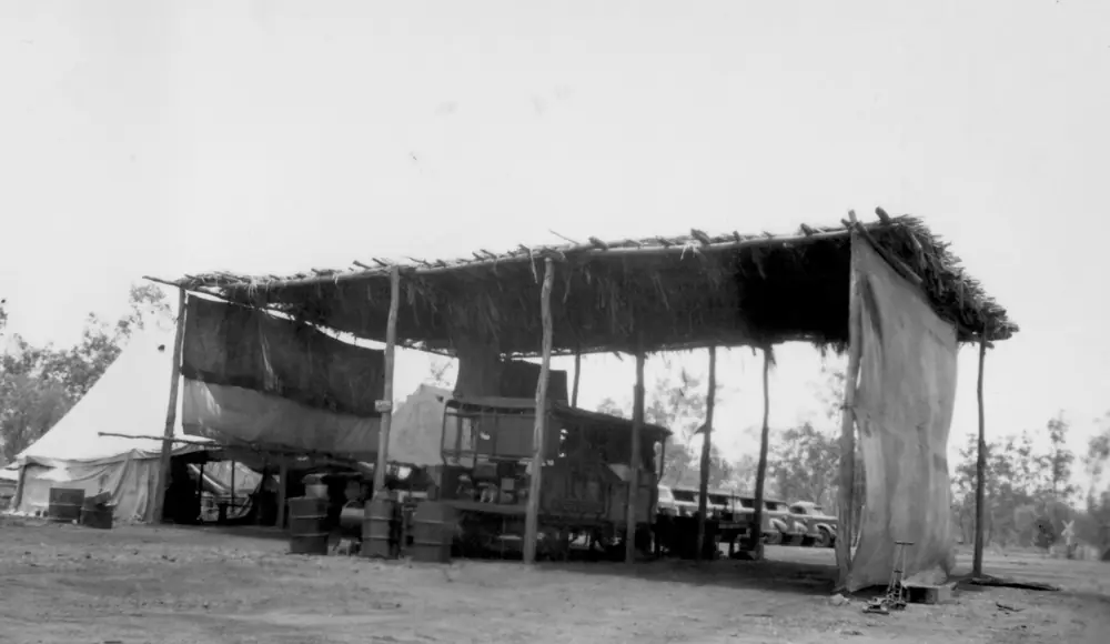
Workshop building at LarrimahPhoto: Chas Wales · CC BY-SA 4.0 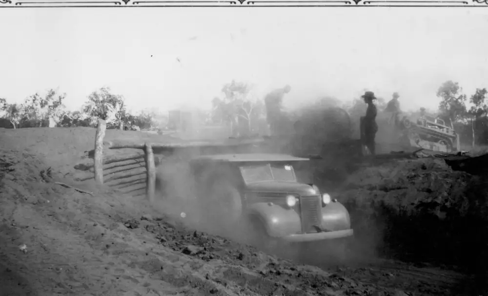
Workshop under construction at LarrimahPhoto: Chas Wales · CC BY-SA 4.0
Larrimah sits on the Stuart Highway in this site’s Top End hub, inside Roper Gulf Regional Council’s Never Never Ward, between Mataranka and Daly Waters. Tourism Top End puts the town 185 kilometres south of Katherine along the Stuart Highway. Roper Gulf puts it 182 kilometres south of Katherine and 76 kilometres south of Mataranka. This hub is the Stuart Highway railhead-and-wartime locality, not a Darwin suburb. Darwin is the Territory capital; it has no town page in this rebuild.
Tourism Top End’s destination sentence is the geography used here: Larrimah means ‘meeting place’ in the local Aboriginal language. It is a small town that came into being in 1940 with the construction of nearby Gorrie Airfield, later the rail head and shunting yards after the demise of Birdum, remaining a busy rail and road terminus until the railway closed in 1976. That is a wartime-and-railway founding, not a thermal-pool story borrowed from Mataranka and not a Gulf fishing story borrowed from Borroloola.
The Australian Bureau of Statistics does not publish a 2021 Urban Centre (UCL) named Larrimah. Use suburbs-and-localities SAL70160: 27 people, median age 37, sex split 64.3% male / 35.7% female. 9 families, 18 private dwellings, average household size 2.1. QuickStats notes limited tables because of the small population. Travellers stop for the pub, the museum and wartime relics. You still need Road report NT in the Wet, because a sealed highway is no use if a floodway is closed.
Where it is, and how far
Larrimah is the Stuart Highway settlement in the Birdum region, which Roper Gulf describes as stretching down the highway from south of Mataranka to Newcastle Waters Station. Tourism Top End and Roper Gulf both treat it as a Katherine-region highway town, not a Darwin street. Roper Gulf: the trip takes approximately two hours from Katherine on sealed double-lane Stuart Highway.
Tourism Top End puts Daly Waters 265 kilometres south of Katherine and Dunmarra 316 kilometres south of Katherine. Those Katherine-end figures are printed on the same official page as Larrimah’s 185 km. This hub does not subtract them into a fake Larrimah–Daly Waters kilometre. Roper Gulf’s Larrimah services table does print fuel at Daly Waters as 100 km from Larrimah, and fuel at Mataranka as 76 km.
| Place | Distance from Larrimah (sourced) |
|---|---|
| Katherine | 185 km south of Katherine (Tourism Top End); 182 km south of Katherine (Roper Gulf) |
| Mataranka | 76 km north (Roper Gulf) |
| Daly Waters (fuel) | 100 km (Roper Gulf fuel line) |
| Gorrie Airfield turn-off | 10 km north (Tourism Top End) |
| BIPOD and No.45 Camp Hospital signs | 7 km south (Tourism Top End) |
A Darwin kilometre was not on those sourced town pages, so this hub does not invent one. Darwin has no town page here.
Facts at a glance
Population. ABS 2021 Census SAL70160: 27 people. Median age 37. Limited tables. Use Larrimah QuickStats.
Climate. Bureau of Meteorology LARRIMAH, 014612, 15.57°S, 133.21°E, elevation 180 m, commenced 1952, status: open, latest available data 06 November 2026. Mean maximum (46 years, 1965–2012): January 35.3 °C, June 29.2 °C, November 37.9 °C (hottest mean maximum), annual 33.9 °C. Mean minimum: December 24.5 °C, July 12.2 °C, annual 19.6 °C. Mean rainfall (63 years, 1952–2026): annual 864.8 mm; February 210.0 mm wettest mean month; August 0.6 mm driest. Mean days of rain ≥ 1 mm: 54.4. This is a Top End Wet–Dry table, not a Nullarbor winter-rain table. See Larrimah weather.
Visitor information. Tourism Top End’s Larrimah, Daly Waters and Dunmarra page and Roper Gulf’s Larrimah community page are the official listings used here. Roads: Road report NT. Council service delivery for Larrimah is through the Mataranka Council Service Delivery Centre, (08) 8977 2300, because Roper Gulf lists no council office in Larrimah.
Traditional Owners
A Traditional Owner nation named for the Larrimah townsite was not on the Tourism Top End Larrimah page or the Roper Gulf Larrimah page fetched for this guide. Tourism Top End prints that Larrimah means ‘meeting place’ in the local Aboriginal language. That is a place-name sentence, not a nation label this hub will invent. Confirm current wording with Roper Gulf and Tourism Top End before you treat any label as a townsite acknowledgement. See visiting Country respectfully.
History
Tourism Top End: the town came into being in 1940 with nearby Gorrie Airfield, a major airfield servicing the war effort. It later became the rail head and shunting yards after the demise of the township of Birdum, and remained a busy rail and road terminus until the railway closed in 1976. You can see the remains of the old railway shunting yards near the Larrimah Hotel. Remnants of wartime camp relics are dotted throughout town.
Roper Gulf: the Larrimah Museum is in the heritage-listed WWII Larrimah Telephone Repeater Station and Powerhouse buildings, completed in 1942. The Larrimah railway siding was a “vital road-rail transhipment and refuelling depot and military staging camp”, and was included in that communication network.
Tourism Top End names interpretive signs at the former BIPOD (Bulk Issue Petrol and Oil Depot) and the No.45 Australian Camp Hospital, 7 kilometres south of Larrimah. Gorrie Airfield turn-off is 10 kilometres north. Tourism Top End: it was a highly secretive RAAF base visited by General MacArthur (the page prints “McArthur”) and built to provide maintenance and repair facilities to the allied air forces during WWII. The entire complex once had 6,500 personnel. Explore the remains of the airstrips, but keep to the marked trails — it covers an extensive area and it is easy to become lost.
This is a 1940s rail-and-air story, not an 1870s telegraph-only founding. The Overland Telegraph is still part of the museum display Tourism Top End names, because the museum is in the old telegraph building.
Things to do
Tourism Top End and Roper Gulf name these in and around Larrimah:
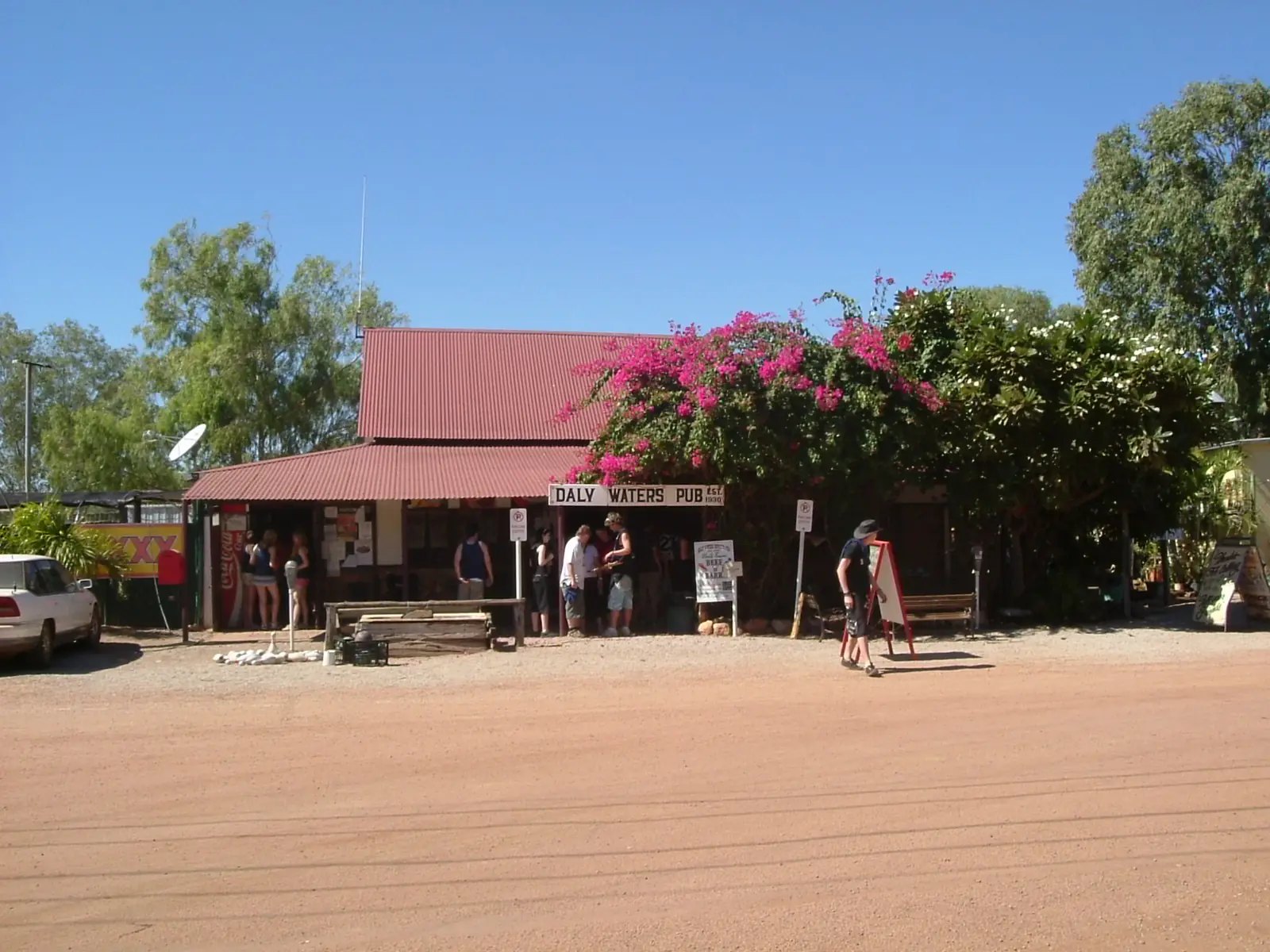
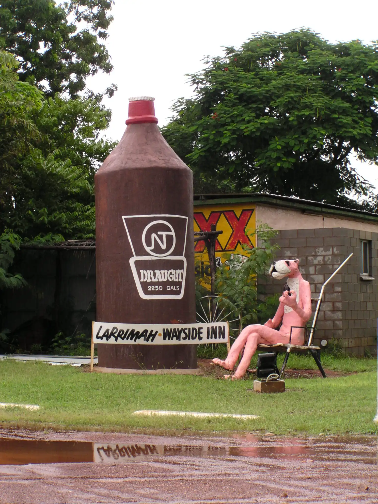
- Larrimah Pub / Larrimah Pink Panther Hotel — Tourism Top End: originally the WWII Officer’s Mess; extensions used materials from the dismantled Birdum Hotel; Pink Panther and 15-foot stubby. Roper Gulf names the historic Larrimah Hotel / Pink Panther Hotel as commercial accommodation
- Larrimah Museum — old telegraph building (Tourism Top End); heritage-listed 1942 Telephone Repeater Station and Powerhouse (Roper Gulf); WWII, Overland Telegraph and railway displays
- Old police station — Tourism Top End: step inside the cells; memorabilia display
- Railway shunting yards — remains near the hotel (Tourism Top End)
- Wartime camp relics — in town, with interpretive signs
- BIPOD and No.45 Australian Camp Hospital signs — 7 km south
- Gorrie Airfield — 10 km north; stay on marked trails
Nearby, not in-town: Mataranka thermal pools sit in Elsey National Park, which Parks NT puts 8 km from Mataranka — that is a Mataranka day, not a Larrimah main-street walk. Daly Waters holds the historic pub and aviation complex Tourism Top End puts 265 km south of Katherine.
Where to stay
Roper Gulf’s BushTel table lists commercial accommodation: Larrimah Pink Panther Hotel, (08) 8975 9931. Tourism Top End names the Larrimah Pub. Those are official named types, not a ranked motel strip. This hub does not invent extra motels, cabins or a star rating.
Roper Gulf also lists a community store / café — Fran’s Devonshire Tea House, (08) 8975 9945. Confirm on arrival that a café of 27 people is actually open.
If Larrimah is full, Mataranka is 76 km north and Daly Waters is the next named pub-and-park stop south on Tourism Top End’s same page.
- How to choose: Larrimah accommodation
- Camping detail: Larrimah caravan parks
- Operator enquiries: feature your business
Caravan and camping
Vans use Larrimah as a Stuart Highway pause between Mataranka springs and the Daly Waters pub. Neither Tourism Top End nor Roper Gulf names a caravan park at Larrimah. Ask at the named hotel whether a site exists tonight. Do not unhitch on the verge of a wartime relic or at Gorrie Airfield. Read Larrimah caravan parks and outback camping.
Fuel and services
Roper Gulf / BushTel is blunt: fuel is not available in Larrimah. Fill at Mataranka (76 km) or Daly Waters (100 km) on that council table. A locality of 27 people will not match Katherine for a hospital. Roper Gulf lists no health centre, no police station (serviced by Mataranka Police Station, (08) 8975 4511), no school, no post office, no airstrip, no council service delivery centre. Telstra 4G telephone and internet coverage is listed as yes.
Transport: Katherine Coaches and NT Bush Bus are named on the council table. Alcohol: no restrictions apply, on that same table.
For maps and springs, use Mataranka and Katherine. Roads: Road report NT. See fuel, permits and road conditions.
Road access
The Stuart Highway is sealed. Roper Gulf: double-lane, approximately two hours from Katherine. Wildlife, cattle and fatigue are the highway risks on this site’s Stuart Highway and Adelaide to Darwin pages — not a 4WD track. After rain, check Road report NT. Do not drive off marked trails at Gorrie Airfield.
North: Mataranka, then Katherine. South: Daly Waters, then Dunmarra on Tourism Top End’s corridor list. East toward the Gulf is a Daly Waters / Carpentaria Highway decision, not a Larrimah side street — Borroloola is the Gulf town on this site.
Nearby parks and towns
Larrimah does not sit inside a Parks NT park named on the sourced town pages. The nearest named park on this site’s Mataranka hub is Elsey National Park.
Towns on this site:
- Mataranka — 76 km north, thermal pools
- Daly Waters — next named Stuart Highway pub and airfield stop south
- Katherine — regional city, 182–185 km north
- Borroloola — Gulf / Savannah Way town, not a Larrimah suburb
When to go, and how long
BOM Larrimah’s November mean maximum of 37.9 °C and January 35.3 °C are the build-up and Wet heat. June’s 29.2 °C mean maximum and July’s 12.2 °C mean minimum, with February 210.0 mm, is the classic Top End contrast: a 864.8 mm annual table that is almost dry in August (0.6 mm). This site’s Top End pages treat May–September as the Dry; the Wet is heat, storms and closed floodways.
An hour covers the pub photograph, museum and police-station cells if those named places are open. A half day covers the 7 km hospital/BIPOD signs and a cautious Gorrie look from marked trails. A night is enough unless you are waiting out a Wet-season closure. Two full tourist days in a locality of 27 people is more than the sourced main-street list supports.
Operators who want a checked listing: feature your business. The listings slot on this hub stays empty until then.
Plan this trip
Tell us the dates, who you are travelling with and where you need help. We reply with planning notes for Larrimah — we are not a booking agent.
Events and road-conditions newsletter
Occasional notes on outback festivals, race days and official road-condition sources — not a daily blast. We use these details only to send the newsletter.
Northern Territory · Top End
Larrimah accommodation
Where to stay in Larrimah: Roper Gulf names Larrimah Pink Panther Hotel. Tourism Top End names the Larrimah Pub. Confirm before you unhitch. Stuart Highway NT, not Darwin.
Read · 3 min
Northern Territory · Top End
Larrimah caravan parks
Camping in Larrimah: Roper Gulf and Tourism Top End do not name a caravan park. Ask at the Pink Panther Hotel. Confirm before you unhitch. Stuart Highway NT, not Darwin.
Read · 3 min
Northern Territory · Top End
Larrimah weather
Larrimah climate from BOM Larrimah (014612): November mean max 37.9 °C, June 29.2 °C, annual rainfall 864.8 mm with February 210.0 mm. Open station. Stuart Highway NT, not a Darwin table.
Read · 4 min
Northern Territory · Top End
Things to do in Larrimah
Things to do in Larrimah: heritage museum in the 1942 repeater station, old police station cells, Gorrie Airfield 10 km north, BIPOD signs 7 km south. Stuart Highway NT, not a Darwin suburb.
Read · 4 min
Frequently asked questions
Is Larrimah in Darwin or on the Stuart Highway?
This hub is Larrimah in Roper Gulf’s Never Never Ward, on the Stuart Highway between Mataranka and Daly Waters. Tourism Top End puts it 185 km south of Katherine. It is not a Darwin suburb. Darwin has no town page in this rebuild.
How far is Larrimah from Katherine and Mataranka?
Tourism Top End: 185 kilometres south of Katherine along the Stuart Highway. Roper Gulf: 182 kilometres south of Katherine and 76 kilometres south of Mataranka, about two hours from Katherine on sealed double-lane Stuart Highway.
What is Larrimah’s population?
27 people at the 2021 Census for Larrimah suburbs-and-localities (SAL70160), median age 37. QuickStats notes limited tables because of the small population. The ABS does not publish a 2021 Urban Centre named Larrimah.
Is there fuel in Larrimah?
No. Roper Gulf’s community page, drawing on NT Government BushTel data, lists fuel as not available in Larrimah. Fuel is at Mataranka (76 km) or Daly Waters (100 km) on that same council table.
What is there to do in Larrimah?
Tourism Top End names the Larrimah Pub (WWII Officer’s Mess, Pink Panther and 15-foot stubby), the museum in the old telegraph building, the old police station cells, wartime camp relics, the BIPOD and No.45 Australian Camp Hospital interpretive signs 7 km south, and Gorrie Airfield 10 km north.
What is the weather like in Larrimah?
BOM Larrimah (014612, open): January mean maximum 35.3 °C, June 29.2 °C, November 37.9 °C (hottest mean maximum). Annual rainfall 864.8 mm (63 years, 1952–2026). February 210.0 mm is the wettest mean month; August 0.6 mm the driest. Temperature means use 46 years (1965–2012).
Sources and further reading
Facts on this page were checked against these primary and official sources. Conditions change — confirm before you travel or buy.
- Larrimah 2021 Census QuickStats (SAL70160) — Australian Bureau of Statistics
- Climate statistics for Larrimah (014612) — Bureau of Meteorology
- Larrimah, Daly Waters and Dunmarra — Tourism Top End
- Larrimah — Roper Gulf Regional Council
- Road report NT — Northern Territory Government
- Be Crocwise NT — Northern Territory Government