At a glance
Sourced facts only. Distances and services change — confirm before you travel.
- Local government
- Central Desert Regional Council
- Traditional Owners
- NT Police: pastoral settlement from the 1950s ended the wholly traditional life of the Eastern Aranda people. NT Place Names records Atitjere (alternate names Arltarlpilta, Hart Range, Harts Range) as an Aboriginal community, Central Land Council, on an excision from Mount Riddock station.Central Desert Regional Council places Atitjere in Akityarre ward. Confirm current wording at the council office before treating a label as a townsite acknowledgement.
- Nearest regional city
- Alice Springs, 215 km (Central Desert Regional Council Atitjere page). Council getting-there: travel north from Alice Springs, turn right at Plenty Highway, then east about 180 km; the road is sealed the whole way.
- Nearest fuel
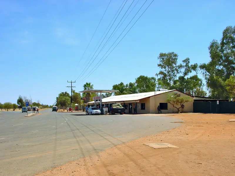
- Central Desert Regional Council: Atitjere offers a convenient shop where you can find fuel and other necessities. NT Government fossicking page: fuel, groceries and general supplies at the Atitjere Community store. Confirm on arrival.
- Nearest hospital or clinic
- Central Desert Regional Council names a remote health clinic. NT Police: the health clinic has a permanent nurse; a doctor visits once a month from Alice Springs.
- Mobile coverage
- Check Telstra and Optus coverage maps before travel; do not assume a signal on Plenty Highway gaps or on fossicking tracks.
- Best time to visit
- May–August cooler means on BOM Jervois (015602), the Plenty Highway open station BOM publishes: July mean max 22.0 °C, mean min 5.4 °C. BOM’s NT named list has no Harts Range climate table.
Climate
Monthly means from the Bureau of Meteorology station Jervois (015602). This is not a forecast. Open station on the Plenty Highway east of Atitjere. BOM’s NT named climate list has no Harts Range or Atitjere table. Temperature 58 years (1967–2026); rainfall 57 years (1966–2026). Latest available data 14 November 2026. Do not treat Jervois as the Atitjere townsite.
| Month | Mean max (°C) | Mean min (°C) | Rainfall (mm) |
|---|---|---|---|
| Jan | 38.7 | 23.3 | 51.3 |
| Feb | 37.0 | 22.2 | 57.1 |
| Mar | 34.9 | 19.7 | 40.1 |
| Apr | 30.6 | 14.5 | 15.0 |
| May | 25.3 | 10.1 | 16.8 |
| Jun | 22.1 | 6.6 | 9.6 |
| Jul | 22.0 | 5.4 | 13.6 |
| Aug | 25.1 | 7.2 | 6.5 |
| Sep | 29.8 | 11.5 | 10.4 |
| Oct | 33.5 | 15.9 | 14.3 |
| Nov | 36.1 | 19.2 | 24.6 |
| Dec | 37.9 | 21.7 | 39.8 |
Harts Range in pictures
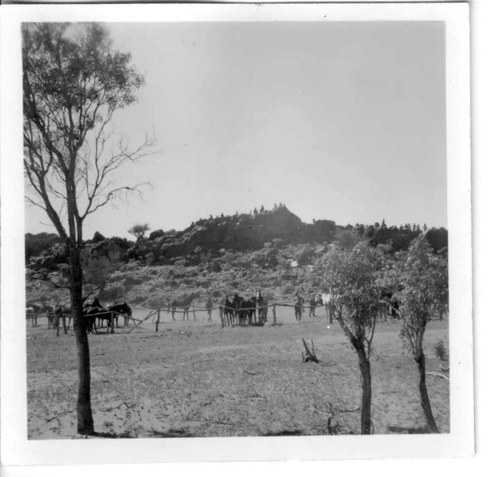
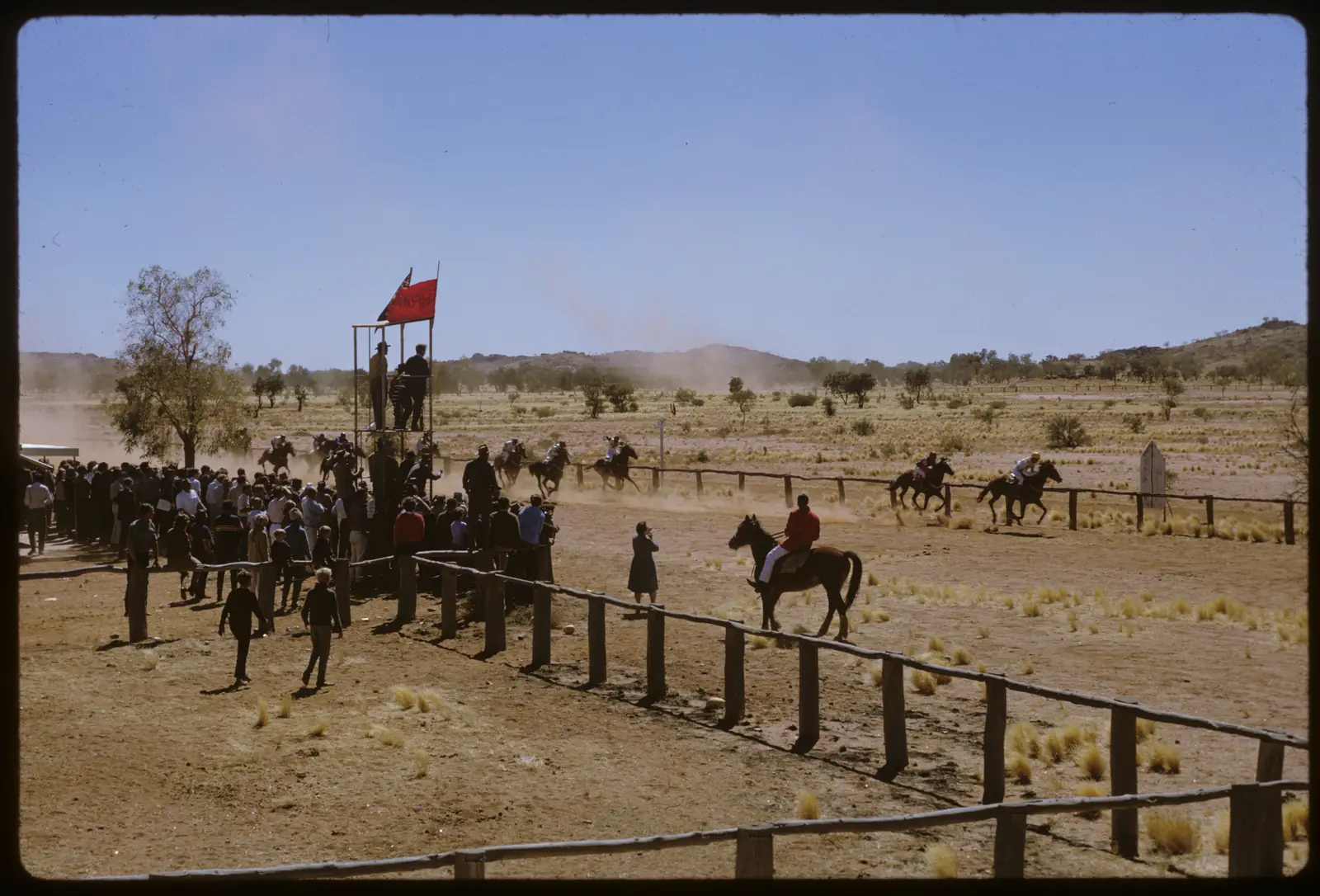
Harts Range racecoursePhoto: Harry Birtwhistle · CC BY-SA 4.0
Harts Range is the Plenty Highway community of Atitjere in the Red Centre listing on this site, 215 kilometres from Alice Springs on Central Desert Regional Council. Council: travel north from Alice Springs, turn right at the Plenty Highway, then east about 180 km; the road is sealed the whole way on that page. NT Place Names records Atitjere adjacent to Harts Range townsite, on an excision from Mount Riddock station, with alternate names Arltarlpilta, Hart Range, Harts Range. This hub is the Northern Territory community, not a Western Australian range page and not an Alice Springs suburb. Darwin is the capital; it has no town page here.
NT Place Names’ range extract is the hill-name story used here. Harts Range appears on Ringwood’s 1873 map of the Overland Telegraph Line, believed named by John Ross in 1870 while exploring for a telegraph route, after Hon. John Hart CMG, South Australian parliamentarian and three-time Premier. The community is the later mica-field townsite. NT Government fossicking: between the 1890s and 1960, almost all the nation’s mica came from the Northern Territory, and most was extracted from Harts Range. That is a mica-and-range founding, not a Stuart Highway roadhouse story borrowed from Ti Tree.
The 2021 Census publishes SAL70020 Atitjere: 204 people, median age 28, sex split 49.0% male / 51.0% female. 50 families, 55 private dwellings. Aboriginal and Torres Strait Islander people 157 (77.0%). Central Desert Regional Council still prints around 260, including outstations Mt Eaglebeak, Spotted Tiger, Irrelirre and Foxalls Well. Use 2021 SAL for the locality; keep council’s outstation figure as a wider community count. You still need the NT Road Report after rain, because a sealed Plenty Highway sentence is no use if a fossicking track is closed.
Where it is, and how far
Harts Range / Atitjere sits on the Plenty Highway, on the same corridor as our Plenty Highway guide. West, the Stuart Highway junction is the way council describes from Alice Springs. Central Desert Regional Council also names Gemtree as a fossicking visit from Atitjere. East, the Plenty continues toward Jervois and the Queensland border on that track guide — this hub does not invent those kilometres. Ti Tree is a Stuart Highway town, not a Plenty Highway suburb.
| Place | Distance from Harts Range (sourced) |
|---|---|
| Alice Springs | 215 km (Central Desert Regional Council) |
| Plenty Highway east of the Stuart turn | about 180 km, sealed the whole way (Central Desert Regional Council getting-there) |
| Mount Palmer | elevation 1136 m, due south of Atitjere in the Central Harts Range fossicking area (NT Government fossicking) |
A separate Harts Range–Gemtree kilometre was not on the council or fossicking pages used here, so this hub does not invent one. NT Police name Gemtree as an attraction with fuel and camping.
Facts at a glance
Population. ABS 2021 Census SAL70020: 204 people. Median age 28. Indigenous 157 (77.0%). Use Atitjere QuickStats.
Climate. BOM’s NT named list has no Harts Range table. This hub uses JERVOIS, 015602, 22.95°S, 136.14°E, elevation 328 m, commenced 1966, status open, latest available data 14 November 2026 — the Plenty Highway station BOM publishes further east. Mean maximum (58 years, 1967–2026): January 38.7 °C, July 22.0 °C, annual 31.1 °C. Mean minimum: January 23.3 °C, July 5.4 °C, annual 14.8 °C. Mean rainfall (57 years, 1966–2026): annual 289.9 mm. Mean days of rain ≥ 1 mm: 27.7. Do not treat Jervois as the Atitjere townsite. See Harts Range weather.
Visitor information. Central Desert Regional Council’s Atitjere page: 08 8956 9787. NT Government fossicking pages are the official mineral-field listings. Roads: NT Road Report. Centre Bush Bus: council points to Harts Range bus timetables.
Traditional Owners
NT Police: new pastoral country was occupied from the 1950s, ending the wholly traditional life of the Eastern Aranda people who had until then remained uninfluenced by western culture. NT Place Names: Atitjere, Central Land Council, excision from Mount Riddock station. Alternate names include Arltarlpilta. Central Desert Regional Council places the community in Akityarre ward.
NT Government fossicking: the track to Mount Palmer passes through Spotted Tiger Bore (Pwetyalaneme) Aboriginal Land. Traditional owners do not require fossickers to apply for permits to enter that Aboriginal land on the wording of that page; they request normal courtesies and a check with the Atitjere Council office (next to the community store) before proceeding. Conditions of access may change. Stay on signed tracks. See visiting Country respectfully.
History
NT Place Names (range): named in the telegraph-exploration years around 1870–1873 after John Hart. NT Place Names (community): Harts Range was the site of a former mica field. NT Government fossicking: mica mining from the 1890s to 1960; most Australian mica from Harts Range; foundations of stone-walled houses and bough structures that once housed a community of up to one hundred men remain, with some mining equipment. Respect them. Shafts are unstable and dangerous.
NT Police: Harts Range Amateur Race Club has strong support; the annual Harts Range Bush Sports Weekend in August attracts some 3,000 people on that police profile. Council names the same Bush Weekend. Those are community events, not a weekly visitor timetable.
Things to do
Official named things to do sit in community and on the fossicking field:
- Akngerrekenhe Art Centre — Central Desert Regional Council
- Atitjere Community store — fuel, groceries, Aboriginal artefacts and paintings on the NT Government fossicking page
- Central Harts Range fossicking area — Mount Palmer, Spotted Tiger, Kismet, Rex mines; NT Government; fossicking rules apply
- Spotted Tiger campground — entrance to Mount Palmer area, NT Government
- Harts Range Bush Weekend / races — council and NT Police
- Gemtree — council and NT Police; fossicking, fuel, camping as named types
- Outback Way Outdoor Art Gallery and Mac and Rose Chalmers Conservation Reserve — named on the council visiting list; confirm access locally
Council also names Iytwelepenty / Davenport Ranges National Park on the Atitjere page. That park is a remote 4WD oasis on NT Parks, not an Atitjere main-street walk — this hub does not invent a kilometre from the store to Old Police Station Waterhole. See things to do in Harts Range.
Where to stay
NT Government names Spotted Tiger campground and bush camping on the fossicking area (no facilities on the field). NT Police name Gemtree camping facilities. Central Desert Regional Council’s Atitjere page has an accommodation heading without a named motel on the text fetched here. This guide does not invent extra lodges. If Atitjere is full, Gemtree is the named Plenty Highway stay type west toward Alice Springs.
- How to choose: Harts Range accommodation
- Camping detail: Harts Range caravan parks
- Operator enquiries: feature your business
Caravan and camping
Council says the Plenty Highway approach from Alice Springs is sealed the whole way. NT Government allows bush camping on the fossicking area; take rubbish; provide your own water (bore water at the community store). The field lies within Mt Riddock station — do not interfere with cattle. Read Harts Range caravan parks and outback camping. Tracks to mines are 4WD on the NT Government access page.
Fuel and services
A community of 204 people will not match Alice Springs for a hospital. Council names a shop with fuel, takeaway, remote health clinic, police, Central Land Council office, post office agency and council office. NT Police: permanent nurse; doctor monthly from Alice Springs. This guide does not list other bowser brands. Fill in Alice Springs if you are unsure. Council: 08 8956 9787.
Road access
Plenty Highway sealed from the Stuart turn to Atitjere on council’s getting-there sentence. Further east on this site’s Plenty Highway guide, long stretches remain unsealed. NT Road Report is the authority. Fossicking tracks: 4WD, shafts, closed Burma Road. Aboriginal land courtesies at the council office. A fossicking permit is an NT Government minerals question — check current rules before you dig.
Nearby parks and towns
Parks and fields (nearby, not in-town):
- Central Harts Range fossicking area / Mount Palmer — NT Government
- Mac and Rose Chalmers Conservation Reserve — named by council
- Iytwelepenty / Davenport Ranges National Park — named on the council page as a remote 4WD park, not a town walk
Towns on this site:
- Alice Springs — 215 km
- Ti Tree — Stuart Highway west of this corridor
- Plenty Highway corridor: Plenty Highway
When to go, and how long
Jervois’ January mean maximum of 38.7 °C is a Plenty Highway summer. July’s 22.0 °C mean maximum and 5.4 °C mean minimum, with August’s 6.5 mm, is the cool Dry on a 289.9 mm annual table. NT Police’s August Bush Sports Weekend sits in that cooler window. Two hours covers the store, art centre if open, and a council-office fossicking briefing. A night covers Spotted Tiger if the campground is taking people. Mount Palmer is a 4WD and walking day, not a town stroll.
Operators who want a checked listing: feature your business. The listings slot on this hub stays empty until then.
Plan this trip
Tell us the dates, who you are travelling with and where you need help. We reply with planning notes for Harts Range — we are not a booking agent.
Events and road-conditions newsletter
Occasional notes on outback festivals, race days and official road-condition sources — not a daily blast. We use these details only to send the newsletter.
Northern Territory · Red Centre
Harts Range accommodation
Where to stay at Harts Range / Atitjere: NT Government names Spotted Tiger campground. NT Police name Gemtree camping. Confirm before you unhitch. Plenty Highway NT, not WA.
Read · 3 min
Northern Territory · Red Centre
Harts Range caravan parks
Camping at Harts Range / Atitjere: NT Government names Spotted Tiger campground and bush camping on the Central Harts Range fossicking area. Confirm before you unhitch. Plenty Highway NT.
Read · 3 min
Northern Territory · Red Centre
Harts Range weather
Harts Range climate from BOM Jervois (015602), Plenty Highway east of Atitjere: January mean max 38.7 °C, July 22.0 °C, annual rainfall 289.9 mm. No Harts Range named table.
Read · 3 min
Northern Territory · Red Centre
Things to do in Harts Range
Things to do in Harts Range / Atitjere: Akngerrekenhe Art Centre, Central Harts Range mica mines, Spotted Tiger, Gemtree, Bush Weekend. Plenty Highway, not Harts Range WA.
Read · 4 min
Frequently asked questions
Is Harts Range the same place as Atitjere?
Yes, as official alternate names. NT Place Names records Atitjere as an Aboriginal community adjacent to Harts Range townsite, with alternates Arltarlpilta, Hart Range and Harts Range. Central Desert Regional Council’s community page is titled Atitjere and puts the community 215 km from Alice Springs on the Plenty Highway in Akityarre ward. This hub is the Northern Territory community, not a Western Australian range page.
How far is Harts Range from Alice Springs?
Central Desert Regional Council: located 215 kilometres from Alice Springs on the Plenty Highway. Getting there: travel north from Alice Springs, turn right at Plenty Highway, then travel east for about 180 km. The road is sealed the whole way on that council page. Confirm the day’s drive on the NT Road Report.
What is Harts Range’s population?
204 people at the 2021 Census for Atitjere suburbs-and-localities (SAL70020), median age 28. Aboriginal and Torres Strait Islander people 157 (77.0%). Central Desert Regional Council prints around 260, including outstations Mt Eaglebeak, Spotted Tiger, Irrelirre and Foxalls Well. Use 2021 SAL for the locality.
What is there to do in Harts Range?
Central Desert Regional Council names Akngerrekenhe Art Centre, the annual Harts Range Bush Weekend, Gemtree fossicking, the Outback Way Outdoor Art Gallery and Mac and Rose Chalmers Conservation Reserve. NT Government’s Central Harts Range fossicking area lies due south of Atitjere around the abandoned mica mines of Mount Palmer (elevation 1136 m). NT Police name the Harts Range Amateur Race Club and a Bush Sports Weekend in August.
What is the weather like in Harts Range?
BOM’s NT named list has no Harts Range table. This hub uses Jervois (015602), the open Plenty Highway station: January mean maximum 38.7 °C, July 22.0 °C, annual rainfall 289.9 mm (57 years, 1966–2026). Temperature means use 58 years (1967–2026). Jervois is further east on the same highway, not the Atitjere townsite.
Can I camp at Harts Range?
NT Government’s Central Harts Range fossicking page names the Spotted Tiger campground at the entrance to the Mount Palmer area, and allows bush camping on the fossicking area with no facilities. Fuel and supplies are at the Atitjere Community store. Check with the Atitjere council office before using tracks that pass through Spotted Tiger Bore (Pwetyalaneme) Aboriginal Land.
Sources and further reading
Facts on this page were checked against these primary and official sources. Conditions change — confirm before you travel or buy.
- Atitjere 2021 Census QuickStats (SAL70020) — Australian Bureau of Statistics
- Climate statistics for Jervois (015602) — Bureau of Meteorology
- Atitjere — Central Desert Regional Council
- Atitjere (Place Names Register, id 22414) — NT Place Names Register
- Harts Range — NT Police, Fire and Emergency Services
- Central Harts Range fossicking area — Northern Territory Government
- Plenty Highway — Outback Now
- NT Road Report — Northern Territory Government