At a glance
Sourced facts only. Distances and services change — confirm before you travel.
- Local government
- Victoria Daly Regional Council
- Traditional Owners
- Ngaliwurra and Nungali (Victoria Daly Regional Council); Tourism NT names Ngaliwurra for the townParks NT lists Ngarinyman, Karrangpurru, Malngin, Wardaman, Ngaliwurru, Nungali and Bilinara for Judbarra / Gregory National Park, not as a single townsite label.
- Nearest regional city
- Katherine, 285 km east (Tourism NT Timber Creek). Victoria Daly prints 286 km south-west of Katherine.
- Capital
- A Darwin kilometre for the township is not printed on the sourced town pages. Tourism NT’s Judbarra page puts the park approximately 360 km south of Darwin.
- Nearest fuel
- Parks NT’s Judbarra fact sheet names fuel and supplies in Timber Creek. Confirm on arrival; this hub does not invent a bowser brand.
- Nearest hospital or clinic
- Timber Creek Health Centre, Katherine West Health Board, (08) 8975 0727
- Mobile coverage
- Check Telstra and Optus coverage maps before travel; do not assume a signal.
- Best time to visit
- May–September (Tourism NT / Parks NT Dry for Judbarra 4WD; BOM Timber Creek Wet is November–March)
Climate
Monthly means from the Bureau of Meteorology station Timber Creek (014850). This is not a forecast. Open station. Temperature 34 years (1981–2014); rainfall 38 years (1981–2021). Latest available data 25 March 2021.
| Month | Mean max (°C) | Mean min (°C) | Rainfall (mm) |
|---|---|---|---|
| Jan | 35.9 | 25.0 | 241.3 |
| Feb | 35.1 | 24.6 | 232.2 |
| Mar | 35.4 | 23.5 | 150.9 |
| Apr | 35.2 | 21.1 | 32.9 |
| May | 32.9 | 18.3 | 7.9 |
| Jun | 30.4 | 15.4 | 2.2 |
| Jul | 30.6 | 14.8 | 1.6 |
| Aug | 32.9 | 15.7 | 0.5 |
| Sep | 36.5 | 20.5 | 6.0 |
| Oct | 38.4 | 24.0 | 25.3 |
| Nov | 38.4 | 25.1 | 83.6 |
| Dec | 37.1 | 25.4 | 182.6 |
Timber Creek in pictures
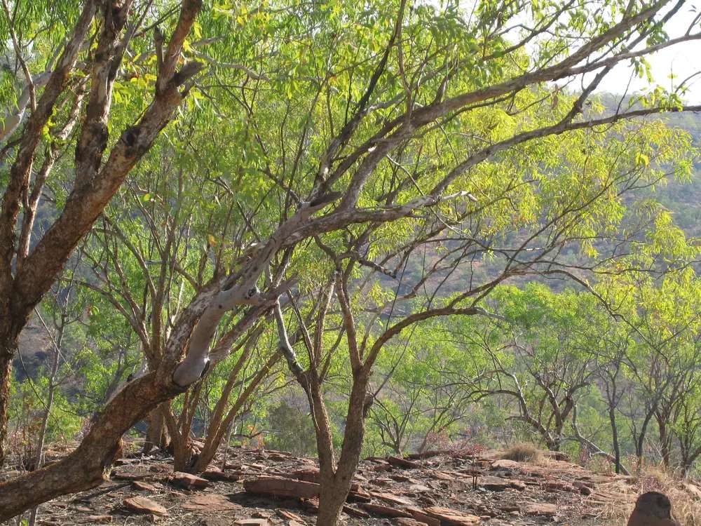
Nackeroos memorial lookout outside Timber CreekPhoto: MargaretRDonald · CC BY-SA 4.0 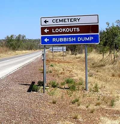
Local road sign (cemetery / lookouts) near Timber CreekPhoto: Anatomix · CC BY-SA 3.0 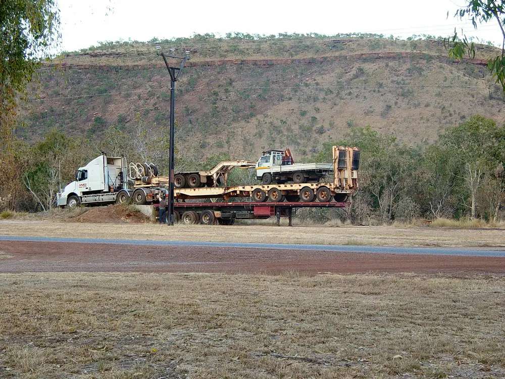
Semi-trailer unloading in Timber CreekPhoto: Photo taken and uploaded to English Wikipedia by Brian Voon Yee Yap (User Yewenyi) Transferred to Commons by User:Head · CC BY-SA 3.0 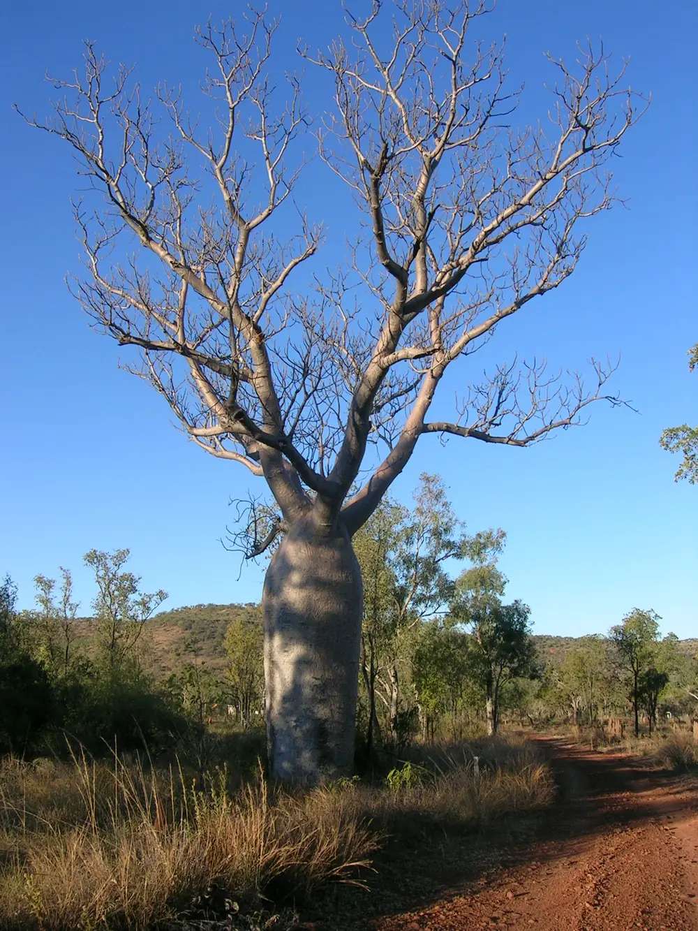
Boab tree in Timber CreekPhoto: Whitenoise01 at English Wikipedia · CC BY 2.5
Timber Creek is a Victoria Highway town in the Top End, 285 km west of Katherine on Tourism NT’s destination page. Victoria Daly Regional Council prints 286 km south-west of Katherine and 195 km east of the Western Australian border on the same sealed highway. This hub is the town, not a second Katherine and not a Stuart Highway stop. The Stuart towns on this site sit east of here; you reach Timber Creek by turning west from Katherine onto the Victoria Highway, which is also the Savannah Way corridor toward Kununurra.
Victoria Daly’s community profile is the naming story used here. The first inhabitants were the Ngaliwurra and Nungali Aboriginal people, descendants of whom still live in Timber Creek. The town was named in 1855 when explorer Augustus Gregory used timber from the banks of the creek to repair his expedition’s boat. That is a river-repair story, not a gold-rush founding and not a Stuart Telegraph anecdote borrowed from Pine Creek.
The 2021 Census publishes matching counts for suburbs-and-localities SAL70257 and Urban Centre UCL722031: 278 people, median age 33, sex split 54.8% male / 45.2% female. 43 families, 117 private dwellings. Aboriginal and Torres Strait Islander people 155 (55.8%). Tourism NT’s destination page still prints “about 70 people.” Use the Census.
Where it is, and how far
Timber Creek sits on the public sealed Victoria Highway, the only significant settlement Victoria Daly names between Katherine and the WA border on that road. Katherine West Health Board’s clinic page puts the town approximately 300 km west of Katherine — a health-board figure, not a third drive table this hub will average with 285 and 286. Darwin is the capital; it has no town page in this rebuild. Tourism NT’s Judbarra destination page puts the park approximately 360 km south of Darwin. That is a park sentence, not a town-to-Darwin kilometre invented here.
Keep River National Park is the next Parks NT landscape west toward the border on Tourism NT’s Judbarra FAQ. This hub does not invent a Timber Creek–Keep River kilometre Parks NT does not print for the township.
| Place | Distance from Timber Creek (sourced) |
|---|---|
| Katherine | 285 km east (Tourism NT Timber Creek); 286 km (Victoria Daly) |
| Western Australian border | 195 km west (Victoria Daly) |
| Big Horse Creek Campground | 10 km west on the Victoria Highway (Parks NT Judbarra fact sheet) |
| Gregory’s Tree | 9 km west of Big Horse Creek, then 3 km unsealed 2WD (Parks NT fact sheet) |
| Bullita Homestead | 56 km from Timber Creek (Tourism NT Bullita listing); access via unsealed Bullita Access Road |
Facts at a glance
Population. ABS 2021 Census SAL70257 / UCL722031: 278 people. Median age 33. Indigenous 155 (55.8%). Use SAL QuickStats or UCL QuickStats.
Climate. TIMBER CREEK, 014850, 15.66°S, 130.48°E, elevation 20 m, commenced 1981, status open, latest available data 25 March 2021. Mean maximum (34 years, 1981–2014): October and November 38.4 °C (hottest months by mean max), June 30.4 °C, annual 34.9 °C. Mean minimum: December 25.4 °C, July 14.8 °C, annual 21.1 °C. Mean rainfall (38 years, 1981–2021): annual 958.8 mm. Mean days of rain ≥ 1 mm: 63.7. See Timber Creek weather.
Visitor information. Tourism NT’s Timber Creek destination page is the official town listing used here. Parks NT phone for Judbarra is 08 8973 8888. Roads: NT Road Report. Health: Katherine West Health Board Timber Creek Health Centre, (08) 8975 0727.
Traditional Owners
Victoria Daly Regional Council: the first inhabitants were the Ngaliwurra and Nungali Aboriginal people; Ngaliwurru and Ngarinyman are the main traditional languages for this region, with English predominantly spoken; the Ngaliwurru and Nungali Aboriginal people are the original inhabitants and Traditional Owners of the lands surrounding the town. Tourism NT’s town page names Ngaliwurra as the traditional land of Timber Creek.
Judbarra / Gregory National Park is nearby park Country, not a town-main-street label. Parks NT: the park includes the traditional lands of several Aboriginal language groups, including Ngarinyman, Karrangpurru, Malngin, Wardaman, Ngaliwurru, Nungali and Bilinara. Tourism NT’s Gregory’s Tree listing records special significance to the local Ngaringman people and registration as a Sacred Site. This guide keeps those official wordings rather than flattening seven park groups onto the townsite. Stay on public roads. See visiting Country respectfully.
History
Victoria Daly: named 1855 when Gregory repaired his boat with creek-bank timber. A police station was constructed in 1898 and upgraded in 1908. Tourism NT: a police station was first established in 1898, initially a hut and a goat yard, upgraded to iron and steel in 1908, and that structure has been reopened as the Timber Creek Police Station Museum. Tourism NT’s museum listing puts the station as the centre of administration for the northern Victoria River District from 1908 to the 1930s.
Victoria Daly adds: in 1911 a depot was established to service river trade; during WWII the 21st North Australia Observer Unit (“Nackeroos”) used Aboriginal guides; in 1998 the unit was recognised with a memorial on the escarpment. Tourism NT’s Gregory’s Tree page is the expedition story: the boab marks Gregory’s “entrenchment camp” from October 1855 to July 1856 and still bears inscriptions noting arrival and departure. Parks NT repeats Gregory’s Tree as an Aboriginal sacred site and registered heritage site. This hub does not invent a visitor count or a boat-repair date other than the council’s 1855 naming.
Things to do
Tourism NT and Parks NT name these in and around Timber Creek:
- Timber Creek Police Station Museum — Tourism NT; 1908 iron-and-steel station
- Victoria River barramundi fishing — Tourism NT; Parks NT: saltwater crocodiles in all park waterways, do not swim, Be Crocwise; fishing with lures only in the park (no bait, to avoid capturing turtles); size and bag limits
- Gregory’s Tree — Tourism NT / Parks NT; sacred site and heritage boab; Parks NT fact sheet: 500 m return, Grade 1, wheelchair access, boardwalk
- Judbarra / Gregory National Park — NT’s second-largest park on Tourism NT; NT Parks Visitor Pass for visitors to the NT
- Bullita Homestead — Tourism NT: 56 km from Timber Creek, original timber stockyards, interpretive display; unsealed access that may close November–April
- Big Horse Creek Campground — Parks NT fact sheet, 10 km west; popular anglers’ base with sealed boat ramp
Nearby, not in-town: Keep River National Park toward the WA border; Nitmiluk at Katherine. Crocodile safety is a Parks NT brief, not a Timber Creek pool review.
See things to do in Timber Creek.
Where to stay
Victoria Daly says the town has a range of accommodation, activities and other facilities for travellers. Parks NT’s fact sheet names camping and other accommodation in Timber Creek, plus Big Horse Creek Campground. Tourism NT’s Judbarra FAQ lists Timber Creek among camping spots in the park landscape, alongside Victoria River Roadhouse, Sullivan Creek, Big Horse Creek and Bullita. Those are named types and park camps, not a motel strip this hub will invent. If the town is full, Katherine is 285 km east.
- How to choose: Timber Creek accommodation
- Camping detail: Timber Creek caravan parks
- Operator enquiries: feature your business
Caravan and camping
The Victoria Highway is sealed. Parks NT names Big Horse Creek for caravan camping (with Sullivan Creek and Victoria River Roadhouse). Park camps need the NT Parks Visitor Pass for visitors to the NT; book online before you go; you cannot pay at the site. Pets are permitted along the Victoria Highway and must be kept on a leash (Parks NT). Read Timber Creek caravan parks and outback camping. Wet-season closures are an NT Road Report and Parks NT status question.
Fuel and services
A town of 278 people will not match Katherine for a hospital or a supermarket aisle. Parks NT’s fact sheet names fuel and supplies, meals, public telephones, medical assistance and police in Timber Creek. This guide does not list bowser brands. Katherine West Health Board’s Timber Creek Health Centre is the named clinic — walk-in hours Monday to Thursday 8:30 am–4:00 pm, Friday 1:00 pm–4:00 pm, with after-hours emergency via the clinic number or 000. Fill in Katherine if you are unsure about the next bowser west. For current questions use Tourism NT, Victoria Daly, Parks NT 08 8973 8888, and the NT Road Report.
Road access
Victoria Highway sealed east–west. NT Road Report is the authority, especially in the Wet when 958.8 mm of annual mean rain arrives in a few months (January mean 241.3 mm). Parks NT: the park is open all year, but roads may not be accessed at times during the Wet. Bullita Access Road and the southern 4WD network close seasonally; the fact sheet recommends high-clearance 4WD and says the Bullita road is unsuitable for caravans. Stay on gazetted roads. Aboriginal land and park tracks need the permits those agencies print.
Our Savannah Way and Northern Territory road trip guides are the road-trip pages. The Stuart Highway is a different spine; do not add Katherine’s Stuart kilometres and call the sum a Timber Creek distance.
Nearby parks and towns
Parks (nearby, not in-town except highway-side Judbarra sites):
- Judbarra / Gregory National Park — Ngarinyman, Karrangpurru, Malngin, Wardaman, Ngaliwurru, Nungali and Bilinara Country on Parks NT; NT Parks Pass
- Keep River National Park — Tourism NT’s west-of-Judbarra next stop near the WA border
- Nitmiluk National Park — via Katherine
Towns on this site:
- Katherine — 285 km east
- Pine Creek — Stuart Highway gold town 90 km north of Katherine (not on the Victoria Highway)
- Kununurra — east Kimberley, west of the border on the same Savannah Way corridor
- Wyndham — Kimberley port neighbour of Kununurra
Darwin is the capital. It has no town page here.
When to go, and how long
Timber Creek’s October and November mean maximum of 38.4 °C is the build-up. January’s 35.9 °C sits under 241.3 mm of January mean rain. June’s 30.4 °C mean maximum and July’s 14.8 °C mean minimum, with August’s 0.5 mm mean rain, is the Dry on the 1981–2021 rain table. Tourism NT and Parks NT: explore Judbarra from May to September because many access roads and 4WD tracks close in the Wet. The station’s latest data is 25 March 2021 — treat means as an open station that has not published a later averages year on that table. Crocodile risk in river and park water is a Parks NT brief in every month.
Two hours covers the museum and a highway photograph if Tourism NT’s named places are open. A night covers Gregory’s Tree and Big Horse Creek only if Parks NT status agrees. Bullita and the 4WD network are separate park days, not a Timber Creek main-street add-on.
Operators who want a checked listing: feature your business. The listings slot on this hub stays empty until then.
Plan this trip
Tell us the dates, who you are travelling with and where you need help. We reply with planning notes for Timber Creek — we are not a booking agent.
Events and road-conditions newsletter
Occasional notes on outback festivals, race days and official road-condition sources — not a daily blast. We use these details only to send the newsletter.
Northern Territory · Top End
Things to do in Timber Creek
Things to do in Timber Creek: Police Station Museum, Gregory’s Tree sacred boab, Victoria River fishing with crocodile rules, Judbarra / Gregory National Park and Bullita Homestead.
Read · 5 min
Northern Territory · Top End
Timber Creek accommodation
Where to stay in Timber Creek: camping and other accommodation named by Parks NT and Victoria Daly, plus Big Horse Creek park camp 10 km west. Confirm before you unhitch. No invented motel strip.
Read · 4 min
Northern Territory · Top End
Timber Creek caravan parks
Camping in Timber Creek: Parks NT names town camping plus Big Horse Creek 10 km west, Sullivan Creek and Victoria River Roadhouse. NT Parks Pass for park camps. Confirm on the NT Road Report.
Read · 4 min
Northern Territory · Top End
Timber Creek weather
Timber Creek climate from BOM Timber Creek (014850): October mean max 38.4 °C, June 30.4 °C, annual rainfall 958.8 mm. Open station, latest data 25 March 2021. NT Road Report in the Wet.
Read · 4 min
Frequently asked questions
How far is Timber Creek from Katherine?
Tourism NT’s Timber Creek destination page puts the town 285 km west of Katherine. Victoria Daly Regional Council prints 286 km south-west of Katherine along the Victoria Highway, and 195 km east of the Western Australian border. Confirm the day’s drive on the NT Road Report.
What is Timber Creek’s population?
278 people at the 2021 Census for both Timber Creek suburbs-and-localities (SAL70257) and the Timber Creek Urban Centre (UCL722031). Median age 33. Aboriginal and Torres Strait Islander people 155 (55.8%). Tourism NT’s destination page still prints “about 70 people” — use the Census count.
Is Timber Creek on the Stuart Highway?
No. Timber Creek sits on the Victoria Highway between Katherine and the WA border. The Stuart Highway towns on this site are Katherine, Pine Creek, Adelaide River, Mataranka, Daly Waters and Tennant Creek. Do not treat a Stuart kilometre as a Timber Creek distance.
Do I need an NT Parks Pass in Timber Creek itself?
The township is not a Parks NT park. Judbarra / Gregory National Park, if you add it as a nearby park day, requires an NT Parks Visitor Pass for visitors to the NT. Camping in the park is booked online. Check park status, crocodile signs and Wet-season track closures.
What is the weather like in Timber Creek?
BOM Timber Creek (014850) monthly means: October and November mean maximum 38.4 °C (hottest months by mean max), June 30.4 °C, annual rainfall 958.8 mm (38 years, 1981–2021). Temperature means use 34 years (1981–2014). Status open; latest available data 25 March 2021.
Can I camp at Timber Creek?
Yes, as named types. Parks NT’s Judbarra fact sheet names camping and other accommodation in Timber Creek, plus Big Horse Creek Campground on the Victoria Highway 10 km west of town (toilets, fire places, picnic tables, limited water, sealed boat ramp). Park camps need an NT Parks Visitor Pass for visitors to the NT and must be booked online. Confirm town sites when you arrive.
Sources and further reading
Facts on this page were checked against these primary and official sources. Conditions change — confirm before you travel or buy.
- Timber Creek 2021 Census QuickStats (SAL70257) — Australian Bureau of Statistics
- Timber Creek (L) 2021 Census QuickStats (UCL722031) — Australian Bureau of Statistics
- Climate statistics for Timber Creek (014850) — Bureau of Meteorology
- Timber Creek — Tourism NT
- Gregory’s Tree, Timber Creek — Tourism NT
- Bullita Homestead — Tourism NT
- Judbarra/Gregory National Park — Tourism NT
- Judbarra / Gregory National Park — Northern Territory Government
- Judbarra / Gregory National Park fact sheet and map — Northern Territory Government
- Timber Creek — Victoria Daly Regional Council
- Timber Creek Health Centre — Katherine West Health Board
- NT Parks Visitor Pass — Northern Territory Government
- NT Road Report — Northern Territory Government