At a glance
Sourced facts only. Distances and services change — confirm before you travel.
- Population
- 19 people (SAL31375, 2021 Census)QuickStats notes limited tables because of the small population.
- Local government
- Bulloo Shire / Paroo Shire (Hungerford (part) on Paroo listings; Bulloo names Hungerford as a shire community)
- Nearest regional city
- Currawinya park office 20 km north (Queensland Parks); Thargomindah 164 km north on the Dowling Track (Explore Bulloo); Eulo Queen Hotel 111 km on Outback Queensland’s Hungerford stay list
- Nearest fuel
- Do not invent a Hungerford bowser. Fill on the Cunnamulla, Thargomindah or Eulo approaches named on this hub.
- Nearest hospital or clinic
- No Hungerford clinic on the sourced pages. Use Thargomindah or Cunnamulla service towns named on this hub.
- Mobile coverage
- Check Telstra and Optus coverage maps before travel; do not assume a signal on floodways, parks or unsealed approaches.
- Best time to visit
- May–September on Cunnamulla Post Office (044026) cooler mean maxima (July 18.9 °C; January 36.3 °C). QLDTraffic after rain.
Climate
Monthly means from the Bureau of Meteorology station Cunnamulla Post Office (044026). This is not a forecast. Commenced 1879. Elevation 189 m. Status: Open. Annual mean rainfall 375.3 mm. Hungerford (Paroo River) (044181) has no monthly climate-averages table. Cunnamulla Post Office is the labelled comparison.
| Month | Mean max (°C) | Mean min (°C) | Rainfall (mm) |
|---|---|---|---|
| Jan | 36.3 | 22.5 | 47.7 |
| Feb | 35.0 | 21.8 | 50.4 |
| Mar | 32.5 | 19.1 | 42.8 |
| Apr | 28.1 | 14.3 | 26.4 |
| May | 23.0 | 9.9 | 29.5 |
| Jun | 19.4 | 6.9 | 26.0 |
| Jul | 18.9 | 5.8 | 22.7 |
| Aug | 21.5 | 7.2 | 17.3 |
| Sep | 25.8 | 10.8 | 18.4 |
| Oct | 29.8 | 15.0 | 25.4 |
| Nov | 33.0 | 18.3 | 31.3 |
| Dec | 35.4 | 20.9 | 38.5 |
Hungerford in pictures
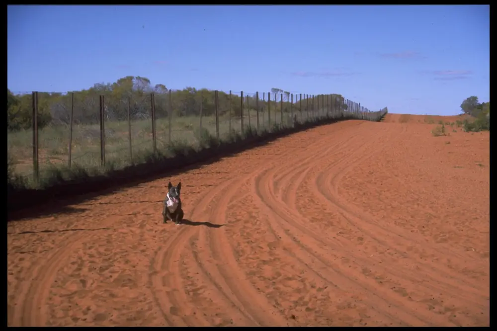
The dog-proof fence at HungerfordPhoto: Narraburra · CC BY-SA 4.0 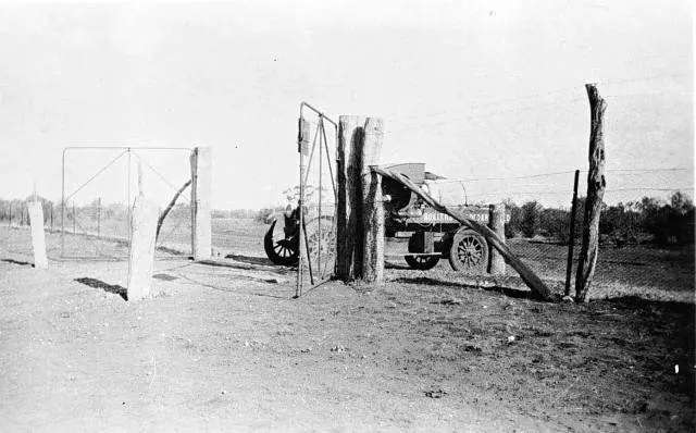
The rabbit-proof fence at HungerfordPhoto: unknown - old photograph · Public domain 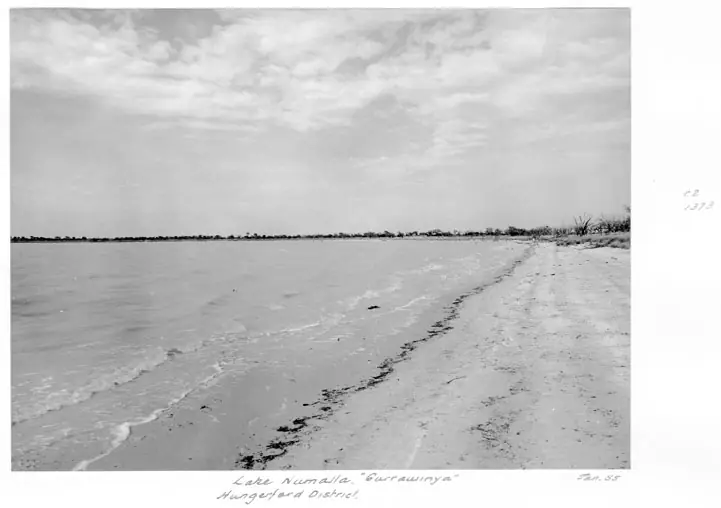
Lake Numalla in Currawinya near HungerfordPhoto: Lands Department, Survey Office, Cartographic Branch, Photographic Section · Public domain
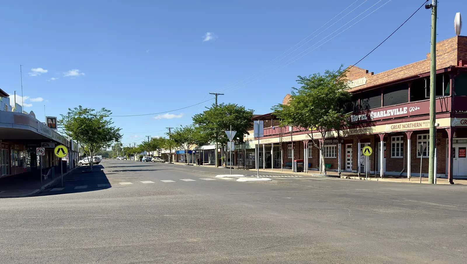
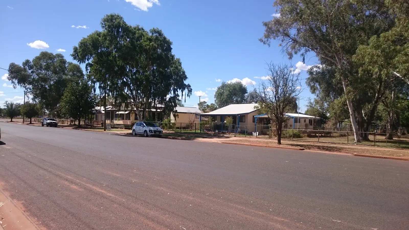
Hungerford is a tiny Queensland border locality on the Paroo River, at the Queensland–New South Wales line, in the south-west. This hub is the Queensland side of that fence — not a Wiltshire mix-up, and not a claim that the New South Wales locality of the same name is the same town. Outback Queensland describes a tiny border town near the Paroo with a large border gate that doubles as the wild dog / dingo fence. Queensland Parks puts Currawinya National Park on this border, about 170 km south-west of Cunnamulla, turning toward Hungerford 4 km west of Eulo, with the park office 20 km north of Hungerford. Explore Bulloo puts Hungerford 164 km south of Thargomindah on the Dowling Track.
The Australian Bureau of Statistics does not publish a 2021 Urban Centre (UCL) named Hungerford. Use suburbs-and-localities SAL31375: 19 people, median age 65, sex split 47.1% male / 52.9% female. QuickStats also prints 3 families and 9 private dwellings, and notes limited tables because of the small population. A locality of 19 people does not have a high street of services this guide can invent.
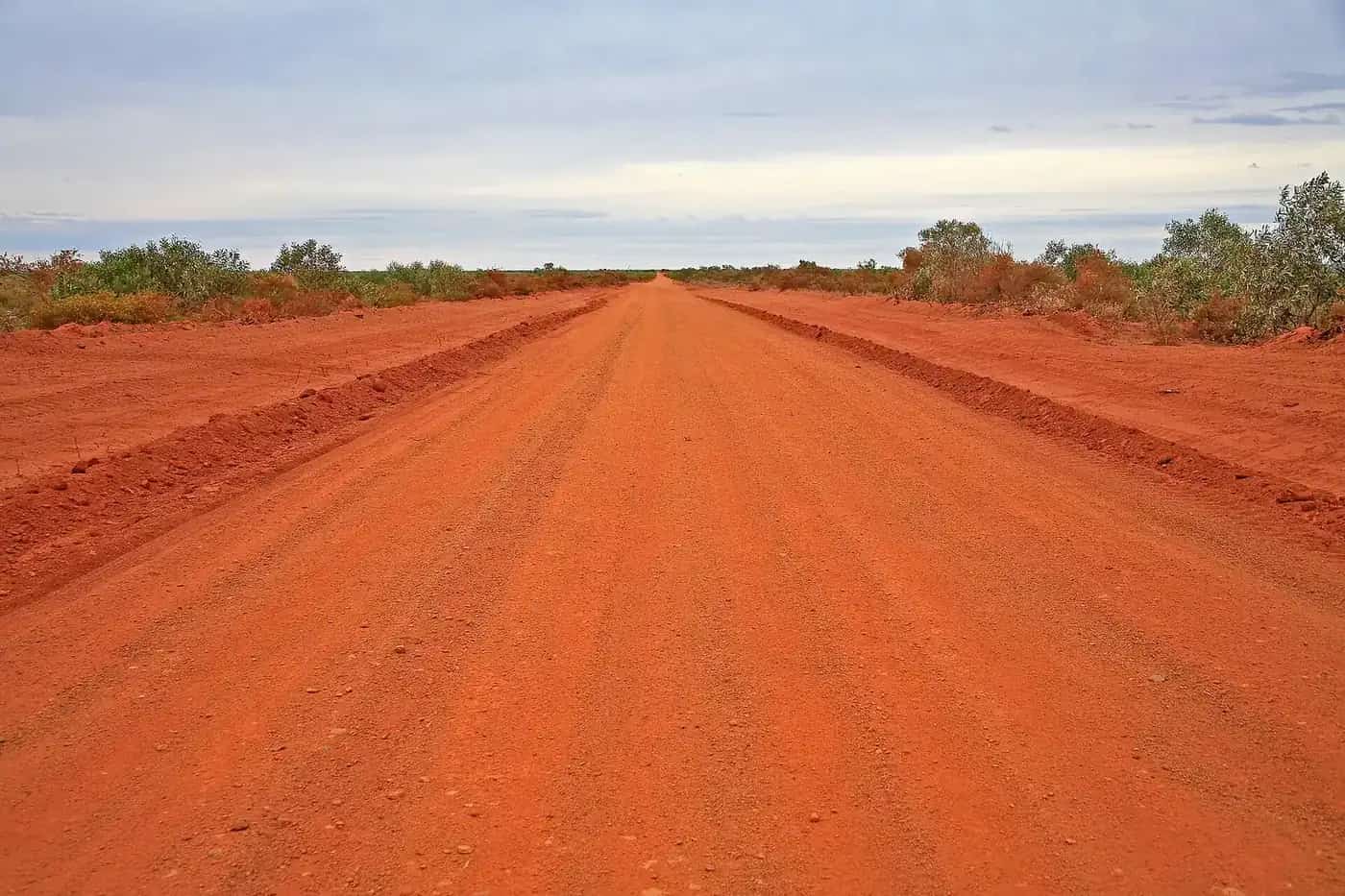
Access roads to Currawinya are unsealed. Queensland Parks recommends 4WD and says even small amounts of rain can make roads impassable. You need QLDTraffic, and Live Traffic NSW if you are coming from Bourke. A 20 km run to the park office is no use if the Hungerford Road is closed.
Where it is, and how far
Hungerford sits on the Dowling Track at the border gate, with Currawinya immediately north. Queensland Parks: from the south, enter the park via Hungerford, 217 km north-west of Bourke; the park office is 4 km north of Ten-Mile Bore or 20 km north of Hungerford. From the north, about 170 km south-west of Cunnamulla, turn toward Hungerford 4 km west of Eulo. Outback Queensland’s Hungerford stay list prints the Eulo Queen Hotel at 111 km.
Bulloo Shire’s about page names Hungerford as a community of 19 people, 164 km south of Thargomindah, near the Paroo on the border. Paroo Shire’s economic profile lists Hungerford (part) among Paroo localities, with Currawinya as a major feature of that shire. This hub reports both official geographies rather than picking a fight between two neighbouring councils.
| Place | Distance from Hungerford (sourced) |
|---|---|
| Currawinya park office | 20 km north (Queensland Parks) |
| Cunnamulla (northern approach) | about 170 km south-west of Cunnamulla to the Hungerford turn, 4 km west of Eulo (Queensland Parks — that is the approach, not a separate Hungerford–Cunnamulla town-to-town figure on that page) |
| Thargomindah | 164 km north (Explore Bulloo / Bulloo Shire) |
| Eulo Queen Hotel | 111 km (Outback Queensland stay list) |
| Bourke | 217 km south-east (Queensland Parks, southern park entrance via Hungerford) |
Cunnamulla and Thargomindah are the service towns. Eulo is the Adventure Way break on the northern approach.
Facts at a glance
Population. ABS 2021 Census, Suburbs and Localities SAL31375: 19 people. Median age 65. 3 families, 9 private dwellings. No UCL. Use the Hungerford (Qld) SAL QuickStats.
Climate. BOM’s Queensland rainfall list records HUNGERFORD (PAROO RIVER), 044181 at about 28.997°S, 144.409°E, January 1884–October 2026. BOM does not publish a monthly climate-averages table for that site. The nearest published open table on the northern approach is Cunnamulla Post Office, 044026, commenced 1879, elevation 189 m, January mean maximum 36.3 °C, July 18.9 °C, July mean minimum 5.8 °C, annual rainfall 375.3 mm (146 years, 1879–2026). BOM Cunnamulla Post Office. The closed western table is Thargomindah Post Office, 045017 (closed 16 March 2005): January mean maximum 36.9 °C, July 19.2 °C, annual rainfall 286.3 mm. See Hungerford weather.
Visitor information. No Hungerford VIC on the sourced pages. Explore Bulloo / Thargomindah: 37 Dowling Street, (07) 4621 8095, tourism@bulloo.qld.gov.au. Cunnamulla Fella Information Centre for the Eulo–Paroo approach. The Royal Mail Hotel is named by Explore Bulloo for local tourist information and brochures, 9 Archenar Street, (07) 4655 4093.
Traditional Owners
Queensland Parks welcomes visitors to Currawinya on Budjiti Country and asks you to respect the lands and waters and walk softly. The park page records thousands of years of Aboriginal cultural heritage, scatters of Indigenous materials, and outstanding Indigenous and shared-history sites. Paroo Shire’s Corporate Plan, used on this site’s Eulo guide, lists traditional groups in and around Cunnamulla as Kooma, Kunja, Kullilli, Budjiti, Mardigan, Bidjara and Murrawarri. This hub follows Parks’ Budjiti wording for Currawinya and does not flatten seven Paroo groups onto the Hungerford townsite. Confirm a sentence you want on a plaque with the Thargomindah or Cunnamulla desks.
History
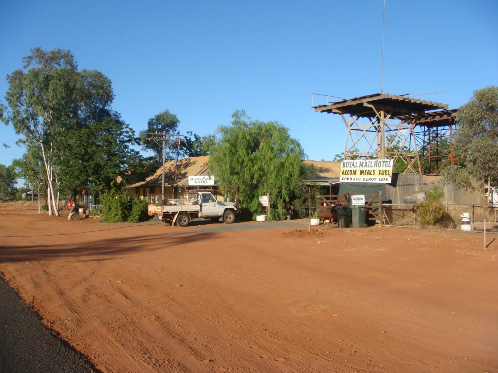
Outback Queensland and Explore Bulloo: the town is named for Irish pioneer pastoralist Thomas Hungerford. The Royal Mail Hotel was built in 1873 of corrugated iron hauled more than 200 km from New South Wales; it is the original building still in use. From 1875 it was a Cobb & Co staging post. Explore Bulloo and Outback Queensland both record that Henry Lawson drank here; Explore Bulloo’s Hungerford sheet treats Lawson’s 1896 sketch in While the Billy Boils, written after a visit in the summer of 1892–1893, as the town’s famous literary mention. This hub does not reprint that sketch.
The wild dog / dingo barrier fence at the border gate began as rabbit-proof fencing in the 1880s on Outback Queensland’s page; smaller sections were joined, and the structure now stretches from Jimbour in Queensland to the Eyre Peninsula in South Australia.
Outback Queensland: Hungerford holds an annual sports day in October with a horse and motorbike gymkhana. No 2026 calendar date sat on that page when this guide was written. Confirm with Explore Bulloo rather than advertising a meeting.
Things to do
Royal Mail Hotel — 9 Archenar Street. Rooms, bunkhouse, meals, fuel station as a listed feature, post office, tourist brochures. Phone (07) 4655 4093. Hours change. Do not treat the bar as a 24-hour museum.
Border gate and dog fence — the named photograph. Stay off the fence; it is working infrastructure.
Paroo River — Bulloo Shire: fishing at Hungerford and at Currawinya a few kilometres away. Queensland fisheries rules apply.
Currawinya National Park — Budjiti Country; Ramsar lakes Wyara (salt) and Numalla (fresh); about 344,000 ha on the current park page; 4WD; park office 20 km north. Camping with a permit. See things to do in Hungerford.
That is the official list. This hub will not invent a café strip.
Where to stay
Official named types:
- Royal Mail Hotel — single, twin and family rooms plus a bunkhouse for 18, shower and toilet blocks, laundry (Explore Bulloo / Outback Queensland)
- Hungerford Caravan Park — named by Bulloo Shire’s Hungerford page
- Currawinya camping — Ourimperee Waterhole, Caiwarro, Corni Paroo, Pump Hole, Myninya; permit and fees; all areas close when the Paroo floods (Queensland Parks)
Confirm at (07) 4655 4093 or (07) 4621 8095.
- How to choose: Hungerford accommodation
- Camping detail: Hungerford caravan parks
- Operator enquiries: feature your business
If Hungerford is full, Eulo is 111 km on the stay list and Cunnamulla is the larger northern service town. Those are distance facts, not booking guarantees.
Caravan and camping
Vans use Hungerford as a Currawinya jump-off and a Dowling Track overnight. Official named camps are the Hungerford Caravan Park, hotel grounds facilities as listed for guests, and park camping with a permit. Ask Thargomindah or the hotel for stay limits. Read Hungerford caravan parks and outback camping.
After rain, Currawinya access is the constraint. Queensland Parks: flooding isolates the park for long periods; the road to the lakes often closes; be self-sufficient. QLDTraffic and park alerts first.
Fuel and services
A locality of 19 people will not match Cunnamulla for groceries or a hospital. This guide does not list bowser brands or invent a supermarket. Explore Bulloo lists a fuel station among Royal Mail Hotel features; Bulloo Shire’s about page also names fuel among Hungerford services. Confirm when you arrive. Fill up in Cunnamulla or Thargomindah if you cannot confirm a bowser. Bulloo Shire names a police station, post office, hotel, meals, a small council depot and caravan park, a medical facility, community hall, tennis courts, rodeo ground and a sealed airstrip, with RFDS monthly. Those are council-named types, not opening hours. For current questions, use Bulloo Shire Council and (07) 4621 8095.
Road access
The Dowling Track / Thargomindah–Hungerford Road is the northern sealed-and-unsealed mix to Thargomindah 164 km. The Hungerford Road from 4 km west of Eulo is the Currawinya spine; Queensland Parks calls all park roads unsealed and impassable when wet. From the south, 217 km from Bourke. After rain, check QLDTraffic and 13 19 40, plus Currawinya park alerts. Do not drive around closed signs to keep a camping permit. Access is via working pastoral properties; leave gates as you find them.
Queensland Parks: after good rains locally or far upstream, flooding isolates the park; camp sites along the Paroo can go under. Mobile coverage is not something this hub will invent. Be self-sufficient.
Nearby parks and towns
Parks:
- Currawinya National Park — 20 km to the office, Ramsar lakes, Paroo waterholes, Myninya camping
Towns on this site:
- Eulo — 111 km on the stay list; mud baths, Heritage Trail
- Cunnamulla — Fella centre, Warrego, the northern sealed service town
- Thargomindah — 164 km; artesian hydro, Bulloo Shire centre
The Adventure Way is the Cunnamulla–Eulo–Thargomindah sealed spine you leave to come here.
When to go, and how long
Cunnamulla Post Office’s January mean maximum of 36.3 °C is hot for a fence photograph at midday. July’s 18.9 °C mean maximum is the comfortable season; July’s 5.8 °C mean minimum is why a river camp needs a layer. Annual rainfall 375.3 mm at Cunnamulla is wetter than Thargomindah Post Office’s closed-station 286.3 mm. Two hours at the hotel, gate and river is the minimum. A night lets you use the hotel or caravan park if confirmed. Two nights only if Currawinya is open, booked, and QLDTraffic agrees. Queensland Parks: be totally self-sufficient.
Operators who want a checked listing: feature your business. The listings slot on this hub stays empty until then.
Plan this trip
Tell us the dates, who you are travelling with and where you need help. We reply with planning notes for Hungerford — we are not a booking agent.
Events and road-conditions newsletter
Occasional notes on outback festivals, race days and official road-condition sources — not a daily blast. We use these details only to send the newsletter.
Queensland · South West
Hungerford accommodation
Where to stay in Hungerford: Royal Mail Hotel rooms and bunkhouse named by Explore Bulloo, Hungerford Caravan Park, Currawinya camping with a permit. Tiny locality — confirm before you arrive.
Read · 3 min
Queensland · South West
Hungerford caravan parks
Camping in Hungerford: Hungerford Caravan Park named by Bulloo Shire, Royal Mail Hotel guest facilities, Currawinya camping with a permit. Confirm roads on QLDTraffic.
Read · 3 min
Queensland · South West
Hungerford weather
Hungerford climate: BOM station 044181 has no monthly averages table. Use Cunnamulla Post Office (044026): January mean max 36.3 °C, July 18.9 °C, 375.3 mm rain.
Read · 4 min
Queensland · South West
Things to do in Hungerford
Things to do in Hungerford: Royal Mail Hotel and Cobb & Co story, border dog fence, Paroo River fishing and Currawinya National Park 20 km north. Tiny locality, sourced list only.
Read · 3 min
Frequently asked questions
Is Hungerford in Paroo Shire or Bulloo Shire?
Both appear on official pages. Queensland Parks and Outback Queensland place the township on the Queensland–NSW border near the Paroo River and Currawinya. Bulloo Shire’s about page names Hungerford as a shire community 164 km south of Thargomindah. Paroo Shire’s economic profile lists Hungerford (part) among Paroo localities. This hub is the Queensland border town, not a NSW suburb of the same name.
How far is Hungerford from Cunnamulla, Thargomindah and Eulo?
Queensland Parks puts the northern park approach about 170 km south-west of Cunnamulla, turning toward Hungerford 4 km west of Eulo, and the park office 20 km north of Hungerford. Explore Bulloo puts Hungerford 164 km south of Thargomindah on the Dowling Track. Outback Queensland’s Hungerford stay list prints the Eulo Queen Hotel at 111 km.
What is Hungerford’s population?
19 people at the 2021 Census for Hungerford (Qld) suburbs-and-localities (SAL31375). The ABS does not publish a 2021 Urban Centre (UCL) named Hungerford. QuickStats notes limited tables because of the small population.
Can I camp at Hungerford and Currawinya?
Yes, as named types. Bulloo Shire names the Hungerford Caravan Park and Currawinya National Park camping. Queensland Parks names Ourimperee, Caiwarro, Corni Paroo, Pump Hole and Myninya, with a permit. Confirm roads on QLDTraffic and park alerts.
What is the weather like in Hungerford?
BOM lists Hungerford (Paroo River) (044181) as a rainfall station but does not publish a monthly climate-averages table. Use Cunnamulla Post Office (044026): January mean maximum 36.3 °C, July 18.9 °C, annual rainfall 375.3 mm.
Where is the visitor centre?
There is no Hungerford visitor centre on the sourced pages. Use the Thargomindah visitor desk at 37 Dowling Street, (07) 4621 8095, tourism@bulloo.qld.gov.au, or the Cunnamulla Fella Information Centre for the Eulo–Currawinya approach.
Sources and further reading
Facts on this page were checked against these primary and official sources. Conditions change — confirm before you travel or buy.
- Hungerford (Qld) 2021 Census QuickStats (SAL31375) — Australian Bureau of Statistics
- Climate statistics for Cunnamulla Post Office (044026) — Bureau of Meteorology
- Climate statistics for Thargomindah Post Office (045017) — Bureau of Meteorology
- Outback Queensland — Hungerford — Outback Queensland Tourism Association
- Royal Mail Hotel — Explore Bulloo — Bulloo Shire Council
- Hungerford — Bulloo Shire Council — Bulloo Shire Council
- About Council — Bulloo Shire — Bulloo Shire Council
- Currawinya National Park — Queensland Parks and Wildlife Service
- Visiting Currawinya safely — Queensland Parks and Wildlife Service
- QLDTraffic — Queensland Government