At a glance
Sourced facts only. Distances and services change — confirm before you travel.
- Local government
- McKinlay Shire
- Traditional Owners
- Koa people named by Queensland Parks for Combo Waterhole; McKinlay Shire planning scheme names Kalkadoon, Yulluna, Mitakoodi and Mayi for the LGAMcKinlay Shire’s Our Towns page for Kynuna does not print a single nation for the townsite only.
- Nearest regional city
- Julia Creek, 115 km on a fully sealed road (McKinlay Shire Getting Here)
- Nearest fuel
- Kynuna Roadhouse (07) 4746 8683 as named in the McKinlay Shire business directory. Queensland Parks: nearest fuel at Kynuna (13 km from Combo) or Winton (132 km). Confirm hours.
- Mobile coverage
- Check Telstra and Optus coverage maps before travel; do not assume a signal.
- Best time to visit
- April–September for Combo Waterhole (Queensland Parks); Julia Creek Airport cooler mean maxima
Climate
Monthly means from the Bureau of Meteorology station Julia Creek Airport (029058). This is not a forecast. Open. Nearest complete open table used here — not a Kynuna township temperature table (requested 030133 returned not found). 115 km on McKinlay Shire Getting Here. Commenced 2001. Elevation 123 m.
| Month | Mean max (°C) | Mean min (°C) | Rainfall (mm) |
|---|---|---|---|
| Jan | 37.8 | 24.2 | 120.5 |
| Feb | 36.6 | 23.0 | 130.6 |
| Mar | 36.1 | 21.5 | 83.0 |
| Apr | 34.3 | 17.6 | 16.2 |
| May | 30.5 | 13.5 | 8.4 |
| Jun | 27.4 | 9.9 | 13.1 |
| Jul | 27.4 | 8.9 | 11.5 |
| Aug | 29.9 | 9.8 | 3.2 |
| Sep | 34.1 | 14.5 | 4.4 |
| Oct | 37.8 | 18.8 | 13.5 |
| Nov | 39.0 | 21.8 | 32.4 |
| Dec | 39.8 | 23.9 | 76.2 |
Kynuna in pictures
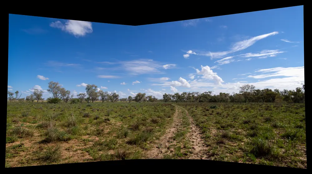
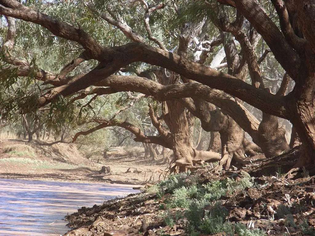
Combo Waterhole near KynunaPhoto: Ben Cordia · CC BY-SA 4.0 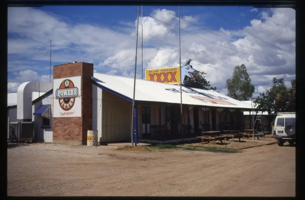
Kynuna's Blue Heeler HotelPhoto: Queensland State Archives · PDM-owner 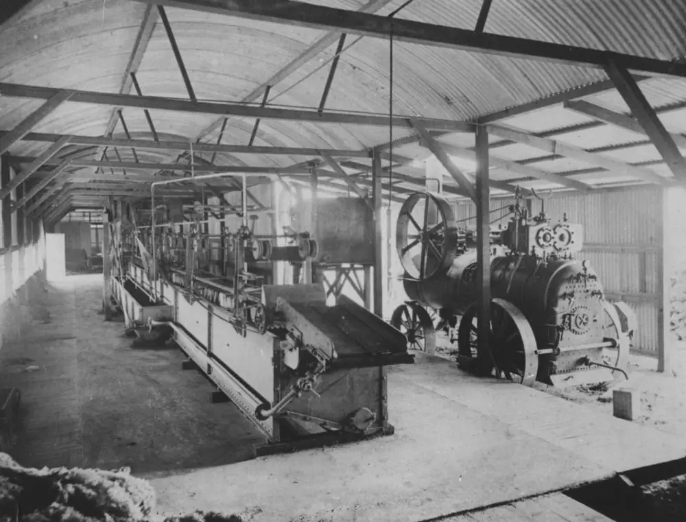
Kynuna wool scoursPhoto: Item is held by John Oxley Library, State Library of Queensland. · Public domain
Kynuna sits in McKinlay Shire on the Landsborough Highway — the Matilda Way between Winton and McKinlay Qld, through Queensland’s outback north. McKinlay Shire’s Getting Here page puts Julia Creek to Kynuna at 115 km on a fully sealed road. Queensland Parks puts Combo Waterhole Conservation Park just south of Kynuna and 132 km north-west of Winton. Experience Winton’s Combo page puts the same park 156 km northwest of Winton. This hub prints that kilometre discrepancy rather than inventing a compromise. You still need QLDTraffic after rain, because a 115 km run to Julia Creek is no use if the highway is closed.
The Australian Bureau of Statistics 2021 QuickStats product used here is suburbs-and-localities SAL31599: 52 people, median age 31. QuickStats notes limited tables because of the small population. This guide does not invent a 2021 Urban Centre (UCL) count. McKinlay Shire’s Our Towns page calls Kynuna the heart of Waltzing Matilda Country. Queensland Parks: Combo’s waterholes reputedly inspired Banjo Paterson to write Waltzing Matilda. This hub copies that park and council wording. It does not invent Banjo Paterson quotes.
Where it is, and how far
Kynuna sits on the Landsborough Highway (Matilda Way) in the southern part of McKinlay Shire. Official pages used here do not agree on a single Combo Waterhole kilometre or a single Winton kilometre. This table prints the discrepancy.
| Place | Distance from Kynuna (official pages used here) |
|---|---|
| Julia Creek | 115 km (McKinlay Shire Getting Here; fully sealed Julia Creek–Kynuna Road) |
| Combo Waterhole Conservation Park | Queensland Parks: turn south off the Landsborough Highway 13 km south of Kynuna, then 8 km into the park. Outback Queensland Kynuna page: 16 km east of Kynuna. Do not pick one. |
| Winton (to Combo) | Queensland Parks: Combo is 132 km north-west of Winton. Experience Winton Combo page: 156 km northwest of Winton. Parks also names nearest fuel at Winton 132 km. Do not pick one Winton figure. |
| McKinlay | named as the Matilda Way neighbour in the shire; no Kynuna–McKinlay kilometre on the pages used here |
| Longreach | further south on the Matilda Way beyond Winton; no Kynuna–Longreach kilometre on those pages |
| Cloncurry | north-west of McKinlay on the same highway; no Kynuna–Cloncurry kilometre on the pages used here |
Use QLDTraffic for the day you drive. Do not add a Kynuna–Longreach total from a Winton figure.
Facts at a glance
Population. ABS 2021 Census, Suburbs and Localities SAL31599: 52 people, 53.1% male / 46.9% female, median age 31, 10 families, 31 private dwellings. Limited information because of the small population. Use the Kynuna SAL QuickStats. Do not paste McKinlay Shire’s whole-LGA headcount onto this town.
Climate. The BOM climate-averages product used here does not publish a Kynuna township temperature table — the requested 030133 climate-averages URL returned not found. For a labelled shire comparison, use Julia Creek Airport, 029058, 115 km on Getting Here: commenced 2001, status Open, elevation 123 m, December mean maximum 39.8 °C, June and July 27.4 °C, annual rainfall 503.0 mm. Queensland Parks: visiting Combo is recommended from April to September as summer temperatures reach over 40 °C, and summer rains often cause flooding. See Kynuna weather.
Visitor information. Kynuna does not have its own visitor information centre on the McKinlay Shire pages used here. Use the Julia Creek Visitor Information Centre, corner of Burke and Julia Streets, for local road conditions — McKinlay Shire’s Getting Here instruction. Council switchboard: (07) 4746 7166. For Combo Waterhole, Queensland Parks’ tourism links name the Waltzing Matilda Centre, 50 Elderslie Street, Winton, (07) 4657 1466 or 1300 665 115, waltzing@matildacentre.com.au. Hours change.
Traditional Owners
Queensland Parks’ About Combo Waterhole page: the Koa people were the first to follow the Diamantina River — a web of life that traverses the land in braided channels — pioneering paths of trade and travel. McKinlay Shire’s planning scheme states that the traditional owners of the land are the Kalkadoon, Yulluna, Mitakoodi and Mayi peoples. McKinlay Shire’s Our Towns page for Kynuna does not print a single nation name for the townsite only. This guide prints Koa as Parks names them for Combo, and the shire’s four-group list for the wider local government area, rather than flattening one onto the other. Visit as a guest; see visiting Country respectfully. Confirm wording at the Waltzing Matilda Centre or the Julia Creek desk.
History
McKinlay Shire Our Towns: Kynuna was first established on the Diamantina River at the junction of five roads as a teamsters camp and supply point for Kynuna Station and other properties on the western routes. It was gazetted as a town in 1894 and within a few years had a substantial population of up to 700 people and several hotels. Today only one hotel remains, the Blue Heeler Hotel, and it is the last remaining building with any association with the first days of the song Waltzing Matilda. Built in 1889 as the Kynuna Hotel, it is believed that the squatter, Bob MacPherson and the swagman, Samuel Hoffmeister, drank their last drinks at the bar of the Blue Heeler Hotel. Banjo Paterson also drank at the hotel and it was where the song Waltzing Matilda was first performed. Those sentences are council wording. This hub does not add invented quotes.
Outback Queensland’s Kynuna page: established in the 1860s; in its early days boasted three hotels; a staging post for Cobb and Co Coaches; today just one hotel, the Blue Heeler Hotel, built 1889. Folklore on that page: Bob MacPherson (owner of Dagworth Station) told Banjo the story of the suicide of Samuel Hoffmeister beside the Combo Waterhole, 13 kilometres upstream of the Diamantina River, in September 1894; Hoffmeister had reportedly been one of the striking shearers involved in the burning down of the Dagworth Woolshed; this story, together with other stories which Paterson had heard, inspired him to write Waltzing Matilda at Dagworth; Christina MacPherson adapted a popular Scottish tune Craiglea. That is destination folklore as Outback Queensland prints it, not a sourced Paterson quotation.
Queensland Parks About: did the jolly swagman camp by Combo Waterhole? We will probably never know, but the waterholes of this 49 ha park offered shady picnic spots in 1895 for stagecoach passengers and the residents of neighbouring Dagworth Station. Historic stone-pitched overshots dam the Diamantina’s channels. Outback Queensland: overshot dams built by Chinese labourers in 1883. Experience Winton: unique flagstone overshots built by Chinese labour to help the Cobb & Co coaches.
Things to do
Blue Heeler Hotel. McKinlay Shire: last remaining building with a Waltzing Matilda association; built 1889 as the Kynuna Hotel. Shire business directory: (07) 4746 8650, hotel and meals. Hours change. Confirm with the Julia Creek desk before you treat the bar as a guaranteed lunch.
Combo Waterhole Conservation Park. Queensland Parks: 49 ha; waterholes reputedly inspired Banjo Paterson; refuge for wildlife during dry times; historic stone-pitched overshots; parking, toilets, walking; no camping, no campfires; domestic animals not permitted. Getting there on Parks: 2WD to the car park; vehicles not permitted beyond the car park; self-guided walking track. Outback Queensland: walk the 2.5 kilometre return circuit to the waterhole along the Diamantina River; picnic under the shade of a Coolibah tree on that page’s wording; camping prohibited; dry weather entry only. Experience Winton: conventional vehicle, although 4WD is recommended. Check park alerts and QLDTraffic. A fuller order of a Combo visit is on things to do in Kynuna.
Kynuna Roadhouse. Shire business directory: (07) 4746 8683, fuel, accommodation, meals. Parks: nearest fuel and supplies at Kynuna (13 km from Combo) or Winton (132 km). Confirm hours before you count on a pump.
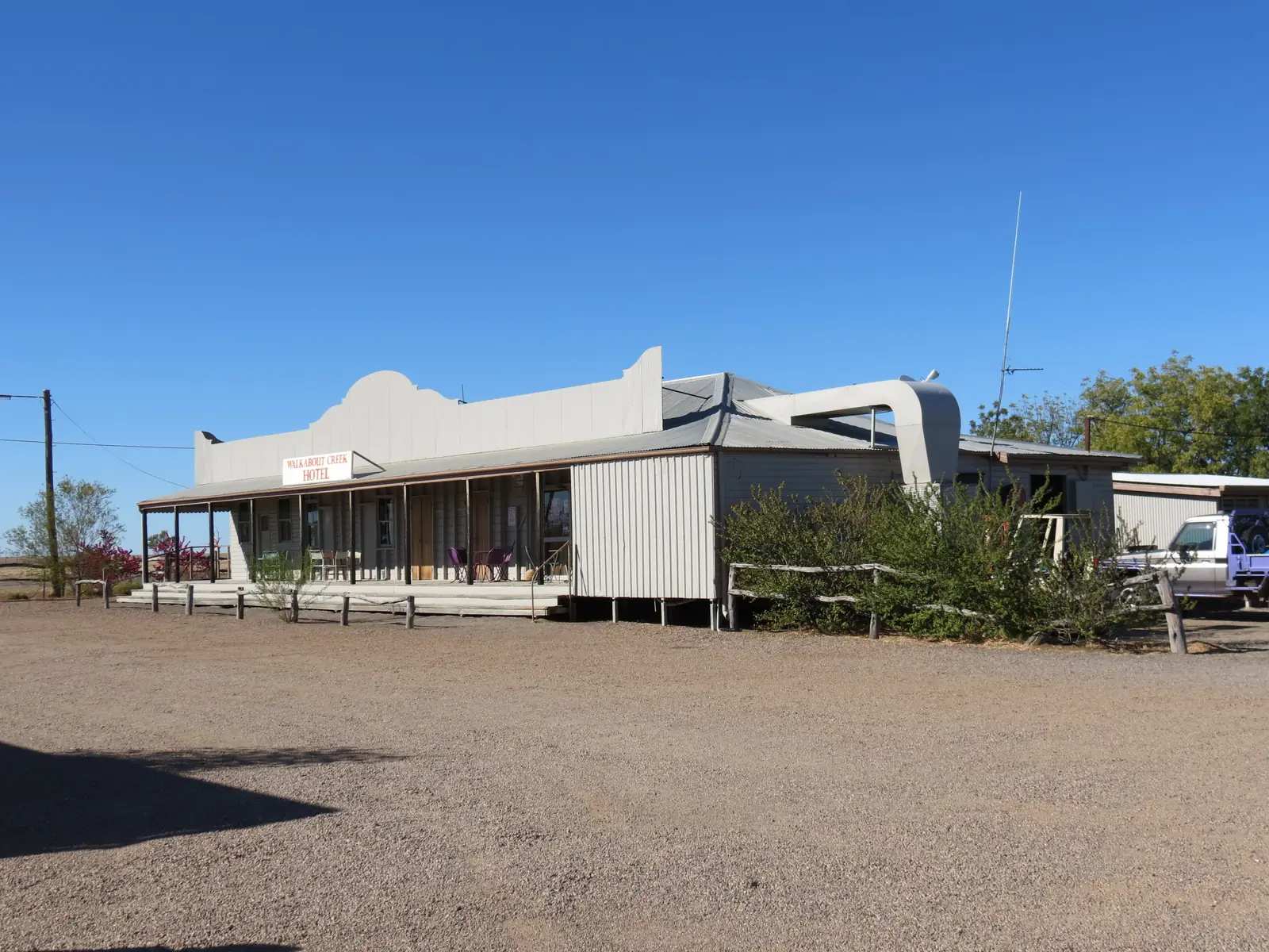
Nearby, not in Kynuna township: the Waltzing Matilda Centre and Bladensburg National Park sit in and around Winton. Diamantina National Park is further west in Channel Country. McKinlay Qld has the Walkabout Creek Hotel. Longreach is further south on the Matilda Way.
Where to stay
McKinlay Shire’s planning scheme: Kynuna has two caravan parks, a hotel roadhouse and police station. The shire business directory names the Blue Heeler Hotel (hotel, meals) and Kynuna Roadhouse (fuel, accommodation, meals). Outback Queensland’s Kynuna page lists nearby stays in Winton and Julia Creek, not a 40-room Kynuna strip. Combo Waterhole is not a stay: Parks lists no camping.
Ask the Julia Creek Visitor Information Centre or the Waltzing Matilda Centre. If Kynuna has no vacancy, Winton and Julia Creek are the service towns on the official distance table.
- How to choose a type of stay: Kynuna accommodation
- Parks and camping: Kynuna caravan parks
- Operator enquiries: feature your business
Caravan and camping
Vans reach Kynuna on the sealed Landsborough Highway because Combo Waterhole sits just south of town on Parks’ getting-there note. Official named stay types in the planning scheme are two caravan parks plus a hotel roadhouse. That is a type count, not a powered-site sheet this hub will invent with extra brand names. Confirm stay limits at the Julia Creek desk. Do not camp at Combo Waterhole. Parks: no camping, no campfires, no bins — take rubbish with you. Read Kynuna caravan parks and outback camping.
After rain, even small amounts can make Combo’s access impassable on Parks’ own wording. Julia Creek Airport’s January mean of 120.5 mm and February 130.6 mm are the station warning. QLDTraffic first. Parks: flooding can occur up to two weeks after rain has fallen elsewhere in the catchment.
Fuel and services
McKinlay Shire’s planning scheme names a hotel roadhouse and police station. The business directory lists Kynuna Roadhouse (07) 4746 8683 as fuel, accommodation and meals, and the Blue Heeler Hotel (07) 4746 8650 as hotel and meals. Queensland Parks: nearest fuel and supplies at Kynuna (13 km) from Combo or Winton (132 km). This guide does not invent a supermarket, hospital or second bowser the directory does not list. Confirm roadhouse hours before you treat a directory line as a 2026 24-hour pump. Carry drinking water for Combo — Parks: at least 7 litres per person per day, and enough emergency food and water for at least two weeks in case of stranding.
Greyhound Australia stops in Kynuna on McKinlay Shire’s Getting Here page. Arrival times change. The Inlander rail service named on that page stops at Julia Creek, not Kynuna.
For current questions, use McKinlay Shire (07) 4746 7166, the Waltzing Matilda Centre (07) 4657 1466, and QLDTraffic.
Road access
The Landsborough Highway (Matilda Way) is the named sealed spine between Longreach and Cloncurry. McKinlay Shire: sealed, double lane, accessible to all vehicles during the dry season. After rain, check QLDTraffic and 13 19 40. Do not drive around closed signs to keep a Combo walk.
Julia Creek–Kynuna Road is 115 km, fully sealed, on Getting Here. McKinlay Shire calls the Kynuna > Julia Creek > Burke & Wills route the Barra Express. Combo’s last 8 km is the Parks access drive; 2WD to the car park in ordinary weather; vehicles not beyond the car park. Experience Winton still recommends 4WD. Outback Queensland: dry weather entry only.
Air: McKinlay Shire names REX from Julia Creek Airport. Winton’s visitor desk is the Combo tourism contact on Parks.
Nearby parks and towns
Named sites (official pages):
- Combo Waterhole Conservation Park — Queensland Parks, 49 ha, no camping
- Blue Heeler Hotel — McKinlay Shire Our Towns and directory
- Kynuna Roadhouse — shire directory
- Bladensburg National Park — Winton district, not in Kynuna
- Diamantina National Park — further west; Combo is in the Diamantina catchment on Parks’ maps page
Towns on this site:
- Winton — Waltzing Matilda Centre
- McKinlay — Walkabout Creek Hotel
- Julia Creek — 115 km, shire centre
- Longreach — Matilda Way south
When to go, and how long
Queensland Parks recommends April to September for Combo. Julia Creek Airport’s December mean maximum of 39.8 °C is the labelled shire heat warning; Parks says summer at Combo reaches over 40 °C. January–February rainfall at Julia Creek Airport (120.5 mm, 130.6 mm) is why floodways close. July mean maximum 27.4 °C is the walking season on paper; July mean minimum 8.9 °C is why a Kynuna night needs a layer.
Forty-five minutes at the Blue Heeler if it is open is the town minimum. Add two hours or more for Combo’s 2.5 km return circuit on Outback Queensland, only if Parks and QLDTraffic agree. A night in Kynuna if the hotel or roadhouse has a bed or a site. Two nights if you are adding Winton’s Waltzing Matilda Centre. Do not plan a three-night Combo camping trip: camping is prohibited.
Operators who want a checked listing: feature your business. The listings slot on this hub stays empty until then.
Plan this trip
Tell us the dates, who you are travelling with and where you need help. We reply with planning notes for Kynuna — we are not a booking agent.
Events and road-conditions newsletter
Occasional notes on outback festivals, race days and official road-condition sources — not a daily blast. We use these details only to send the newsletter.
Queensland · Outback North
Kynuna accommodation
Where to stay in Kynuna: McKinlay Shire names two caravan parks, a hotel roadhouse and police station. Directory lists Blue Heeler Hotel and Kynuna Roadhouse. Combo Waterhole has no camping.
Read · 4 min
Queensland · Outback North
Kynuna caravan parks
Camping in Kynuna: McKinlay Shire’s planning scheme names two caravan parks and a hotel roadhouse. Queensland Parks lists no camping at Combo Waterhole Conservation Park. Confirm stay limits at Julia Creek or Winton.
Read · 4 min
Queensland · Outback North
Kynuna weather
Kynuna has no BOM township temperature table on the product used here. Julia Creek Airport (029058): December mean max 39.8 °C, June and July 27.4 °C, annual rainfall 503.0 mm. Parks recommends Combo April–September.
Read · 5 min
Queensland · Outback North
Things to do in Kynuna
Things to do in Kynuna: Combo Waterhole Conservation Park as named by Queensland Parks, the Blue Heeler Hotel on McKinlay Shire wording, and the Landsborough Highway stop. No invented Banjo quotes.
Read · 4 min
Frequently asked questions
How far is Kynuna from Julia Creek and Combo Waterhole?
McKinlay Shire’s Getting Here page puts Julia Creek to Kynuna at 115 km on a fully sealed road. Queensland Parks: turn south off the Landsborough Highway 13 km south of Kynuna, then 8 km into Combo Waterhole Conservation Park. Outback Queensland’s Kynuna page puts Combo Waterhole 16 km east of Kynuna. This guide does not pick a single Combo kilometre those official pages disagree on.
What is Kynuna’s population?
52 people at the 2021 Census for Kynuna suburbs-and-localities (SAL31599). Median age 31. QuickStats notes limited tables because of the small population. The ABS product used here is the SAL, not a 2021 Urban Centre (UCL) count this guide will invent.
What is Combo Waterhole Conservation Park?
Queensland Parks: a 49 ha park 132 km north-west of Winton, near Kynuna. Combo’s waterholes reputedly inspired Banjo Paterson to write Waltzing Matilda. Historic stone-pitched overshots dam the Diamantina’s channels. No camping, no campfires, no pets. Experience Winton puts Combo 156 km north-west of Winton. This guide prints both kilometres.
What is the weather like in Kynuna?
The BOM climate-averages product used here does not publish a Kynuna township temperature table (the requested station 030133 URL returned not found). Julia Creek Airport (029058) is the labelled shire comparison: December mean maximum 39.8 °C, June and July 27.4 °C, annual rainfall 503.0 mm. Queensland Parks recommends visiting Combo from April to September as summer temperatures reach over 40 °C.
Can I camp at Combo Waterhole?
No. Queensland Parks lists no camping and no campfires in Combo Waterhole Conservation Park. Outback Queensland’s Kynuna page also says camping is prohibited. Nearest fuel and supplies on the Parks page are Kynuna (13 km) or Winton (132 km). Stay in Kynuna as named types, or in Winton or Julia Creek.
Sources and further reading
Facts on this page were checked against these primary and official sources. Conditions change — confirm before you travel or buy.
- Kynuna 2021 Census QuickStats (SAL31599) — Australian Bureau of Statistics
- Climate statistics for Julia Creek Airport (029058) — Bureau of Meteorology
- Combo Waterhole Conservation Park — Queensland Parks and Wildlife Service
- Visiting Combo Waterhole safely — Queensland Parks and Wildlife Service
- About Combo Waterhole — Queensland Parks and Wildlife Service
- Outback Queensland — Kynuna — Outback Queensland Tourism Association
- Experience Winton — Combo Waterhole — Winton Shire Council (Experience Winton)
- McKinlay Shire Council — Our Towns — McKinlay Shire Council
- McKinlay Shire Council — Getting Here — McKinlay Shire Council
- McKinlay Shire Planning Scheme 2019 — McKinlay Shire Council
- McKinlay Shire Business Directory — McKinlay Shire Council
- QLDTraffic — Queensland Government