At a glance
Sourced facts only. Distances and services change — confirm before you travel.
- Local government
- McKinlay Shire
- Nearest regional city
- 104 km south-east of Cloncurry (Outback Queensland and McKinlay Shire planning scheme); Julia Creek 80 km (McKinlay Shire Getting Here)
- Mobile coverage
- Check Telstra and Optus coverage maps before travel; do not assume a signal.
- Best time to visit
- May–September on Cloncurry Airport cooler mean maxima (labelled comparison)
Climate
Monthly means from the Bureau of Meteorology station Cloncurry Airport (029141). This is not a forecast. Open. Labelled comparison — BOM climate-averages product used here does not publish a McKinlay township temperature table (requested 029034 returned not found). Commenced 1978. Elevation 186 m.
| Month | Mean max (°C) | Mean min (°C) | Rainfall (mm) |
|---|---|---|---|
| Jan | 37.3 | 25.1 | 149.7 |
| Feb | 36.2 | 24.3 | 109.1 |
| Mar | 35.7 | 23.0 | 79.1 |
| Apr | 33.6 | 20.1 | 16.4 |
| May | 29.3 | 15.7 | 7.1 |
| Jun | 26.3 | 11.7 | 7.5 |
| Jul | 26.3 | 10.8 | 6.1 |
| Aug | 28.9 | 12.3 | 3.7 |
| Sep | 33.1 | 16.6 | 6.4 |
| Oct | 36.6 | 20.7 | 20.2 |
| Nov | 37.9 | 23.3 | 37.8 |
| Dec | 38.7 | 25.0 | 84.4 |
McKinlay Qld in pictures
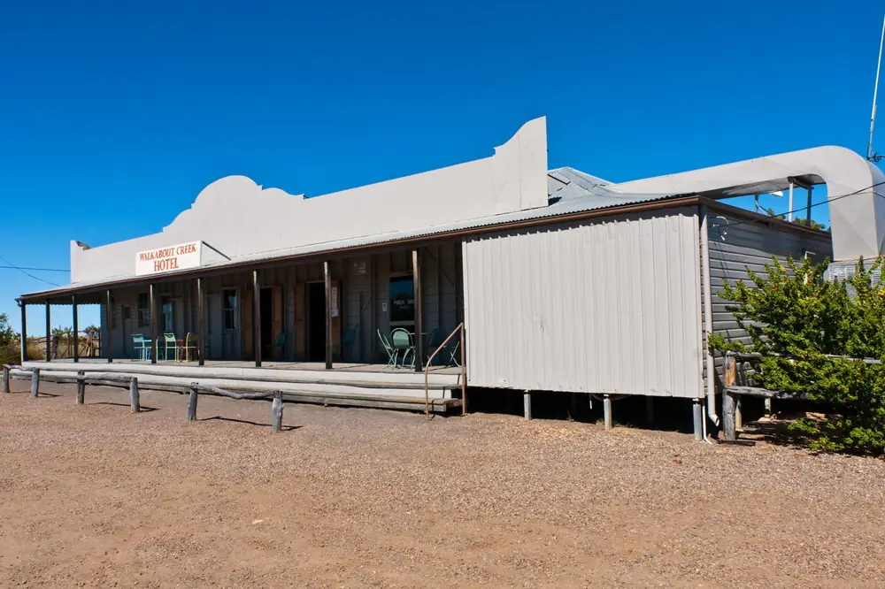
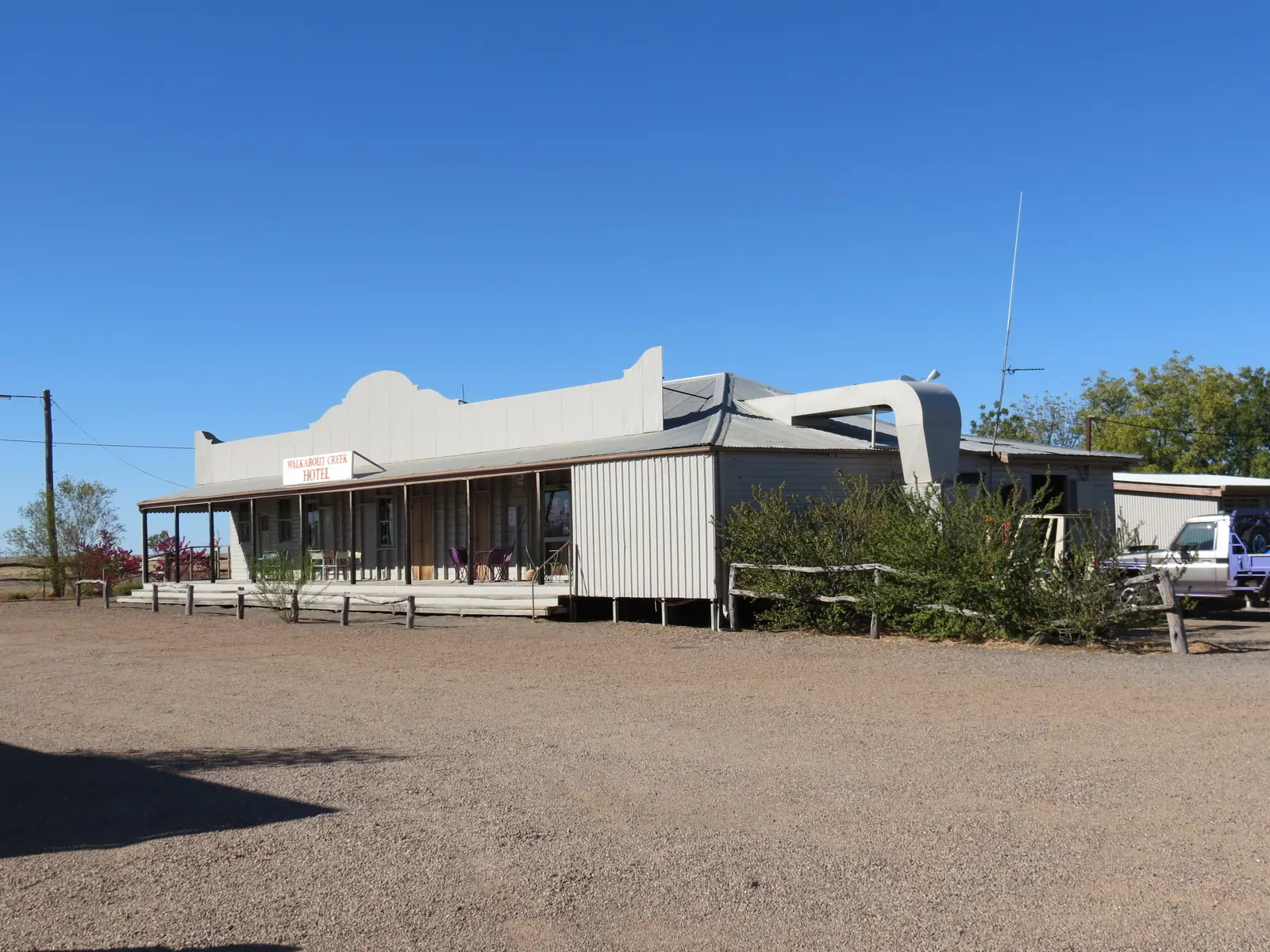
Walkabout Creek in McKinlayPhoto: Unnaugan · CC BY-SA 4.0 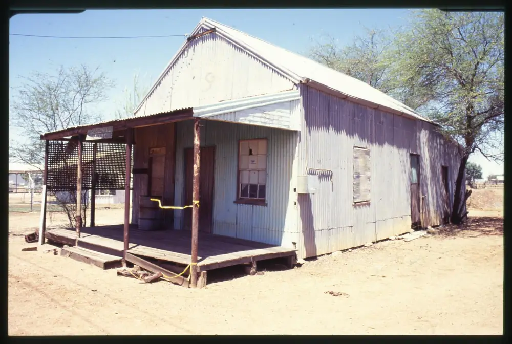
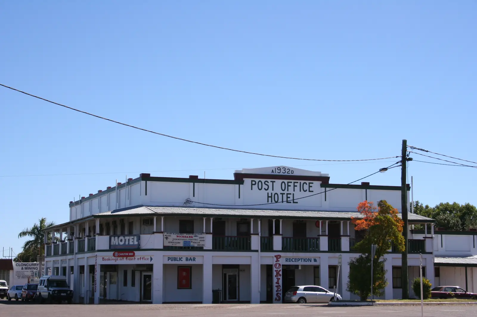
McKinlay's general storePhoto: Unknown authorUnknown author · CC BY 4.0 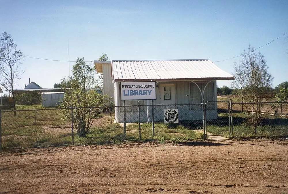
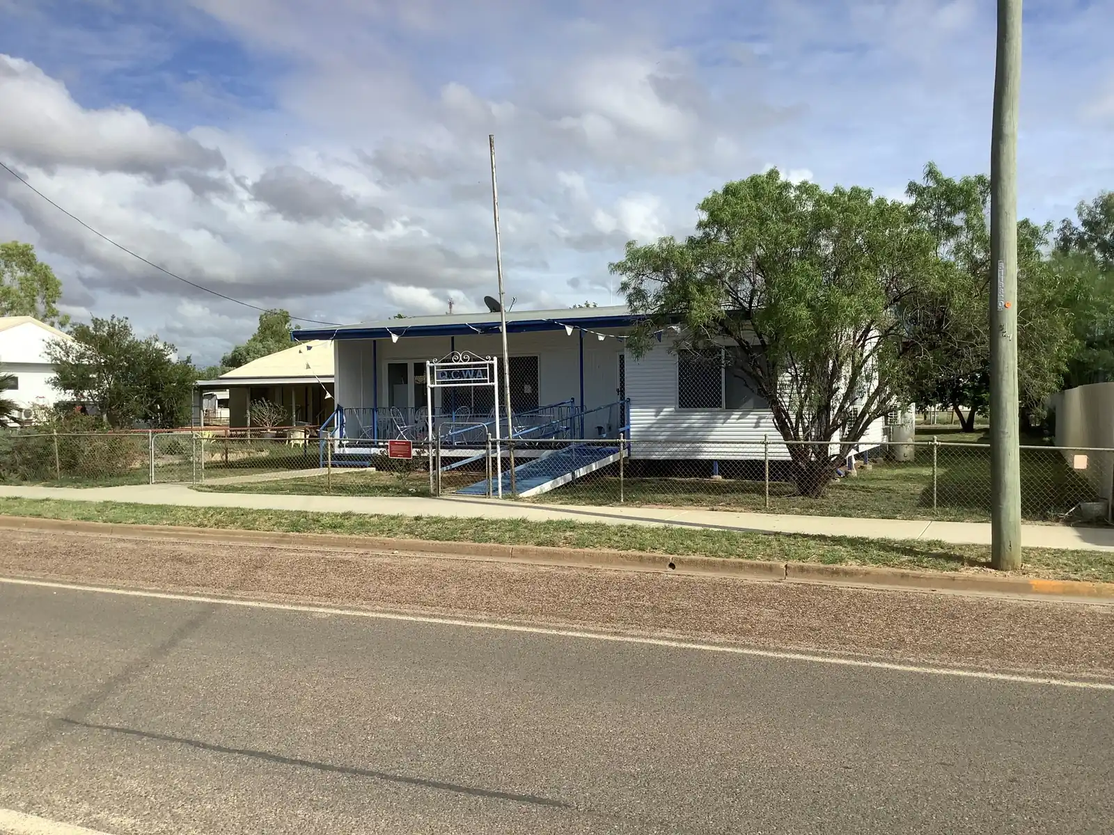
McKinlay Shire Council libraryPhoto: Unknown authorUnknown author · CC BY 3.0 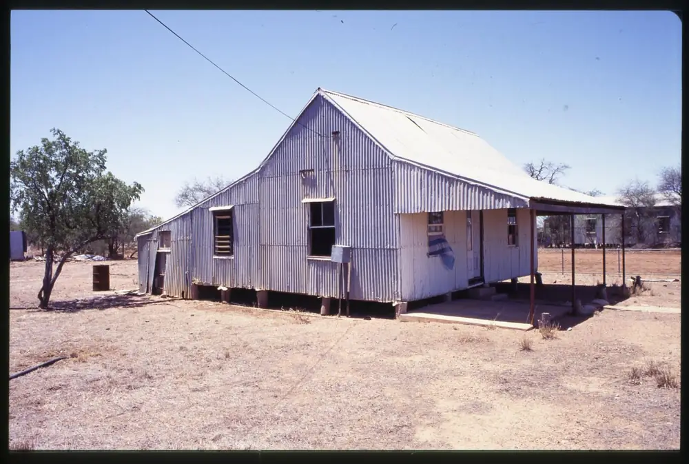
A house in McKinlayPhoto: Unknown authorUnknown author · CC BY 4.0
McKinlay Qld sits in McKinlay Shire on the Landsborough Highway — the Matilda Way between Cloncurry and Winton, through Queensland’s outback north. Outback Queensland puts it 104 km south-east of Cloncurry. McKinlay Shire’s planning scheme uses the same 104 kilometres south-east of Cloncurry. McKinlay Shire’s Getting Here page puts Julia Creek to McKinlay at 80 km on a one-lane, recently fully sealed road. Search McKinlay Qld if a search engine offers a different McKinlay first. This is not Cloncurry Shire. Council offices were in McKinlay until 1930, when they moved to Julia Creek.
The Australian Bureau of Statistics 2021 QuickStats product used here is suburbs-and-localities SAL31794: 162 people, median age 37. That SAL is not a promise of a motel strip. Outback Queensland names the Walkabout Creek Hotel, originally the Federal Hotel in 1900, as a filming location for Crocodile Dundee. This hub copies that official naming and does not recap the film plot as if it were sourced local history. You still need QLDTraffic after rain, because an 80 km run to Julia Creek is no use if the highway is closed.
Where it is, and how far
McKinlay sits on the Landsborough Highway (Matilda Way) in the south-west of McKinlay Shire. Official pages used here do not invent a McKinlay–Winton kilometre this hub will invent. Cannington’s published direction disagrees between two official pages; this table prints both.
| Place | Distance from McKinlay (official pages used here) |
|---|---|
| Cloncurry | 104 km south-east of Cloncurry (Outback Queensland town page; McKinlay Shire planning scheme) |
| Julia Creek | 80 km (McKinlay Shire Getting Here; one-lane sealed Julia Creek–McKinlay Road) |
| Cannington mine | Outback Queensland: 87 km south. McKinlay Shire Our Towns: 85 km west. Do not pick one. |
| Kynuna | named as the next Matilda Way town in the shire; no McKinlay–Kynuna kilometre on the pages used here |
| Winton | on the Landsborough Highway south of Kynuna; no McKinlay–Winton kilometre on those pages |
| Quamby | Cloncurry Shire neighbour north of Cloncurry; no McKinlay kilometre on the pages used here |
Use QLDTraffic for the day you drive. Do not add a McKinlay–Mount Isa total from the Cloncurry figure.
Facts at a glance
Population. ABS 2021 Census, Suburbs and Localities SAL31794: 162 people, 74.4% male / 25.6% female, median age 37, 14 families, 41 private dwellings. Aboriginal and/or Torres Strait Islander 5.6% on that QuickStats table (with a large not-stated share). Use the McKinlay SAL QuickStats. Do not paste McKinlay Shire’s whole-LGA headcount onto this town.
Climate. The BOM climate-averages product used here does not publish a McKinlay township temperature table — the requested McKinlay Roadhouse 029034 climate-averages URL returned not found. For labelled nearby comparisons, use Cloncurry Airport, 029141 (104 km on the official town kilometre): commenced 1978, status Open, elevation 186 m, December mean maximum 38.7 °C, July 26.3 °C, annual rainfall 522.1 mm. And Julia Creek Airport, 029058 (80 km on Getting Here): commenced 2001, status Open, elevation 123 m, December mean maximum 39.8 °C, June and July 27.4 °C, annual rainfall 503.0 mm. See McKinlay weather.
Visitor information. Outback Queensland names Queensland’s smallest public library and visitor centre on Middleton Street, with fiction and non-fiction, internet access and local brochures. For shire-wide road questions, McKinlay Shire’s Getting Here page sends you to the Julia Creek Visitor Information Centre on the corner of Burke and Julia Streets. Council switchboard: (07) 4746 7166, 29 Burke Street, Julia Creek, reception@mckinlay.qld.gov.au. Hours change.
Traditional Owners
McKinlay Shire’s planning scheme states that the traditional owners of the land are the Kalkadoon, Yulluna, Mitakoodi and Mayi peoples, with a strong cultural connection to the land and many places of cultural significance in the Shire. McKinlay Shire’s Our Towns page for the McKinlay township does not print a single nation name for the townsite only. This guide follows that shire list rather than flattening four groups onto one street. Visit as a guest; see visiting Country respectfully. Confirm wording at the Julia Creek visitor desk.
History
Outback Queensland: the town takes its name from the McKinlay River, discovered by explorer John McKinlay, who led the South Australian Burke Relief Expedition in 1861 during the search for Burke and Wills. Established over a century ago, McKinlay served as a vital staging post for Cobb & Co. coaches and a social hub for graziers from surrounding properties.
McKinlay Shire Our Towns: the township was established in 1888 as a staging post for the Cobb and Co. coaches and a gathering point for graziers. The McKinlay Shire Council offices were originally located in McKinlay until 1930, when they were moved to Julia Creek.
The Walkabout Creek Hotel is the named landmark. Outback Queensland: originally built as the Federal Hotel in 1900; a key filming location for Crocodile Dundee. McKinlay Shire: this historic pub was once the Shire Hall and has recently gained notoriety as the pub in that film; originally named the Federal Hotel, built in 1900 and licensed in 1901. Outback Queensland’s attraction listing adds: original movie bar donated by producer John Cornell; relocated to its current position overlooking the Landsborough Highway in 1996; local family and graziers Angus and Jo purchasing the pub in 2025. Those are official tourism sentences. This hub does not recap the film as local history.
Outback Queensland also names Cannington South32, 87 km south, opened 1997, world’s largest and lowest-cost single mine producer of silver and lead, supplier of silver for medals at the 2000 Sydney and 2008 Beijing Olympic Games. McKinlay Shire Our Towns puts the same mine 85 km west, established 1997, official supplier of silver to the Sydney Olympics and Para-Olympics and the 2008 Beijing Olympics. Print the kilometre discrepancy. The mine is not a public walk-in attraction on those pages.
Things to do
Walkabout Creek Hotel, 30 Wylde Street. Outback Queensland: cold drinks, meals, hearty hospitality; phone 074746 8424, admin@walkaboutcreekhotel.com.au. McKinlay Shire business directory: hotel, accommodation, meals, (07) 4746 8424, corner Kirby and Wylde Street. Hours change. Confirm with the Julia Creek desk before you treat the verandah as a guaranteed lunch.
Smallest public library / visitor centre, Middleton Street — named on Outback Queensland’s town page. Brochures, internet, a surprising array of books on that wording.
McKinlay River name and Cobb & Co story — read the Outback Queensland and shire paragraphs. Do not invent a museum catalogue this hub does not have.
Nearby, not in McKinlay township: Kynuna and Combo Waterhole Conservation Park sit further south on the Matilda Way. Cloncurry is 104 km. Julia Creek is 80 km, with At the Creek and the artesian baths. Quamby is the Cloncurry Shire locality north of Cloncurry. HF / DF Station Power House Ruins on Outback Queensland are listed at Flinders Highway, Julia Creek, not as a McKinlay main-street stop.
A fuller order of a day is on things to do in McKinlay.
Where to stay
Outback Queensland’s Walkabout Creek listing: single rooms plus powered and unpowered caravan and camping sites. McKinlay Shire’s planning scheme names some tourist accommodation in the township, plus a library, police station and medical clinic (Bush Nurses). The shire business directory lists Walkabout Creek Hotel as hotel accommodation and meals. Outback Queensland’s McKinlay town page also lists nearby stays in Julia Creek and Cloncurry, not a 40-room McKinlay strip.
Ask at Walkabout Creek (074746 8424) or the Julia Creek Visitor Information Centre. If McKinlay has no vacancy, Julia Creek and Cloncurry are the service towns on the official distance table.
- How to choose a type of stay: McKinlay accommodation
- Parks and camping: McKinlay caravan parks
- Operator enquiries: feature your business
Caravan and camping
Vans reach McKinlay on the sealed Landsborough Highway because the Walkabout Creek story sits here. Official named camping on Outback Queensland’s hotel listing is powered and unpowered caravan and camping sites at the hotel. That is a type, not a powered-site sheet this hub will invent. Confirm stay limits with the hotel. Do not assume a highway shoulder is a legal overnight. Read McKinlay caravan parks and outback camping.
After rain, the Landsborough Highway is still a QLDTraffic question. Cloncurry Airport’s January mean of 149.7 mm is the station warning for the Cloncurry comparison. QLDTraffic first.
Fuel and services
McKinlay Shire’s planning scheme names a library, police station and medical clinic (Bush Nurses) in the township. The business directory used here lists Walkabout Creek Hotel as hotel, accommodation and meals — not as a bowser. A 2019 community plan names a McKinlay Roadhouse servicing travellers on the Landsborough Highway; that plan is not a 2026 pump-hours sheet. This guide does not invent a fuel brand, supermarket or hospital the current directory does not list. Fill up in Cloncurry or Julia Creek if you have not confirmed a McKinlay bowser. Confirm any remaining roadhouse with the Julia Creek visitor desk before you treat a 2019 sentence as a 2026 shop.
Greyhound Australia stops in McKinlay on McKinlay Shire’s Getting Here page. Arrival times change; check greyhound.com.au. The Inlander rail service named on that page stops at Julia Creek, not McKinlay.
For current questions, use McKinlay Shire, (07) 4746 7166, and QLDTraffic.
Road access
The Landsborough Highway (Matilda Way) is the named sealed spine between Longreach and Cloncurry. McKinlay Shire: sealed, double lane, accessible to all vehicles during the dry season. After rain, check QLDTraffic and 13 19 40. Do not drive around closed signs to keep a hotel booking.
Julia Creek–McKinlay Road is 80 km, one-lane, recently fully sealed, on Getting Here. Julia Creek–Kynuna Road is 115 km, fully sealed — useful if you are looping via the shire centre rather than staying on the Matilda Way.
Air: McKinlay Shire names REX from Julia Creek Airport to Townsville and Mount Isa, Monday, Wednesday and Friday; call 13 17 13. Cloncurry and Mount Isa airports are named on that page as 137 km east and 258 km east of Julia Creek — those figures are from Julia Creek, not McKinlay street kilometres.
Nearby parks and towns
Named sites (official pages):
- Walkabout Creek Hotel — 30 Wylde Street, Outback Queensland
- Middleton Street library / visitor centre — Outback Queensland
- Cannington South32 — 87 km south or 85 km west depending on the official page; not a public mine tour on those pages
- Combo Waterhole Conservation Park — Queensland Parks, near Kynuna, not in McKinlay township
Towns on this site:
- Cloncurry — 104 km
- Julia Creek — 80 km, shire centre
- Kynuna — Matilda Way neighbour
- Winton — Waltzing Matilda Centre
- Quamby — Cloncurry Shire locality north of Cloncurry
When to go, and how long
Cloncurry Airport’s December mean maximum of 38.7 °C and Julia Creek Airport’s 39.8 °C are the labelled heat warnings. January rainfall at Cloncurry Airport (149.7 mm) is why floodways close. July mean maximum 26.3 °C at Cloncurry Airport is the walking season on paper; July mean minimum 10.8 °C is why a hotel site needs a layer.
Forty-five minutes at the hotel and library is the minimum. A night if Walkabout Creek has a room or a site. Two nights if you are adding Julia Creek’s artesian baths or continuing to Kynuna and Combo Waterhole. Do not plan a three-night McKinlay holiday as if this were a service city.
Operators who want a checked listing: feature your business. The listings slot on this hub stays empty until then.
Plan this trip
Tell us the dates, who you are travelling with and where you need help. We reply with planning notes for McKinlay Qld — we are not a booking agent.
Events and road-conditions newsletter
Occasional notes on outback festivals, race days and official road-condition sources — not a daily blast. We use these details only to send the newsletter.
Queensland · Outback North
McKinlay accommodation
Where to stay in McKinlay Qld: Outback Queensland names single rooms plus powered and unpowered sites at Walkabout Creek Hotel. Confirm on 074746 8424. Nearby beds sit in Julia Creek and Cloncurry.
Read · 4 min
Queensland · Outback North
McKinlay caravan parks
Camping in McKinlay Qld: Outback Queensland names powered and unpowered caravan and camping sites at Walkabout Creek Hotel. Confirm stay limits on 074746 8424. No extra park names are invented here.
Read · 3 min
Queensland · Outback North
McKinlay weather
McKinlay Qld has no BOM township temperature table on the product used here. Cloncurry Airport (029141): December mean max 38.7 °C, July 26.3 °C, 522.1 mm. Julia Creek Airport (029058): December 39.8 °C, 503.0 mm.
Read · 5 min
Queensland · Outback North
Things to do in McKinlay
Things to do in McKinlay Qld: Walkabout Creek Hotel as named on Outback Queensland (former Federal Hotel, Crocodile Dundee filming site), Middleton Street library, Cobb & Co story. Confirm what is open at Julia Creek.
Read · 4 min
Frequently asked questions
How far is McKinlay from Cloncurry and Julia Creek?
Outback Queensland and McKinlay Shire’s planning scheme put McKinlay 104 km south-east of Cloncurry on the Landsborough Highway. McKinlay Shire’s Getting Here page puts Julia Creek to McKinlay at 80 km on a one-lane, recently fully sealed road.
What is McKinlay’s population?
162 people at the 2021 Census for McKinlay suburbs-and-localities (SAL31794). Median age 37. The ABS product used here is the SAL, not a 2021 Urban Centre (UCL) count this guide will invent.
Is McKinlay in Cloncurry Shire?
No. McKinlay Shire Council’s Our Towns page places the township in McKinlay Shire. Council offices were originally in McKinlay until 1930, when they moved to Julia Creek. Cloncurry is the neighbouring shire to the north-west.
What is the Walkabout Creek Hotel?
Outback Queensland names the Walkabout Creek Hotel at 30 Wylde Street, originally the Federal Hotel in 1900, a filming location for Crocodile Dundee. McKinlay Shire: the historic pub was once the Shire Hall, built 1900 and licensed 1901. This guide does not recap the film plot as local history.
What is the weather like in McKinlay?
The BOM climate-averages product used here does not publish a McKinlay township temperature table (the requested McKinlay Roadhouse 029034 URL returned not found). Cloncurry Airport (029141) is a labelled comparison: December mean maximum 38.7 °C, July 26.3 °C, annual rainfall 522.1 mm. Julia Creek Airport (029058) is the shire-centre comparison: December 39.8 °C, June and July 27.4 °C, 503.0 mm.
Sources and further reading
Facts on this page were checked against these primary and official sources. Conditions change — confirm before you travel or buy.
- McKinlay 2021 Census QuickStats (SAL31794) — Australian Bureau of Statistics
- Climate statistics for Cloncurry Airport (029141) — Bureau of Meteorology
- Climate statistics for Julia Creek Airport (029058) — Bureau of Meteorology
- Outback Queensland — McKinlay — Outback Queensland Tourism Association
- Walkabout Creek Hotel — Outback Queensland Tourism Association
- McKinlay Shire Council — Our Towns — McKinlay Shire Council
- McKinlay Shire Council — Getting Here — McKinlay Shire Council
- McKinlay Shire Planning Scheme 2019 — McKinlay Shire Council
- McKinlay Shire Business Directory — McKinlay Shire Council
- QLDTraffic — Queensland Government