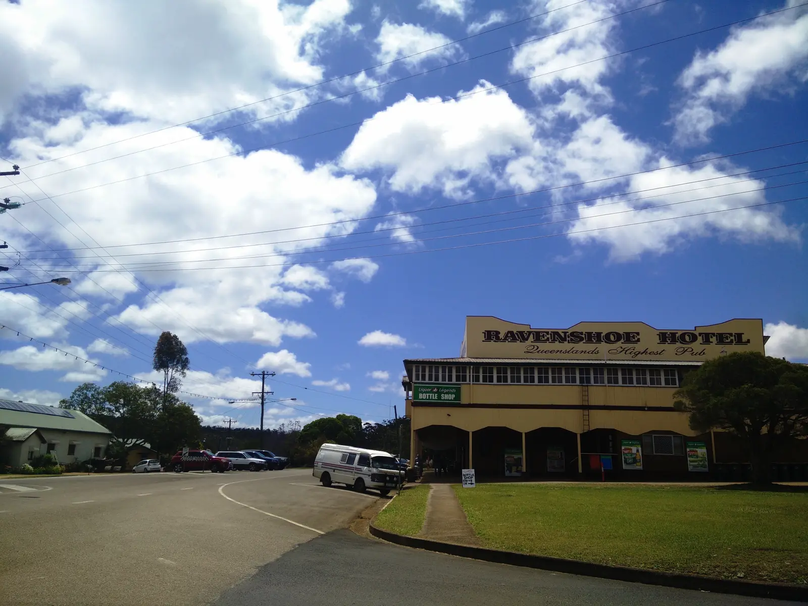
Ravenshoe sits on the Great Dividing Range at Queensland’s highest town elevation on Tropical Tablelands Tourism wording. Bureau of Meteorology station RAVENSHOE KURADILLA STREET, 031053, 17.61°S, 145.48°E, elevation 912 m, opened 1928, closed 15 October 2014. That station is rainfall-only. BOM does not publish a monthly climate-averages temperature table for Ravenshoe. This page therefore uses Herberton Mowbray Rd, 031029, as a labelled neighbour comparison. Do not blend the two rainfall series.
Kuradilla Street (031053) all-years monthly rainfall means (millimetres):
| Month | Mean rain mm |
|---|---|
| January | 224.8 |
| February | 279.7 |
| March | 238.5 |
| April | 90.5 |
| May | 56.5 |
| June | 38.1 |
| July | 25.2 |
| August | 21.8 |
| September | 19.3 |
| October | 28.0 |
| November | 75.7 |
| December | 124.0 |
| Annual | 1216.6 |
February is the wettest mean month. September is the driest. Highest annual total in that table 2241.0 mm; lowest 604.6 mm; median annual 1157.8 mm.
Herberton Mowbray Rd (031029) commenced 1886, closed 26 November 2015, elevation 909 m. Means on the climate-averages table:
| Month | Mean max °C | Mean min °C | Mean rain mm |
|---|---|---|---|
| January | 28.0 | 18.2 | 239.2 |
| February | 27.3 | 18.3 | 234.7 |
| March | 26.3 | 17.5 | 211.3 |
| April | 24.6 | 15.6 | 84.4 |
| May | 22.9 | 13.2 | 46.2 |
| June | 21.5 | 10.6 | 33.7 |
| July | 21.4 | 9.7 | 22.3 |
| August | 22.7 | 10.1 | 17.7 |
| September | 24.9 | 12.0 | 16.3 |
| October | 27.5 | 14.3 | 26.5 |
| November | 28.6 | 16.2 | 79.6 |
| December | 28.9 | 17.5 | 138.5 |
| Annual | 25.4 | 14.4 | 1154.6 |
Years of record on that table: temperature 83 (1907–1991), rainfall 111 (1886–2015). Full columns: BOM Herberton Mowbray Rd.
Parks QLD’s Millstream visiting-safely page separately prints park-visitor climate: lower humidity and daytime temperatures than the coast; maximum summer temperatures around 29 °C; winter temperatures can fall below 10 °C, when frosts are not uncommon; most rain November–March. That is Parks wording, not a BOM table.
Tully Falls Road and unsealed park roads are the wet-season constraint. Parks QLD: avoid unsealed roads during and after heavy rains. Check QLDTraffic and 13 19 40. Do not drive around closed signs to keep a falls photograph.
Ravenshoe Visitor Centre, 22–24 Moore Street, 4089 2243, can confirm what is open on a wet day. Council hours: Monday–Saturday 9am–3pm, Sunday closed.
Nearby climate context on this site includes Innot Hot Springs and Mount Garnet. Those pages are neighbours, not substitutes for the labelled tables above.
Our outback weather by month guide explains how to read those columns for inland Australia. Ravenshoe is a high Tablelands town, not Channel Country, but Tully Falls Road still closes.
How to use the table on the road
Why two stations. 031053 is the closed Ravenshoe rainfall record. It is not a temperature climate-averages table. Herberton Mowbray Rd is the labelled neighbour with maxima and minima, itself closed in 2015. If you need last week’s observations, use BOM forecasts, not this averages page.
Summer. A January Herberton mean maximum of 28.0 °C is milder than a Gulf January. Kuradilla’s February 279.7 mm mean is why Millstream tracks are slippery and Tully Falls Road closes. Parks QLD separately prints park summer maxima around 29 °C. Check QLDTraffic (13 19 40). Closed means closed.
Winter. A July Herberton mean maximum of 21.4 °C is comfortable walking weather for the Avenue of Honour and Big Millstream Falls. A July mean minimum of 9.7 °C is why a van night needs a warm layer. Parks QLD notes frosts are not uncommon at the park. September’s 19.3 mm is Kuradilla’s driest mean month.
Rainfall. 1216.6 mm a year at Kuradilla is a Wet Tropics-edge figure, much wetter than Cloncurry or Roma. It is still not a Cairns coastal mean. Averages are not a week-ahead prediction.
How closed roads behave. The Kennedy Highway is sealed. Tully Falls Road is sealed and unsealed on Tropical Tablelands Tourism wording. Parks QLD: avoid unsealed roads during and after heavy rains. Do not drive around a closed sign to keep a falls photograph. If you are towing, wet grass at a picnic area is as much a problem as the highway. See Ravenshoe caravan parks and wet season and road closures.
When to visit Ravenshoe
If you are choosing months for comfort:
- Autumn and spring — the usual compromise. Silky oaks on the Avenue of Honour typically bloom July to September on the destination FAQ. Book accommodation.
- Winter days — good for falls and the wind-farm lookout; start early if you want photographs without frost on fittings.
- Summer — possible if you have rain jackets, extra water and a habit of checking QLDTraffic and park alerts. Do not tent on Tully Falls Road in a 279 mm mean-rain month unless you know what you are doing.
- October — Torimba Festival of the Forest is named on the destination page. Confirm dates at 22–24 Moore Street.
People drive the Kennedy Highway year-round. Climate is a packing and booking problem more than a closed season on the sealed highway, unlike Cape York. Side roads are another matter. See best time to visit the outback.
Combining weather with a trip plan
Platypus and tree-kangaroo watching on the destination page can be excellent after rain and disappointing in a dry spell. We do not have a sourced best wildlife month, so we do not invent one. Ask at 22–24 Moore Street.
If you are continuing to Innot Hot Springs or Mount Garnet, take the Kuradilla rainfall table and the labelled Herberton temperature table with you as the regional picture and still check QLDTraffic for each day’s road.
Related
Plan this trip
Tell us the dates, who you are travelling with and where you need help. We reply with planning notes for Ravenshoe — we are not a booking agent.
Frequently asked questions
What is the weather like in Ravenshoe?
BOM Ravenshoe Kuradilla Street (031053) is a closed rainfall-only station: annual mean 1216.6 mm, February 279.7 mm wettest, September 19.3 mm driest. For temperature use Herberton Mowbray Rd (031029), labelled as a different closed station: January mean maximum 28.0 °C, July 21.4 °C, annual rainfall 1154.6 mm.
How hot does it get in summer?
Herberton Mowbray Rd’s January mean maximum is 28.0 °C and January mean minimum 18.2 °C. Parks QLD’s Millstream visiting-safely page separately prints maximum summer temperatures around 29 °C at the park. Those are labelled comparisons, not Kuradilla Street temperatures.
How cold are winter nights?
Herberton Mowbray Rd’s July mean minimum is 9.7 °C and July mean maximum 21.4 °C. Parks QLD notes winter temperatures at Millstream Falls can fall below 10 °C, when frosts are not uncommon.
When is the wettest month?
On the Kuradilla Street rainfall table, February mean rainfall is 279.7 mm and the annual total 1216.6 mm. Most rain at Millstream Falls falls between November and March on Parks QLD’s visiting-safely wording.
Sources and further reading
Facts on this page were checked against these primary and official sources. Conditions change — confirm before you travel or buy.
- Monthly rainfall — Ravenshoe Kuradilla Street (031053) — Bureau of Meteorology
- Climate statistics for Herberton Mowbray Rd (031029) — Bureau of Meteorology
- Visiting Millstream Falls safely — Queensland Parks and Wildlife Service
- QLDTraffic — Queensland Government
- Tropical Tablelands Tourism — Ravenshoe — Tropical Tablelands Tourism