At a glance
Sourced facts only. Distances and services change — confirm before you travel.
- Local government
- Tablelands Regional Council
- Nearest regional city
- 147 km from Cairns via the Gillies Highway (Parks QLD Millstream Falls). Tropical Tablelands Tourism’s destination FAQ also prints about a two-hour drive from Cairns — time, not a second kilometre.
- Nearest fuel
- Parks QLD visiting-safely page for Millstream Falls: fuel and supplies are available from Ravenshoe. This guide does not list bowser brands.
- Nearest hospital or clinic
- Confirm with Queensland Health — do not invent a clinic name
- Mobile coverage
- Check Telstra and Optus coverage maps before travel; do not assume a signal on Tully Falls Road or at Koombooloomba.
- Best time to visit
- May–September on labelled Herberton cooler mean maxima; Torimba Festival of the Forest is named in October (Tropical Tablelands Tourism)
Climate
Monthly means from the Bureau of Meteorology station Herberton Mowbray Rd (031029). This is not a forecast. Closed 26 Nov 2015. Labelled Tablelands comparison table, elevation 909 m. Ravenshoe Kuradilla Street (031053) is a closed rainfall-only station (elevation 912 m). Do not blend the two.
| Month | Mean max (°C) | Mean min (°C) | Rainfall (mm) |
|---|---|---|---|
| Jan | 28.0 | 18.2 | 239.2 |
| Feb | 27.3 | 18.3 | 234.7 |
| Mar | 26.3 | 17.5 | 211.3 |
| Apr | 24.6 | 15.6 | 84.4 |
| May | 22.9 | 13.2 | 46.2 |
| Jun | 21.5 | 10.6 | 33.7 |
| Jul | 21.4 | 9.7 | 22.3 |
| Aug | 22.7 | 10.1 | 17.7 |
| Sep | 24.9 | 12.0 | 16.3 |
| Oct | 27.5 | 14.3 | 26.5 |
| Nov | 28.6 | 16.2 | 79.6 |
| Dec | 28.9 | 17.5 | 138.5 |
Ravenshoe in pictures
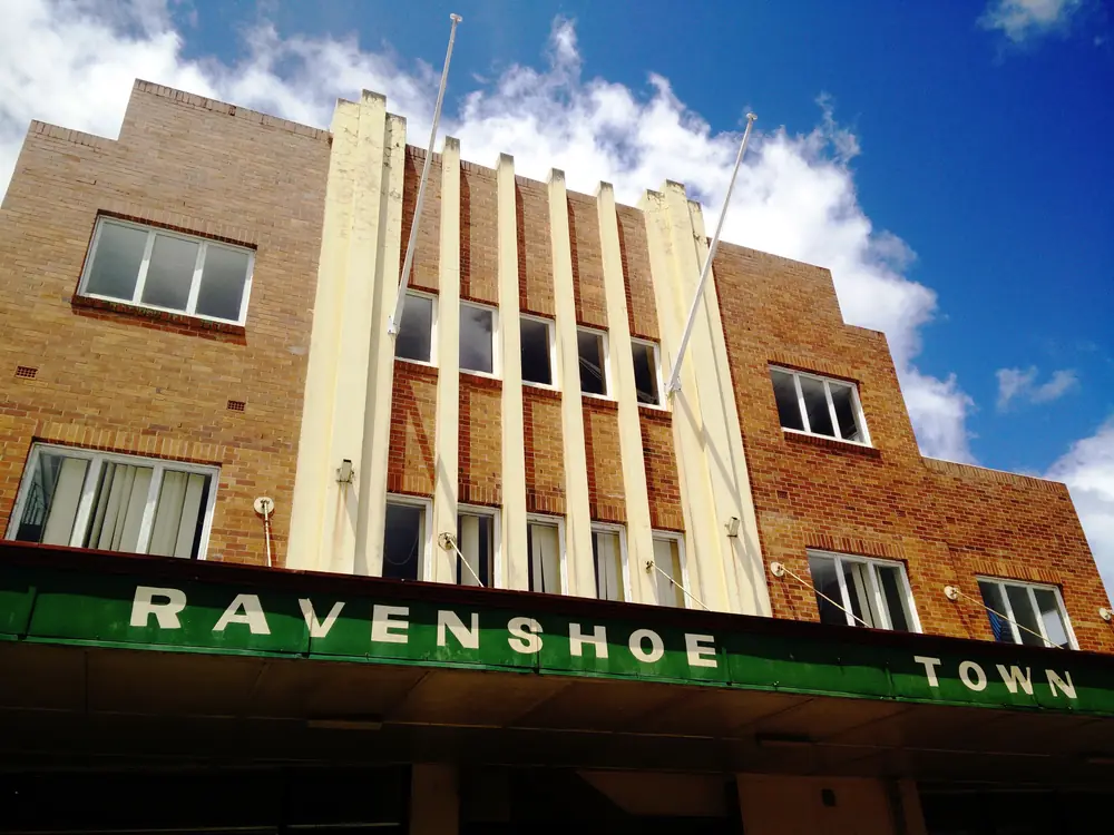
Ravenshoe Town HallPhoto: Christopher Neugebauer from Hobart, Australia · CC BY-SA 2.0 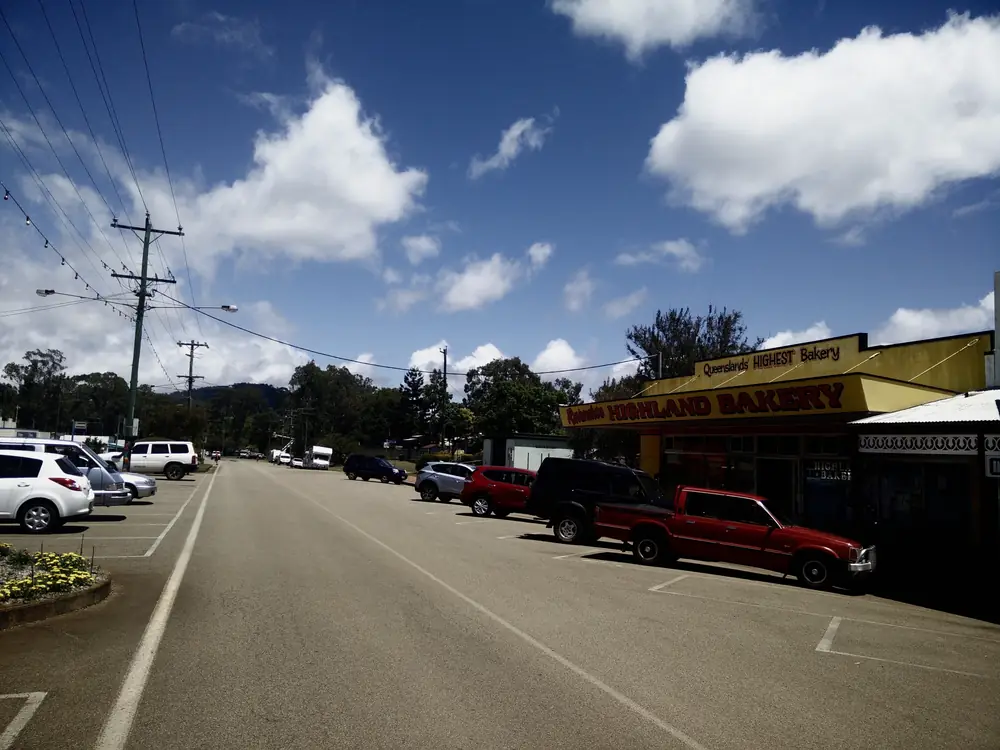
Street and bakery in RavenshoePhoto: Christopher Neugebauer from Hobart, Australia · CC BY-SA 2.0 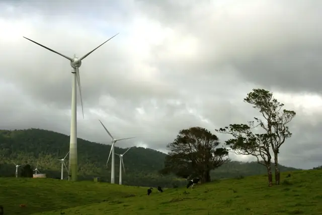
Ravenshoe wind farm on the Atherton TablelandPhoto: www.gondwananet.com · CC BY-SA 3.0 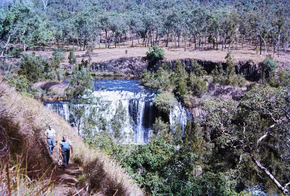
Millstream Falls, 15 km southwest of RavenshoePhoto: Jack Bain · CC BY 4.0
Ravenshoe sits in Tablelands Regional Council at the southern edge of the Atherton Tablelands, in Queensland’s outback north inventory on this site. Tablelands Regional Council and Tropical Tablelands Tourism both call it Queensland’s highest town. One Tropical Tablelands Tourism destination page prints 920 metres above sea level; that organisation’s Ravenshoe FAQ prints 930 metres. This hub prints both official elevations rather than picking a compromise. Parks QLD places the town 147 km from Cairns via the Gillies Highway. This is timber-and-wind-farm country between Wet Tropics rainforest to the east and Gulf Savannah woodland to the west, not a coast city.
The 2021 Census counted 786 people in the urban centre and 1,332 in the wider locality. Travellers stop for Millstream Falls, a heritage-listed Avenue of Honour, Windy Hill Wind Farm, and the Nganyaji Interpretive Centre. Innot Hot Springs is the named thermal neighbour on the Kennedy Highway between Ravenshoe and Mount Garnet. You still need QLDTraffic in the wet, because a Savannah Way run toward Mount Surprise is no use if Tully Falls Road is closed.
Where it is, and how far
Ravenshoe sits on the Great Dividing Range at the southern Tablelands, with the Kennedy Highway / Savannah Way corridor running west toward Innot Hot Springs and Mount Garnet. Parks QLD’s Millstream Falls page is the sourced Cairns kilometre. Tropical Tablelands Tourism’s destination FAQ prints time to Cairns, not a second kilometre. Official pages used here do not print a Ravenshoe–Innot or Ravenshoe–Mount Garnet kilometre. This hub does not invent them.
| Place | Distance from Ravenshoe (official pages used here) |
|---|---|
| Cairns | 147 km via the Gillies Highway (Parks QLD Millstream Falls). Tropical Tablelands Tourism FAQ: about a two-hour drive — time, not a second kilometre |
| Big Millstream Falls | 3.5 km south-west on the Kennedy Highway, then 1 km to the picnic area (Parks QLD visiting-safely) |
| Little Millstream Falls | Tully Falls Road 3 km, then Wooroora Road 1.5 km (same Parks page) |
| Park entrances | both within 4.5 km of Ravenshoe (Parks QLD park page) |
| Koombooloomba National Park boundary | 20 km south on Tully Falls Road (Tropical Tablelands Tourism destination page) |
| Innot Hot Springs | on the Kennedy Highway between Ravenshoe and Mount Garnet; no kilometre on the sources used here |
| Mount Garnet | west on the Savannah Way; no kilometre on those pages |
| Mareeba | larger Tablelands neighbour on this site; no Ravenshoe kilometre on those pages |
| Brisbane | not published on those pages |
Mareeba is the larger Tablelands centre on this site. Chillagoe is the western Tablelands cave town. Use QLDTraffic for the day you drive.
Facts at a glance
Population. ABS 2021 Census, Urban Centre UCL321088 Ravenshoe (L): 786 people. Median age 51. Sex split 51.7% male / 48.3% female (404 male, 377 female). Families 198. Private dwellings 455. Average household size 2.1. Median weekly household income $807. Aboriginal and/or Torres Strait Islander people 190 (24.2%) on that QuickStats table. Locality SAL32396: 1,332 people, median age 52, sex split 52.0% male / 48.0% female, families 337, private dwellings 745, Aboriginal and/or Torres Strait Islander people 254 (19.1%). Do not mix the two in one sentence. Use the Ravenshoe (L) UCL QuickStats for the town.
Climate. BOM RAVENSHOE KURADILLA STREET, 031053, 17.61°S, 145.48°E, elevation 912 m, opened 1928, closed 15 Oct 2014. Rainfall-only. All-years monthly means: annual 1216.6 mm; February 279.7 mm wettest; September 19.3 mm driest; January 224.8 mm; March 238.5 mm. BOM does not publish a monthly climate-averages temperature table for that station. The labelled Tablelands comparison table used here is Herberton Mowbray Rd, 031029, closed 26 Nov 2015, elevation 909 m, January mean maximum 28.0 °C, July 21.4 °C, July mean minimum 9.7 °C, annual rainfall 1154.6 mm. Do not blend Kuradilla rain with Herberton rain. Full Herberton columns: BOM Herberton Mowbray Rd. Parks QLD’s Millstream visiting-safely page separately prints park-visitor climate: maximum summer temperatures around 29 °C, winter temperatures can fall below 10 °C, most rain November–March. That is Parks wording, not a BOM table. See Ravenshoe weather.
Visitor information. Ravenshoe Visitor Centre & Nganyaji Interpretive Centre, 22–24 Moore Street, 4089 2243, ravenshoevic@trc.qld.gov.au. Tablelands Regional Council hours: Monday–Saturday 9am–3pm, Sunday closed. Closed Good Friday, Christmas Day and Boxing Day. The Atherton Tablelands Information Centre, 1A Herberton Road, Atherton, 1300 366 361, is listed 9am–4pm seven days on the same council page. Hours change.
Traditional Owners
Queensland’s Country Culture map for Jirrbal states that Jirrbal Country extends from coastal areas near Tully, inland from Tully Gorge to Ravenshoe and Herberton, incorporating areas such as Innot Hot Springs and Wild River. Parks QLD’s Millstream Falls welcome is from the Jirrbal People, who continue cultural obligations and ask visitors to respect and care for the park. Tablelands Regional Council describes the free Nganyaji Interpretive Centre as recognising the lives of the local Indigenous people, the Jirrbal. Visit as a guest; see visiting Country respectfully. This hub does not flatten neighbouring Warrungnu country at Mount Garnet onto the Ravenshoe townsite.
History
Tropical Tablelands Tourism’s destination page is the visitor-history source used here. Historically Ravenshoe was a town with a proud heritage of extracting timber from the surrounding forests. Since 1987, when the government World Heritage listed 900,000 hectares of surrounding rainforest, the main industries have been tourism, beef and dairy farming. Locals celebrate that change every year in the annual Torimba Festival of the Forest in October. Dates move. Confirm at 22–24 Moore Street rather than treating a destination sentence as this year’s ticket.
Parks QLD: Millstream Falls National Park was gazetted on 19 June 1909 as the first national park in North Queensland. Camp sites were constructed for the Battalions of the 7th and 9th Divisions between 1943 and 1945. Those camp sites could house almost 1000 men each. A network of rock-lined granite paths is still visible along the World War II heritage walk.
The destination FAQ names a heritage-listed Avenue of Honour of silky oak trees on the town’s southern edge, each dedicated to a serviceperson from the district who served in the First World War, typically in bloom July to September.
Things to do
Nganyaji Interpretive Centre and Heritage Gallery. At the visitor centre. Council: learn about the change from timber town to Wet Tropics World Heritage heart, and leave time for historical photos.
Avenue of Honour. Heritage-listed silky oaks on the southern edge. Confirm bloom and access at the desk.
Millstream Falls National Park. Parks QLD: Big Millstream Falls is reputedly the widest single-drop waterfall in Australia. Walking track to a viewing area. Little Millstream Falls is a separate entrance. No camping in the park. Pets are not permitted. This site does not publish a Millstream Falls park page — use parks.qld.gov.au/parks/millstream-falls.
Windy Hill Wind Farm. Tropical Tablelands Tourism: the first wind farm built in Queensland, created on the extinct Windy Hill volcano in 2000, 20 turbines, generating enough electricity to supply about 3500 homes. Lookout platform named on that page.
Koombooloomba Dam. 20 km south on Tully Falls Road. Camping permits required at designated sites. The road is sealed and unsealed.
Wildlife watching. The destination page names platypus, 12 species of possums, 340 bird species and Lumholtz’s tree kangaroo.
A fuller order of a day is on things to do in Ravenshoe.
Nearby, not in the main street: Innot Hot Springs for Nettle Creek thermal pools; Mount Garnet for fossicking and Wurruma Swamp; Chillagoe for caves further west.
Where to stay
Tropical Tablelands Tourism’s RV Facilities page names Tall Timbers Motel and Caravan Park, 13185 Kennedy Highway, and Ravenshoe Railway Caravan Park, 63 Grigg Street. It does not print a room count, a tariff or a star rating. This hub will not invent them. Ask 4089 2243.
- How to choose a type of stay: Ravenshoe accommodation
- Parks and camping: Ravenshoe caravan parks
- Operator enquiries: feature your business
If Ravenshoe is full, Innot Hot Springs is the named Kennedy Highway neighbour; Mareeba is the larger Tablelands centre on this site. That is geography, not a booking guarantee.
Caravan and camping
Vans use Ravenshoe because it is the southern-Tablelands dump-point town and the Millstream Falls overnight. Official named parks on Tropical Tablelands Tourism’s RV page are Tall Timbers Motel and Caravan Park and Ravenshoe Railway Caravan Park. Tablelands Regional Council’s public dump point is 26 Ascham Street, open all hours on that council page. Millstream Falls National Park has no camping. Koombooloomba camping needs a permit. Read Ravenshoe caravan parks and outback camping.
After rain, Tully Falls Road and the Kennedy Highway are the constraint. QLDTraffic first.
Fuel and services
Parks QLD’s Millstream visiting-safely page states fuel and supplies are available from Ravenshoe. It does not list bowser brands, 24-hour hours or prices. This guide does not invent them. Fill up before a Koombooloomba or Savannah Way run. There is no Ravenshoe hospital named on the sourced pages. Confirm with Queensland Health rather than assuming a clinic.
For current questions, use Tablelands Regional Council and 4089 2243. Sunday the visitor centre is closed on the council hours fetched here.
Road access
The Kennedy Highway is the named sealed spine west toward Innot Hot Springs, Mount Garnet and the Savannah Way. Tully Falls Road is the south run to Little Millstream Falls and Koombooloomba — sealed and unsealed on the Tropical Tablelands Tourism destination page. Parks QLD: avoid unsealed roads during and after heavy rains. Check QLDTraffic and 13 19 40. Do not drive around closed signs to keep a falls photograph.
East: Atherton Tablelands toward Mareeba and Cairns via the Gillies Highway on Parks QLD’s 147 km figure. West: Innot, Mount Garnet, then Mount Surprise and Undara Volcanic National Park. This is not Channel Country.
Nearby parks and towns
Named nature sites (official pages):
- Millstream Falls National Park — Parks QLD; no camping
- Koombooloomba National Park and Conservation Park — camping permits
- Windy Hill Wind Farm lookout
- Misty Mountains walking tracks — Ravenshoe is named as the highest point of that network on the destination page
Towns on this site:
- Innot Hot Springs — thermal neighbour on the Kennedy Highway
- Mount Garnet — Savannah Way fossicking town
- Mareeba — larger Tablelands centre
- Chillagoe — western Tablelands caves
- Mount Surprise — Savannah Way overnight toward Undara
When to go, and how long
Herberton Mowbray Rd’s January mean maximum of 28.0 °C is milder than a Gulf January, but Kuradilla’s February mean rainfall of 279.7 mm is why Tully Falls Road closes. July’s 21.4 °C mean maximum is the comfortable walking season on that labelled table; July’s 9.7 °C mean minimum is why a van night needs a layer. Parks QLD separately notes frosts are not uncommon in winter at the park. Two hours at the visitor centre, the Avenue of Honour and Big Millstream Falls is the minimum. A night lets you use a named park if a site has been confirmed. Two nights only if you are adding Innot, Koombooloomba or a Windy Hill day and QLDTraffic agrees. Torimba is named in October; confirm dates at the desk.
Operators who want a checked listing: feature your business. The listings slot on this hub stays empty until then.
Plan this trip
Tell us the dates, who you are travelling with and where you need help. We reply with planning notes for Ravenshoe — we are not a booking agent.
Events and road-conditions newsletter
Occasional notes on outback festivals, race days and official road-condition sources — not a daily blast. We use these details only to send the newsletter.
Guide
Ravenshoe accommodation
Where to stay in Ravenshoe — Tall Timbers Motel and Caravan Park and Ravenshoe Railway Caravan Park as named on Tropical Tablelands Tourism’s RV page. Confirm at 22–24 Moore Street.
Read · 4 min
Guide
Ravenshoe caravan parks
Caravan parks and camping around Ravenshoe — Tall Timbers and Ravenshoe Railway Caravan Park as named on Tropical Tablelands Tourism’s RV page. Public dump at 26 Ascham Street. No camping in Millstream Falls National Park.
Read · 4 min
Guide
Ravenshoe weather
Ravenshoe weather and climate — Kuradilla Street is a closed rainfall-only station. Use labelled Herberton Mowbray Rd (031029) means. Check QLDTraffic on Tully Falls Road after rain.
Read · 4 min
Guide
Things to do in Ravenshoe
Things to do in Ravenshoe — Nganyaji Interpretive Centre, heritage-listed Avenue of Honour, Millstream Falls, Windy Hill Wind Farm, Koombooloomba Dam and Jirrbal Country.
Read · 3 min
Frequently asked questions
Is Ravenshoe Queensland’s highest town?
Tablelands Regional Council and Tropical Tablelands Tourism both call Ravenshoe Queensland’s highest town. One Tropical Tablelands Tourism destination page prints 920 metres; that organisation’s Ravenshoe FAQ prints 930 metres. This guide prints both official elevations rather than picking one.
How far is Ravenshoe from Cairns?
Parks QLD’s Millstream Falls page places Ravenshoe 147 km from Cairns via the Gillies Highway. Tropical Tablelands Tourism’s Ravenshoe FAQ also prints about a two-hour drive from Cairns. Do not convert that time into a second kilometre.
What is Ravenshoe’s population?
786 people at the 2021 Census for the Ravenshoe urban centre (UCL321088), median age 51. The suburbs-and-localities figure (SAL32396) is 1,332 people, median age 52, and is not the town count.
Where are Millstream Falls?
Parks QLD: the two park entrances are within 4.5 km of Ravenshoe. Big Millstream Falls is 3.5 km south-west of Ravenshoe on the Kennedy Highway. Little Millstream Falls is reached via Tully Falls Road for 3 km then Wooroora Road for 1.5 km. There is no Millstream Falls park page on this site — use parks.qld.gov.au/parks/millstream-falls.
What is the weather like in Ravenshoe?
BOM Ravenshoe Kuradilla Street (031053) is a closed rainfall-only station: annual mean 1216.6 mm, February 279.7 mm wettest, September 19.3 mm driest. For temperature use Herberton Mowbray Rd (031029), labelled as a different closed station: January mean maximum 28.0 °C, July 21.4 °C, annual rainfall 1154.6 mm.
Whose Country is Ravenshoe on?
Queensland’s Country Culture map for Jirrbal names Country extending inland from Tully Gorge to Ravenshoe and Herberton. Parks QLD’s Millstream Falls welcome is from the Jirrbal People. Tablelands Regional Council’s Ravenshoe Visitor Centre includes the Nganyaji Interpretive Centre for Jirrbal culture. Confirm Welcome to Country wording at 22–24 Moore Street.
Sources and further reading
Facts on this page were checked against these primary and official sources. Conditions change — confirm before you travel or buy.
- Ravenshoe (L) 2021 Census QuickStats (UCL321088) — Australian Bureau of Statistics
- Ravenshoe 2021 Census QuickStats (SAL32396) — Australian Bureau of Statistics
- Monthly rainfall — Ravenshoe Kuradilla Street (031053) — Bureau of Meteorology
- Climate statistics for Herberton Mowbray Rd (031029) — Bureau of Meteorology
- Tropical Tablelands Tourism — Ravenshoe — Tropical Tablelands Tourism
- Tropical Tablelands Tourism — Ravenshoe destination FAQ — Tropical Tablelands Tourism
- Millstream Falls National Park — Queensland Parks and Wildlife Service
- Visiting Millstream Falls safely — Queensland Parks and Wildlife Service
- About Millstream Falls — Queensland Parks and Wildlife Service
- Tablelands Regional Council — Information centres — Tablelands Regional Council
- RV Facilities — Atherton Tablelands — Tropical Tablelands Tourism
- RV Sanitary Dump Points — Tablelands Regional Council — Tablelands Regional Council
- Jirrbal — Rainforest People Country Culture — Queensland Government
- QLDTraffic — Queensland Government