At a glance
Sourced facts only. Distances and services change — confirm before you travel.
- Local government
- Pastoral Unincorporated Area (Outback Communities Authority)
- Traditional Owners
- Not named for the Lyndhurst townsite on the sourced pagesDEW names the Adnyamathanha people as traditional custodians of the Flinders Ranges. This is not Lyndoch in the Barossa. Confirm wording at Leigh Creek.
- Nearest regional city
- About 40 km north of Leigh Creek on this site’s Leigh Creek guide. DIT lists the Strzelecki Track as Innamincka–Lyndhurst.
- Nearest fuel
- Confirm on the day. Fill at Leigh Creek before you rely on a Lyndhurst bowser. SATC hotel hits for Lyndhurst are Barossa Lyndoch.
- Nearest hospital or clinic
- Leigh Creek Health Service, Black Oak Drive, (08) 8678 6022 (SA Health). Emergencies 000.
- Mobile coverage
- Check Telstra and Optus coverage maps before travel; do not assume a signal.
- Best time to visit
- Cooler months on Leigh Creek Airport (017110): January mean max 36.0 °C, July 16.9 °C. DIT before the Strzelecki.
Climate
Monthly means from the Bureau of Meteorology station Leigh Creek Airport (017110). This is not a forecast. BOM does not publish a Lyndhurst climate-averages table. Nearest open table used here is Leigh Creek Airport, about 40 km south on this site’s Leigh Creek guide. Temperature 43 years (1982–2026); rainfall 37 years (1982–2026). This is not Lyndoch in the Barossa.
| Month | Mean max (°C) | Mean min (°C) | Rainfall (mm) |
|---|---|---|---|
| Jan | 36.0 | 21.1 | 23.9 |
| Feb | 34.7 | 20.5 | 25.1 |
| Mar | 31.5 | 17.7 | 20.2 |
| Apr | 26.5 | 13.1 | 13.6 |
| May | 21.1 | 8.8 | 15.9 |
| Jun | 17.2 | 5.6 | 16.9 |
| Jul | 16.9 | 4.8 | 14.1 |
| Aug | 19.4 | 6.3 | 16.4 |
| Sep | 23.7 | 9.5 | 15.7 |
| Oct | 27.3 | 12.8 | 18.9 |
| Nov | 30.8 | 16.2 | 18.9 |
| Dec | 33.6 | 18.9 | 19.9 |
Lyndhurst in pictures
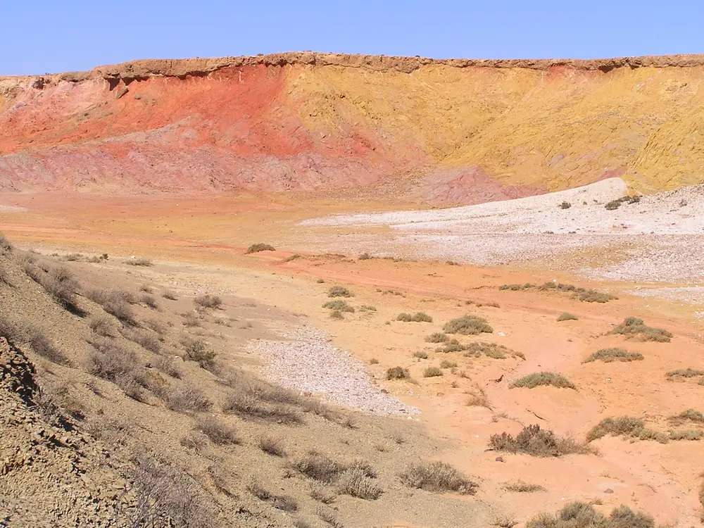
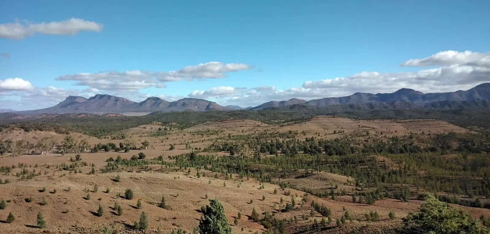
Australia 2004Photo: ogwen · CC BY-SA 3.0 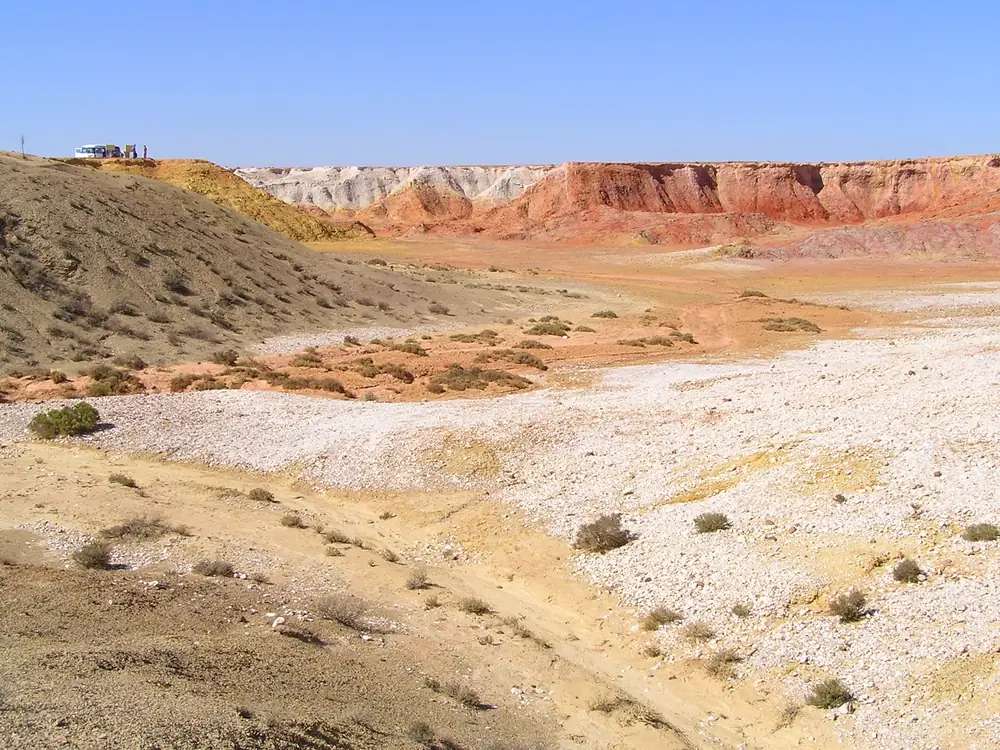
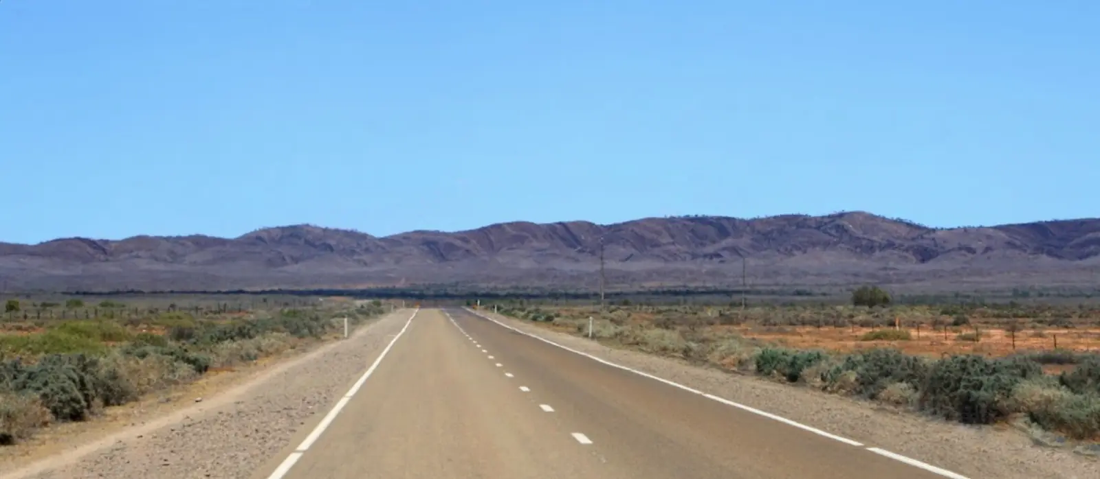
Australia 2004Photo: ogwen · CC BY-SA 3.0 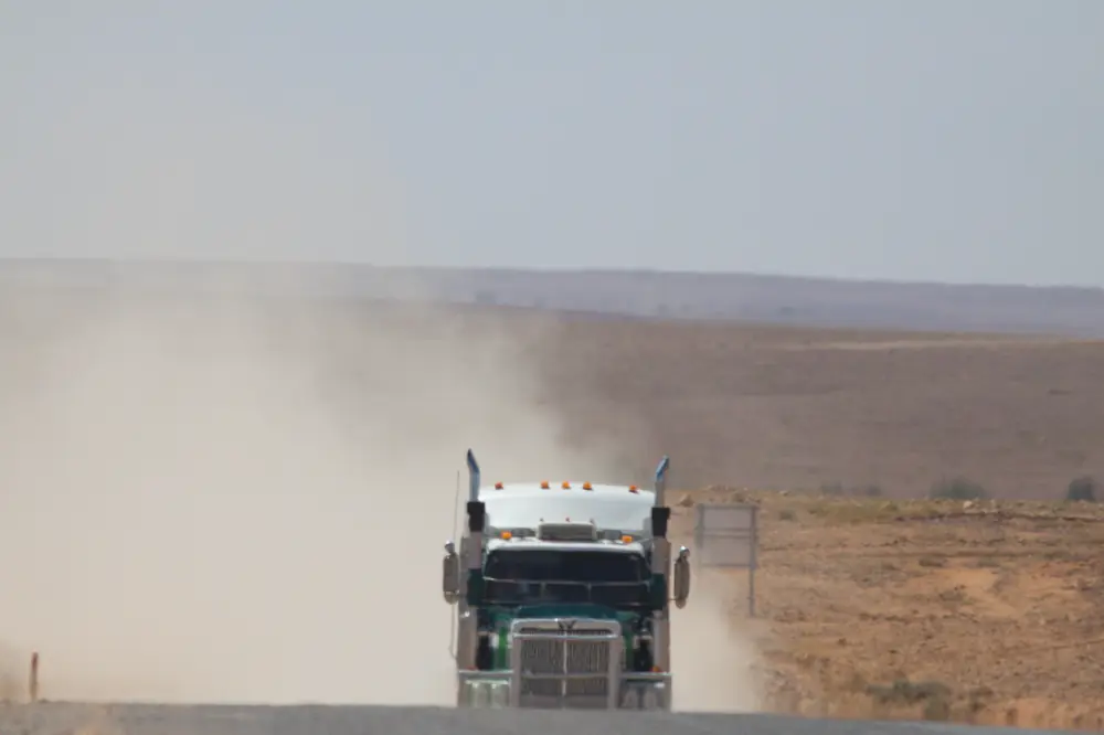
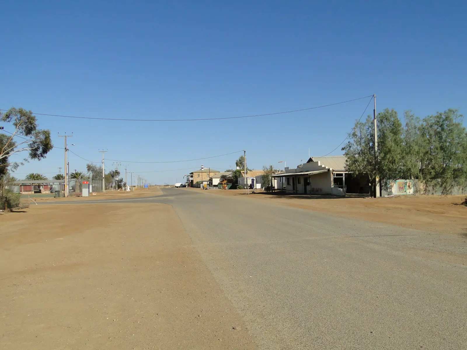
Strzelecki TrackPhoto: Ron Knight · CC BY 2.0
Lyndhurst is the northern Flinders approach where South Australia’s Strzelecki Track is listed by DIT as Innamincka–Lyndhurst (Primary road 12000). It is a neighbour of Leigh Creek and Marree, on the sealed road this site’s Marree guide describes from Leigh Creek and Lyndhurst to Marree. It is not Lyndoch in the Barossa — SATC hotel search hits for “Lyndhurst” are a different town.
The 2021 Census does not publish a people count for Lyndhurst (SA) (SAL40793) because the area had no people or a very low population. Read that ABS QuickStats sentence rather than inventing a round number. There is no UCL named Lyndhurst (SA) on the pages used here.
This site groups it with Flinders Ranges towns because the original Outback Now directory did. Local government is the Outback Communities Authority pattern used on this site’s Leigh Creek guide, not The Flinders Ranges Council.
Where it is, and how far
Lyndhurst sits north of Leigh Creek on the way to Marree, at the southern end of the Strzelecki run toward Innamincka. The Australian Government infrastructure announcement used here describes a 472-kilometre Strzelecki Track and a project to create a continuous sealed road between Lyndhurst and Innamincka. DIT’s grading program lists that same Innamincka–Lyndhurst primary road. Sealing works do not mean the track is always open; DIT outback warnings still apply, and the ministerial release notes weather closures.
| Place | Official note |
|---|---|
| Leigh Creek | About 40 km south (this site’s Leigh Creek guide) |
| Marree | Sealed road from Leigh Creek and Lyndhurst (this site’s Marree FAQ) |
| Innamincka via Strzelecki Track | DIT Innamincka–Lyndhurst listing; Australian Government release used here: 472 km track |
| Adelaide | This hub does not invent an Adelaide kilometre. Use Leigh Creek (about 560 km north of Adelaide on this site’s Leigh Creek page) plus the Leigh Creek–Lyndhurst note above. |
Sealed highway: Traffic SA. Unsealed Strzelecki and other outback roads: DIT outback road warnings. Parks SA also prints 1300 361 033.
Facts at a glance
Population. ABS 2021 SAL40793: no information can be provided because the area had no people or a very low population. Do not substitute a blog count or a Barossa Lyndoch figure.
Climate. No Lyndhurst BOM table. Use Leigh Creek Airport (017110): 30.60°S, 138.42°E, elevation 259 m, commenced 1982, status open. January mean maximum 36.0 °C, July 16.9 °C, annual rainfall 212.8 mm. Full columns: Lyndhurst weather.
Visitor information. There is no SATC-accredited VIC in Lyndhurst on the product pages used here. Use Leigh Creek services, the Flinders Ranges Visitor Information Centre in Quorn, Hawker’s desk, SATC Explorers Way material (the map names Lyndhurst), and DIT before the track.
Traditional Owners
DEW’s Flinders Ranges facts page names the Adnyamathanha people as traditional custodians of the Flinders Ranges. Parks SA jointly manages Ikara-Flinders Ranges National Park and co-manages Vulkathunha-Gammon Ranges with the Adnyamathanha people. This site’s Marree guide names Arabana and Dieri Country further north at Marree. This hub does not flatten those nations onto a single Lyndhurst label without a page that names the townsite. Confirm wording at Leigh Creek or the Quorn visitor centre. Read visiting Country respectfully.
DEW’s Flinders facts page also states the northern Flinders Ranges is home to ochre pits mined for painting and ceremony and traded long distances. DEW’s Beltana article names Pukardu, near Parachilna Gorge, as a red-ochre source on that trade. Those official pages do not print a kilometre figure from Lyndhurst townsite on the fetches used here. Do not treat a tyre-sign blog as a Parks SA site. If a public viewing area exists on the day you drive, stay off escarpments and do not remove ochre.
History and the track
Lyndhurst’s visitor meaning on official transport pages is the southern end of the Strzelecki Track. The Australian Government release used here: the track is a freight, pastoral and tourism corridor; unsealed sections are subject to bulldust, sand drift and flooding; between September 2020 and September 2026 the release counts 67 weather events, 248 days closed to all traffic and 595 days of restrictions. That is why this hub refuses to treat sealing works as a touring guarantee.
This site’s Strzelecki Track guide covers cattle-duffing history, Moomba industry traffic and Cooper Creek. Use that page for the track; use this page for the locality at the Flinders end. SATC’s Explorers Way map marks Lyndhurst on the way toward Farina and Marree.
Things to do
A tiny ABS-suppressed locality does not need an invented attraction list. Official pages support:
- Starting or finishing the Strzelecki Track toward Innamincka — DIT + this site’s track guide. Check warnings first.
- Continuing sealed to Marree for the Oodnadatta and Birdsville tracks — this site’s Marree FAQ on seal.
- Turning back to Leigh Creek for fuel, a bed and Aroona Dam as named on this site’s Leigh Creek guide.
- Northern Flinders parks via Copley toward Arkaroola and Vulkathunha — unsealed; DIT.
A fuller planning note is on things to do in Lyndhurst.
Where to stay
SATC product search used for this guide did not return a Lyndhurst (Flinders) hotel or caravan-park listing. Barossa Lyndoch motels are the wrong town. This hub will not invent a pub trading name.
Stay types in a settlement this small:
- Leigh Creek hotel, resort-style rooms and caravan park — the service town about 40 km south on this site’s Leigh Creek guide.
- Marree roadhouse / motel / park types named on SATC’s 11-day itinerary if you are continuing north on seal.
- Camping as a type only if an official page or the Outback Communities Authority has designated it. Do not assume a rest area is a legal overnight.
- Innamincka and park camps if the Strzelecki is actually open and you are equipped — see the track page.
How to choose: Lyndhurst accommodation. Parks and camping: Lyndhurst caravan parks. Operators: feature your business.
If you need a grocer, SATC’s 11-day itinerary still tells you to stock up in Hawker before more remote country.
Caravan and camping
A van can reach Lyndhurst on sealed road from Leigh Creek on this site’s Marree FAQ. The Strzelecki is a different surface, even where sealing works are underway. Do not treat a DIT primary-road pin as a camp. Read Lyndhurst caravan parks. Check DIT before any unsealed kilometre after rain.
Fuel and services
Confirm fuel. SATC did not return a Lyndhurst bowser product in this research. This site’s Strzelecki Track page records fuel at Lyndhurst and none at Moomba; treat that as a type to confirm, not a 24-hour guarantee. Fill at Leigh Creek before you rely on Lyndhurst. Carry a reserve if you are starting the 472 km corridor. There is no SATC supermarket listing. Medical services: Leigh Creek Health Service is named on this site’s Leigh Creek guide; Port Augusta is the larger hospital on that same pattern.
Road access
- Sealed Leigh Creek–Lyndhurst–Marree road — this site’s Marree FAQ. Traffic SA.
- Strzelecki Track (DIT Primary 12000, Innamincka–Lyndhurst) — unsealed sections, flood closures, industry traffic including road trains. DIT outback warnings. Australian Government release: sealing project in progress; still check the map.
- Not the Stuart Highway — that sealed Darwin road leaves from Port Augusta. Lyndhurst is the Flinders–Strzelecki junction, not the Stuart.
An outback South Australia road trip uses this corridor toward Marree. SATC Explorers Way marks Lyndhurst on the same northern run.
Nearby parks and towns
Official landscape:
- Strzelecki Track / Strzelecki Desert (DIT; this site’s track guide)
- Northern Flinders ochre country as a DEW regional fact — not a sourced Lyndhurst picnic ground
- Vulkathunha-Gammon Ranges National Park via Copley
- Ikara-Flinders Ranges National Park via Hawker
Towns on this site:
- Leigh Creek — about 40 km south; fuel and rooms
- Marree — sealed north; Oodnadatta and Birdsville starts
- Beltana — Heritage town 40 km south of Leigh Creek on DEW
- Parachilna — SATC Prairie Hotel
- Hawker — grocer
- Arkaroola — sanctuary east of Copley
- Quorn — Pichi Richi gateway
- Port Augusta
- Andamooka — opal side trip, not on this road
- Innamincka — Strzelecki far end
When to go, and how long
Leigh Creek Airport January mean maximum 36.0 °C is extreme for starting a desert track. SATC cooler months and the ministerial closure counts both argue for autumn–spring and a DIT check every morning. A fuel-and-turnaround stop is the honest SATC-pattern visit. One night only if a confirmed bed exists — this hub found none on SATC. The Strzelecki is a multi-day track, not a Lyndhurst street day. See Lyndhurst weather.
Operators who want a checked listing: feature your business. The listings slot stays empty until then.
Plan this trip
Tell us the dates, who you are travelling with and where you need help. We reply with planning notes for Lyndhurst — we are not a booking agent.
Events and road-conditions newsletter
Occasional notes on outback festivals, race days and official road-condition sources — not a daily blast. We use these details only to send the newsletter.
South Australia · Flinders Ranges
Lyndhurst accommodation
Where to stay near Lyndhurst: SATC did not return a Flinders Lyndhurst hotel. Use Leigh Creek about 40 km south, or Marree on seal. Not Lyndoch in the Barossa. No invented rates.
Read · 4 min
South Australia · Flinders Ranges
Lyndhurst caravan parks
Camping near Lyndhurst: SATC does not publish a Flinders Lyndhurst holiday park. Leigh Creek is the service-town fallback. DIT’s Strzelecki pin is not a camp. Confirm dump points.
Read · 4 min
South Australia · Flinders Ranges
Lyndhurst weather
Lyndhurst has no BOM climate table. Use Leigh Creek Airport (017110), about 40 km south: January mean max 36.0 °C, July 16.9 °C, annual rainfall 212.8 mm. Check DIT before the Strzelecki.
Read · 4 min
South Australia · Flinders Ranges
Things to do in Lyndhurst
Things to do in Lyndhurst: DIT southern end of the Strzelecki Track, sealed road to Marree on this site’s Marree FAQ, neighbour of Leigh Creek. Not Lyndoch. No invented ochre-pit kilometres.
Read · 5 min
Frequently asked questions
How far is Lyndhurst from Leigh Creek and Marree?
This site’s Leigh Creek guide puts Lyndhurst about 40 km north of Leigh Creek. This site’s Marree FAQ states the road from Leigh Creek and Lyndhurst to Marree is sealed. DIT lists the Strzelecki Track as Innamincka–Lyndhurst (Primary road 12000). This hub does not invent a separate Lyndhurst–Marree kilometre that was not on those official DIT or SATC product pages.
What is Lyndhurst’s population?
The 2021 Census Suburbs and Localities page for Lyndhurst (SA) (SAL40793) publishes no people count because the area had no people or a very low population. Do not invent a town figure. This is not Lyndoch in the Barossa.
Is this Lyndoch in the Barossa?
No. SATC product search for Lyndhurst hotel returns Barossa Lyndoch listings. This hub is Lyndhurst in South Australia’s northern Flinders / far north, the DIT southern end of the Strzelecki Track toward Innamincka.
Do I need to check outback road warnings?
Yes, before any unsealed kilometre. DIT outback road warnings cover the Strzelecki Track. Parks SA also prints the Outback Road Report 1300 361 033. Sealed Leigh Creek–Lyndhurst–Marree kilometres are Traffic SA. The track closes after rain.
What weather record should I use?
BOM does not publish a Lyndhurst climate-averages table. This guide uses Leigh Creek Airport (017110): January mean maximum 36.0 °C, July 16.9 °C, annual rainfall 212.8 mm.
Is there fuel in Lyndhurst?
Confirm on the day. SATC did not return a Lyndhurst fuel or hotel product in the research for this hub (Barossa Lyndoch is a different town). This site’s existing Strzelecki Track page records fuel at Lyndhurst; treat that as a type to confirm at Leigh Creek, not a 24-hour guarantee. Fill at Leigh Creek before you rely on a Lyndhurst bowser.
Sources and further reading
Facts on this page were checked against these primary and official sources. Conditions change — confirm before you travel or buy.
- Lyndhurst (SA) 2021 Census QuickStats (SAL40793) — Australian Bureau of Statistics
- Climate statistics for Leigh Creek Airport (017110) — Bureau of Meteorology
- Outback Unsealed Roads Grading Program — Department for Infrastructure and Transport SA
- Outback road warnings — Department for Infrastructure and Transport SA
- Strzelecki Track upgrade milestone — Australian Government Department of Infrastructure
- Vulkathunha-Gammon Ranges National Park — National Parks and Wildlife Service SA
- Ikara-Flinders Ranges National Park — National Parks and Wildlife Service SA
- 15 fascinating facts about the Flinders Ranges — Department for Environment and Water
- Explorers Way Road Trip — South Australian Tourism Commission
- Traffic SA — Government of South Australia
- Outback Communities Authority — Outback Communities Authority