At a glance
Sourced facts only. Distances and services change — confirm before you travel.
- Local government
- Pastoral Unincorporated Area (Outback Communities Authority)
- Traditional Owners
- Far West Coast people (Parks SA conservation-park acknowledgement)SANTS: Far West Coast Native Title determination area includes the town of Fowlers Bay. Parks SA’s park page acknowledges Far West Coast people as custodians of the Far West Coast region, co-managed through the Yumbarra Conservation Park Co-management Board.
- Nearest regional city
- Parks SA: 119 km from Ceduna to the Fowlers Bay turn-off (access via Fowlers Bay township). Ceduna is the last major service town on this site.
- Capital
- Parks SA prints Fowlers Bay Conservation Park 915.27 km from Adelaide. Ceduna Tourism / council put Ceduna 780 km west of Adelaide. This hub does not invent a separate township-to-Adelaide drive.
- Nearest fuel
- Confirm in Ceduna before the detour. SATC’s Nullarbor map treats Penong as a highway services stop. This hub does not invent a Fowlers Bay bowser.
- Nearest hospital or clinic
- Ceduna District Health Services / Ceduna Hospital, 3 Eyre Highway, (08) 8626 2110 (SA Health). Emergencies 000.
- Mobile coverage
- Parks SA: limited mobile phone coverage throughout the park; phone range can be sought from Esplanade Fowlers Bay township and higher points in the park.
- Best time to visit
- Parks SA whale season May–October; BOM Fowlers Bay January mean max 25.1 °C (temperature means 1927–1967)
Climate
Monthly means from the Bureau of Meteorology station Fowlers Bay (018030). This is not a forecast. Open station in the township name. Temperature means 40 years (1927–1967) — historic, not a current AWS series. Rainfall 94 years (1878–2026). Elevation 3 m. Latest available data 30 September 2026. Do not blend with Ceduna AMO 018012.
| Month | Mean max (°C) | Mean min (°C) | Rainfall (mm) |
|---|---|---|---|
| Jan | 25.1 | 17.1 | 8.4 |
| Feb | 24.1 | 17.0 | 12.3 |
| Mar | 24.2 | 16.0 | 14.0 |
| Apr | 22.5 | 13.4 | 21.4 |
| May | 20.3 | 10.3 | 41.2 |
| Jun | 17.8 | 8.1 | 51.7 |
| Jul | 17.0 | 6.9 | 44.2 |
| Aug | 18.2 | 7.6 | 35.8 |
| Sep | 20.3 | 9.6 | 21.5 |
| Oct | 21.8 | 11.8 | 21.1 |
| Nov | 23.2 | 13.9 | 16.2 |
| Dec | 24.0 | 15.7 | 12.3 |
Fowlers Bay in pictures
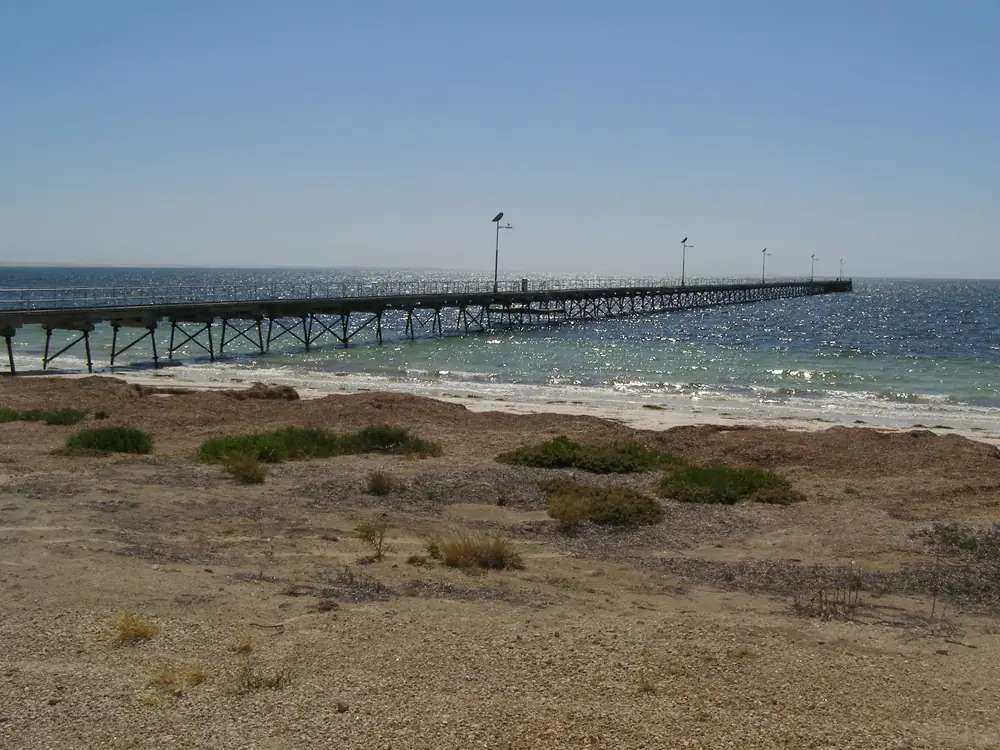
Jetty at Fowlers BayPhoto: Kerry Raymond at English Wikipedia · CC BY-SA 3.0 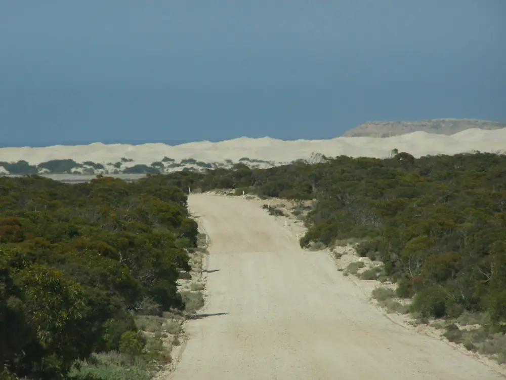
Approach to Fowlers BayPhoto: Kerry Raymond at English Wikipedia · CC BY-SA 3.0 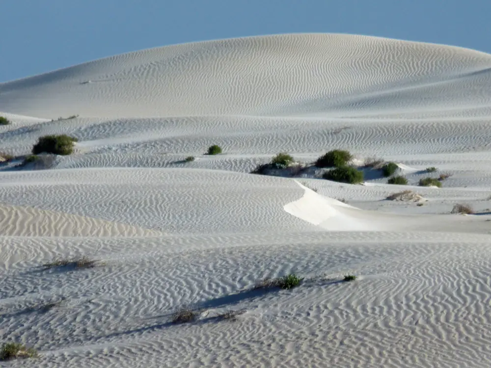
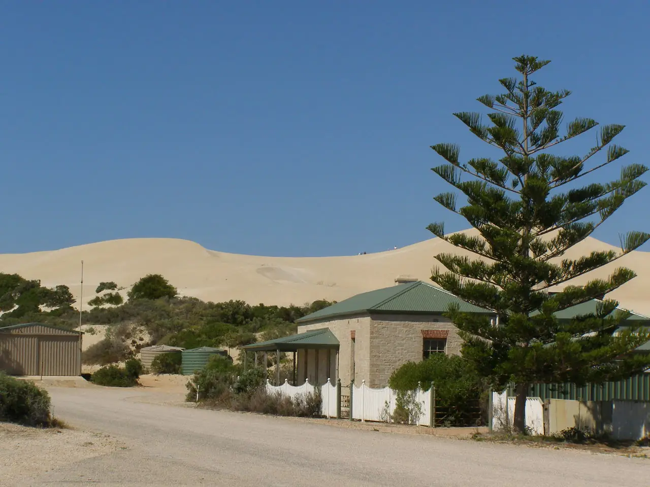
Sandhills in Fowlers Bay Conservation ParkPhoto: Gypsy Denise · CC BY-SA 4.0
Fowlers Bay is a Far West Coast township in unincorporated South Australia, reached from the Eyre Highway west of Ceduna. Parks SA’s conservation-park page is the geography used here: 119 km from Ceduna to the Fowlers Bay turn-off (access via Fowlers Bay township) and 147.47 km from Ceduna to the Coorabie turn-off. This hub is that South Australian Bight village, not Fowlers Bay in Western Australia, and not a Penong suburb. Penong keeps the Windmill Museum and the highway services SATC names. Eucla is the WA Nullarbor town on this site.
A 2021 Census QuickStats page titled Fowlers Bay was not returned on the ABS site used for this rebuild. There is no 2021 Urban Centre named Fowlers Bay on those pages. Neighbouring Coorabie (SAL40307) counted 71 people — that is Coorabie’s figure. The 2016 State Suburb SSC40453 page titled Fowlers Bay counted 51 people. This hub does not invent a 2021 town total.
This site groups Fowlers Bay with Outback SA towns. Municipal services sit with the Outback Communities Authority. Tourism questions on SATC’s Penong museum listing go to the Ceduna Visitor Information Centre, 08 8625 3343. Parks SA Ceduna office 08 8625 3144.
Where it is, and how far
Fowlers Bay sits south of the Eyre Highway on Port Eyre, at the western end of the larger bay Parks SA and the township share a name with. The sealed highway is Traffic SA. The detour, beaches and the salt-lake road to Scotts Beach are Parks SA: dry weather only across the salt lake; 4WD access across dunes and beaches; bogging areas; unregistered vehicles prohibited.
| Place | Official note |
|---|---|
| Ceduna | Parks SA: 119 km to the Fowlers Bay turn-off; this site’s Ceduna guide is the service-town page (780 km west of Adelaide on Ceduna Tourism / council) |
| Coorabie turn-off | Parks SA: 147.47 km from Ceduna |
| Adelaide | Parks SA prints the conservation park 915.27 km from Adelaide; not a separate township survey on that page |
| Penong | East on the Eyre Highway; SATC Windmill Museum town |
| Eucla | Western Australian Nullarbor town; 10 minutes from the SA border on Tourism WA — a different state page |
Sealed highway: Traffic SA. Unsealed park tracks: Parks SA 1300 361 033 and DIT outback road warnings.
Facts at a glance
Population. No 2021 SAL titled Fowlers Bay on the ABS pages fetched here. Do not reuse Coorabie 71. Historical 2016 SSC40453: 51 people. Read neighbouring Coorabie QuickStats only as a neighbour.
Climate. FOWLERS BAY, 018030, 31.99°S, 132.44°E, elevation 3 m, commenced 1878, status open. Temperature means are 40 years (1927–1967) — historic. Rainfall means 94 years (1878–2026), annual 299.4 mm. January mean maximum 25.1 °C, July 17.0 °C. June 51.7 mm wettest mean month. Do not blend with Ceduna AMO. Full columns: Fowlers Bay weather.
Visitor information. Ceduna VIC 08 8625 3343. Parks SA Ceduna 08 8625 3144. Public toilets in the township on the park page. Limited mobile coverage in the park; Parks SA: try the Esplanade in the township.
Traditional Owners
Parks SA’s Fowlers Bay Conservation Park page is managed by the Yumbarra Conservation Park Co-management Board. The Board acknowledges the park is part of the traditional lands of the Far West Coast people and that it respects their spiritual relationship with their country; it also acknowledges Far West Coast people as custodians of the Far West Coast region. SA Native Title Services states that on 5 December 2013 the Court recognised the Far West Coast Native Title Claim Group, and that the determination area includes Fowlers Bay (with Ceduna/Thevenard, Koonibba, Denial Bay, Smoky Bay, Penong, Nundroo and Coorabie). The group includes Mirning, Wirangu and Kokatha peoples. This hub follows those official sentences. Confirm wording at the Ceduna VIC. Read visiting Country respectfully.
History
Parks SA’s European-history note on the park page: a ruined lookout and whale bones on Point Fowler are evidence of the area’s whaling history; other history about and around Fowlers Bay can be found on Fowlers Bay Esplanade/Seafront. SATC’s Ceduna National Trust Museum listing names the cast of a basking shark found at Fowlers Bay in 1914 — that exhibit is in Ceduna, not in this township.
This is a Bight-and-whale story, not a wheat silo town and not a Stuart Highway roadhouse. The township sits in the Pastoral Unincorporated Area under OCA. This hub does not invent a gazettal year or a visitor count Parks SA does not print for the town.
Things to do
Parks SA names these in and around Fowlers Bay:
- Southern right whale watching — May to October; keep legal distances (vessels, swimmers, aircraft) printed on that park page
- Mexican Hat and Scotts Beach — camping, surf fishing; vehicle needed
- Point Fowler — ruined lookout and whale bones
- Headland, sheltered bays and beaches — no designated walking trails; visitors may explore
- Seabirds and wildlife — osprey, white-bellied sea-eagle, hooded plover, pied oystercatcher, fairy tern, southern hairy-nosed wombats, Australian sea-lions
- Fishing — mulloway, whiting, garfish, tommy ruff, trevally, sweep; Nuyts Archipelago marine park restrictions apply
- 4WD beaches and dunes — deflate tyres; bogging; warning signs
Nearby, not in-town: Penong Windmill Museum and Cactus Beach detours live on that hub. Ceduna oysters and Oysterfest are Ceduna.
See things to do in Fowlers Bay.
Where to stay
Parks SA: privately owned visitor accommodation is available within Fowlers Bay Township (apartments/caravan park) as a named type. This hub does not invent a brand, tariff or star rating. Park camping is the other official type: three designated bush camps, fees, book before arrival.
- How to choose: Fowlers Bay accommodation
- Camping detail: Fowlers Bay caravan parks
- Ceduna has more rooms if the township is full
- Operator enquiries: feature your business
Caravan and camping
Vans use Fowlers Bay as a whale-season coast night, not as a highway roadhouse. Official named camping is Parks SA’s Mexican Hat Flat, Mexican Hat Headland and Scotts Beach. No water at campgrounds; bring enough. Dogs not permitted in the park, including in vehicles. Township apartments/caravan park is a Parks SA type — confirm with the Ceduna VIC. Read Fowlers Bay caravan parks.
Fuel and services
A Far West Coast detour will not match Ceduna for fuel, groceries or a hospital. This guide does not invent a bowser. Fill in Ceduna (and treat Penong as the next highway services conversation on SATC’s Nullarbor map). Ceduna Hospital, 3 Eyre Highway, (08) 8626 2110. Emergencies 000. Parks SA: be self-sufficient; strong currents and rips; do not climb slippery rocks.
Road access
Eyre Highway sealed to the turn-off (Traffic SA). 119 km from Ceduna to the Fowlers Bay turn-off (Parks SA). Beaches and salt-lake road: dry weather, 4WD, Parks SA and DIT. The park is closed on catastrophic fire-danger days. Our Nullarbor guide is the highway crossing page — this township is a south-of-highway coast detour, not the treeless run itself.
Nearby parks and towns
Parks and named nature:
- Fowlers Bay Conservation Park — Parks SA page used throughout this hub
- Nuyts Archipelago marine park — fishing restrictions on the Parks SA page
- Yumbarra Conservation Park — co-management board named on the Fowlers Bay park page
Towns on this site:
- Ceduna — service town, 119 km to the turn-off
- Penong — Eyre Highway windmill town
- Eucla — WA Nullarbor town, not this page
- Outback SA hub
When to go, and how long
Parks SA whale season is May–October. BOM Fowlers Bay’s January mean maximum of 25.1 °C (1927–1967 temperature series) is a mild Bight table; June 51.7 mm is the winter-rain peak. Wind on the escarpment is a packing problem. See Fowlers Bay weather.
An hour covers the Esplanade and a whale look if animals are in the bay and you stay back. A night covers a booked park camp or a township bed if one exists. Two days belong to beaches and weather, not to an invented main-street trail.
Operators who want a checked listing: feature your business. The listings slot stays empty until then.
Plan this trip
Tell us the dates, who you are travelling with and where you need help. We reply with planning notes for Fowlers Bay — we are not a booking agent.
Events and road-conditions newsletter
Occasional notes on outback festivals, race days and official road-condition sources — not a daily blast. We use these details only to send the newsletter.
South Australia · Outback SA
Fowlers Bay accommodation
Where to stay in Fowlers Bay: Parks SA names privately owned township apartments/caravan park as a type, plus three conservation-park camps. No invented motel strip. Ceduna is the overflow.
Read · 4 min
South Australia · Outback SA
Fowlers Bay caravan parks
Camping in Fowlers Bay: Parks SA Mexican Hat Flat, Mexican Hat Headland and Scotts Beach. Fees, book before arrival, no water, dogs not permitted. Township caravan park is a named type.
Read · 3 min
South Australia · Outback SA
Fowlers Bay weather
Fowlers Bay climate from BOM Fowlers Bay (018030): January mean max 25.1 °C, July 17.0 °C, annual rainfall 299.4 mm. Temperature means 1927–1967. Far West Coast SA, not a Ceduna AMO blend.
Read · 3 min
South Australia · Outback SA
Things to do in Fowlers Bay
Things to do in Fowlers Bay: Parks SA southern right whales May–October, Point Fowler whale bones, Mexican Hat and Scotts Beach fishing. Far West Coast SA, not Fowlers Bay WA.
Read · 4 min
Frequently asked questions
Is Fowlers Bay in South Australia or Western Australia?
This hub is Fowlers Bay on South Australia’s Far West Coast, reached from the Eyre Highway west of Ceduna. Parks SA prints 119 km from Ceduna to the Fowlers Bay turn-off. It is not a Western Australian town page. Eucla is the WA Nullarbor town on this site.
What is Fowlers Bay’s population?
A 2021 Census QuickStats page titled Fowlers Bay was not returned on the ABS site used for this rebuild. There is no 2021 Urban Centre named Fowlers Bay on those pages. Neighbouring Coorabie (SAL40307) counted 71 people — do not reuse that as a Fowlers Bay town figure. The 2016 State Suburb SSC40453 page for Fowlers Bay counted 51 people.
Whose Country is this?
Parks SA’s Fowlers Bay Conservation Park page acknowledges Far West Coast people as custodians of the Far West Coast region. SA Native Title Services states the Far West Coast Native Title determination area includes the towns of Ceduna/Thevenard, Koonibba, Denial Bay, Smoky Bay, Penong, Fowlers Bay, Nundroo and Coorabie. The claim group includes Mirning, Wirangu and Kokatha peoples.
When can I see whales?
Parks SA: every year between May and October, southern right whales gather along the southern coastline of Australia to mate and calve. Fowler’s Bay Conservation Park is named as an overnight camping stop for whale watching along the Eyre Peninsula coast.
Where can I camp?
Parks SA names three designated bush camping areas in the conservation park — Mexican Hat Flat, Mexican Hat Headland and Scotts Beach — with fees, book before arrival, no water at campgrounds, dogs not permitted. Parks SA also notes privately owned visitor accommodation in Fowlers Bay township (apartments / caravan park) as a type. Confirm with the Ceduna VIC.
What weather record should I use?
BOM Fowlers Bay (018030): January mean maximum 25.1 °C, July 17.0 °C, annual rainfall 299.4 mm. Temperature means use 1927–1967. Rainfall means use 1878–2026. Do not blend with Ceduna AMO.
Sources and further reading
Facts on this page were checked against these primary and official sources. Conditions change — confirm before you travel or buy.
- Climate statistics for Fowlers Bay (018030) — Bureau of Meteorology
- Coorabie 2021 Census QuickStats (SAL40307) — Australian Bureau of Statistics
- Fowlers Bay 2016 Census QuickStats (SSC40453) — Australian Bureau of Statistics
- Fowlers Bay Conservation Park — National Parks and Wildlife Service SA
- Far West Coast Aboriginal Corporation RNTBC — SA Native Title Services
- Eyre Peninsula Nullarbor map — South Australian Tourism Commission
- Ceduna District Health Services — SA Health
- Outback Communities Authority — Outback Communities Authority
- Outback road warnings — Department for Infrastructure and Transport SA
- Traffic SA — Government of South Australia