At a glance
Sourced facts only. Distances and services change — confirm before you travel.
- Population
- 25 people (SAL41153, 2021 Census). The ABS does not publish a 2021 Urban Centre named Pimba.
- Local government
- Pastoral Unincorporated Area (Outback Communities Authority)
- Traditional Owners
- Not named for the Pimba townsite on the sourced Defence village, SATC Explorers Way or OCA pagesDefence’s Woomera Prohibited Area Aboriginal cultural heritage page names six groups across the range. That is a range sentence, not a Pimba townsite acknowledgement.
- Nearest regional city
- Port Augusta is the southern gateway city on this site’s Woomera and Stuart Highway guides. A surveyed Pimba–Port Augusta kilometre is not printed on the Defence visits page or SATC Explorers Way copy used here.
- Capital
- Defence states the Woomera Prohibited Area is about 450 km north-west of Adelaide. That figure is for the range, not a Pimba town-to-city drive.
- Nearest fuel
- This site’s Stuart Highway and Adelaide–Darwin guides treat Pimba as the Woomera turn-off on the sealed highway. Confirm bowsers and hours on the day. This hub does not invent a brand.
- Mobile coverage
- Check Telstra and Optus coverage maps before travel; do not assume a signal on the long Stuart Highway legs either side of the junction.
- Best time to visit
- Cooler months on SATC Explorers Way (some outback places close mid December–mid February); BOM Woomera Aerodrome January mean max 34.8 °C
Climate
Monthly means from the Bureau of Meteorology station Woomera Aerodrome (016001). This is not a forecast. BOM does not publish a Pimba climate-averages table. Nearest open complete Stuart Highway-corridor table used here is Woomera Aerodrome. Temperature 78 years (1949–2026); rainfall 75 years (1949–2026). Elevation 167 m. Woomera’s additional-sites list names Olympic Dam, Andamooka and Yudnapinna — not Pimba.
| Month | Mean max (°C) | Mean min (°C) | Rainfall (mm) |
|---|---|---|---|
| Jan | 34.8 | 19.7 | 17.6 |
| Feb | 33.8 | 19.4 | 19.1 |
| Mar | 30.6 | 17.0 | 13.1 |
| Apr | 25.7 | 13.2 | 12.5 |
| May | 20.7 | 9.4 | 17.8 |
| Jun | 17.4 | 6.7 | 16.1 |
| Jul | 17.1 | 5.8 | 13.9 |
| Aug | 19.1 | 6.8 | 13.1 |
| Sep | 23.0 | 9.6 | 13.6 |
| Oct | 26.6 | 12.6 | 17.2 |
| Nov | 29.9 | 15.5 | 17.2 |
| Dec | 32.6 | 17.8 | 14.6 |
Pimba is the Stuart Highway junction in unincorporated outback South Australia where travellers leave the sealed Adelaide–Darwin bitumen for Woomera, or stay on the highway toward Glendambo and Coober Pedy. The Department of Defence’s visits page is the warrant for that geometry: the Stuart Highway, the Olympic Dam Highway and Woomera Village are authorised routes that do not need a Woomera Prohibited Area permit if you stay on them. This hub is the highway junction, not a second copy of the Defence village. Woomera keeps the Heritage Centre and Missile Park story.
The Australian Bureau of Statistics does not publish a 2021 Urban Centre (UCL) named Pimba. Use suburbs-and-localities SAL41153: 25 people, median age 52, sex split 50.0% male / 50.0% female. 8 families, 20 private dwellings, average household size 1.6. QuickStats notes limited tables because of the small population. Do not reuse a Woomera UCL of 132 as a Pimba count.
This site groups Pimba with Outback SA towns. Local government is the Pastoral Unincorporated Area under the Outback Communities Authority. SATC’s Explorers Way is the sealed Adelaide–Darwin tourism corridor that carries you through this country; it does not print a Pimba destination paragraph on the English itinerary used here.
Where it is, and how far
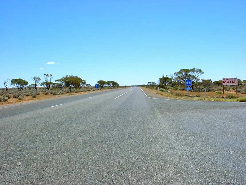
Pimba sits on the sealed Stuart Highway (A87) north of Port Augusta. Defence: leave the highway here for the short sealed road into Woomera Village, or continue on the Olympic Dam Highway toward Roxby Downs and Andamooka. North on the same Stuart Highway, this site’s Port Augusta and Adelaide–Darwin guides name Glendambo, then Coober Pedy. That is a corridor sequence, not a surveyed Pimba kilometre table.
Defence’s published distance is the Woomera Prohibited Area, about 450 km north-west of Adelaide, about 122,000 km². That figure is for the range, not a village-to-city or junction-to-city drive. SATC Explorers Way copy used here does not print a Pimba–Adelaide or Pimba–Port Augusta kilometre. This hub does not invent one.
| Place | Official note |
|---|---|
| Woomera | Sealed detour from this junction; Defence authorised route, no WPA permit on that road |
| Olympic Dam Highway | Sealed from Pimba toward Roxby Downs; Defence authorised route |
| Port Augusta | Southern gateway city on this site’s Woomera hub; kilometre not printed on Defence visits / SATC Explorers Way pages used here |
| Adelaide | Defence: WPA about 450 km north-west — range figure, not a Pimba drive |
| Glendambo | Next named Stuart Highway roadhouse stop north on this site’s Adelaide–Darwin guide |
Sealed highway: Traffic SA. Unsealed tracks off the bitumen: DIT outback road warnings and a Defence tourist permit if you leave authorised routes. The Anne Beadell Highway is in that permit category on Defence’s visits page.
Facts at a glance
Population. ABS 2021 SAL41153: 25 people. Median age 52. Limited tables. Use Pimba QuickStats.
Climate. No Pimba BOM table on the South Australia site-name list used here. Use Woomera Aerodrome (016001): 31.16°S, 136.81°E, elevation 167 m, commenced 1949, status open. January mean maximum 34.8 °C, July 17.1 °C, annual rainfall 183.0 mm (temperature 78 years, 1949–2026; rainfall 75 years, 1949–2026). Woomera’s additional-sites list names Olympic Dam, Andamooka and Yudnapinna — not Pimba. This is a corridor table, not a junction AWS. Full columns: Pimba weather.
Visitor information. There is no SATC-accredited VIC in a locality of 25 people on the product pages used here. Use Defence’s visits, tourism and travel page if you are turning off for the missile park, Wadlata in Port Augusta for the crossroads, and the Coober Pedy visitor centre if you are already northbound.
Traditional Owners
A Traditional Owner nation named for the Pimba townsite was not on the Defence village pages, SATC Explorers Way copy, or the OCA home page fetched for this rebuild. Defence’s Aboriginal cultural heritage page states that the Woomera Prohibited Area encompasses traditional lands of six Aboriginal groups. Maralinga Tjarutja and the Anangu Pitjantjatjara Yankunytjatjara (APY) hold almost 30 per cent of the west as freehold. Four other groups hold native title: Antakirinja Matu-Yankunytjatjara, Arabana, Gawler Ranges and Kokatha. Which of those six is the primary Traditional Owner of Pimba itself is not stated on those pages. This hub uses Defence’s WPA list rather than flattening a single nation onto the junction. Confirm wording before you print a Welcome to Country for the roadhouse. Read visiting Country respectfully.
History
Defence built Woomera as a village for staff on the joint United Kingdom–Australia long-range weapons project. Pimba is the highway hinge that makes that village reachable without a range permit. This hub does not invent a gazettal year, a railway opening date, or a private roadhouse origin story that Defence, SATC and OCA do not print for Pimba on the pages used here.
The locality sits in the Pastoral Unincorporated Area. OCA is the municipal-services warrant, not a museum caption. SATC treats the sealed Stuart Highway as Explorers Way / Adelaide–Darwin bitumen. The interesting public history for most travellers is next door at Woomera’s Heritage Centre — not a Pimba main-street trail this page will invent.
Things to do
Official days at Pimba are practical:
- Rest, fuel (if a bowser is actually open) and decide whether to turn off for Woomera or stay on the Stuart Highway (Traffic SA; Defence authorised routes).
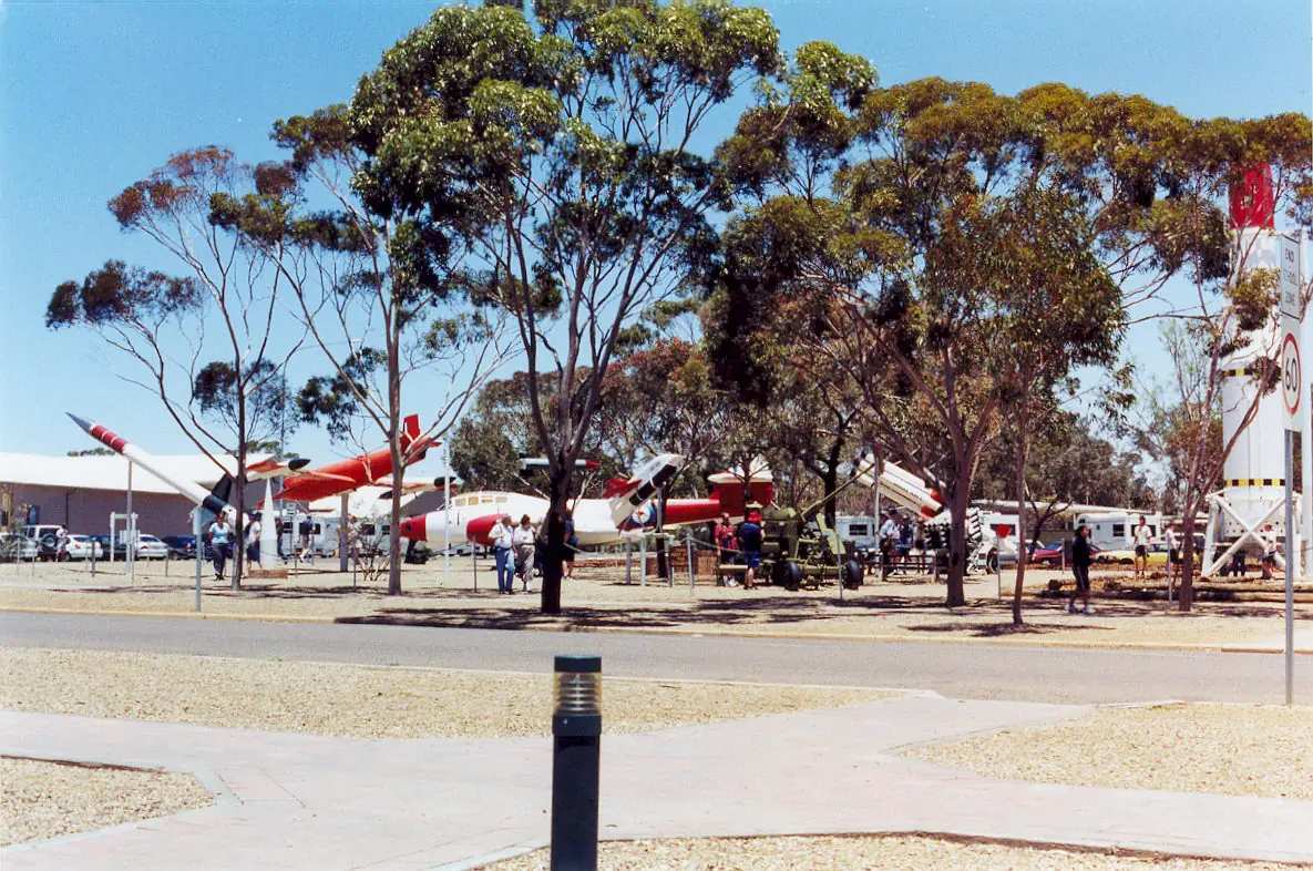
- Woomera Heritage Centre and Aircraft and Missile Park — the public stop Defence and SATC name. That visit belongs on the Woomera town guide, a short sealed detour, not a Pimba street walk.
- Continue north to Glendambo or south to Port Augusta. East on the Olympic Dam Highway: Roxby Downs.
There is no SATC destination paragraph that invents a lookout trail at the junction. A fuller caution list is on things to do in Pimba.
Nearby, not in-town: Lake Gairdner National Park is a Parks SA salt-lake trip toward Glendambo on that park’s access wording — not a Pimba walk. Parks SA recognises the Gawler Ranges People as Traditional Owners of that park.
Where to stay
A locality of 25 people is a junction, not a hotel strip. SATC Explorers Way copy and Defence visits pages used here do not publish a ranked motel list for Pimba. This hub will not name a private complex those pages do not name.
- Woomera is the Defence village detour; SATC’s Heritage Museum listing names the Eldo Hotel as that museum’s contact.
- Port Augusta is the southern city with rooms.
- Glendambo is the next named highway roadhouse stop north on this site’s Adelaide–Darwin guide.
- Roxby Downs is the mining town on the Olympic Dam Highway.
How to choose: Pimba accommodation. Camping detail: Pimba caravan parks. Operator enquiries: feature your business.
January’s 34.8 °C mean maximum at Woomera Aerodrome is a reason to book cooling somewhere on this corridor, not a reason to camp on the verge.
Caravan and camping
Vans use Pimba because the Stuart Highway is sealed and the Woomera turn is short. Official named camping at the junction was not published on the Defence, SATC Explorers Way or OCA pages fetched for this rebuild. Ask on arrival rather than treating the verge as a park. Woomera’s own caravan-park inventory was also not on those official pages — that town’s hub says ask at the Heritage Centre. Read Pimba caravan parks and outback camping.
Do not camp on range tracks. Defence permit rules are not a campsite booking.
Fuel and services
Treat Pimba as a confirm-on-arrival junction, not as a city supermarket. SATC’s outback itinerary tells travellers to carry extra fuel, water and food in this region. Port Augusta is the last full-service city south. Woomera is a small Defence village, not a substitute for Port Augusta. Glendambo is the next named highway roadhouse north on this site’s guides.
This guide does not list bowser brands or invent clinic hours. A locality of 25 people will not match Port Augusta for a hospital. Emergencies 000. Check Traffic SA for the bitumen.
Road access
- Stuart Highway — sealed Explorers Way / Adelaide to Darwin corridor. Traffic SA. Defence: no WPA permit on that authorised route.
- Road into Woomera Village — sealed, authorised, no WPA permit on Defence’s list.
- Olympic Dam Highway — sealed toward Roxby Downs; Defence authorised.
- Unsealed tracks including the Anne Beadell Highway — Defence tourist permit plus DIT. Call 1300 WPA DEL (1300 972 335, option 1) for daily restrictions.
Do not drive a closed track. Rain that barely wets the highway can still close dirt. See fuel, permits and road conditions.
Nearby parks and towns
Parks and named nature (confirm access):
- Lake Gairdner National Park — Parks SA access toward Glendambo; not a Pimba town walk
Towns on this site:
- Woomera — Defence village off this junction
- Glendambo — Stuart Highway north
- Port Augusta — southern gateway city
- Roxby Downs — Olympic Dam Highway
- Outback SA hub
When to go, and how long
SATC Explorers Way prefers cooler months and notes some places close mid December–mid February. Woomera Aerodrome’s January mean maximum of 34.8 °C and 183.0 mm of rain a year is a hot, dry Stuart Highway table. July’s 17.1 °C mean maximum and 5.8 °C mean minimum is the milder touring window on paper. See Pimba weather.
An hour covers a fuel decision and the turn to Woomera if the Heritage Centre is the day’s reason. A night at the junction only makes sense if a legal room or site exists — confirm, then sleep. Two tourist days in a locality of 25 people is more than the sourced main-street list supports.
Operators who want a checked listing: feature your business. The listings slot on this hub stays empty until then.
Plan this trip
Tell us the dates, who you are travelling with and where you need help. We reply with planning notes for Pimba — we are not a booking agent.
Events and road-conditions newsletter
Occasional notes on outback festivals, race days and official road-condition sources — not a daily blast. We use these details only to send the newsletter.
South Australia · Outback SA
Pimba accommodation
Where to stay near Pimba: Defence and SATC do not publish a ranked Pimba motel list. Confirm Woomera, Port Augusta or Glendambo. This is the Stuart Highway junction, not a second Woomera hotel page.
Read · 4 min
South Australia · Outback SA
Pimba caravan parks
Camping at Pimba: Defence, SATC and OCA pages used here do not publish a named Pimba caravan-park inventory. Confirm Woomera, Port Augusta or Glendambo. Do not camp on the range.
Read · 3 min
South Australia · Outback SA
Pimba weather
Pimba climate from BOM Woomera Aerodrome (016001): January mean max 34.8 °C, July 17.1 °C, annual rainfall 183.0 mm. No Pimba-named table. Stuart Highway junction, not a Woomera village AWS.
Read · 3 min
South Australia · Outback SA
Things to do in Pimba
Things to do in Pimba: the Stuart Highway / Woomera junction, Defence authorised routes, and the short sealed detour to the Heritage Centre. Not a second Woomera village page.
Read · 4 min
Frequently asked questions
Is Pimba the same place as Woomera?
No. Pimba is the Stuart Highway junction. Woomera is the Defence village reached by leaving the highway at Pimba. Defence lists the Stuart Highway, the Olympic Dam Highway and Woomera Village as authorised routes that do not need a WPA permit if you stay on them.
What is Pimba’s population?
25 people at the 2021 Census for Pimba suburbs-and-localities (SAL41153). Median age 52. Sex split 50.0% male / 50.0% female. The ABS does not publish a 2021 Urban Centre named Pimba. QuickStats notes limited tables because of the small population.
How far is Pimba from Adelaide?
Defence states the Woomera Prohibited Area is about 450 km north-west of Adelaide. A surveyed Pimba-to-Adelaide driving distance is not published on the Defence visits page or SATC Explorers Way copy used here. This hub does not invent one.
Do I need a permit to turn off at Pimba for Woomera?
No, if you stay on authorised routes Defence names, including the Stuart Highway, the Olympic Dam Highway and Woomera Village. Other tracks need a Defence tourist permit and can close for range use. Call 1300 WPA DEL (1300 972 335, option 1) for daily restrictions.
What weather record should I use?
BOM does not publish a Pimba climate-averages table. Use Woomera Aerodrome (016001): January mean maximum 34.8 °C, July 17.1 °C, annual rainfall 183.0 mm.
Is there fuel at Pimba?
This site’s Stuart Highway and Adelaide–Darwin guides treat Pimba as the Woomera highway turn-off. Confirm bowsers, hours and card systems on the day. Do not treat a junction type as a 24-hour guarantee, and do not invent a brand.
Sources and further reading
Facts on this page were checked against these primary and official sources. Conditions change — confirm before you travel or buy.
- Pimba 2021 Census QuickStats (SAL41153) — Australian Bureau of Statistics
- Climate statistics for Woomera Aerodrome (016001) — Bureau of Meteorology
- About Woomera — Department of Defence
- Woomera visits, tourism and travel — Department of Defence
- Aboriginal cultural heritage — Woomera — Department of Defence
- Explorers Way Road Trip — South Australian Tourism Commission
- Outback Communities Authority — Outback Communities Authority
- Outback road warnings — Department for Infrastructure and Transport SA
- Traffic SA — Government of South Australia
- Lake Gairdner National Park — National Parks and Wildlife Service SA