At a glance
Sourced facts only. Distances and services change — confirm before you travel.
- Local government
- Pastoral Unincorporated Area (Outback Communities Authority)
- Traditional Owners
- Not named for the Glendambo townsite on the sourced pagesParks SA names the Gawler Ranges People as Traditional Owners of Lake Gairdner National Park (Barngarla, Kokatha and Wirangu foundation families). Kokatha Aboriginal Corporation describes Kokatha Country north of Port Augusta. Confirm wording before using a single label for the highway stop.
- Nearest regional city
- Coober Pedy visitor guide: Glendambo 252 km south of Coober Pedy on the Stuart Highway
- Capital
- A Glendambo–Adelaide kilometre is not printed on the SATC Explorers Way page or the Coober Pedy visitor guide used here.
- Nearest fuel
- Named as a roadhouse stop on this site’s Stuart Highway and Adelaide–Darwin guides and on the Coober Pedy visitor guide. Confirm bowsers and hours on the day.
- Nearest hospital or clinic
- Coober Pedy Hospital, Lot 89 Hospital Road, 24-hour accident and emergency, (08) 8672 5009 (SA Health). Emergencies 000.
- Mobile coverage
- Check Telstra and Optus coverage maps before travel; do not assume a signal on the long Stuart Highway legs.
- Best time to visit
- Cooler months on SATC Explorers Way (some outback places close mid December–mid February); BOM Woomera January mean max 34.8 °C
Climate
Monthly means from the Bureau of Meteorology station Woomera Aerodrome (016001). This is not a forecast. BOM does not publish a Glendambo climate-averages table. Nearest open complete Stuart Highway-corridor table used here is Woomera Aerodrome. Temperature 78 years (1949–2026); rainfall 75 years (1949–2026). Elevation 167 m.
| Month | Mean max (°C) | Mean min (°C) | Rainfall (mm) |
|---|---|---|---|
| Jan | 34.8 | 19.7 | 17.6 |
| Feb | 33.8 | 19.4 | 19.1 |
| Mar | 30.6 | 17.0 | 13.1 |
| Apr | 25.7 | 13.2 | 12.5 |
| May | 20.7 | 9.4 | 17.8 |
| Jun | 17.4 | 6.7 | 16.1 |
| Jul | 17.1 | 5.8 | 13.9 |
| Aug | 19.1 | 6.8 | 13.1 |
| Sep | 23.0 | 9.6 | 13.6 |
| Oct | 26.6 | 12.6 | 17.2 |
| Nov | 29.9 | 15.5 | 17.2 |
| Dec | 32.6 | 17.8 | 14.6 |
Glendambo in pictures
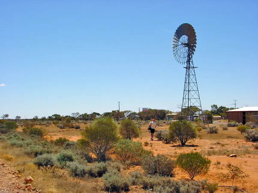
Windmill and buildings at GlendamboPhoto: Frans-Banja Mulder · CC BY 3.0 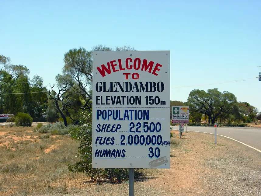
“Welcome to Glendambo” roadside signPhoto: Frans-Banja Mulder · CC BY 3.0
Glendambo is a Stuart Highway locality in unincorporated outback South Australia, marked on SATC’s Explorers Way map with Kingoonya and the long sealed run toward Coober Pedy. This site’s Stuart Highway and Adelaide to Darwin guides name it as a roadhouse stop before that long run. The Coober Pedy visitor guide used here puts Glendambo 252 km south of Coober Pedy and says the Glendambo Roadhouse complex provides all main services. It is not a Defence village like Woomera, and it is not Coober Pedy’s underground town.
The 2021 Census does not publish a people count for Glendambo (SAL40504) because the area had no people or a very low population. Read that ABS QuickStats sentence rather than inventing a round number. There is no UCL named Glendambo on the pages used here. Do not reuse a Woomera or Coober Pedy SAL.
This site groups it with Outback SA towns. Local government is the Pastoral Unincorporated Area under the Outback Communities Authority.
Where it is, and how far
Glendambo sits on the sealed Stuart Highway north of Port Augusta and south of Coober Pedy. This site’s Port Augusta hub names Pimba (for Roxby Downs and Andamooka), then Glendambo, then Coober Pedy, as the northbound sequence. Parks SA puts the northern end of Lake Gairdner a few kilometres south of Kingoonya, the Trans Australian Railway and the Stuart Highway, with Waltumba Tank campground reached via the Stringer Highway towards Glendambo.
| Place | Official note |
|---|---|
| Coober Pedy | 252 km north (Coober Pedy visitor guide) |
| Port Augusta | 538 km south of Coober Pedy on that same guide; a separate Glendambo–Port Augusta kilometre was not printed |
| Adelaide | Not printed as a Glendambo figure on the SATC Explorers Way page used here |
| Lake Gairdner (Waltumba Tank) | Parks SA: via the Stringer Highway towards Glendambo; park tracks unsealed |
Sealed highway: Traffic SA. Unsealed park and station tracks: DIT outback road warnings and Parks SA 1300 361 033.
Facts at a glance
Population. ABS 2021 SAL40504: no information can be provided because the area had no people or a very low population. Do not substitute a blog count.
Climate. No Glendambo BOM table on the South Australia site-name list used here. Use Woomera Aerodrome (016001): 31.16°S, 136.81°E, elevation 167 m, commenced 1949, status open. January mean maximum 34.8 °C, July 17.1 °C, annual rainfall 183.0 mm (temperature 78 years, 1949–2026; rainfall 75 years, 1949–2026). Full columns: Glendambo weather. Woomera’s additional-sites list on that BOM page names Olympic Dam, Andamooka and Yudnapinna — not Glendambo. This is a corridor table, not a town AWS.
Visitor information. There is no SATC-accredited VIC in Glendambo on the product pages used here. Use the Coober Pedy visitor centre for the northbound opal town, Wadlata in Port Augusta for the crossroads, and Defence’s Woomera pages if you are detouring to the missile park.
Traditional Owners
Parks SA’s Lake Gairdner page states the Gawler Ranges People are recognised as traditional owners of that Country, attaining native title in 2011, a distinct group of foundation families made up of, but not all, the Barngarla, Kokatha and Wirangu people. Traditional Owners ask visitors not to move rocks around the lake or walk onto the salt. Kokatha Aboriginal Corporation describes Kokatha People as Traditional Owners of a large area north of Port Augusta, from Lake Torrens to the Gawler Ranges, including country around Olympic Dam. Neither page names the Glendambo highway stop as a townsite. This hub does not flatten those nations onto a single label. Confirm wording before you print a Welcome to Country for the roadhouse. Read visiting Country respectfully.
History and the highway
Glendambo’s visitor meaning on SATC and Parks SA pages is the Stuart Highway stop and the Stringer Highway direction for Lake Gairdner, not a 19th-century railway town. SATC’s Explorers Way map marks Glendambo with Kingoonya. Parks SA still names Kingoonya as the settlement near the northern salt. This hub does not invent a 1980s highway-realignment date that was not on those official pages.
The Stuart Highway itself is the sealed spine this site’s highway guide dates as fully sealed since February 1987 (final section near Marla). SATC’s Explorers Way page tells travellers to verify outback road conditions, and to plan fuel, water and supplies carefully. The Coober Pedy visitor guide’s speeding graphic for the Glendambo to Coober Pedy leg is a safety sermon, not a licence to invent a third speed limit. South Australia’s open-road maximum on this site’s Stuart Highway FAQ is 110 km/h.
Things to do
A Census-suppressed locality does not need an invented attraction list. Official pages support:
- Fuel, food and a night on the Stuart Highway — named as a roadhouse stop on this site’s highway guides; Coober Pedy visitor guide: all main services at the roadhouse complex. Confirm what is actually open.
- Continuing north to Coober Pedy — 252 km on that visitor guide; underground town, Kanku-Breakaways.
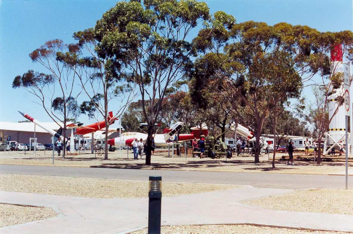
- Detouring to Woomera — Heritage Centre and Missile Park off the highway at Pimba, on authorised Defence routes only.
- Lake Gairdner National Park — Parks SA: Australia’s third-largest salt lake, Waltumba Tank toward Glendambo, no driving on the salt without a permit, dogs not permitted, free camping at Waltumba, high-clearance access. Contact Mount Ive for the southern 34 km station track and gate key. This is not a stroll from the roadhouse.
See things to do in Glendambo.
Where to stay
Official pages name types, not a ranked motel strip:
- The Coober Pedy visitor guide describes a roadhouse complex providing all main services. This hub does not invent a room count, star rating or cabin brand.
- Parks SA names Waltumba Tank campground in Lake Gairdner National Park (free, no online booking, high ground clearance, toilet, self-sufficient). That is a park camp via the Stringer Highway, not a Glendambo street park.
- If the roadhouse is full or closed, Coober Pedy is 252 km north on that visitor guide and Port Augusta is the last city this site names before the outback.
Confirm on the day. See Glendambo accommodation and Glendambo caravan parks. Operators: feature your business.
Caravan and camping
Vans use Glendambo as a Stuart Highway overnight so they are not arriving in Coober Pedy after a 252 km dusk run. Ask what powered sites, if any, the roadhouse complex actually offers. Do not unhitch on the highway verge. Lake Gairdner camping is a park decision with unsealed access. Read outback camping.
Fuel and services
Fill when you can. SATC’s Explorers Way page is blunt about planning fuel on the sealed Stuart Highway. The Coober Pedy visitor guide treats Glendambo as the services point south of the opal town. This guide does not list bowser brands or prices. Confirm diesel, unleaded and opening hours before you rely on a night arrival.
Coober Pedy Hospital, Lot 89 Hospital Road, (08) 8672 5009, has 24-hour accident and emergency on SA Health’s page. There is no Glendambo hospital on the SA Health list used here. Emergencies 000. Port Augusta is the larger crossroads hospital corridor if you are still southbound.
For current questions use OCA and Traffic SA.
Road access
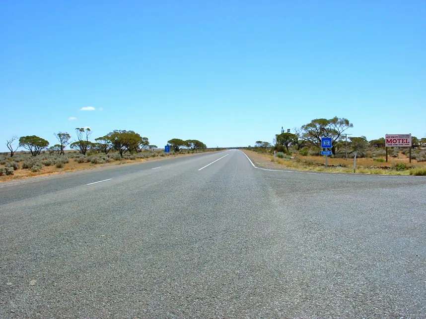
The Stuart Highway is sealed all the way. This site’s highway guide: South Australia open-road maximum 110 km/h; road trains; avoid night driving because of wildlife. The Coober Pedy visitor guide’s Glendambo–Coober Pedy speeding table is a reminder that the leg is long and enforced.
Side trips:
- Woomera / Pimba — authorised Defence routes only.
- Lake Gairdner — unsealed; Parks SA and DIT.
- Gawler Ranges — a separate park, not a Glendambo suburb.
Check Traffic SA for the seal. Check DIT before any unsealed kilometre. Closed means closed.
Nearby parks and towns
Parks:
- Lake Gairdner National Park — salt lake, Waltumba Tank toward Glendambo, Gawler Ranges People
- Gawler Ranges National Park — further south-west; not a highway picnic
- Kanku-Breakaways — north at Coober Pedy
Towns on this site:
- Coober Pedy — 252 km north
- Woomera — Defence village off the highway at Pimba
- Port Augusta — last city, Stuart / Eyre / Augusta junction
- Marla — later Stuart Highway fuel north of Coober Pedy
- Roxby Downs and Andamooka — east of Pimba, not a Glendambo side street
When to go, and how long
Woomera Aerodrome’s January mean maximum of 34.8 °C is hot for a Lake Gairdner day on unsealed tracks. July’s 17.1 °C mean maximum is the comfortable highway season on paper; July’s 5.8 °C mean minimum is why a van night needs a layer. Annual rainfall 183.0 mm. SATC’s Explorers Way page flags mid December to mid February heat closures at some outback places.
A fuel-and-sleep stop is the sourced Glendambo visit. Add Lake Gairdner only if Parks SA, Mount Ive (for the southern key) and DIT agree. Two nights in the locality is more than the sourced main-street list supports unless you are waiting on a road opening.
Operators who want a checked listing: feature your business. The listings slot on this hub stays empty until then.
Plan this trip
Tell us the dates, who you are travelling with and where you need help. We reply with planning notes for Glendambo — we are not a booking agent.
Events and road-conditions newsletter
Occasional notes on outback festivals, race days and official road-condition sources — not a daily blast. We use these details only to send the newsletter.
South Australia · Outback SA
Glendambo accommodation
Where to stay at Glendambo: roadhouse complex named by the Coober Pedy visitor guide, plus Parks SA Waltumba Tank toward Glendambo. Confirm on the day. No invented motels.
Read · 3 min
South Australia · Outback SA
Glendambo caravan parks
Camping at Glendambo: ask the named Stuart Highway roadhouse complex about sites, plus Parks SA Waltumba Tank toward Glendambo. Confirm. No invented park brands.
Read · 3 min
South Australia · Outback SA
Glendambo weather
Glendambo climate from BOM Woomera Aerodrome (016001): January mean max 34.8 °C, July 17.1 °C, annual rainfall 183.0 mm. No Glendambo BOM table.
Read · 4 min
South Australia · Outback SA
Things to do in Glendambo
Things to do in Glendambo: Stuart Highway roadhouse stop, then Coober Pedy, Woomera or Lake Gairdner if Parks SA and DIT agree. No invented lookouts.
Read · 3 min
Frequently asked questions
How far is Glendambo from Coober Pedy and Port Augusta?
The Coober Pedy visitor guide used here puts Glendambo 252 km south of Coober Pedy on the Stuart Highway and Port Augusta 538 km south of Coober Pedy. It does not print a separate Glendambo–Port Augusta kilometre. This hub does not subtract those figures into a fake third distance.
What is Glendambo’s population?
The 2021 Census Suburbs and Localities page for Glendambo (SAL40504) publishes no people count because the area had no people or a very low population. Do not invent a town figure or reuse a neighbouring SAL.
Is there fuel at Glendambo?
This site’s Stuart Highway and Adelaide–Darwin guides name Glendambo as a roadhouse stop. The Coober Pedy visitor guide says the Glendambo Roadhouse complex provides all main services. Confirm bowsers, hours and card systems on the day. Do not treat a roadhouse type as a 24-hour guarantee.
What weather record should I use?
BOM does not publish a Glendambo climate-averages table. This guide uses Woomera Aerodrome (016001): January mean maximum 34.8 °C, July 17.1 °C, annual rainfall 183.0 mm.
How does Lake Gairdner relate to Glendambo?
Parks SA says access to Waltumba Tank campground in Lake Gairdner National Park is via the Stringer Highway towards Glendambo. The northern end of the lake is a few kilometres south of Kingoonya, the Trans Australian Railway and the Stuart Highway. That is a park trip, not a village walk. Driving on the salt needs the appropriate permit.
Do I need to check outback road warnings?
The Stuart Highway is sealed (Traffic SA). Parks SA still tells Lake Gairdner visitors to check the Northern and Western outback roads report (1300 361 033) because park tracks are unsealed gravel or sand. Side roads close after rain.
Sources and further reading
Facts on this page were checked against these primary and official sources. Conditions change — confirm before you travel or buy.
- Glendambo 2021 Census QuickStats (SAL40504) — Australian Bureau of Statistics
- Climate statistics for Woomera Aerodrome (016001) — Bureau of Meteorology
- Explorers Way Road Trip — South Australian Tourism Commission
- Coober Pedy visitor guide — Coober Pedy
- Lake Gairdner National Park — National Parks and Wildlife Service SA
- Outback road warnings — Department for Infrastructure and Transport SA
- Traffic SA — Government of South Australia
- Coober Pedy Hospital — SA Health
- Outback Communities Authority — Outback Communities Authority
- Kokatha Aboriginal Corporation — Kokatha Aboriginal Corporation RNTBC