At a glance
Sourced facts only. Distances and services change — confirm before you travel.
- Population
- 20,880 people (UCL412004, 2021 Census)
- Local government
- Whyalla City Council
- Traditional Owners
- Barngarla Country named by the Whyalla Visitor Information CentreLandscape SA’s Spencer subregional description names the Barngarla people as Traditional Owners of the Whyalla City Council area.
- Nearest regional city
- Port Augusta is the Stuart / Eyre / Augusta highway junction at the head of the gulf. SATC does not print a Whyalla–Adelaide kilometre on the destination paragraph used here.
- Nearest fuel
- Full-service steel city on the Lincoln Highway. Confirm bowsers on the day.
- Mobile coverage
- Check Telstra and Optus coverage maps before travel; do not assume a signal.
- Best time to visit
- SATC giant cuttlefish May–August. Whyalla Aero January mean max 30.2 °C, July 17.0 °C.
Climate
Monthly means from the Bureau of Meteorology station Whyalla Aero (018120). This is not a forecast. Open. Commenced 1945. Elevation 9 m. Mean maxima 41 years (1945–2026); rainfall 38 years (1945–2026). January mean maximum 30.2 °C; July 17.0 °C; annual rainfall 259.5 mm.
| Month | Mean max (°C) | Mean min (°C) | Rainfall (mm) |
|---|---|---|---|
| Jan | 30.2 | 17.9 | 19.8 |
| Feb | 29.7 | 17.8 | 21.3 |
| Mar | 27.4 | 15.8 | 17.8 |
| Apr | 24.1 | 12.0 | 20.3 |
| May | 20.5 | 8.7 | 22.5 |
| Jun | 17.3 | 6.2 | 27.5 |
| Jul | 17.0 | 5.3 | 21.9 |
| Aug | 18.6 | 6.1 | 21.8 |
| Sep | 21.8 | 8.2 | 24.1 |
| Oct | 24.2 | 10.9 | 23.8 |
| Nov | 26.5 | 14.0 | 23.2 |
| Dec | 28.3 | 16.0 | 24.3 |
Whyalla in pictures
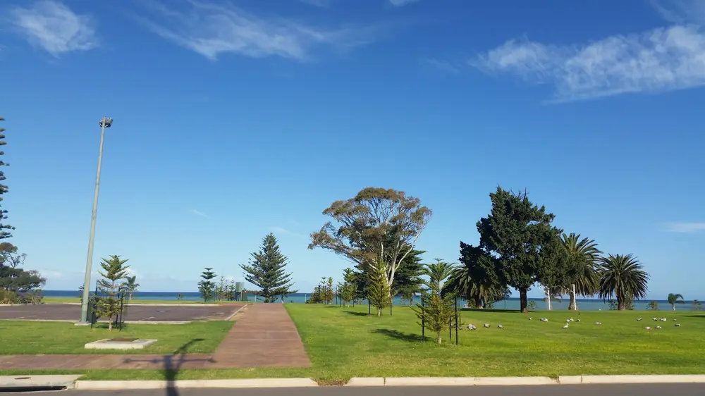
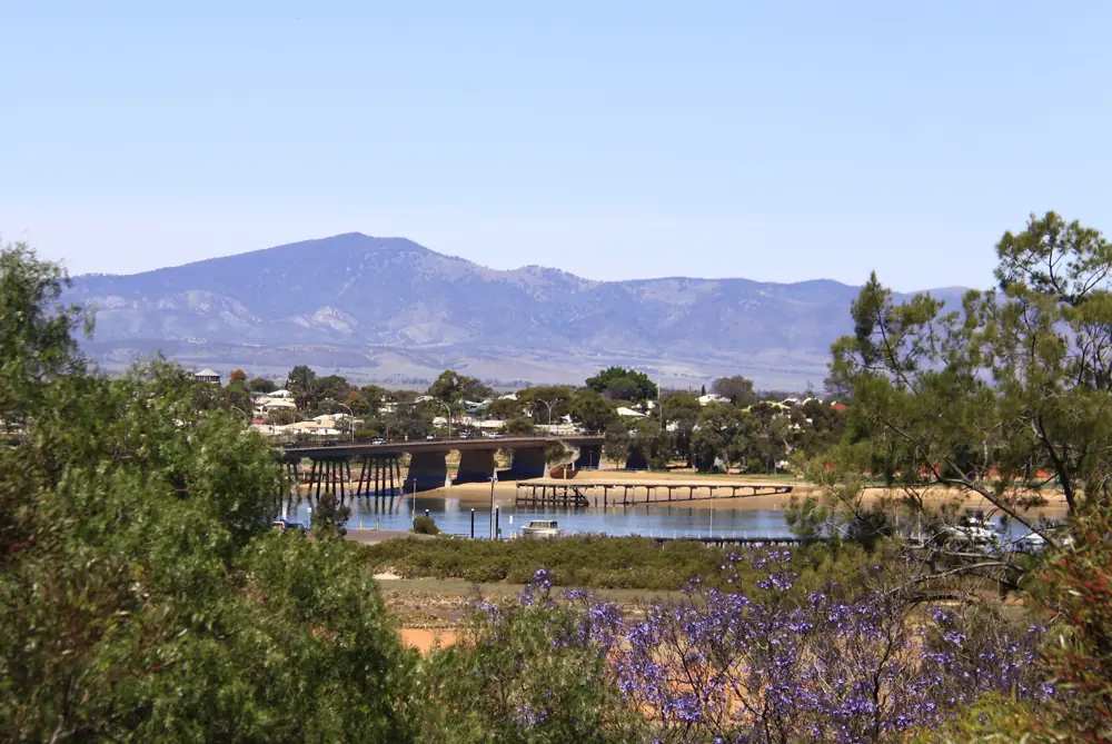
Whyalla ForeshorePhoto: Whyallagirl · CC BY-SA 4.0 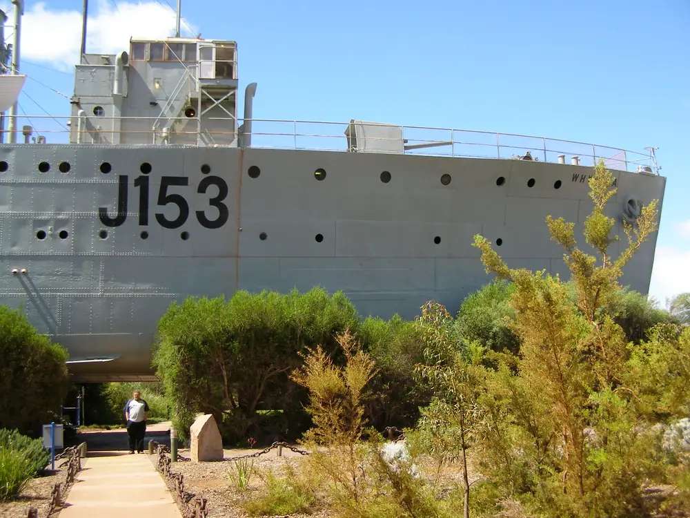
Whyalla corvettePhoto: Kerry Raymond · CC BY-SA 3.0 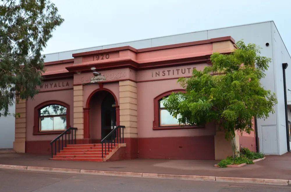
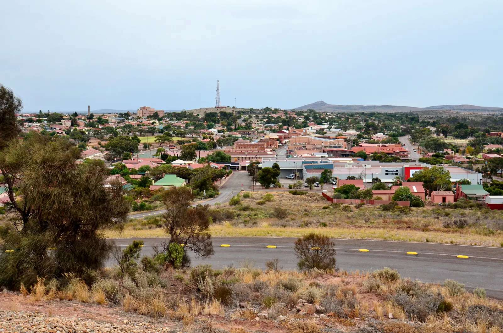
Whyalla Institute building, 2017Photo: Bahnfrend · CC BY-SA 4.0 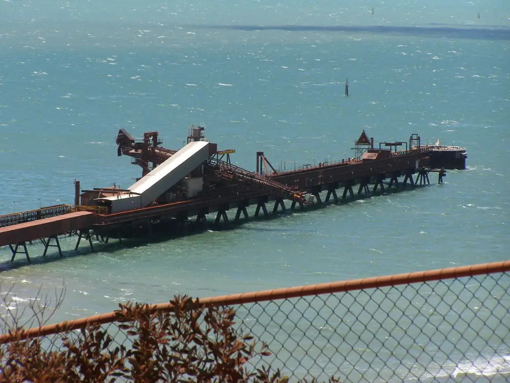
Whyalla portPhoto: Kerry Raymond at English Wikipedia · CC BY-SA 3.0
Whyalla sits on the western shore of Spencer Gulf, on the Lincoln Highway, on Barngarla Country. SATC calls it the gateway to the Eyre Peninsula and the biggest town in that region. On this site it belongs in outback SA as a steel city gateway: a full-service industrial city where you restock before Port Augusta sends you north on the Stuart Highway, and before Ceduna sits out on a different highway — the Eyre Highway — across the top of the peninsula toward the Nullarbor.
The 2021 Census counted 20,880 people in the Whyalla urban centre (UCL412004). Use that figure for the city. The inner suburb SAL41585 counted only 3,609. The local government area counted 21,244. Do not mix them. Read the ABS QuickStats page for Whyalla UCL.
Where it is, and how far
Whyalla is on the Lincoln Highway, which Landscape SA’s Spencer description calls the gateway to southern Eyre Peninsula. That is not the Eyre Highway. Travellers mix the two names. Do not. If you are going to Ceduna and the Nullarbor, you are on the Eyre Highway after Port Augusta, not on a straight continuation of Whyalla’s Lincoln Highway beach road.
Port Augusta, about the head of the gulf, is where the Stuart, Eyre and Augusta highways meet. Whyalla is the steel city on the gulf’s west bank. SATC does not publish a Whyalla-to-Adelaide kilometre figure on the destination paragraph used here, so this guide does not invent one.
| Place | Official note |
|---|---|
| Lincoln Highway | Whyalla’s highway; northern entrance VIC (Visit Whyalla / SATC) |
| Port Augusta | Stuart / Eyre / Augusta junction; outback SA neighbour on this site |
| Ceduna | Eyre Highway west — a different corridor, neighbour on this site |
| Spencer Gulf | Upper gulf city; steelworks, foreshore, Point Lowly views from Hummock Hill |
Check Traffic SA for sealed highways and DIT outback road warnings before you leave the bitumen.
Facts at a glance
Population. Australian Bureau of Statistics 2021 Census, Urban Centres and Localities UCL412004: 20,880 people. Median age 41. Sex split 50.2% male / 49.8% female. Families 5,463. Private dwellings 10,960. Average household size 2.2. Use the ABS UCL QuickStats.
Climate. Bureau of Meteorology station Whyalla Aero (018120). Location 33.05°S, 137.52°E, elevation 9 m. Commenced 1945 (status open; product date on the table used here 14 November 2026). Mean maxima use 41 years (1945–2026). Annual mean rainfall 259.5 mm over 38 years (1945–2026). Hottest month by mean maximum: January 30.2 °C. Coolest month by mean maximum: July 17.0 °C. Full columns sit on the BOM Whyalla Aero table and on Whyalla weather. Gulf air keeps summer maxima milder than inland Woomera or Marla.
Visitor centre. Lincoln Highway, northern entrance, at the Whyalla Maritime Museum complex. Weekdays 9am–4pm; weekends and public holidays 10am–4pm; closed Good Friday and Christmas Day. Phone (08) 8645 7900 or toll free 1800 088 589. Email visitor.centre@whyalla.sa.gov.au. SATC and Visit Whyalla both describe it as the booking desk for HMAS Whyalla ship tours and the steelworks bus tour. This is the desk that answers beds. We do not publish a ranked hotel list for a city this size.
Traditional Owners
Visit Whyalla’s visitor-centre page states it is located on Barngarla Country. Landscape SA’s Spencer subregional description names the Barngarla Aboriginal people as Traditional Owners of the region including Whyalla City Council, with native title recognised over land and marine areas of the gulf. Barngarla Determination Aboriginal Corporation is based in Whyalla Norrie. This hub follows those official sentences. Read visiting Country respectfully.
History
SATC and the steelworks tour page describe Whyalla as a historic seaside industrial town and one of Australia’s largest integrated steelmaking operations, from mining raw materials to rolling finished steel, with about 1.2 million tonnes of raw steel a year in that SATC copy. Confirm current tour operations at the visitor centre; bookings are essential.
HMAS Whyalla is named by SATC and Visit Whyalla as a land-locked warship at the Maritime Museum. The ship tour involves 39 stairs and is not suitable for people who cannot climb (Visit Whyalla accessibility note). The museum and gardens have a DDA-compliant path.
Hummock Hill Lookout is on Visit Whyalla’s lookouts page: first-settlement site, Second World War gun battery, developed by BHP as a centenary gift and opened during the 1986 SA Jubilee Royal Visit. One-way sealed road suitable for caravans and coaches. Views of the steelworks, foreshore, marina, Spencer Gulf, Southern Flinders, Port Bonython and Point Lowly Lighthouse.
This guide does not invent a gazettal year beyond those official pages.
Things to do
Start at the visitor centre on the Lincoln Highway. Then:
- Whyalla Maritime Museum and HMAS Whyalla tour (book).
- Steelworks bus tour (book; SATC).
- Hummock Hill Lookout (Visit Whyalla).
- Giant Australian cuttlefish snorkel or dive May–August (SATC); the VIC also books glass-bottom boat tours and seasonal snorkel products.
- Point Lowly campsites are a VIC booking on the whyalla.com/vic page — confirm rules.
A fuller list is on things to do in Whyalla.
Where to stay
Whyalla is large enough for motels, hotels, apartments, caravan parks and Point Lowly campsites booked through the VIC. This hub does not rank operators or quote prices.
- Confirm rooms at the Whyalla Visitor Information Centre, 1800 088 589.
- How to choose: Whyalla accommodation
- Parks and camping: Whyalla caravan parks
- Operator enquiries: feature your business
Cuttlefish season (May–August) and school holidays fill gulf rooms. Book. We do not guess occupancy.
Caravan and camping
Vans use Whyalla because the Lincoln Highway is sealed, the city has supplies, and Hummock Hill’s lookout road is described as caravan-suitable. Town parks are the overnight choice. Point Lowly is a VIC campsite booking, not a dump-and-hope beach. Read Whyalla caravan parks. Check Traffic SA. DIT outback warnings apply only once you leave this sealed gulf city for dirt.
Fuel and services
Whyalla is a full-service city of 20,880 people: fuel, groceries, hospital, workshops. This guide does not list bowser brands. Fill up here before Port Augusta if you like, and certainly before you treat Ceduna as “just up the road” — it is not on this highway.
Road access
- Lincoln Highway — Whyalla’s sealed gulf road, south toward Eyre Peninsula towns, north toward the Port Augusta approaches.
- Not the Eyre Highway — that is Ceduna’s Nullarbor road, joined from Port Augusta.
- Stuart Highway — the Darwin road, joined from Port Augusta, not from Whyalla’s beachfront.
These are freight roads. Check Traffic SA. For dirt beyond the gulf, use DIT outback road warnings. An outback South Australia road trip, Adelaide to Darwin or Nullarbor itinerary often stages through Port Augusta; Whyalla is the steel-and-cuttlefish side trip on the gulf.
Nearby parks and towns
Places named by Visit Whyalla / SATC (confirm access):
- Hummock Hill Lookout
- Point Lowly / Port Bonython views
- Whyalla Maritime Museum precinct
Towns on this site:
- Port Augusta — highway crossroads, arid-lands garden, outback museum.
- Ceduna — Eyre Highway, different corridor.
- Outback SA hub.
When to go, and how long
May–August is cuttlefish season on the SATC page and the milder half of the BOM table (July mean maximum 17.0 °C). January’s 30.2 °C mean maximum is hot for an unshaded lookout but milder than inland outback SA. Annual rainfall 259.5 mm is dry gulf country. See Whyalla weather.
One night is enough for the lookout and a restock. Two nights lets you add a booked ship or steelworks tour. Three nights if cuttlefish season and a Point Lowly day are both in play.
Operators who want a checked listing: feature your business. The listings slot stays empty until then.
Plan this trip
Tell us the dates, who you are travelling with and where you need help. We reply with planning notes for Whyalla — we are not a booking agent.
Events and road-conditions newsletter
Occasional notes on outback festivals, race days and official road-condition sources — not a daily blast. We use these details only to send the newsletter.
South Australia · Outback SA
Things to do in Whyalla
Things to do in Whyalla: visitor centre on the Lincoln Highway, Maritime Museum and HMAS Whyalla, steelworks bus tour, Hummock Hill Lookout and May–August cuttlefish.
Read · 4 min
South Australia · Outback SA
Whyalla accommodation
Where to stay in Whyalla: city hotels and motels, caravan parks, and Point Lowly campsites booked through the visitor centre. Official desk, not a fake hotel ranking.
Read · 3 min
South Australia · Outback SA
Whyalla caravan parks
Caravan parks and camping in Whyalla: town parks confirmed at the visitor centre, Point Lowly campsites booked through the VIC, and a caravan-suitable lookout road on Hummock Hill.
Read · 3 min
South Australia · Outback SA
Whyalla weather
Whyalla climate from Bureau of Meteorology Whyalla Aero (018120): January mean maximum 30.2 °C, July 17.0 °C, annual rainfall 259.5 mm. Full monthly table and cuttlefish-season timing.
Read · 3 min
Frequently asked questions
Is Whyalla on the same highway as Ceduna?
No. Whyalla sits on the Lincoln Highway on the western shore of Spencer Gulf. Ceduna is west on the Eyre Highway, a different corridor across the top of Eyre Peninsula. Port Augusta is the junction of the Stuart, Eyre and Augusta highways.
What is Whyalla’s population?
20,880 people at the 2021 Census for the Whyalla urban centre (UCL412004). Median age 41. Do not use the inner suburb SAL41585 figure of 3,609 as the city count. The LGA figure is 21,244.
Whose Country is Whyalla on?
The Whyalla Visitor Information Centre states it is located on Barngarla Country. Landscape SA’s Spencer subregional description names the Barngarla people as Traditional Owners of the Whyalla City Council area.
When do giant cuttlefish gather?
SATC’s Whyalla page says the annual migration of giant Australian cuttlefish is between May and August, the only place they are known to gather en masse to breed.
Where is the visitor centre?
On the Lincoln Highway at the entrance to the Whyalla Maritime Museum, northern entrance to the city. Weekdays 9am–4pm; weekends and public holidays 10am–4pm; closed Good Friday and Christmas Day. Phone (08) 8645 7900 or 1800 088 589.
How hot is summer?
Bureau of Meteorology means for Whyalla Aero (018120) show January mean maximum 30.2 °C and July 17.0 °C. Annual mean rainfall is 259.5 mm.
Sources and further reading
Facts on this page were checked against these primary and official sources. Conditions change — confirm before you travel or buy.
- Whyalla 2021 Census QuickStats (UCL412004) — Australian Bureau of Statistics
- Climate statistics for Whyalla Aero (018120) — Bureau of Meteorology
- Whyalla — South Australian Tourism Commission
- Whyalla Visitor Information Centre — South Australian Tourism Commission
- Whyalla Steelworks Tour — South Australian Tourism Commission
- Whyalla Visitor Information Centre — Whyalla City Council / Visit Whyalla
- Lookouts — Whyalla City Council / Visit Whyalla
- Spencer Subregional Description — Landscape SA / Eyre Peninsula Landscape Board
- Traffic SA — Government of South Australia
- Outback road warnings — Department for Infrastructure and Transport SA