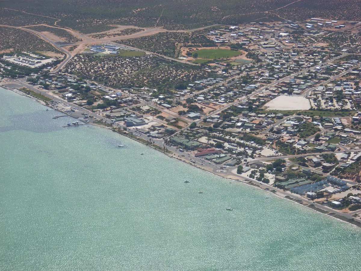
This page uses one named Bureau of Meteorology station: DENHAM, 006044, 25.93°S, 113.53°E, elevation 6 m, commenced 1893, status: open, latest available data 30 June 2025. BOM climate table. Temperature means use 34 years of maxima and 33 years of minima (1988–2023). Rainfall uses 116 years (1893–2025). Mean days of rain ≥ 1 mm: 23.2.
Do not blend this Shark Bay coast table with Carnarvon Airport (006011) on Carnarvon weather, with Hamelin Pool, or with Learmonth Airport (005007) used on the Exmouth and Coral Bay weather pages. Those are different towns and different stations.
Denham is the Shire of Shark Bay town on the Peron Peninsula — 723 people in the urban centre (UCL521019). Tourism WA: a 10-hour drive from Perth or a two-hour 15-minute flight. The Council Plan: 129 km from the North West Coastal Highway. Monkey Mia is 24 km sealed, or twenty minutes, or 30 minutes, depending which official page you open.
Monthly climate (BOM Denham 006044)
| Month | Mean max °C | Mean min °C | Mean rain mm |
|---|---|---|---|
| January | 30.8 | 22.2 | 7.2 |
| February | 31.8 | 22.8 | 15.8 |
| March | 31.2 | 22.2 | 14.2 |
| April | 28.6 | 19.7 | 14.2 |
| May | 25.8 | 16.5 | 35.9 |
| June | 22.8 | 13.9 | 53.9 |
| July | 21.8 | 12.8 | 38.9 |
| August | 22.6 | 13.4 | 21.7 |
| September | 24.0 | 14.9 | 7.9 |
| October | 25.7 | 16.7 | 6.0 |
| November | 27.6 | 18.6 | 3.0 |
| December | 29.3 | 20.5 | 2.2 |
Annual mean maximum 26.8 °C. Annual mean minimum 17.8 °C. Annual rainfall 223.0 mm. February is the warmest mean month at 31.8 °C. July is the coolest mean month at 21.8 °C maximum and 12.8 °C minimum. June is the wettest mean month at 53.9 mm. December is the driest at 2.2 mm.
Temperature in prose
Mean maximum (34 years, 1988–2023): January 30.8 °C, February 31.8 °C, March 31.2 °C, April 28.6 °C, May 25.8 °C, June 22.8 °C, July 21.8 °C, August 22.6 °C, September 24.0 °C, October 25.7 °C, November 27.6 °C, December 29.3 °C.
Mean minimum (33 years, 1988–2023): January 22.2 °C, February 22.8 °C, March 22.2 °C, April 19.7 °C, May 16.5 °C, June 13.9 °C, July 12.8 °C, August 13.4 °C, September 14.9 °C, October 16.7 °C, November 18.6 °C, December 20.5 °C.
February’s 31.8 °C mean maximum is milder than inland Gascoyne January on the Gascoyne Junction and Carnarvon tables. That comparison is a reminder to use each town’s named station, not a licence to average them.
Rainfall and roads
Mean rainfall (116 years, 1893–2025): January 7.2 mm, February 15.8 mm, March 14.2 mm, April 14.2 mm, May 35.9 mm, June 53.9 mm, July 38.9 mm, August 21.7 mm, September 7.9 mm, October 6.0 mm, November 3.0 mm, December 2.2 mm.
This is a winter-peak table. June 53.9 mm is more than twenty times December’s 2.2 mm. After rain, Main Roads WA — World Heritage Drive and François Peron’s unsealed precinct road can close when wet. Parks WA: the unsealed road to the Heritage Precinct is usually 2WD; high-clearance 4WD north of it.
When to go
The Shire Council Plan: François Peron camping is busiest in winter and school holidays — the cooler months on this table, and the wetter ones. Carry water: the Shark Bay place page says no supplies, services or fresh water in the park. No dogs. Park entry fees. 1080 baiting. Parks WA: no swimming at Cape Peron because two currents can form a strong rip — a current warning, not a season.
Monkey Mia’s dolphin briefing is 7:45 am year-round on Shark Bay Visit; dolphins may not come. Confirm hours at the Discovery Centre, 53 Knight Terrace, 1300 367 072. Shark Bay Health Centre is not listed as a 24-hour hospital on the WACHS Midwest page; call 000.
The Shire of Shark Bay Council Plan 2023–2033 acknowledges the Malgana Peoples as traditional custodians of the land and sea in and around the Shire. The district includes three Aboriginal language groups: Malgana, Nhanda and Yingkarta. On 4 December 2018 the Malgana people were formally recognised as native title holders of a significant area of the lands within the Shire. Parks WA: François Peron National Park is jointly managed with the Malgana Aboriginal Corporation; Peron Peninsula is known as Wulyibidi. Confirm current wording at 53 Knight Terrace. See visiting Country respectfully.
Tourism WA: since Captain Henry Mangles Denham first charted the bay in 1858 aboard the HMS Herald, scientists have recognised Shark Bay for its evolutionary history. It is one of a handful of sites worldwide that satisfy all criteria for World Heritage listing. Shark Bay was inscribed in 1991, covering 2.2 million hectares on the Council Plan. François Peron was a sheep station until 1990, declared a national park in 1993. Parks WA names Bottle Bay, Big Lagoon, Herald Bight, Gregories and South Gregories — winter and school holidays busiest; no caravans on sandy tracks north of the Heritage Precinct.
Discovery Centre hours on Shark Bay Visit: Monday–Friday 9 am–4:30 pm, Saturday 10 am–2 pm, Sunday closed on one block and open 10 am–2 pm in peak season — print the disagreement. The April 2026 shire phone book names Shark Bay Fuel fishing & Camping Centre, 85 Knight Terrace, (08) 9948 1239. Confirm on arrival. Fill in Carnarvon before you leave the highway if you are northbound toward World Heritage Drive. Neighbours: Coral Bay, Exmouth, Gascoyne Junction.
Do not paste Carnarvon Airport, Learmonth Airport or Winning onto this page. Hub: Denham. Things to do: Denham things to do. Stay: Denham accommodation. Vans: Denham caravan parks.
Plan this trip
Tell us the dates, who you are travelling with and where you need help. We reply with planning notes for Denham — we are not a booking agent.
Frequently asked questions
What is the weather like in Denham?
BOM Denham (006044, open): February mean maximum 31.8 °C, July 21.8 °C, annual rainfall 223.0 mm (116 years, 1893–2025). June is the wettest mean month at 53.9 mm; December the driest at 2.2 mm. Temperature means use 1988–2023. Latest available data 30 June 2025.
Is Denham hotter than Carnarvon?
Do not blend stations. BOM Denham February mean maximum is 31.8 °C; July 21.8 °C. Carnarvon Airport is a different station on the Carnarvon weather page. Use each town’s named station.
When is the wettest month in Denham?
BOM Denham rainfall (116 years, 1893–2025): June 53.9 mm is the wettest mean month; December 2.2 mm is the driest. Annual mean 223.0 mm. Mean days of rain ≥ 1 mm: 23.2.
When is François Peron camping busiest?
The Shire of Shark Bay Council Plan: François Peron camping is busiest in winter and school holidays. BOM Denham July mean maximum 21.8 °C; June rainfall 53.9 mm.
Sources and further reading
Facts on this page were checked against these primary and official sources. Conditions change — confirm before you travel or buy.
- Climate statistics for Denham (006044) — Bureau of Meteorology
- Denham — Tourism Western Australia
- Shire of Shark Bay Council Plan 2023–2033 — Shire of Shark Bay
- Francois Peron National Park — Parks and Wildlife Service, DBCA