At a glance
Sourced facts only. Distances and services change — confirm before you travel.
- Local government
- Shire of Upper Gascoyne
- Traditional Owners
- Not named for the Gascoyne Junction townsite on the sourced Tourism WA, Golden Outback or Shire of Upper Gascoyne town pagesParks WA recognises Yinggarda people as Traditional Owners of Kennedy Range National Park. Tourism WA names the Wadjari Aboriginal people for Mount Augustus (Burringurrah). Those park sentences are not flattened onto this townsite.
- Nearest regional city
- Carnarvon, 176 km west (Shire About Us) or 177 km (Shire Road Distances). Tourism WA, Golden Outback and Australia’s Coral Coast: a two-hour drive east of Carnarvon.
- Capital
- 1,064 km from Perth via the Carnarvon–Mullewa Road (Shire Road Distances). Alternative 980 km via Pimbee/Wahroonga Road on the same table.
- Nearest fuel
- Shire About Us names Junction Pub & Tourist Park as the main business providing a roadhouse and convenience store. Confirm the bowser on arrival; this hub does not invent a brand or hours.
- Nearest hospital or clinic
- Monthly WACHS GP and nursing clinics at the Gascoyne Junction Community Resource Centre (shire Medical Clinics page). Outside clinic days the shire sends residents to Carnarvon or Meekatharra; RFDS 1800 625 800. Not a 24-hour hospital.
- Mobile coverage
- Check Telstra and Optus coverage maps before travel; do not assume a signal off the Carnarvon–Mullewa Road or on Kennedy Range tracks.
- Best time to visit
- Cooler BOM Gascoyne Junction mean maxima May–August (July 23.0 °C). Shire: wildflowers July–September. Parks WA Kennedy Range: hotter months at least December–March often exceed 40 °C.
Climate
Monthly means from the Bureau of Meteorology station Gascoyne Junction (006022). This is not a forecast. Open station. Temperature 48 years (1940–2015); rainfall 97 years (1907–2026). Latest available data 10 November 2026. Winter-peak rain on a 215.2 mm annual table, not a Kimberley Wet. Temperature means stop in 2015 even though the station remains open.
| Month | Mean max (°C) | Mean min (°C) | Rainfall (mm) |
|---|---|---|---|
| Jan | 40.7 | 23.8 | 22.8 |
| Feb | 39.7 | 24.4 | 30.5 |
| Mar | 37.4 | 22.5 | 29.0 |
| Apr | 32.8 | 18.6 | 13.9 |
| May | 27.7 | 13.8 | 27.4 |
| Jun | 23.8 | 10.5 | 31.0 |
| Jul | 23.0 | 9.3 | 26.0 |
| Aug | 24.9 | 10.0 | 12.1 |
| Sep | 28.3 | 12.0 | 2.9 |
| Oct | 32.2 | 15.3 | 4.4 |
| Nov | 35.2 | 18.1 | 3.4 |
| Dec | 38.7 | 21.3 | 4.3 |
Gascoyne Junction in pictures
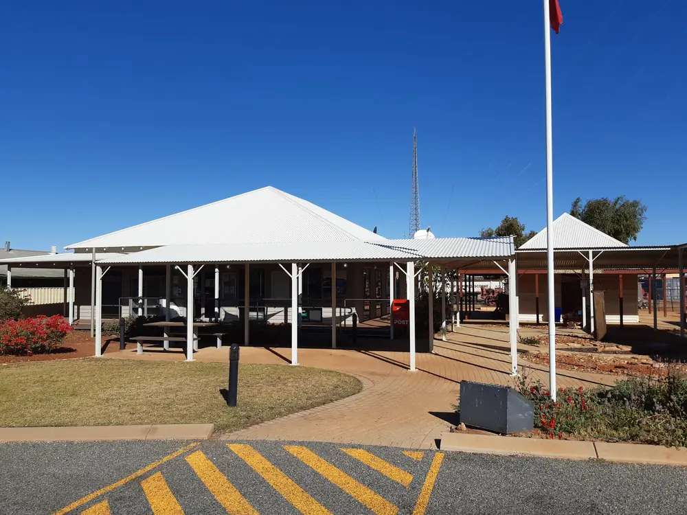
Gascoyne Junction Community Resource CentrePhoto: Calistemon · CC BY-SA 4.0 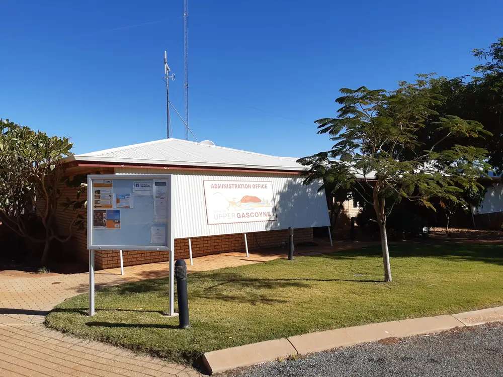
Shire of Upper Gascoyne officePhoto: Calistemon · CC BY-SA 4.0 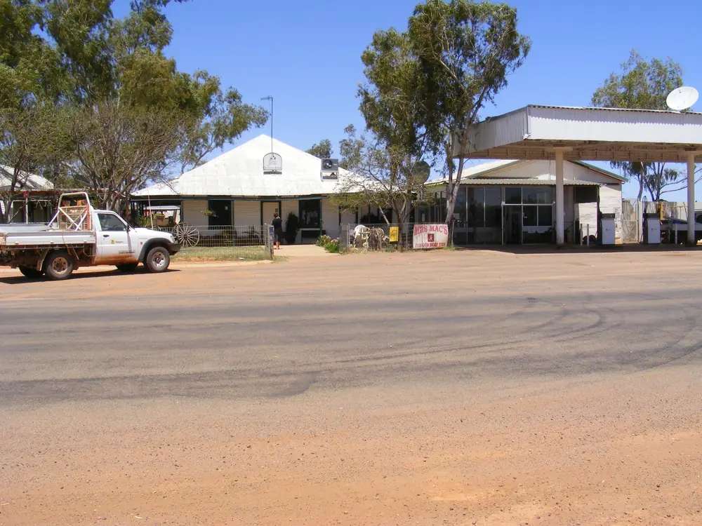
Gascoyne Junction Hotel before the 2010 floodPhoto: Rob McGregor · CC BY 3.0
Gascoyne Junction sits at the meeting of the Gascoyne and Lyons rivers in Western Australia’s inland North West, the administrative hub of the Shire of Upper Gascoyne. Tourism WA, Australia’s Golden Outback and Australia’s Coral Coast put the town a two-hour drive east of Carnarvon. The shire About Us page puts the township 176 km east of Carnarvon. This hub is that inland river-junction town, not a Carnarvon suburb, not a plantation Fruit Loop page, and not a Ningaloo beach guide. Carnarvon is the coastal service town. Perth is the capital; it has no town page here.
Tourism WA’s destination sentence is the geography used here: Mount Augustus is the largest rock on Earth (twice the size of Uluru) and Gascoyne Junction is your gateway to discovering it, with the wildlife-rich canyons of the Kennedy Range and the Kingsford Smith Mail Run or Wool Wagon Pathway. That is a Gascoyne River / Kennedy Range sentence, not a second Carnarvon jetty story and not a wheatbelt town borrowed from Mullewa.
The Australian Bureau of Statistics does not publish a 2021 Urban Centre (UCL) named Gascoyne Junction. Use suburbs-and-localities SAL50530: 65 people, median age 47, sex split 62.5% male / 37.5% female. 16 families, 51 private dwellings. QuickStats notes limited tables because of the small population. Travellers stop for the museum, the river, fuel and a Kennedy Range night. You still need Main Roads WA after rain, because a two-hour run from Carnarvon is no use if the Carnarvon–Mullewa Road is closed.
Where it is, and how far
Gascoyne Junction is the inland Gascoyne settlement on the Carnarvon–Mullewa Road. The shire contact block puts the office 168 km east of the North West Coastal Highway, with the turn-off 12 km north of Carnarvon. Tourism WA: sitting at the meeting point of the Gascoyne and Lyons rivers, following the original trail blazed by transport pioneer Charles Kingsford Smith along the Kingsford Smith Mail Run. From here you can also re-live the adventures of the early pastoral pioneers and Afghan hawkers along the Wool Wagon Pathway.
The shire About Us page: Gascoyne Junction is also where Western Australia’s two longest rivers the Gascoyne and Lyons meet. That river sentence is the town, not a Carnarvon mouth-of-the-river plantation walk.
| Place | Distance from Gascoyne Junction (sourced) |
|---|---|
| Carnarvon | 176 km (shire About Us); 177 km (Road Distances); two hours (Tourism WA, Golden Outback, Coral Coast) |
| Perth via Carnarvon–Mullewa Road | 1,064 km (Road Distances) |
| Perth via Pimbee/Wahroonga Road | 980 km (Road Distances) |
| North West Coastal Highway turn-off | 168 km (shire contact block) |
| Kennedy Range Park | 48 km (Road Distances Mount Augustus route option) |
| Temple Gorge Campground | 56 km north (shire Attractions) |
| Mount Augustus via Cobra/Dairy Creek Road | 288 km (Road Distances) |
| Mount Augustus via Ullawarra Road | 305 km (Road Distances) |
| Mullewa | 500 km (Road Distances) |
| Meekatharra | 452 km (Road Distances) |
Australia’s Coral Coast’s Kennedy Range page puts the park approximately 185 kilometres or 3 hours’ drive east of Carnarvon and 55 km from Gascoyne Junction. Those are different park-from-Carnarvon and park-from-town figures; this hub does not average them with the shire’s 48 km and 56 km sentences.
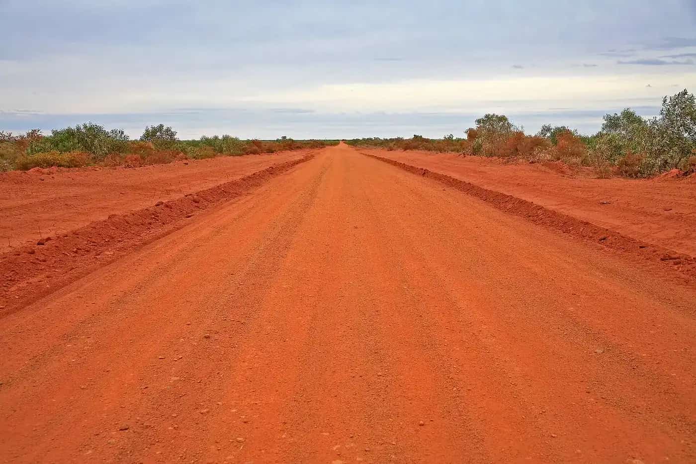
Golden Outback’s Northern Explorer wildflower trail describes a five-and-a-half-hour drive east from Gascoyne Junction to Mount Augustus, with no services on that gravel road and four-wheel-drive recommended. Fill before you leave town.
Facts at a glance
Population. ABS 2021 Census SAL50530: 65 people. Median age 47. Limited tables. Use Gascoyne Junction QuickStats. Local government area LGA58470 Upper Gascoyne: 170 people, median age 37, Aboriginal and/or Torres Strait Islander people 95 (55.9%). The shire About Us page separately describes a shire population of approximately 250. Those are three different geographies; this hub does not pick a favourite.
Climate. Bureau of Meteorology GASCOYNE JUNCTION, 006022, 25.05°S, 115.21°E, elevation 144 m, commenced 1907, status: open, latest available data 10 November 2026. Mean maximum (48 years, 1940–2015): January 40.7 °C, July 23.0 °C, annual 32.0 °C. Mean minimum: February 24.4 °C, July 9.3 °C, annual 16.6 °C. Mean rainfall (97 years, 1907–2026): annual 215.2 mm; June 31.0 mm wettest mean month; September 2.9 mm driest. Mean days of rain ≥ 1 mm: 22.9. This is a hot inland Gascoyne table with a modest winter-rain peak, not a Kimberley Wet. See Gascoyne Junction weather.
Visitor information. Golden Outback names the Gascoyne Junction Community Resource and Visitor Information Centre, 5 Scott Street, (08) 9943 0988, weekdays 8:30 am–4:30 pm (Friday to 3:00 pm). Shire office: 4 Scott Street. Free walking tours from the CRC at 3 pm Monday to Friday from April to September (not public holidays) on the shire Gascoyne Junction page. Roads: Main Roads WA and the shire road report.
Traditional Owners
A Traditional Owner nation named for the Gascoyne Junction townsite was not on the Tourism WA destination page, the Golden Outback Gascoyne Junction page, or the Shire of Upper Gascoyne town and About Us pages fetched for this hub. Parks WA’s Kennedy Range page recognises and acknowledges Yinggarda people as the Traditional Owners of Kennedy Range National Park, jointly managed with the Yinggarda Aboriginal Corporation; the visitor guide is titled Mundatharrda. Australia’s Coral Coast’s Kennedy Range page uses Inggarda for the same park. Tourism WA names the Wadjari Aboriginal people, who call Mount Augustus Burringurrah, for the rock east of town. Those park sentences are not flattened onto the townsite. The shire’s 48-hour itinerary asks visitors to experience being on country with traditional owners without naming a nation on that page. Confirm current wording at the CRC before you treat any label as a townsite acknowledgement. See visiting Country respectfully.
Honeycomb Gorge Trail is a culturally significant site on Parks WA: Yinggarda Traditional Owners respectfully ask that you refrain from taking photos and not touching the sacred wall.
History
Tourism WA and Golden Outback: the nearby town site of Gascoyne Junction was originally proposed in 1897. Today it is a centre for mining, pastoral and desert merino fine wool industries, but relics of its pioneering past can be found in the museum collection, kindly donated by locals from generations gone by.
The shire Gascoyne Junction page: visitors gain an understanding of today’s town as it has rebuilt after the devastation of the 2010 Gascoyne River flood that decimated the town. Golden Outback’s Upper Gascoyne blog repeats that flood rebuild sentence. This is a river-junction and flood-rebuild story, not a gold-rush naming and not a coastal jetty anecdote.
Golden Outback’s Historical Museum listing: housed within the original Road Board Building. It showcases relics from the region’s pastoral history, samples representing the unique geology of the area, and a visual timeline tracing the evolution of communication — from telegraphs and party lines to microwave communications. Address on that listing: 5 Scott Street.
The shire About Us page: the town includes a Remote Community School, a Community Resource Centre, and a sealed air-strip with pilot activated lights used by the Royal Flying Doctor Service.
Things to do
The shire and the destination pages name these in and around Gascoyne Junction:
- Upper Gascoyne / Gascoyne Junction Historical Museum — original Road Board Building, Golden Outback product listing
- Federation Park — Tourism WA pergola for a shady picnic or barbecue; shire playground, pavilion, rotunda, free gas BBQ and wood-fired pizza oven
- Two Rivers Memorial Park and Killili Bridge — shire Gascoyne Junction page
- The Waterhole — shire: swim, birdlife, stars
- Gascoyne River and nearby Lyons River — shire
- Free walking tours — CRC, 3 pm Monday to Friday, April to September
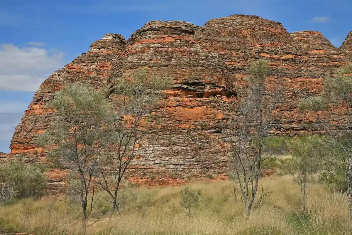
- Kennedy Range National Park — Tourism WA: cliffs rise 100 metres above the Lyons River Valley plain; Parks WA: plateau 75 km long and 12–25 km wide, towers 80 m above the surrounding red earth plain. Those are different official height sentences; this hub does not average them.
- Mount Augustus (Burringurrah) — Tourism WA gateway sentence; shire Road Distances 288–317 km depending on route
Nearby, not a town walk: Temple Gorge, Honeycomb Gorge, Drapers Gorge and Sunrise View are Kennedy Range trailheads on Parks WA — a northbound park day from town. The 49-kilometre scenic base trail around Mount Augustus is a four-wheel drive only circuit on Tourism WA, hours east of the Junction.
See things to do in Gascoyne Junction.
Where to stay
Shire accommodation page: Junction Pub & Tourist Park, (08) 9943 0868, nestled on the banks of the Gascoyne River, the perfect base for exploring Kennedy Range and Mt Augustus National Parks. The tourist park has chalets, caravan and camping sites, a camp kitchen, playground, laundry and swimming pool. Caravan and camping sites offer sunset views with the Kennedy Range as backdrop. Tourism WA: pull into the caravan park, or find an overnight base at a nearby farm or station stay.
Those are official named types, not a ranked motel strip. If the Junction is full, you are still in remote shire country — do not invent a second hotel here.
- How to choose: Gascoyne Junction accommodation
- Camping detail: Gascoyne Junction caravan parks
- Operator enquiries: feature your business
Caravan and camping
Vans use Gascoyne Junction as the inland Gascoyne night before Kennedy Range or Mount Augustus. Official named camping in town is the caravan and camping sites at Junction Pub & Tourist Park. Parks WA names Temple Gorge Campground on the eastern side of Kennedy Range; Tourism WA’s campground listing: basic bush camping, picnic benches and two long drop toilets; no drinking water in the park. Shire Attractions: Temple Gorge is 56 kilometres north of Gascoyne Junction. Ask on arrival for stay limits, dump points and pets. Read Gascoyne Junction caravan parks and outback camping. Do not camp on the riverbank as a free substitute for a named site.
Fuel and services
A locality of 65 people will not match Carnarvon for a hospital. The shire Medical Clinics page: a GP clinic on the first Wednesday of each month and a nursing clinic on the third Wednesday, both at the CRC, thanks to WACHS. Outside those clinics, residents travel to Carnarvon or Meekatharra; in an emergency the RFDS can be called on 1800 625 800. An RFDS Medical Chest is available at the CRC. This is not a 24-hour emergency department.
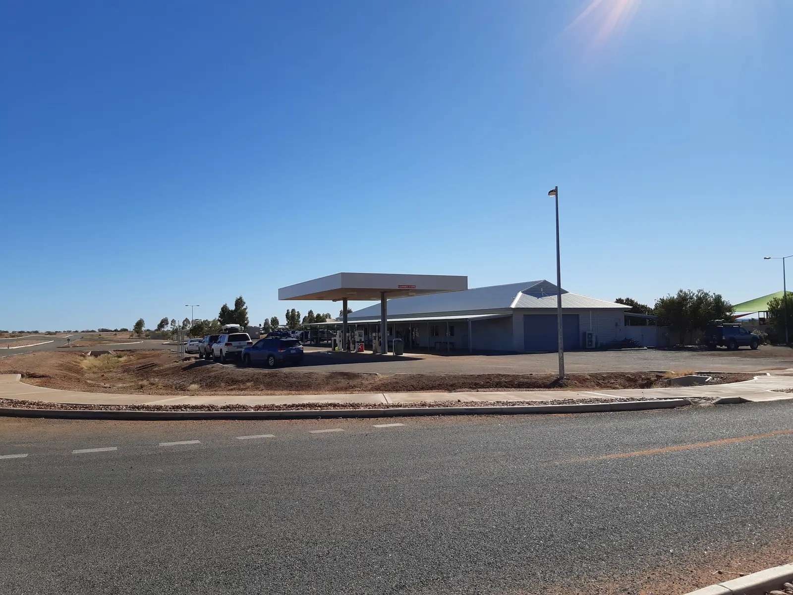
The shire About Us page names Junction Pub & Tourist Park as the main business providing a roadhouse and convenience store along with a pub serving meals seven days a week. This guide does not list a bowser brand or invent clinic hours. Fill in Carnarvon before you leave the coast if you are eastbound, and treat the Junction roadhouse as a confirm-on-arrival bowser before Kennedy Range or Mount Augustus. Golden Outback’s Northern Explorer page: replenish fuel, water and food supplies before leaving Gascoyne Junction for the rock.
Public toilets: shire About Us — next to the Shire Administration Building on Scott Street, and inside the CRC during opening hours. For maps, use the CRC. Roads: Main Roads WA and the shire road report.
Road access
The Carnarvon–Mullewa Road is the sealed spine the shire contact block describes from the North West Coastal Highway turn-off. Tourism WA treats the Kingsford Smith Mail Run as the historic alignment of that inland run. After rain, check Main Roads and the Upper Gascoyne road report. Parks WA: the unsealed road to the Kennedy Range eastern escarpment is usually suitable for two-wheel-drive vehicles; access to the western side via the Gascoyne River is recommended only for high-clearance, high-capability four-wheel drive. Golden Outback’s fuel-and-closures page has separately recorded the Kennedy Range Loop Track closed by river levels — treat that as a check-before-you-go fact, not a permanent closure this hub will timetable.
West: Carnarvon, then the North West Coastal Highway. East and north-east: Kennedy Range, then Mount Augustus on the shire kilometre table. South-east: 500 km to Mullewa on the same Road Distances page — a Wool Wagon Pathway corridor, not a Junction suburb. Meekatharra is 452 km on that table.
Nearby parks and towns
Kennedy Range National Park is the named park on the doorstep. Parks WA: no park entry fee; no dogs; no drinking water; Temple Gorge Campground. Mount Augustus National Park is the further inland rock on Tourism WA’s gateway sentence.
Towns on this site:
- Carnarvon — coastal Gascoyne service town, two hours west
- Exmouth — North West Cape, Ningaloo
- Coral Bay — Ningaloo village in the Shire of Carnarvon
- Denham — Shark Bay
- Mullewa — 500 km on the Carnarvon–Mullewa Road
- Meekatharra — 452 km, a medical alternative the shire names
When to go, and how long
BOM Gascoyne Junction’s January mean maximum of 40.7 °C is a heat problem Parks WA flags for Kennedy Range walks: during the hotter months (at least December–March) temperatures often exceed 40 °C, and each person needs to carry and drink 1 litre of water per hour on trails. July’s 23.0 °C mean maximum and 9.3 °C mean minimum, with June 31.0 mm, is the cooler, slightly wetter winter on a 215.2 mm annual table. The shire: wildflowers carpet the Shire from July to September. Parks WA: spring is a great time to visit the park.
An afternoon covers the museum, Federation Park and a river photograph if those named places are reachable. A night covers fuel, a chalet or van site, and an early start for Temple Gorge. Kennedy Range is a separate park day. Mount Augustus is a separate inland run of 288 km or more. Two full tourist days in the township is more than the sourced main-street list supports unless you are waiting out heat or a closed road.
Operators who want a checked listing: feature your business. The listings slot on this hub stays empty until then.
Plan this trip
Tell us the dates, who you are travelling with and where you need help. We reply with planning notes for Gascoyne Junction — we are not a booking agent.
Events and road-conditions newsletter
Occasional notes on outback festivals, race days and official road-condition sources — not a daily blast. We use these details only to send the newsletter.
Western Australia · North West
Gascoyne Junction accommodation
Where to stay in Gascoyne Junction: the Shire of Upper Gascoyne names Junction Pub & Tourist Park chalets, caravan and camping sites. Tourism WA names a caravan park and nearby station stays. Confirm before you unhitch. Inland Gascoyne, not Carnarvon.
Read · 4 min
Western Australia · North West
Gascoyne Junction caravan parks
Camping in Gascoyne Junction: the Shire of Upper Gascoyne names Junction Pub & Tourist Park caravan and camping sites. Parks WA names Temple Gorge Campground in Kennedy Range. Confirm before you unhitch. Inland Gascoyne, not Carnarvon.
Read · 4 min
Western Australia · North West
Gascoyne Junction weather
Gascoyne Junction climate from BOM Gascoyne Junction (006022): January mean max 40.7 °C, July 23.0 °C, annual rainfall 215.2 mm with June 31.0 mm. Open station. Inland Gascoyne, not a Carnarvon coastal table.
Read · 4 min
Western Australia · North West
Things to do in Gascoyne Junction
Things to do in Gascoyne Junction: Upper Gascoyne Historical Museum, Federation Park, Killili Bridge, the Waterhole, and Kennedy Range National Park. Inland Shire of Upper Gascoyne, not a Carnarvon suburb page.
Read · 4 min
Frequently asked questions
Is Gascoyne Junction a suburb of Carnarvon?
No. This hub is Gascoyne Junction in the Shire of Upper Gascoyne, at the meeting of the Gascoyne and Lyons rivers. Tourism WA, Golden Outback and Australia’s Coral Coast put it a two-hour drive east of Carnarvon. The shire About Us page puts the township 176 km east of Carnarvon. Carnarvon is the coastal Gascoyne service town; it has a town page on this site.
How far is Gascoyne Junction from Perth and Carnarvon?
The Shire of Upper Gascoyne Road Distances page puts Carnarvon 177 km from Gascoyne Junction and Perth 1,064 km via the Carnarvon–Mullewa Road (980 km via Pimbee/Wahroonga Road). The shire About Us page puts the township 176 km east of Carnarvon. Tourism WA and Golden Outback describe a two-hour drive east of Carnarvon.
What is Gascoyne Junction’s population?
65 people at the 2021 Census for suburbs-and-localities SAL50530, median age 47. QuickStats notes limited tables because of the small population. The Shire of Upper Gascoyne local government area counted 170 (LGA58470). The ABS does not publish a 2021 Urban Centre named Gascoyne Junction. The shire About Us page separately describes a shire population of approximately 250.
What is there to do in Gascoyne Junction?
The shire names the Junction Pub & Tourist Park, Upper Gascoyne Historical Museum, Two Rivers Memorial Park, Killili Bridge, Federation Park, the Waterhole, and free walking tours from the CRC at 3 pm Monday to Friday from April to September. Tourism WA and Golden Outback treat the town as the gateway to Kennedy Range National Park and Mount Augustus. Kennedy Range is a nearby park day, not a Carnarvon beach walk.
What is the weather like in Gascoyne Junction?
BOM Gascoyne Junction (006022, open): January mean maximum 40.7 °C, July 23.0 °C, annual rainfall 215.2 mm (97 years, 1907–2026). June is the wettest mean month at 31.0 mm. Temperature means use 48 years (1940–2015). Latest available data 10 November 2026.
Can I camp at Gascoyne Junction?
Yes, as named types. The shire accommodation page names Junction Pub & Tourist Park chalets plus caravan and camping sites, with a camp kitchen, playground, laundry and swimming pool. Parks WA and the shire also name Temple Gorge Campground in Kennedy Range National Park north of town. Confirm on arrival. This hub does not invent extra parks.
Sources and further reading
Facts on this page were checked against these primary and official sources. Conditions change — confirm before you travel or buy.
- Gascoyne Junction 2021 Census QuickStats (SAL50530) — Australian Bureau of Statistics
- Upper Gascoyne 2021 Census QuickStats (LGA58470) — Australian Bureau of Statistics
- Climate statistics for Gascoyne Junction (006022) — Bureau of Meteorology
- Gascoyne Junction — Tourism Western Australia
- Gascoyne Junction — Australia's Golden Outback
- Gascoyne Junction — Australia's Coral Coast
- Gascoyne Junction — Shire of Upper Gascoyne — Shire of Upper Gascoyne
- About Us — Shire of Upper Gascoyne — Shire of Upper Gascoyne
- Road Distances — Shire of Upper Gascoyne — Shire of Upper Gascoyne
- Accommodation — Shire of Upper Gascoyne — Shire of Upper Gascoyne
- Attractions — Shire of Upper Gascoyne — Shire of Upper Gascoyne
- Medical Clinics — Shire of Upper Gascoyne — Shire of Upper Gascoyne
- Gascoyne Junction Historical Museum — Australia's Golden Outback
- Gascoyne Junction Community Resource and Visitor Information Centre — Australia's Golden Outback
- Kennedy Range National Park — Parks and Wildlife Service, DBCA
- Kennedy Range National Park — Australia's Coral Coast
- Main Roads WA travel map — Main Roads Western Australia