At a glance
Sourced facts only. Distances and services change — confirm before you travel.
- Local government
- City of Greater Geraldton
- Traditional Owners
- Southern Yamatji Native Title Claimants, named on the City of Greater Geraldton Welcome to Country guide for the local government area including MullewaConfirm current wording at the Mullewa Visitor Centre. The same guide names Wajarri Yamatji, Mullewa Wadjari and Widi Mob claims overlapping the outer LGA boundary — those are not flattened onto the townsite.
- Nearest regional city
- Geraldton, 98 km east-northeast (City of Greater Geraldton Mullewa page). Australia’s Coral Coast: around 100 km east of Geraldton. Tourism WA: just over one hour’s drive east of Geraldton.
- Capital
- Six-hour drive north of Perth (Tourism WA Mullewa). Mullewa Community Resource Centre: 99 km east of Geraldton and 450 km north of Perth.
- Nearest fuel
- Tourism WA and the City of Greater Geraldton treat Mullewa as a hinterland service town. Confirm the bowser on arrival; this hub does not invent a brand or hours.
- Nearest hospital or clinic
- Mullewa Health Centre (WA Country Health Service Midwest hospitals page), 24-hour emergency care.
- Mobile coverage
- Check Telstra and Optus coverage maps before travel; do not assume a signal off the Geraldton–Mount Magnet Road.
- Best time to visit
- Tourism WA wildflower window July–October; Coral Coast late July to October. Cooler BOM Mullewa mean maxima May–August (July 19.0 °C).
Climate
Monthly means from the Bureau of Meteorology station Mullewa (008095). This is not a forecast. Open station. Temperature 81 years (1925–2026); rainfall 119 years (1896–2026). Latest available data 13 November 2026. Winter-peak rain (June 63.5 mm), Midwest hinterland, not a Kimberley Wet.
| Month | Mean max (°C) | Mean min (°C) | Rainfall (mm) |
|---|---|---|---|
| Jan | 37.0 | 19.6 | 13.2 |
| Feb | 36.6 | 20.3 | 19.1 |
| Mar | 33.8 | 18.6 | 20.4 |
| Apr | 28.9 | 15.2 | 21.1 |
| May | 23.9 | 11.3 | 44.7 |
| Jun | 20.1 | 8.6 | 63.5 |
| Jul | 19.0 | 7.1 | 58.6 |
| Aug | 20.3 | 7.3 | 42.6 |
| Sep | 23.6 | 8.7 | 21.1 |
| Oct | 27.3 | 11.3 | 12.8 |
| Nov | 31.2 | 14.5 | 9.0 |
| Dec | 34.6 | 17.2 | 8.4 |
Mullewa in pictures
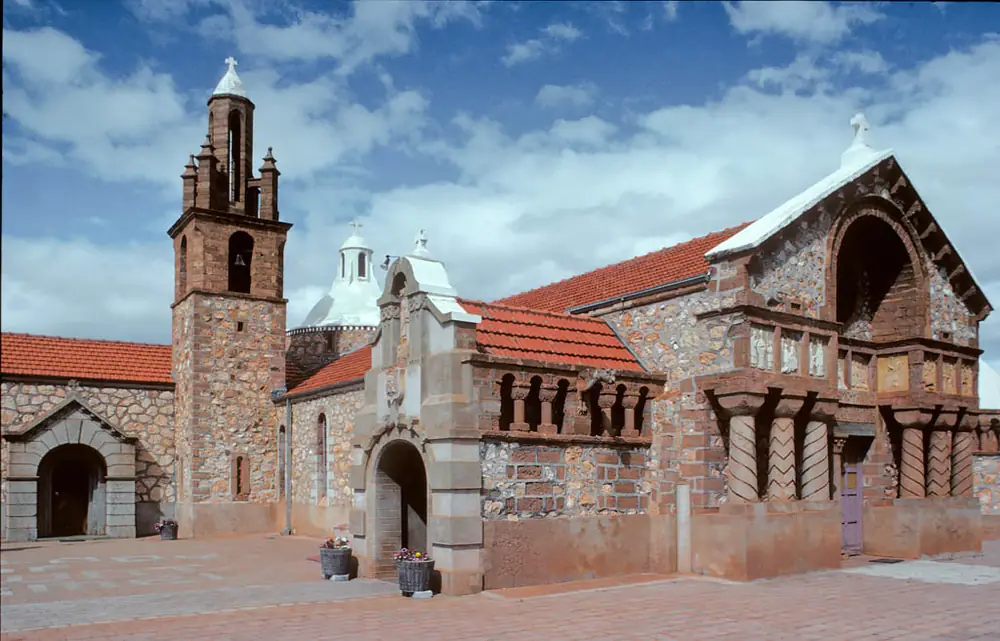
Our Lady of Mount Carmel church, MullewaPhoto: Michal Lewi · CC BY-SA 4.0 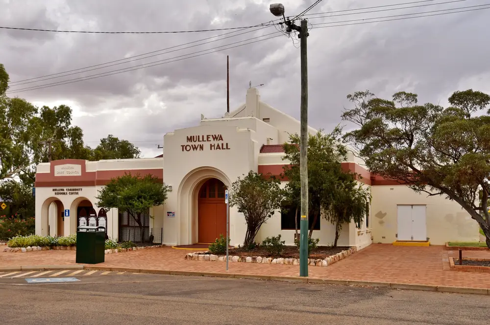
Mullewa Town HallPhoto: Bahnfrend · CC BY-SA 4.0 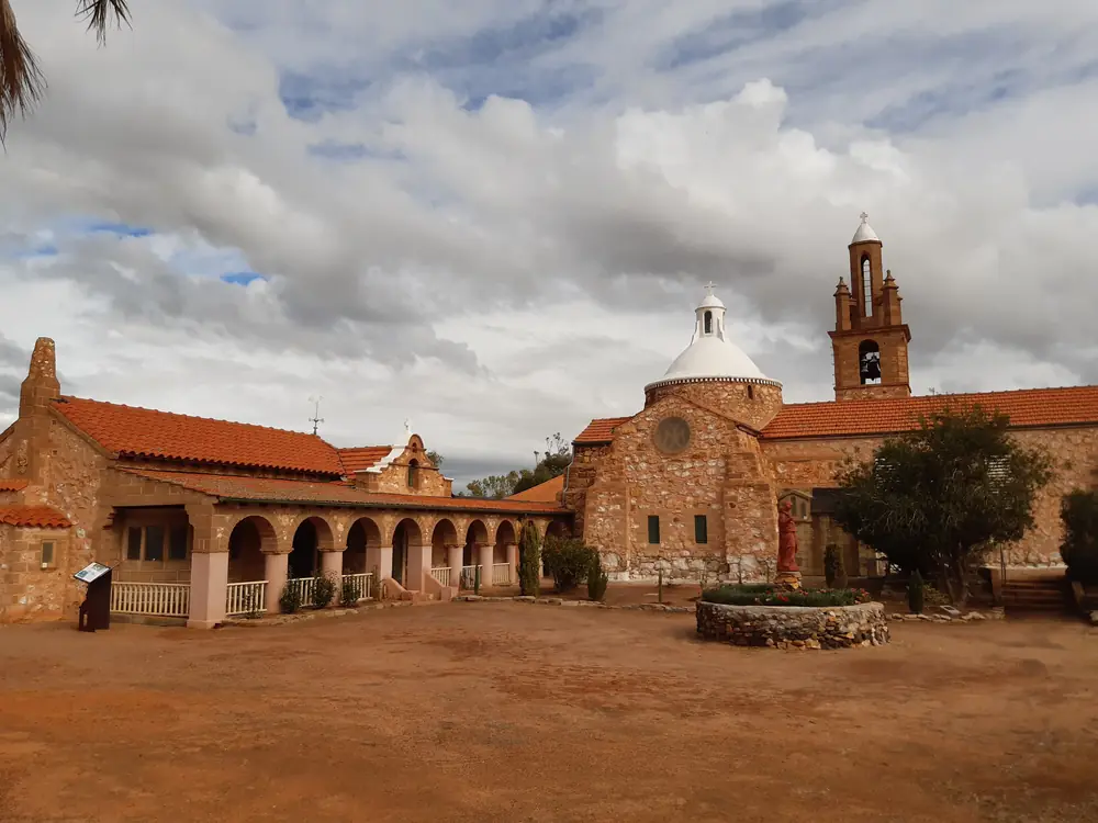
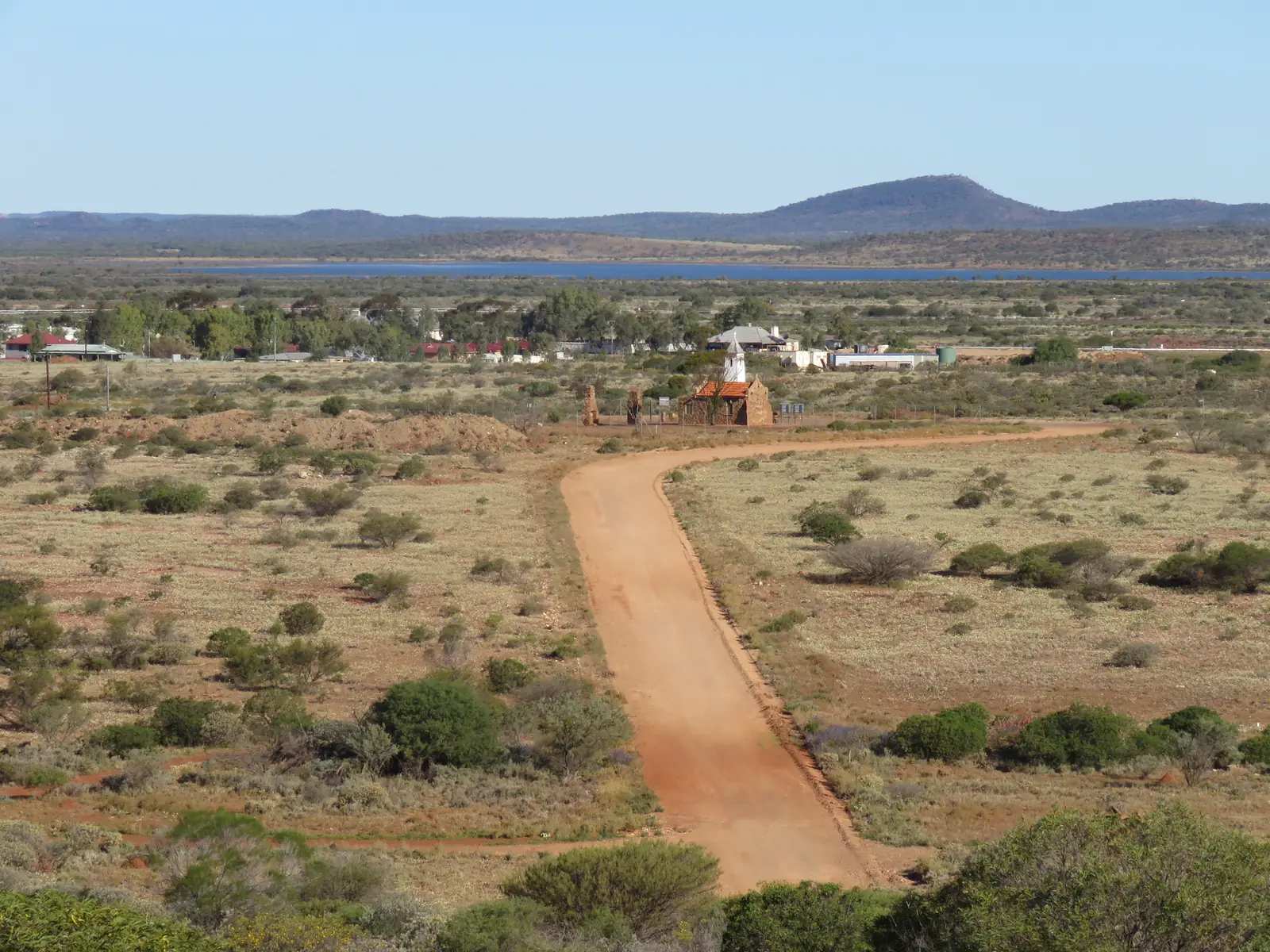
Priest House and church, MullewaPhoto: Calistemon · CC BY-SA 4.0 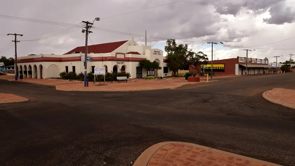
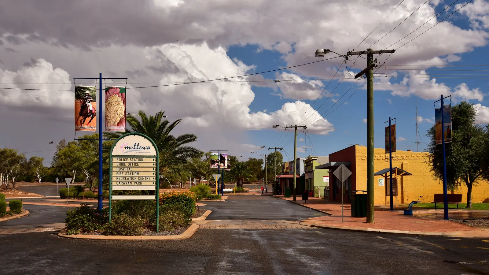
Maitland Road, MullewaPhoto: Bahnfrend · CC BY-SA 4.0
Mullewa sits in the Midwest hinterland east of Geraldton, inside the City of Greater Geraldton, on the sealed Geraldton–Mount Magnet Road toward Yalgoo. Tourism WA puts the town a six-hour drive north of Perth and just over one hour’s drive east of Geraldton. Australia’s Coral Coast files it in Wildflower Country, around 100 km east of Geraldton. This site’s inventory region is the Golden Outback, because that is how the neighbour towns Yalgoo, Paynes Find and Mount Magnet are grouped here — not because Mullewa is a Goldfields gold town. This hub is the Geraldton hinterland wildflower and Hawes town, not a coastal Geraldton page and not a second Yalgoo chapel page.
Tourism WA’s destination sentence is the geography used here: Mullewa celebrates an annual wildflower show and the legacy of architect-priest Monsignor John Hawes. That is a Midwest wildflower sentence, not a Gascoyne river-junction story borrowed from Gascoyne Junction.
The Australian Bureau of Statistics publishes a 2021 Urban Centre Mullewa (L), UCL522049: 312 people, median age 45, sex split 51.6% male / 48.4% female. 53 families, 207 private dwellings. Suburbs-and-localities SAL51049: 356 people. Travellers stop for wreath flowers, the church, and a night before Yalgoo. You still need Main Roads WA after rain, because a hinterland hour from Geraldton is no use if the unsealed Pindar road is closed.
Where it is, and how far
Mullewa is the eastern Geraldton hinterland settlement on the Geraldton–Mount Magnet Road. The Mullewa Community Resource Centre: located at the junction of a number of significant transport routes. The Geraldton–Mount Magnet Road connects Geraldton with the mining and pastoral regions of Yalgoo, Mount Magnet, Cue and Meekatharra. The Mullewa–Wubin Road heads south-east through Morawa and Perenjori. South is the 90 km Mullewa–Mingenew Road. The Carnarvon–Mullewa Road travels north through the Murchison Settlement and Gascoyne Junction. Golden Outback places Yalgoo on that Geraldton–Mount Magnet Road, east of Mullewa.
| Place | Distance or time from Mullewa (sourced) |
|---|---|
| Geraldton | 98 km east-northeast (City of Greater Geraldton); around 100 km east (Coral Coast); 99 km east (Mullewa CRC); just over one hour (Tourism WA) |
| Perth | six-hour drive north (Tourism WA); 450 km north (Mullewa CRC) |
| Pindar (wreath flowers) | 30 km east, then 10 km north on the Pindar–Berringarra Road, unsealed (Coral Coast) |
| Waterfall picnic spot | 7 km east (Tourism WA) |
| Mingenew (via Mullewa–Mingenew Road) | 90 km (Mullewa CRC) |
| Yalgoo | east on the Geraldton–Mount Magnet Road (Golden Outback); a kilometre figure was not on the sourced Mullewa town pages |
| Gascoyne Junction | 500 km from Gascoyne Junction on the Shire of Upper Gascoyne Road Distances page |
A separate Mullewa–Yalgoo kilometre was not on the Tourism WA, Coral Coast or City of Greater Geraldton town pages fetched here, so this hub does not invent one. Use Yalgoo’s own hub for that town’s Perth figure.
Facts at a glance
Population. ABS 2021 Census UCL522049: 312 people. Median age 45. Use Mullewa (L) QuickStats. SAL51049: 356 people, median age 45. The Mullewa CRC separately describes a district population of approximately 450, with 60 percent living within the town — CRC wording, not a Census geography.
Climate. Bureau of Meteorology MULLEWA, 008095, 28.54°S, 115.51°E, elevation 268 m, commenced 1896, status: open, latest available data 13 November 2026. Mean maximum (81 years, 1925–2026): January 37.0 °C, July 19.0 °C, annual 28.0 °C. Mean minimum: February 20.3 °C, July 7.1 °C, annual 13.3 °C. Mean rainfall (119 years, 1896–2026): annual 331.3 mm; June 63.5 mm wettest mean month; December 8.4 mm driest. Mean days of rain ≥ 1 mm: 43.6. This is a Midwest winter-rain table, not a Kimberley Wet. See Mullewa weather.
Visitor information. Mullewa Visitor Centre at the Community Resource Centre, corner of Maitland and Jose Streets, next to the Town Hall. CRC: Monday to Friday 9 am–3 pm, with Saturday and Sunday opening during wildflower season (August and September). Phone (08) 9961 1500. If closed, the Mullewa District Office is on the corner of Thomas and Padbury Streets, (08) 9956 6643. Tourism WA’s visitor-centre listing: open seven days during August and September. Roads: Main Roads WA.
Traditional Owners
The City of Greater Geraldton Welcome to Country guide (September 2025) names the Southern Yamatji Native Title Claimants for the local government area, including the major population centres of Mullewa and Geraldton (claim WAD 6002 of 2004). The same guide names Wajarri Yamatji, Mullewa Wadjari and Widi Mob claims overlapping the outer local government area boundaries — those outer-boundary sentences are not flattened onto the townsite. Australia’s Coral Coast’s Bushland Trail page says interpretation signage focuses on natural heritage and indigenous culture without naming a nation. Confirm current wording at the Visitor Centre. City of Greater Geraldton also names Redland Roses, a flower-growing venture run by the local Aboriginal Corporation, and an Aboriginal Art Workshop and Gallery. See visiting Country respectfully.
History
Tourism WA: the town is blessed with an enchanting church designed and built by Mullewa’s most famous resident, Catholic priest and architect Monsignor John Hawes. Following the four-day Monsignor Hawes Heritage Trail, you will find 15 fine works that dot the landscape from Geraldton and Northampton to Yalgoo, Morawa and Perenjori. Or, for a shorter walk, the 500-metre Hawes Heritage Trail on foot.
City of Greater Geraldton: the Church of Our Lady of Mount Carmel and the Holy Apostles St Peter and St Paul is a striking Romanesque-style church, designed and largely built by Hawes — architect, foreman and labourer — an attempt to recreate a village church typical of Italy and Spain. The Priest House next door was completed in 1927 and is now a museum. Mullewa Town Hall was built in 1935 in art-deco style. Saint Andrews Anglican Church is a stone building on Padbury Street.
The CRC: the railway from Mullewa toward the Murchison is the historic spine Golden Outback still uses for Yalgoo — Yalgoo’s own hub records the railway from Mullewa opening in 1898. Mullewa also marks the finishing line on Tourism WA for the De Grey Stock Route, following early stockmen from Port Hedland. Coral Coast: the trail was first gazetted in 1905.
This is a wheat-and-wildflower hinterland founding with a Hawes skyline, not a Nullarbor roadhouse story and not a Kennedy Range gorge town.
Things to do
Tourism WA, Coral Coast and the City of Greater Geraldton name these in and around Mullewa:
- Wreath flower / Wreath Leschenaultia — Coral Coast: drive 30 km east to Pindar, then 10 km north on the unsealed Pindar–Berringarra Road; bloom August–October, September often optimal. Pull off the road, not onto the flowers.
- Everlastings Wildflower Trail — Tourism WA, July to October
- Mullewa Annual Wildflower Show — Tourism WA late August; Coral Coast every September; City of Greater Geraldton: four-day celebration, over 200 species, entry $5 adults, $3 pensioners/children, children under five free
- Wildflower Walk — Tourism WA starting at Lovers Lane; Coral Coast begins opposite the caravan park
- Coalseam Conservation Park — Tourism WA spring picnic; nearby, not the main street
- Church of Our Lady of Mount Carmel and Priest House Museum — Hawes
- Hawes Heritage Trail — 500 m on foot; four-day drive taking in Yalgoo
- Mullewa Bushland Trail — Coral Coast 2.3 km loop from the Scenic Lookout
- Town Heritage Walk and Rail Heritage Loop — Coral Coast
- Northern Loop and Southern Circuit wildflower trails — Coral Coast; 2WD with care on unsealed sections
- Bindoo Hill — Coral Coast glacial moraine
- Waterfall — Tourism WA seven kilometres east
- Mullewa Scenic Lookout, Mass Rock, Pioneer Cemetery, Butterabby Grave — City of Greater Geraldton
- Mullewa Muster and Rodeo — late May or early June on the City page
- Mullewa Agricultural Show — late August or early September
Nearby, not in-town: Yalgoo Dominican Chapel of St Hyacinth is the next Hawes stop east. Coalseam is a conservation park on the Coral Coast trail list, not a Mullewa block.
Where to stay
Tourism WA: make Mullewa your base and book into the hotel, motel, caravan park, bed and breakfast or a nearby farm/station stay. Visit Geraldton lists Mullewa Caravan Park on Lovers Lane, operated by the City of Greater Geraldton, (08) 9956 6643 during office hours, check-in after 11 am. Those are official named types, not a ranked motel strip. If Mullewa is full, Yalgoo is the next named hinterland town on this site to the east.
- How to choose: Mullewa accommodation
- Camping detail: Mullewa caravan parks
- Operator enquiries: feature your business
Caravan and camping
Vans use Mullewa as a Midwest wildflower night, or the last hinterland night before Yalgoo. Official named camping is Mullewa Caravan Park on Lovers Lane, directly opposite the Wildflower Walk on Visit Geraldton’s listing, with powered sites and unpowered overflow across the road by the Sports Club. Ask on arrival for stay limits, dump points and pets. Read Mullewa caravan parks and outback camping. Do not camp on the wreath-flower verges at Pindar.
Fuel and services
A town of 312 in the urban centre still has a named health service. WA Country Health Service Midwest hospitals page: Mullewa Health Centre, 24-hour emergency care, plus allied health, community health, PATS and telehealth. This guide does not list a bowser brand or invent clinic hours. Fill in Geraldton before you leave the coast if you are eastbound toward Yalgoo, and treat Mullewa as a confirm-on-arrival bowser.
For maps, use the Mullewa Visitor Centre. The CRC notes TransWA operates a regular bus service to Mullewa — check TransWA for the current timetable rather than treating this hub as a bus guide. Roads: Main Roads WA.
Road access
The Geraldton–Mount Magnet Road is the sealed spine the CRC and Golden Outback name through Mullewa toward Yalgoo. Most of the Carnarvon–Mullewa Road between Mullewa and Murchison Settlement is now sealed on the CRC getting-here paragraph. Unsealed roads, including the Pindar wreath-flower spur, can be affected by weather — the CRC: check before you travel, carry water, let someone know where you are going. After rain, Main Roads WA.
West: Geraldton. East: Yalgoo, then Mount Magnet, Cue and Meekatharra. North: Carnarvon–Mullewa Road toward Gascoyne Junction. South-east: Mullewa–Wubin Road through Morawa and Perenjori on the Hawes drive Tourism WA names. Perenjori has no town page here. South: Mingenew on the Mullewa–Mingenew Road (90 km on the Mullewa CRC).
Nearby parks and towns
Coalseam Conservation Park is the named Parks-style picnic on Tourism WA and Coral Coast, a spring everlasting stop, not inside the townsite. Explore Parks WA did not return a national park inside Mullewa townsite in this research.
Towns on this site:
- Yalgoo — next Hawes and Murchison town east
- Paynes Find — shire partner of Yalgoo on Golden Outback
- Mount Magnet — further east on the Geraldton–Magnet road
- Cue — Murchison gold town further on
- Gascoyne Junction — 500 km on the Carnarvon–Mullewa Road from the Junction’s own table
- Mingenew — 90 km on the Mullewa–Mingenew Road (Mullewa CRC)
- Morawa — Mullewa–Wubin Road / Hawes drive
- Northampton — Midwest heritage town north of Geraldton
When to go, and how long
BOM Mullewa’s January mean maximum of 37.0 °C is hot for a church-and-lookout walk at midday. July’s 19.0 °C mean maximum and 7.1 °C mean minimum, with June 63.5 mm, is the cool, wetter winter on a 331.3 mm annual table — the rain that Tourism WA’s July–October wildflower window depends on. Coral Coast: blaze of colour from late July to October. CRC: late July to September. City of Greater Geraldton: late winter and spring. Those official windows overlap; this hub does not pick a single peak week.
A morning covers the church exterior, Priest House if open, and the lookout. A day covers a wildflower drive if the Visitor Centre says the wreath flower is out. A night at the caravan park lets you add the Bushland Trail at a sane hour. Two nights only if the Wildflower Show, Muster or Agricultural Show is actually running. See Mullewa weather.
Operators who want a checked listing: feature your business. The listings slot on this hub stays empty until then.
Plan this trip
Tell us the dates, who you are travelling with and where you need help. We reply with planning notes for Mullewa — we are not a booking agent.
Events and road-conditions newsletter
Occasional notes on outback festivals, race days and official road-condition sources — not a daily blast. We use these details only to send the newsletter.
Western Australia · Golden Outback
Mullewa accommodation
Where to stay in Mullewa: Tourism WA names a hotel, motel, caravan park, bed and breakfast and farm or station stay. Visit Geraldton lists Mullewa Caravan Park on Lovers Lane. Confirm before you unhitch. Midwest hinterland, not Geraldton.
Read · 3 min
Western Australia · Golden Outback
Mullewa caravan parks
Camping in Mullewa: Visit Geraldton names Mullewa Caravan Park on Lovers Lane, City of Greater Geraldton operator, powered and unpowered overflow. Confirm before you unhitch. Midwest hinterland, not Geraldton.
Read · 3 min
Western Australia · Golden Outback
Mullewa weather
Mullewa climate from BOM Mullewa (008095): January mean max 37.0 °C, July 19.0 °C, annual rainfall 331.3 mm with June 63.5 mm. Open station. Midwest hinterland, not a Geraldton coastal table.
Read · 4 min
Western Australia · Golden Outback
Things to do in Mullewa
Things to do in Mullewa: wreath flowers at Pindar, Monsignor Hawes church and Priest House, Wildflower Walk, Coalseam, Muster and Agricultural Show. Midwest hinterland, not a Geraldton beach page.
Read · 4 min
Frequently asked questions
How far is Mullewa from Geraldton and Perth?
The City of Greater Geraldton Mullewa page puts the town 98 km east-northeast of Geraldton. Australia’s Coral Coast says around 100 km east of Geraldton. Tourism WA: a six-hour drive north of Perth and just over one hour’s drive east of Geraldton. The Mullewa Community Resource Centre: 99 km east of Geraldton and 450 km north of Perth.
What is Mullewa’s population?
312 people at the 2021 Census for the urban centre Mullewa (L), UCL522049, median age 45. Suburbs-and-localities SAL51049 counted 356. The Mullewa Community Resource Centre separately describes a district population of approximately 450, with 60 percent living within the town — that is CRC wording, not a Census geography.
What is there to do in Mullewa?
Tourism WA names the annual wildflower show, the Everlastings Wildflower Trail from July to October, the wreath flower, Coalseam Conservation Park, Monsignor John Hawes’ church and heritage trails, the De Grey Stock Route finishing line, and a natural waterfall seven kilometres east. Australia’s Coral Coast adds Pindar wreath flowers, the Northern Loop and Southern Circuit, and the 2.3 km Bushland Trail.
What is the weather like in Mullewa?
BOM Mullewa (008095, open): January mean maximum 37.0 °C, July 19.0 °C, annual rainfall 331.3 mm (119 years, 1896–2026). June is the wettest mean month at 63.5 mm. Temperature means use 81 years (1925–2026). Latest available data 13 November 2026.
Can I camp at Mullewa?
Yes, as named types. Tourism WA names a hotel, motel, caravan park, bed and breakfast and nearby farm or station stay. Visit Geraldton lists Mullewa Caravan Park on Lovers Lane, operated by the City of Greater Geraldton, with powered and unpowered sites. Confirm on arrival. This hub does not invent extra parks.
Whose Country is Mullewa on?
The City of Greater Geraldton Welcome to Country guide names the Southern Yamatji Native Title Claimants for the local government area including Mullewa and Geraldton. Confirm current wording at the Mullewa Visitor Centre. This hub does not flatten overlapping outer-boundary claims onto the townsite.
Sources and further reading
Facts on this page were checked against these primary and official sources. Conditions change — confirm before you travel or buy.
- Mullewa (L) 2021 Census QuickStats (UCL522049) — Australian Bureau of Statistics
- Mullewa 2021 Census QuickStats (SAL51049) — Australian Bureau of Statistics
- Climate statistics for Mullewa (008095) — Bureau of Meteorology
- Mullewa — Tourism Western Australia
- Mullewa — Australia's Coral Coast
- Mullewa — City of Greater Geraldton — City of Greater Geraldton
- About Mullewa — Mullewa Community Resource Centre — Mullewa Community Resource Centre
- Mullewa Community Resource and Visitor Centre — Tourism Western Australia
- Mullewa Caravan Park — Visit Geraldton
- Midwest hospitals and health services — WA Country Health Service
- Welcome to Country — City of Greater Geraldton
- Yalgoo and Paynes Find — Australia’s Golden Outback — Australia's Golden Outback
- Main Roads WA travel map — Main Roads Western Australia