At a glance
Sourced facts only. Distances and services change — confirm before you travel.
- Population
- 798 people in the urban centre (UCL521028, 2021 Census); 877 in the wider locality (SAL50747)
- Local government
- Shire of Kellerberrin
- Traditional Owners
- Njaki Njaki Nyoongar (Central Wheatbelt Visitor Centre Welcome to Country page, which names Kellerberrin on Njaki Njaki traditional lands)Confirm current wording with the Shire visitor information office.
- Nearest regional city
- West of Merredin on the Great Eastern Highway (this site’s Merredin hub). A Kellerberrin–Merredin kilometre was not on the sourced town pages.
- Capital
- 2.5-hour drive east of Perth along the Great Eastern Highway (Tourism WA). Golden Outback: two and a half hour drive from Perth along the Goldfields Trail.
- Nearest fuel
- Golden Outback names a roadhouse/motel as a stay type. Confirm the bowser on arrival; this hub does not invent a brand or hours.
- Mobile coverage
- Check Telstra and Optus coverage maps before travel; do not assume a signal on granite picnic spurs or Durokoppin.
- Best time to visit
- Tourism WA: August–November wildflowers at Durokoppin Reserve. Cooler BOM Kellerberrin mean maxima May–September; July mean maximum 16.4 °C.
Climate
Monthly means from the Bureau of Meteorology station Kellerberrin (010073). This is not a forecast. Open station. Temperature 101 years (1910–2020) for maxima; rainfall 127 years (1892–2026). Latest available data 4 November 2026. Winter-peak rain (June 52.0 mm). Do not blend with Merredin 010092.
| Month | Mean max (°C) | Mean min (°C) | Rainfall (mm) |
|---|---|---|---|
| Jan | 34.0 | 16.9 | 13.2 |
| Feb | 33.3 | 16.9 | 15.1 |
| Mar | 30.3 | 15.2 | 21.9 |
| Apr | 25.6 | 11.7 | 21.4 |
| May | 20.8 | 8.4 | 40.3 |
| Jun | 17.5 | 6.7 | 52.0 |
| Jul | 16.4 | 5.7 | 50.7 |
| Aug | 17.6 | 5.5 | 41.7 |
| Sep | 20.7 | 6.4 | 25.5 |
| Oct | 24.7 | 8.8 | 18.3 |
| Nov | 29.0 | 12.3 | 12.7 |
| Dec | 32.0 | 15.0 | 12.8 |
Kellerberrin in pictures
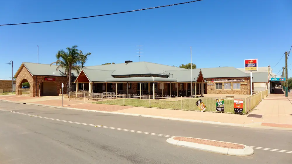
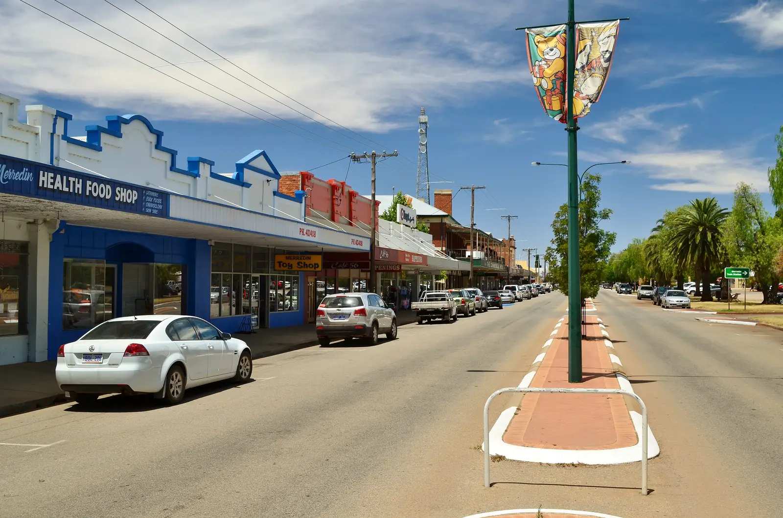
Kellerberrin Motor HotelPhoto: Bahnfrend · CC BY-SA 4.0 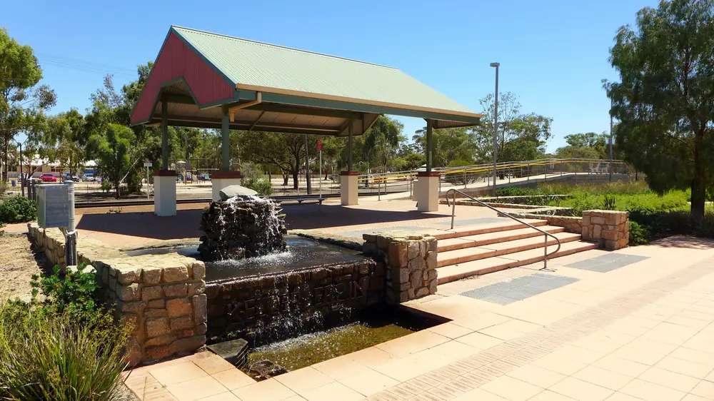
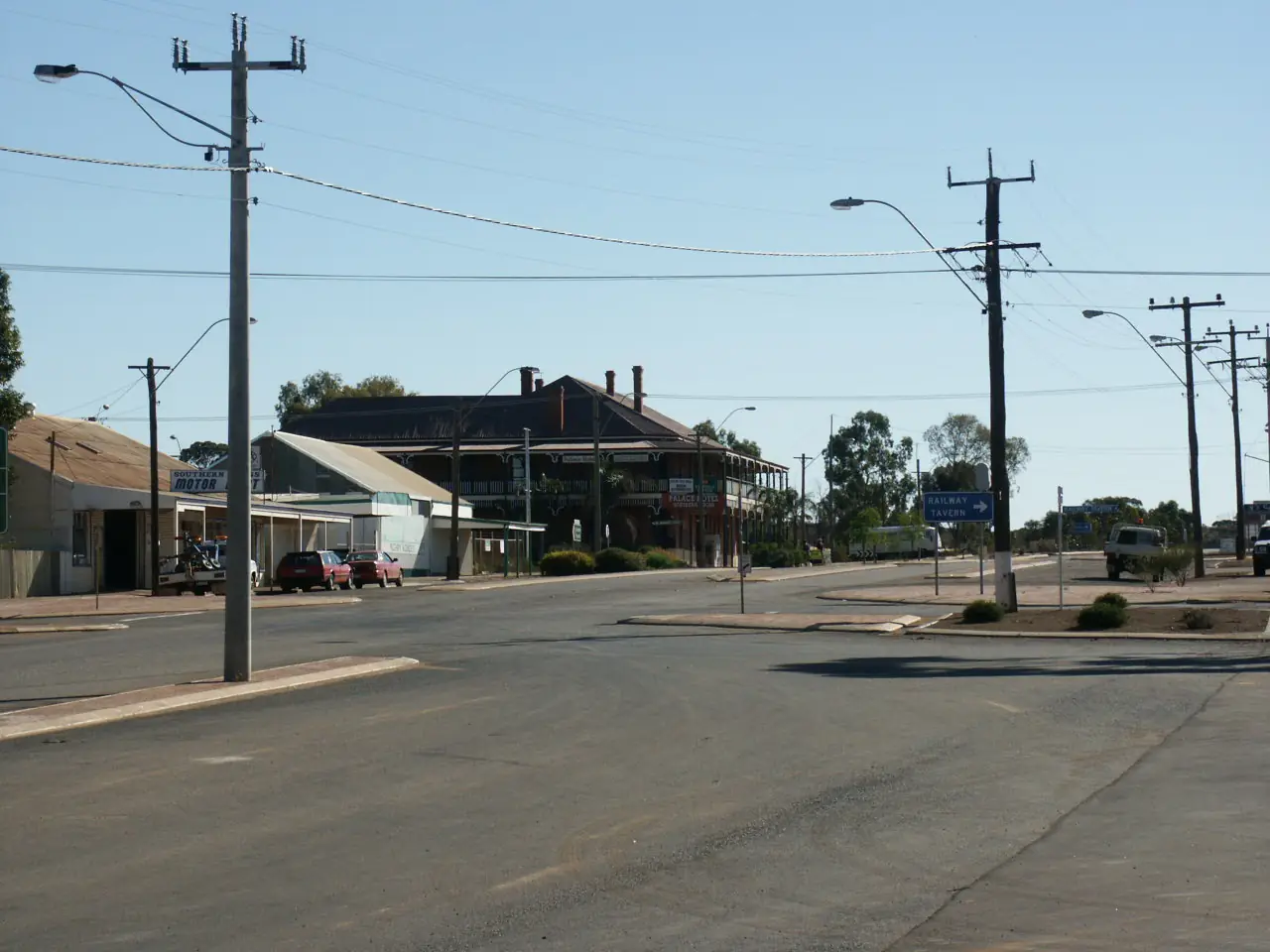
Kellerberrin railway stationPhoto: Bahnfrend · CC BY-SA 4.0 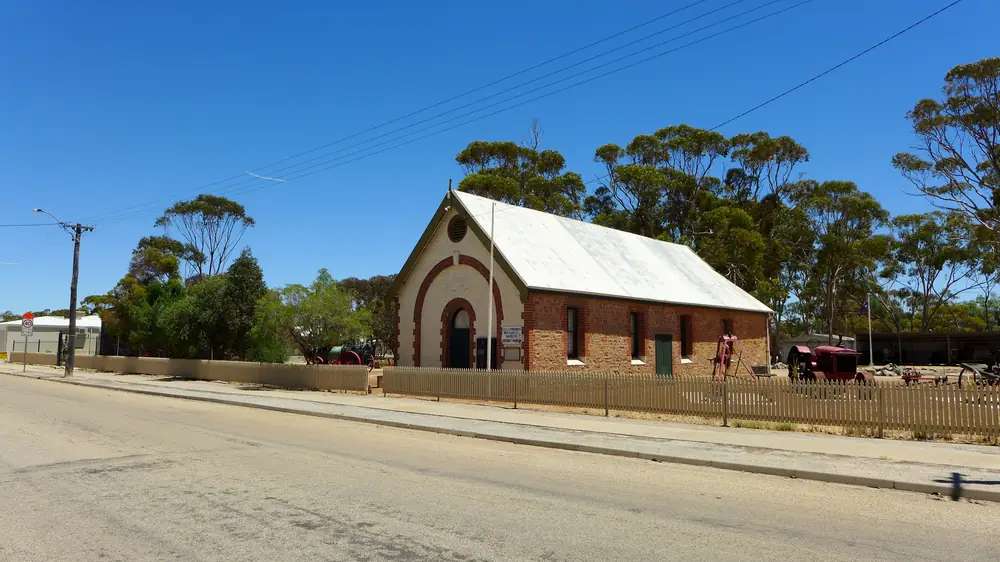
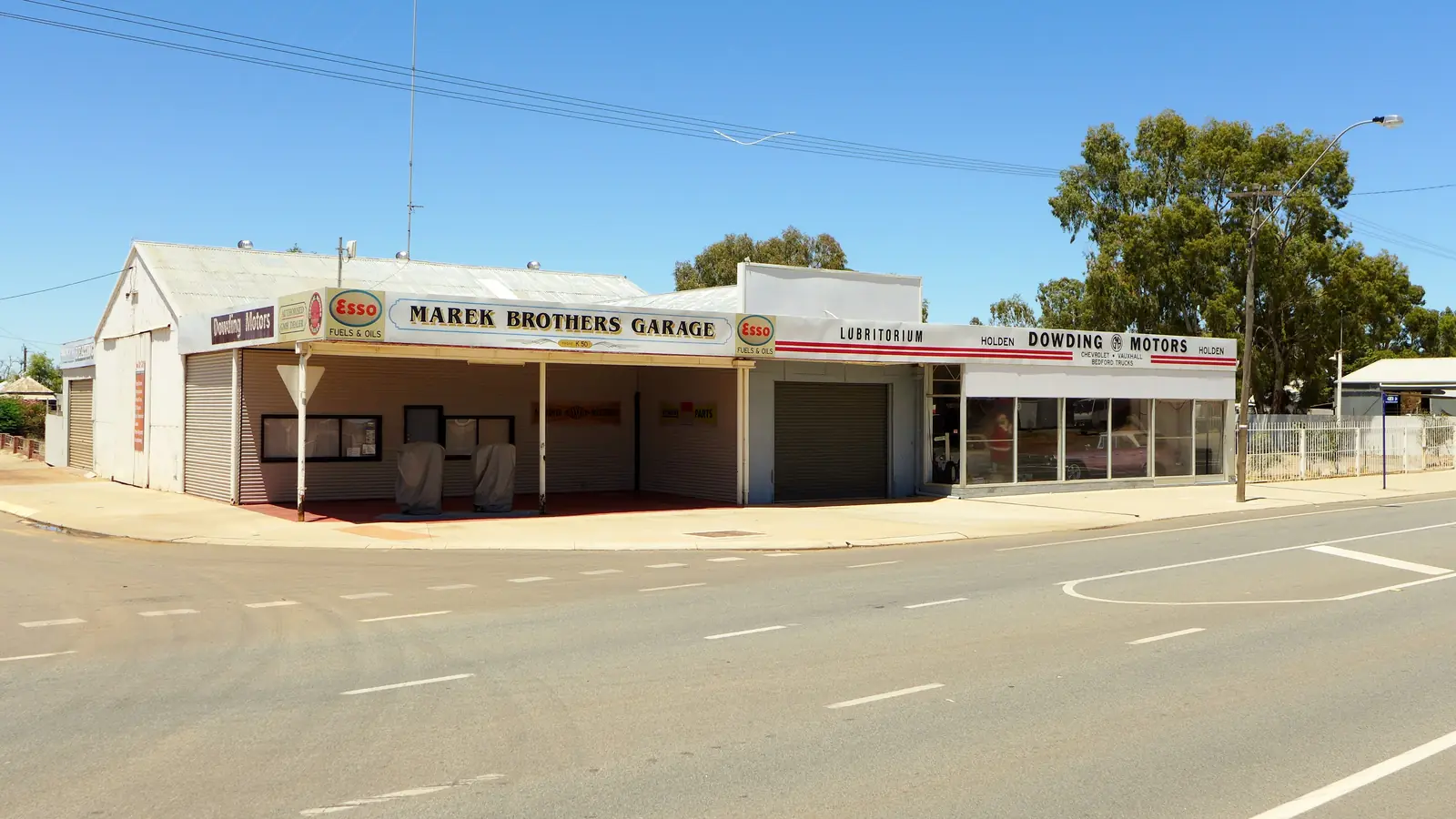
Kellerberrin District MuseumPhoto: Bahnfrend · CC BY-SA 4.0 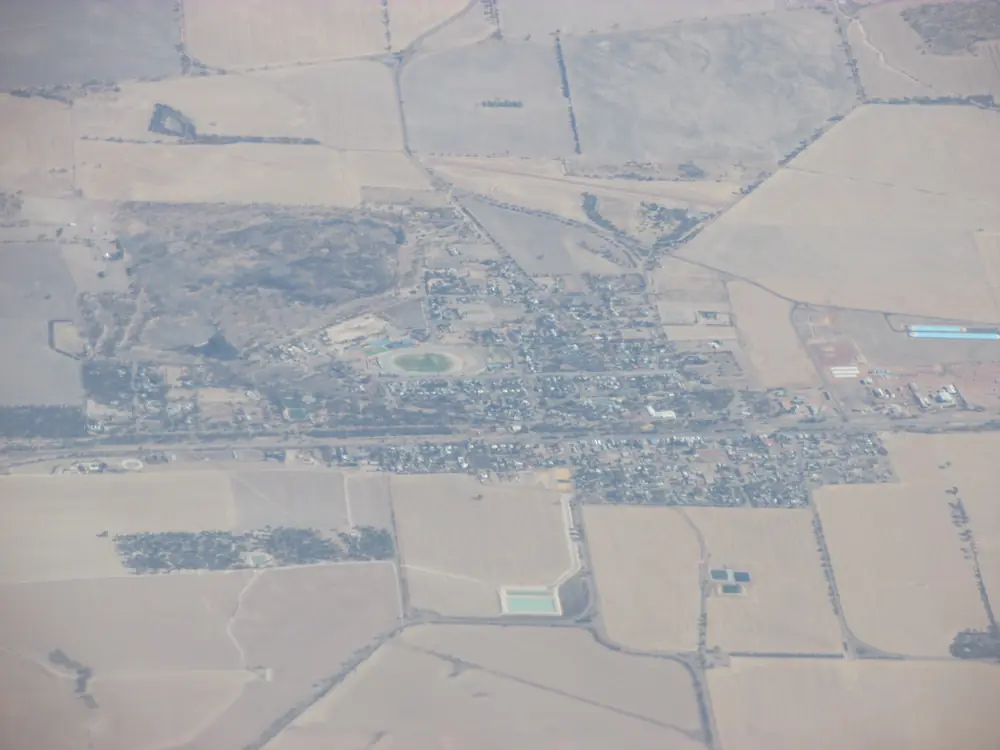
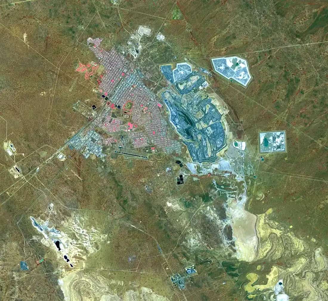
Aerial view of KellerberrinPhoto: Orderinchaos · CC BY-SA 4.0
Kellerberrin sits on the Great Eastern Highway in Western Australia’s Golden Outback, west of Merredin, inside the Shire of Kellerberrin. Tourism WA: only a 2.5-hour drive east of Perth along the highway. Golden Outback: two and a half hour drive from Perth along the Goldfields Trail. Tourism WA also places it as one of the first must-stops along the 650-kilometre Golden Pipeline Heritage Trail. This hub is that Wheatbelt pipeline town — not Merredin’s larger CBH centre, not a Southern Cross Goldfields-edge reprint, and not a New South Wales namesake. Perth is the capital; it has no town page here.
Golden Outback’s industry sentence is the hinge used here: wheat and sheep farming and the manufacture of agricultural equipment are the region’s main industries. That is a farm-and-pipeline story, not a 600,000-tonne silo statistic borrowed from Merredin and not a gold-rush streetscape borrowed from Coolgardie.
The ABS publishes two 2021 geographies. Use urban centre Kellerberrin (L) UCL521028: 798 people, median age 53, sex split 49.8% male / 50.2% female. Suburbs-and-localities SAL50747 counted 877, median age 53, Aboriginal and/or Torres Strait Islander people 81 (9.2%). 188 families and 424 private dwellings on the UCL; 213 families and 464 dwellings on the SAL. The Shire LGA54410 counted 1,138. Do not mix them. Travellers stop for the Folk Museum, Kellerberrin Hill and a highway night. You still need Main Roads WA after rain.
Where it is, and how far
Kellerberrin is the Great Eastern Highway town west of Merredin. Tourism WA’s Golden Pipeline wording is the corridor used here: the trail follows the path of the Goldfields water scheme. The Shire attractions page: in the 1890s CY O’Connor engineered a pipeline to carry fresh water from Mundaring Weir to the arid goldfields, some 560 km to the east — print that kilometre beside Tourism WA’s 650-kilometre trail figure; they are different wordings. Discover pipeline sites at Kellerberrin Hill Lookout and Old Doodlakine town site on the Shire page.
| Place | Distance from Kellerberrin (sourced) |
|---|---|
| Perth | 2.5 hours / two and a half hours (Tourism WA; Golden Outback) |
| Lake Baandee | 25 km east off the Great Eastern Highway (Shire attractions) |
| Kokerbin Rock | 30 km south (Shire attractions) |
| Durokoppin Wildlife Sanctuary | 27 km north (Shire attractions) |
| Mount Caroline and Mount Stirling | 22 km south (Shire attractions) |
| Charles Gardner Nature Park | 35 km south-west (Shire attractions) |
| Caravan park | 404 George Street (Shire caravan-park page) |
A Kellerberrin–Merredin or Kellerberrin–Perth kilometre was not on those sourced town pages, so this hub does not invent one.
Facts at a glance
Population. ABS 2021 Census Urban Centres UCL521028: 798 people. Median age 53. 188 families, 424 private dwellings. Average household 2.1. SAL SAL50747: 877 people. Use the UCL QuickStats for the town.
Climate. Bureau of Meteorology KELLERBERRIN, 010073, 31.62°S, 117.72°E, elevation 250 m, commenced 1892, status: open, latest available data 4 November 2026. Mean maximum (101 years, 1910–2020): January 34.0 °C, July 16.4 °C, annual 25.2 °C. Mean minimum (100 years, 1910–2020): January and February 16.9 °C, August 5.5 °C, annual 10.8 °C. Mean rainfall (127 years, 1892–2026): annual 326.5 mm; June 52.0 mm wettest mean month; November 12.7 mm driest. Mean days of rain ≥ 1 mm: 47.2. This is a southern winter-rain Wheatbelt table. See Kellerberrin weather.
Visitor information. Golden Outback: contact the Shire’s visitor information office at kellerberrin.wa.gov.au. The Central Wheatbelt Visitor Centre in Merredin (45 Barrack Street, (08) 9041 1666) is the regional desk the Shire of Merredin operates with support from neighbouring shires including Kellerberrin. Roads: Main Roads WA.
Traditional Owners
The Central Wheatbelt Visitor Centre Welcome to Country page names Njaki Njaki Nyoongar traditional lands covering Kellerberrin, Merredin, Hyden and listed neighbouring towns. Ballardong Nyoongar and Gubrun are named on that page for other Wheatbelt towns — those sentences are not flattened onto Massingham Street. The Shire attractions page: Mount Caroline and Mount Stirling granite outcrops are important water sources for Aboriginal people and early explorers; the rock pools are called gnamma holes. Confirm current wording at the Shire office. See visiting Country respectfully.
History
Golden Outback: the Folk Museum is based at the old Agricultural Hall, the town’s first building, built in 1897. It has served as a school, courthouse and Road Board offices. The Shire: the museum is manned by volunteers of the Kellerberrin Historical Society every Sunday 10am–12pm, or by appointment, 0427 523 332, Leake Street.
Tourism WA: follow the Kellerberrin Heritage Trail past 19th and early 20th century architecture including the post office, St Joseph’s Roman Catholic Church, Massingham House and the fire station. Entering Pioneer Park, old farming implements sit as a backdrop for the Folk Museum.
The Shire’s Golden Pipeline paragraph is the water-scheme founding used here — Mundaring Weir to the goldfields, sites in Kellerberrin at the Hill lookout and Old Doodlakine. 2/28th Battalion Park is named on the Shire attractions page for men of the 2/28th and women of the Nursing Corps from this area. This is an agricultural-hall and pipeline story, not a CBH-silo statistic.
Things to do
Tourism WA, Golden Outback and the Shire attractions page name these in and around Kellerberrin:
- Kellerberrin Hill Lookout — Nicholls Drive (Shire); Golden Pipeline Lookout on Tourism WA
- Folk / Pioneer Museum — 1897 Agricultural Hall, Leake Street; Sundays 10am–12pm or appointment
- Kellerberrin Heritage Trail — Tourism WA named buildings
- Centenary Park — Leake Street; nature playground, skate park, flying fox, free BBQ (Shire)
- Toilet Block Mural — Massingham Street / Great Eastern Highway (Shire)
- International Art Space Kellerberrin Australia (IASKA) — Tourism WA
- Kokerbin Rock — 30 km south (Shire). Tourism WA: Western Australia’s third largest monocline, mini Wave Rock, Dog Rock and Devils Marbles. Golden Outback: third largest monolith in WA. Shire: reputed to be Australia’s largest monolith. This hub prints those official wordings and does not pick a favourite.
- Lake Baandee — 25 km east; gazetted water skiing when the lake is full (Shire). Golden Outback spells it Bandee Ski Lake and says check conditions.
- Mount Caroline and Mount Stirling — 22 km south, Yoting Road (Shire)
- Durokoppin Wildlife Sanctuary — 27 km north (Shire); Tourism WA: August–November wildflowers via Trayning/Bencubbin Road
- Milligan Homestead — Kellerberrin/Bencubbin Road (Golden Outback)
- Doodlakine Well / Old Doodlakine — Golden Outback heritage walk; Shire pipeline site
Nearby, not in-town: Granite Way is a 60 km self-drive trail, partnership of the Shires of Bruce Rock, Quairading and Kellerberrin. Free camping at the old Kwolyin football oval is maintained by the Shire of Bruce Rock on that attractions page — not a Kellerberrin town park. Hyden Wave Rock / Katter Kich is a separate Wheatbelt day.
See things to do in Kellerberrin.
Where to stay
Tourism WA: motel, motor hotel, hostel or caravan park. Golden Outback: hotel, a caravan park, a roadhouse/motel and self contained cabins, plus Mather Farm as a named short-stay farmhouse listing. The Shire owns and operates Kellerberrin Caravan Park, 404 George Street, 0428 138 474, caravanpark@kellerberrin.wa.gov.au — powered bays, grassed camp sites, dormitory-style air-conditioned rooms, self-contained units, communal kitchen, RV friendly, Ezy-dump point, on-site manager, pet friendly on leash outdoors only. Those are official named types. This hub does not reprint dollar figures that date. If Kellerberrin is full, Merredin is the larger highway centre east.
- How to choose: Kellerberrin accommodation
- Camping detail: Kellerberrin caravan parks
- Operator enquiries: feature your business
Caravan and camping
Vans use Kellerberrin as a Great Eastern Highway night west of Merredin. Official named camping in town is Kellerberrin Caravan Park. Kwolyin oval camping is a Bruce Rock site on the Granite Way page, not a second Kellerberrin park. Ask on arrival for stay limits. Read Kellerberrin caravan parks and outback camping. Do not camp on Kellerberrin Hill or at gnamma holes.
Fuel and services
A locality of 798 people will not match Merredin’s named four-bowser strip. Golden Outback names a roadhouse/motel as a stay type. This guide does not invent a bowser brand or clinic hours. Fill in Merredin if you want the Visitor Centre’s named BP, Liberty and Caltex list, and treat Kellerberrin as confirm-on-arrival.
WACHS Eastern Wheatbelt Primary Health Service is located at Merredin Health Service and services the shire of Kellerberrin, (08) 9081 3222. A Kellerberrin hospital was not named on the sourced town pages, so this hub does not invent one. For maps, use the Shire office or Merredin’s 45 Barrack Street. Roads: Main Roads WA.
Road access
The Great Eastern Highway is sealed. The Golden Pipeline Heritage Trail is the parallel heritage story. After rain, granite access at Kokerbin, Mount Stirling and Durokoppin is the constraint. Main Roads first.
East: Merredin, then Southern Cross, Coolgardie, Kalgoorlie-Boulder. West: Perth. South: Kokerbin 30 km and Granite Way toward Bruce Rock and Quairading — those shires do not have town pages on this site; name them, do not invent paths. Hyden is a Brookton Highway / Pathways to Wave Rock geometry.
Nearby parks and towns
A Parks WA national-park page named for Kellerberrin was not on the sourced town pages. Shire-named nature: Durokoppin Wildlife Sanctuary, Charles Gardner Nature Park, Kokerbin Rock, Mount Caroline and Mount Stirling.
Towns on this site:
- Merredin — Eastern Wheatbelt centre east on the same highway
- Southern Cross — Yilgarn seat further east
- Coolgardie — Goldfields neighbour of Kalgoorlie-Boulder
- Hyden — Wave Rock / Katter Kich
When to go, and how long
Tourism WA: August–November for Durokoppin wildflowers. BOM Kellerberrin’s January mean maximum of 34.0 °C is hot Wheatbelt summer. July’s 16.4 °C mean maximum and 5.5 °C August mean minimum, with June’s 52.0 mm, is the cool, wetter winter on a 326.5 mm annual table.
An hour covers Centenary Park, the mural and a Hill lookout if the road is open. A half day adds the museum on a Sunday morning or by appointment. Kokerbin 30 km south is a separate granite hour, not a town walk. Lake Baandee is a when-the-lake-is-full ski day, not a summer guarantee.
Operators who want a checked listing: feature your business. The listings slot on this hub stays empty until then.
Plan this trip
Tell us the dates, who you are travelling with and where you need help. We reply with planning notes for Kellerberrin — we are not a booking agent.
Events and road-conditions newsletter
Occasional notes on outback festivals, race days and official road-condition sources — not a daily blast. We use these details only to send the newsletter.
Western Australia · Golden Outback
Kellerberrin accommodation
Where to stay in Kellerberrin: Tourism WA names motel, motor hotel, hostel or caravan park. The Shire operates Kellerberrin Caravan Park at 404 George Street. Golden Outback names hotel, roadhouse/motel and cabins. Confirm before you unhitch.
Read · 3 min
Western Australia · Golden Outback
Kellerberrin caravan parks
Camping in Kellerberrin: the Shire owns Kellerberrin Caravan Park at 404 George Street with powered sites, camp sites and units. Tourism WA names a caravan park as a stay type. Confirm before you unhitch.
Read · 3 min
Western Australia · Golden Outback
Kellerberrin weather
Kellerberrin climate from BOM Kellerberrin (010073): January mean max 34.0 °C, July 16.4 °C, annual rainfall 326.5 mm with June 52.0 mm. Open station. WA Wheatbelt west of Merredin.
Read · 3 min
Western Australia · Golden Outback
Things to do in Kellerberrin
Things to do in Kellerberrin: Kellerberrin Hill, 1897 Folk Museum, Heritage Trail, Kokerbin Rock 30 km south, Lake Baandee. This is the WA highway town west of Merredin, not a NSW page.
Read · 4 min
Frequently asked questions
How far is Kellerberrin from Perth and Merredin?
Tourism WA: only a 2.5-hour drive east of Perth along the Great Eastern Highway. Golden Outback: two and a half hour drive from Perth along the Goldfields Trail. A Kellerberrin–Merredin kilometre was not on those sourced town pages. Merredin is the Eastern Wheatbelt centre east of Kellerberrin on this site.
What is Kellerberrin’s population?
Use the 2021 urban centre Kellerberrin (L) UCL521028: 798 people, median age 53. Suburbs-and-localities SAL50747 counted 877, median age 53. Do not mix the two geographies. The Shire of Kellerberrin LGA54410 counted 1,138 — that is the whole local government area, not the town.
Is Kellerberrin west of Merredin?
Yes. This hub is the Great Eastern Highway town in the Shire of Kellerberrin, Western Australia, west of Merredin. Tourism WA places it as one of the first must-stops along the Golden Pipeline Heritage Trail. It is not a New South Wales town page.
What is there to do in Kellerberrin?
Tourism WA and Golden Outback name the Folk Museum in the 1897 Agricultural Hall, Kellerberrin Hill, Kokerbin Rock, the Heritage Trail, and IASKA. The Shire attractions page adds Centenary Park, Lake Baandee 25 km east, the toilet-block mural, Durokoppin Wildlife Sanctuary 27 km north, and Mount Caroline and Mount Stirling 22 km south. Shire: Kokerbin Rock 30 km south.
What is the weather like in Kellerberrin?
BOM Kellerberrin (010073, open): January mean maximum 34.0 °C, July 16.4 °C, annual rainfall 326.5 mm (127 years, 1892–2026). June is the wettest mean month at 52.0 mm. Temperature maxima use 101 years (1910–2020).
Can I camp at Kellerberrin?
Yes, as named types. The Shire of Kellerberrin owns and operates Kellerberrin Caravan Park at 404 George Street, with powered sites, grassed camp sites, dormitory-style rooms and self-contained units. Tourism WA: motel, motor hotel, hostel or caravan park. Golden Outback: hotel, caravan park, roadhouse/motel and self contained cabins. Confirm on 0428 138 474.
Sources and further reading
Facts on this page were checked against these primary and official sources. Conditions change — confirm before you travel or buy.
- Kellerberrin (L) 2021 Census QuickStats (UCL521028) — Australian Bureau of Statistics
- Kellerberrin 2021 Census QuickStats (SAL50747) — Australian Bureau of Statistics
- Climate statistics for Kellerberrin (010073) — Bureau of Meteorology
- Kellerberrin — Tourism Western Australia
- Kellerberrin — Australia's Golden Outback
- Attractions — Shire of Kellerberrin
- Caravan Park — Shire of Kellerberrin
- Welcome to Country — Shire of Merredin
- Central Wheatbelt Visitor Centre — Shire of Merredin
- Main Roads WA travel map — Main Roads Western Australia