At a glance
Sourced facts only. Distances and services change — confirm before you travel.
- Population
- 207 people (SAL10487, 2021 Census)
- Local government
- Moree Plains Shire
- Traditional Owners
- Gamilaroi people (Tourism Moree for the Moree Plains; also spelled Gamilaraay / Gomeroi)Confirm wording at Moree Visitor Information Centre, 67 Alice Street.
- Nearest regional city
- Moree, 94 km (Visit Moree Plains; Moree Plains Shire); 93 km north-west (Visit NSW)
- Nearest fuel
- Confirm bowsers in Boomi or Moree; this guide does not name a brand. Fill in Moree if a village bowser is not named.
- Nearest hospital or clinic
- Confirm with NSW Health — do not invent a clinic name. Moree is the shire service town.
- Mobile coverage
- Check Telstra and Optus coverage maps before travel; do not assume a signal on Macintyre floodplain roads.
- Best time to visit
- May–September (cooler BOM Moree Aero mean maxima). Visit NSW: routes from Moree and Goondiwindi are fully sealed.
Climate
Monthly means from the Bureau of Meteorology station Moree Aero (053115). This is not a forecast. Open. Nearest complete open shire table — BOM publishes no Boomi climate-averages table. Commenced 1995. Elevation 213 m. Rainfall 30 years (1995–2026). Mungindi Post Office 052020 is the open table toward the Barwon; do not blend the two.
| Month | Mean max (°C) | Mean min (°C) | Rainfall (mm) |
|---|---|---|---|
| Jan | 34.6 | 20.6 | 73.8 |
| Feb | 33.4 | 19.8 | 65.4 |
| Mar | 31.3 | 17.6 | 60.2 |
| Apr | 27.3 | 12.8 | 25.4 |
| May | 22.7 | 8.5 | 32.7 |
| Jun | 19.0 | 6.0 | 35.5 |
| Jul | 18.4 | 4.6 | 34.3 |
| Aug | 20.7 | 5.5 | 26.8 |
| Sep | 24.8 | 9.0 | 33.5 |
| Oct | 28.4 | 13.1 | 51.7 |
| Nov | 31.0 | 16.5 | 74.6 |
| Dec | 33.1 | 18.7 | 64.3 |
Boomi in pictures
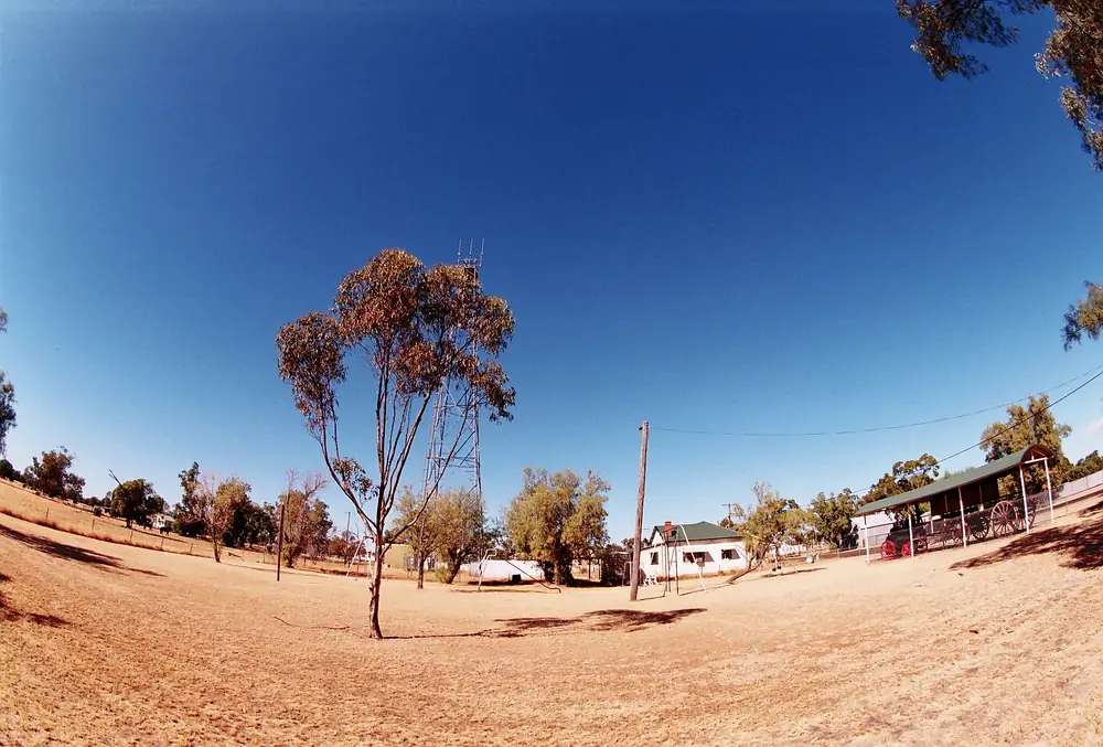
Boomi sits on the NSW side of the MacIntyre River in Moree Plains Shire, 94 km north of Moree on Visit Moree Plains and the shire’s towns-and-villages page. Visit NSW puts the same locality 93 kilometres north-west of Moree, about one hour from Moree and one hour west of Goondiwindi, near the New South Wales–Queensland border. This hub is the NSW village. It is not a city, not Goondiwindi, and not a second Mungindi. The Mungindi map pad used on this site’s Mungindi guide prints 70 km to Boomi. Sealed roads from Moree and Goondiwindi, and north to Talwood, are the Visit NSW wording. After rain on the Macintyre floodplain, still check Live Traffic NSW and QLDTraffic before you count on that 94 km Moree figure.
The Australian Bureau of Statistics does not publish a 2021 Urban Centre (UCL) named Boomi on the QuickStats pages used here. Use suburbs-and-localities SAL10487: 207 people, median age 41, sex split 54.5% male / 45.5% female, 33 families, 136 private dwellings. QuickStats notes small random adjustments for confidentiality. Read the ABS SAL QuickStats.
Travellers stop for the Boomi Artesian Pool, the community co-op and a quiet overnight. Moree Plains Shire names the Boomi BATS theatre group, with the village swelling every two years for a performance. Confirm dates at 67 Alice Street. This hub is the locality. Moree remains the artesian aquatic-centre town on the Great Artesian Spa Tour.
Where it is, and how far
Boomi is north of Moree toward the Macintyre and the Queensland line. Visit Moree Plains and the shire are the source for 94 km. Visit NSW is the source for 93 km and the one-hour wording both ways. The Mungindi map pad is the source for 70 km from Mungindi. This hub does not invent a Brisbane kilometre. Fill and plan in Moree if you need a larger service town.
| Place | Distance from Boomi (sourced) |
|---|---|
| Moree | 94 km (Visit Moree Plains; Moree Plains Shire); 93 km (Visit NSW) |
| Mungindi | 70 km (Mungindi map pad used on this site’s Mungindi guide) |
| Goondiwindi | one hour east on Visit NSW’s wording; no kilometre on that page; this site does not have a Goondiwindi town guide |
| Talwood (Qld) | sealed road north on Visit NSW’s wording; no kilometre on that page |
Lightning Ridge is a longer opal drive, not a Boomi suburb.
Facts at a glance
Population. ABS 2021 Census, Suburbs and Localities SAL10487: 207 people. Median age 41. No UCL on the pages used here.
Climate. BOM does not publish a climate/averages/tables page named Boomi in the NSW monthly-statistics list used here. Use Moree Aero, 053115, the nearest open shire table: commenced 1995, location 29.49°S, 149.85°E, elevation 213 m. January mean maximum 34.6 °C, July 18.4 °C, annual rainfall 577.2 mm. Mungindi Post Office, 052020, toward the Barwon: January 35.7 °C, July 19.1 °C, annual rainfall 505.9 mm. Do not average the two into a fake Boomi mean. See Boomi weather.
Visitor information. There is no Boomi VIC on the sourced pages. Use Moree Visitor Information Centre, 67 Alice Street, weekdays 9am–5pm, weekends and public holidays 9am–1pm, (02) 6757 3350, info@moreetourism.com.au.
Traditional Owners
Tourism Moree states that the Moree Plains lie on the traditional lands of the Gamilaroi people (also spelled Gamilaraay / Gomeroi; Tourism Moree uses Gamilaroi or Gomeroi for the people and Gamilaraay for the language). Boomi is a Moree Plains Shire town on that visitor account. Moree Plains Shire’s towns page uses Kamilaroi for Toomelah, another shire community. This hub follows those official sentences rather than inventing a Macintyre-only nation label. Confirm wording at 67 Alice Street. Read visiting Country respectfully.
History
Visit NSW: the town of Boomi was established at its present location in 1897, having been moved from Kunopia on the banks of the Boomi River. That is the sourced relocation sentence. This hub does not invent an earlier gazette year.
Moree Plains Shire: the town’s biggest assets are the hot artesian spa baths, Boomi Community Co-op (a not-for-profit co-operative with 110 members) and the Boomi BATS. Overnight visitors are welcomed for self-guided tours, fishing, a cotton tour and theatre productions. Every two years the community swells for the BATS performance. Confirm the current year at the Moree VIC. See the Great Artesian Basin.
Things to do
Boomi Artesian Pool — Visit Moree Plains: artesian bathing, camping and caravanning in the quiet village. Visit NSW: quiet, well-shaded hot artesian spa baths in the centre of town. Moree Plains Shire: the town’s biggest asset. Confirm hours at (02) 6757 3350. Limit soaks in hot artesian water. This is a village pool, not the Moree Artesian Aquatic Centre.
Boomi Community Co-op — shire: not-for-profit, 110 members. Visit NSW: takeaway coffee, takeaway food and grocery ordering; call or email. Next to the baths on the visitor wording used here.
Boomi BATS — named by Visit Moree Plains and the shire. Every two years on the shire page. Confirm dates. Do not treat an old poster as a ticket.
Fishing and self-guided tours — named by Moree Plains Shire. NSW fisheries rules apply. Stay on public access.
Mungindi’s border marker and Moree’s aquatic centre are other town days.
Where to stay
Official named stay types:
- Boomi Caravan Park — Visit NSW: powered and unpowered sites
- Camping at the artesian pool precinct — Visit Moree Plains names camping and caravanning with the pool
- Moree rooms — 94 km if Boomi is full
- Mungindi — 70 km on the Mungindi map pad; hotel motel and caravan park on that town’s official lists
Those are official named types, not a ranked inventory. Confirm at (02) 6757 3350. This page will not invent a second motel brand.
- How to choose: Boomi accommodation
- Camping detail: Boomi caravan parks
- Operator enquiries: feature your business
Caravan and camping
Vans use Boomi as a Macintyre-plains overnight between Moree and the border. Official named camps are the Boomi Caravan Park (powered and unpowered on Visit NSW) and the pool camping named by Visit Moree Plains. Ask 67 Alice Street for stay limits. Read Boomi caravan parks. After rain, Live Traffic NSW and QLDTraffic first.
Fuel and services
A locality of 207 people will not match Moree for fuel, groceries or a hospital. Visit NSW names the Co-op for coffee, food and grocery ordering. This guide does not list bowser brands. Fill in Moree. Carry water. January’s mean maximum at Moree Aero is 34.6 °C.
The shire mobile library van visits Boomi — a resident service, not a visitor attraction with hours we invent.
For current questions, use Moree VIC (02) 6757 3350.
Road access
Visit NSW: roads from Moree and Goondiwindi are bitumen; some maps that show gravel are incorrect; the road north to Talwood is bitumen. After rain on the Macintyre, check Live Traffic NSW south toward Moree and QLDTraffic once you cross toward Talwood or Goondiwindi. Do not drive around closed signs to keep a pool booking. Road trains use these plains. See road trains.
Nearby parks and towns
There is no national park inside Boomi on the visitor pages used here.
Towns on this site:
Goondiwindi is named on Visit NSW as a one-hour direction. It does not have a town guide on this site. Do not invent one.
When to go, and how long
Moree Aero’s January mean maximum of 34.6 °C is hot for a midday unhitch. July’s 18.4 °C mean maximum is the comfortable soaking season; July’s 4.6 °C mean minimum is why a camp night needs a layer. See Boomi weather.
One night covers the pool and the co-op. Two nights if a BATS year is on and 67 Alice Street has confirmed dates. Two full tourist days on Boomi Street is more than the sourced main-street list supports unless you are using Boomi as a rest day on the border plains.
Operators who want a checked listing: feature your business. The listings slot stays empty until then.
Plan this trip
Tell us the dates, who you are travelling with and where you need help. We reply with planning notes for Boomi — we are not a booking agent.
Events and road-conditions newsletter
Occasional notes on outback festivals, race days and official road-condition sources — not a daily blast. We use these details only to send the newsletter.
New South Wales · New England North West
Boomi accommodation
Where to stay in Boomi: Visit NSW names powered and unpowered caravan-park sites. Confirm at Moree VIC. Moree is 94 km if the village is full.
Read · 3 min
New South Wales · New England North West
Boomi caravan parks
Camping in Boomi: Visit NSW names powered and unpowered caravan-park sites. Visit Moree Plains names camping with the artesian pool. Confirm at 67 Alice Street.
Read · 3 min
New South Wales · New England North West
Boomi weather
Boomi climate: BOM publishes no Boomi monthly table. Use Moree Aero (053115): January mean max 34.6 °C, July 18.4 °C, annual rainfall 577.2 mm. Mungindi Post Office is the Barwon table.
Read · 4 min
New South Wales · New England North West
Things to do in Boomi
Things to do in Boomi: Moree Plains artesian spa baths, community co-op, fishing and the two-yearly Boomi BATS. Moree and Mungindi are other town days.
Read · 3 min
Frequently asked questions
How far is Boomi from Moree and Mungindi?
Visit Moree Plains and Moree Plains Shire both put Boomi 94 km from Moree. Visit NSW’s Boomi page puts it 93 kilometres north-west of Moree, about one hour from Moree and one hour west of Goondiwindi. The Mungindi map pad used on this site’s Mungindi guide prints 70 km to Boomi.
What is Boomi’s population?
207 people at the 2021 Census for Boomi suburbs-and-localities (SAL10487), median age 41. The ABS does not publish a 2021 Urban Centre (UCL) named Boomi on the QuickStats pages used here.
Is Boomi in NSW or Queensland?
New South Wales. Moree Plains Shire says the town is on the NSW side of the MacIntyre River, 94 km north of Moree. Visit NSW places it near the NSW–Queensland border. This hub is the NSW Moree Plains locality, not a Queensland town.
What is the weather like in Boomi?
BOM does not publish a monthly climate-averages table named Boomi in the NSW list used here. Use Moree Aero (053115): January mean maximum 34.6 °C, July 18.4 °C, annual rainfall 577.2 mm. Mungindi Post Office (052020) is the open table toward the Barwon.
Are the roads sealed?
Visit NSW: despite some maps indicating gravel, routes from Moree and Goondiwindi are fully sealed, and the road north to Talwood in Queensland is bitumen. Check Live Traffic NSW and QLDTraffic anyway.
Sources and further reading
Facts on this page were checked against these primary and official sources. Conditions change — confirm before you travel or buy.
- Boomi 2021 Census QuickStats (SAL10487) — Australian Bureau of Statistics
- Climate statistics for Moree Aero (053115) — Bureau of Meteorology
- Climate statistics for Mungindi Post Office (052020) — Bureau of Meteorology
- Boomi — Moree Plains Shire / Tourism Moree
- Towns and Villages — Moree Plains Shire Council
- Boomi — Destination NSW
- Moree Visitor Information Centre — NSW Government
- Live Traffic NSW — Transport for NSW
- QLDTraffic — Queensland Government