At a glance
Sourced facts only. Distances and services change — confirm before you travel.
- Local government
- MacDonnell Regional Council
- Traditional Owners
- Pitjantjatjara and Yankunytjatjara speakers; the area traditionally known as Aputula (MacDonnell Regional Council)Keep council wording. Do not flatten neighbouring Kulgera Pitjantjatjara / Luritja sentences or Hermannsburg Western Arrarnta wording onto this community.
- Nearest regional city
- Alice Springs. MacDonnell Regional Council: the community is accessed by a 434 km road that mostly follows the old Ghan railway route through Titjikala to Alice Springs. Finke Desert Race organisers describe a course of about 460 km Alice Springs–Aputula and back (about 230 km each leg) — a race-track figure, not a substitute for the council road kilometre.
- Capital
- A Darwin kilometre is not printed on the sourced community pages. Darwin has no town page on this site.
- Nearest fuel
- Finke Desert Race competitor information: the General Store has basic food supplies, opal unleaded and diesel fuel available on race weekend. Confirm the store on arrival outside race weekend; this hub does not invent hours.
- Nearest hospital or clinic
- MacDonnell Regional Council names a Health Care centre. NT Police’s Kulgera profile: Finke and Imanpa communities have a clinic staffed by a full-time registered nurse. Confirm before travel.
- Mobile coverage
- Finke Desert Race competitor information: very limited mobile phone service at Apatula community and none at the Finke campground. Check Telstra and Optus coverage maps before travel.
- Best time to visit
- BOM Finke Post Office (015526, closed 31 Dec 1980) January mean maximum 37.5 °C; July 19.9 °C. Tourism NT camping around Alice Springs: cooler months April to September. Race weekend is the King’s Birthday long weekend in June — see the live event page.
Climate
Monthly means from the Bureau of Meteorology station Finke Post Office (015526). This is not a forecast. Named town station. Closed 31 December 1980. Commenced 1938. Elevation 267 m. Temperature 41 years (1938–1980); rainfall 38 years (1938–1980). Latest available data 1 December 1980. Do not blend with open Kulgera 015603 or Alice Springs Airport 015590.
| Month | Mean max (°C) | Mean min (°C) | Rainfall (mm) |
|---|---|---|---|
| Jan | 37.5 | 22.8 | 21.5 |
| Feb | 36.1 | 22.2 | 40.0 |
| Mar | 33.7 | 19.3 | 16.9 |
| Apr | 28.6 | 14.1 | 13.9 |
| May | 23.3 | 9.7 | 12.5 |
| Jun | 20.3 | 6.7 | 11.8 |
| Jul | 19.9 | 5.6 | 10.8 |
| Aug | 22.2 | 7.1 | 11.5 |
| Sep | 26.9 | 10.9 | 7.0 |
| Oct | 30.9 | 15.3 | 15.7 |
| Nov | 34.1 | 18.7 | 10.1 |
| Dec | 36.4 | 21.2 | 17.4 |
Finke is Aputula, a living community in the Red Centre listing on this site, in MacDonnell Regional Council’s Rodinga Ward. Council’s community page is the geography used here: the community takes its name from the usually dry Finke River (one of the oldest river systems in the world dating back 350 million years) that meanders by the area traditionally known as Aputula. The name Aputula is still used by the approximately 160 local Pitjantjatjara and Yankunytjatjara speakers when referring to their community of Finke. This hub is the town, not a second Alice Springs, not Kulgera’s Stuart Highway village, and not a rewrite of the live Finke Desert Race event page. Darwin is the capital; it has no town page here.
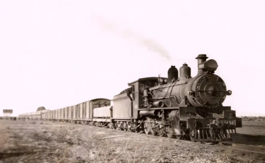
MacDonnell Regional Council: Finke was originally established as a railway siding on the original Ghan railway line until 1981, when the railway line was relocated 150 km to the west. Today the community is accessed by a 434 km road that mostly follows the old Ghan railway route through Titjikala to Alice Springs. Apart from general tourism in the area, Finke has become famous as the midway point for the annual Finke Desert Race.
The 2021 Census publishes matching counts for suburbs-and-localities SAL70099 and Urban Centre UCL722006: 191 people, median age 28, sex split 55.4% male / 44.6% female. 42 families, 59 private dwellings, 3.7 people per household. Aboriginal and/or Torres Strait Islander people 179 (93.7% on the UCL). Council still prints approximately 160 local speakers. Use the Census. You still need the NT Road Report after rain.
Where it is, and how far
Finke sits east of the Stuart Highway, reached on council wording by a 434 km road that mostly follows the old Ghan through Titjikala to Alice Springs. Kulgera is the Stuart Highway village NT Police place 21 km from the SA border. Erldunda is the Stuart / Lasseter junction. Marla is the South Australian Stuart Highway town on the other side of the border. This hub does not invent a Finke–Kulgera kilometre those sourced community pages do not print.
The Finke Desert Race organisers describe a 460 km course: Alice Springs to Aputula on day one and back on day two, so each leg is roughly 230 km. That is a race-track figure, not a substitute for council’s 434 km road. Darwin has no sourced kilometre on the community page.
| Place | Distance (sourced) |
|---|---|
| Alice Springs by road | 434 km via Titjikala on the old Ghan route (MacDonnell Regional Council) |
| Alice Springs by race course | about 230 km each leg; about 460 km return (Finke Desert Race organisers) |
| Ghan railway relocation | 150 km west in 1981 (MacDonnell Regional Council) |
| SA / NT border from Kulgera | 21 km (NT Police Kulgera profile) — a Kulgera figure, not a Finke offset invented here |
Facts at a glance
Population. ABS 2021 SAL70099 / UCL722006: 191 people. Median age 28. Indigenous 179 (93.7%). Use SAL QuickStats or UCL QuickStats.
Climate. FINKE POST OFFICE, 015526, 25.58°S, 134.57°E, elevation 267 m, commenced 1938, status: closed 31 December 1980, latest available data 1 December 1980. Mean maximum (41 years, 1938–1980): January 37.5 °C, July 19.9 °C, annual 29.2 °C. Mean rainfall (38 years, 1938–1980): annual 193.4 mm. February 40.0 mm wettest mean month; September 7.0 mm driest. Do not blend with Kulgera. See Finke weather.
Visitor information. MacDonnell Regional Council Finke community page. Council contact: 08 8959 8700, finke@macdonnell.nt.gov.au, CMB 184 via Alice Springs NT 0872. Race weekend: Finke Desert Race and finkedesertrace.com.au. Roads: NT Road Report.
Traditional Owners
MacDonnell Regional Council: the area is traditionally known as Aputula; the name Aputula is still used by the approximately 160 local Pitjantjatjara and Yankunytjatjara speakers when referring to their community of Finke. NT Government’s council list prints Finke (Apatula). Rodinga Ward languages on council’s ward page include Pitjantjatjara, Yankunytjatjara, Central and Eastern Arrernte — a ward sentence, not flattened into a Finke-only label.
Stay on public roads. Race supplementary regulations ask visitors to respect marked sacred-site areas on the Apatula Aboriginal Land Trust; areas that are roped off are not to be crossed. The live race page: Aputula (Finke) is a living Aboriginal community, not a tourist stop. Check permit requirements with the Central Land Council before travelling on Aboriginal land. See visiting Country respectfully.
This guide does not invent photography rules, visitor numbers, or cultural detail that is not on those official pages.
History
MacDonnell Regional Council: Finke was originally established as a railway siding on the original Ghan railway line until 1981, when the railway line was relocated 150 km to the west. The community takes its name from the usually dry Finke River, dated on that page to 350 million years. Council also notes Finke was named Territory Tidy Town 2017.
The Finke Desert Race began in 1976 as a there-and-back challenge between local motorbike riders, on that event page’s own wording. This hub links that page and does not rewrite it.
Things to do
MacDonnell Regional Council names community services, not a tourist roster. Sourced visitor facts:
- Living community — council: Health Care centre, school, church, store, NPY Women’s Council Aboriginal Corporation youth program and sport and recreation from the recreation hall
- Finke Desert Race midway point — council; full spectator rules on the event page
- Tidy Town 2017 — council
- Old Ghan route — access road, not a steam-train timetable this page will invent
Nearby, not in-town: Kulgera is the Stuart Highway village. Erldunda is the Lasseter turn. Alice Springs is the regional town. Uluru is a Yulara park day, not a Finke walk.
Where to stay
MacDonnell Regional Council’s community page does not name a motel. Race competitor information: facilities at Apatula community are extremely limited; the General Store is open for business on Saturday, Sunday and Monday of race weekend. Spectator camping at the Race Camp is discouraged for spectators and reserved for competitors, crew, officials and volunteers. Alcohol is prohibited in Aputula and its campground on official race wording. Those are race-weekend sentences. For ordinary travel, confirm the store; do not invent a hotel.
- How to choose: Finke accommodation
- Camping detail: Finke caravan parks
- Race rules: Finke Desert Race
- Operator enquiries: feature your business
Caravan and camping
This is a living community, not a tourist caravan park. Official named camping on fetched pages is the Race Camp on the Aputula Aboriginal Land Trust — reserved for competitors, crew, officials and volunteers on spectator information. Register and pay if you still choose to camp, on that page’s wording. Read Finke caravan parks and outback camping. Do not camp on marked sacred-site areas.
Fuel and services
MacDonnell Regional Council: Health Care centre, school, church, store, NPY Women’s Council; council provides cemetery, rubbish, roads, parks, sporting grounds, airstrip maintenance, children’s services, home care, night patrol; contracted Power Water, Australia Post and Centrelink agency in the council office. NT Police’s Kulgera profile: Finke has a clinic staffed by a full-time registered nurse. Race competitor information: basic food, opal unleaded and diesel at the General Store on race weekend; amenities at the campground are toilets, no showers. Confirm the store outside race weekend. This hub does not invent hours. Emergencies 000. Fill in Alice Springs or Kulgera if you are unsure.
Council phone 08 8959 8700. Roads: NT Road Report.
Road access
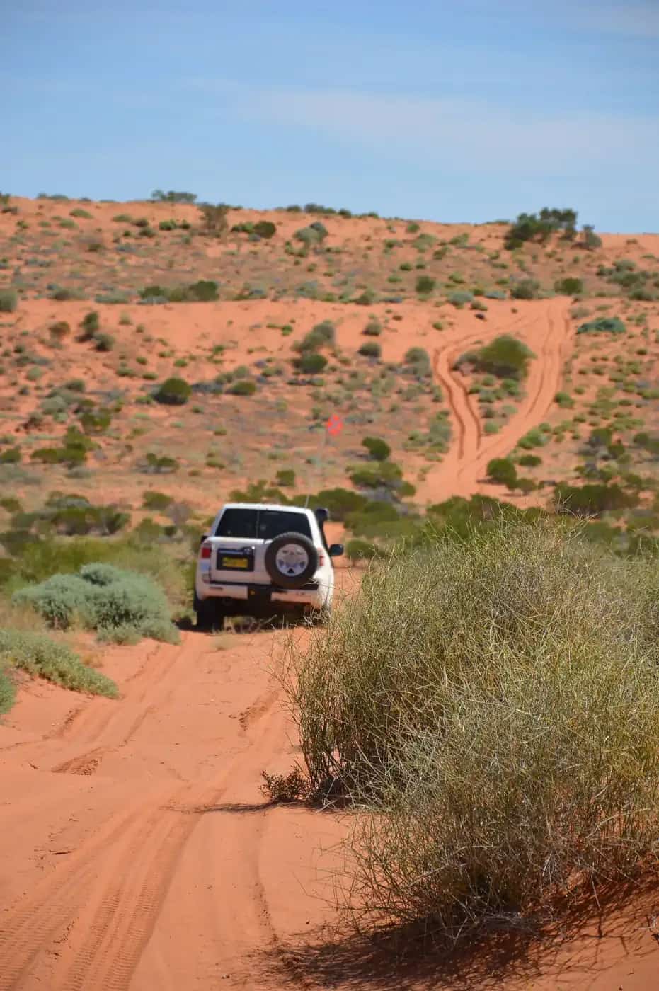
Council: a 434 km road that mostly follows the old Ghan through Titjikala. That is not the sealed Stuart Highway. NT Road Report is the authority. Stay on gazetted roads. Aboriginal land needs the permits those agencies print. Race days close the road between Deep Well and Finke 6 am to 6 pm on Sunday and Monday on spectator information — a race-weekend closure, not a year-round timetable.
West toward the Stuart Highway: Kulgera and Erldunda on those towns’ own pages. South: Marla in South Australia via the border. North: Alice Springs. Darwin is named only.
Nearby parks and towns
Finke does not sit inside a Parks NT park named on the sourced community page. The Finke River is the named landscape on council’s page.
Towns on this site:
- Kulgera — Stuart Highway village, 21 km from the SA border
- Erldunda — Stuart / Lasseter junction
- Alice Springs — 434 km by the council road
- Marla — Stuart Highway in South Australia
Named, not linked: Titjikala (on the council access road), Darwin.
When to go, and how long
BOM Finke Post Office’s January mean maximum of 37.5 °C (closed station, 1938–1980) is a southern Red Centre summer. July’s 19.9 °C mean maximum and 5.6 °C mean minimum, with September’s 7.0 mm, is the cool Dry on a 193.4 mm annual table. Tourism NT’s Alice Springs camping page prefers April to September. Race weekend is the King’s Birthday long weekend in June on the event page.
This is a living community. An ordinary visit is not a tourist day-trip the council page timetables. Race weekend has its own rules on the event page. Do not invent visitor numbers.
Operators who want a checked listing: feature your business. The listings slot on this hub stays empty until then.
Plan this trip
Tell us the dates, who you are travelling with and where you need help. We reply with planning notes for Finke — we are not a booking agent.
Events and road-conditions newsletter
Occasional notes on outback festivals, race days and official road-condition sources — not a daily blast. We use these details only to send the newsletter.
Northern Territory · Red Centre
Finke accommodation
Where to stay in Finke / Aputula: MacDonnell Regional Council names a store, not a motel. Race camp is reserved for competitors. Alcohol prohibited on official race wording. Confirm before you travel.
Read · 3 min
Northern Territory · Red Centre
Finke caravan parks
Camping in Finke / Aputula: no named caravan park on MacDonnell Regional Council’s page. Race Camp is reserved for competitors. Alcohol prohibited. Living community, not a tourist park.
Read · 3 min
Northern Territory · Red Centre
Finke weather
Finke climate from BOM Finke Post Office (015526, closed 1980): January mean max 37.5 °C, July 19.9 °C, annual rainfall 193.4 mm. Named town station. Do not blend with Kulgera.
Read · 3 min
Northern Territory · Red Centre
Things to do in Finke
Things to do in Finke / Aputula: living Pitjantjatjara and Yankunytjatjara community on MacDonnell Regional Council’s page. Link the Finke Desert Race event page. Official wording only.
Read · 3 min
Frequently asked questions
Is Finke the same place as Aputula?
Yes. MacDonnell Regional Council: the name Aputula is still used by the approximately 160 local Pitjantjatjara and Yankunytjatjara speakers when referring to their community of Finke. The area is traditionally known as Aputula. NT Government’s find-your-council list prints Finke (Apatula). This hub uses both official spellings as those agencies print them.
How far is Finke from Alice Springs?
MacDonnell Regional Council: today the community is accessed by a 434 km road that mostly follows the old Ghan railway route through Titjikala to Alice Springs. The Finke Desert Race organisers describe about 460 km Alice Springs to Aputula and back, roughly 230 km each leg — a race course, not the council road kilometre. Confirm the day’s drive on the NT Road Report.
What is Finke’s population?
191 people at the 2021 Census for both Finke suburbs-and-localities (SAL70099) and Apatula (Finke) Urban Centre (UCL722006). Median age 28. Aboriginal and/or Torres Strait Islander people 179 (93.7% on the UCL). MacDonnell Regional Council still prints approximately 160 local speakers — use the Census count.
Can visitors camp in Finke?
Finke Desert Race spectator information: camping on the Aputula Aboriginal Land Trust at the Finke Community, in the Race Camp north of the community, is discouraged for all spectators and reserved for competitors, crew, officials and volunteers. Alcohol is prohibited in Aputula and its campground on the live race page and official spectator / supplementary-regulation wording. This is a living community, not a tourist caravan park. Read the [Finke Desert Race](/outback-events/finke-desert-race) event page.
What is the weather like in Finke?
BOM Finke Post Office (015526) is the named town station: January mean maximum 37.5 °C, July 19.9 °C, annual rainfall 193.4 mm (38 years, 1938–1980). The station closed on 31 December 1980. Do not blend that closed table with open Kulgera (015603) or Alice Springs Airport (015590).
Do I need a permit?
MacDonnell Regional Council’s Finke community page used here does not print a town-visit permit rule. The live race page asks visitors to check permit requirements with the Central Land Council before travelling on Aboriginal land. Finke Desert Race supplementary regulations ask competitors and crew to respect marked sacred-site areas. Confirm current wording with CLC and council before you travel. Darwin has no town page on this site.
Sources and further reading
Facts on this page were checked against these primary and official sources. Conditions change — confirm before you travel or buy.
- Finke 2021 Census QuickStats (SAL70099) — Australian Bureau of Statistics
- Apatula (Finke) (L) 2021 Census QuickStats (UCL722006) — Australian Bureau of Statistics
- Climate statistics for Finke Post Office (015526) — Bureau of Meteorology
- Finke — MacDonnell Regional Council
- Find your council — Northern Territory Government
- Kulgera — NT Police, Fire and Emergency Services
- Spectators information — Finke Desert Race Inc.
- Tatts Finke Desert Race — Finke Desert Race Inc.
- NT Road Report — Northern Territory Government